
Rostov Region Mountaineering and Climbing Federation
Report
on the ascent to the summit Akairy 3262 m via the northwestern ridge presumably 2A cat. complexity. First ascent
2014
ASCENT DOCUMENTATION
- Region: Western Caucasus, Arkhyz area, Sofiyskoe valley, section 2.1 of the mountain peak route classifier.
- Peak: Akairy (3262 m), via the northwestern ridge.
- Proposed category: 2A cat. complexity, first ascent.
- Route type: rock.
- Elevation gain: 150 m. Route length (technical section): 800 m. Average steepness of the technical section: 15°.
- Pitons left on the route: 0. Pitons used on the route: 8 (slings, chocks). Bolts and ITO were not used.
- Total time: 9 hours, 1 day.
- Descent from the summit via the ascent route.
- Leader: Dergachev Andrey Viktorovich, 1st sports category, instructor III category.
Participants:
- A. Smolin, 1st sports category
- V. Dzyubin, 1st sports category
- R. Mesaoutov, 1st sports category
- A. Spitsyn, novice
- A. Barinova, novice
- Date of ascent: May 7, 2012. Departure from the assault camp: 8:00. Arrival at the pass (start of the route): 9:00. Arrival at the summit: 12:00. Return to the assault camp: 17:00.
- Rostov Region Mountaineering and Climbing Federation.
- Responsible for the report Dergachev A.V. aderg@narod.ru

Fig. 1. General view of the Sofiyskiy ridge section from the northeast. May 2, 2013.
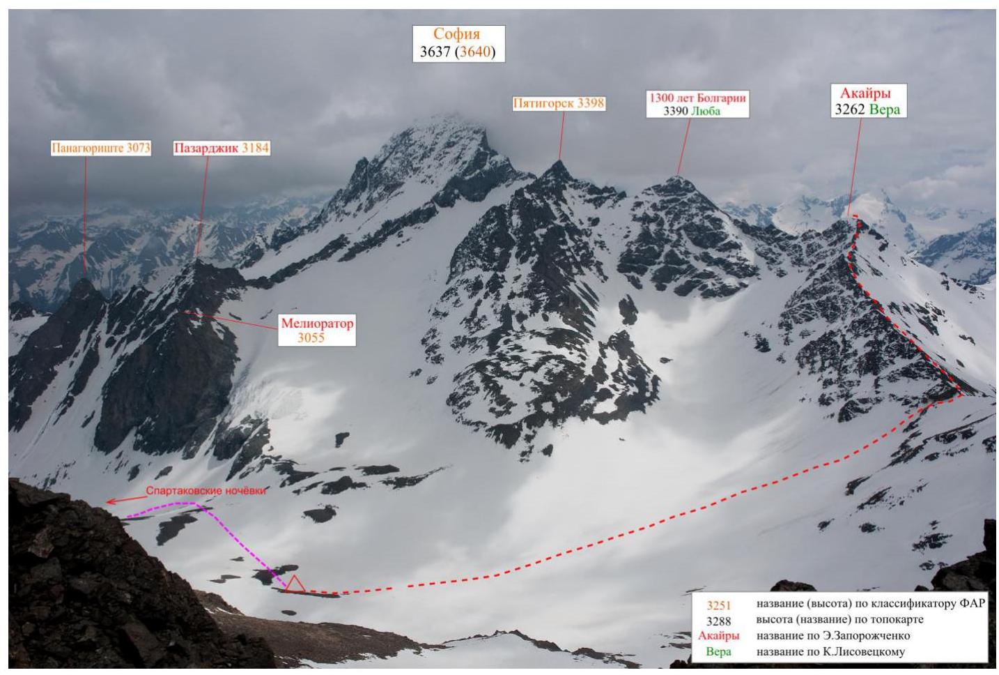
Fig. 2. General view of the Sofiyskiy ridge section from the northwest. May 6, 2012.
Geographical description of the region and the ascent object
The ascent object — the peak Akairy (Ak-Airy) with a height of 3262 m — is located in the Zelenchuksky district of the Karachay-Cherkess Republic, in the Sofiyskiy ridge of the Western Caucasus. The peak is a nodal point – the Chuchkhur ridge is adjacent to it from the south.
The ascent was made from the Akairy river side, a left tributary of the Sofia river. The assault camp was located at the "upper" bivouac, which is situated on the moraine of the left bank of the Akairy river, at an altitude of about 2800 m, above the more well-known Spartak bivouac.
Path to the assault camp: from the Arkhyz settlement by car on the asphalt road to the bridge across the Arkhyz river – 4 km, then on a dirt road to the Taulu glade – 2.5 km.
Further into the Sofia river gorge leads a broken dirt road, unsuitable for regular vehicles. To the upper part of the gorge (the "Glacier Farm" tract) from the Taulu glade is 8 km, it can be reached on foot or by ordering a high-clearance vehicle.
From the confluence of the Akairy and Sofia rivers, a trail goes along the left (orographic) side of the Akairy gorge. After 1.5 km, the gorge bifurcates, and you need to turn left, bypassing the rock falls on the right. Above the falls, on a flattened area at an altitude of about 2550 m, is the Spartak bivouac.

Fig. 3. Overview map of the area
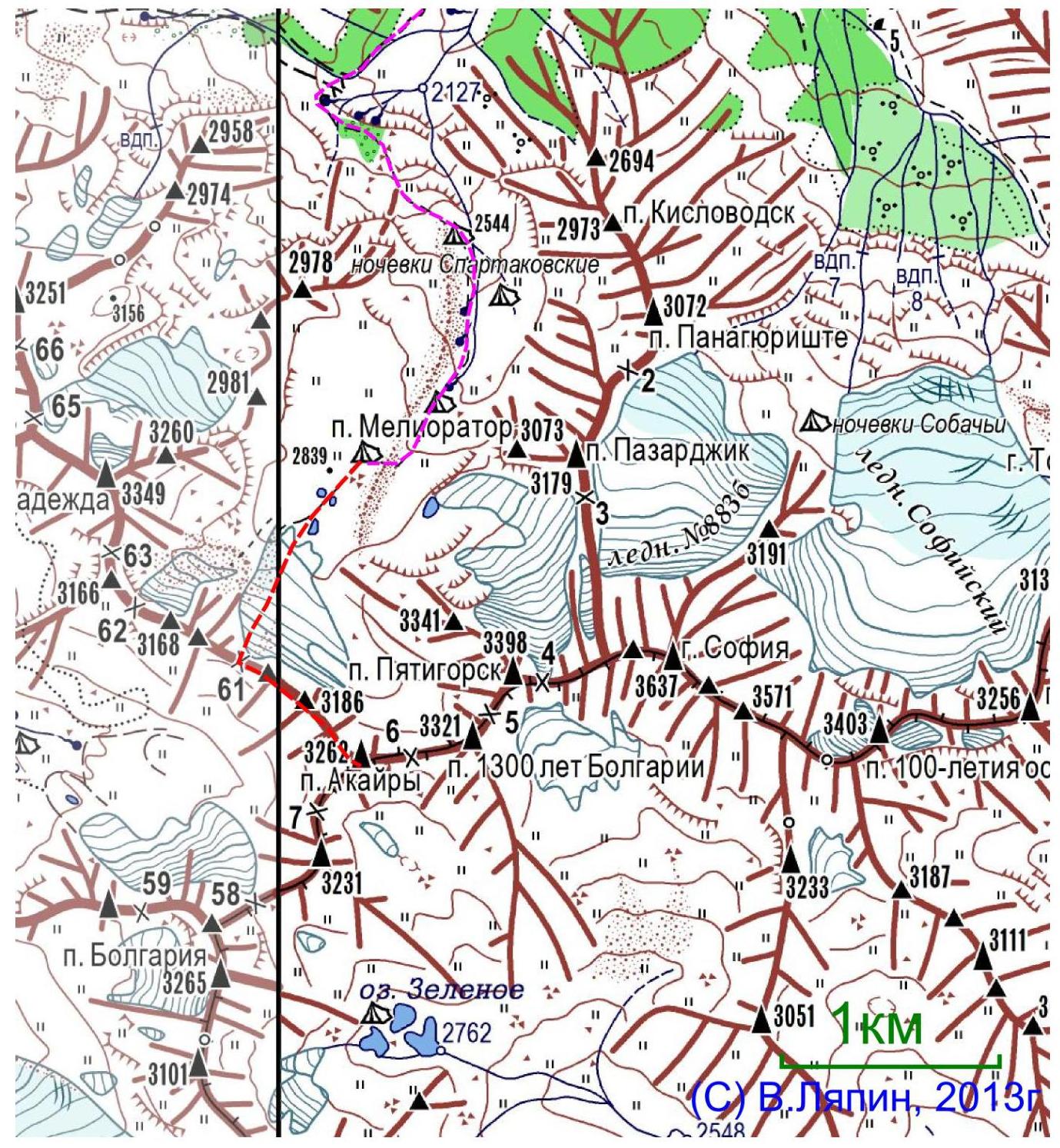
Fig. 4. Ridge diagram by V. Lyapin
Table 1. List of technical sections of the route
| Section | Length, m | Steepness, degrees | Terrain type | Category of complexity | Number of pitons |
|---|---|---|---|---|---|
| R0–R1 | 300 m | 10 | Rocky-scree ridge | 1 | 0 |
| R1–R2 | 40 m | 20 | Rocky outcrop | 2 | 2 |
| R2–R3 | 200 m | 10 | Rocky-scree ridge | 1–2 | 0 |
| R3–R4 | 40 m | 20 | Rocky outcrop | 2 | 2 |
| R4–R5 | 160 m | 10 | Rocky-scree ridge | 1–2 | 0 |
| R5–R6 | 60 m | 40 | Rocky ridge | 3 | 4 |
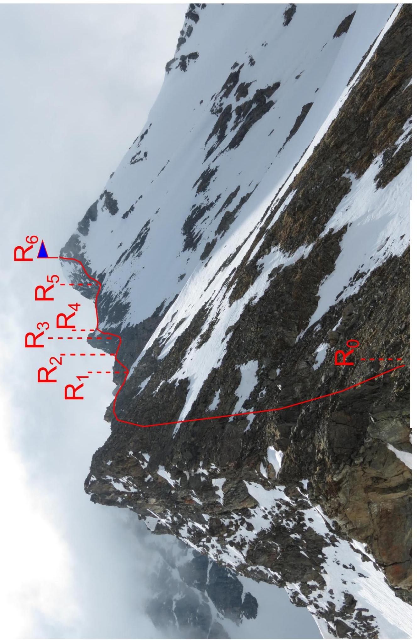
Fig. 5. Photo of the route
Description of the approach to the start of the technical section of the route
The peak Akairy is visible from the assault camp. Climb the snowy (in summer, likely scree) slope to the right of the peak, towards the depression in the ridge — Akairy Central pass (also known as a variant of Akairy Western pass). The ascent to the pass is done directly towards the depression.
Attention:
- In winter and inter-season, it may be avalanche-prone!
- In summer, it may be rockfall-prone.
The start of the route is on the pass. 1 hour from the assault camp.
Description of the route passage
Section R0–R1. From the pass along the scree ridge with outcrops of destroyed rocks, keeping to the right side of the ridge, to a small rocky outcrop (gendarme). 320 m, 1 cat. complexity.
Section R1–R2. Climb simple rocks. 20°, 20 m, 2 cat. complexity.
Section R2–R3. Along the scree ridge with outcrops of destroyed rocks, keeping to the right side of the ridge. 200 m, 1–2 cat. complexity.
Section R3–R4. Bypass the gendarme on the right along the snowy-scree slope and simple rocks. 40 m, 2 cat. complexity.
Section R4–R5. Along the scree ridge with outcrops of destroyed rocks. 160 m, 1–2 cat. complexity.
Section R5–R6. Along the rocky ridge, ascend to the summit. 40°, 60 m, 3 cat. complexity.
Descent via the ascent route.
Photos of the route

Fig. 6. Section R1–R2
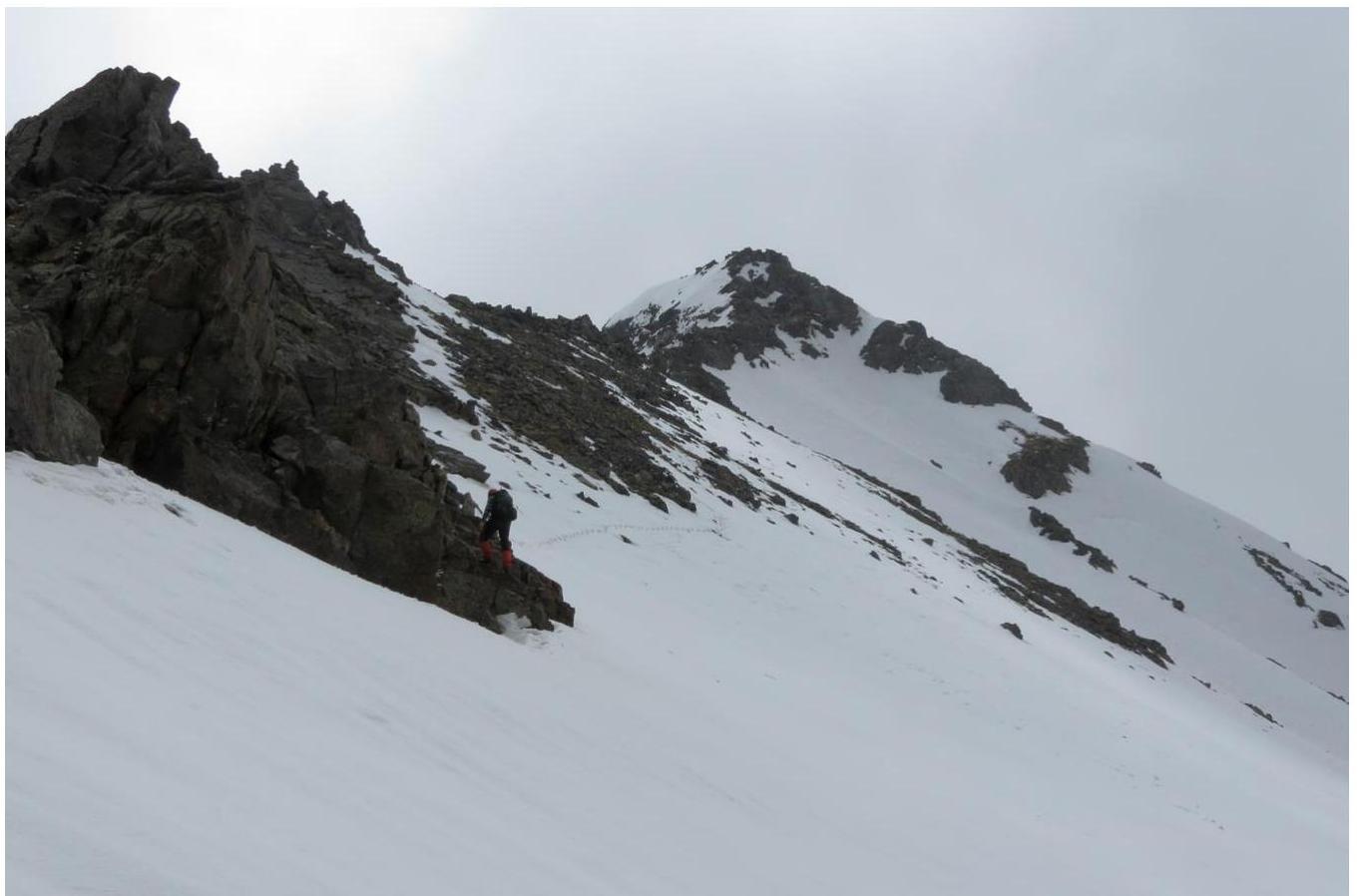
Fig. 7. Section R4–R5
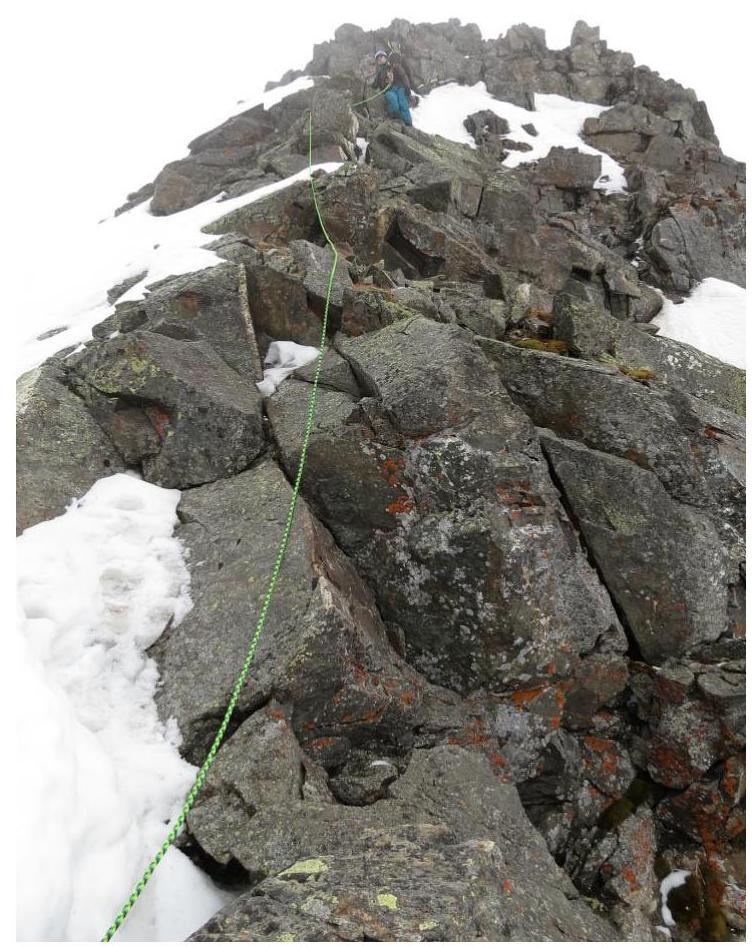
Fig. 8. Section R5–R6.
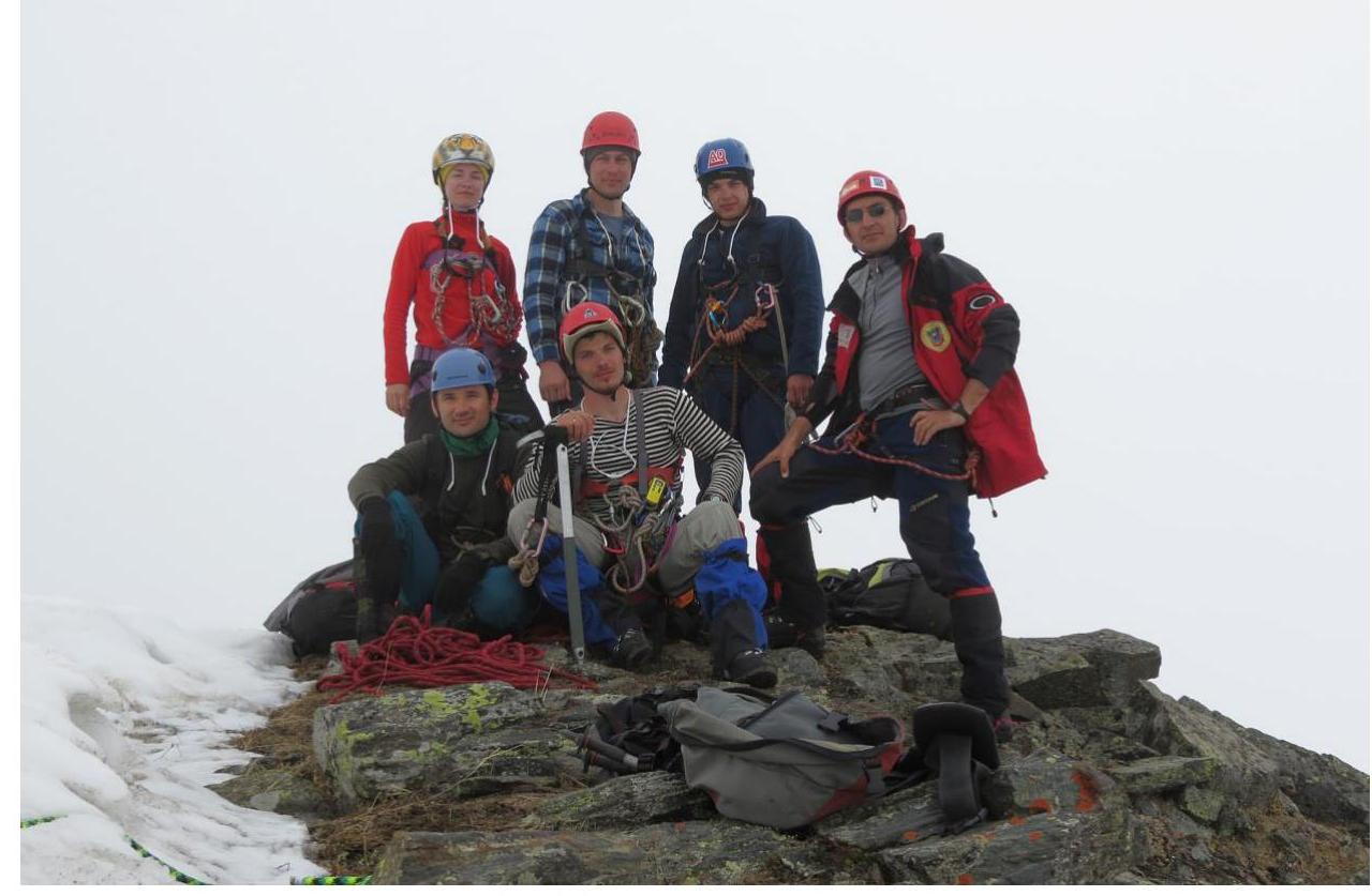
Fig. 9. Group at the summit.
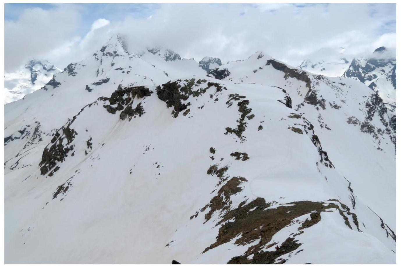
Fig. 10. View from the summit towards the Chuchkhur ridge (south).
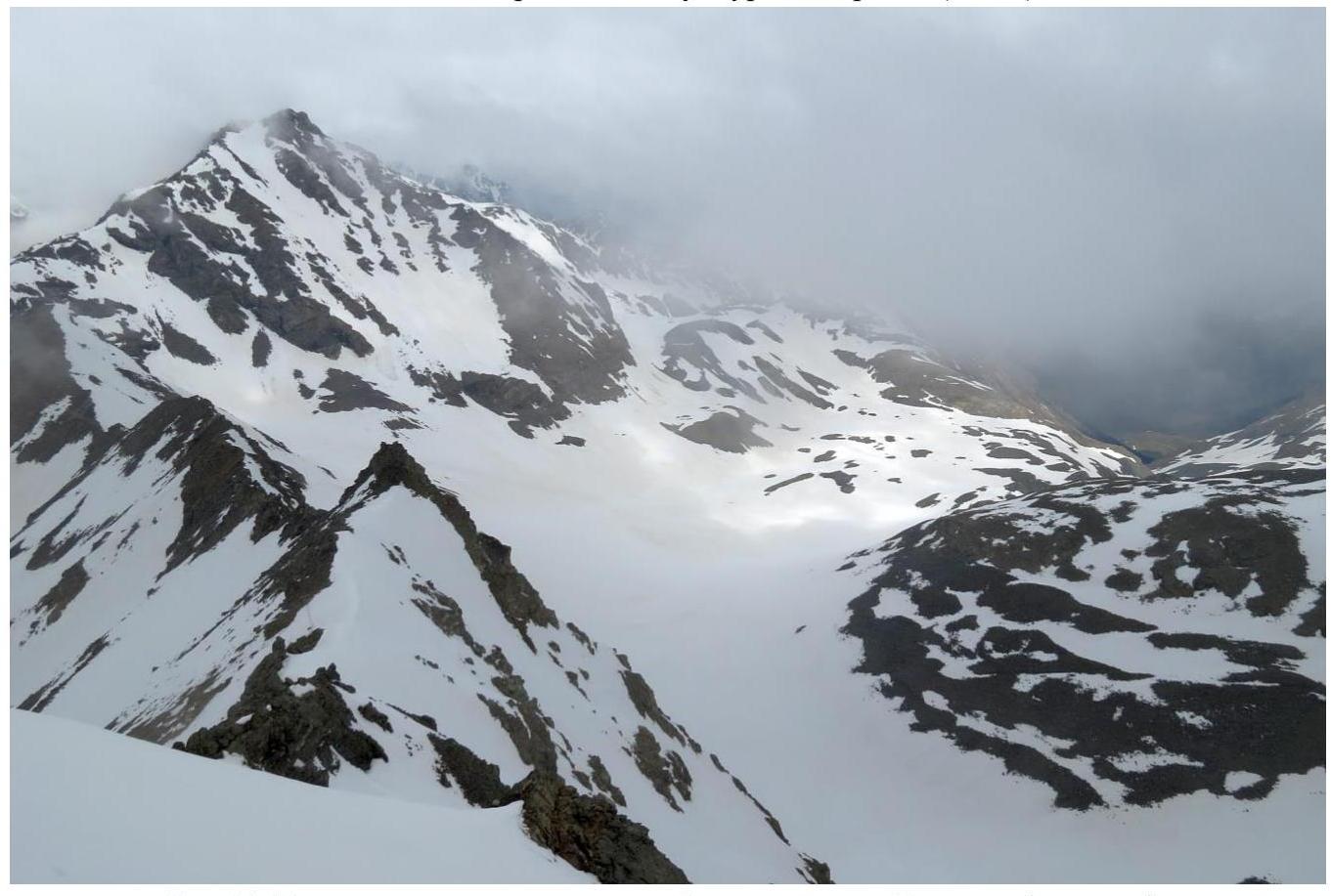
Fig. 11. View from the summit towards the ascent route and the peak Nadezhda (north).
General conclusions
Since the weather on the day of the ascent was overcast, it was not possible to capture a panorama from the summit. At the summit, a cairn and a note from the Novocherkassk gathering group were found, dated May 5, 2012, leader A. Zagorodnyuk, the peak was climbed during a traverse of 3A cat. complexity. peak Piatigorsk – peak Nadezhda.
Nearby classified routes in the area:
- Traverse 3A cat. complexity. peak Piatigorsk – peak Nadezhda
- 1B cat. complexity. on peak Nadezhda
- 1B cat. complexity. on peak Piatigorsk
- 2A cat. complexity. on peak Pazardzhik.
The closest route in complexity to the one climbed is the route to peak Pazardzhik 2A cat. complexity.
Based on the objective complexity of the technical section of the route to the peak Akairy via the northwestern ridge and comparing it with other routes climbed by the participants earlier, it is proposed to classify it as 2A category of complexity.
Comments
Sign in to leave a comment