Mshatka-Kaya — Category 16
On the left side of the "triangle" in the eastern part of the massif ("left triangle"), beyond
Between the Central and Eastern bastions, in the upper part of the wall, two long, oblique, intermittent ledges with trees form a large oblique angle, clearly visible from the road, and named the Triangle.
The middle part of the route passes along the left ledge, forming the Triangle.
From the upper road, 30 m east of the fork to the lower (main) road and the village of Foros, ascend first along the trail, and then up and to the right along the talus and simple rocks to a shrub- and tree-covered inclined terrace,
located under the "Triangle". Along it, left and up to a large rusty inner corner (section R0: 100 m, 30–45°, no category; 50 m, 50^{\circ}, category I; 50 m, 30–40°, no category)
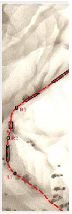
On section R1–R2 — first 20 m up the sheer corner or its left wall. Then:
- 20 m up the wall to the left of the inner corner;
- 10 m up and left into the next inner corner.
(30 m, 80°, category IV+; 20 m, 70°, category III).
On section R2–R3 — first up and to the right along the inner corner and further along the wall to the exit onto a long inclined ledge — the left side of the Triangle (R2–R3: 50 m, 75°, category III).
On section R3–R4 — a long traverse up and to the right 100 m along the inclined ledge to the beginning of a wide inner corner (R3–R4: 100 m, 60–70°, category II–III).
On section R4–R5 — up 40 m along the wide inner corner and its left side to the base of a sheer inner corner (R4–R5: 40 m, 75°, category IV).
On the final section of the route — up the sheer inner corner to the exit onto the summit plateau (R5–summit: 30 m, 80°, category IV+)
The ascent takes 3–4 hours. The length of the main part of the route is 270 m.
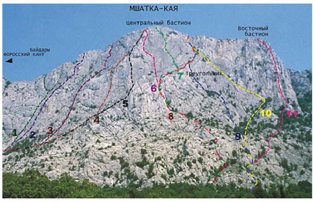
| 1–3А | 2–3Б | 3–4Б | 4–4Б | 5–5А | 6–5Б | 7–5Б | 8–3А | 9–4А | 10–3Б | 11–5А |
|---|---|---|---|---|---|---|---|---|---|---|
| 2004.6 | MOTATOOSH | VVO | Tpeavrymymetppocna |