
Report on the First Ascent to the summit of Ai-Petri Eastern via the eastern part of the wall on the route ("Zakonoobrazovatel's") 6A category of complexity by the team from Muhalatka for the period from 20.07.2019 to 20.07.2019.
I. Climbing Report Passport
| 1. General Information | ||
|---|---|---|
| 1.1 | Full name, sports rank of the team leader | Lisin Alexander Alexandrovich, CMS |
| 1.2 | Full name, sports rank of participants | Vlasenko Alexey Sergeevich — no rank, Umnov Anton Sergeevich — no rank, Lisin Alexander Alexandrovich — CMS |
| 1.3 | Full name of the coach | Kruglov Yuri Igorevich — MS |
| 1.4 | Organization | none |
| 2. Characteristics of the Climbing Object | ||
| 2.1 | Region | Russian Federation, Crimean Federal District, Miskhor settlement |
| 2.2 | Valley | |
| 2.3 | Number according to the 2013 classification table | |
| 2.4 | Name and height of the summit | Ai-Petri Eastern summit 1100 m, via the eastern part of the wall |
| 2.5 | Geographical coordinates of the summit (latitude–longitude), GPS coordinates | |
| 3. Characteristics of the Route | ||
| 3.1 | Name of the route | Route by A. Umnov, A. Lisin, A. Vlasenko "Zakonoobrazovatel's" |
| 3.2 | Proposed category of complexity | 6A |
| 3.3 | Degree of route exploration | First ascent |
| 3.4 | Terrain characteristics | Rock climbing |
| 3.5 | Height difference of the route (data from altimeter or GPS) | |
| 3.6 | Route length (in meters) | 220 m |
| 3.7 | Technical elements of the route (total length of sections of various complexity categories with terrain characteristics (ice-snow, rock)) | IV cat. rock – 38 m. V–VI cat. rock – 142 m. Rock VI, A3 – 42 m |
| 3.8 | Average steepness of the route, (°) | 80 |
| 3.9 | Average steepness of the main part of the route, (°) | 85 |
| 3.10 | Descent from the summit | Downhill via Koreiz trail |
| 3.11 | Additional route characteristics | Presence (absence) of water |
| 4. Characteristics of the Team's Actions | ||
| 4.1 | Time of movement (team's walking hours, in hours and days) | 12 h |
| 4.2 | Overnight stays | none |
| 4.3 | Time of route preparation | none |
| 4.4 | Start of the route | 20.07.2019 at 6:00 |
| 4.5 | Arrival at the summit | 20.07.2019 at 18:00 |
| 4.6 | Return to the base camp | 20.07.2019 at 19:30 |
| 6. Person responsible for the report | ||
| 6.1 | Full name, e-mail | Lisin A. A., lisinkaldun@yandex.ru |
II. Description of the Ascent
1. Characteristics of the Climbing Object
General photo of the summit
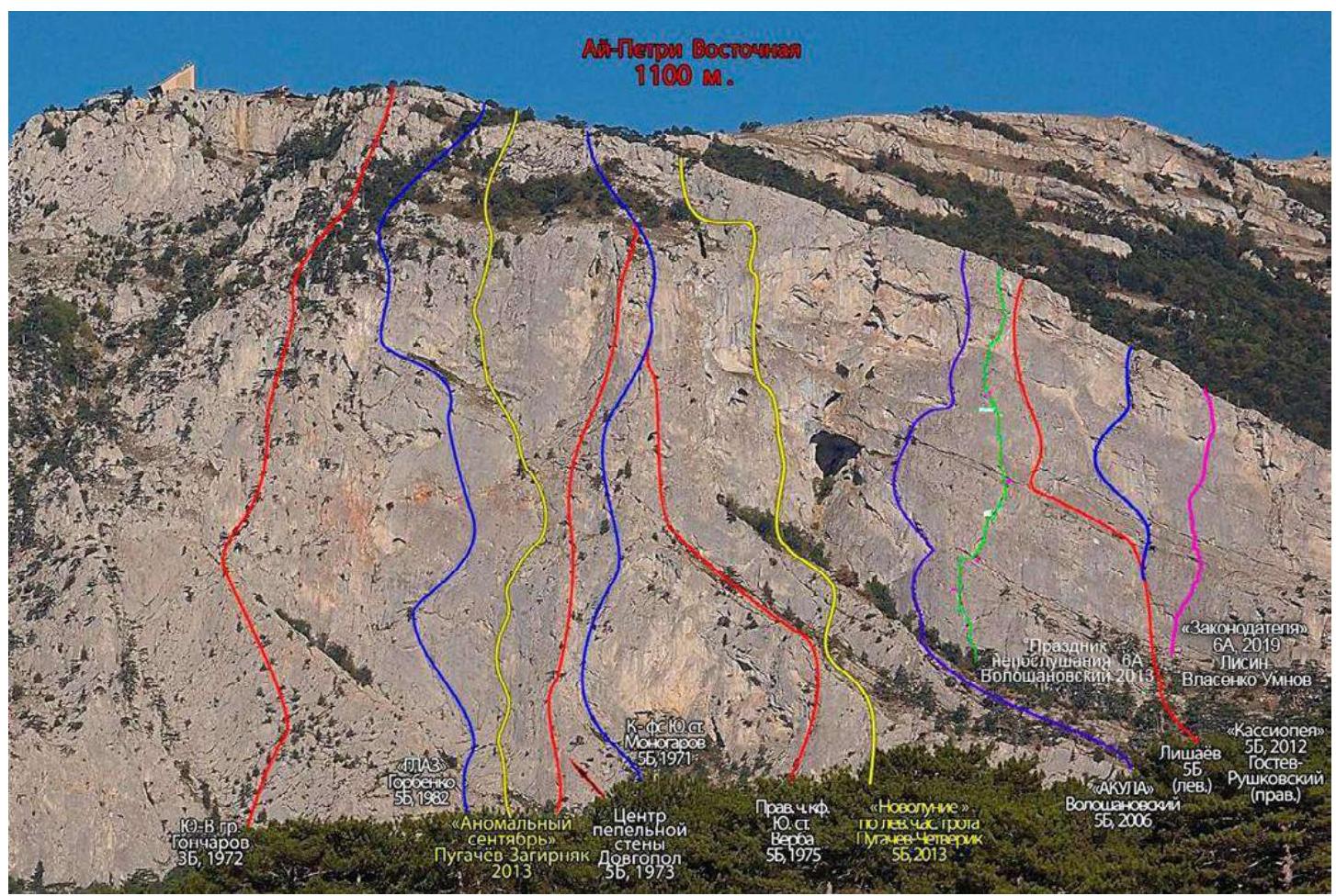
The Ai-Petri Eastern summit is located above the Miskhor settlement. The height above sea level is 1100 m, with a maximum wall height difference of about 450 m. The rock is mostly monolithic.
- The left part of the massif has classic routes of moderate complexity.
- The central part of the massif is rarely visited and features the most challenging routes.
- The right part of the wall — the Eastern Bastion — is very rarely visited and is enigmatic in terms of routes.
General information about the wall:
- In terms of length, it is comparable to the Forcant, but wider.
- In terms of architecture, it is likely a leader in Crimea, especially noticeable when walking nearby.
- In terms of visitation, it is one of the outsiders along with the Alupka wall, the Big Canyon group, Spirada, and Demerdzhi.
The approach to the wall is via the Koreiz trail, also known as the Miskhor trail, which is the shortest route to the Ai-Petri summit. The trail is not difficult and is well-trodden. The trail length is 11 km. Time — 3–4 hours. The climb at the end is difficult and steep.
Main landmarks:
- Fork in the road at the 8 km mark of the new Sevastopol highway
- Spring near the forester's gazebo
- 2nd spring
- Voron'ya Rock
- Pine tree
- Airplane
- Thousand-year-old yew
- Ai-Petri teeth
- Weather station
From Alupka, Miskhor, Gaspra, and Koreiz, it is best to ascend to Ai-Petri via the Koreiz trail, which starts where the Sevastopol highway branches off to Gaspra, Miskhor, and Koreiz. From the fork (stone signpost "Sevastopol – 72 – Yalta – 9"), follow a noticeable dirt road. Landmarks include arrow signs and Voron'ya Rock, visible from the highway to the right of the Ai-Petri massif's cliff.
The route passes through the right part of the massif. Approach via the Koreiz trail. Landmark — a large internal angle, route by Yu. Lishaev 5B cat. complexity (start of the line 20 m to the right of Yu. Lishaev's R0).
The start is through a system of blind cracks "corners" in the shape of the ninth letter of the Russian alphabet.
20 m to the right of our route, bolted holes of the unclassified line "Gostev – Rushkovsky", Yalta, are visible. Landmark — a bolt immediately after the corner, 5 m above the ground.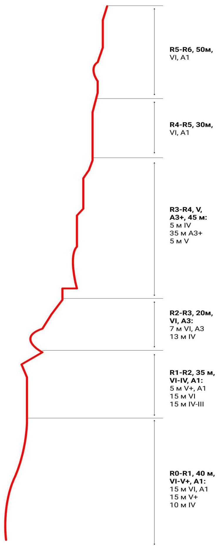
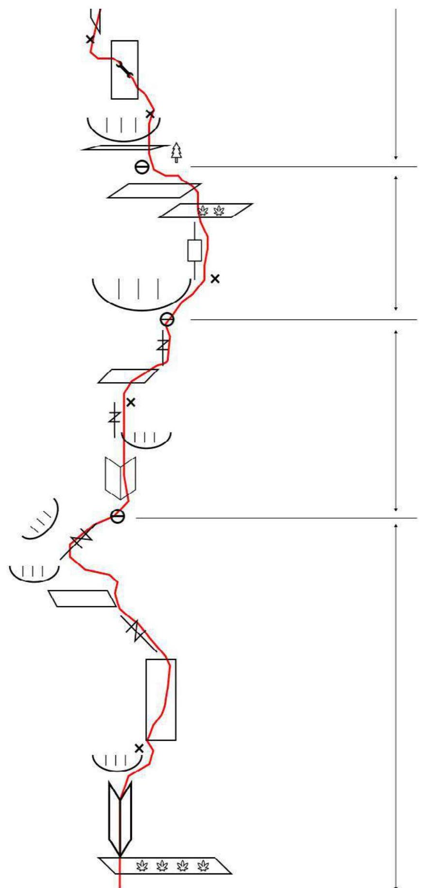
Drawn profile of the route
2. Characteristics of the Route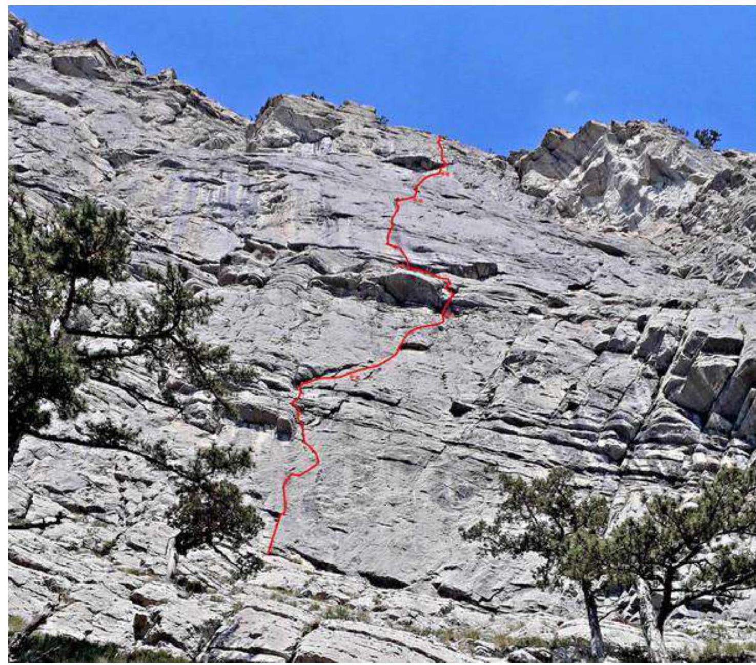
Technical photograph Sections R0–R5
Route Scheme
- R4–R5, 50 m, VI, A1
- R4–R5, 30 m, VI, A1
- R3–R4, V, A3+, 45 m: 5 m IV 35 m A3+ 5 m V
Route Scheme
- R2–R3, 20 m, VI, A3: 7 m VI, A3 13 m IV
- R1–R2, 35 m, VI–IV, A1: 5 m V+, A1 15 m VI 15 m IV–III
- R0–R1, 40 m, VI–V+, A1: 15 m VI, A1 15 m V+ 10 m IV
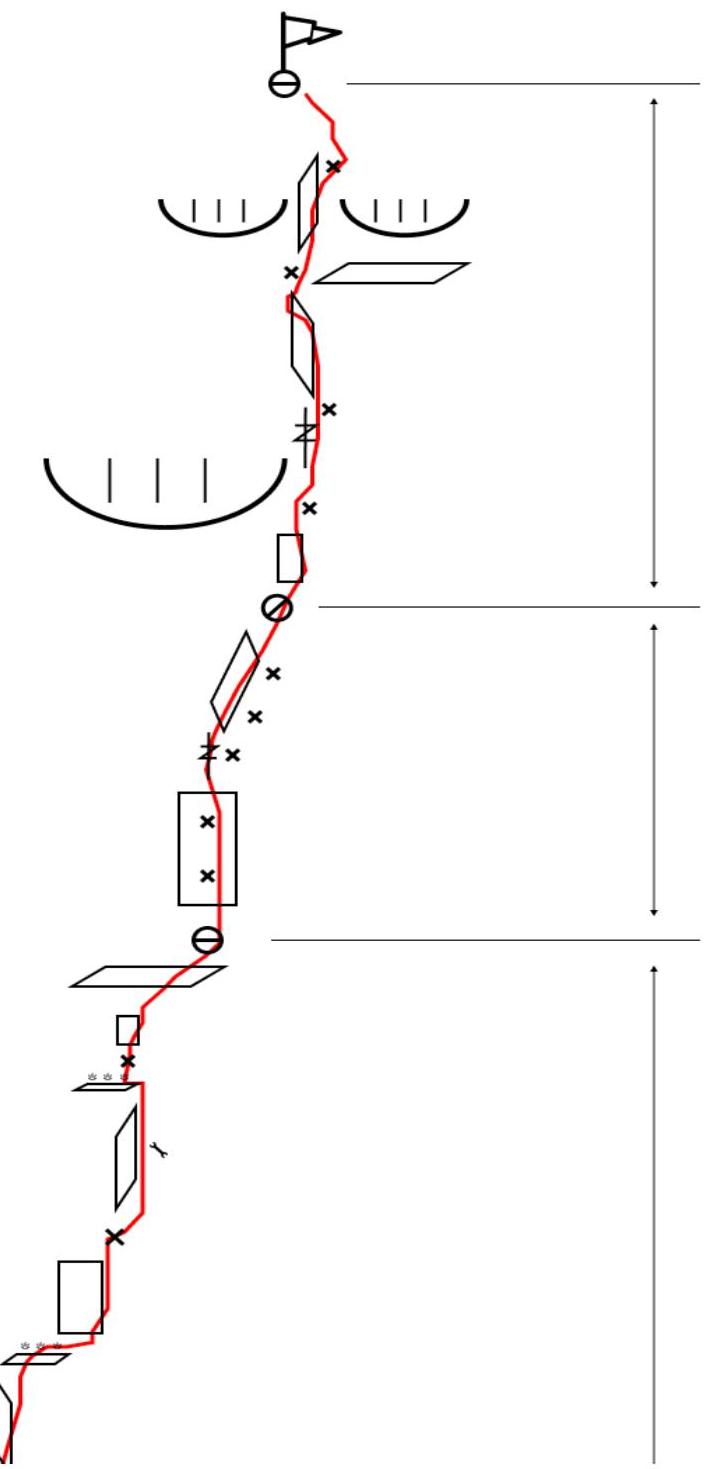
| Section # | Type and number of pitons | Complexity of section in symbols | Length of section, m | Steepness, ° | ||||
|---|---|---|---|---|---|---|---|---|
| Pitons as intermediate protection points | Anchor pitons and ITO (if applicable) | Friends (if applicable) | Nuts (if applicable) | Skyhooks | ||||
| 1 | 1 | 6 (3) | 3 | - | - | VI+, A1 | 40 | 85 |
| 2 | 1 | 4 | 2 | 1 | - | VI, A1 | 35 | 75 |
| 3 | 1 | 2 (1) | 3 (2) | - | - | VI, A2+ | 20 | 95 |
| 4 | 4 | 3 (3) | 4 (2) | 1 (1) | 13 | A3+ | 45 | 90 |
| 5 | 3 | 2 | 4 | - | - | VI | 30 | 85 |
| 6 | 3 | 3 | 2 | 1 | - | VI | 50 | 70 |
3. Characteristics of the Team's Actions
| Section # | Description | Photo # |
|---|---|---|
| R0–R1, 40 m VI+ (A1) | Move through the corner to the piton and then across the slab to the crack (VI+). Then through the crack left upwards to the open inner corner (loose rocks!). Through it 6 m upwards to approach under the slanting overhanging crack going right upwards (V+). Traverse right upwards, across a series of ledges to the crack at the base of the inner corner (IV). Station — piton plus own protection. | Photo 1, 2, 3 |
| R1–R2, 35 m VI (A1) | From the station 3 m upwards through the crack (V+, A1) to approach the blind inner corner leading to a small ledge with a red streak. Through the corner with difficult climbing (protection is complicated) and then through the crack in the left part of the ledge to exit into a hollow above the ledge (VI), piton. Then right upwards across simple rocks to exit onto a ledge under the right part of the large ledge (IV–III), here is the station. | Photo 4 |
| R2–R3, 20 m VI (A2–A2+) | From the station upwards through the ledge across the overhanging crack (A2–A2+, possible direct fall onto the station) to the piton. Then climbing upwards (IV) onto a large ledge. Across it traverse left to the piton. Station — piton plus own protection. | |
| R3–R4, 45 m (А3+) | Key section. From the station upwards onto a ledge (loose rocks!) under the overhang, orienting on the piton. From the piton, complex artificial aids across the slab upwards and left 8 m to the second piton (skyhooks). (Dangerous section! Protection is complicated, possible fall onto the ledge). From the second piton upwards to a pocket with grass. Then upwards to the piton, from it movement across the slab with a black streak to a small ledge with grass (30 m A3+). Here is a piton. Climbing to exit onto a good ledge. Station. At this point, the route intersects and then coincides with the unclassified line "Gostev – Rushkovsky". | Photo 5–11 |
| R4–R5, 30 m VI | Climbing upwards across the slab with good holds to the inner corner and then through it. Then right upwards under the right part of the large ledge. Pitons are encountered. Station is hanging in the right part of the ledge. | Photo 12–14. |
| R5–R6, 50 m VI | From the station climbing upwards 2 m to approach under the crack in the right part of the ledge. Bypass the ledge on the right. Then move upwards, orienting on the pitons of "Gostev – Rushkovsky". Exit onto the summit (2 pitons). |
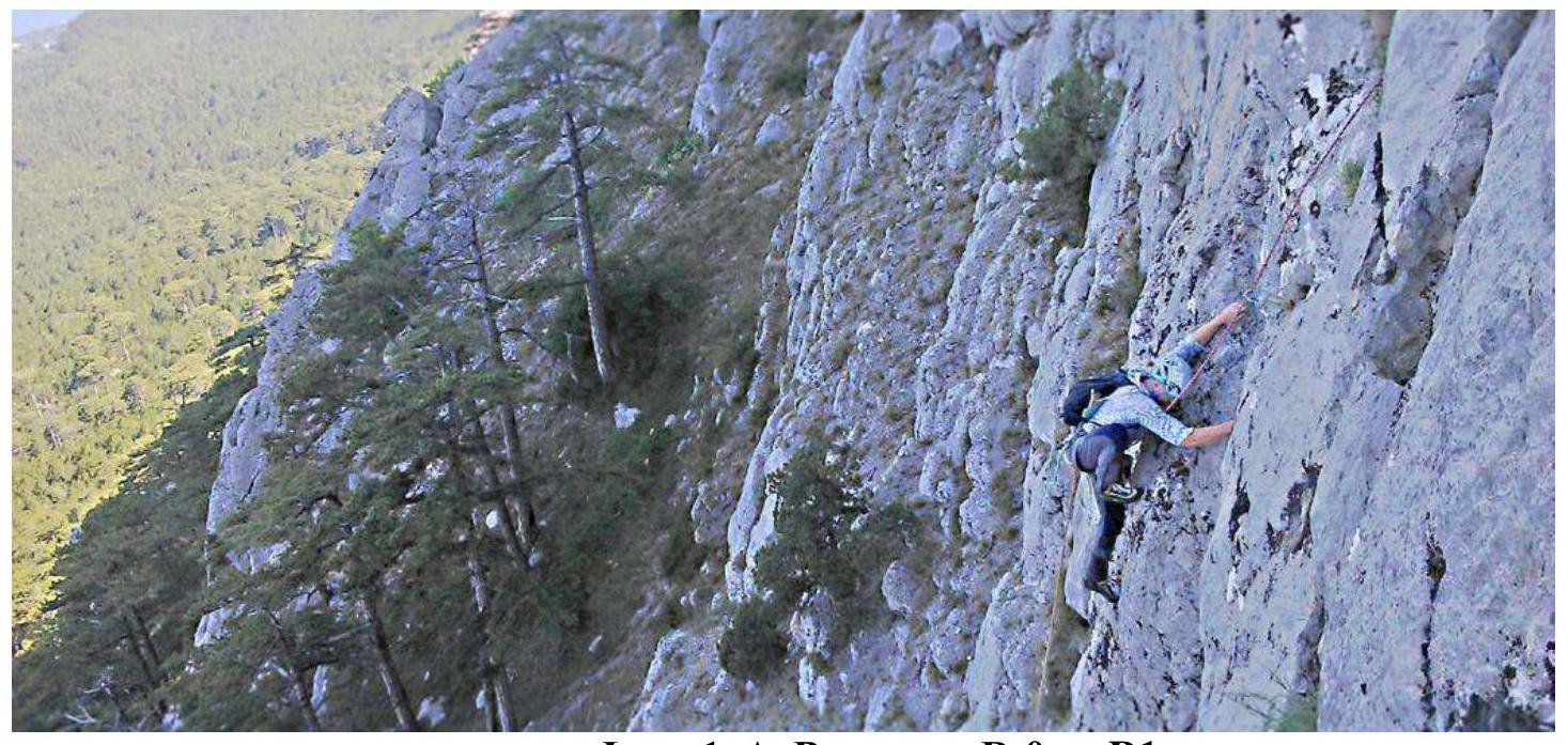
Photo 1. A. Vlasenko R0–R1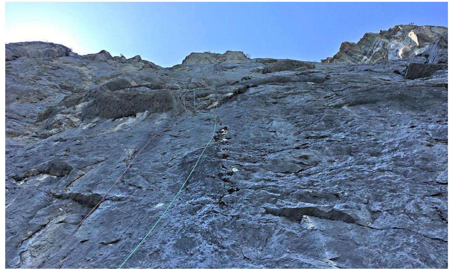
Photo 3. A. Lisin R0–R1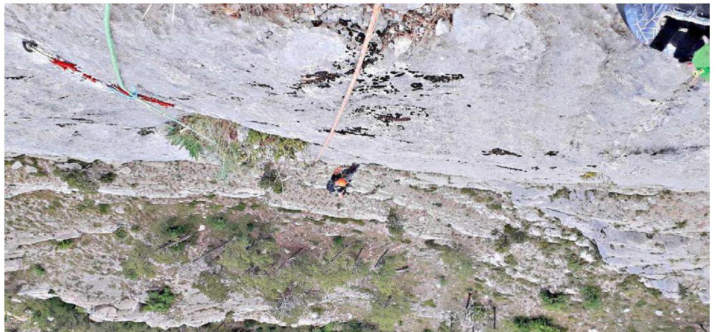
Photo 3. A. Umnov R0–R1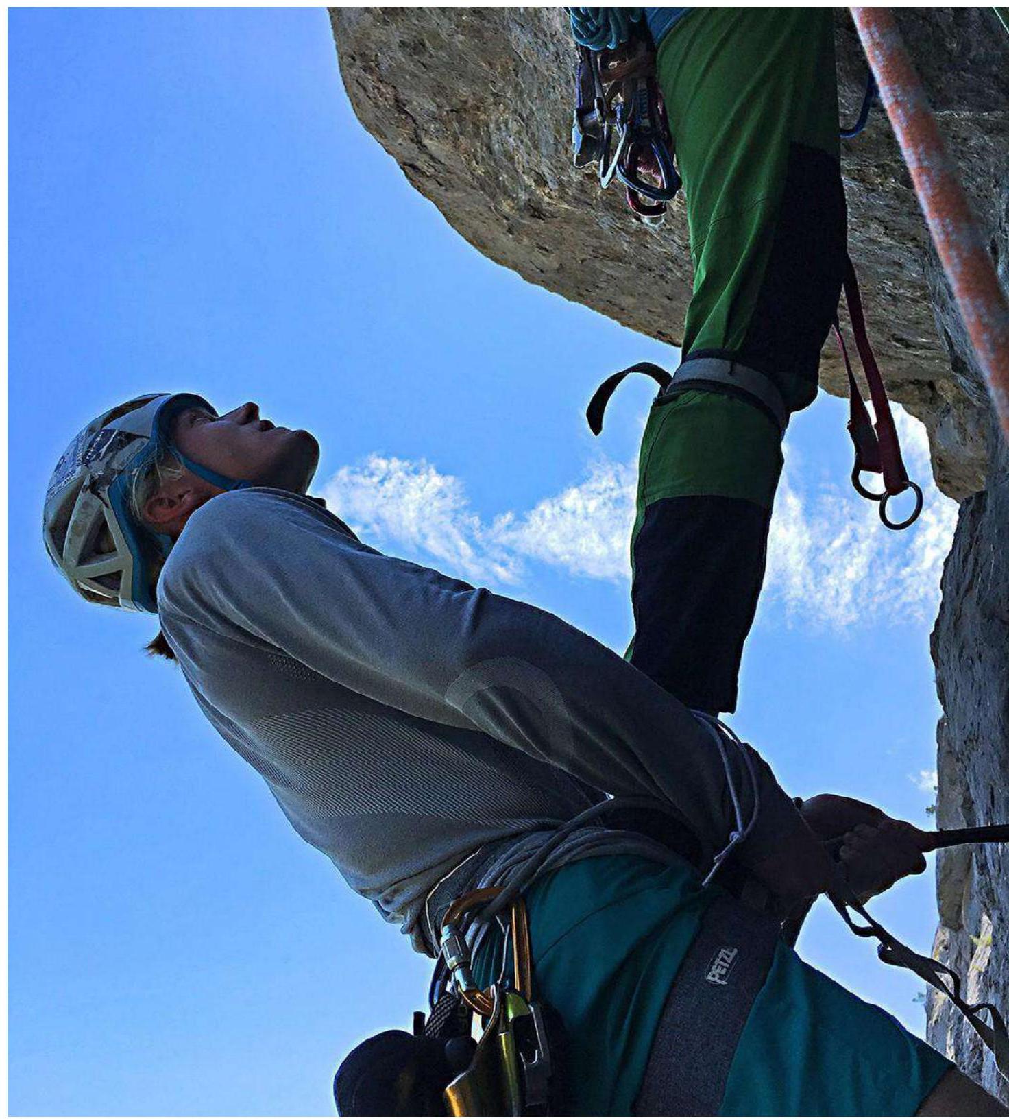
Photo 4. A. Lisin — A. Vlasenko on R1–R2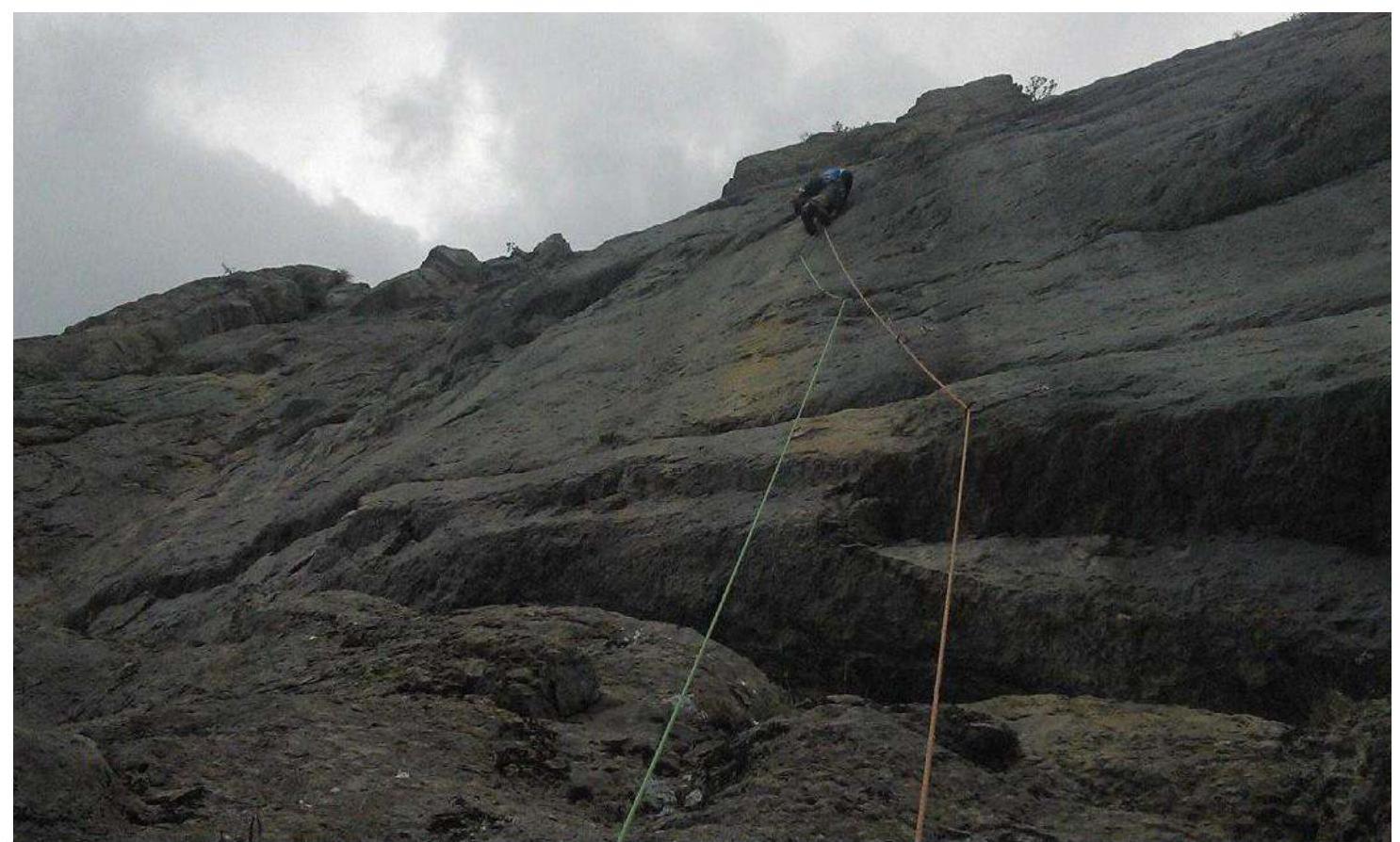
Photo 5. A. Umnov R3–R4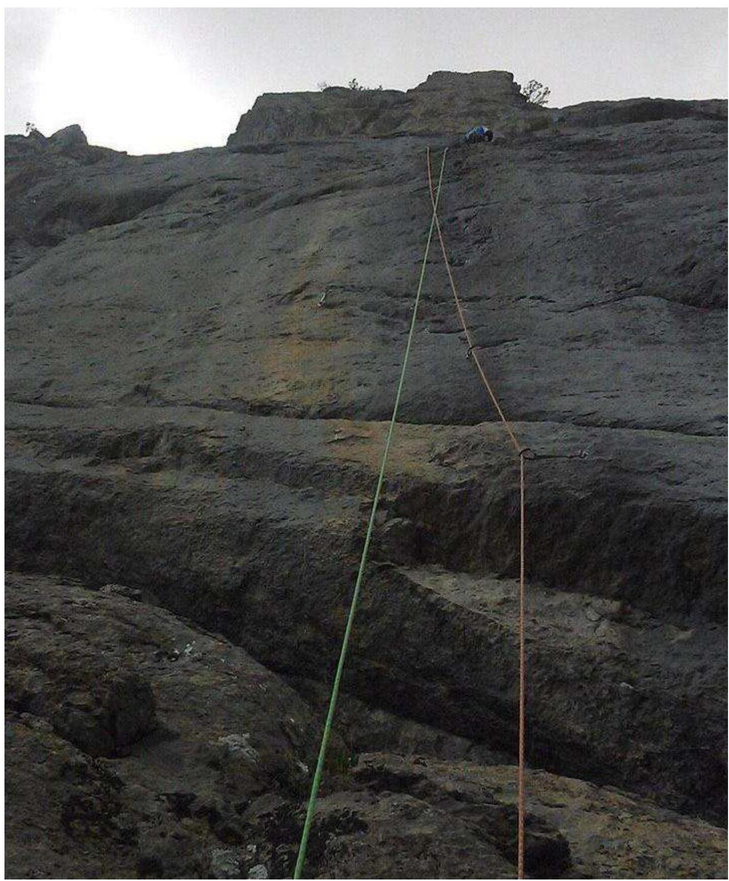
Photo 6. A. Umnov R3–R4
Photo 7, 8. Protection points R3–R4
Photo 9. A. Lisin R3–R4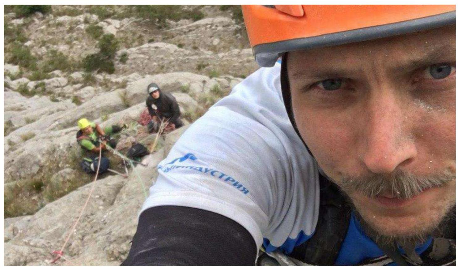
Photo 10. A. Lisin, A. Vlasenko, A. Umnov R3–R4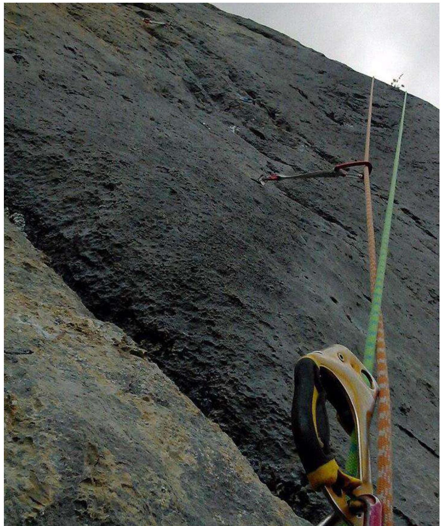
Photo 11. Protection points R3–R4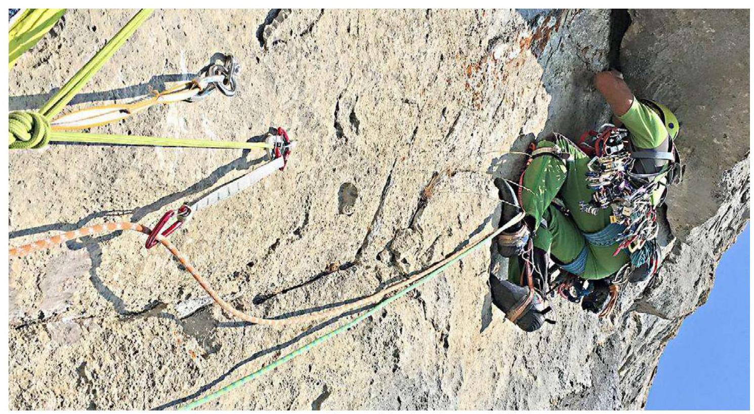
Photo 12. A. Lisin R4–R5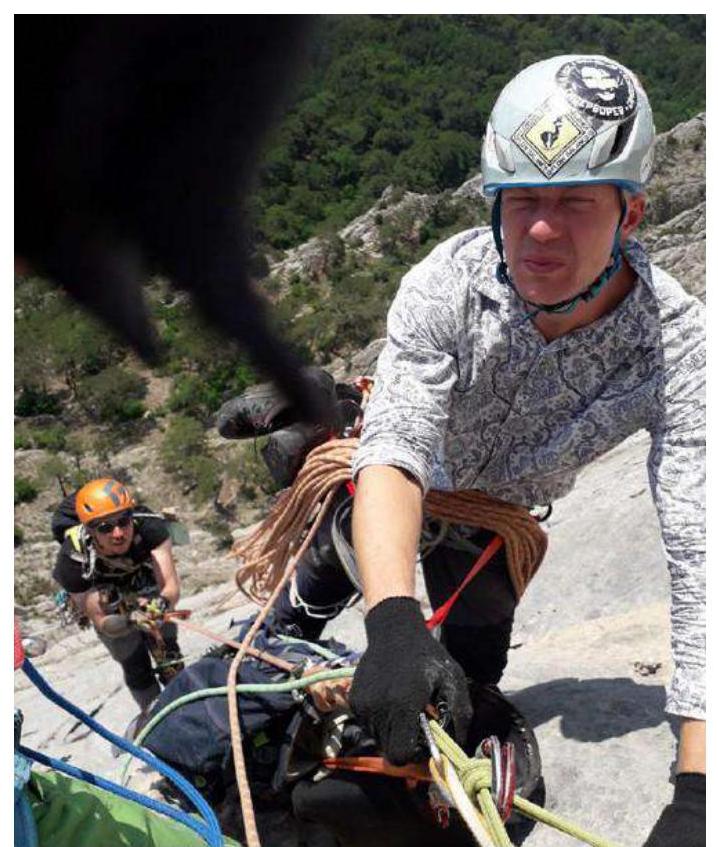
Photo 13. A. Vlasenko, A. Umnov R4–R5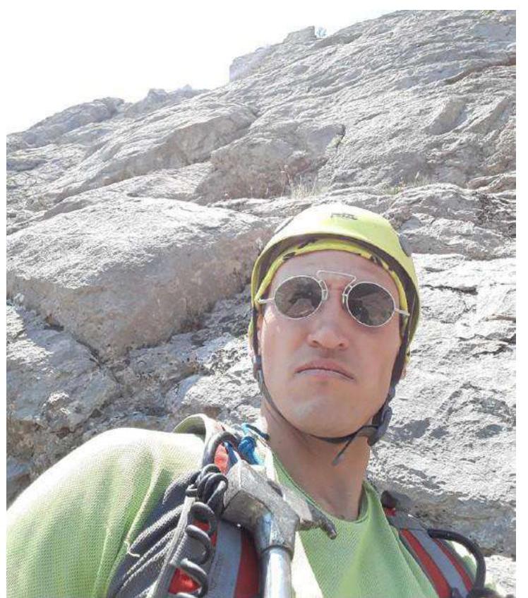
Photo 14. A. Lisin R5
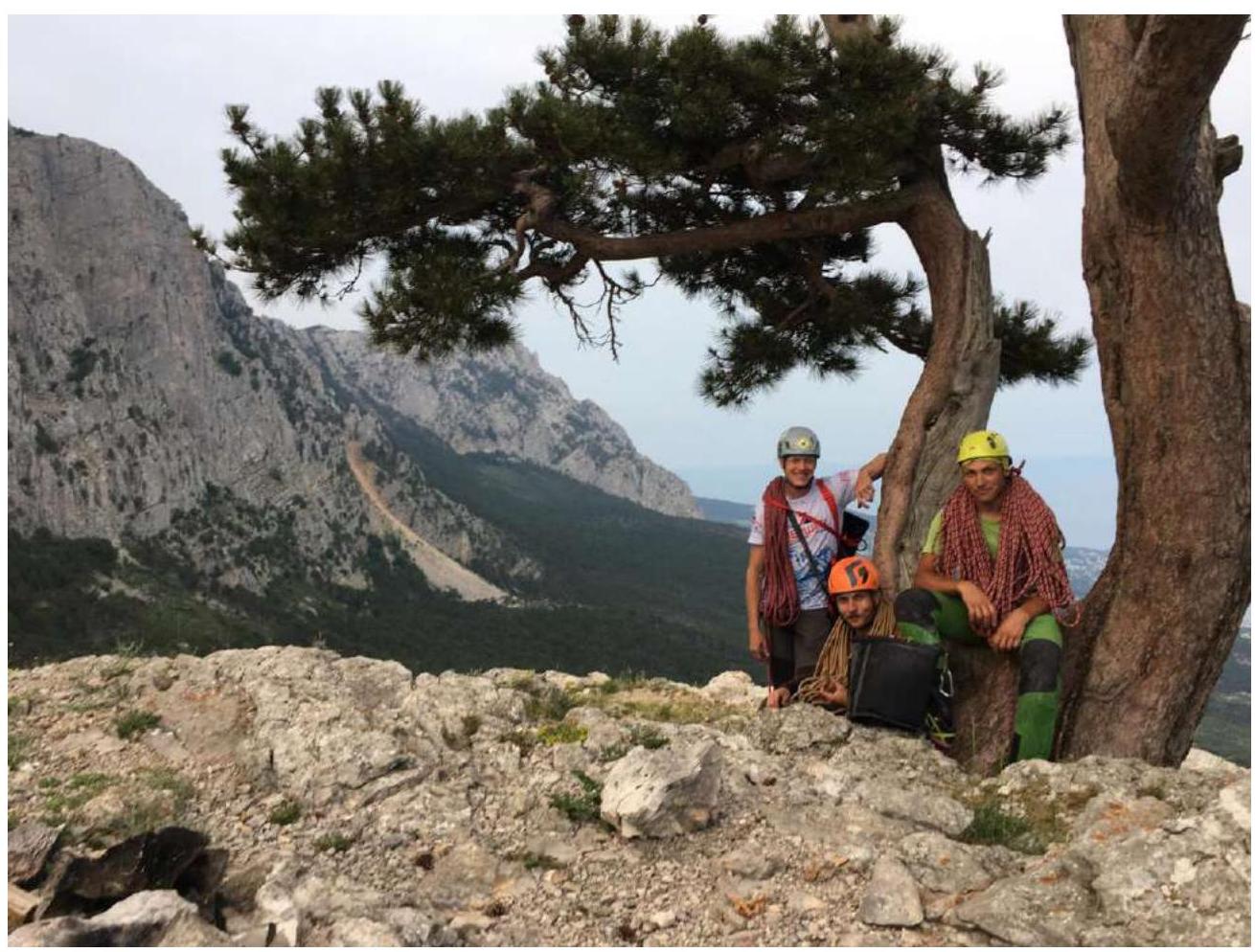
3.2. Photo of the team on the summit with the control post
 3.3. The route is quite monolithic, with minimal destroyed rocks.
- At the beginning of the second section, there is a very complex climb (around 6A+) across a slab with poor protection.
- On the 4th section, there are quite large gaps between pitons with skyhook moves between them. There is a risk of falling onto the ledge.
- There is a very complex section — the 4th pitch. On it, climbers will need good artificial aid techniques on skyhooks.
The route is not uniform.
Cell phone coverage is good throughout the route. After reaching the plateau, descend left downwards. Exit onto the equipped tourist trail (Koreiz trail), which leads to the South Coast highway near the Koreiz stop. The descent takes about 1.5 hours.
Compared to other Crimean sixth category routes, this route is quite complex due to the 4th pitch, which stands out with its complex artificial aids. Not recommended as a first 6B.
Comments
Sign in to leave a comment