Report on the first ascent of the route to Yukspor (1,037 m) via the right-hand part of the SW ridge (“Surovaia zhenshchina” - "Severe Woman"), approximately category 2A difficulty.
Climbing Passport
- Khibiny, section number 8.6.
- Yukspor - 1,037 m; via the right-hand part of the SW ridge.
- Proposed category 2A; first winter ascent.
- Nature of the route - combined.
- Height difference on the route - 600 m. Route length: 730 m. Length of sections with category 3 difficulty - 20 m. Steepness of the key part of the route - 75°; average steepness of the entire route about 45°.
- Pitons left on the route - none.
Total equipment used on the route:
- pitons - 2 anchor pitons;
- protection - 8 nuts;
- slings - 2.
- Team's climbing time - 4.5 hours; days - 1.
- Leader: Morozova Irina Yurievna, Candidate Master of Sports.
Participants:
- Romanov Aleksey Mikhailovich - 3rd sports category;
- Sofieva Mariia Alekseevna - 2nd sports category;
- Skavinskii Nikolai Yurievich - 3rd sports category;
- Ovsyannikova Anna Mikhailovna - 2nd sports category.
- Coach: Morozova Irina Yurievna, Candidate Master of Sports.
- Departure for the route: 11:00, March 28, 2008. Reach the summit: 15:30, March 28, 2008. Return: 18:00, March 28, 2008.
- Organization: CSKA named after Demchenko.
The second ascent of the route, confirming its estimated category 2A difficulty, was made on March 29, 2008, by a team from the Belarusian mountaineering and tourism club "Nadir" consisting of:
- Leader: Puchkov Mikhail Nikolaevich - 1st sports category.
- Participants: Sviridov N.V.
- Lukyanov A.A.
- Khoruzhko A.V.
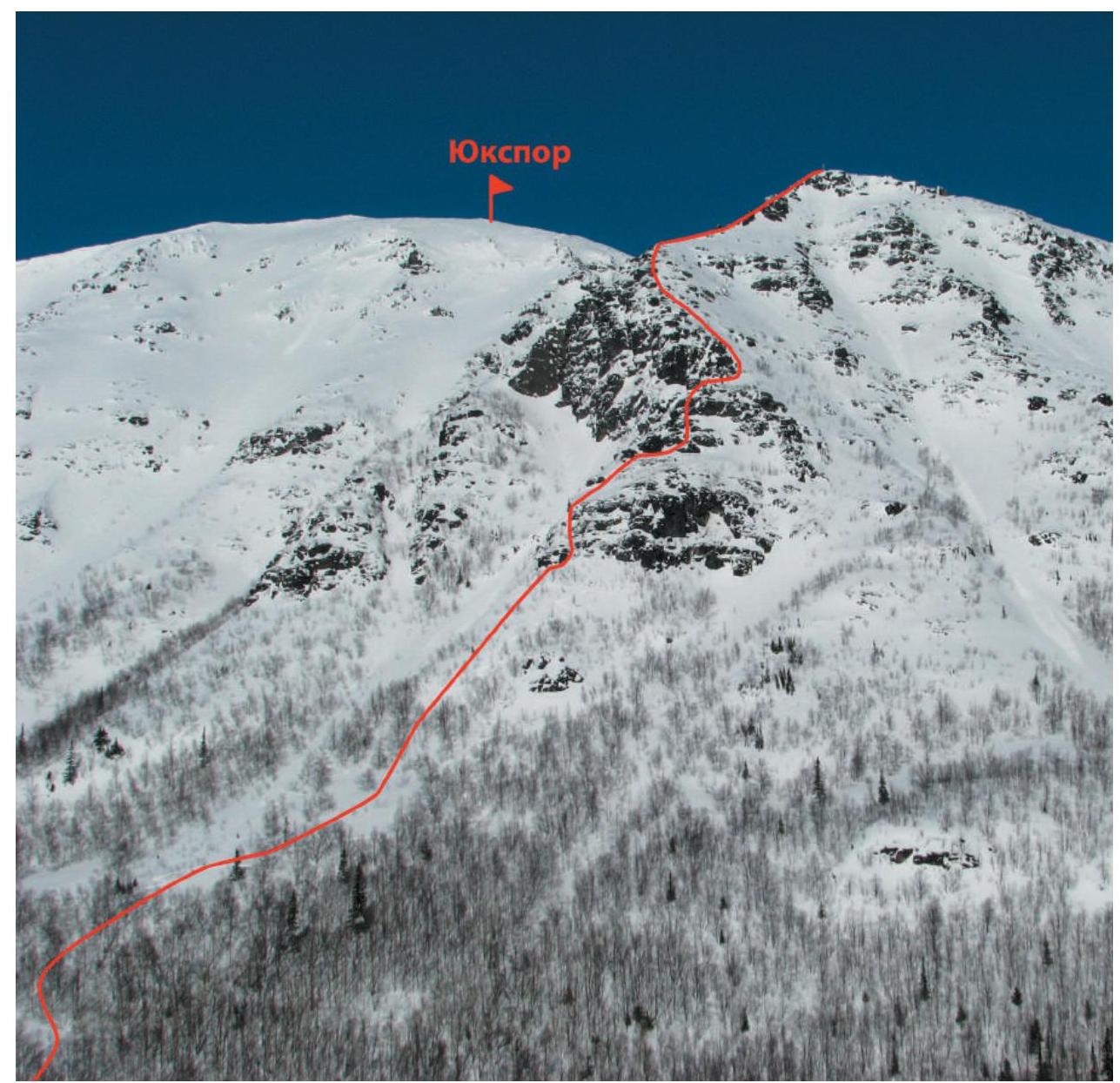
General photo of the route
Route Description
Climb a steep snowy slope for 400 m to reach the right-hand part of the SW ridge rocks, to the right of a clearly visible large avalanche couloir.
R0–R1.
- Climb a small snow-filled chimney-couloir for 7 m at 40° (category II difficulty).
- Then, climb a small rock wall for 2 m at 75° (category III difficulty) to reach a ledge.
- Traverse left along the ledge for 4 m.
- Then, move right and climb another small rock wall for 3 m at 70° (category III difficulty) to a large snowy ledge.
R1–R2. Follow the snowy ledge, passing over protruding "ram's foreheads," to approach the second rock belt. Traverse right under the rock wall and then climb the rocks for 50 m at 20° (category II difficulty).
R2–R3. Climb rocks of moderate difficulty for 15 m (category III difficulty) straight up, then traverse left along a ledge, and continue upwards for 3 m at 70° (category III difficulty) to a sloping ledge, which leads to the third rock belt.
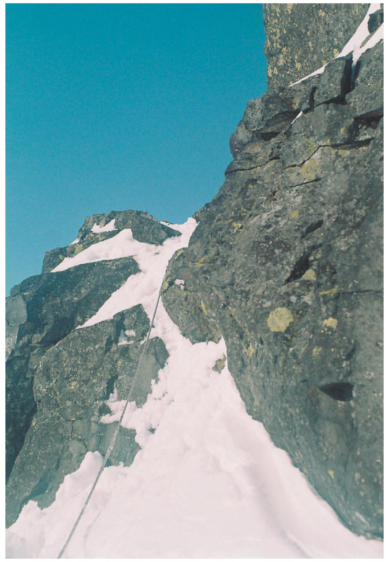
R3–R4. Traverse right along a snowy slope at 40°, avoiding the walls of the third rock belt, and then climb a steep snowy slope to the right of the rocks to reach the edge of a buttress.
R4–R5. Follow the edge for 100 m to reach the shoulder of the SW ridge, and then move right along the buttress to a sub-summit, where a cross is installed.
R5–R6. From the sub-summit, cross small snowy rises and continue along a snowy plateau straight-left. Then, move left to reach the summit of Yukspor, where a triangulation point is located.
Approach to the Route
From Kirovsk or the settlement of Kukisvumchorr (25 km), take transport to the 23 km stop. Then follow the road to the MSU educational and scientific base.
From the base: Head towards the reserve railway tracks running under the slopes of Yukspor. Follow the railway tracks for 300 m until you are under the slopes of Yukspor, where the training avalanche couloir is located. Then move through the forest towards this couloir, and continue up the right-hand part of the couloir and then up a snowy slope to reach the right-hand part of the SW ridge rocks.
Conclusions and Recommendations for the Route
The difficulty of the route sections was assessed based on winter conditions. The route is technically challenging and is recommended for training and sports groups as a training climb. The route is climbed with simultaneous protection (anchor pitons, cams). In winter, it is ideal for practicing rope work on rock, combined, and mixed terrain with the organization of intermediate protection points using pitons and nuts. The route's proximity to the base and relative avalanche safety make it an ideal training route that can be accessed in any weather.
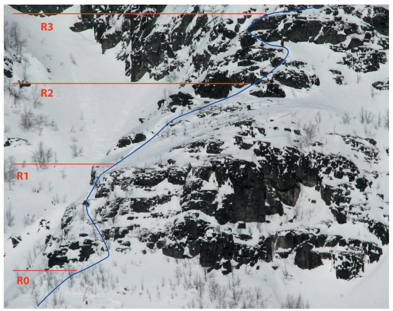
Photo of the technical part of the route
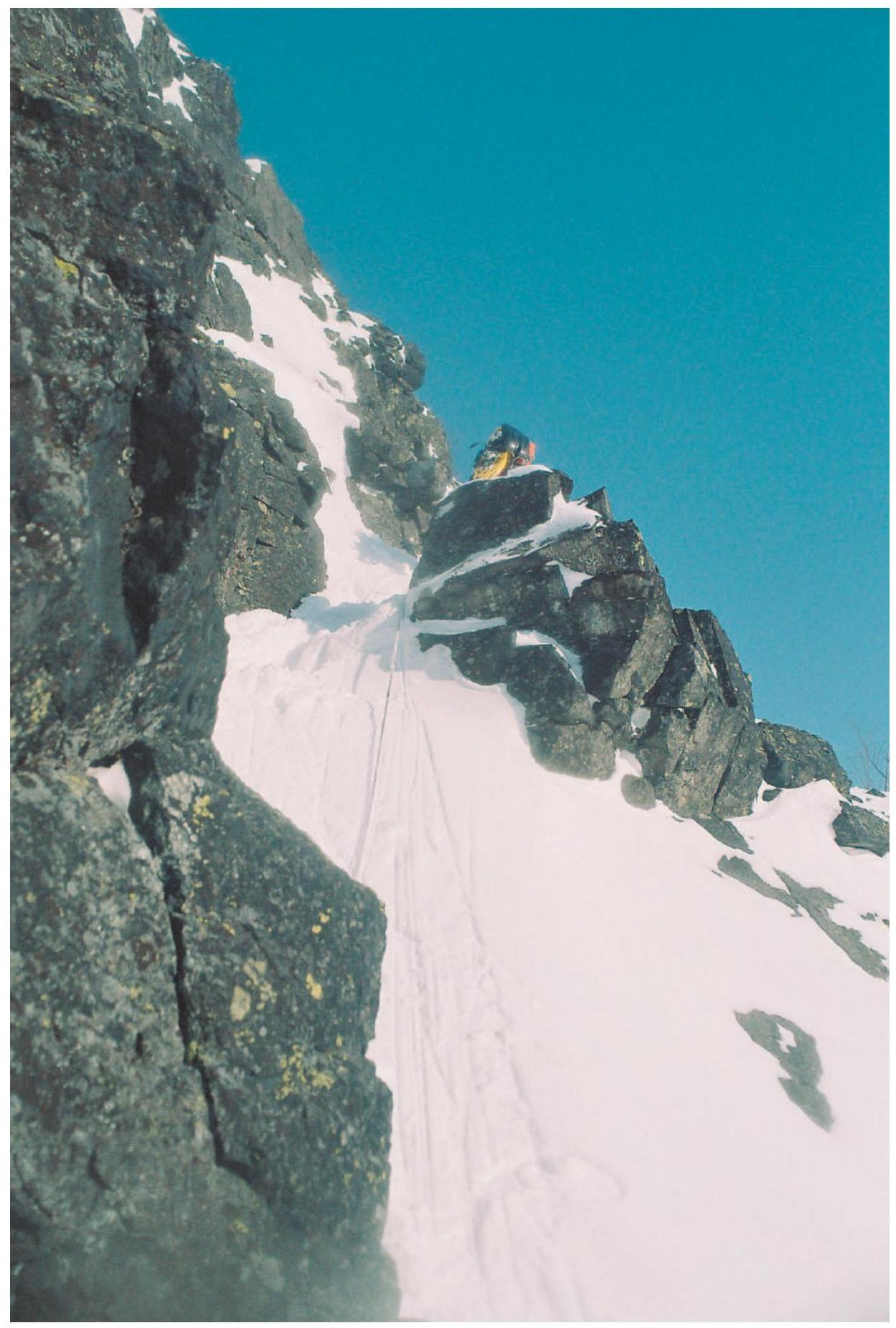
Photos of sections of the route
Photos of sections of the route

Photos of sections of the route
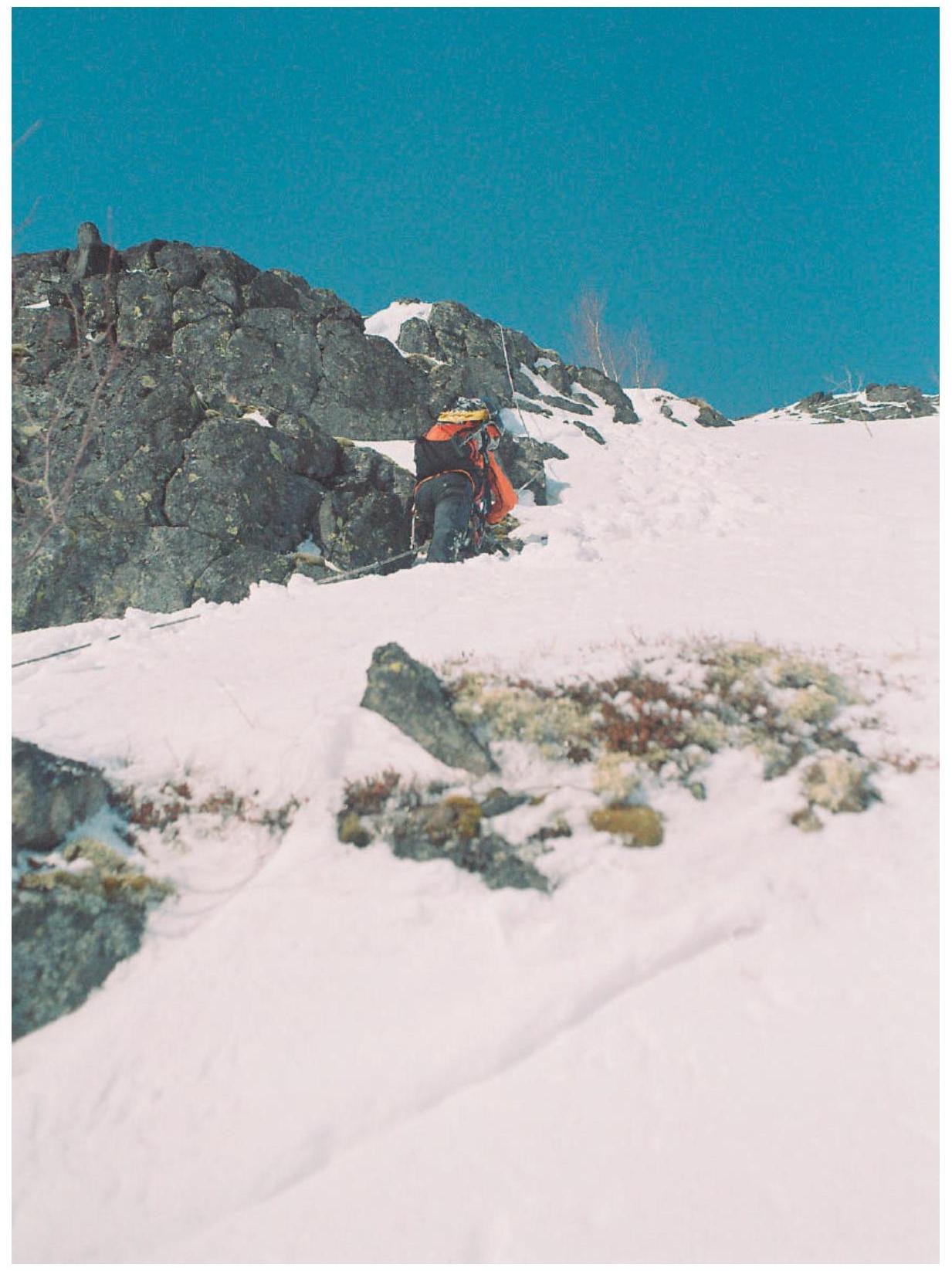
Photos of sections of the route
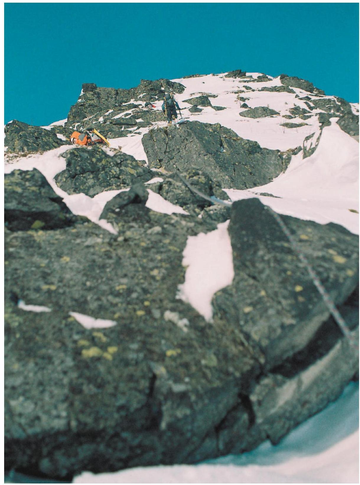
Photo of the edge of the buttress
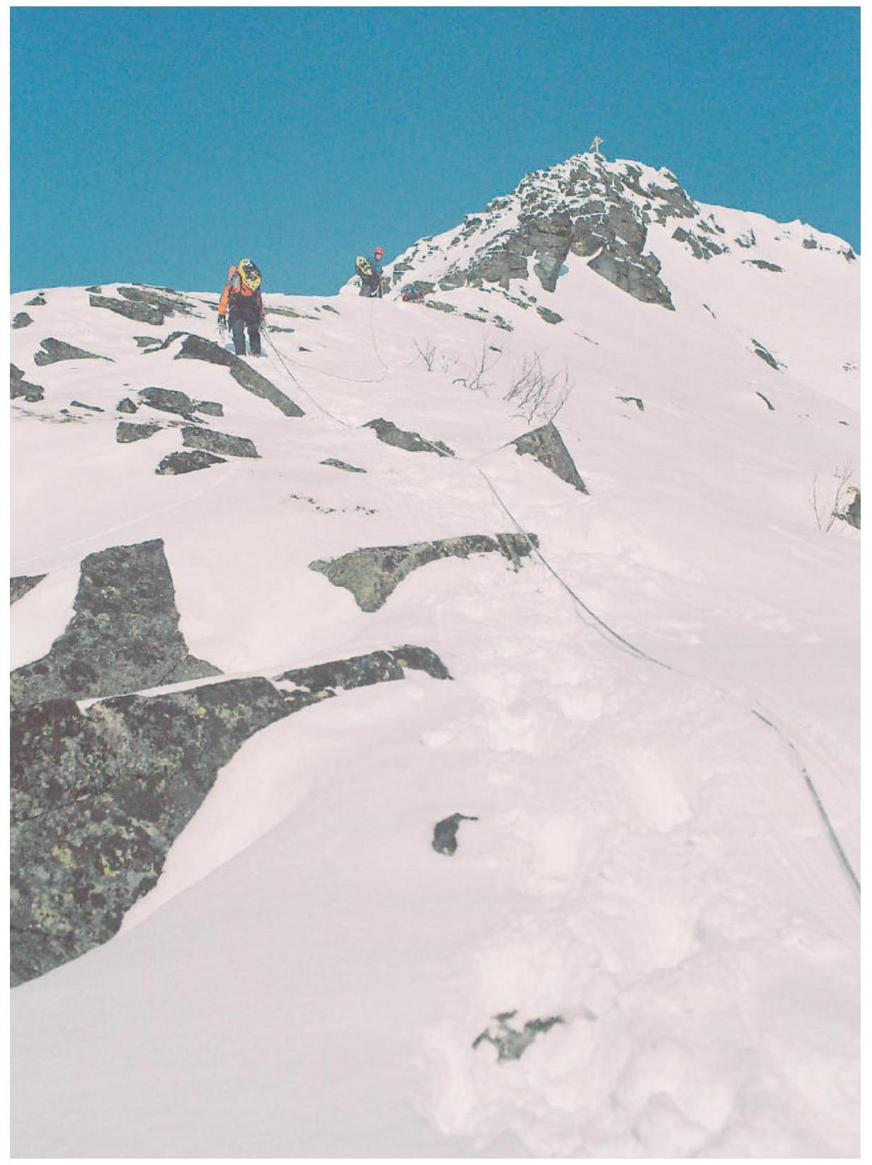
Photo of the upper part of the buttress. Exit to the sub-summit

On the summit of Yukspor


