Report
On the first ascent to the summit of Vudyavrchorr via the route of category 2B complexity on July 6, 2022
I. Climbing Report
| 1. General Information | ||
|---|---|---|
| 1.1 | Full name, sports rank of the leader | Shcherbakov Alexander Vladimirovich, 2nd sports rank |
| 1.2 | Full name, sports rank of participants | Petrova Alena Mikhailovna, 2nd sports rank |
| 1.3 | Full name of the coach | Vernus Tatiana Viktorovna |
| 1.4 | Organization | |
| 2. Characteristics of the Climbing Object | ||
| 2.1 | Region | Khibiny |
| 2.2 | Valley | Massif "Rascheska" |
| 2.3 | Number of section according to the classification table of 2013 | |
| 2.4 | Name and height of the summit | Vudyavrchorr |
| 2.5 | Geographical coordinates of the summit (latitude/longitude), GPS coordinates | N67° 38′ E33° 35′ |
| 3. Characteristics of the Route | ||
| 3.1 | Name of the route | Along the 2nd spur of the SW ridge "Panoramik" |
| 3.2 | Proposed category of complexity | 2B |
| 3.3 | Degree of route development | First ascent |
| 3.4 | Relief characteristics of the route | In summer - rocky, in winter - combined |
| 3.5 | Height difference of the route (data from altimeter or GPS) | 640 m |
| 3.6 | Length of the route (in meters) | 1750 m |
| 3.7 | Technical elements of the route (total length | Category I - rocks - 200 m, Category II - rocks - 50 m |
| of sections of different complexity categories indicating relief characteristics (ice-snow, rocky)) | Category III - rocks - 15 m. Category IV - ice/rocks/combination - m. Category V - ice/rocks/combination - m. Category VI - ice/rocks/combination - m. Rocks VI, A3 - m. Rocks VI, A4 - m | |
| :--: | :--: | :--: |
| 3.8 | Average steepness of the route, (°) | 50° |
| 3.9 | Average steepness of the main part of the route, (°) | 70° |
| 3.10 | Descent from the summit | By category complexity in the valley |
| 3.11 | Additional characteristics of the route | Presence of water at the start of the route |
| 4. Characteristics of the Team's Actions | ||
| 4.1 | Time of movement (team's walking hours, in hours and days) | 4 h |
| 4.2 | Overnights | |
| 4.3 | Time spent on route development | hours, days |
| 4.4 | Start of the route | 21:30, July 6, 2022 |
| 4.5 | Summit reached | 23:30, July 6, 2022 |
| 4.6 | Return to the base camp | 1:00, Polar day |
| 5. Characteristics of Weather Conditions | ||
| 5.1 | Temperature, °C | +15 °C |
| 5.2 | Wind speed, m/s | 3 m/s |
| 5.3 | Precipitation | |
| 5.4 | Visibility, m | More than 1000 m |
| 6. Person Responsible for the Report | ||
| 6.1 | Full name, e-mail | tahtar1054@mail.ru |
II. Description of the Ascent
1. Characteristics of the Climbing Object
1.1.

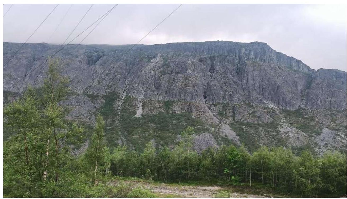
General photo of the mountain. The summit is not visible from the valley.
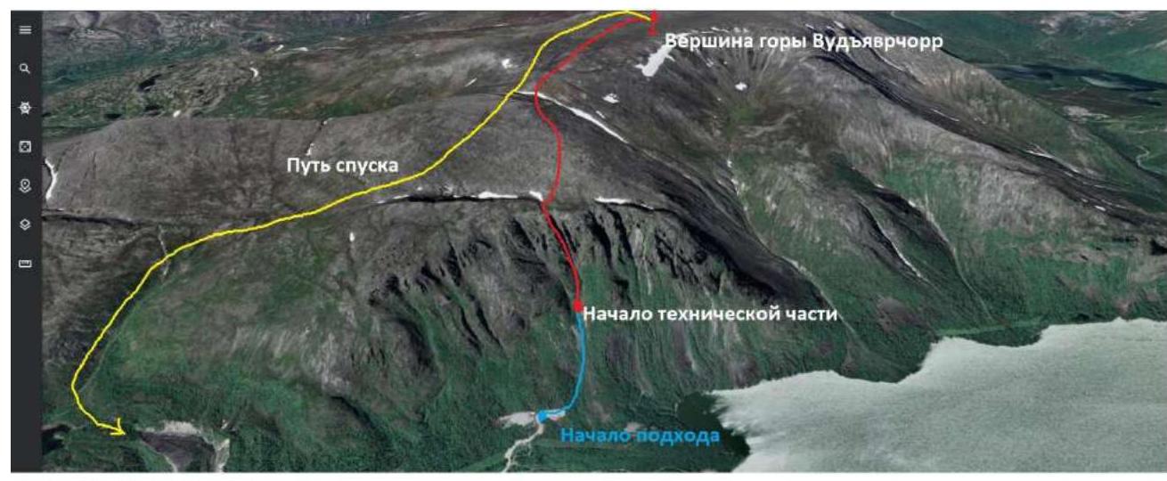
Satellite panorama of the route and summit of Vudyavrchorr. Satellite imagery as of July 5, 2021. Known classified routes in this massif are absent.
1.3. Map of the Area
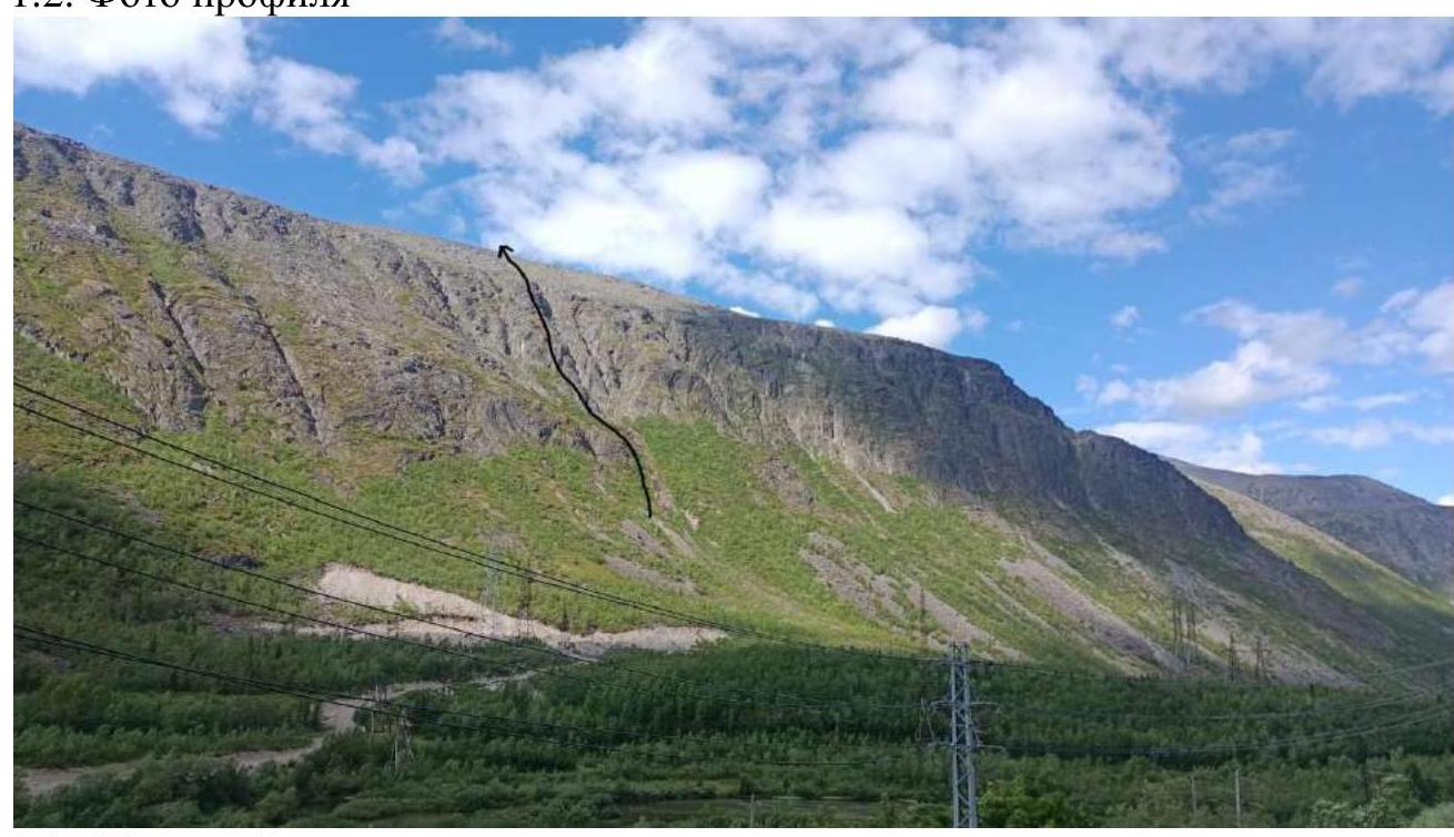
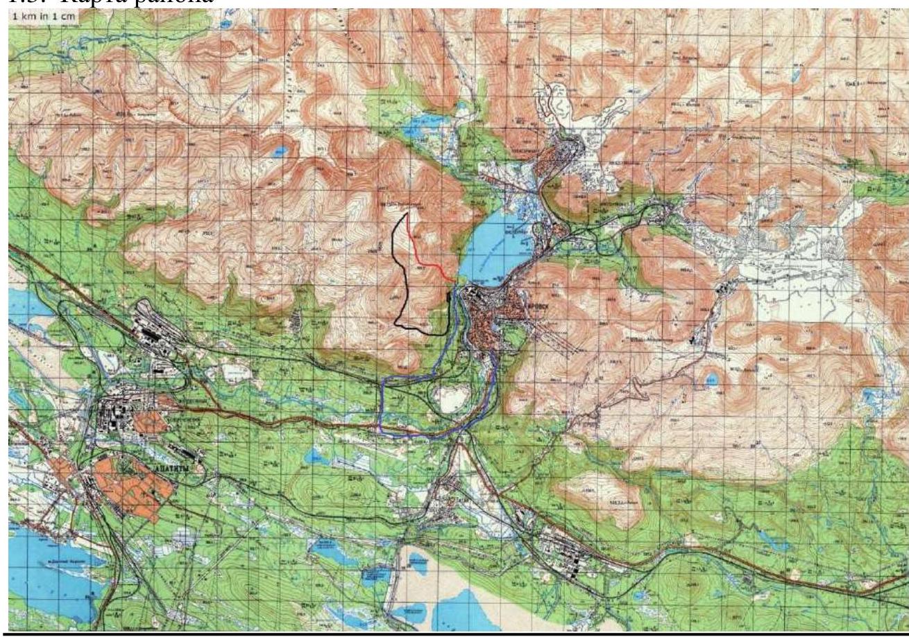
The city of Kirovsk can serve as a reference point (base camp). From the city, move along the asphalt road towards Apatity for about 5 km, then turn right opposite the old airfield, and continue along the dirt road until the railway crossing, and turn right after the crossing. After the turn, continue for another 2 km and turn onto a characteristic forest road, following the northern direction.
The starting point of the approach is:
- a characteristic sandy site;
- an installed power line support.
The landmark is the "Rascheska" massif, visible from almost all sections of the path.
2. Characteristics of the Route
2.1.
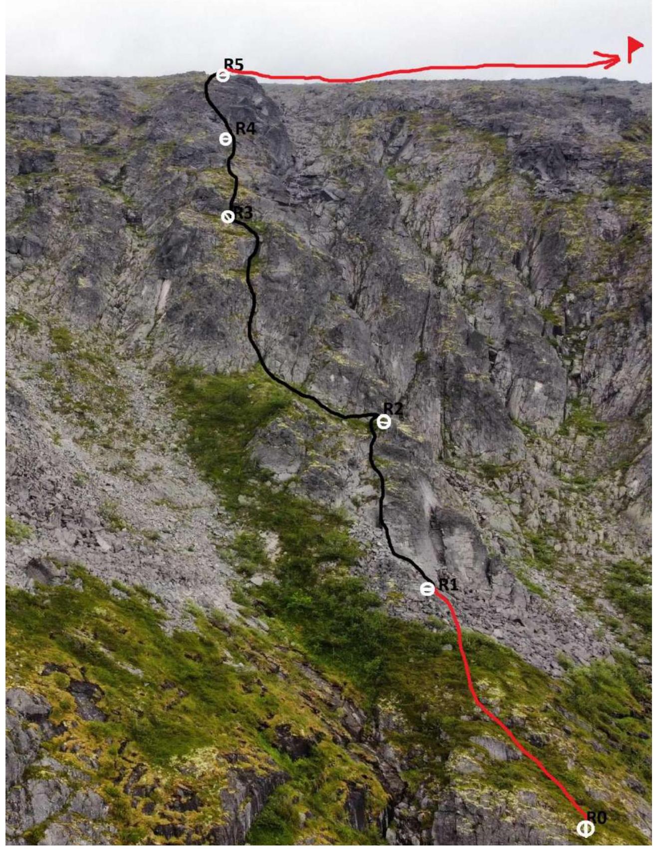
| Section # | Name and number of pitons | Belay points, characteristics in UIAA symbols | Route line in UIAA symbols | Complexity of the section in symbols | Section length, m | Steepness, ° | |
|---|---|---|---|---|---|---|---|
| R4–R5 | 3 | 2–3 | 40 m | 75° | |||
| R4–R3 | 3 | 2–3 | 40 m | 70° | |||
| R3–R2 | 3 | 2 | 50 m | 65° | |||
| R2–R1 | 1 | 2 | 40 m | 70° | |||
| R1–R0 | 1 | 50 m | 50° |
3. Characteristics of the Team's Actions
3.1. Brief description of the route passage.
| Section # | Description | Photo # |
|---|---|---|
| R0–R1 | Start moving along a gentle moss, turning into stone scree. After rain, it can be slippery. | 1 |
| R1–R2 | Then, bypassing a steep stone wall on the left, along mossy ledges, climb up to a convenient ledge. Here you can organize a convenient belay station. | 2 |
| R2–R3 | To the left, up along a mossy ledge, to a characteristic internal corner composed of large slabs and stones. Medium camalots go well. Then, upwards, pass a sloping mossy ledge and exit through a small ledge to the second ledge to the rocky wall. Belay station. | 3, 3.1, 3.2 |
| R3–R4 | Overcome a simple wall 5 m and along a sloping ledge exit under the rocky wall, holding to the left. | 4 |
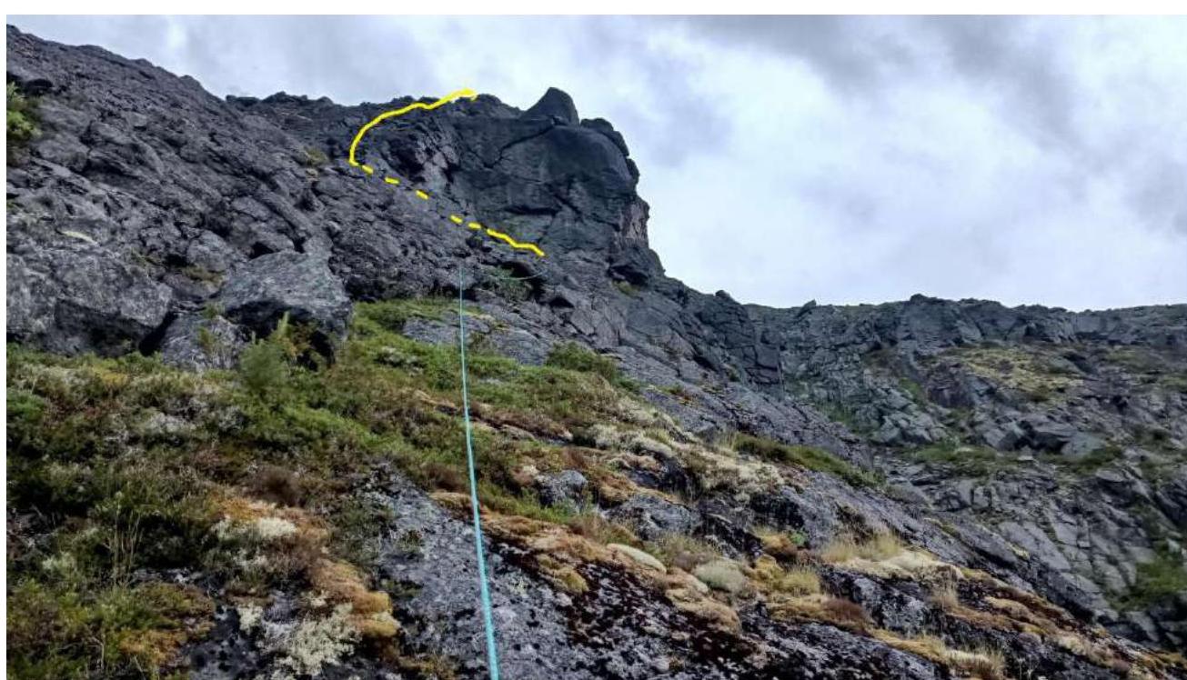
| R4–R5 | From the station, take a left and along the crumbling (initially) wall climb up to the flattening. | 5 |
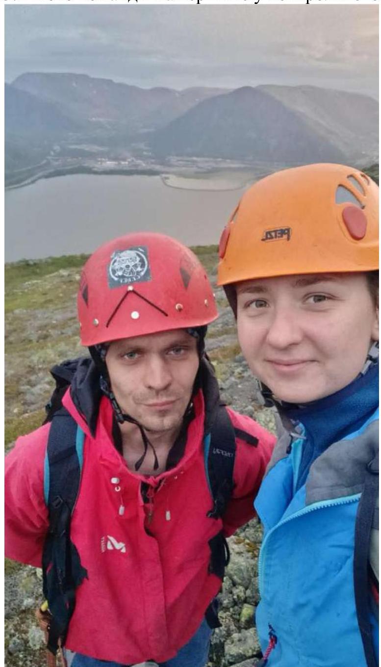
3.2. Photo of the team at the summit with the control tour
3.3. General recommendations for the route passage
The route is logical and simple to pass. It is not recommended to try to bypass sections of the route to the left or right along the scree parts. The path to the summit, after completing the key part, must be performed between two characteristic depressions in the flattening of the plateau. The descent from the summit passes in the southern part of the mountain, through wooded terrain, and leads to a forest road. Landmarks can be the city of Kirovsk and the line of the chairlift on the mountain Aikuayvenchorr. Often the mountain, until the end of the technical part, is hidden by clouds. In such cases, it is necessary to use a navigator or navigate by the noise of the railway passing at the foot of the mountain. The route is avalanche-prone in winter with a 2nd degree of avalanche danger. It is recommended to pass in the summer.
Photo 1 R0–R1
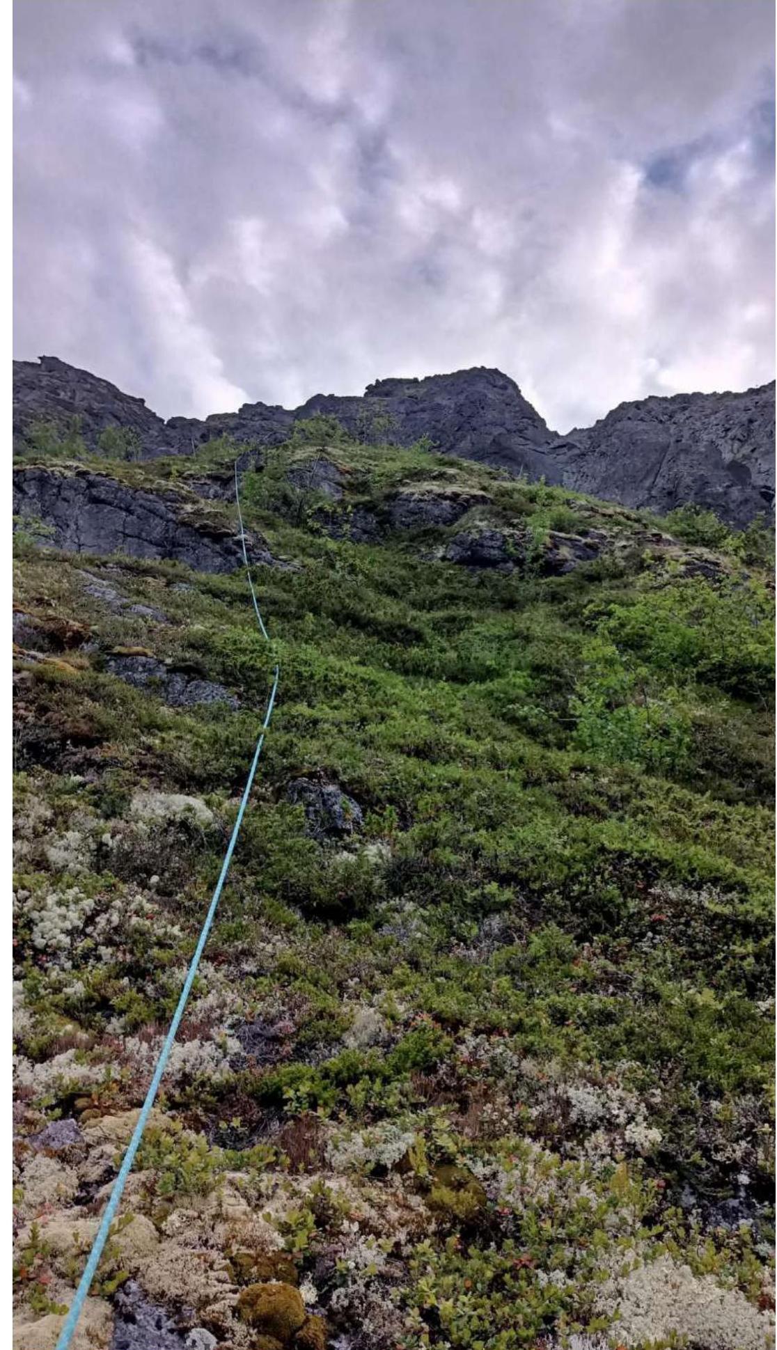
Photo 2 R1–R2
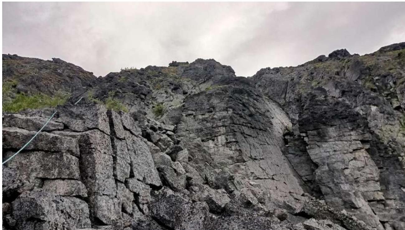
Photo 3 R2–R3
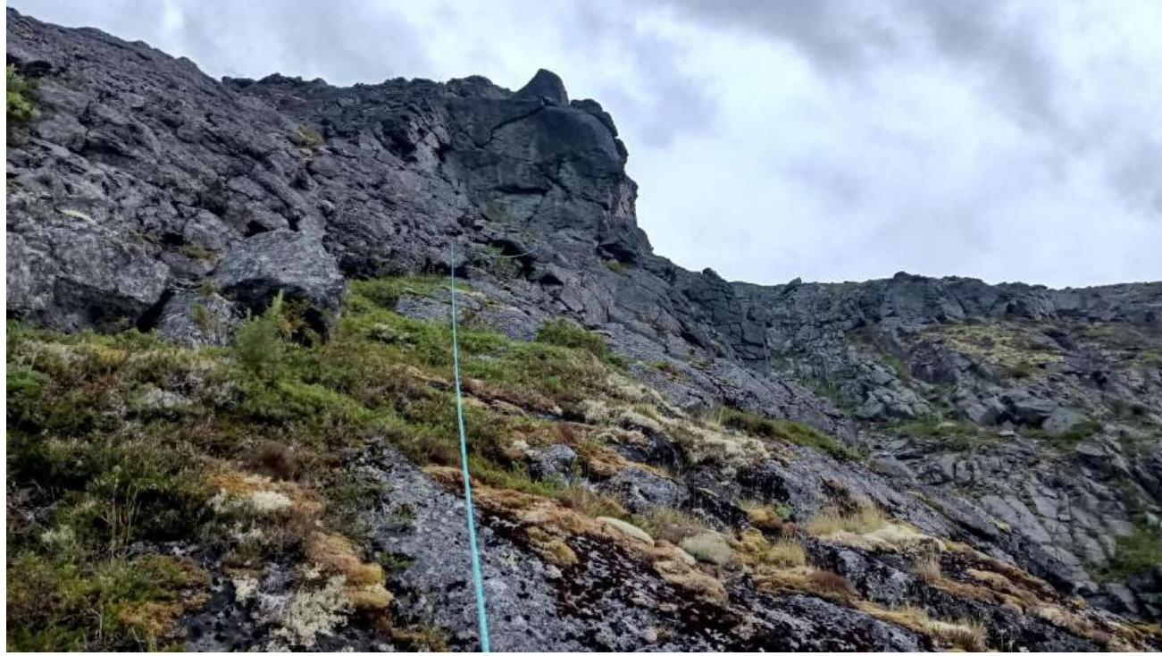
Photo 3.1 start of R2–R3
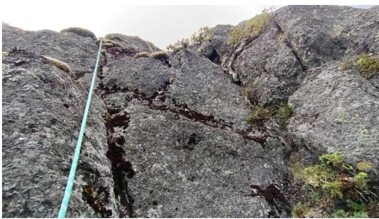
Photo 3.2 start of R2–R3
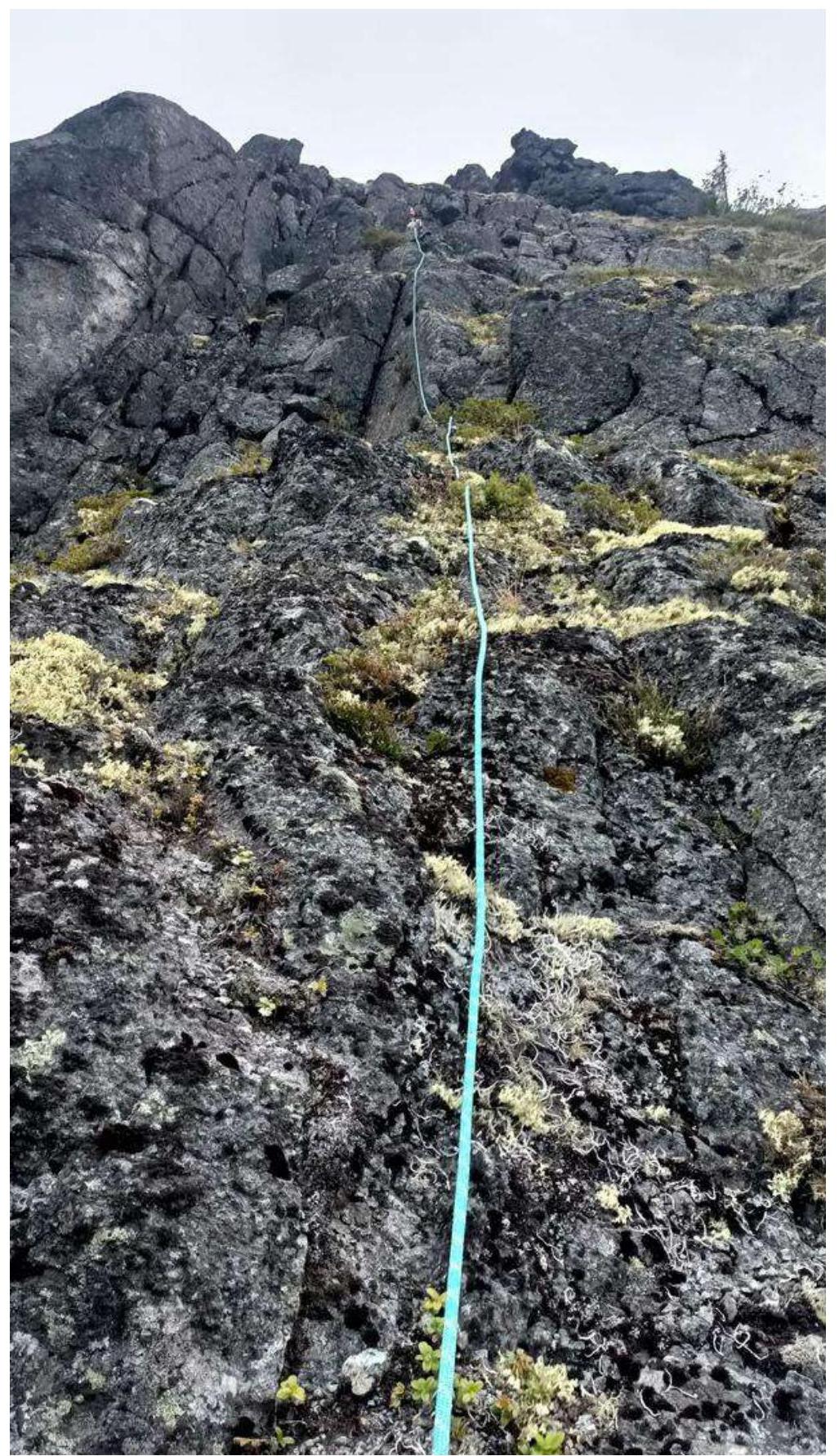
Photo 4 R3–R4
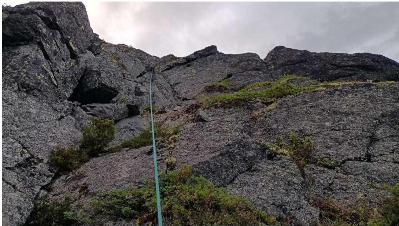
Photo 5 (section R4–R5 marked in yellow)