Murmansk Region Alpinism Federation
Report
on the ascent to the summit Bolshoy Vudyavrchorr via the eastern ridge on April 13, 2019 (first ascent - Vernus T.V., 2003, route classified as 1B)
Ascent Passport
- Murmansk region, Khibiny.
- Maly Vudyavrchorr, 1068 m, via the Eastern ridge (Vernus T.V., 2003). 1B category of difficulty.
- Nature of the route: snow
- Height difference: 700 m Route length: 2.2 km
- Length of sections: 1st category of difficulty — 2000 m, 2nd category of difficulty — 190 m, 3rd category of difficulty — 10 m. Average steepness of the technical part of the route 40°.
- "Hooks" left on the route: 0. "Hooks" used on the route: 9.
- Team's walking hours: 6 hours
- Leader: Vernus Tatiana Viktorovna, instructor 2nd category. Participants: — Balakin Vasily Valeryevich — 1st sports category (rock climbing class); — Kalashnikov Andrey Olegovich, no category; — Sergey Kalinin, no category; — Alexey Hitron, no category.
- Departure to the route: 13:30, April 13, 2019. Reaching the summit: 18:30, April 13, 2019. Return to the base camp: 20:30, April 13, 2019.
- Alpine event: training camp of the Murmansk Region Alpinism Federation.
- Responsible for the report: Kalashnikov A.O., https://vk.com/kalashnikov_ao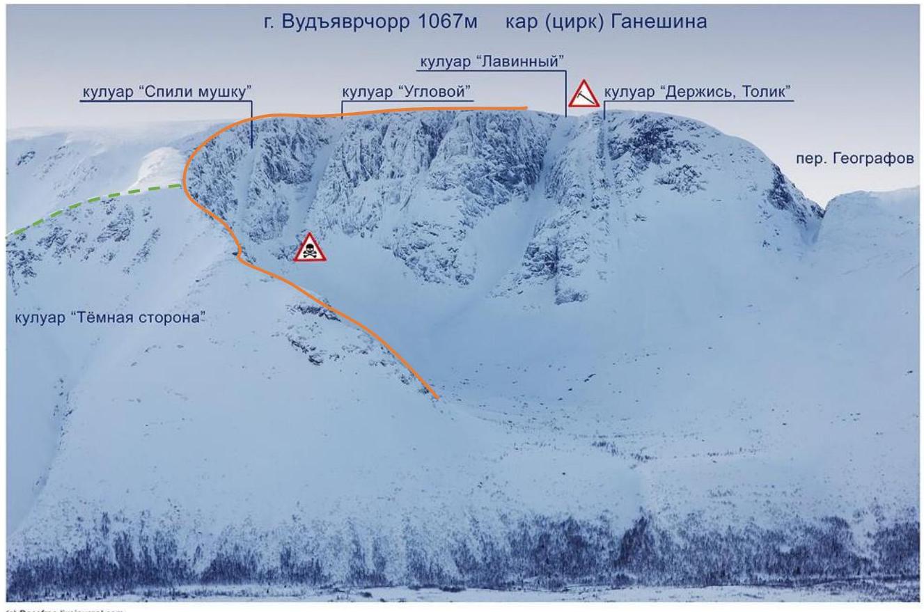©↗ Roselina.Iwspurnat.com
Fig. 1. Gane Shin cirque with freeride toponymy (author Sergey Shestikhin). Orange line — route. Green dotted line — descent option towards "Snow Village".
Approach to the route from the Tirvas sanatorium through the crossing at the source of the Vudyavryok river (in winter, it is possible to cross on the ice of Lake Maly Vudyavr) and further into the Gane Shin cirque. The route passes along the spur of Bolshoy Vudyavrchorr mountain between the Gane Shin cirque and the Botanical cirque. The general view of the Gane Shin cirque and the route line is shown in Fig. 1.
Recommendations on equipment for organizing belays: a set of stoppers, 3 medium pitons.
Route Description
R0–R1. Simultaneous movement on snow 130 m until the start of rock outcrops. Belay on ice axes. Average steepness 30°. 1st category of difficulty.
R1–R2 (photo 1). Start between two large boulders. Movement on snow to large boulders 50 m. The leader passes with belay on an ice axe, the rest move along the rope. Average steepness of the section 45–50°. 2nd category of difficulty.
R2–R3 (photo 2). 30 m up to the wall, average steepness of the section 45°, 2nd category of difficulty. Then 20 m along the wall to the left, average steepness 20°. On the section, belay on ice axes. 1st category of difficulty.
R3–R4. 50 m on icy "ram's foreheads" with an average steepness of 40° to a small wall 2.5 m high. 2nd category of difficulty. 3 belay points are set on the section (2 pitons and 1 stopper).
R4–R5. Bypassing the wall on the left, then 40 m on gentle "ram's foreheads". Average steepness 20°. Belay on ice axes. 1st category of difficulty.
R5–R6. 15 m ascent to the left along the internal snow-filled corner with a steepness of 50° (2nd category of difficulty). 1 stopper is set. Exit to a wide gentle ridge, section 30 m 1st category of difficulty to three large (1–2 m) boulders (photo 3), and then 25 m to the wall.
R6–R7. Crux section (general view — photo 3, start — photo 4). Start under a vertical wall 7 m high. The wall is passed by climbing the inner corner, climbing difficulty 5a (according to the rock climbing classification). 5 stoppers are set on the section — 4 on the wall and 1 above the wall to control the rope. After the wall, there is a 15 m section on snow and "glare ice" with belay on an ice axe with an average steepness of 20°. Then 15 m on gentle rocks (35°) to two large boulders. 2nd category of difficulty.
R7–R8 (photo 5). 35 m on snow and "ram's foreheads" (30°). Exit to a wide gentle ridge and 200 m simultaneous movement along it to the wall. Bypassing the wall on the left. 1st category of difficulty.
R8–R9. 400 m along the dissected ridge. Ridge width 10–70 m. Belay with a rope to boulders and ice axes. Exit to the Vudyavrchorr ridge, movement to the summit 1.2 km. 1st category of difficulty.
Three descent options. The first one, which we used — descent along the spur from the north of the Botanical cirque (between the "Dark Side" couloir and the Botanical cirque, green dotted line in Fig. 1) to the Vudyavryok river near the "Snow Village", Tirvas sanatorium or Botanical garden. The river is crossed in winter on snow bridges. When descending, pay attention to cornices; it is recommended to hang ropes in narrow places. The second option — through the Geografov pass. The third — along the ascent route.
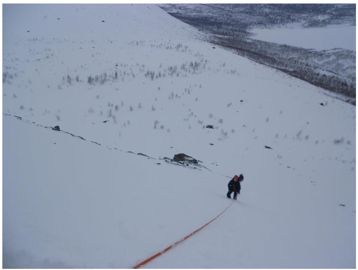
Photo 1. Section R1–R2.
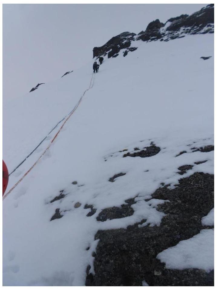
Photo 2. Section R2–R3.
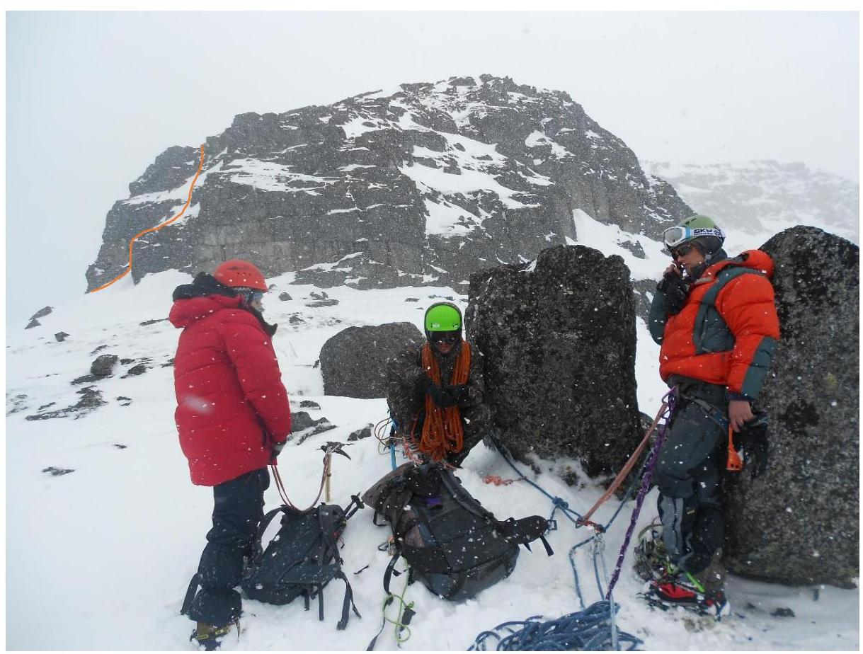
Photo 3. On section R5–R6. The crux section R6–R7 is shown by an orange line.
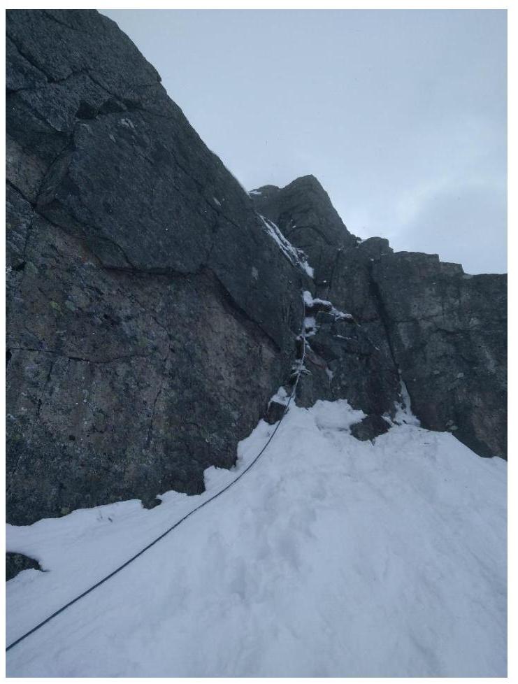
Photo 4. Start of section R6–R7. Crux rope.
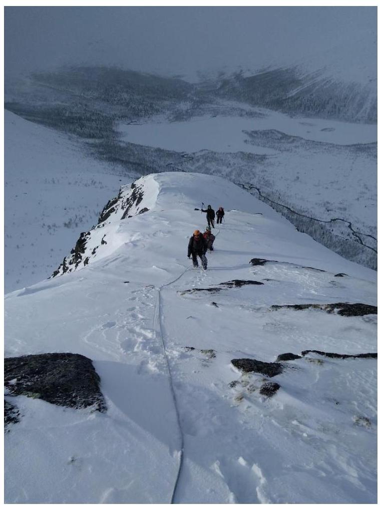
Photo 5. Section R7–R8 along the ridge.


