Ascent Passport
- Ascent area — Northern Urals, Konzhakovsky Kamen massif.
- Serebryansky Kamen peak via the Southern ridge.
- Estimated category of difficulty — 1B.
- Height difference — 300 m, total route length — 800 m.
- Number of walking hours — 4 hours.
- Leader: Kovrizhkin Andrey Vladimirovich CMS (Candidate for Master of Sports)
Participants:
- Demin V.P. 1st sports category
- Ivanov P.Yu. 1st sports category
- Ponomarev S.V. 3rd sports category
- Departure to the route, summit, return on November 7, 1993.
Brief Overview of the Ascent Area
The ascent area is located on the eastern slopes of the Main Ural Range, 45 km west of Karpinsk in the north of the Sverdlovsk region. In the central part of the Northern Urals, the Konzhakovsky Kamen mountain massif stands out.
Its main peak, Konzhakovsky Kamen mountain (or "Konzhak") — the highest point of the Sverdlovsk region — 1569 m. Serebryansky Kamen mountain is an eastern spur of the Konzhakovsky Kamen massif.
This is a typical taiga region. River valleys and mountain slopes up to 800 m are covered with dense coniferous forests. The climate is harsh. Winter (late October — March) is cold and snowy. Frosts are strong and persistent. The prevailing daytime temperature in January is −16 °C, and there are often frosty days with fog and temperatures down to −50 °C. Summer is short (late June — mid-August), moderately warm in valleys and foothills. The average July temperature is 15–17 °C; on hot days, the air temperature rises to 33 °C. The most convenient time for ascents is March: it gets warmer, and the day gets longer.
Access to the ascent area is from Yekaterinburg by train Yekaterinburg — Karpinsk, then by bus Karpinsk — Kytlym.
Route Description
Serebryansky Kamen peak via the Southern ridge, category 1B.
The route begins at the start of the Southern ridge, 200–300 m from the forest boundary. The section from the starting point to the summit involves movement over rocks of 1–2 category complexity, approximately 800 m.
Photo 1. Southern ridge of Serebryansky Kamen. Section from the starting point to the summit.
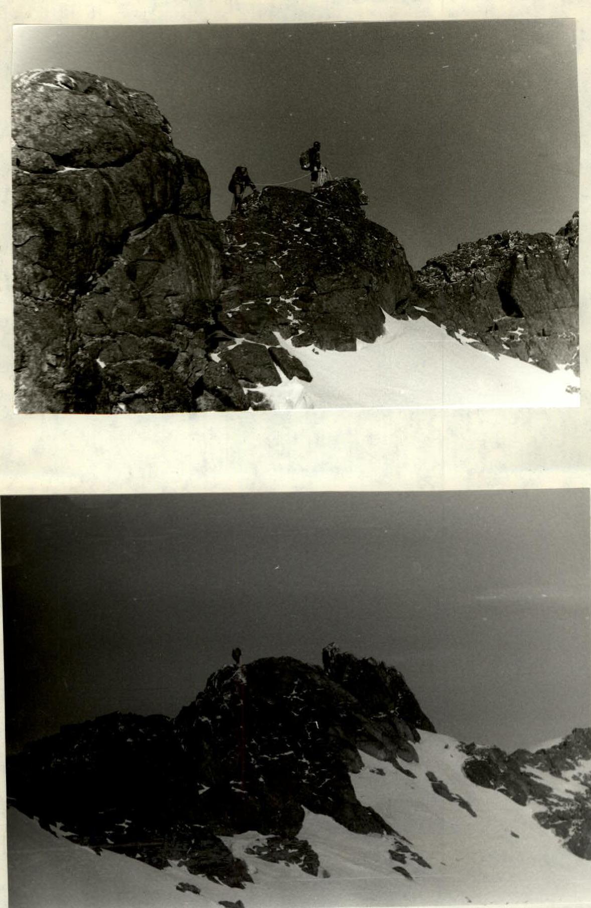
Photo 2–3. Movement along the Southern ridge. Section