Passport
- Subpolar Urals, 8.3 (section number according to the 1999 classifier)
- Peak name: Sablya; route name: via the left bastion of the NE wall
- Proposed 6A category of difficulty, first ascent
- Route type: combined
- Route elevation gain: 700 m (by altimeter) Route length: 750 m. Length of sections with 5th category of difficulty: 310 m, 6th category of difficulty: 200 m. Average steepness of the main part of the route: 79°, of the entire route: 73°
- Pitons left on the route:
total 30; including bolted: 30. Pitons used on the route:
- chocks: 248, including for ITO: 213
- rock screws: 93, including for ITO: 82
- stationary bolts: 20, including for ITO: 18
- removable bolts: 5, including for ITO: 5
- skyhooks: 71, including for ITO: 71. Total ITO used: 389
- Team's climbing hours: 83 hours, 5 days
- Team leader: Sergey Kofanov, Master of Sports
Team members:
- Alexander Korobkov, Master of Sports
- Evgeny Novoseltsev, Candidate for Master of Sports
- Danil Primerov, Candidate for Master of Sports
- Andrey Laryushkin, 1st sports category
- Igor Bobrov, 1st sports category
- Coach: Valery Pershin, Honored Master of Sports, International Master of Sports, honored coach
- Departure to the route: 10:00, May 3, 2004 Summit reached: 17:00, May 7, 2004. Return to base camp: 22:00, May 7, 2004
- Yellow — route climbed by the team
- Blue — K. Korabelnikov's route, 2002
- Blue dashed — V. Puchnin's route, 2002
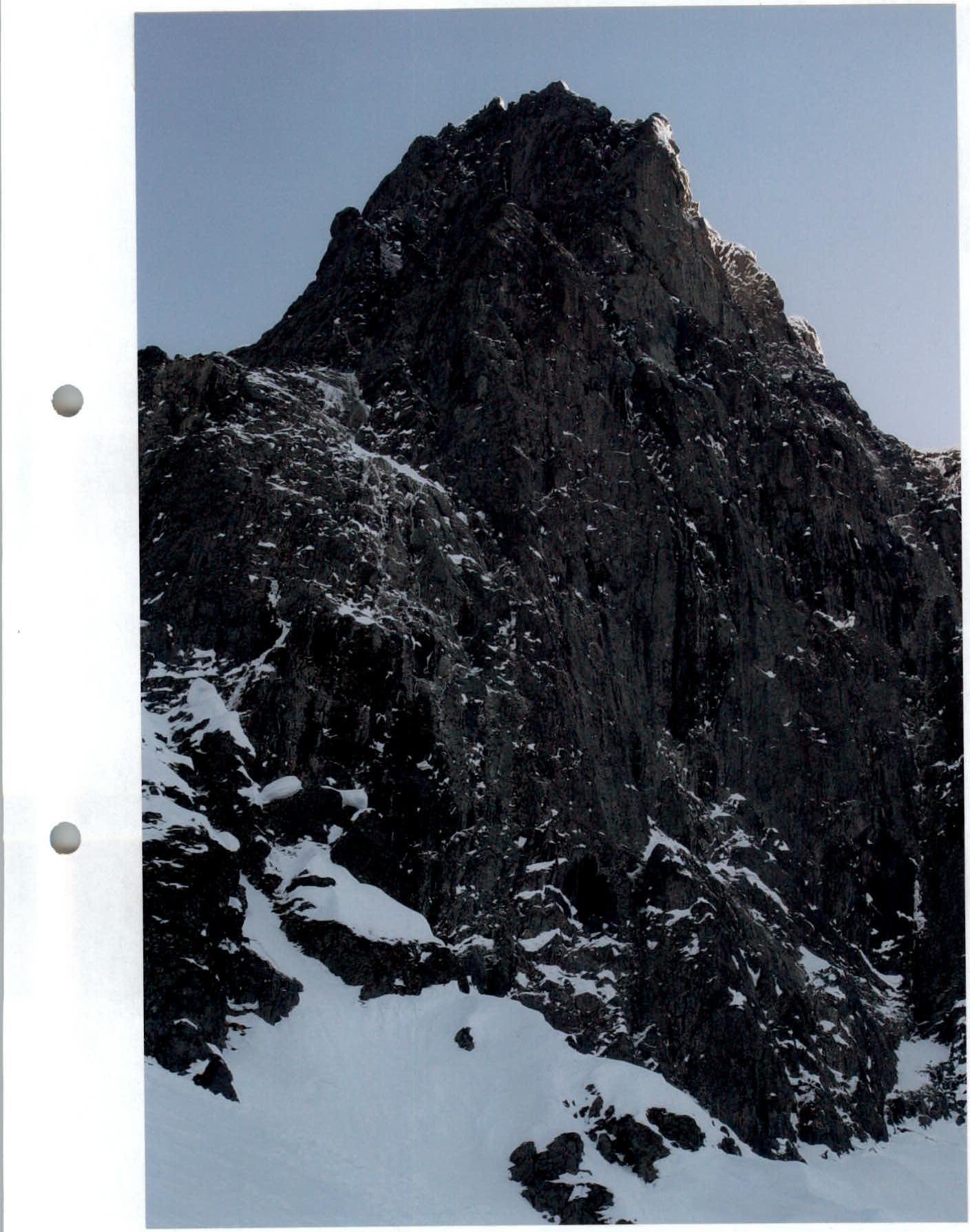
Photo of the wall profile from the left (from a nameless pass)
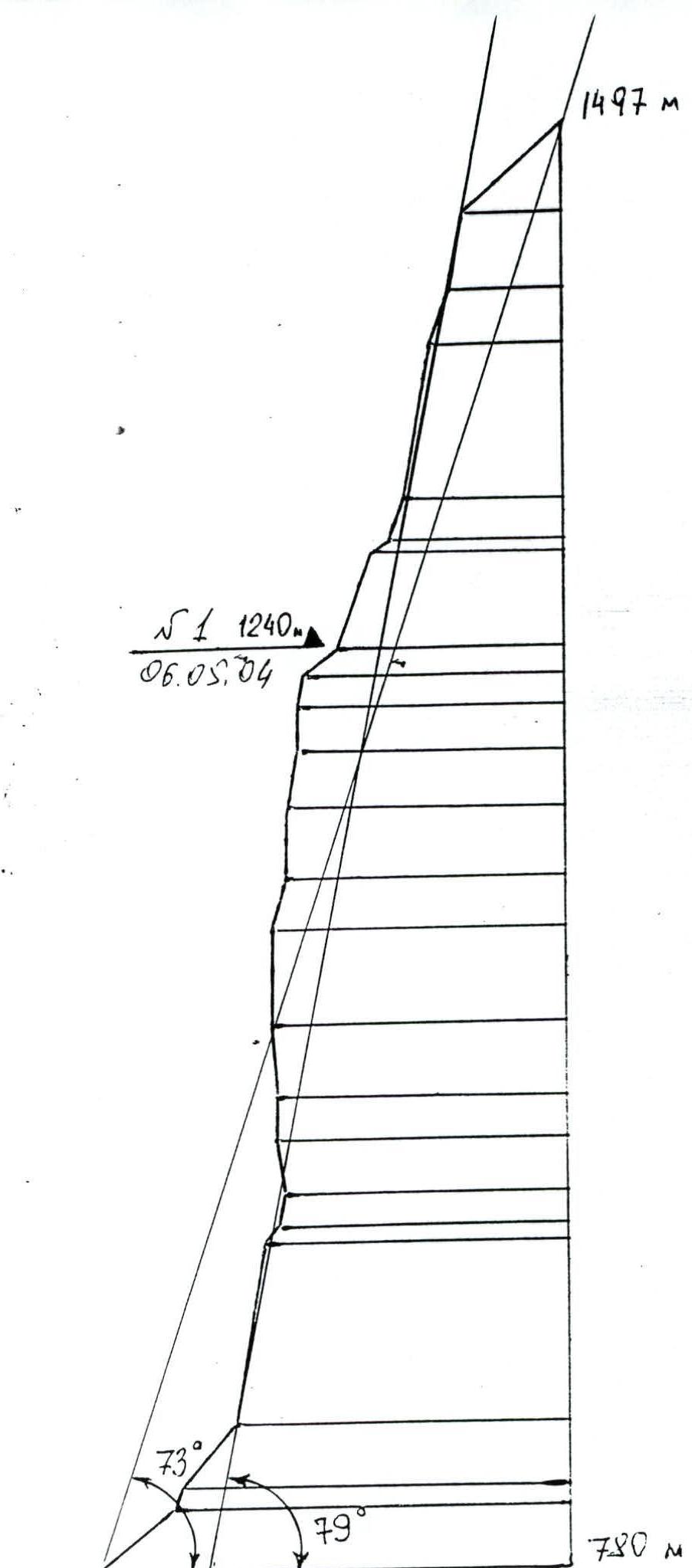
Drawn profile of the route
Brief Overview of the Area
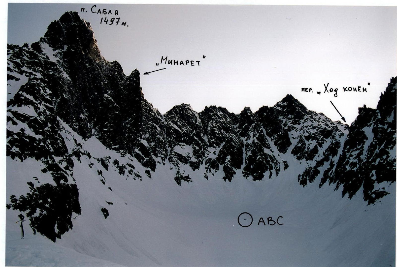
Sablya Peak (1497 m) is located in the central part of the Sablya Range in the Ural Mountains, in the northeast of the Komi Republic, within the Yugyd-Va National Park.
Nearest settlements:
- The nearest major administrative center is the city of Pechora, located 120 km northwest of the range.
- The nearest settlement is the village of Priural'skoye, 70 km north.
Features of the ascent and terrain:
- To the west, where Sablya's slopes are relatively gentle, dozens of tourists climb every year.
- To the northeast, the mountain drops steeply to the sources of the largest glacier in the Urals, the Gofman Glacier.
- The elevation gain from the foot to the summit is 750–800 m.
- The average steepness of the wall section reaches 80°.
Main features of the area:
- Unstable weather.
- Relative inaccessibility:
- In winter, an expedition with all gear can be taken under the wall by snowmobiles across frozen swamps.
- In summer, the optimal option is helicopter transport.
The team chose the "Aranetskiy Prival" refuge, located southwest of the peak, as their base camp. The approach to the ABC, located on the Gofman Glacier directly under the wall, along a marked ski trail, took 3–4 hours to the "Khod konem" pass. From the pass to the glacier, 100 m of rappel were set up. The total distance from the base camp to the ABC is about 10 km.
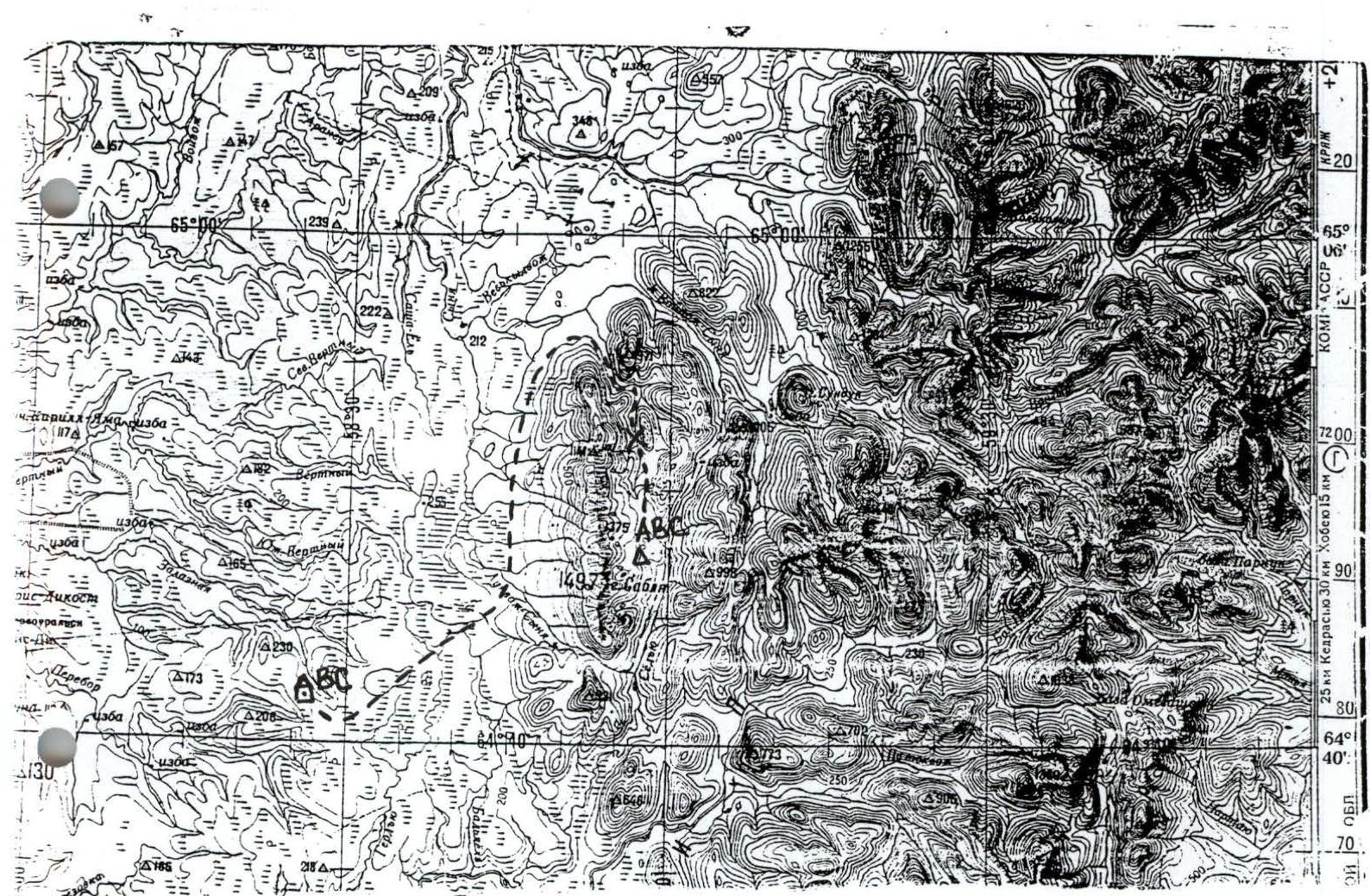
Map of the area
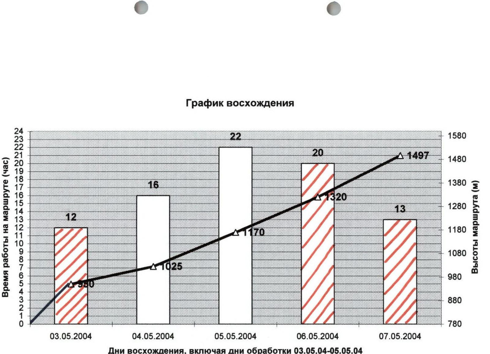
- Time spent on the route. Route diagram in UIAA symbols, Sablya Peak via the left bastion of the NE wall Scale 1:2000
| Section # | Chocks/ITO | Rock screws/ITO | Bolts/ITO | Skyhooks/ITO | Actions/Notes | m | Grade | Difficulty |
|---|---|---|---|---|---|---|---|---|
| 10 | 21/21 | 1/1 | - | 2/2 | 30 | 95 | 6A, A4 | |
| 9 | 10/10 | 4/4 | 2/2 | - | Photo #1 | 20 | 90 | 6A, A3 |
| 8 | 8/8 | 3/3 | 2/2 | 2/2 | Photo #2 | 25 | 100 | 6A, A4 — 10 m; 6A, A3 — 15 m |
| 7 | 5/5 | 3/3 | 2/2 | 2/2 | Photo #2 | 15 | 90 | 6A, A4 |
| 6 | - | - | - | - | Photo #2 | 10 | 50 | 2 |
| 5 | 22/20 | 15/15 | 3/1 | 10/10 | 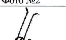 | 70 | 80 | 5B, A2 |
| 4 | 12/10 | 4/4 | 2/2 | 3/3 | 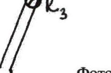 | 20 | 80 | 5B, A2 |
| 3 | - | - | - | - |  | 40 | 50 | 2 |
| 2 | 3/0 | 1/0 | 2/2 | - |  | 10 | 70 | 4 |
| 1 | - | - | - | - |  | 50 | 40 | 2 |
| 25 | 23/20 | 10/10 | 2/2 | 8/8 | Photo #4 | 50 | 80 | 5B, A3 |
| 24 | 5/3 | 5/3 | - | 6/6 | 20 | 70 | 5A, A2 | |
| 23 | - | - | - | - | 10 | 40 | 2 | |
| 22 | 8/8 | 4/4 | 2/2 | - | 20 | 70 | 4B, A2 | |
| 21 | 14/8 | 6/4 | 2/2 | 2/1 | 05/06/2004 | 30 | 70 | 4B, A2 |
| 20 | - | - | - | - | 15 | 40 | 2 | |
| 19 | 6/4 | 4/4 | 2/2 | - | KT2 Photo #3 | 15 | 80 | 5B, A2 |
| 18 | 6/6 | 2/2 | - | 2/2 | 15 | 90 | 6A, A3 | |
| 17 | 6/6 | - | 2/2 | 1/1 | 10 | 90 | 6A, A3 | |
| 16 | 10/8 | 6/5 | - | 4/4 | 30 | 80 | 5A, A2 | |
| 15 | 6/6 | - | 2/2 | - | 10 | 90 | 5B, A2 | |
| 14 | 9/9 | 4/3 | - | 2/2 | 20 | 90 | 6A, A3 | |
| 13 | 8/6 | 1/1 | 2/2 | 5/5 | 20 | 75 | 5A, A3 | |
| 12 | 21/21 | 4/4 | - | 6/6 | 40 | 90 | 6A, A3 | |
| 11 | 5/5 | 1/1 | 2/2 | - | 10 | 90 | 6B, A4 | |
| 30 | 5/0 | 2/0 | - | - | 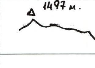 | 70 | 40 | 3A |
| 29 | 17/13 | 6/4 | 2/2 | 6/4 | 40 | 80 | 5A, A2 | |
| 28 | 8/6 | 3/3 | 2/2 | 4/4 |  | 25 | 70 | 5A, A2 |
| 27 | 4/4 | 3/3 | - | - | 10 | 80 | 5B, A2 | |
| 26 | 6/6 | 1/1 | 2/2 | 6/6 | 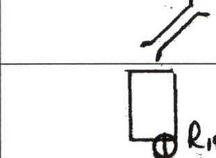 | 15 | 80 | 6A, A3 |
Technical photo of the route
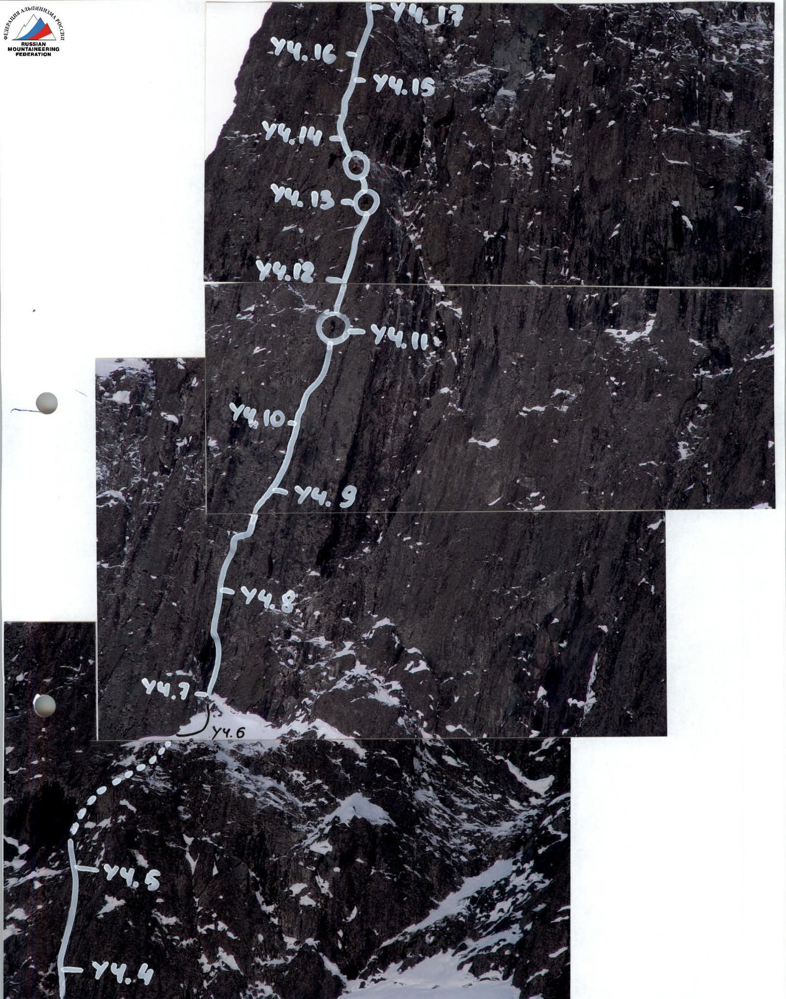
Photo #1. Work on the 6th rope's belay.
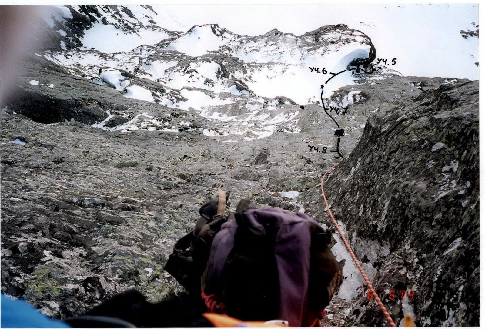
Photo #2. View down from the R6 rope's belay.
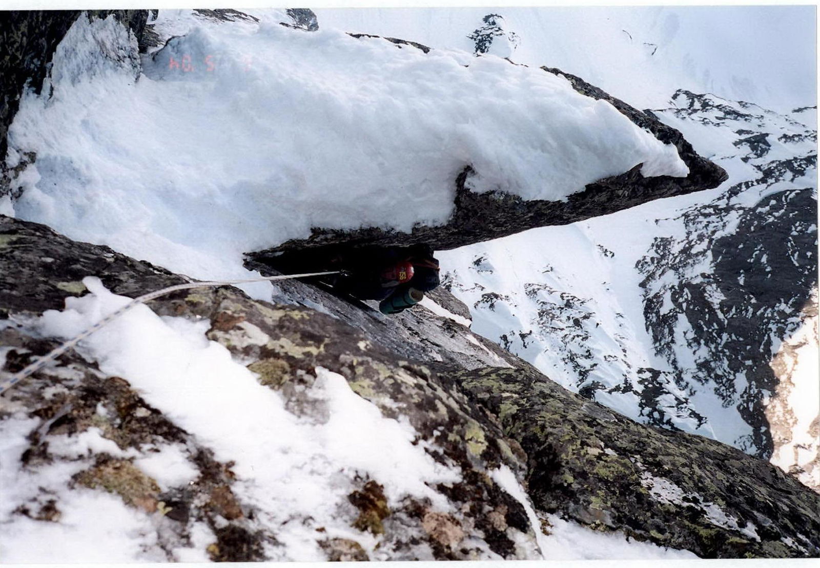
Photo #3. Work on the belay, R11 rope, narrow chimney.

Photo #4. Work in the large "chimney", R14 rope.