Ascent Passport
- Argentina, Andes, Cordón del Plata massif, classifier section 11.5
- Plata, 6050 m, via the northwest slope.
- Proposed category: 2A.
- Route type: combined.
- Route elevation gain: 1850 m.
Route length: 5500 m. Length of sections with category V difficulty: 0, category VI difficulty: 0. Average slope: 37° for the main part of the route, 20° for the entire route.
- Pitons left on the route
Total: 0, drilled pitons: 0.
- Team's travel time: 6.5 hours, 1 day.
- Leader: Ivan Yarovoy, Candidate Master of Sports.
- Coach: —
- Departure from the assault camp
Route started: 6:00 AM, August 16, 2013. Summit reached: 12:30 PM, August 16, 2013. Return to the assault camp: 3:00 PM, August 16, 2013. Descent from the summit via the ascent route.
- Organization: Novosibirsk, Alpinism Federation of Novosibirsk Oblast (FANSO).
- Person responsible for the report: Ivan Yarovoy (email: fanso@mail.ru, phone: 8-913 7246765). Note: In this case, the transition from the base camp to the assault camp took 1 to 1.5 hours, but this was done on a separate day, so the time of departure from the assault camp is indicated in the passport.
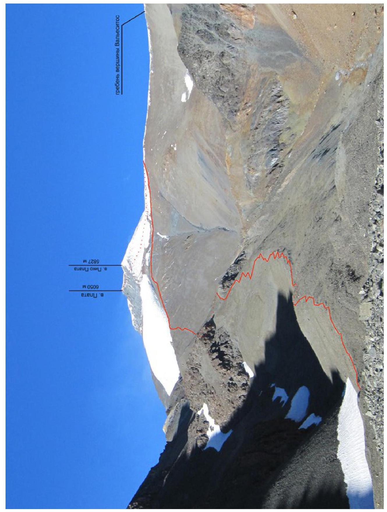
Photo of the summit with the route thread. Taken on February 17, 2013, from the moraine above the base camp. Taking a photo of the route profile was challenging. Instead, a drawn profile is provided.
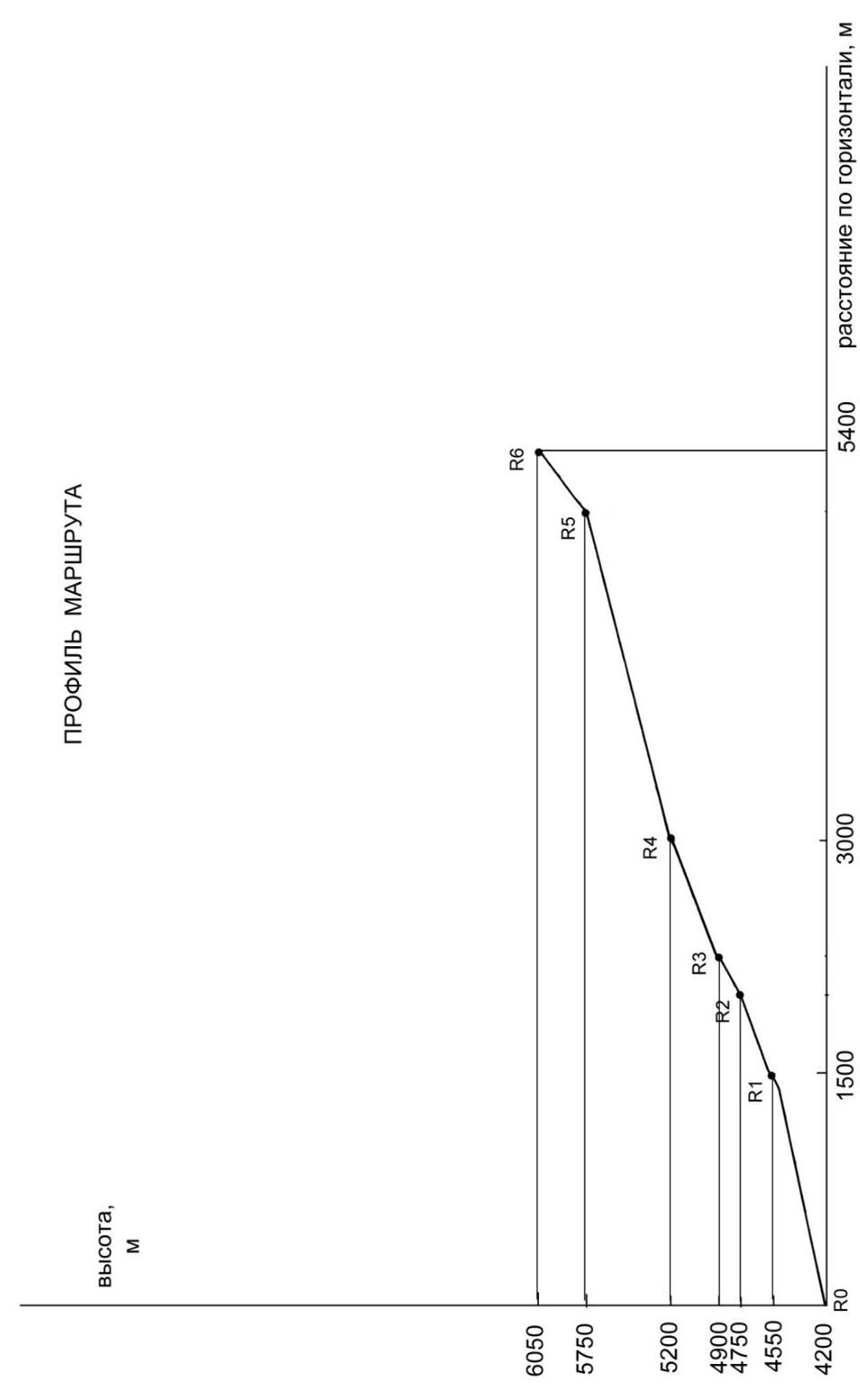
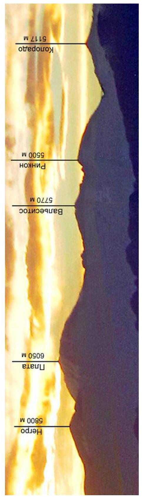
Photo panorama of the area.
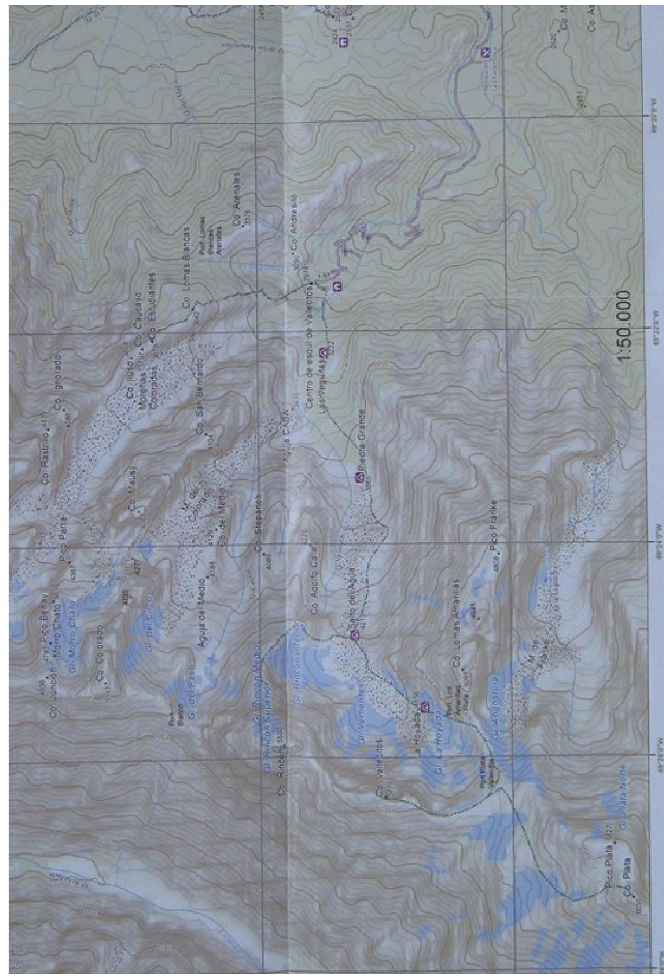
Map of the area.
Brief Overview of the Area
The Cordón del Plata massif is located approximately 50 km from the city of Mendoza, south of the Mendoza-Santiago highway. There is no regular public transportation. Taxis can be taken from Mendoza. The destination is the Vallecitos ski resort.
The area is quite popular among Argentine climbers. Foreigners also visit, although the caretaker of the Vallecitos refuge said he saw Russian climbers for the first time.
About two dozen routes have been laid on the surrounding peaks (mostly not very difficult). There are small glaciers, but the routes are mainly:
- rock climbing,
- or include scree and snow slopes.
The Vallecitos ski resort is at an altitude of 2970 m. When ascending from the refuge, one needs to move left and up, cross a small ridge, and then descend to a stream. The stream is crossed via stones, and further ascent follows a trail along its right (orographic) bank.
The first intermediate camp, Piedra Grande (3500 m), is reached in about 2 hours, mainly via grassy slopes.
El Salto camp, considered the base camp for ascents to Vallecitos and Plata peaks, is located at an altitude of 4200 m. The path from Piedra Grande follows a trail that leads through scree slopes and moraine ridges to the left of the Vallecitos glacier tongue. The journey from Piedra Grande to El Salto takes 2.5–3 hours.
Route Description
The route does not contain technical difficulties, does not require piton insurance, and is traversed on foot with the use of ski poles. Depending on the condition of the slope in the upper part of the route, the use of crampons may be recommended. The main challenges are:
- Altitude
- Often complex weather conditions
Therefore, there is no need for a UIAA symbol scheme or technical photography of the route, as they would not add much to the drawn profile and route description by sections provided below.
| Section | Length, m | Slope, degrees | Terrain characteristics |
|---|---|---|---|
| R0–R1 | 1540 | 13 | Trail mainly follows the moraine ridge. The slope steepens on the last section. |
| R1–R2 | 540 | 22 | Trail along a scree slope. |
| R2–R3 | 290 | 31 | Scree slope. Mainly fine scree. |
| R3–R4 | 800 | 22 | Initially a gentle ridge, then a stony slope with small snow and firn patches. |
| R4–R5 | 2170 | 15 | The route initially follows a |
| stony plateau with some elevation gain, partially snow-covered. Then it traverses the slope of Pico Plata peak via a snow-covered scree slope. The snow is dense and firnified. | |||
| :-- | :--: | :--: | :-- |
| R5–R6 | 500 | 37 | Snow-covered stony slope with large areas of dense firn. Crampons are recommended. |
ROUTE PROGRESSION BY DAYS
February 14, 2013
Made an acclimatization ascent from the base camp (4200 m) to the saddle between Pico Plata and Vallecitos peaks (5200 m) to assess the possibility of setting up a camp on the saddle for an overnight stay before the summit attempt.
After the camp, the trail with a gentle elevation gain goes right onto the ridge of a lateral moraine and continues along the ridge. Then follows a steeper ascent to the shoulder of a weakly defined ridge descending from Lomas Amarillas peak. Immediately beyond this shoulder is a potential site for the assault camp, with several leveled areas for tents.
Further on, the trail:
- continues with a gentle elevation gain along the scree slope,
- crosses small snowfields.
About half a kilometer later, a steeper ascent begins up a fine scree slope onto the ridge connecting Lomas Amarillas with the saddle between Plata and Vallecitos — approximately 300 m.
Then, moving right along the ridge and traversing right and up a stony slope with patches of dense snow, we reach the saddle. On the saddle itself, there is a dense wind crust.
Beyond the saddle, there is:
- a slight depression,
- an inclined stony and snow-covered plateau.
It's possible to find a spot for a tent, but a very strong cold wind blows. Although the wind is hardly felt before reaching the saddle, on the saddle itself, it's almost strong enough to knock one off their feet. Setting up a tent in such conditions (especially alone) seems quite challenging. The risk of the wind breaking the tent poles is also significant. I decided to limit myself to a night at 4500 m.
February 15, 2013
Ascended with bivouac gear to the sites at 4500 m, set up a tent. Besides mine, there were three other tents:
- One with an American and a sensor.
- Two with Argentinians.
Everyone planned to start the summit attempt around 4 AM the next day. I decided to start later, around 6 AM.
February 16, 2013
A strong wind blew throughout the night. The tent creaked and deformed. I was very concerned about the strength of the poles, considering my upcoming trip to Aconcagua.
No one departed at 4 AM, but closer to 5 AM, the first climbers began to move. Additionally, about four people who started from El Salto camp (4200 m) passed by. I departed at 6 AM, being the last to start.
Upon ascending to the ridge (section R2–R3), I met two people returning due to poor health. Nearing the saddle, I overtook two others. Directly at the exit to the saddle, three people were sitting, hesitant to proceed due to the strong and cold wind.
I waited for about ten minutes and then decided to go ahead. The others did not continue.
The wind was indeed very strong, with blowing snow. It was harsh on the eyes. However, ahead, in the upper part of the plateau, two people were moving along the route. The slope on this section was not very steep, but the strong headwind made progress very difficult.
The route follows the plateau, bypassing Pico Plata peak on the right. Then the plateau narrows and ends, and further movement is a traverse along the slope of Pico Plata. I crossed a weakly defined gully and entered the slope of Plata peak, where I put on crampons.
The slope was quite steep, and moving on dense firn without crampons was not very convenient, not to mention the strong wind interfering with balance.
Reached the summit at 12:30 PM.
I reiterate that the route is technically not very difficult. It requires only the ability to move across scree slopes and use crampons on firn. However, the summit altitude is significant, so the route demands proper acclimatization, i.e.:
- a specific schedule for gaining altitude,
- time spent on this.
Additionally, strong winds above 5000 m, according to local climbers, are more the rule than the exception, creating additional challenges.
Considering that the "classic" route on Aconcagua is classified as 2B, I propose evaluating the route to Plata peak as category 2A.
PHOTO ILLUSTRATIONS
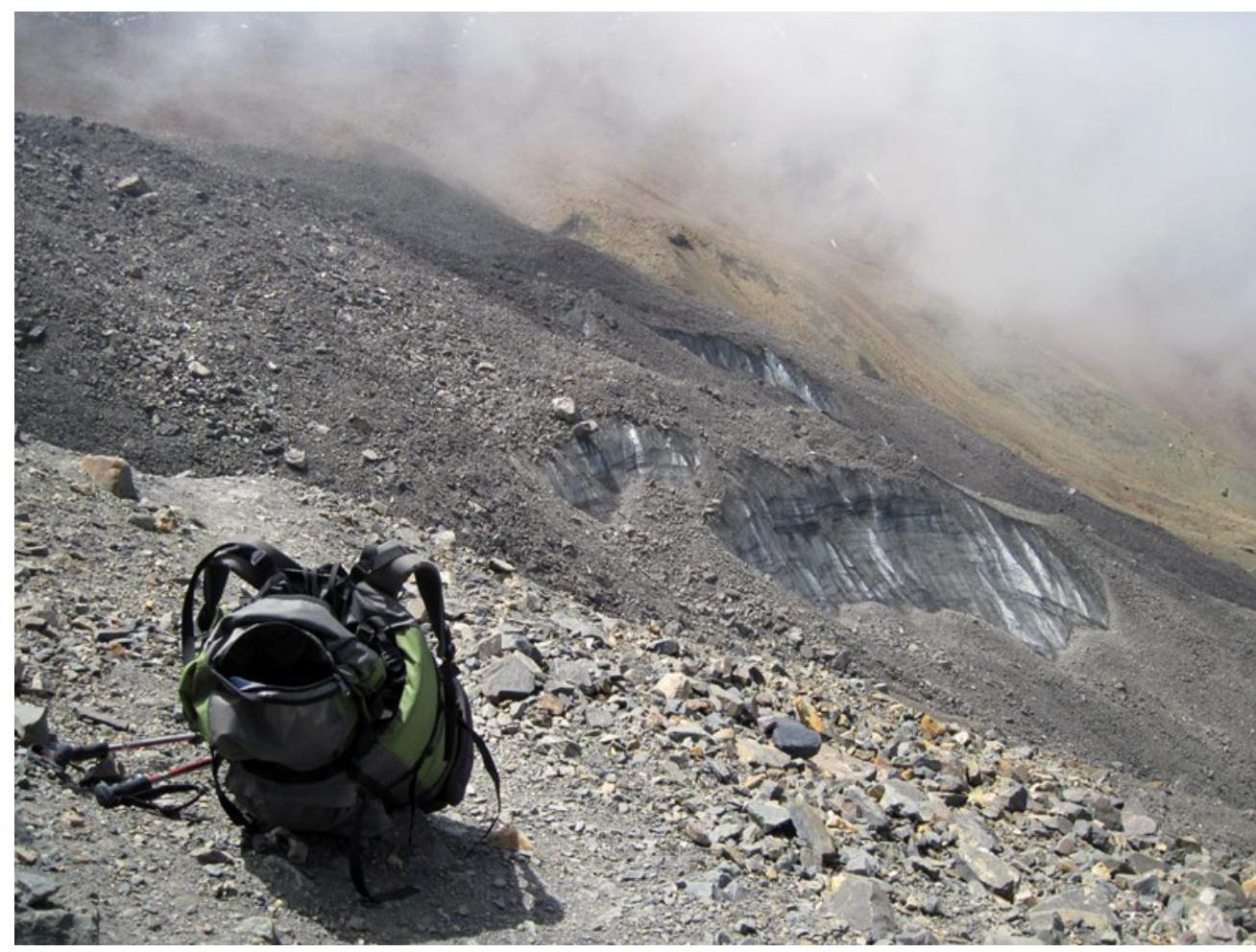
Photo 1. Trail on the approach to the base camp.42. Trail approaching the base camp. Vallecitos glacier is on the right of the trail.
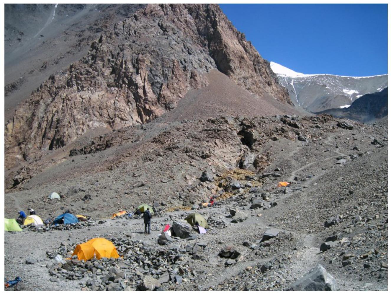
Photo 2. Base camp.
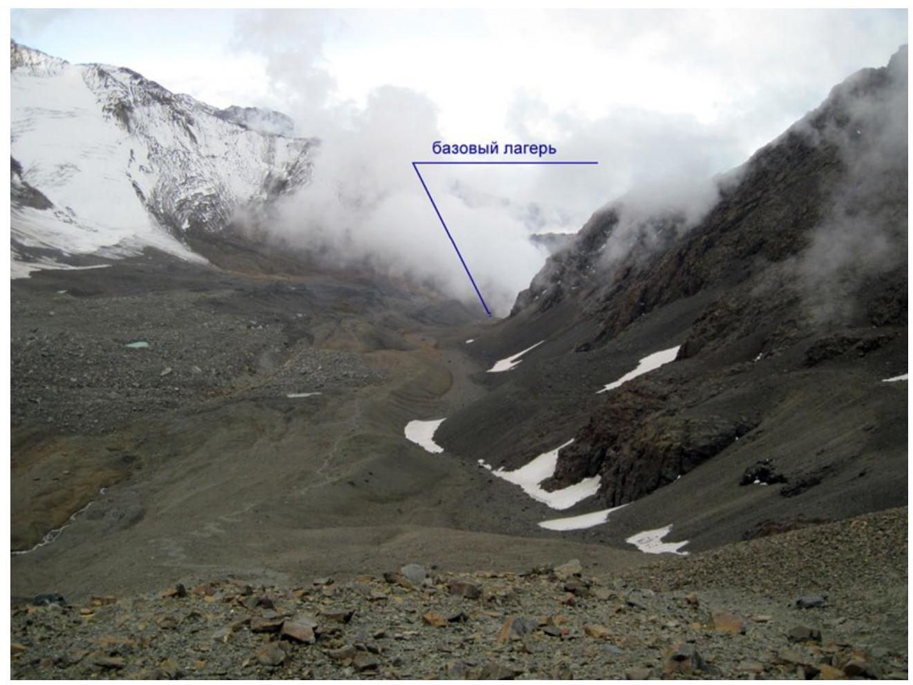
Photo 3. View towards the base camp from the assault camp.
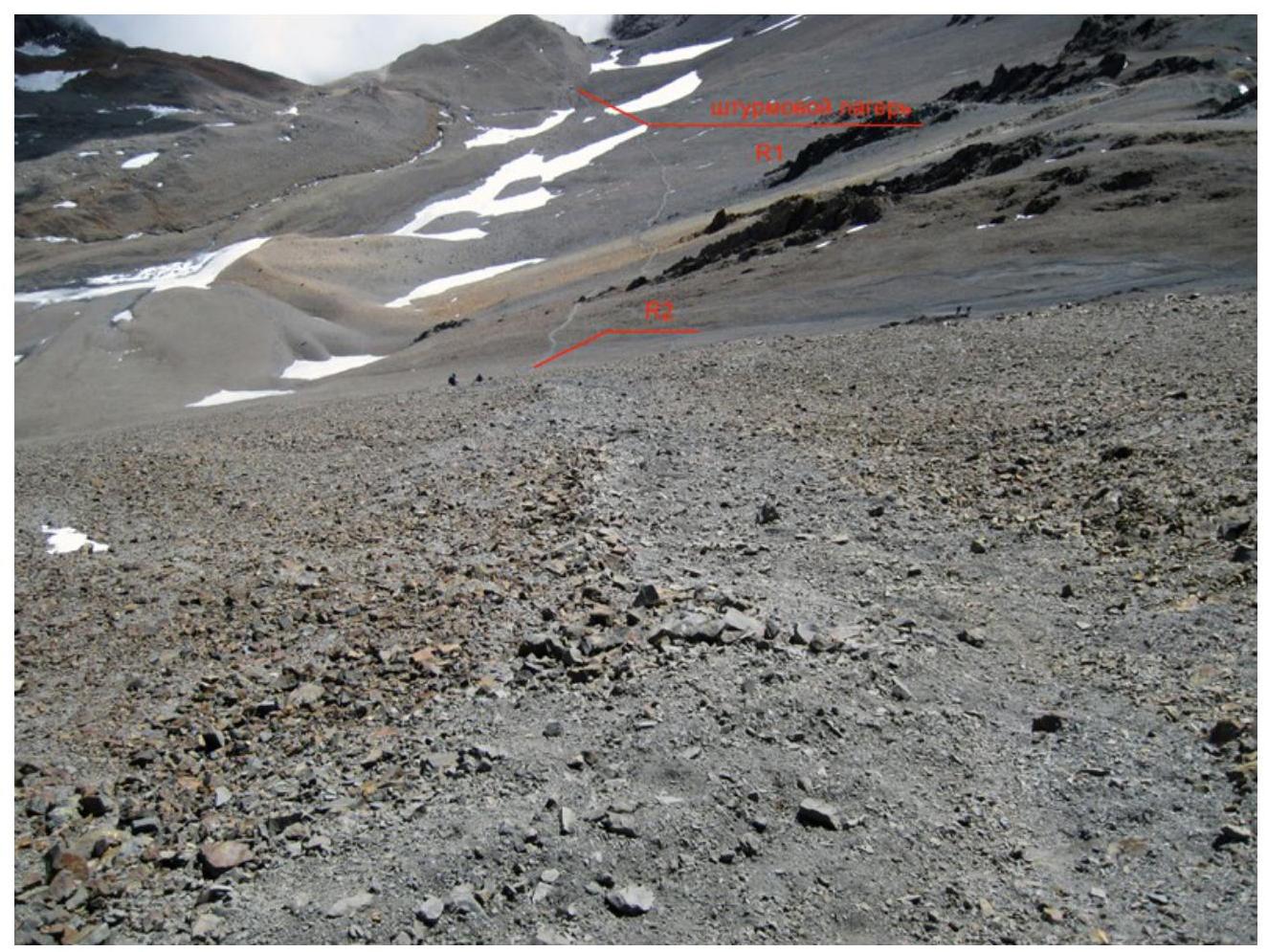
Photo 4. View towards the assault camp from the upper part of section R2–R3.
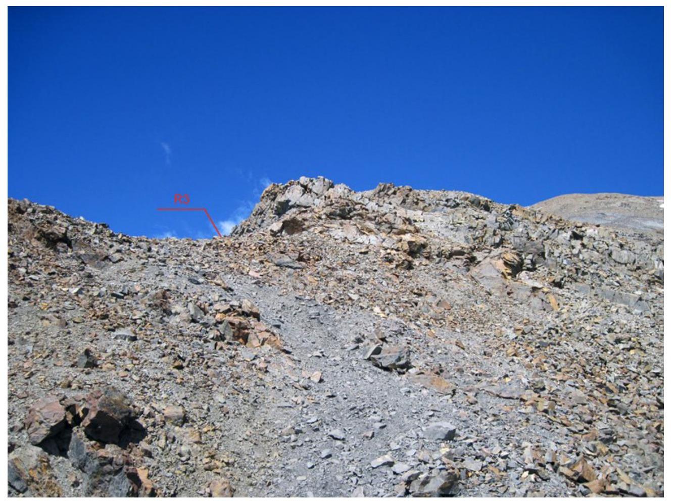
Photo 5. Exit to the ridge.
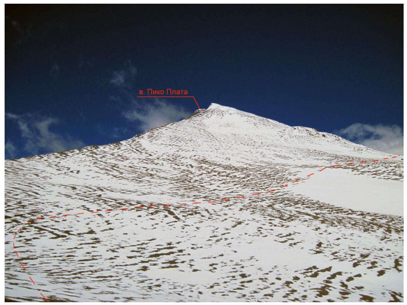
Photo 6. Section R4–R5. Movement along the plateau bypassing Pico Plata peak.
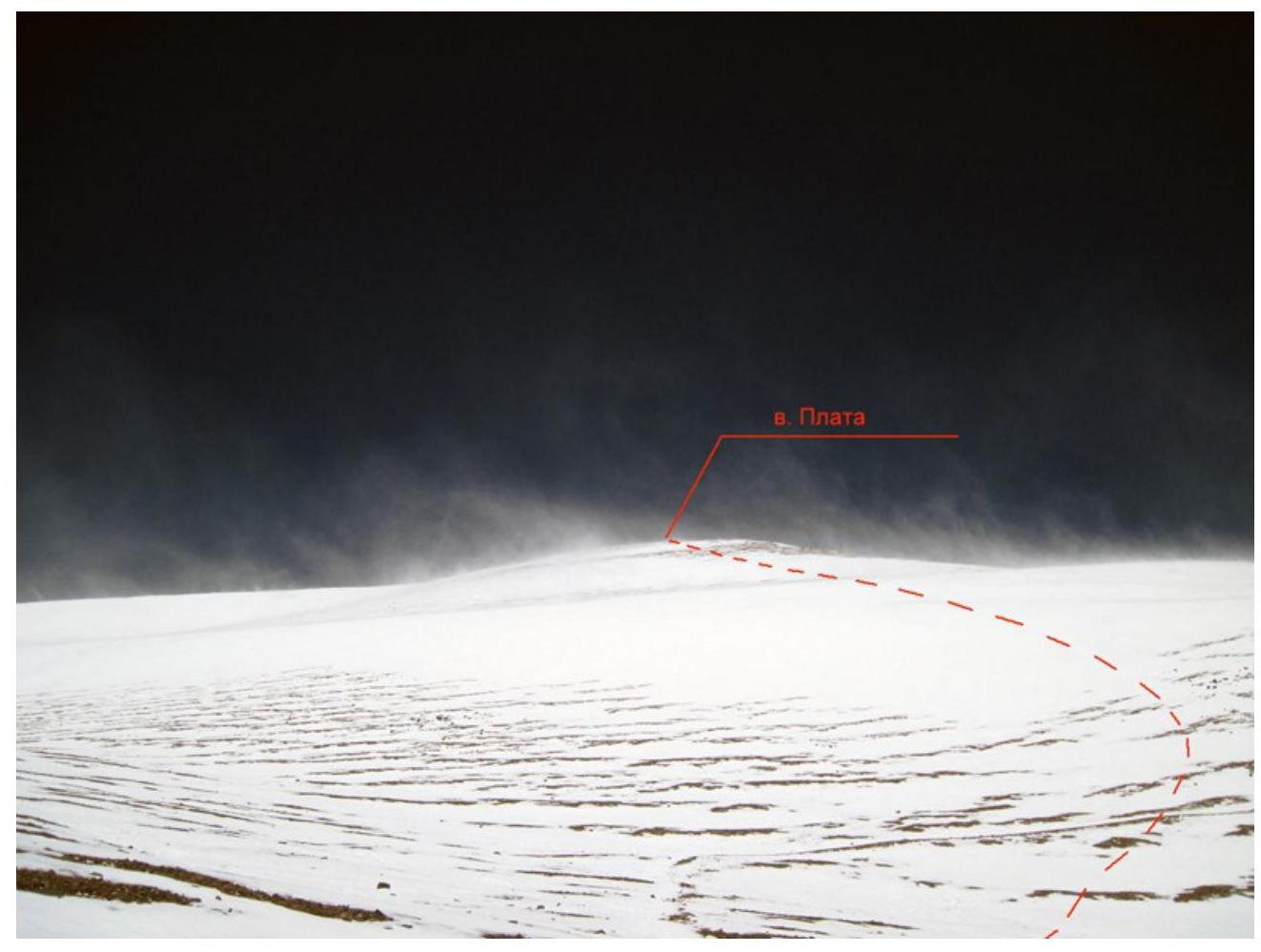
Photo 7. Section R5–R6. Ascent to the summit.
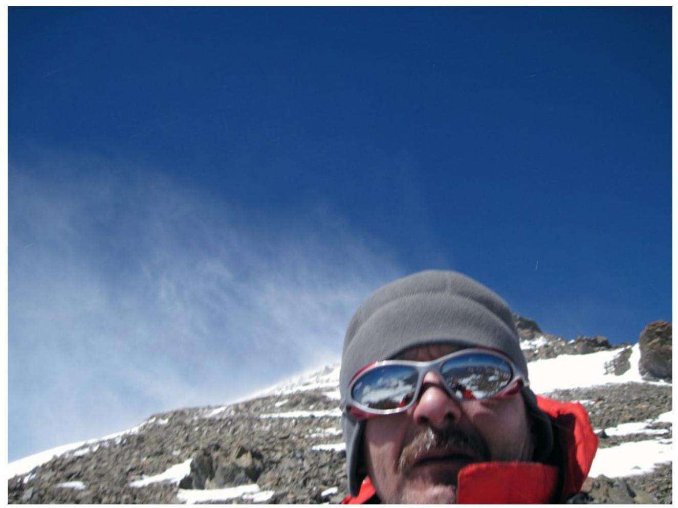
Photo 8. In the background is the summit.
Note: Due to strong winds, blowing snow, and the need to take self-photos with an outstretched arm, a proper summit photo could not be obtained. Hence, a photo taken in close proximity to the summit is provided.
Additionally, a photo providing some insight into the location of the area.
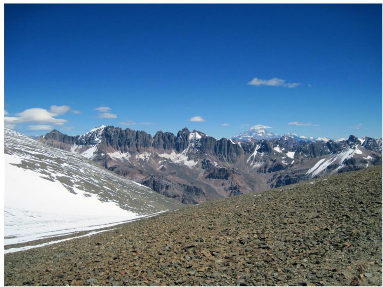
Photo 9. View of Aconcagua from the saddle between Pico Plata and Vallecitos peaks. Taken on February 14, 2013.