
REPORT
First ascent of the Left part of the West face of Guillaumet peak, 2579 m. (Fitz Roy massif, Patagonia, Argentina) March 8, 2012, Yekaterinburg 2012
Contents
- Climbing passport ... 3
- Tactical and technical actions of the team ... 4
- Area map-scheme ... 5
- Panorama of the area ... 6
- General photo of the peak ... 7
- Drawn profile of the route ... 8
- Technical photo ... 9
- Description of the route by sections ... 10
- UIAA scheme ... 11
- Information about notes from the summit ... 13
- Photo of the team on the summit ... 13
- Photos from the route ... 14
Climbing Passport
-
Mountain system: Patagonia (Argentina) — Fitzroy massif. Name of the peak: Guillaumet (Guillaumet), 2579 m (Absent in the 2001 classification table).
-
Name of the route: «Patagonian werewolfs» on the left part of the W face.
-
Estimated category of difficulty: 5B — first ascent.
-
Nature of the route: rock.
-
Characteristics of the route:
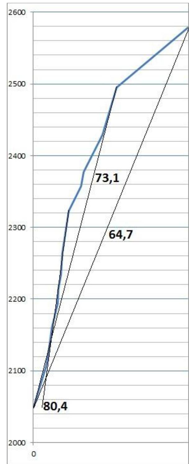
Height difference of the route: 530 m. Wall part: 450 m. Route length: 650 m (500 m). Length of sections:
- 5th cat. diff.: 50 m.
- 6th cat. diff.: 400 m. Average steepness:
- main part of the route: 80.4°.
- to the ridge: 73.1°.
- entire route: 64.7°.
-
Number of pitons used on the route:
Bolt pitons: 0 pcs. Anchor pitons: 10 pcs. Total: 10 pcs. Total number of artificial protection (AP) used — approximately 20 pcs. Number of "pitons" left on the route:
- rock: 0 pcs.
- bolt: 0 pcs.
- ice: 0 pcs.
- snow: 0 pcs.
-
Team's time on the route: 10 hours (1 day).
-
Leader:
Sergey Dashkevich. Sports qualification: Master of Sports. Participants: Marcos Costa (Brazil-China).
-
Coach: Valery Pershin, Honored Coach of Russia.
Sports qualification: Honored Master of Sports, International Master of Sports. Anatoly Yarunov, Master of Sports.
-
Departure from Piedra Negra base camp: 3:30 AM, March 9, 2012. Start of the route: 9:30 AM, March 9, 2012. Summit arrival: 7:30 PM, March 9, 2012. Return to base camp: 11:30 PM, March 9, 2012.
Tactical and Technical Actions of the Team
The West face of Guillaumet peak is a popular climbing object among high-level foreign climbers. This is largely due to the clean granite rock, relatively small height difference of the wall (around 500 m), fairly steep average angle, and perhaps the easiest approach among available technical objects. Nevertheless, we managed to find a spot on the wall for a new route among the existing eight routes. Studying photos from below, we noticed a logical steep system of cracks and inner corners in the left part of the wall between an unknown 1980 route and the Czech-German route "Disfrute la Vida".
Experience from previous ascents showed that it's possible to climb 500 new meters of a route in a day with minimal gear. In connection with this, we took minimal equipment on the route — one pair of crampons for two, one ice axe (used as a rock hammer for the second), a minimal set of cams (without large sizes), one set of stoppers, etc. Bolt pitons and ice screws were left in the base camp. Possible icy sections were planned to be traversed in crampons, with the second climber following on organized ropes.
The climbing style was chosen based on the object. We planned to climb as free solo as possible (ideally, the entire ascent). The leader climbed without etriers to avoid the temptation of using AP in difficult places. The leader also climbed on two ropes (1 and 1/2). The second climber followed on jumars.
However, free first ascent of complex sections is rarely characterized by high speed. In connection with this, to make it down in a day, we had to switch to a standard style mid-ascent, combining AP use in etriers and free climbing. This ultimately allowed the team to complete a one-day ascent.
It's worth noting that before us, ascents of a similar level on the West face of Guillaumet peak were typically done in two days. Bolt pitons were also used on neighboring routes. The speed and style of the team were highly praised by the well-known expert on the area, Rolando Garriotti.
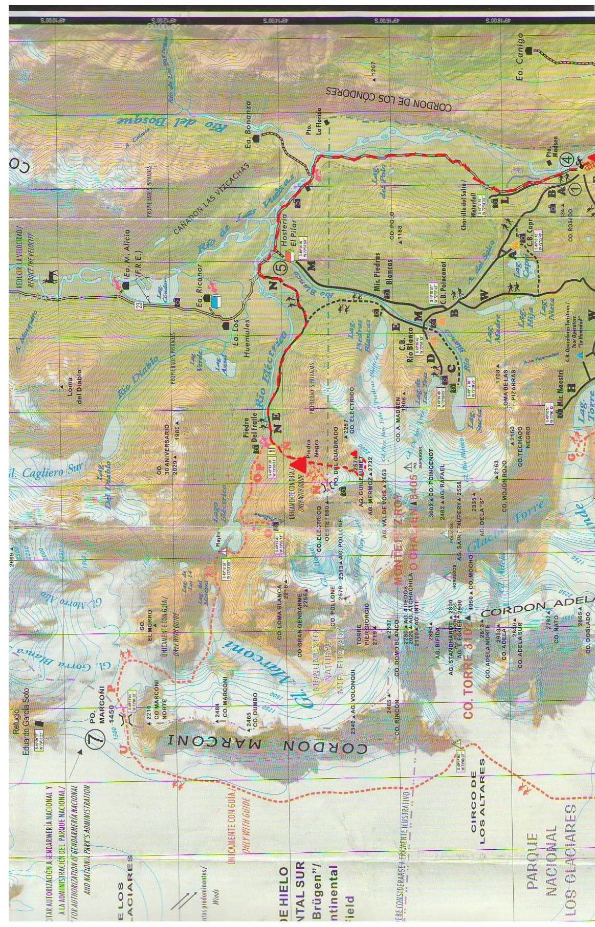
Area Map-Scheme with Description of the Path
Panorama of the Area with Peak Indications
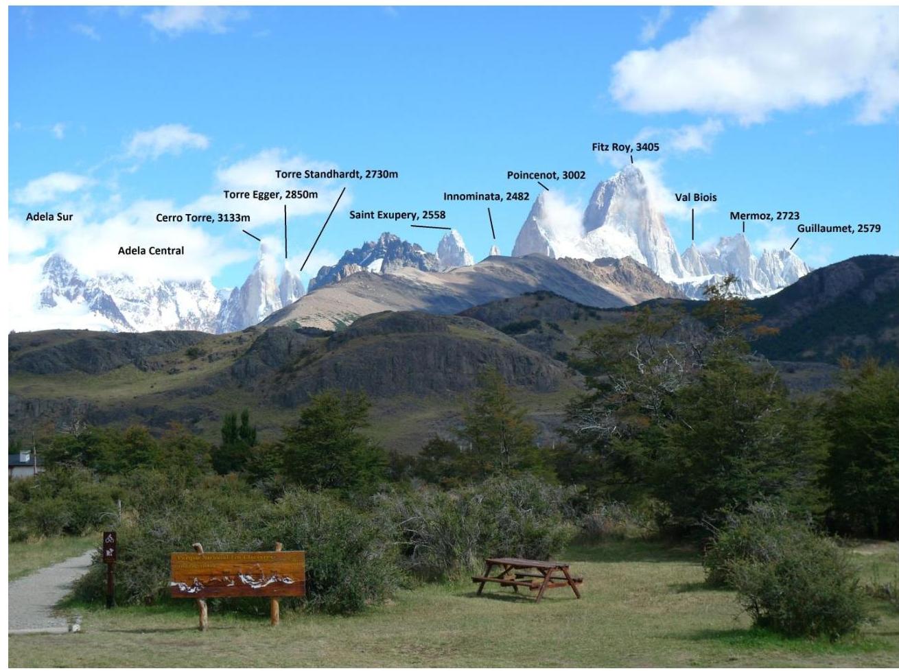
Shooting location — National Park administration (El Chaltén)
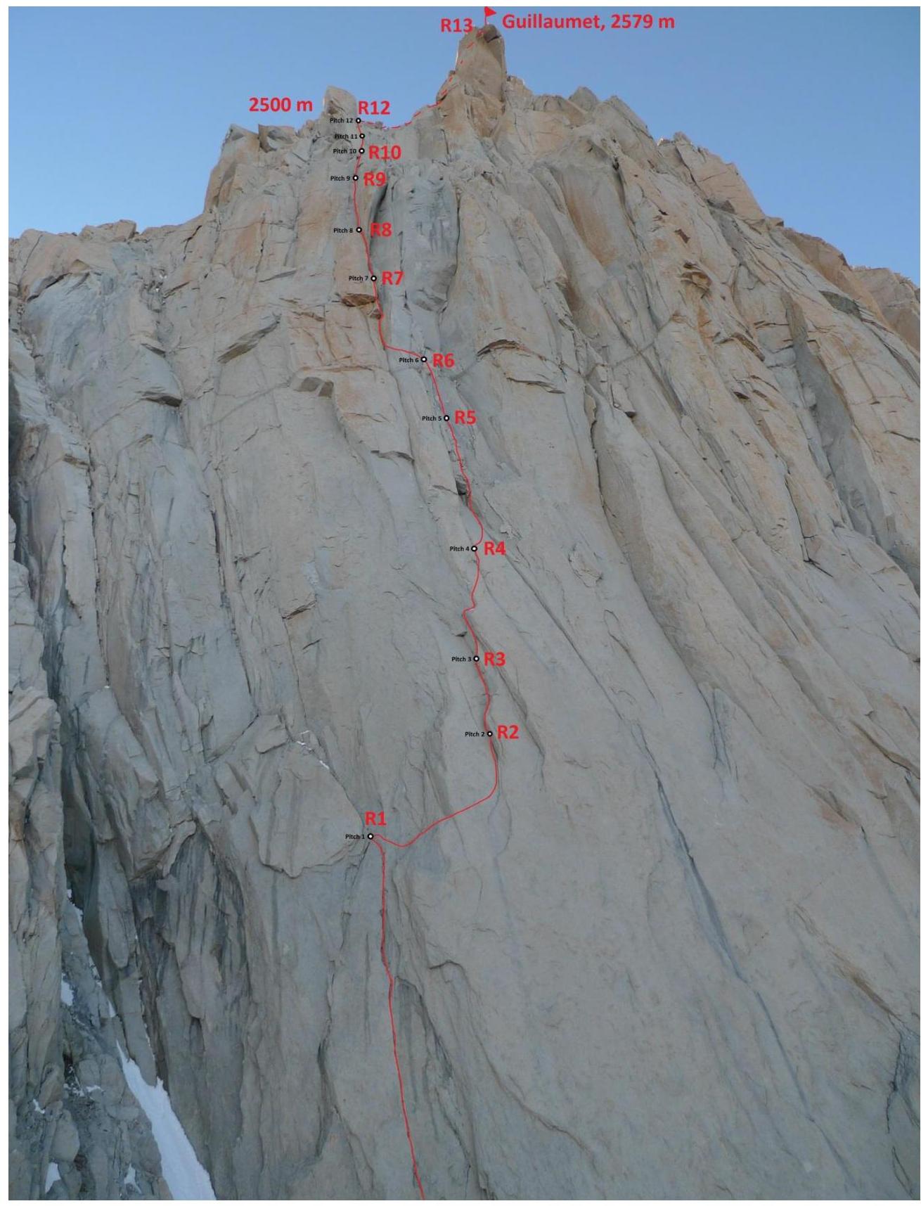
General Photo of the Peak
Red — team's route
Drawn Profile of the Route
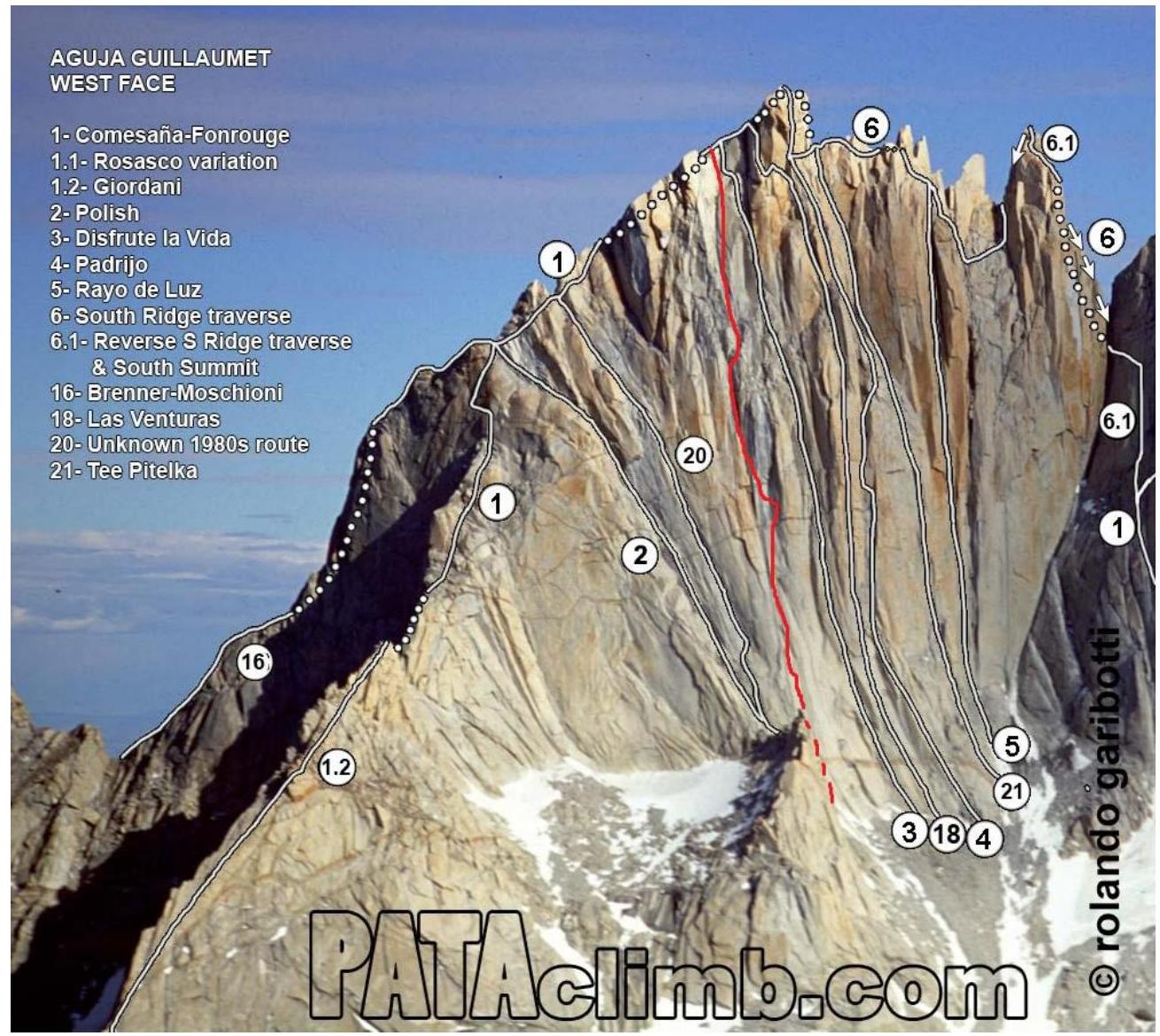
Technical Photo of the Route
Shooting location — saddle in the left part of the West wall
Description of the Route by Sections
From Piedra Negra camp, move to the base of the NW ridge. Traverse the slope through a saddle without losing much height. Reach the start of fixed ropes on "ram's foreheads". Ropes are not fixed all the way. After the ropes end, two pitches (75 m and 40 m) straight up through weak rock with poor protection (similar to the start of routes on Orel peak in Ergaki). Then traverse up and right to a visible saddle. From the saddle, the West wall begins to the right. Here, one rappel down into a couloir is needed to reach the base of the route.
Section R0–R1. Length 60 m, 6 (Fr 6b). Move 20 m up vertical, broken rock and weak terrain to the base of a visible crack. Careful climbing on crumbling terrain. Then move 40 m up a crack slightly smaller than a fist. Protection with cams and stoppers. Convenient belay station on a small ledge after the crack ends on two large cams.
Section R1–R2. Length 30 m, 6 (Fr 7a). Traverse right 10–15 m into a neighboring crack system. Traverse on complex, weak rock. Before starting, it's hard to set up proper protection. Terrain is somewhat rotten. Need anchors that go in deep. Can't place protection on the traverse. Then up a complex crack in an inner corner 15–20 m. Crack has moss, edges are rounded and slightly crumbly. Feet mostly on friction. Protection with medium-sized cams. Station in a crack. Ran out of necessary gear.
Section R2–R3. Length 20 m, 6 (Fr 6c). Up a crack at the base of an inner corner to a small ledge and then slightly right. Up inner corners to the base of a small overhang. Better to make a station here as a complex exit is ahead. Protection on less-than-medium cams and stoppers.
Section R3–R4. Length 30 m, 6 (Fr 7a). Bouldering at the start. I dyno-ed right onto a ledge, then need to roll onto it without relief under the hands. Then move up an inner corner. After 5–10 m, a complex move right into a neighboring crack system. Move on weak rock. Before the move, must set up protection on small cams. Can't set up protection on the traverse. After the traverse, up an inner corner with a good crack at the base. Semi-hanging station.
Section R4–R5. Length 40 m, 6 (Fr 6c). From the station, immediately a complex traverse right 7 m into a neighboring crack system. Then up a double crack through an overhang.
Section R5–R6. Length 20 m, 6 (Fr 6a/b). Up rubble terrain to the base of a large, overhanging inner corner.
Section R6–R7. Length 30 m, 6 (Fr 6c), A1. Pendulum left into the base of a crack leading to a chimney. Then up a wide crack into the chimney. Station in the chimney. Need large cams.
Section R7–R8. Length 30 m, 6 (Fr 6b). Up the chimney and left to a good ledge at the chimney's exit. Convenient spot for a potential bivouac.
UIAA Scheme
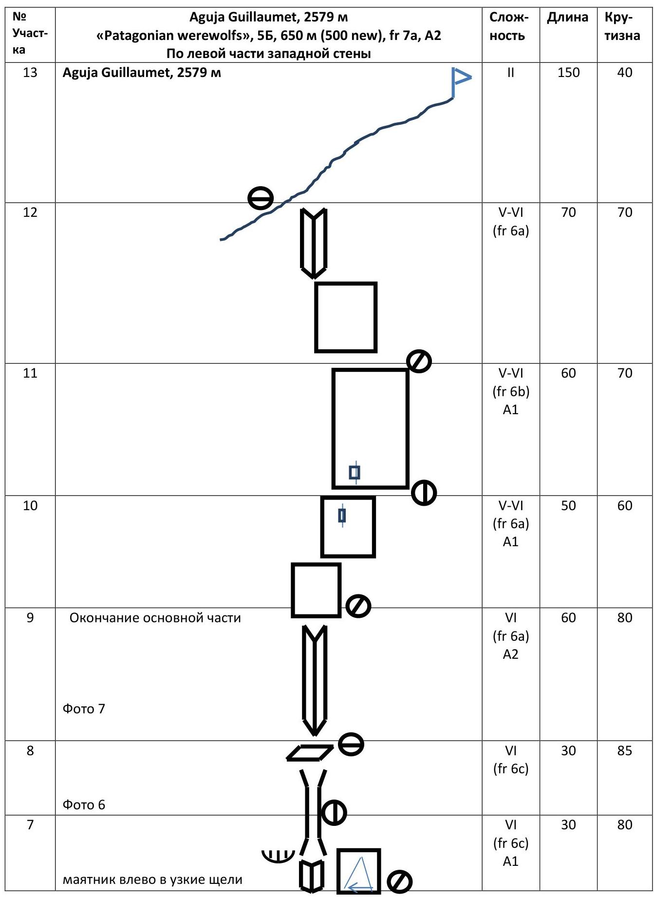
Aguja Guillaumet, 2579 m «Patagonian werewolfs», 5B, 650 m (500 m), Fr 7a, A2 On the left part of the West wall
| Section # | Description | Difficulty | Length | Steepness |
|---|---|---|---|---|
| 13 | Aguja Guillaumet, 2579 m | II | 150 | 40 |
| 12 | 5–6 (Fr 6a) | 70 | 70 | |
| 11 | 5–6 (Fr 6b), A1 | 60 | 70 | |
| 10 | 5–6 (Fr 6a), A1 | 50 | 60 | |
| 9 | End of main part | 6 (Fr 6a), A2 | 60 | 80 |
| 8 | Photo 7 | 6 (Fr 6c) | 30 | 85 |
| 7 | Photo 6. Pendulum left into narrow cracks | 6 (Fr 6c), A1 | 30 | 80 |
| 6 | 6 (Fr 6a/b) | 20 | 85 | |
| 5 | Photo 4,5 | 6 (Fr 6c) | 40 | 75 |
| 4 | Move right on weak rock | 6 (Fr 7a) | 30 | 80 |
| 3 | Photo 3 | 6 (Fr 6c) | 20 | 80 |
| 2 | 6 (Fr 7a) | 30 | 80 | |
| 1 | Good crack under fist. Rotten terrain on approach | 6 (Fr 6b) | 60 | 70 |
Scale 1:2000. Sections longer than 100 m are not to scale.
Information about Notes from the Summit
No control tour found on the summit. Photos and video recording available.
Team Photo on the Summit
Photos from the Route
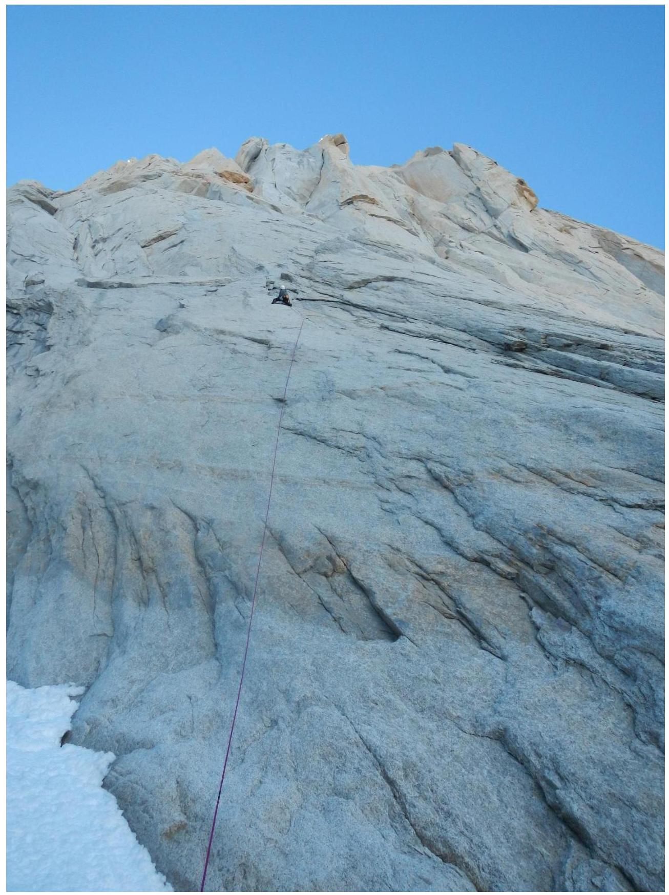
Photo 1. Section R1. Dashkevich leading.
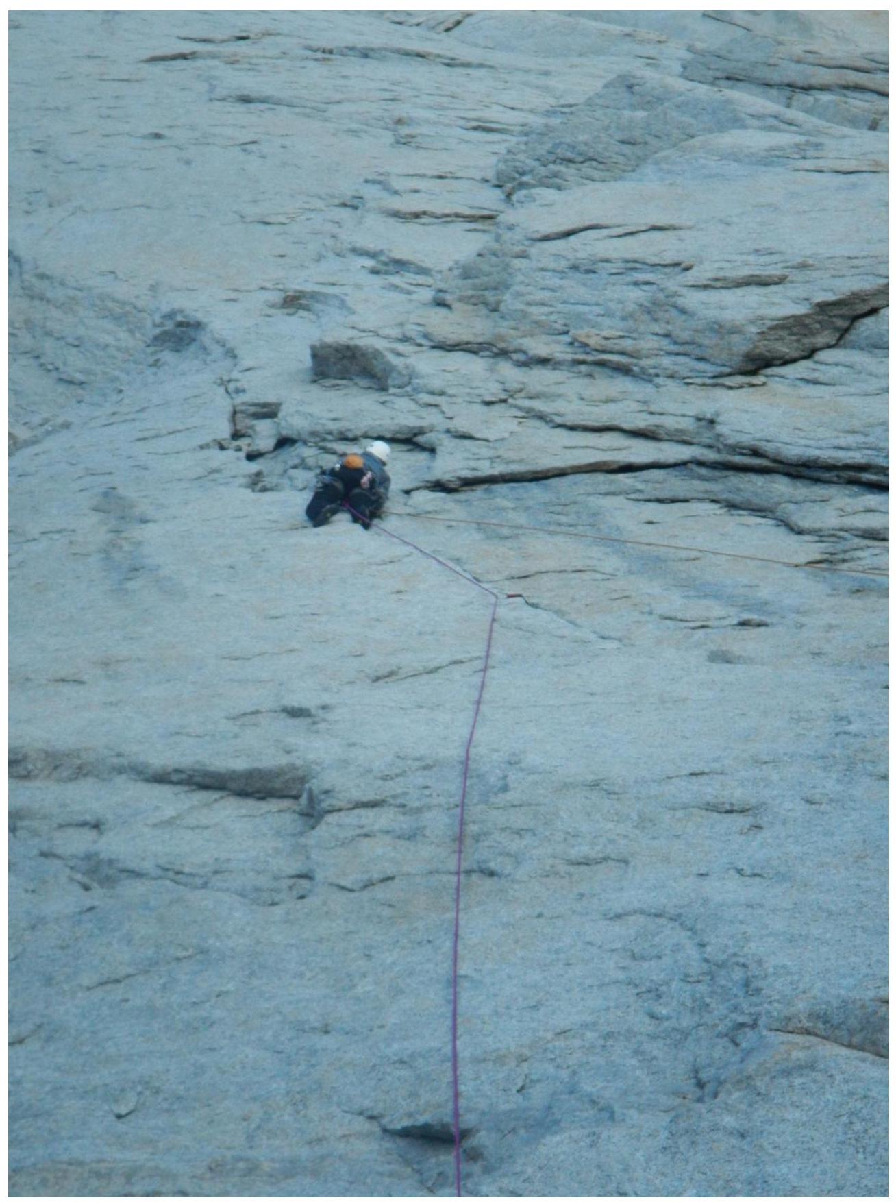
Photo 2. Section R1. Approach to R2.
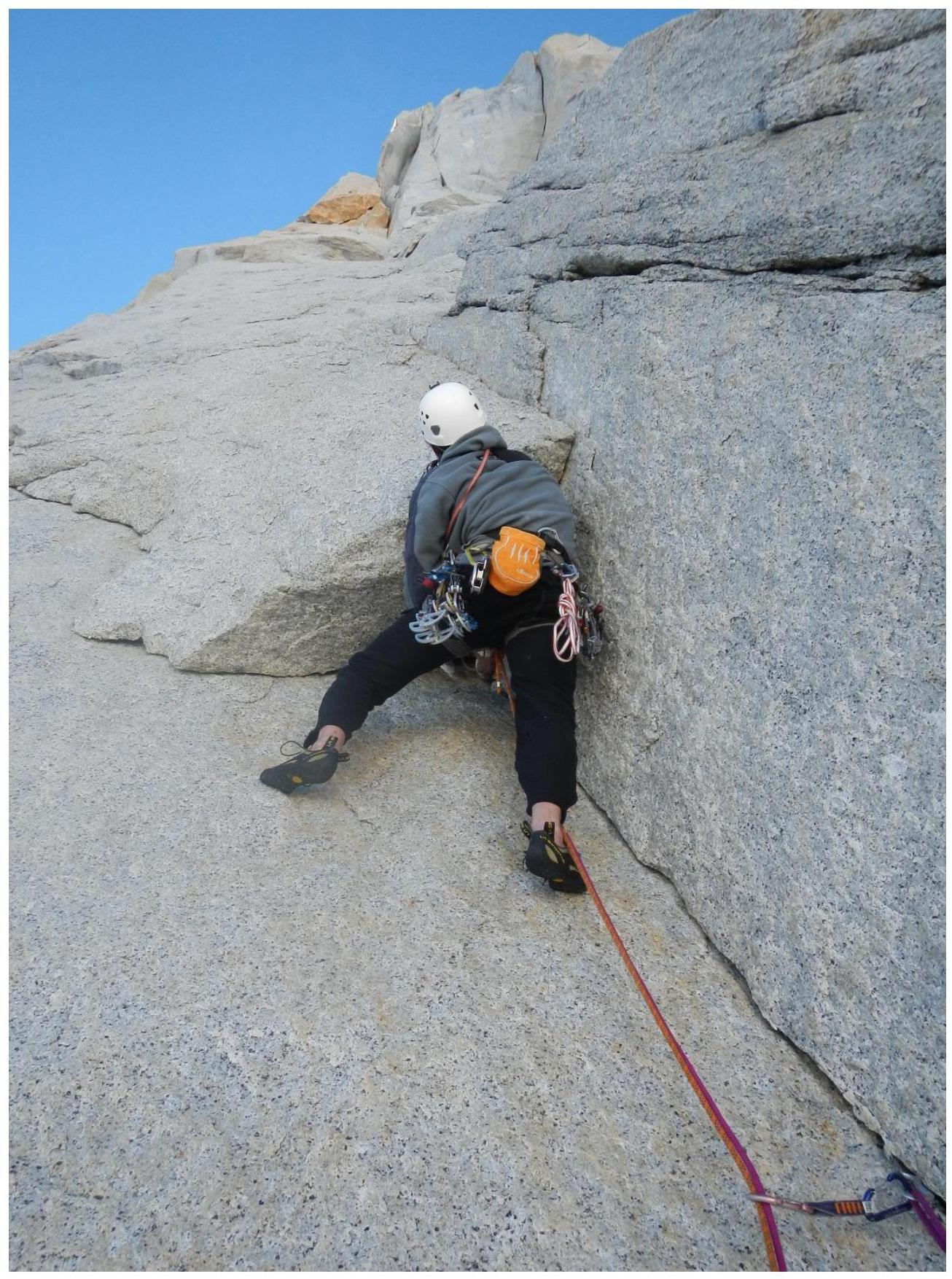
Photo 3. Section R4. Complex bouldering at the start. Dashkevich leading.
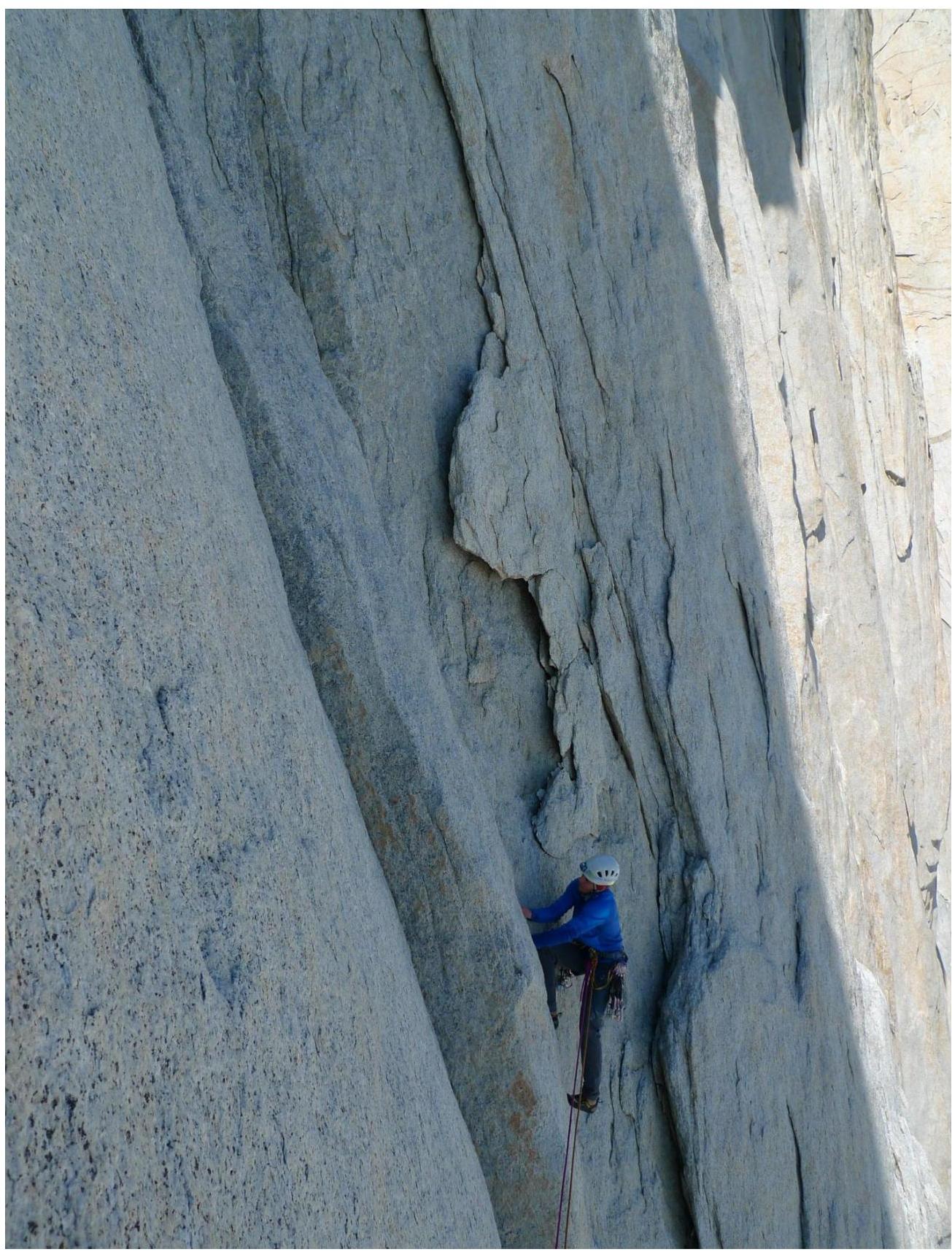
Photo 4. Section R5. Traverse on weak rock right. Marcos Costa leading.
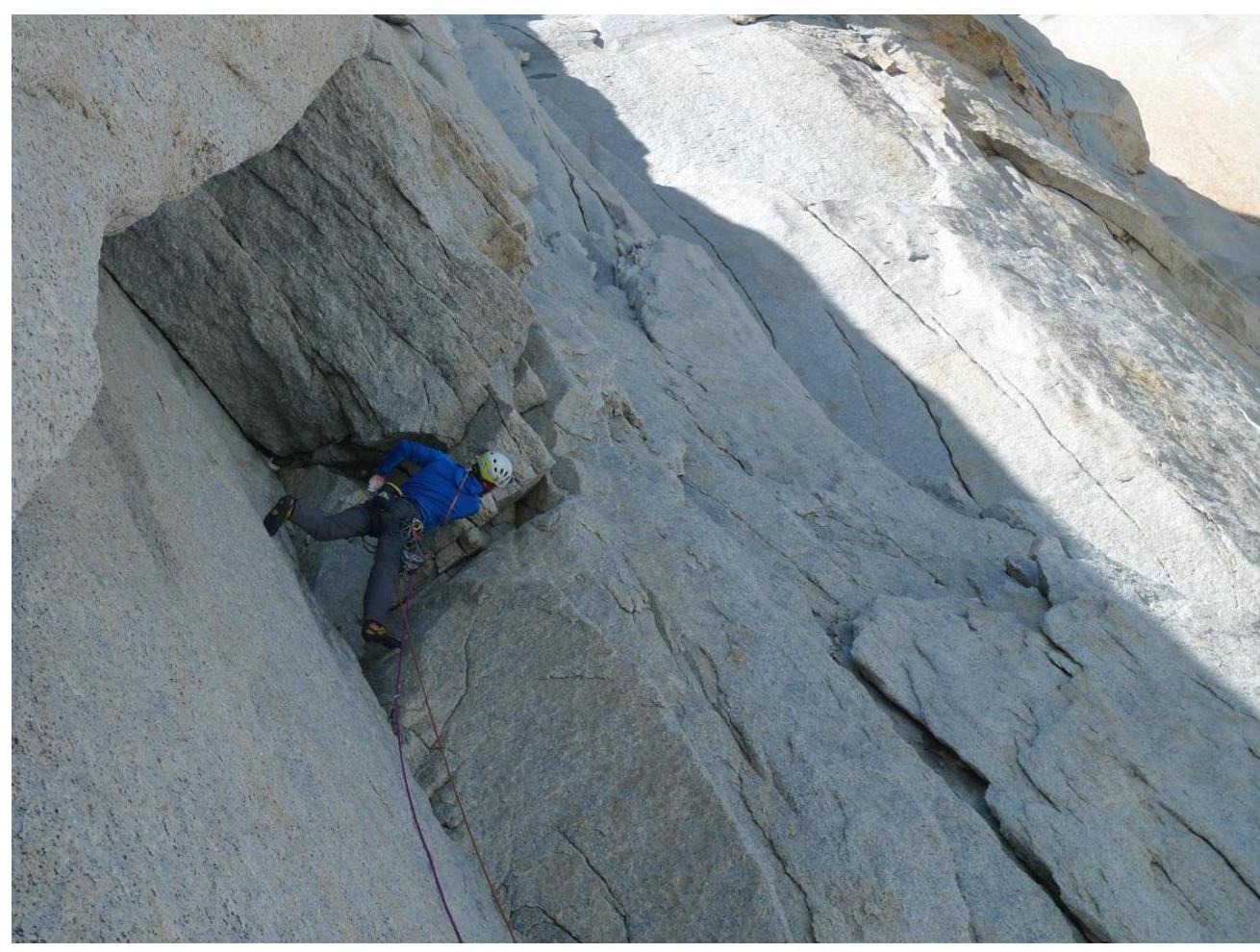
Photo 5. Section R5. Passing an overhang.

Photo 6. Section R8. Chimney with exit to a ledge. Dashkevich leading.
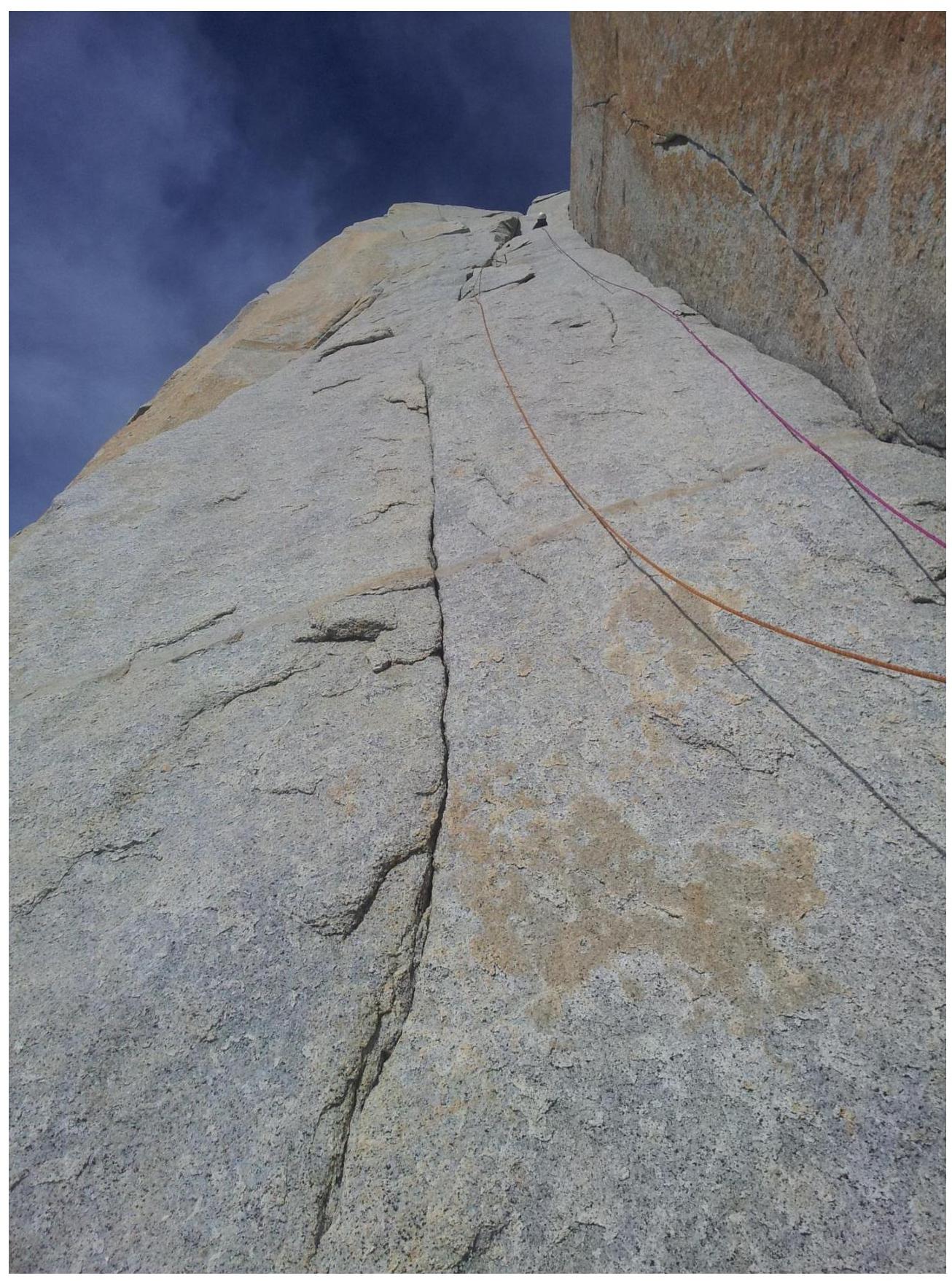
Photo 7. Section R9. Combination of AP and free climbing. Dashkevich leading.