
Ascent Passport
-
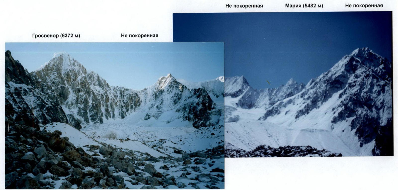
Central China, Sichuan Province, Daxi-Shan ridge, section according to the classification table - "11.3. China"
-
Name of the peak: Maria (5482 m), name of the route: via the eastern ridge.
-
Proposed - 5A cat. dif., first ascent.
-
Nature of the route: combined
-
Route elevation gain: 475 m (by GPS)
Route length: 645 m. Length of sections:
- IV cat. dif. - 260 m
- V cat. dif. - 180 m.
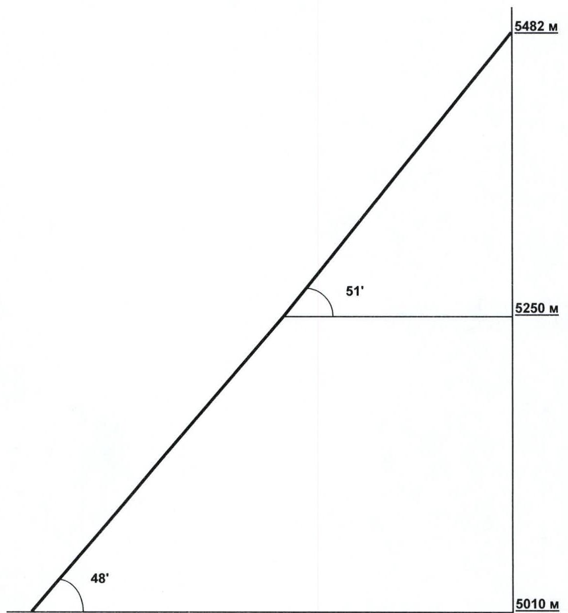
Average steepness:
- Main part of the route - 51°
- Entire route - 47°
-
"Hooks" left on the route:
total: 0 pcs., including pitons: 0 pcs. Hooks used on the route:
- Stationary pitons: 0 pcs., including for artificial aids: 0 pcs.
- Removable pitons: 0 pcs., including for artificial aids: 0 pcs.
Total artificial aids (AID) used:
- Hooks - 5 pcs.
- Chocks - 2 pcs.
-
Team's travel time: 16 hours, 3 days
-
Leader: Krasnolutsky Alexander Vyacheslavovich, Candidate Master of Sports
Participants:
- Eiduss Sergey Vladimirovich, Candidate Master of Sports
- Shapovalenko Igor Nikolaevich, Candidate Master of Sports
- Isaev Alexey Vyacheslavovich, 2nd sports category
-
Coach: Shapovalenko I.N.
-
Departure for the route: 11:00, October 11, 2004
Summit reached: 15:00, October 12, 2004 Return to base camp: 11:00, October 13, 2004
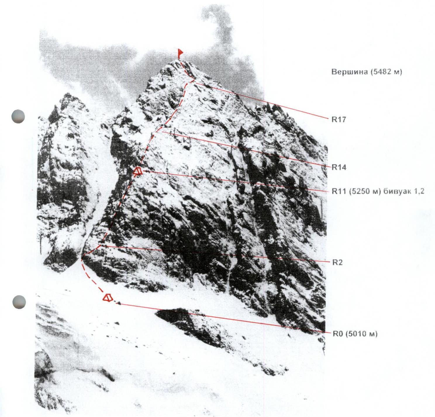
Technical photograph of the route
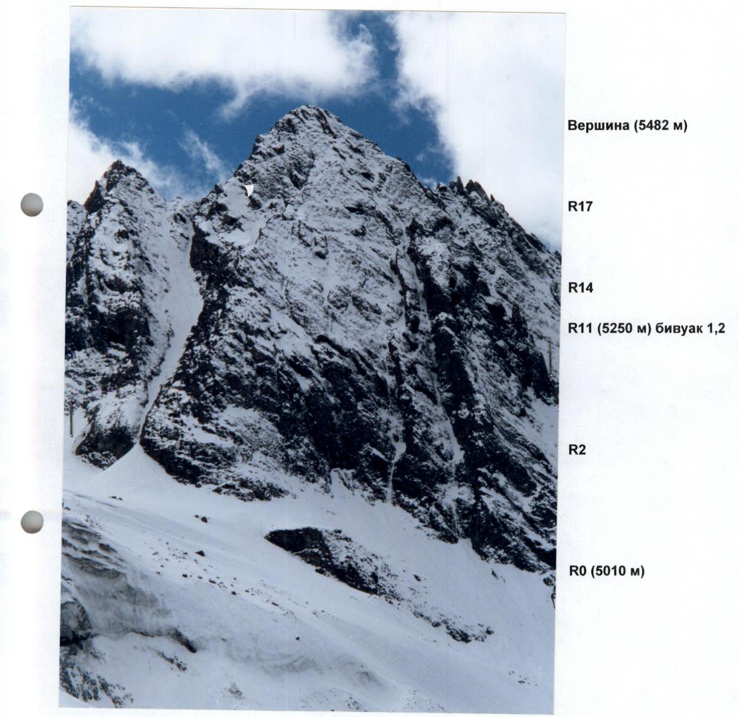
Technical photograph of the route
Panoramic photograph of the area
Hand-drawn profile of the route
Sheet 2, page 4.
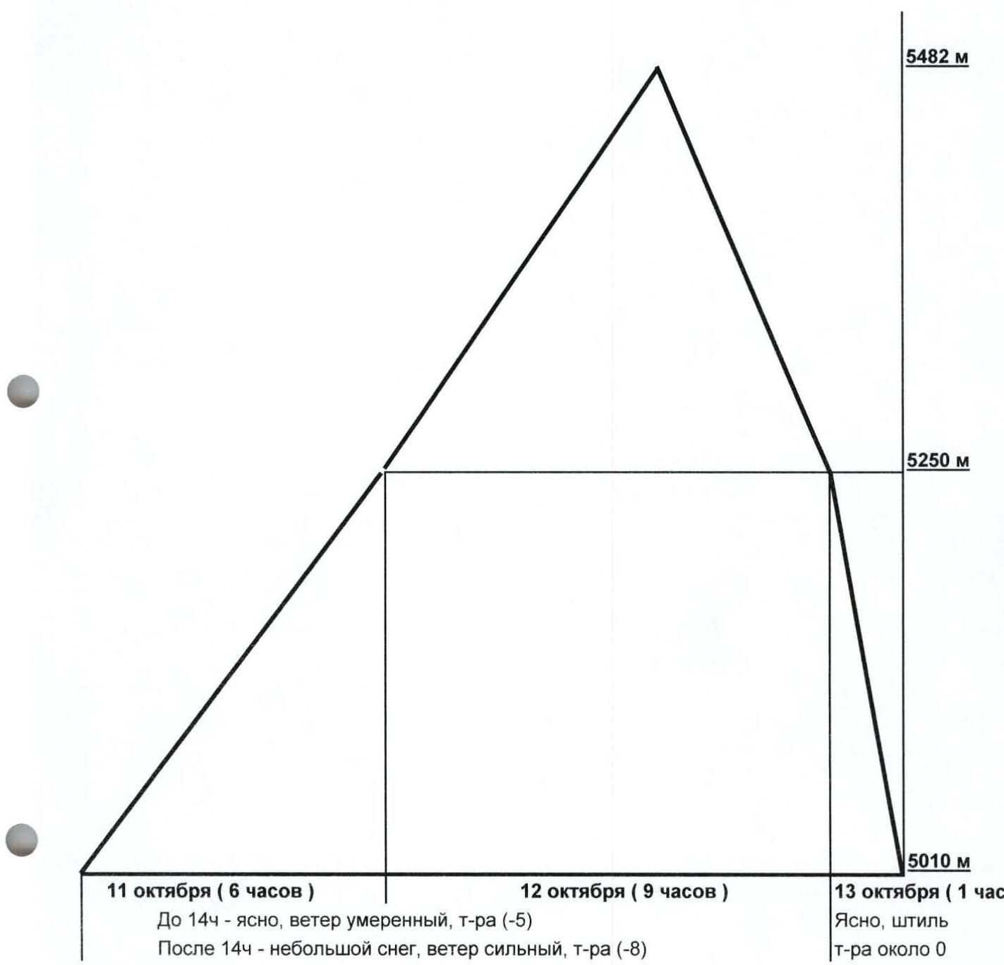
Ascent graph
Sheet 4, page 7.
- October 11 (6 hours): Until 14:00 - clear, moderate wind, temperature -5°C. After 14:00 - light snow, strong wind, temperature -8°C.
- October 12 (9 hours)
- October 13 (1 hour): Clear, calm, temperature around 0°C.

UIAA symbol route diagram
Sheet 4, page 8.

- R17: 3 hooks, 1 friend/2. 20 m, 5, 70°
- R16: 3 hooks, 2 friends/0. PHOTO 6. 45 m, 3, 40°
- R15: 3 hooks, 2 friends, 1 chock/0. PHOTO 5. 40 m, 4, 60°
- R14: 1 hook, 2 friends/0. PHOTO 4. 40 m, 4, 50°
- R13: 3 friends/0. 30 m, 4, 35°
- R12: 2 friends/0. 15 m, 4, 50°
- R11: 5 hooks, 1 friend/0. Bivouac 1,2. PHOTO 3. 8 m, 3, 40°
- R10: 2 hooks, 1 friend/0. 30 m, 5, 70°
- R9: 0/0. 8 m, 3, 25°
- R8: 3 friends, 1 chock/0. 23 m, 4, 60°
- R7: 0/0. 12 m, 3, 30°
- R6: 4 hooks, 3 friends/2. 40 m, 5, 55°
- R5: 2 friends/0. 30 m, 4, 50°
- R4: 2 friends, 2 chocks/0. PHOTO 2. 20 m, 4, 55°
- R3: 5 hooks/1. 15 m, 5, 60°
- R2: 2 hooks, 3 friends/0. PHOTO 1. 40 m, 3, 40°
- R1: 2 hooks, 1 chock/0. 30 m, 4, 50°
- R0: 0/0. 90 m, 2, 25°
- R20: 0/0. 12 m, 4, 40°
- R19: 8 hooks, 4 friends, 2 chocks/2. 75 m, 5, 70°
- R18: 2 hooks, 2 friends/0. 20 m, 4, 50°
Photo 1

Section R2-R5. Two participants at the belay station at the beginning of section R2, the leader is at the beginning of R3.
Photo 2
Two participants at the base of section R4.
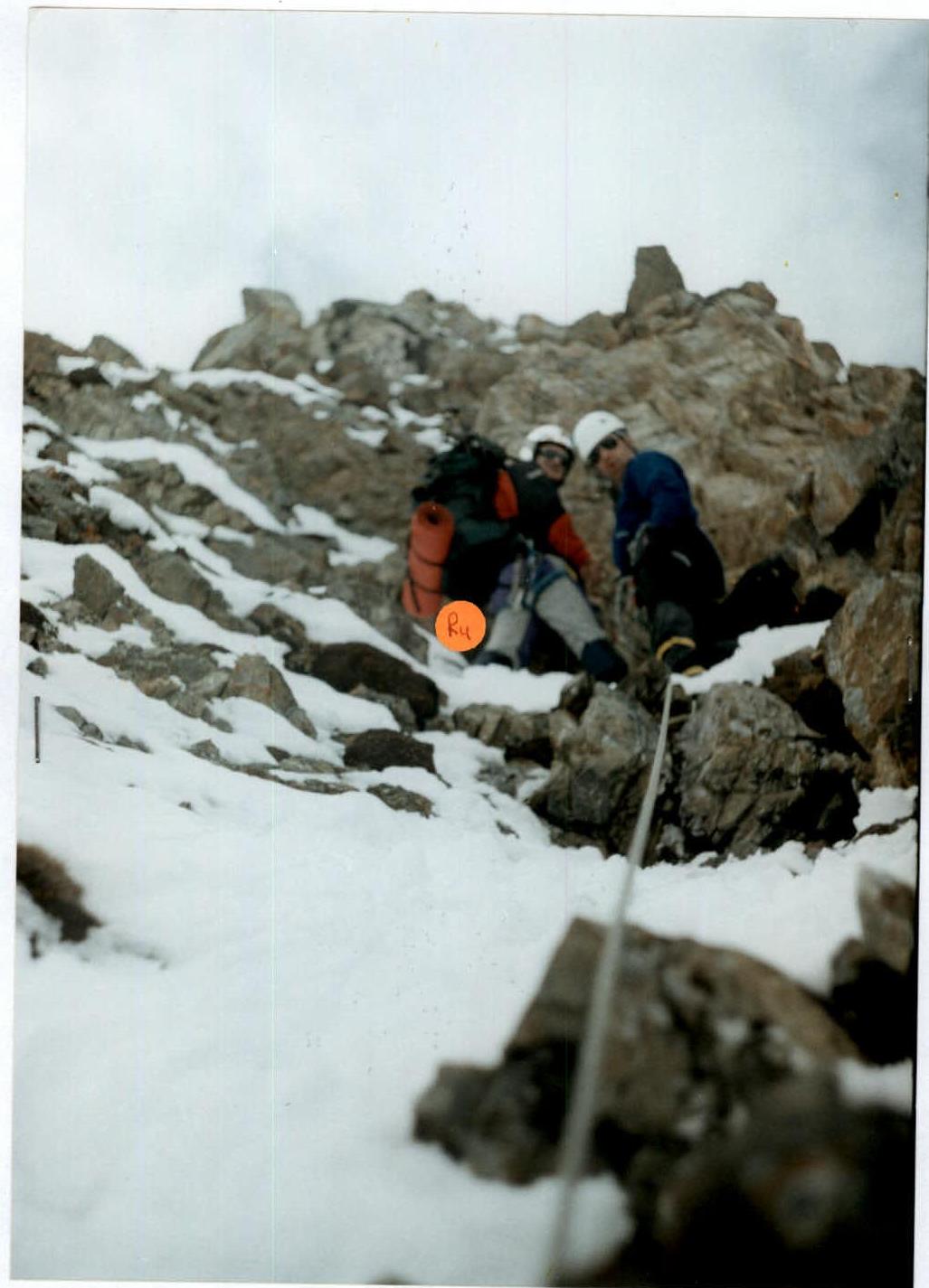
Photo 3
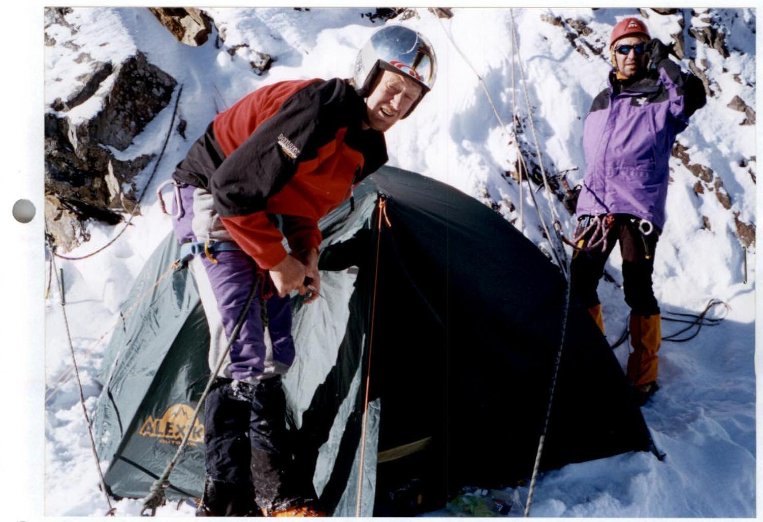
October 12, 2004. Bivouac 1,2.
Photo 4
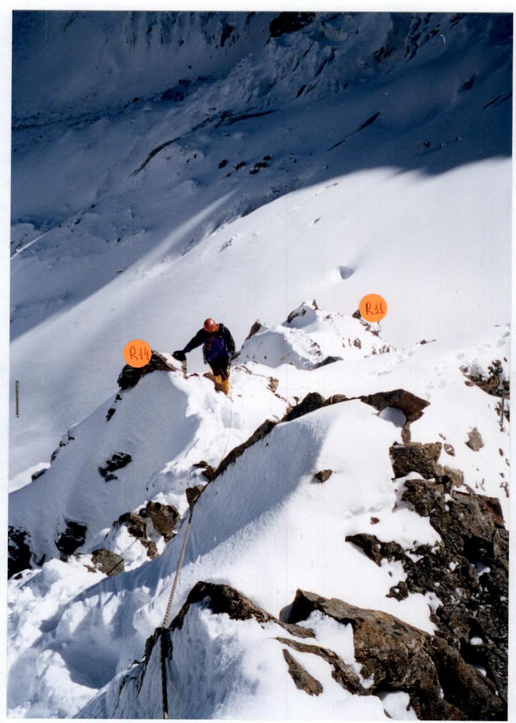
Section R11-R14. Movement along the ridge.
Photo 6
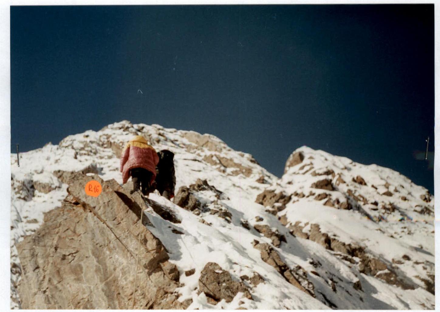
At the belay station before section R16.
Photo 5
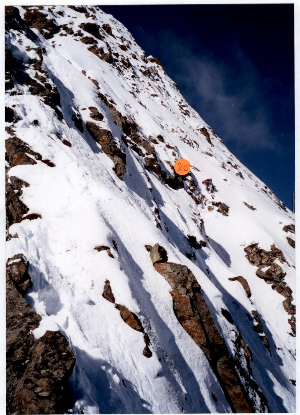
Leader finishing work on section R14.
The report is missing:
-
Overall photo of the summit with routes marked.
Since this was a first ascent, there are no other routes on the peak, and the overall photo is combined with the technical photo of the route.
-
Photo of the wall profile.
The route's location is such that, from any angle, the traversed ridge overlaps with other parts of the mountain.
-
Sketch map.
Since the area is new, no sketch map was found in publicly available sources.
-
Notes from control points and the summit.
We were the first there - what notes are we talking about?
-
Photo of the group on the summit.
Since, by the time the group reached the summit, film was only left in the wide-angle "Zenit" camera, the overall shot resembles a family photo with a perspective from the top of the head to the chest with a blurred background. We could have taken such photos in Primorye as well.