
Report on the ascent to the summit of Index (2595 m) via the Brun—Perru route through the East ridge with category 3A by the training department of AK «Polytechnic» on July 29, 2018
Leader: V. A. Molodozhen Coach: V. A. Molodozhen
St. Petersburg 2018
1. Climbing Report
| №№ | 1. General Information | |
|---|---|---|
| 1.1 | Full name, sports rank of the leader | Molodozhen V. A. — Master of Sports |
| 1.2 | Full name, sports rank of participants | Fineeva A. A. — 3rd sports category, Sadovsky S. V. — 3rd sports category, Duplyak A. K. — 3rd sports category, Limanyuk A. Yu. — 3rd sports category, Bakharev N. N. — 3rd sports category |
| 1.3 | Full name of coach | Molodozhen V. A. |
| 1.4 | Organization | AK «Polytechnic» |
| 2. Characteristics of the Climbing Object | ||
| 2.1 | Region | France, Upper Savoy, Chamonix valley, Aiguilles Rouges |
| 2.2 | Valley | Égaux du Rouge |
| 2.3 | Category according to the 2013 classification table | 10.3 |
| 2.4 | Name and height of the summit | L'Index. Height 2595 m. |
| 2.5 | Geographical coordinates of the summit (latitude/longitude), GPS coordinates | 45.96839°N / 6.86654°E |
| 3. Characteristics of the Route | ||
| 3.1 | Name of the route | Brun—Perru route through the East ridge |
| 3.2 | Proposed category of difficulty | 3A |
| 3.3 | Degree of route development | Well-developed, all stations are drilled, with rare drilling on the route itself |
| 3.4 | Terrain characteristics of the route | Rock |
| 3.5 | Height difference of the route (data from altimeter or GPS) | Height of campsite — 1035 m; Height at the base of the rock ascent — 2380 m; Height of the summit — 2595 m; Height difference from campsite to summit — 1560 m; Height difference from base of rock ascent to summit — 215 m. |
| 3.6 | Length of the route (in meters) | Distance from campsite to base of rock ascent (length of approach) — about 5 km, possibly using a cable car; Distance from base of rock ascent — 250 m; Descent from summit to base of rock ascent — 300 m; Total length of rock part of the route — 215 m; Total length of the route including approach and return to campsite — 5250 m |
| 3.7 | Technical elements of the route (total length of sections with different categories of difficulty, indicating terrain type (ice-snow, rock)) | 3rd cat. diff., rocks 55 m; 4th cat. diff., rocks 120 m; 4+/5- cat. diff., rocks 30 m; |
| 3.8 | Descent from the summit | Rappelling from the summit to the NE towards Col de L'Index 45 m, then descent using simple climbing to the pass 50 m, descent to the cable car along a scree slope |
| 3.9 | Additional characteristics of the route | - |
| 4. Characteristics of Team Actions | ||
| 4.1 | Time of movement (team's walking hours, in hours and days) | 10 hours |
| 4.2 | Overnight stays | Campsite |
| 4.3 | Departure from overnight stay | 07:30, July 29, 2018 |
| 4.4 | Start of the route | 10:00, July 29, 2018 |
| 4.5 | Arrival at intermediate ledge | 11:30, July 29, 2018 |
| 4.6 | Arrival at the northern summit | 14:00, July 29, 2018 |
| 4.7 | Descent from the route | 16:00, July 29, 2018 |
| 4.8 | Return to overnight stay | 17:30, July 29, 2018 |
| 5. Person Responsible for the Report | ||
| 5.1 | Bakharev Nikolai Nikolaevich | mrkoliaska@gmail.com |
2. Description of the Ascent
1. Characteristics of the Climbing Object
1.1 General Photo of the Summit
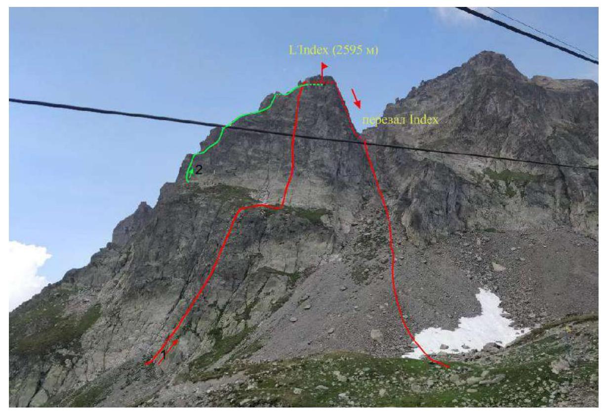
Date of photo — July 29, 2018. Location of photo — Index cable car, France, Chamonix, view of Col de L'Index and the eastern slope of Index.
Routes:
- Brun—Perru route through the East ridge 3A cat. diff.
- Route along the South-East ridge 2A cat. diff.
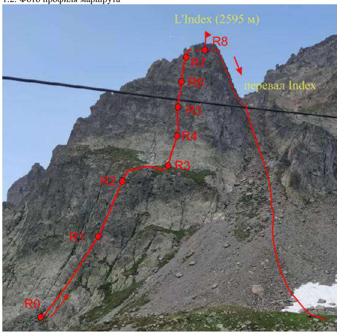
1.2 Photo of the Route Profile
Date of photo — July 29, 2018. Location of photo — Index cable car, France, Chamonix, view of Col de L'Index and the eastern slope of Index.
1.3 Photopanorama of the Area
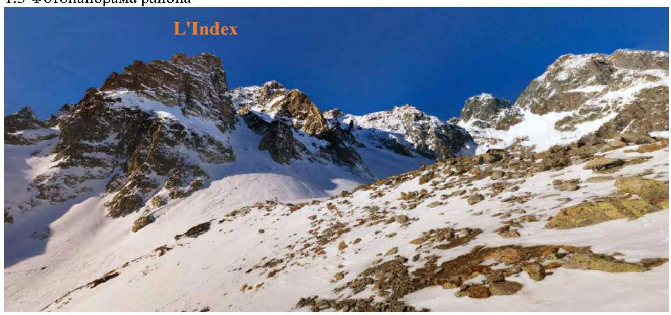
Date of photo — January 2015. Author: Fabio Tosato. Location of photo — Index cable car, France, Chamonix, view of Col de L'Index and the eastern slope of Index.
1.4 Map of the Area
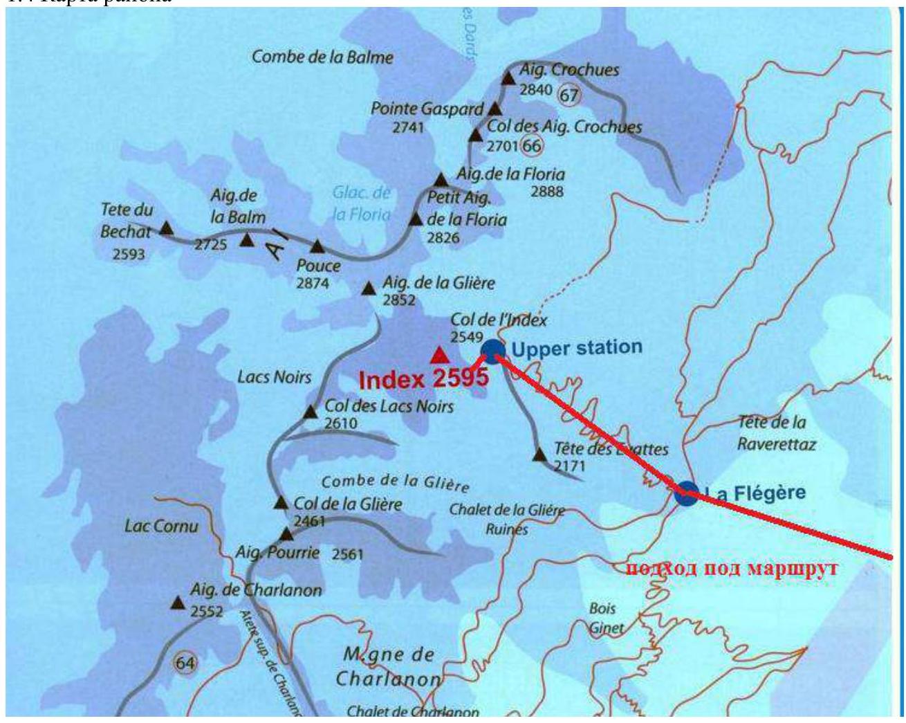
The area where the summit is located is in the Chamonix valley (Upper Savoy, France) in the area called Aiguilles Rouges, north of Chamonix. The route and approach to the route are completed in one day.
From the campsite, it is necessary to reach the Flegere cable car, the second section of which goes to the Index summit. To ascend:
- Move along the cable car or along the ski slope passing nearby.
- From the upper cable car station, move along the trail to the left for 5 minutes.
Distance to the start of the route — about 5 km. Travel time is 3 hours.
You can also use the cable car (starts at 08:00, it is better to buy tickets in advance). In this case, the ascent time will be 20 minutes.
2. Characteristics of the Route
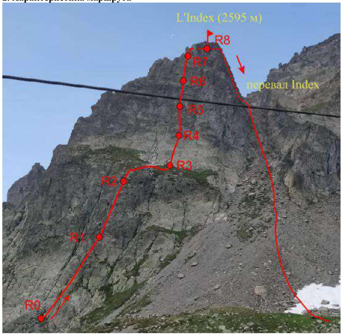
| Section № | Terrain Characteristics | Category of Difficulty | Length |
|---|---|---|---|
| R0–R1 | Rocks | 5Б | 45 m |
| R1–R2 | Rocks | 4С | 35 m |
| R2–R3 | Rocks | - | 45 m |
| R3–R4 | Rocks | 5Б | 30 m |
| R4–R5 | Rocks | 5С | 30 m |
| R5–R6 | Rocks | 5Б | 20 m |
| R6–R7 | Rocks | 5Б | 25 m |
| R7–R8 | Rocks | 3С | 20 m |
| Descent from the route | Rocks | 250 m |
3. Characteristics of Team Actions
| Section № | Description | Photo № |
|---|---|---|
| R0–R1 | Cat. diff. of climbing 5Б. Need to overcome a 45 m slab, with the key section being a steep part approximately in the middle. | 1,2 |
| R1–R2 | Movement along the ridge 35 m to a drilled station under a ledge, cat. diff. 4С. | |
| R2–R3 | Exit to a wide ledge, 45 m. Simultaneous movement is possible. On the ledge — to the right, to the start of the third rope. From this ledge, an emergency descent from the route is possible by climbing simple rocks. | 3 |
| R3–R4 | Movement up the slab slightly to the right, and then back to the left. The first bolt is at a height of about 15 m; it is recommended to organize additional belays. 30 m, cat. diff. 5Б. | |
| R4–R5 | Continue moving along the slab along the crack. This section is key: cat. diff. 5С, 30 m. | |
| R5–R6 | Movement up the slabs 20 m, cat. diff. 5Б. The station is clearly visible. If there are many people on the route and the participants' qualifications allow them to move on more complex terrain, then by moving not strictly up, but up and to the left, overcoming a section of 5th cat. diff., cat. diff. 6А, 20 m, you can get to a grassy ledge, from which it is quite easy (3rd cat. diff. instead of 4th cat. diff. of section R6–R7) to reach point R7. | |
| R6–R7 | Movement up a steep wall divided by a crack. Ignore the ascent leading to the right. 25 m, cat. diff. 5Б. From point R6, you can go to the right: at first, this option seems simpler (4th cat. diff., cat. diff. 5), but in this case, to reach the summit, you will have to overcome a section (5th cat. diff., cat. diff. 6) about 20 m. | |
| R7–R8 | Climbing cat. diff. 3С to exit to the ridge 15 m. Then traverse to the summit 5 m. The summit is a narrow ridge. On this section, it is convenient to use loops for belays on large ledges. | 4 |
| Descent from the route | Traverse along the ridge 10 m to the right, descent 5 m to a ledge and traverse 10 m to rappelling stations. Two rappelling options are possible. The optimal one is towards Col de L'Index on the ridge — 45 m. The main difficulty is to get to a point in one rope from which you can continue moving by simple climbing (see photo 5, which shows the most successful descent point). After that, climb down simple rocks to the pass and continue moving along the scree slope to the cable car. If this rappel is occupied, a descent to the northwest is possible. The descent is carried out in two ropes — 25 m, an intermediate station is drilled. Then you need to climb to Col de L'Index and continue moving along the scree slope to the cable car. | 4–6 |
Along with the route along the South-East ridge, it is one of the most popular routes to the Index summit. All stations, including the rappelling one, are drilled.
There are also bolted hooks every 10–15 meters on the route, but it is recommended to take a set of medium-sized stoppers for additional belays.
The bolted hooks make it quite easy to navigate the route.
Due to the popularity of the route, it is recommended to start before 08:00, as most people take the cable car. If taking the cable car, it is recommended to buy tickets in advance to be able to ascend on the first cabin.
The path to the route is clearly visible. The route is not rockfall-prone.
The proposed assessment of the route is 3A.
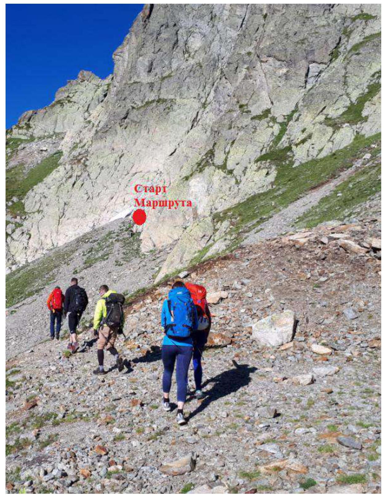
Photo 1. Approach to the route. The start of the route (R0) is marked.
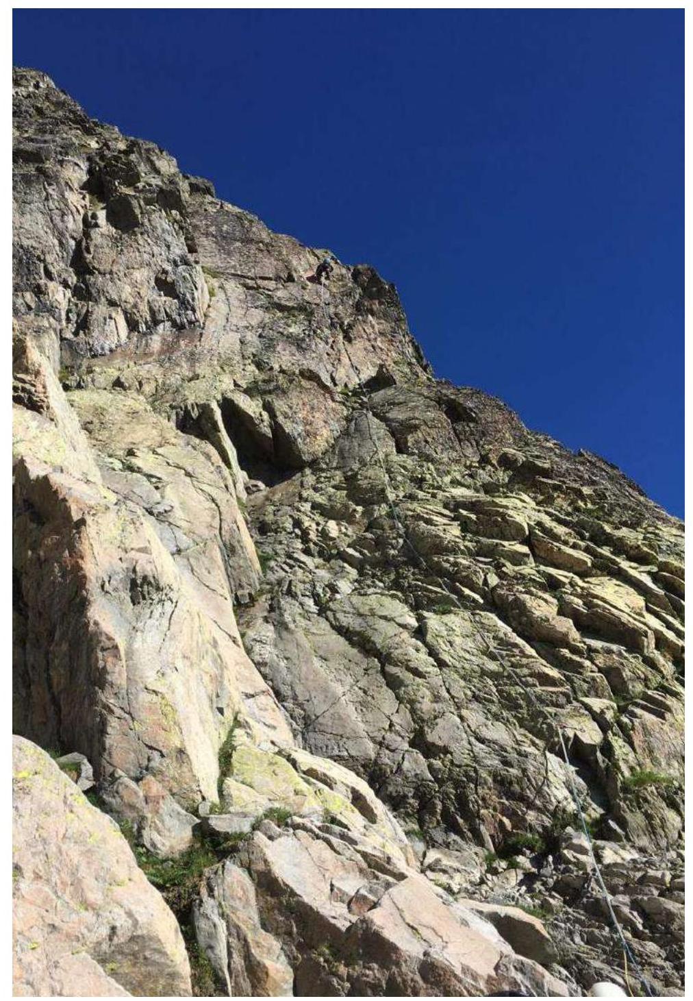
Photo 2. View from the starting point of the route. Section R0–R1.
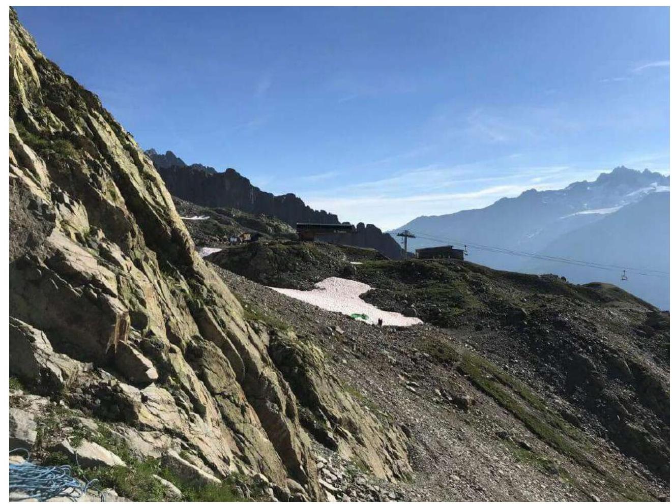
Photo 3. View from R3 at the cable car.
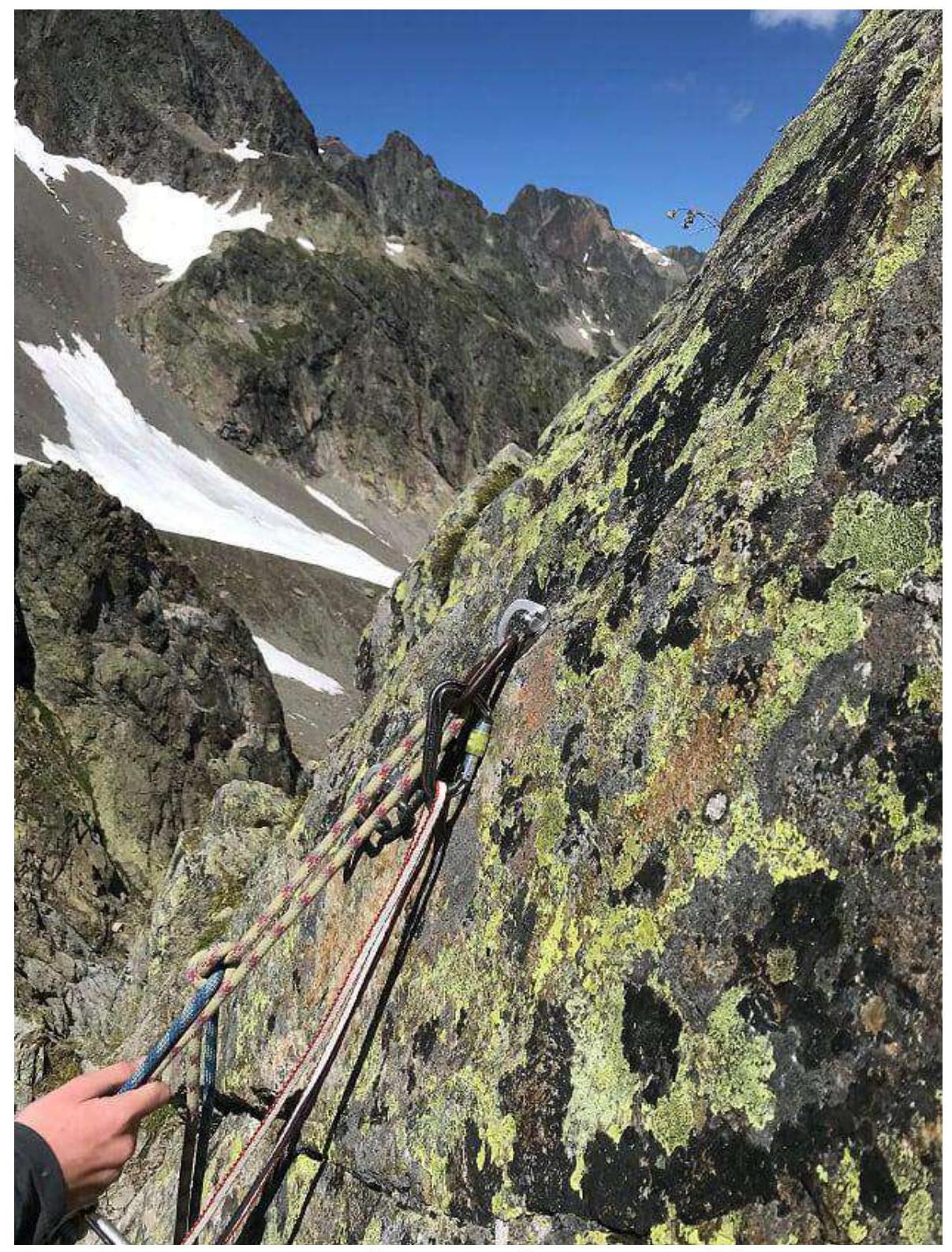
Photo 4. View from a ledge near one of the stations near point R8.
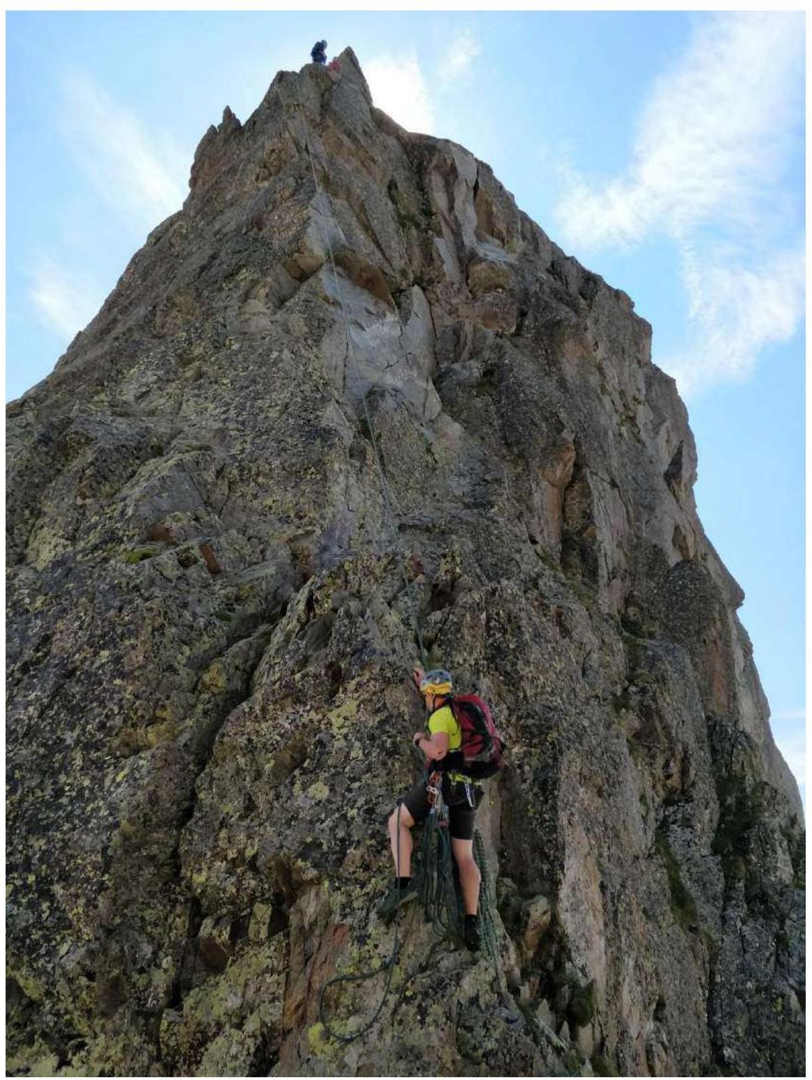
Photo 5. Rappelling towards Col de L'Index.
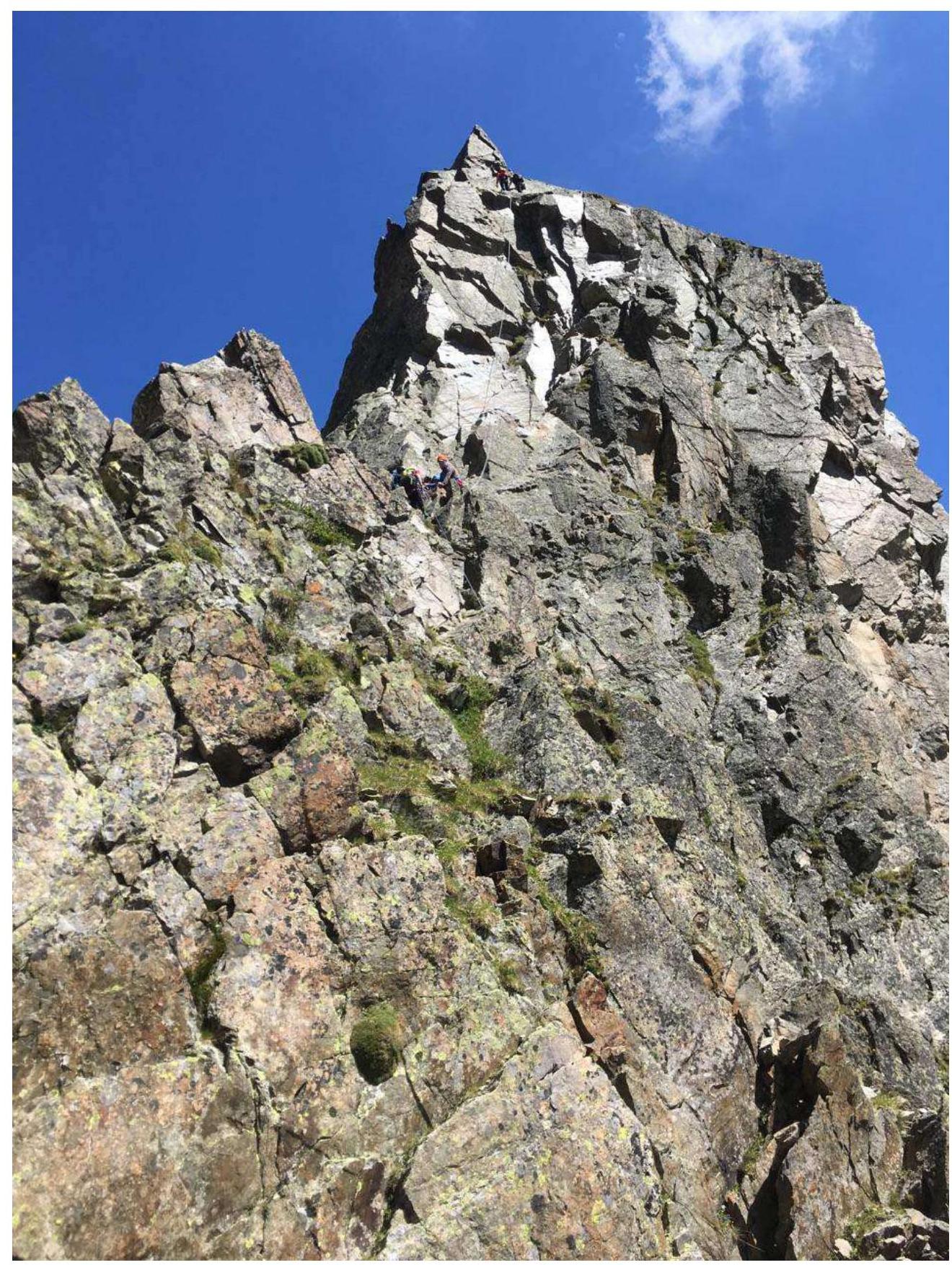
Photo 6. Alternative rappelling option (to the northwest). People are on the intermediate and upper stations.
Comments
Sign in to leave a comment