Report
On the ascent of the CSKA Demchenko team to the summit of Aiguille du Chardonnet (3824 m) via the NW wall couloir, 5A category of difficulty, Savoy Alps, Chamonix area
Team leader: A.V. Sviatitskiy
Senior coach: E.V. Kuznetsova
Ascent Passport
- France, Savoy Alps, Chamonix area. Section № 10.3 (according to KGBM 2013).
- Aiguille du Chardonnet peak (3824 m) via the NW wall couloir (J. Aureille, Y. Feutren, 1942).
- Category of difficulty: 5A.
- Route type: combined.
- Height difference: 600 m. Route length: 760 m.
- Section lengths:
- V category: 300 m
- VI category: 20 m
- Average slope:
- main part: 60°
- entire route: 50°
- Section lengths:
- Equipment left on the route: 0; including pitons: 0.
- Time taken: 10 hours 20 minutes (excluding descent).
- Team leader and climber: Sviatitskiy A.N. (1st sports category), Prilepskaya N.E. (Master of Sports).
- Coach: Kuznetsova E.V.
- Departure from Albert 1 Refuge: 9:00, June 25, 2014. Summit reached: 12:00, June 25, 2014. Return to refuge: 16:15, June 25, 2014. Descent via NW ridge, 2B–3A category.
- Organizing body: CSKA Demchenko training camp (Moscow).
- Report author: Sviatitskiy A. Email: svyatitskiy@gmail.com
General Information about the Ascent Area
The Aiguille du Chardonnet peak is located in the Chamonix valley, within the Savoy Alps in southern France. Chamonix is known for its well-developed mountain infrastructure and rich mountaineering traditions and history. The highest point in the Chamonix area and the Savoy Alps is Mont Blanc (4808 m), the highest peak in the Alps.
The ascent took place during the CSKA Demchenko training camp in June–early July 2014. The base camp was set up in the Montroc campsite. Montroc is the highest settlement in the Chamonix valley after Le Tour, with an elevation of 1300–1400 m.
Most interesting mountaineering routes are found in the Mont Blanc massif. With peaks between 3500–4000 m, the area offers a variety of terrain, including rock, ice, and snow. There are many combined routes ranging from 1B to 6A category of difficulty.
The ascent began from the Albert 1 Refuge, located at the foot of the Glacier du Tour at an altitude of 2702 m. The route up Aiguille du Chardonnet via the NW wall couloir was first climbed by J. Aureille and Y. Feutren in 1942.
Some GPS coordinates:
- Albert 1 Refuge: 45°59′48.36″ N 6°59′11.66″ E
- Summit: 45°58′7.85″ N 7°0′3.85″ E
Area Photopanorama
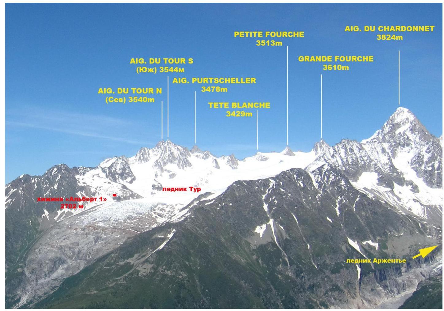
Photo of the Glacier du Tour area, taken from Lac Blanc on July 3, 2014.
Area Map

Approach to Albert 1 Refuge
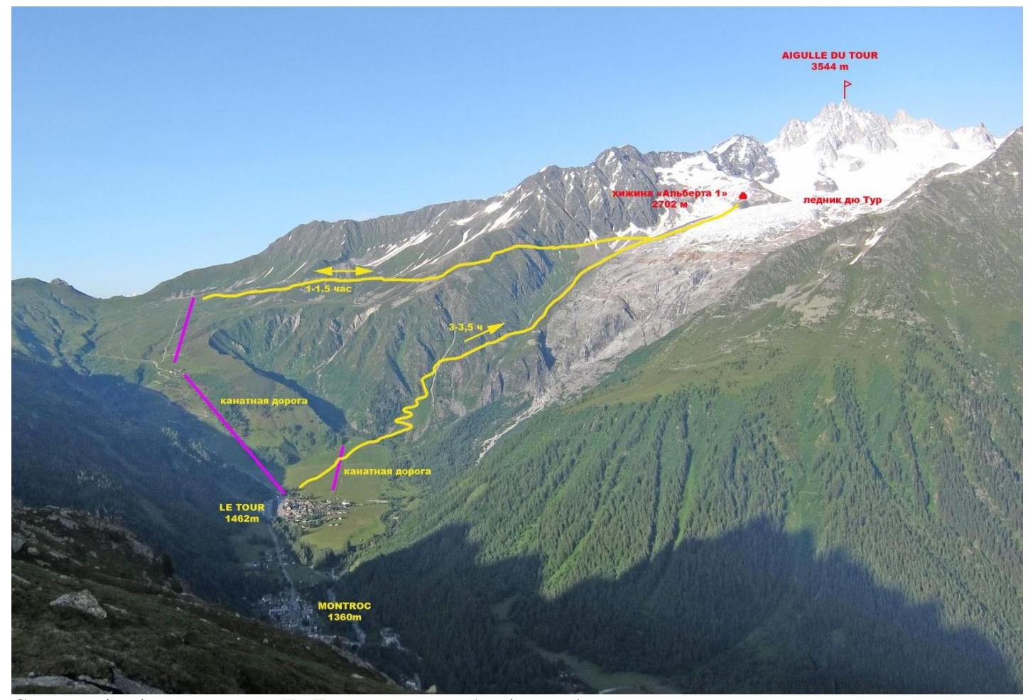
Approach route from Le Tour to Albert 1 Refuge.
Most ascents in the Glacier du Tour area begin from Albert 1 Refuge. There are two paths to reach it:
- From Le Tour village, take the cable car to the start of the trail leading to the refuge. Follow the trail to the refuge (1–1.5 hours).
- From Le Tour village, cross a large field towards the Glacier du Tour. The trail then snakes up the left side of the glacial moraines. The path is marked with red paint on rocky sections. A helicopter pad halfway provides a resting point. The total ascent time is 3–3.5 hours.
General Photo of the Peak
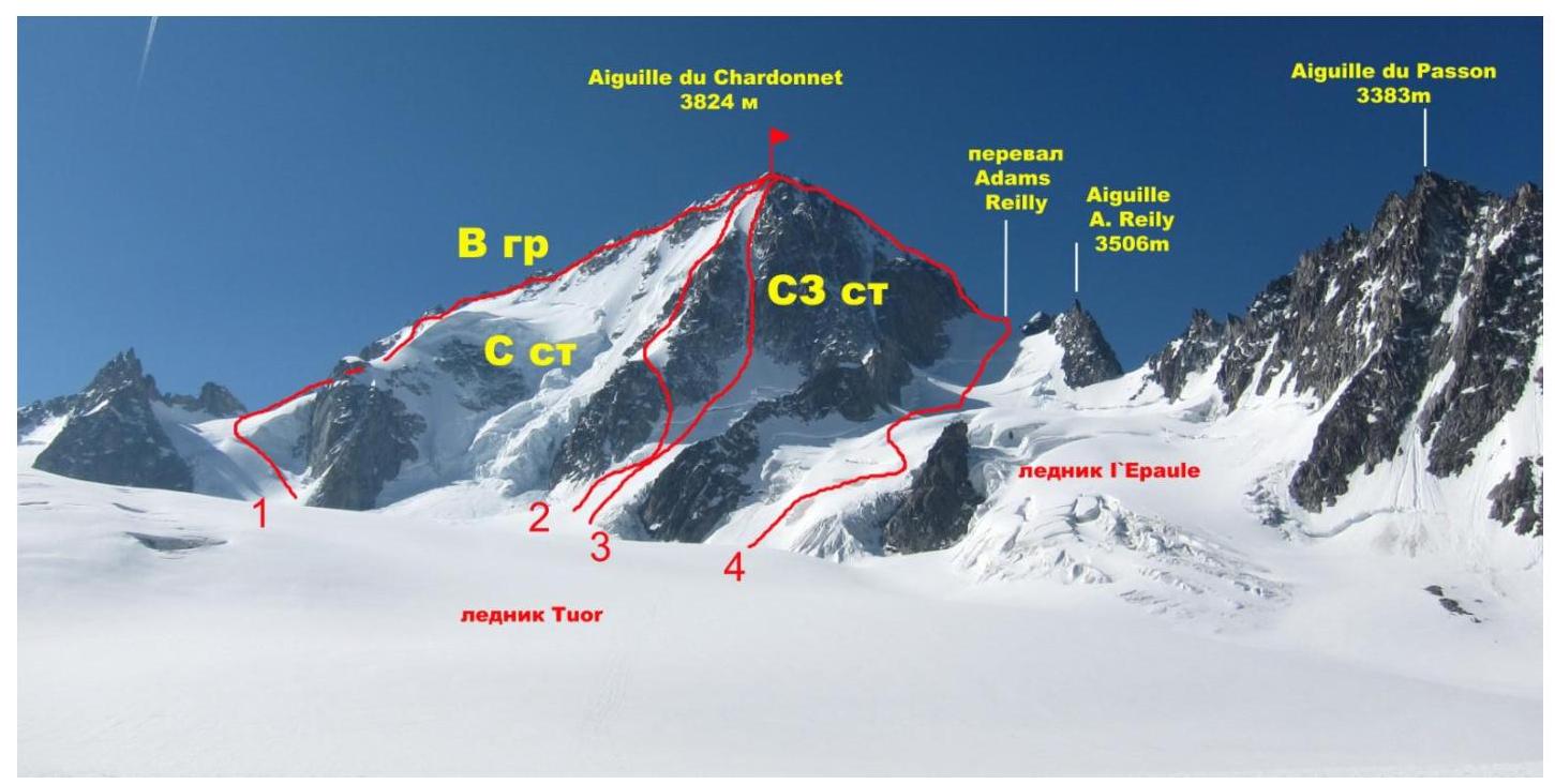
- Route via E ridge, 3B category (AD), P. Sisley, M. & J. Crettez, 1899
- Route via N face and Migot couloir, 4B category (D), A. Migot, C. Devouassoux, 1929
- Team's route
- Route via NW ridge, classic route, 2B–3A category (PD+), P. Thomas, J. Imboden, J-M Lochmatter, 1879
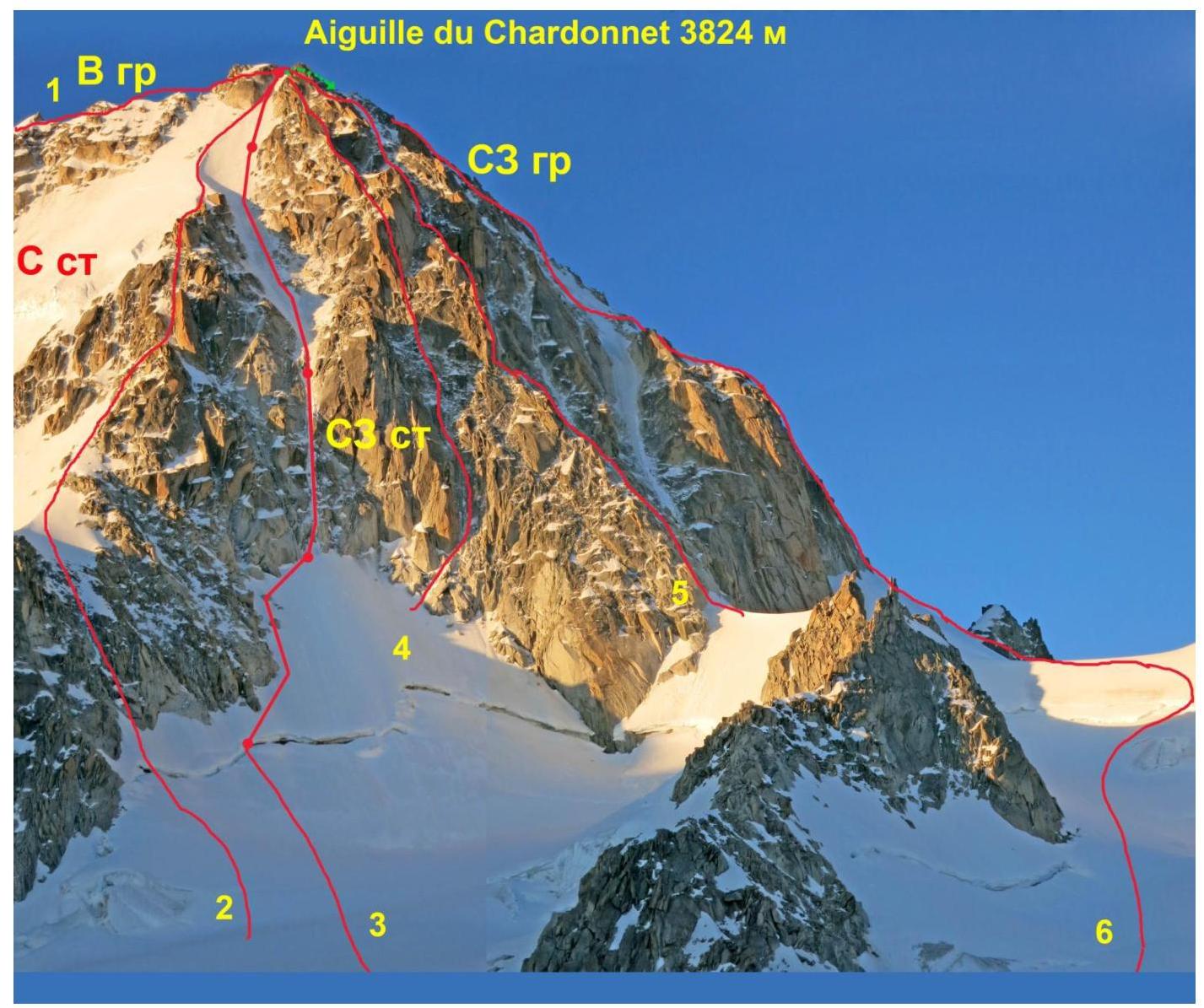
Photo of Aiguille du Chardonnet, June 2014.
- Route via E ridge, 3B category (AD), P. Sisley, M. & J. Crettez, 1899
- Route via N face and Migot couloir, 4B category (D), A. Migot, C. Devouassoux, 1929
- Team's route
- Route via NW wall couloir (D), P. & P. Gabarrou, 1977
- Route via NW couloir and right couloir of NW face (Escarra route) (D+), J. Escarra, 1929
- Route via NW ridge, classic route, 2B–3A category (PD+), P. Thomas, J. Imboden, J-M Lochmatter, 1879
Route Profile Photo
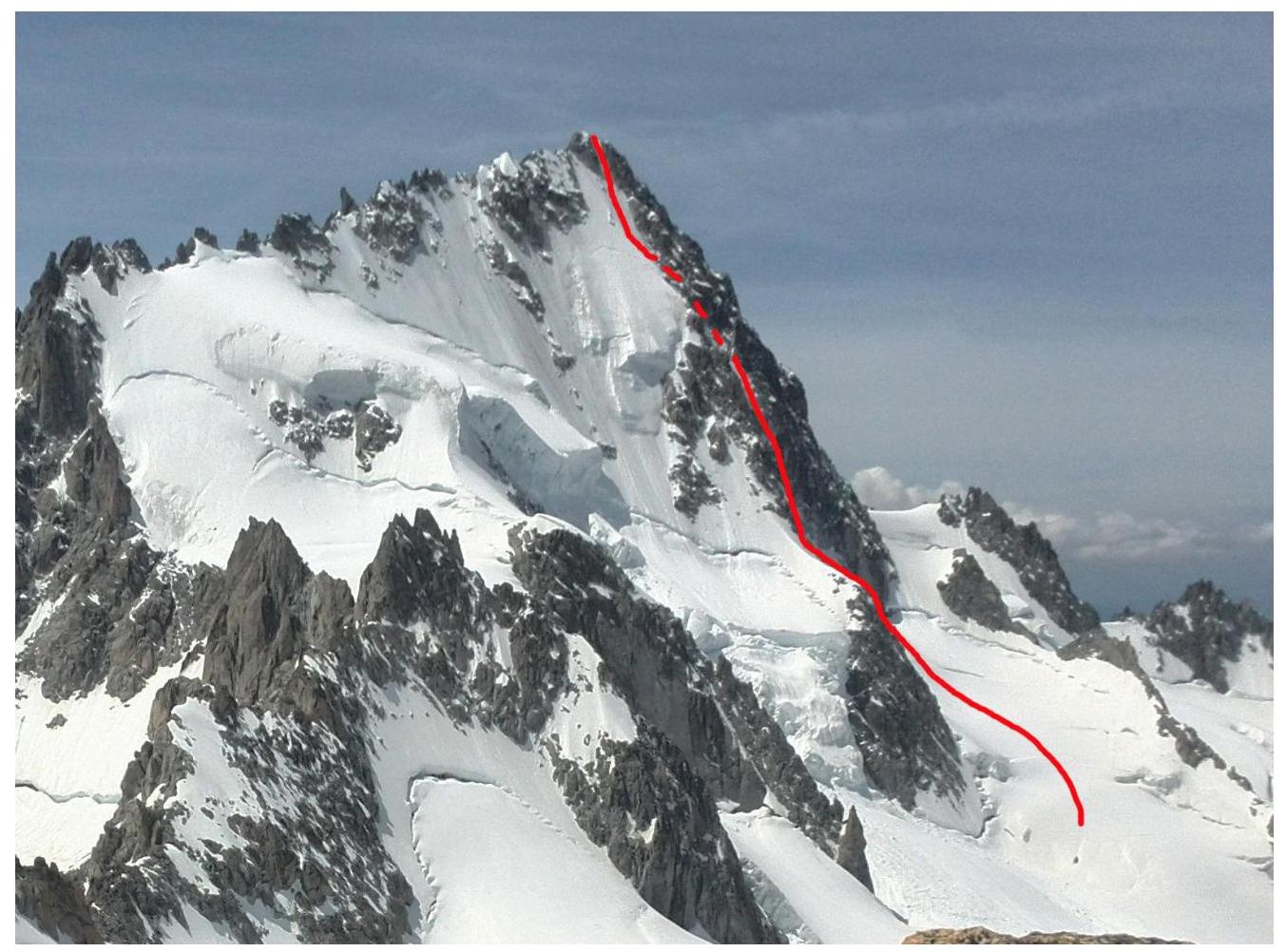
Route profile photo taken from Petit Fourch on June 28, 2014.
Technical Photograph of the Route
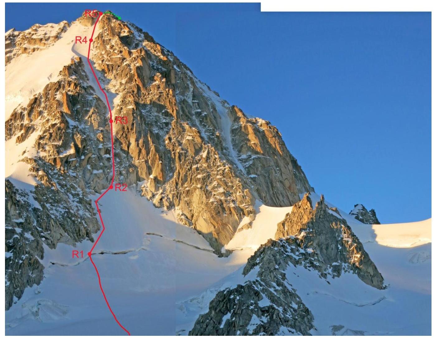
Technical photograph of the route, June 27, 2014.
Description of Route Sections
| Section | Length (m) | Angle (°) | Terrain Type | Category of Difficulty | Pitons Used |
|---|---|---|---|---|---|
| R0–R1 | 200 | 15–30 | Snow, firn, ice | II | 0 |
| R1–R2 | 140 | 50 | Snow-ice slope | III | 8 |
| R2–R3 | 120 | 67 | Snow-ice | VI | 38 |
| R3–R4 | 200 | 55 | Ice | V | 45 |
| R4–R5 | 100 | 50 | Snow-ice | V | 22 |
Route Diagram in UIAA Symbols
| Section | Chocks, Friends | Pitons | Ice Screws | UIAA Difficulty | Length (m) | Angle (°) |
|---|---|---|---|---|---|---|
| 5 | 2 | - | 20 | V | 100 | 50 |
| 4 | 5 | - | 40 | V | 200 | 55 |
| 3 | 7 | 1 | 30 | VI | 120 | 67 |
| 2* | 7 | - | 1 | III | 140 | 50 |
| 1 | - | - | - | II | 200 | 15–30 |
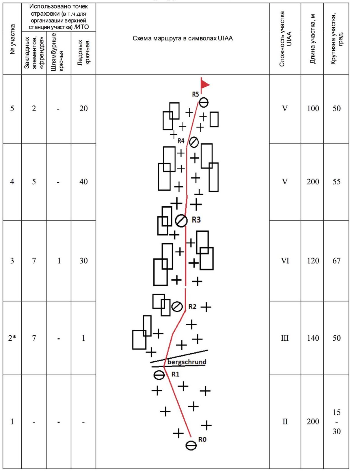
*Few protection points on R1–R2 due to the presence of firm snow instead of ice.
Brief Description of the Route
R0–R1. Approach from Glacier du Tour, bypassing the lower part of Migot ridge on the right. Climb up to an obvious vertical couloir and cross the bergschrund via a snow bridge (3 hours).
R1–R2. From the bergschrund to the base of the couloir. Snow-ice slope with an average angle of 50°. Length: 140 m. Possible protection: on rocks to the left (friends, chocks, slings) or on ice screws at the top. Time: 2 hours 25 minutes.
R2–R3. Narrow couloir with ice on snow and rocks. Average angle: 67°. Short vertical sections at the bottom. Ice is thin and unstable at the lower part. Protection mainly on rocks at the edges (friends, chocks, slings) and on ice screws at the top. Length: 120 m. Time: 3 hours 45 minutes.
R3–R4. Steep ice slope above the couloir. Average angle: 55°. Protection on ice screws. Belay stations possible on ice, rocks at the center, or to the right. Length: 200 m. Time: 3 hours 10 minutes.
R4–R5. Climb up, bypassing the summit tower on the right. Ice slope turning into snow-ice, average angle: 50°. Protection on ice screws. Length: 100 m. Time: 1 hour.
Descent
via NW ridge (classic descent route). From the summit, descend west on a narrow ridge for about 40–50 m to a snow col with a wide snow couloir on the right. Descend this couloir, staying to the right to avoid dangerous slopes below. Do not go into the wide couloir on the left, as it leads towards the Glacier d'Argentière. After 70–120 m, at about 3700 m, move right through a less defined col.
Continue:
- Descend a steep slope for about 100 m; possible rappelling from fixed slings (GPS UTM 32 T 344989 5092527).
- Rappelling down vertical rocks from fixed slings (GPS UTM 32 T 344935 5092556) to the snow saddle Col Supérieur Adams Reilly.
- Descend a steep snow slope to a wide bergschrund on the l'Épaule glacier.
Finish:
- Descend, staying to the right.
- Bypass a rocky outcrop.
- Reach the Glacier du Tour (4 hours).
Recommendations
The route is generally considered relatively safe. Key hazards include falling ice and snow debris in the afternoon and glacier travel on the approach, which can be crevassed. The bergschrund under the NW wall may be in poor condition. The route is recommended during colder months from winter to early summer.
Photo Illustrations

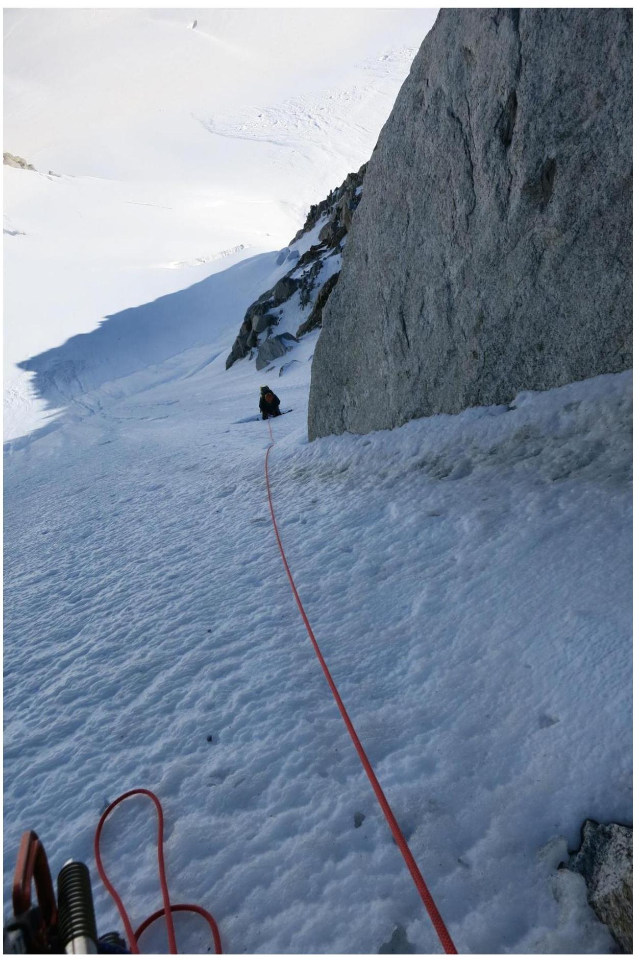
Section R1–R2.
Upper part of section R1–R2.
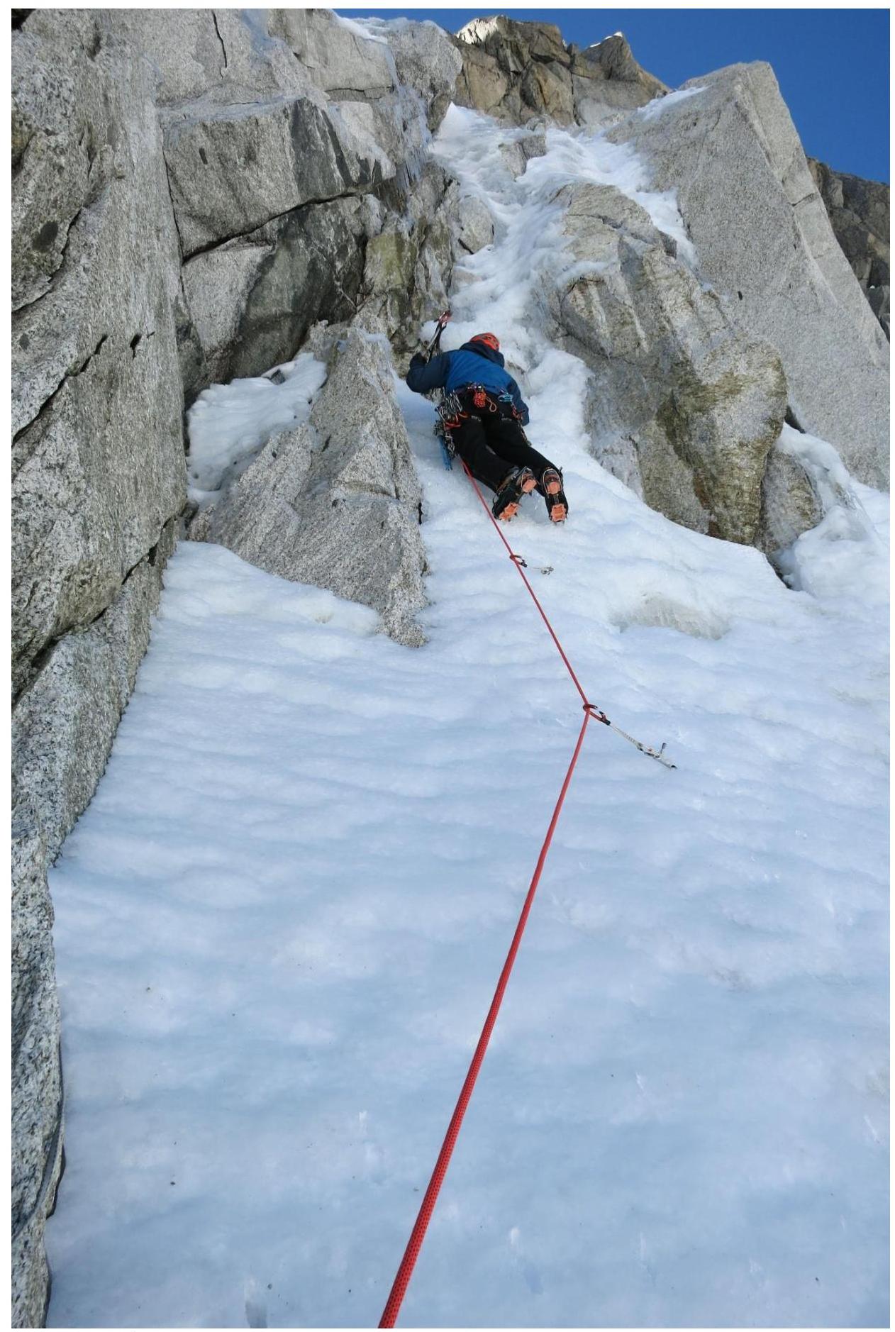
Section R2–R3 (start of key section).

Section R3–R4.
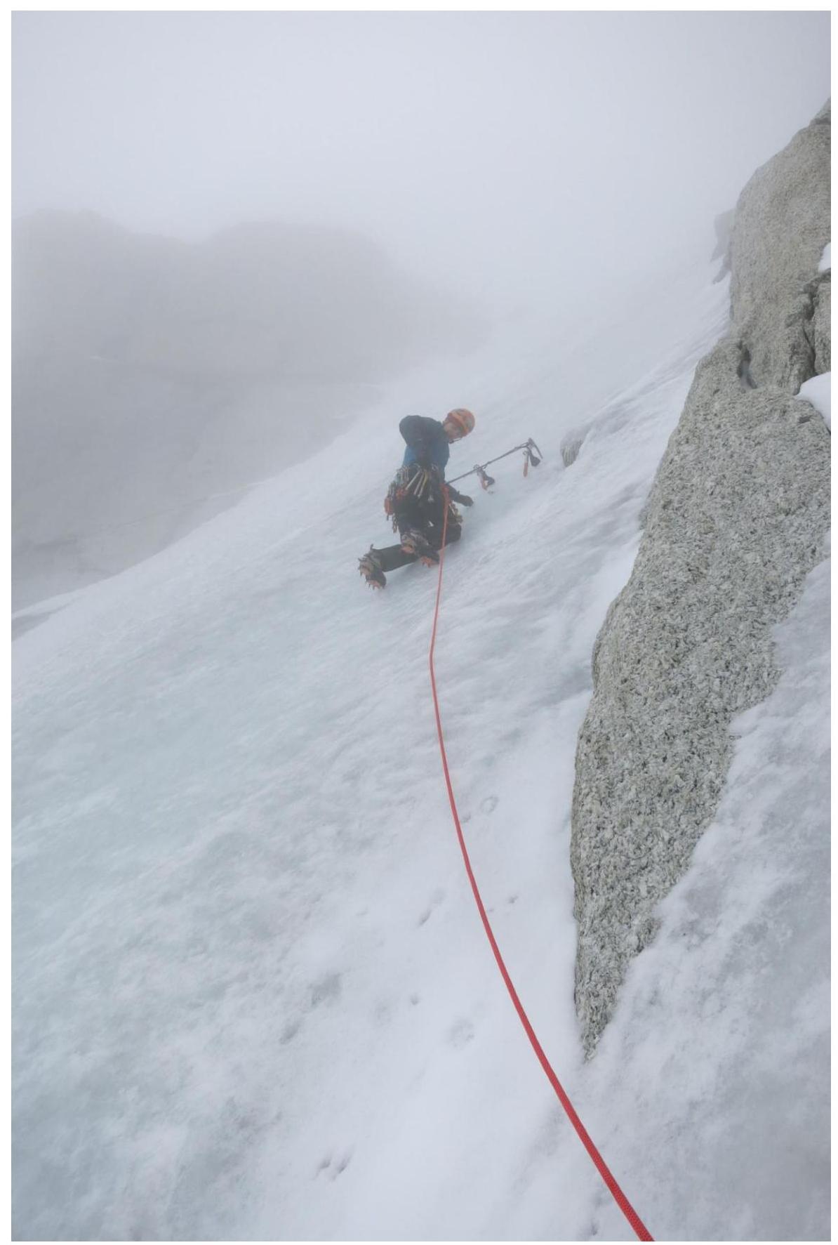
Section R3–R4.
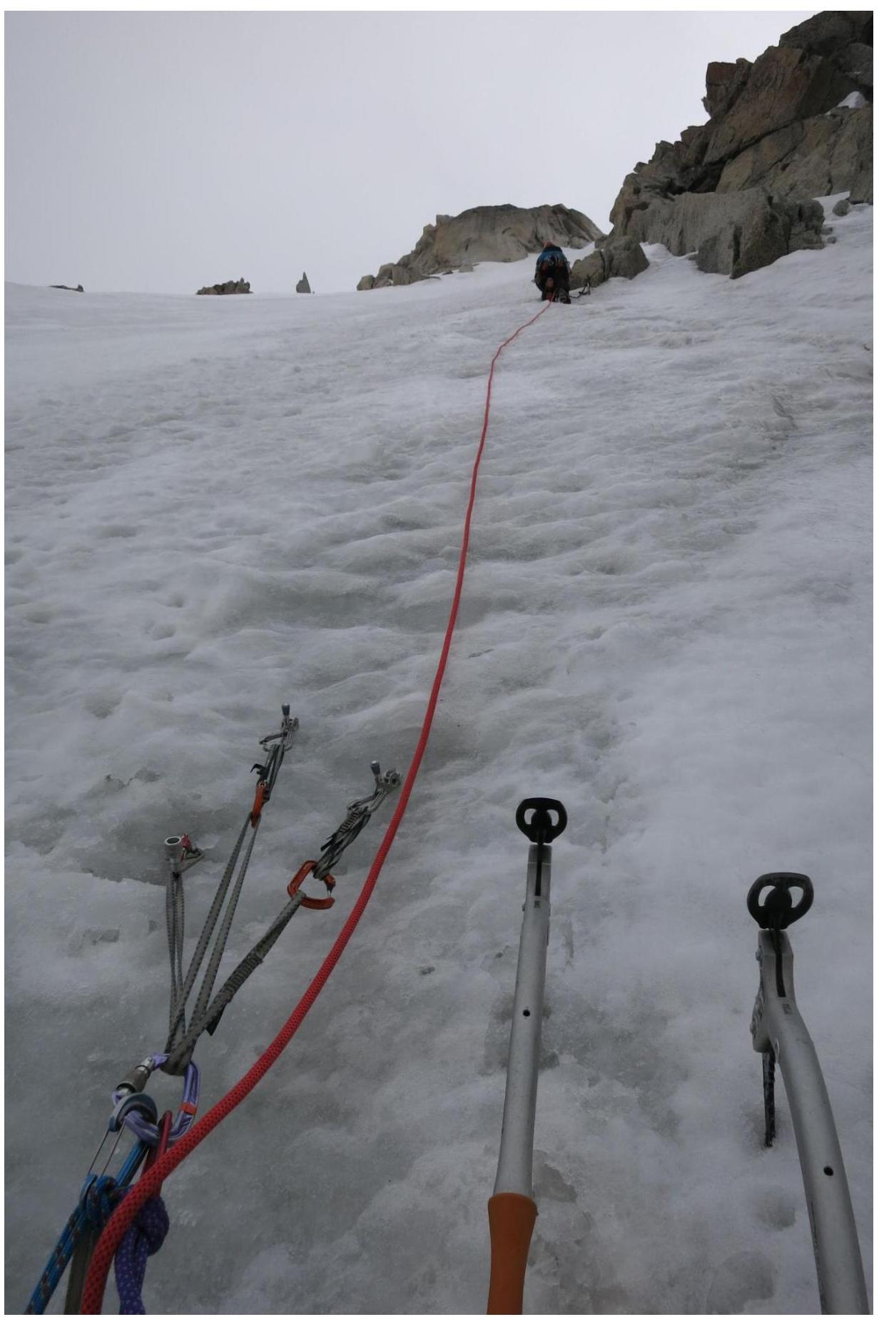
Section R4–R5.
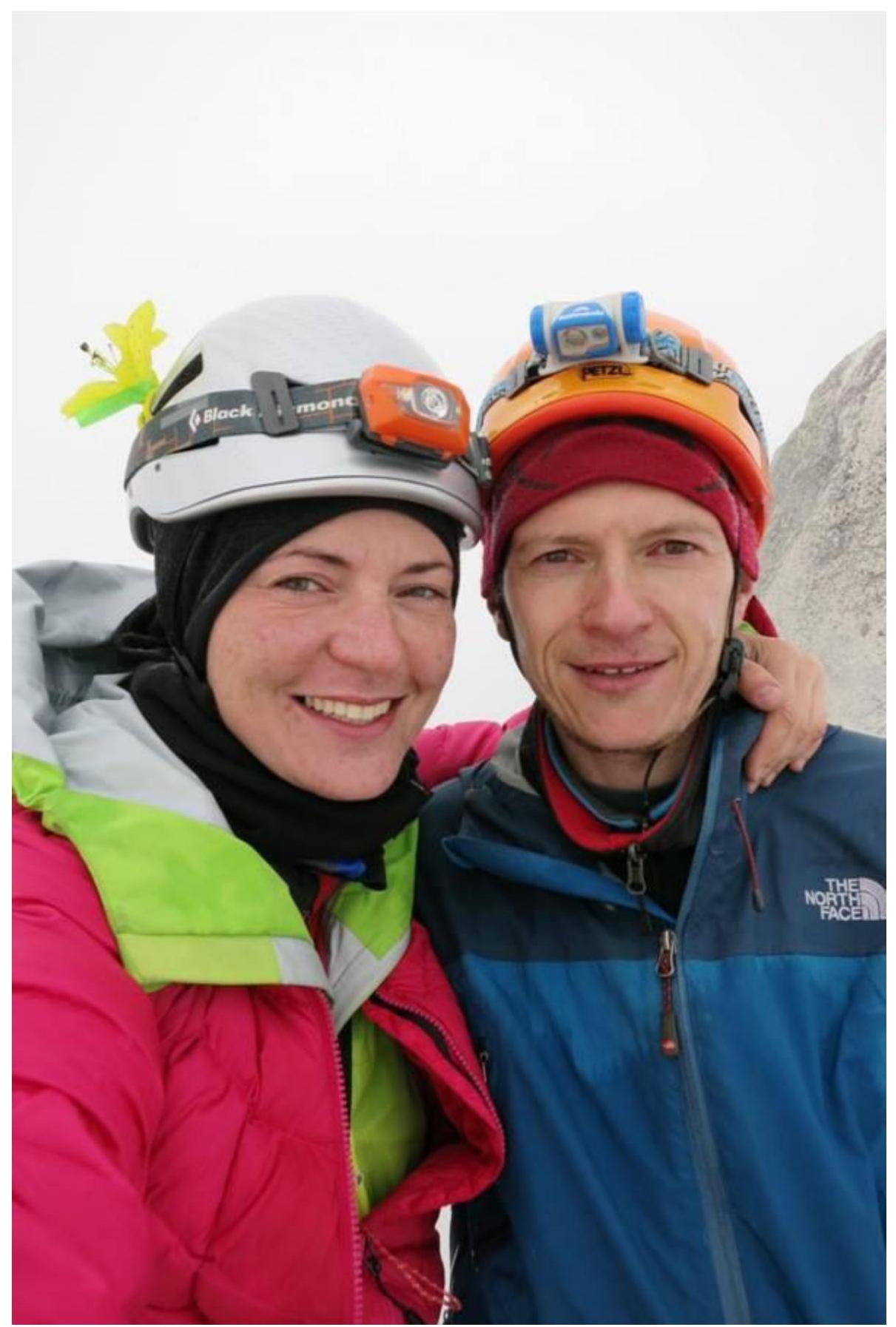
At the summit.