
Report
On the ascent of the CSKA team named after Demchenko to the summit of Aiguille du Midi (3842 m) via the SE wall (Cosmic spur, Rebuffat route) Category 4B difficulty.
June 27, 2014
Savoy Alps, Chamonix area
Team leader: A. Soshnikov Senior coach: E. V. Kuznetsova
Moscow 2014
Ascent Details
- France. Savoy Alps, Chamonix area. Section No. 10.3 (according to KGBM 2013)
- Summit Aiguille du Midi (Aiguille du Midi) 3842 m via the SE wall (Cosmic spur, Rebuffat route) (first ascent by B. Pierre, G. Rebuffat, 1956)
- Presumed — Category 4B difficulty (D+ (French))
- Route type: combined
- Height difference of the route: 300 m
Route length: 700 m.
Length of sections: Category 5 difficulty — 50 m, Category 6 difficulty — 40 m.
Average steepness:
- main part of the route — 60°
- entire route — 30°
- "Hooks" left (used) on the route: total 0; including bolted —
- Team's working hours: 7 hours (excluding descent)
- Team leader: V. V. Vershinin, 2nd sports category
Team members:
A. Soshnikov, Candidate Master of Sports V. Vershinin, 2nd sports category
- Coach: A. V. Yurkin
- Departure for the route from the upper cable car station: June 27, 2014, 10:30. Reaching the summit: June 27, 2014, 17:30. Returning to overnight stay: June 27, 2014, 19:00. Descent from the summit: via cable car to the village of Chamonix.
1. General Information about the Ascent Area
The summit Aiguille du Midi (Aiguille du Midi) 3842 m, which was the target of the ascent, is located in the Chamonix valley area. This valley is territorially situated within the Savoy Alps in southern France. Chamonix is known for its developed mountain infrastructure and rich mountaineering traditions and history.
The highest point in the Chamonix area and the Savoy Alps is Mont Blanc 4808 m, which is the highest peak in the Alps. The ascent to the summit of Aiguille du Midi took place as part of the CSKA training camp named after Demchenko (Moscow) in June – early July 2014.
The base camp of the training camp was located in the Montroc campsite. The village is the highest settlement in the Chamonix valley after Les Houches (the latter is slightly higher but is located off the main road to the pass from Chamonix to the neighboring valley). The elevation is 1300–1400 m above sea level.
Most mountaineering routes of interest are located in the Mont Blanc massif. Since the height of the peaks in the area is 3500–4000 m, almost all forms of relief are present:
- rock;
- ice;
- snow.
There are many combined routes. The area offers a vast variety of rock, ice-snow, and combined routes from Category 1B to 6A difficulty.
The immediate approach to the route was made from the upper cable car station.
The route to the summit of Aiguille du Midi via the southern wall by Bernard Pierre and Gaston Rébuffat was first ascended on August 13, 1956.
Coordinates of key points on the route:
- Upper cable car station (summit Aiguille du Midi) WGS 84: 45.87892° N, 6.88757° E
- Base of the wall WGS 84: 45°52′32″ N, 6°53′12″ E
2. Photopanorama of the Area
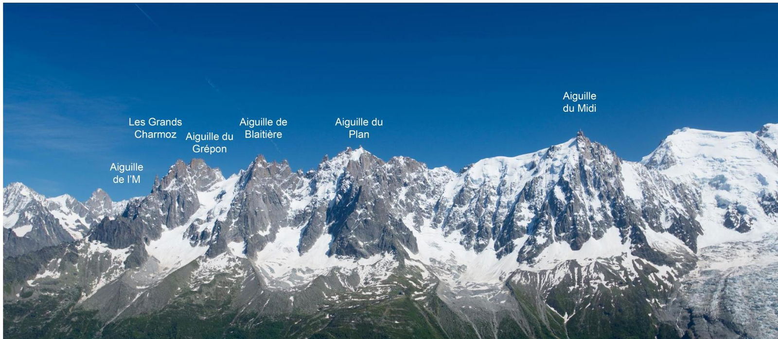
Figure 1 — Photo of the Mont Blanc massif with major peaks marked. View from the summit of Brevent.
3. Map of the Area
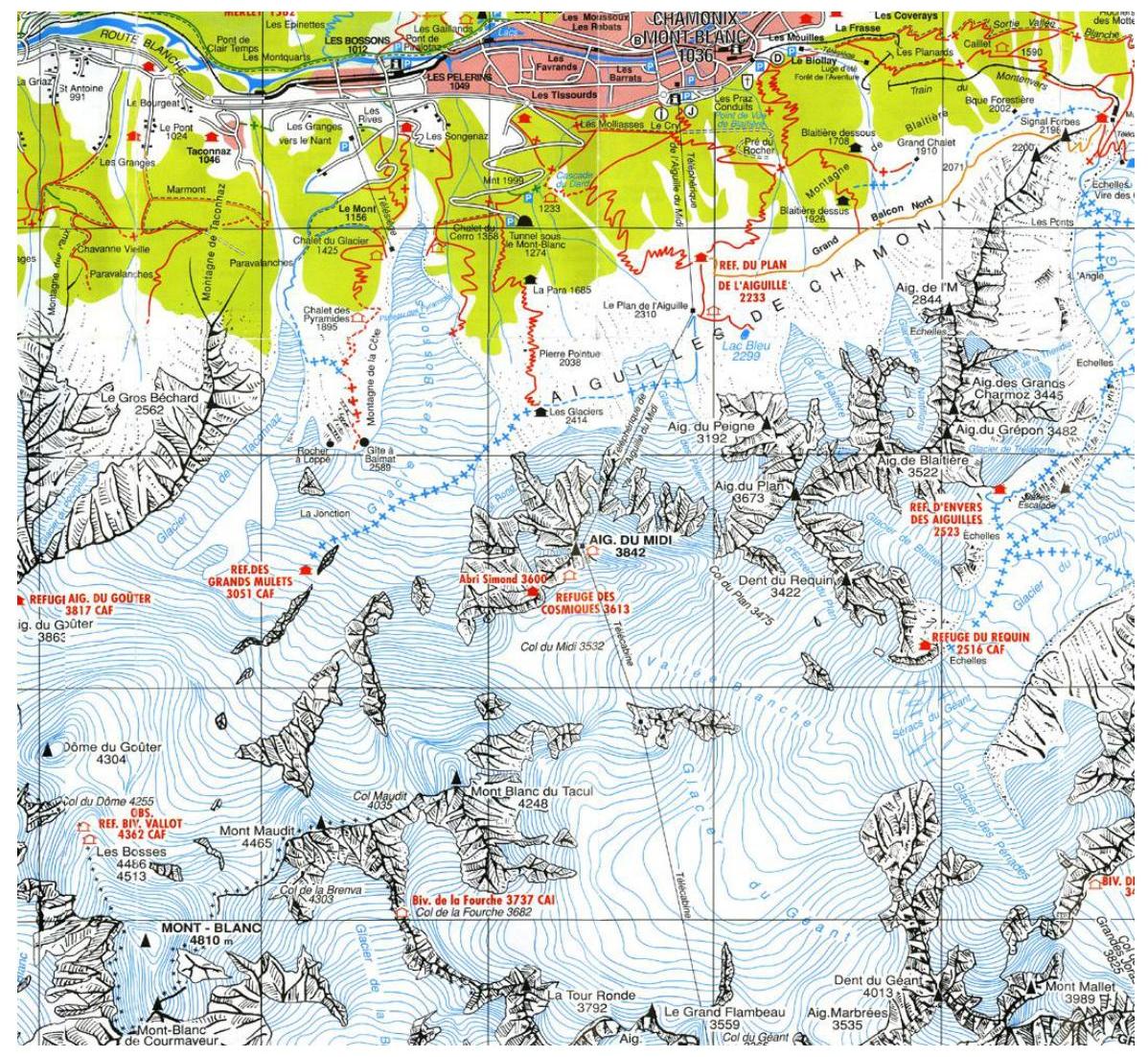
Figure 2 — Topographic map of the Mont Blanc area.
4. Approach to the Route
The vast majority of ascents to Aiguille du Midi from the south are made as follows:
- Take the cable car to the uppermost station.
- Then descend along a narrow ridge to a plateau and move southwest towards the chosen route.
- To approach the start of the route on the southern wall, move along the rock massif, about 300 m before the snowy ascent preceding the ridge.
5. Route Profile
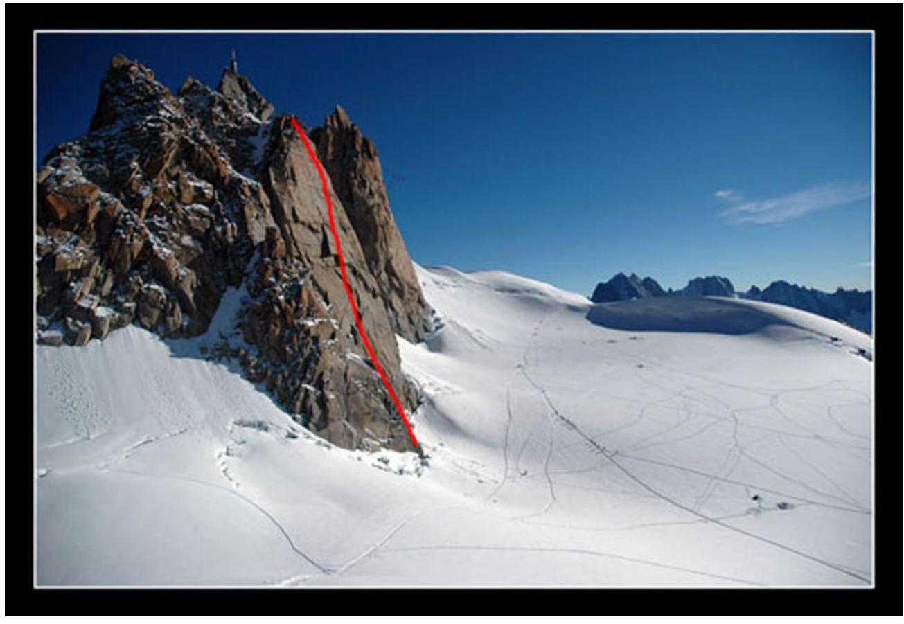
Photo of the route profile. Taken presumably from the Cosmic hut. Photo from www.benoblog.com ↗
6. Description of the Route by Sections
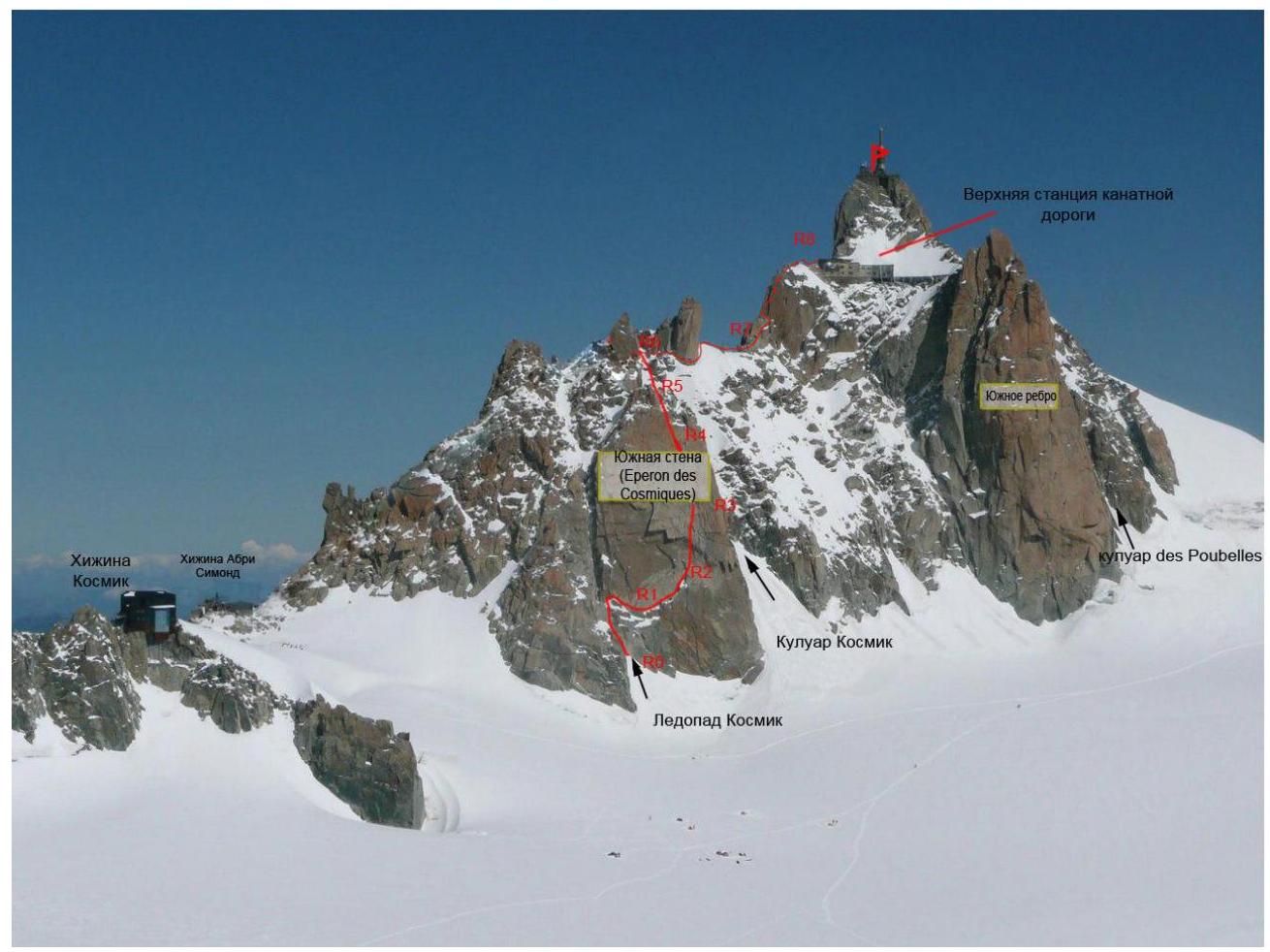
Figure 3 — General view with the route line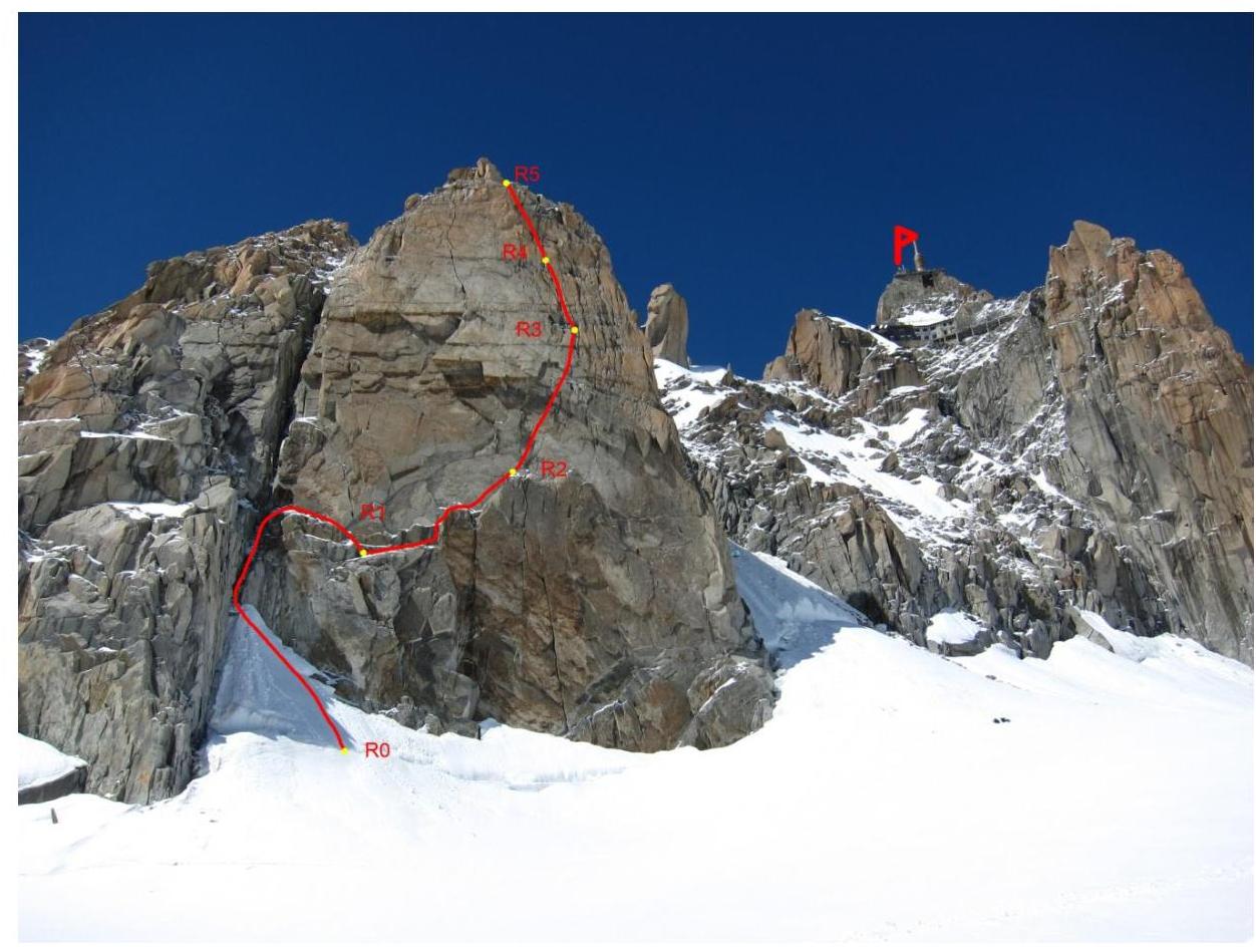
Figure 4 — Wall with the route line
R0–R1 — Ascent to a ledge (30 m, 3, 60°)
R1–R2 — Right along the ledge (40 m, 3, 30°)
R2–R3 — Up through a cornice (40 m, 6, A0, 90°)
R3–R4 — Up through cracks in the rock (50 m, 5, 75°)
R4–R5 — Up through cracks in the rock, reaching gentle slabs before the ridge (50 m, 4, 75°)
R6–R7 — Movement along the ridge, then reaching rocks (240 m, 2, 10°)
R7–R8 — Ascent through rocks, then reaching the summit (120 m, 4, 60°)
Recommendations for the Route
The route up the southern wall to the summit of Aiguille du Midi is logical and safe. The approach is made across a closed glacier (attention — crevasses!). Most of the wall section involves a lot of crack climbing. For section R2–R3, there's a high likelihood of needing to use artificial climbing techniques (ITC).
On the ridge, there's a section requiring the traverse of a small steep snowy slope, where the snow can be soft and quite slippery.
The route line partially coincides with the very popular Cosmic Ridge route, where numerous commercial groups may cause issues.
Photo illustrations from the report
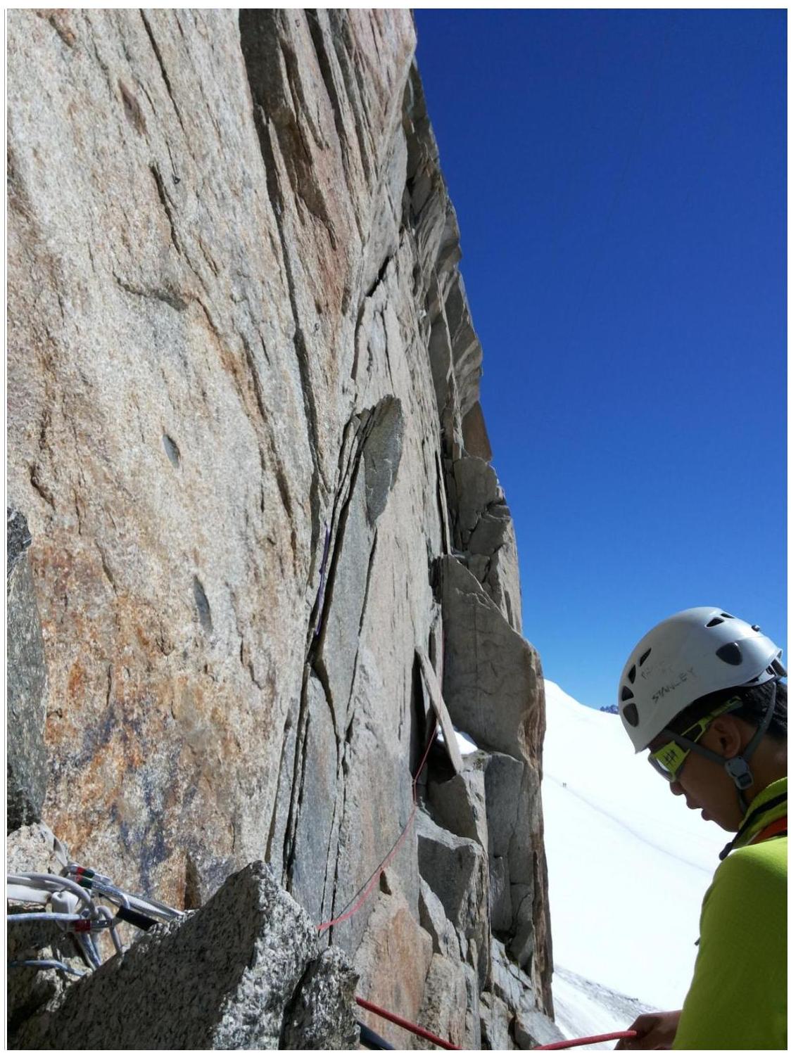
Photo 1 — Start of section R2–R3
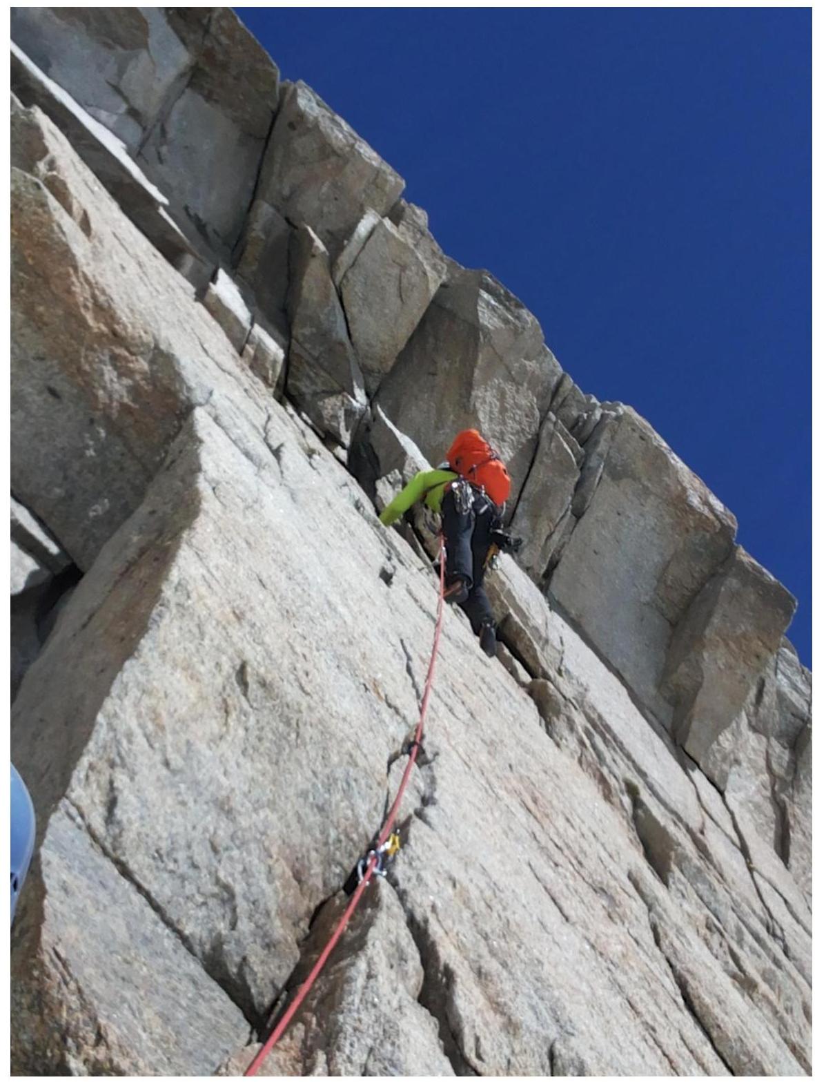
Photo 3 — Cornice
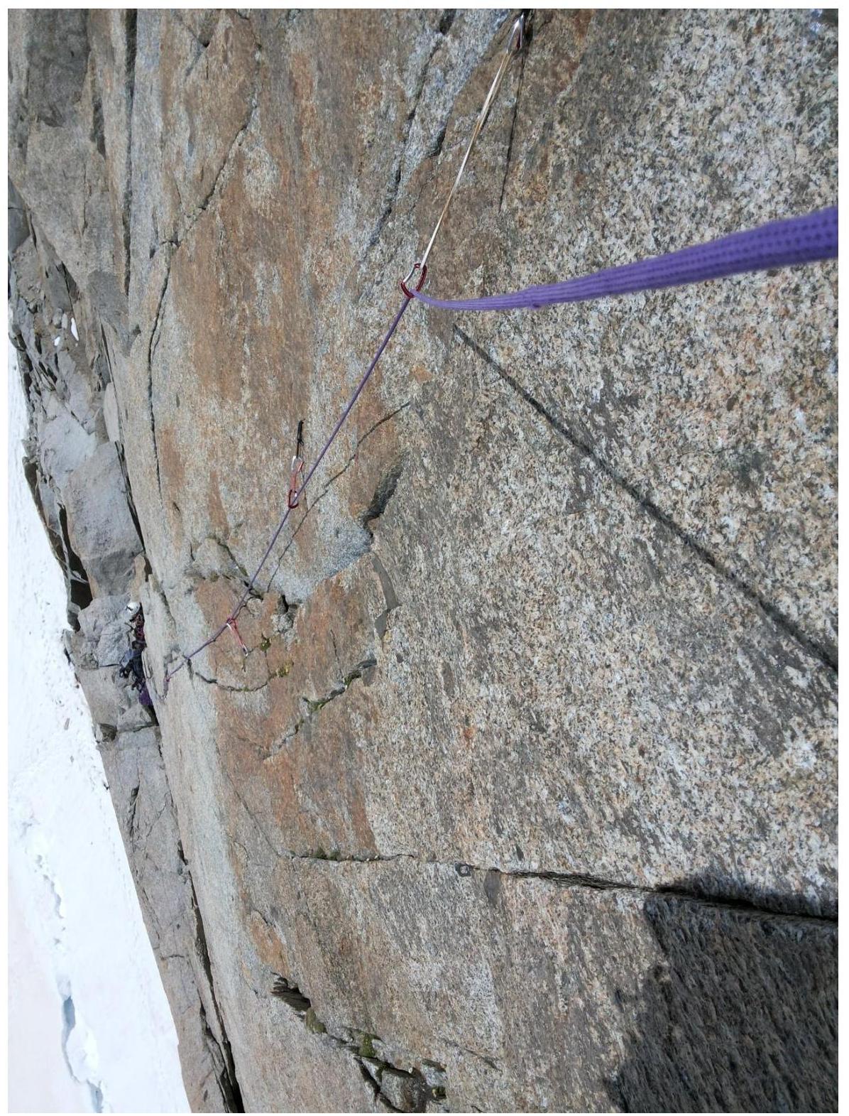
Photo 4 — Section R2–R3
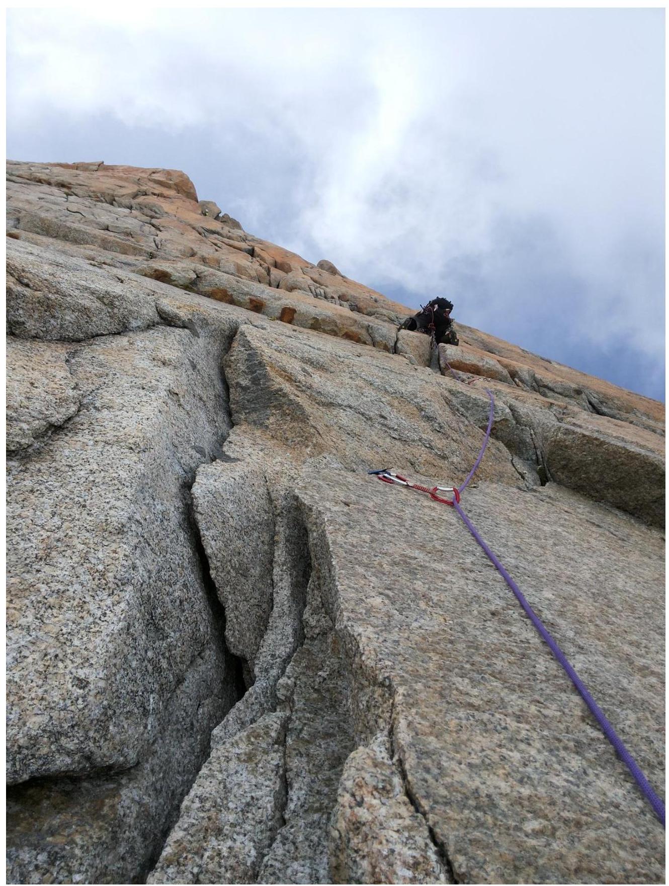
Photo 4 — Section R3–R4
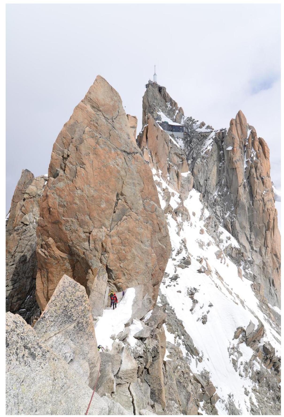
Photo 5 — Cosmic Ridge
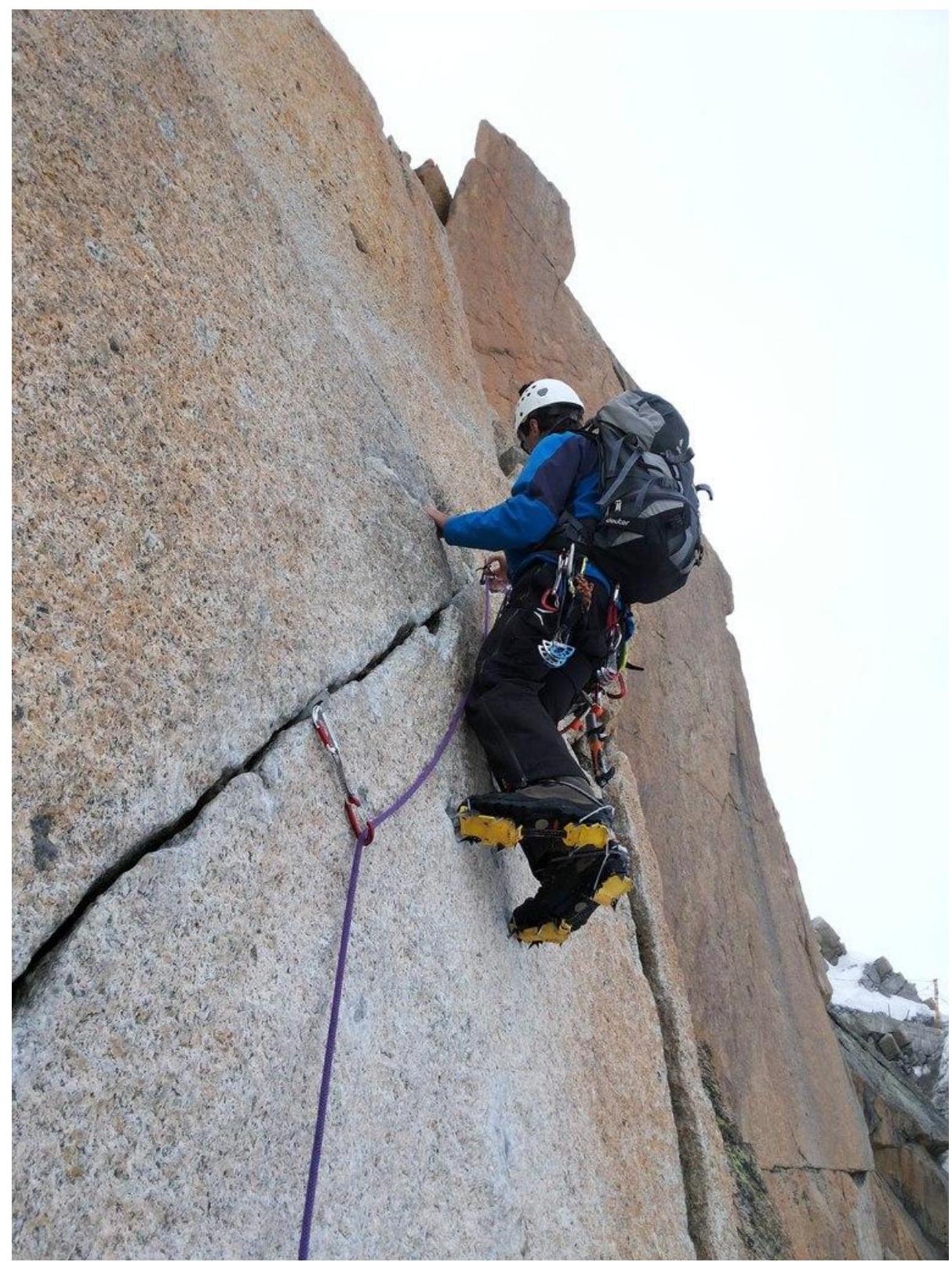
Photo 6 — Rocky wall on section R7–R8
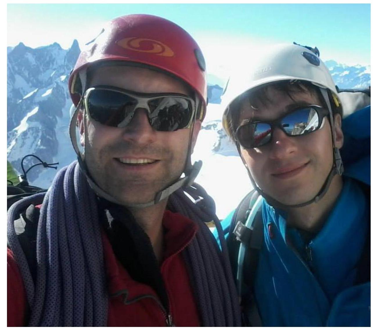
Photo 7 — At the summit
Comments
Sign in to leave a comment