RUSSIAN ALPINISM FEDERATION
Report
On the ascent of the combined team from Moscow, Tomsk, and Omsk Region to the summit of Aiguille Croux 3256 m.
via the SE face, Ottoz–Hurzeler route
Proposed category: 5A Gorodeckaya O.A. — leader
- Prilepskaya N.E.
- Smaikina S.V.
Alps 2013
Climbing Participants
- Leader — Gorodeckaya Olga Alexandrovna, 1st sports category, Omsk. Coach — Zdanovich I.A. Tel. +7(961)884-46-96. Email olagor@gmail.com
- Prilepskaya Natalia Evgenievna, Master of Sports, Moscow. Coach — Kuznetsova E.V.
- Smaikina Svetlana Vladimirovna, Master of Sports, Tomsk. Coach — Sapunova Yu.V.
Contents
- Ascent Passport
- Overall Summit Photograph
- Drawn Route Profile
- Photopanorama of the Area
- Brief Overview of the Area and Climbing Object
- Map-Scheme of the Climbing Area
- Route Diagram in UIAA Symbols
- Technical Photograph of the Route
- Route Description by Sections
- Tactical Actions of the Team
- Ascent Schedule
- Photographs of Individual Route Sections
Ascent Passport
- Region: Alps, section number according to the 2011 classification table — 10.3
- Summit: Aiguille Croux Height: 3256 m. Route: via SE face, Ottoz–Hurzeler route (A. Ottoz, E. Hurzeler, 1935)
- Proposed category: 5A, first ascent
- Route character: rock climbing
- Route height difference: 250 m. Route length: 610 m. Length of sections with V-VI category difficulty – 170 m. Average steepness: main part of the route — 72°; entire route — 60°.
- Number of pitons used on the route (total/IТО): 79
- stationary pitons — 63
- chocks — 16
- Team's climbing hours: 7 hours, 1 day
- Leader: Gorodeckaya Olga Alexandrovna, 1st sports category, coach Zdanovich I.A.
Participants:
- Prilepskaya Natalia Evgenievna, Master of Sports, coach Kuznetsova E.V.
- Smaikina Svetlana Vladimirovna, Master of Sports, coach Sapunova Yu.V.
- Departure from Base Camp: 8:00 August 15, 2013. Summit arrival: 17:00 August 15, 2013. Return to Base Camp: 20:00 August 15, 2013. Descent from the summit: Descent from the saddle via rappel stations towards Monzino hut to a large snowfield. Move across the snowfield to the left until it flattens. Then move across simple rocks to the trail.
- Organizations: Moscow Alpine and Rock Climbing Federation, Tomsk Alpine Federation, Omsk Region Alpine Federation.
- Report responsible: Prilepskaya N.E. email: nprilepskaya@gmail.com, phone: +7 903 186-80-80 Smaikina S.V. email: talery@mail.ru, phone: +7 923 409-10-17
Overall Summit Photograph
Main routes on the SE face of Aiguille Croux:
- Ottoz–Hurzeler route (A. Ottoz, E. Hurzeler, 1935, TD–) (team's route) — red.
- Bertone route (G. Bertone, C. Zappelli, 1967, ED) — green.
- «Demi Portion» (D. Anker, M. Piola, 1989, 6c/7a or A0, 100 m) — blue.
- «Que cherches tu Jean Marie?» (M. Motto, R. Vogler, 1992, ED) — yellow.
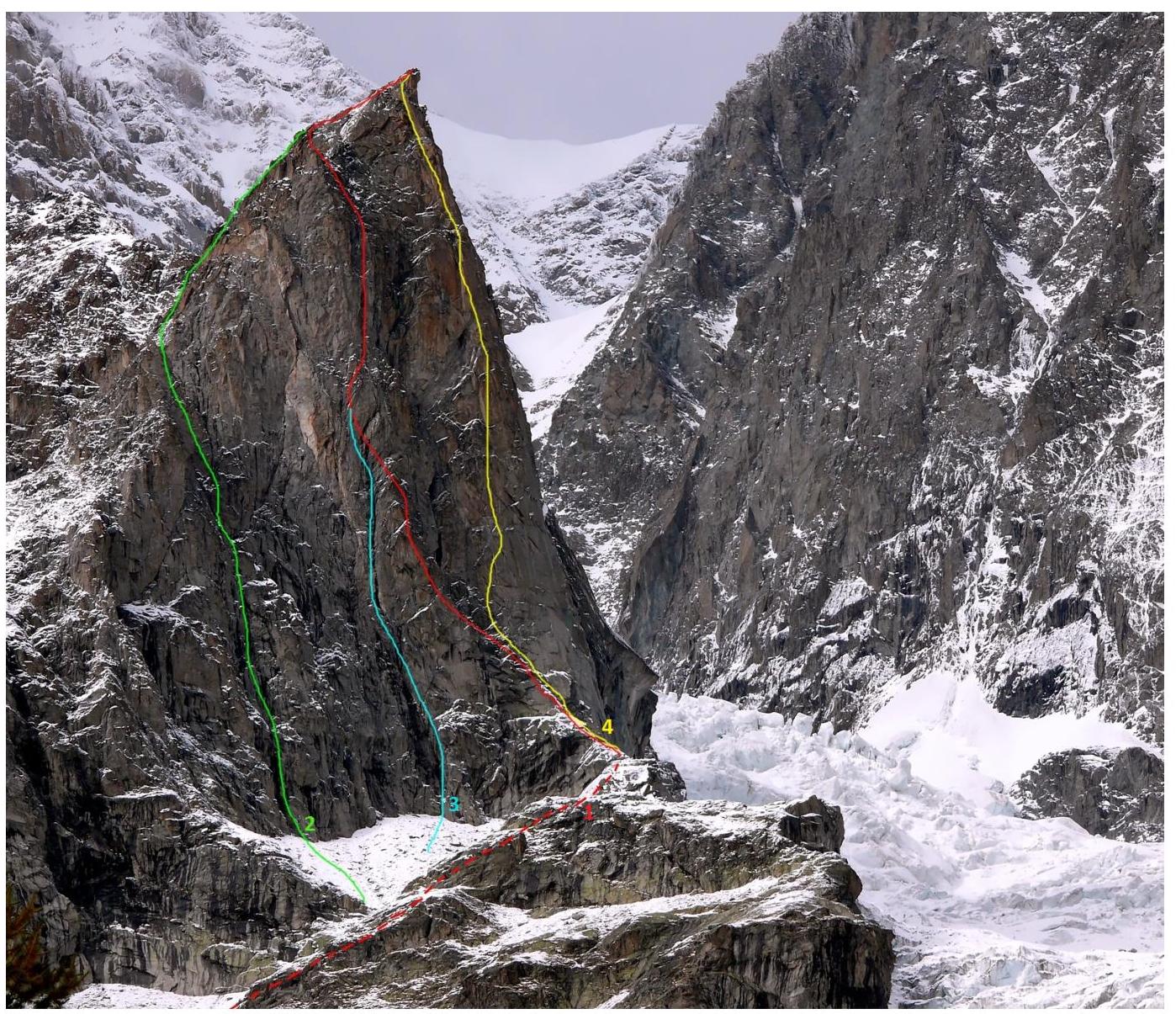 Photo 1. SE face of Aiguille Croux. Source: Internet resource.
Drawn Route Profile
Average steepness:
- main part of the route — 72°
- entire route — 60°
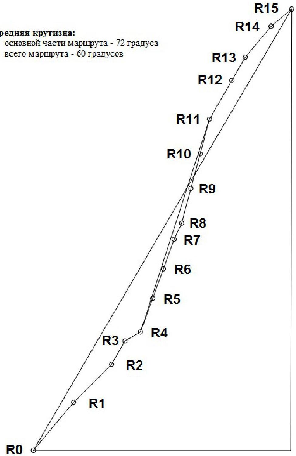 Fig. 1. Drawn profile of Ottoz–Hurzeler route
Photopanorama of the Area
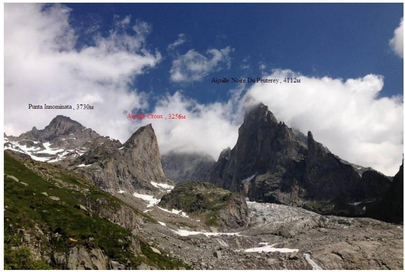 Photo 2. Panorama of the area. The characteristic pyramid Aiguille Croux is visible on the left. Source: Internet resource.
Brief Overview of the Area and Climbing Object
The Alps are the highest mountain system in Western Europe, forming a complex system of ridges and massifs stretching in a northwest-convex arc from the Ligurian Sea to the Danube plains. The Alps span across eight countries:
- France
- Monaco
- Italy
- Switzerland
- Germany
- Austria
- Liechtenstein
- Slovenia
The total length of the Alpine arc is about 1200 km, with an inner edge of about 750 km, and a width of up to 260 km. The highest point in the Alps is Mont Blanc (4810 m).
The Alps are a popular international center for mountaineering, skiing, and tourism. The Alps are considered the "cradle" of mountaineering. In 1786, M. Paccard and J. Balmat ascended Mont Blanc, marking the beginning of mountaineering as a sport.
Aiguille Croux is a summit in the Western Alps on the Italian side of the Mont Blanc massif. It is a granite pyramid visible from the Veny valley. The summit is popular among climbers, offering a panoramic view of the Aiguille Noire du Peuterey wall and a unique view of Picco Gugliermina, Aiguille Blanche, and the Freney walls.
Approach: From Monzino hut, follow the trail towards the wall. The trail passes along a green slope, then a scree slope along the foot of Aiguille Croux towards the route (right side of the slope).
Map-Scheme of the Climbing Area
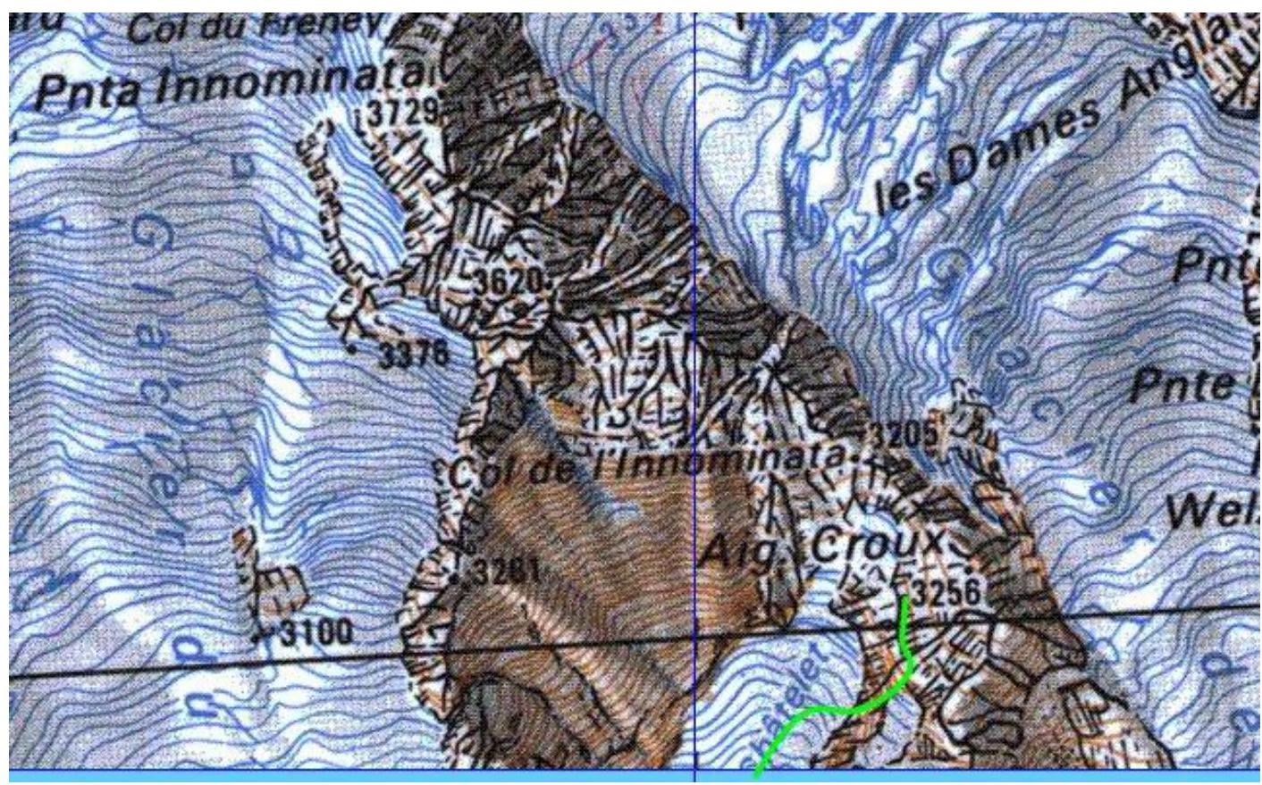 Fig. 2. Map-scheme of the climbing area. Source: Internet resource.
Route Diagram in UIAA Symbols

| Section # | Chocks, "friends" | Stationary pitons | Section difficulty | Section length, m | Section steepness, deg. |
|---|---|---|---|---|---|
| 1 | 4 | IV | 60 | 50 | |
| 2 | 2 | 4 | III–VI | 50 | 40 |
| 3 | 2 | 3 | VI | 35 | 50 |
| 4 | 3 | II–III | 40 | 30 | |
| 5 | 5 | IV+ | 35 | 60 | |
| 6 | 1 | 5 | V+ | 40 | 70 |
| 7 | 5 | V–VI | 25 | 70–80 | |
| 8 | 4 | VI | 20 | 80–90 | |
| 9 | 3 | 4 | V+ | 45 | 70–80 |
| 10 | 2 | 5 | IV | 40 | 50 |
| 11 | 2 | 7 | V | 40 | 70–80 |
| 12 | 3 | 4 | IV | 50 | 50 |
| 13 | 1 | 4 | IV | 50 | 50 |
| 14 | 3 | IV+ | 45 | 60 | |
| 15 | 3 | III | 40 | 40 |
Technical Photograph of the Route
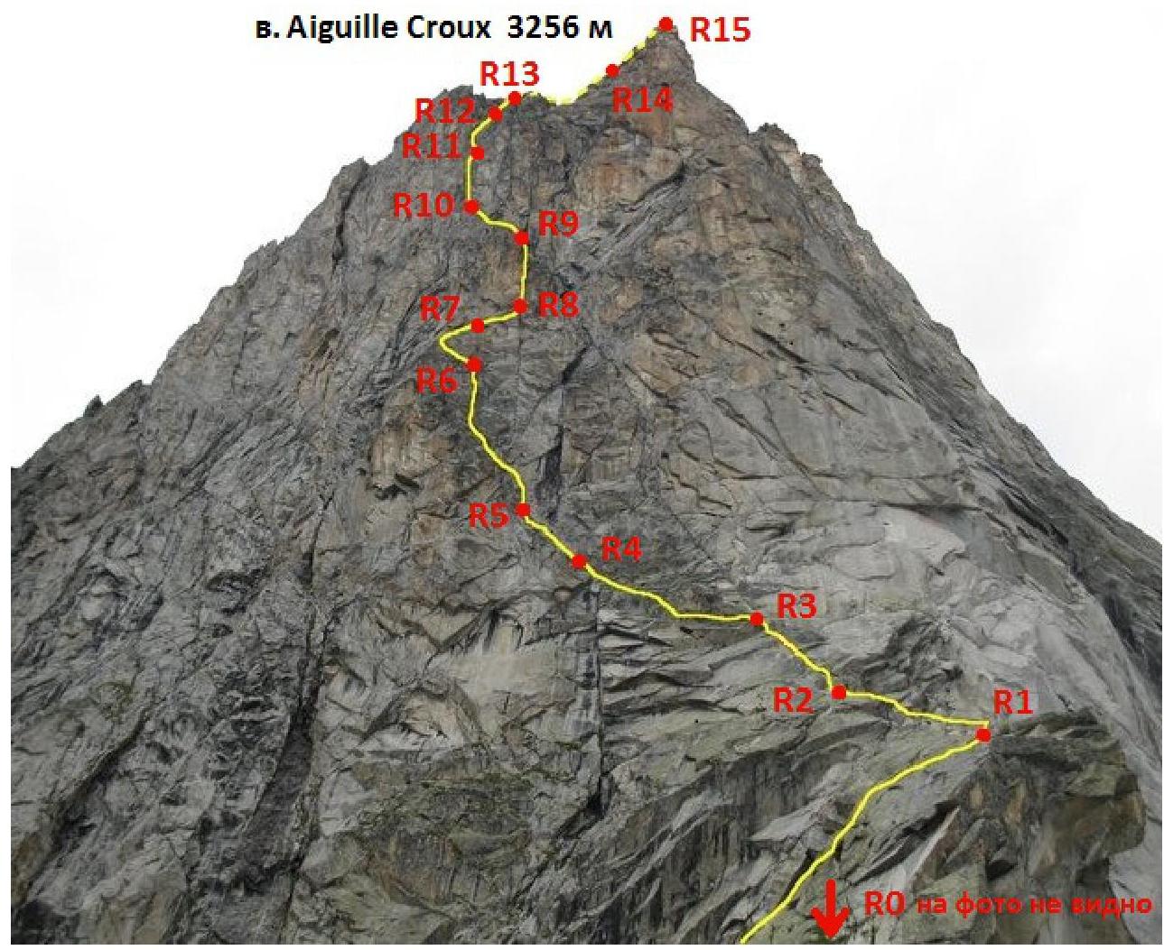 Photo 5. Route thread on the SE face of Aiguille Croux. Source: Internet resource.
Route Description by Sections
R0–R1 — ascend simple rocks to a ridge, with a large convenient ledge on the left. Station on pitons. 60 m, IV. R1–R2 — move along the ridge to the start of the wall. Be cautious of loose rocks! 50 m, III–IV. R2–R3 — ascend an inner corner, staying on the left side, to a station on pitons. 35 m, IV. R3–R4 — traverse left along a ledge to a corner, with a station on pitons. 40 m, II–III. R4–R5 — climb the wall, moving left. Inner corners. 35 m, IV+. R5–R6 — initially climb left, then right to a station on pitons. Chimney. 40 m, V+. R6–R7 — traverse left along a ledge for 4–5 m, then ascend a "ramp" right, then vertically and slightly right to a cornice. Station before the cornice. 25 m, V–VI. R7–R8 — traverse under the cornice to the right, exiting onto an inclined ledge. Station to the right of a chimney. 20 m, VI. R8–R9 — move up a chimney turning into a wide, convenient inner corner. Station on the left wall (pitons). 45 m, V+. R9–R10 — ascend and left along an inclined inner corner, along a ledge to a station on pitons. 40 m, IV. R10–R11 — ascend the wall via a system of cracks. Station on a ledge. 40 m, V. R11–R12 — ascend and right along an inclined inner corner. 50 m, IV. R12–R13 — continue up to a saddle. 50 m, IV. R13–R14 — move along inclined slabs to the summit, with protection on pitons. 45 m, IV+. R14–R15 — inclined slabs to the summit, with protection on pitons. 40 m, III.
Descent: Descend from the saddle via rappel stations towards Monzino hut.
- Distance between stations is 60 m.
- The last (fifth) rappel leads to a large snowfield, gentle enough for simultaneous movement (crampons may be required for the first and last team members).
- Move across the snowfield to the left until it flattens.
- Continue across a green slope with rock outcrops.
- No clear trail on the slope; move down via the simplest sections, no need for belaying, move in teams.
Tactical Actions of the Team
Equipment used:
- main rope (60 m) — 2 pcs
- friends — 5 pcs
- chocks — 5 pcs
- rock shoes — 3 pairs
- quickdraws — 12 pcs
- extenders — 4pt
- sling-carabiner — 5 pcs
- extractor — 1 pc
Ascent started at 6:30, breakfast at Monzino hut from 7:00 to 7:30. Departure from Monzino hut at 8:00.
Movement along a clear, obvious trail towards the wall took about 1.5–2 hours. The starting platform was obvious from the snowfield on the scree up the rock.
Before reaching the snowfield, participants put on their gear (harnesses, helmets, etc.).
On the route, there was no water, so a minimal supply of liquid was taken for the ascent, especially on a hot day.
Climbing began at 10:00. Movement was alternating.
First participant (R0–R4 Gorodeckaya Olga):
- moved on a double rope
- without a backpack
- in rock shoes
- with intermediate protection on pitons (yellow color) and personal anchors
Second and third participants:
- moved with top-rope protection
- free climbing
- with backpacks
- in rock shoes
At 12:00 — leader change (R4–R9). Natalia Prilepskaya took the lead. Svetlana Smaikina provided belay.
At 14:00 — leader change. Svetlana Smaikina took the lead from R9. Olga Gorodeckaya provided belay.
The route condition was good. Rocks were dry. The wall received sunlight due to its favorable SE exposure. Participants felt great, enjoying the climb throughout the day.
Descent began at 17:10:
- Svetlana Smaikina descended first (on a double rope, with belay)
- the second participant also descended on a double rope
- the third on a double, connected rope (for retrieving the rappel)
Descent to the snowfield was relatively safe (caution was needed on gentler sections to avoid dislodging rocks with the rope). Finding rappel stations was not difficult (piton with a chain was clearly visible).
Movement across the snowfield was simultaneous, directed towards Monzino hut (the hut should be straight ahead). Further movement was in teams, simultaneous, with occasional turn-by-turn belaying (if necessary).
19:00 — descent to the trail. 20:00 — return to Monzino hut.
Ascent Schedule
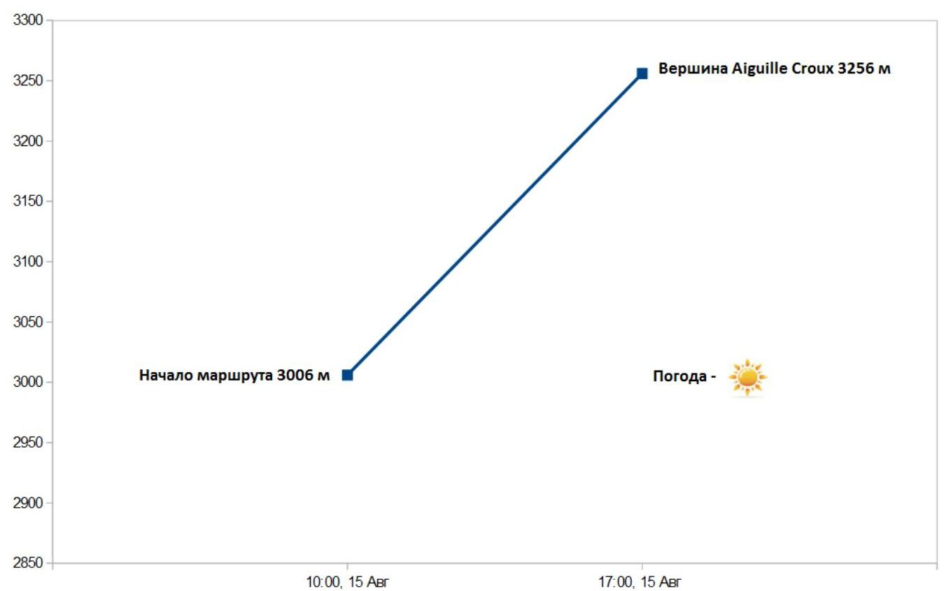 Fig. 3. Team's movement schedule on Ottoz–Hurzeler route
Photographs of Individual Route Sections
 Photo 6. Section R1–R2. Gorodeckaya O. working.
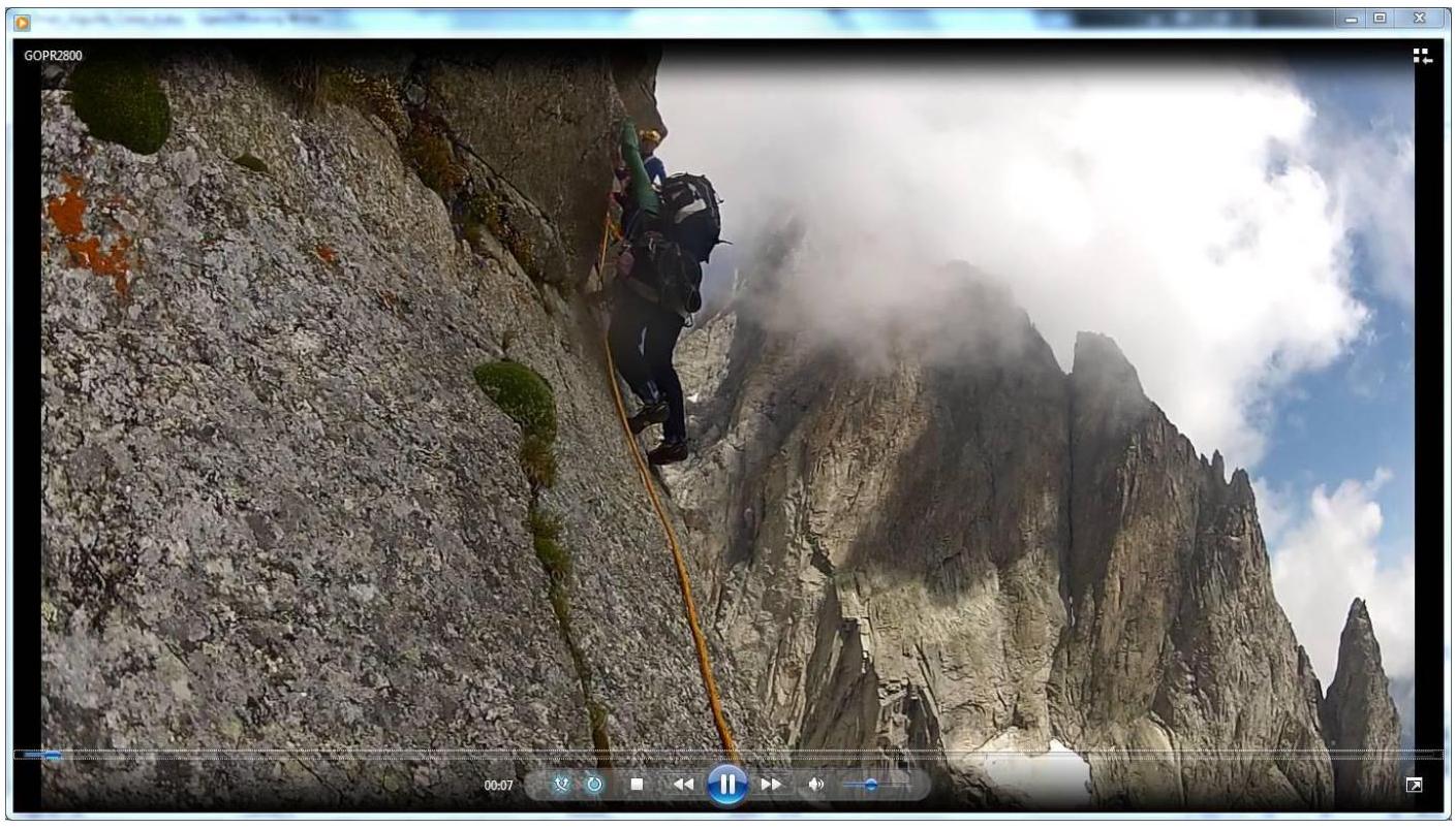 Photo 7. Section R6–R7. Gorodeckaya O. ascending to a station with top-rope protection.
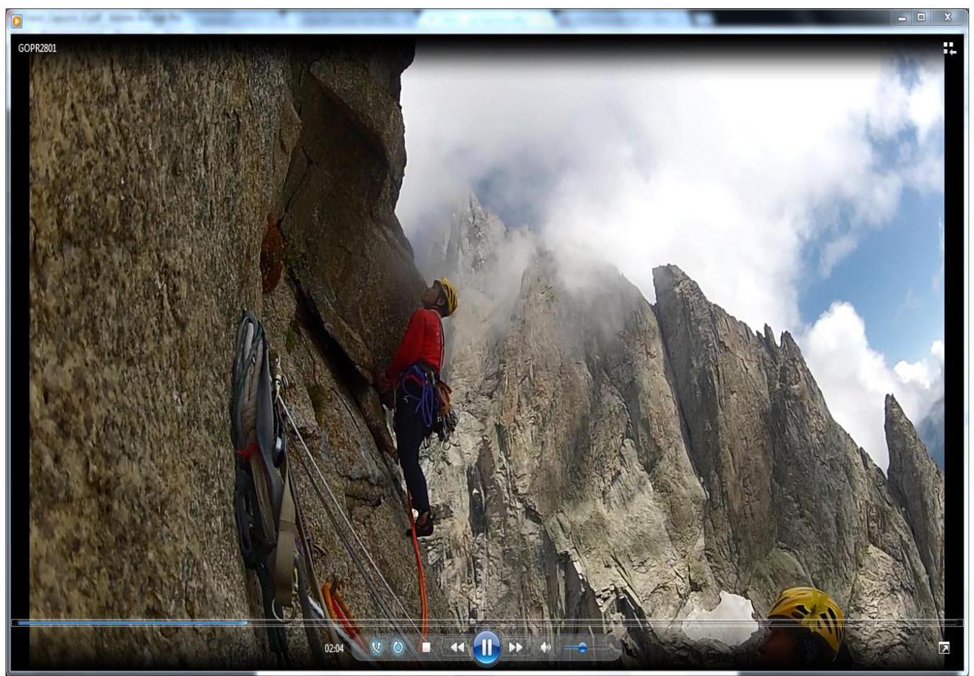 Photo 8. Section R7–R8. Prilepskaya N. working under a cornice.
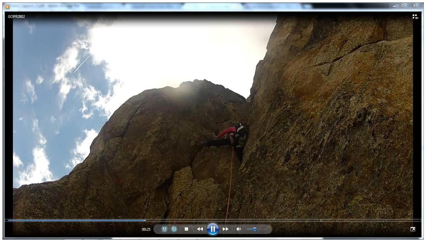 Photo 9. Section R8–R9. Prilepskaya N. working in a chimney.
 Photo 10. Section R10–R11. Smaikina S. working.
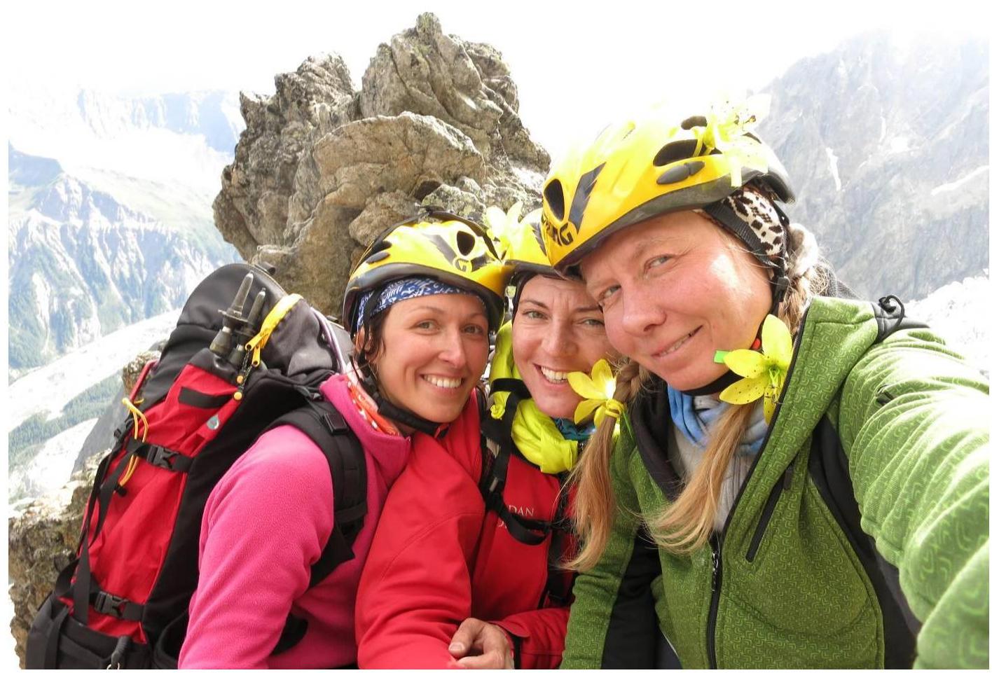 Photo 11. On Aiguille Croux summit:
- Gorodeckaya O.
- Prilepskaya N.
- Smaikina S.