
Report
On the ascent of the CSKA team named after Demchenko to the summit of Ciarforon (3640 m) via the 3rd wall, category 2B, Graian Alps (Italy), Gran Paradiso area.
Team leader: D. I. Trynin Senior coach: E. V. Kuznetsova
Ascent Details
- Graian Alps (Italy), Gran Paradiso area. No. 10.3 (according to KGVB 2011)
- Mt. Ciarforon (3640 m) via the 3rd wall. (F. Gonella, G. Blanc, F. Daynè, 1885).
- Proposed category: 2B,
- Route type: combined.
- Route elevation gain: 600 m
Route length: 1000 m. Section lengths:
- Category V: 0 m.
- Category VI: 0 m. Average slope:
- Main part of the route: 45°
- Entire route: 30°
- Number of pitons left on the route: total; including bolted pitons
- Team's total climbing hours: 6 hours, 1 day
- Team leader: Trynin D.I. 1st sports category
Team members: Cherny S. 1st sports category, Andrianov M.V. 1st sports category Svyatitsky A. 2nd sports category
- Coach: Kuznetsova E. V.
- Route start from Base Camp: Route started: July 26, 2012, at 6:00 AM Summit reached: July 26, 2012, at 12:00 PM Return to Base Camp: July 26, 2012, at 4:00 PM Descent from the summit: via the ascent route;
- Organization: CSKA training camp named after Demchenko (Moscow)
- Report responsible: Trynin D.I., Yurkin A.V.
Email and phone: hobbit_den@mail.ru
General photo of the summit
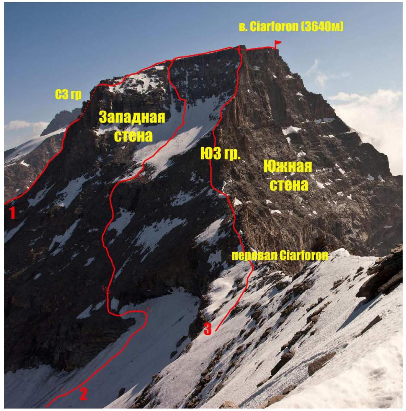
General view of Ciarforon from the west. Photo taken from the NE ridge of Becca di Monciair. Numbers denote routes:
- Route via the NW ridge, category 3B (AD um). (D. Escoffier, O. De Falkner, 1894)
- Team's route
- Route via the SW ridge, category 2B (PD+) (F. Vallino, A. Blanchetti, 1871).
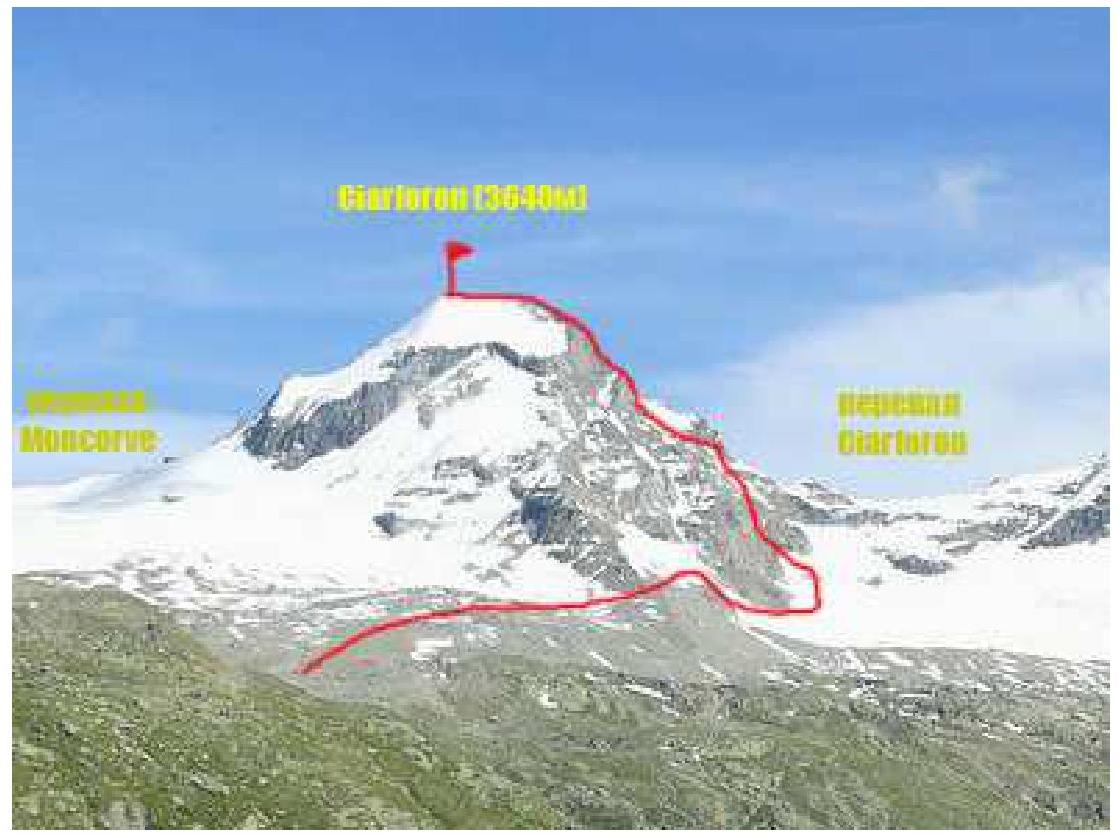
Photo of the route profile.
Panorama of the area.
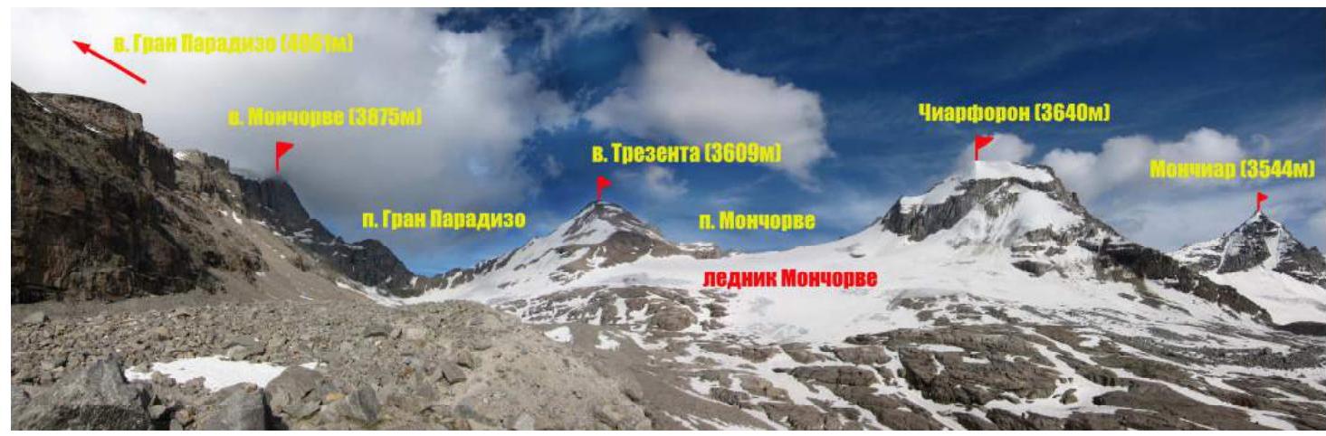
Overview of the Gran Paradiso area
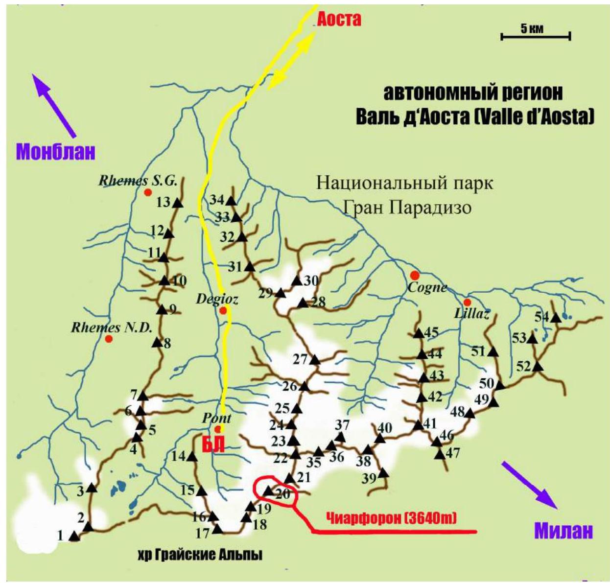
| Peak designations (with elevations) on the map: | |
|---|---|
| 1 — Punta Galicia 3346 m | 28 — Punta Rossa della Grivola 3630 м |
| 2 — Punta Basei 3338 м | 29 — La Grivola 3969 м |
| 3 — Punta Gran Vaudala 3272 м | 30 — Grivoletta 3514 м |
| 4 — Taou Blanc 3438 м | 31 — Gran Nomenon 3488 м |
| 5 — Aouillé 3440 м | 32 — Mont Favret 3173 м |
| 6 — Cima di Entrelor 3430 м | 33 — Punta Valletta 2793 м |
| 7 — Punta Percià 3227 м | 34 — Becca Piana 2271 м |
| 8 — La Roletta 3384 м | 35 — Punta Ceresole 3777 м |
| 9 — Punta Bianca 3427 м | 36 — Testa della Tribolazione 3642 м |
| 10 — Punta Bioula 3414 м | 37 — Testa di Valnontey 3562 м |
| 11 — Punta del Ran 3272 м | 38 — Becca di Gay 3621 м |
| 12 — Punta Chamoussière 2942 м | 39 — Becco Meridionale della Tribolazione 3360 м |
| 13 — Monte Paillasse 2414 м | 40 — Roccia Viva 3650 м |
| 14 — Cima dell'Arolley 2996 м | 41 — Torre del Gran San Pietro 3692 м |
| 15 — Cima di Seiva 3075 м | 42 — Punte Patri 3581 м |
| 16 — Punta Fourà 3411 м | 43 — Punta Valletta 3356 м |
| 17 — Mare Pércia 3385 м | 44 — Punta di Valmiana 3244 м |
| 18 — Denti del Breuil 3454 м | 45 — Punta Fenilia 3053 м |
| 19 — Becca di Monciair 3544 м | 46 — Punta d'Ondezana 3452 м |
| 20 — Ciarforon 3642 м | 47 — Becco di Valsoera 3369 м |
| 21 — La Tresenta 3609 м | 48 — Punta delle Sengie 3408 м |
| 22 — Becca di Moncorvè 3875 м | 49 — Monveso di Forzo 3322 м |
| 23 — Gran Paradiso 4061 м | 50 — Grande Arolla 3246 м |
| 24 — Piccolo Paradiso 3923 м | 51 — Punta della Tsesère 3117 м |
| 25 — Becca di Montandayné 3838 м | 52 — Torre di Lavina 3308 м |
| 26 — Herbetet 3778 м | 53 — Punta di Acque Rosse 2952 м |
| 27 — La Gran Serra 3552 м | 54 — Punta Nera 3064 м |
Ciarforon (3640 m), the summit of the ascent, is located in the Gran Paradiso National Park area. The park is situated within the Graian Alps in the autonomous region of Valle d'Aosta, northern Italy.
The highest point in the Gran Paradiso area is 4061 m, making it the seventh highest peak in the Alps (Mont Blanc being the first).
The Valle d'Aosta region is heavily mountainous, featuring iconic Italian and Alpine peaks such as Monte Bianco (Mont Blanc), Grand Jorasses, Cervino (Matterhorn), and Gran Paradiso.
Most climbing routes of interest are found in the Gran Paradiso range. With peak elevations between 3500–4000 m, the area features a variety of terrain including rock, ice, and snow. Many combined routes are available, with categories ranging from 1 to 4, and some category 5 routes.
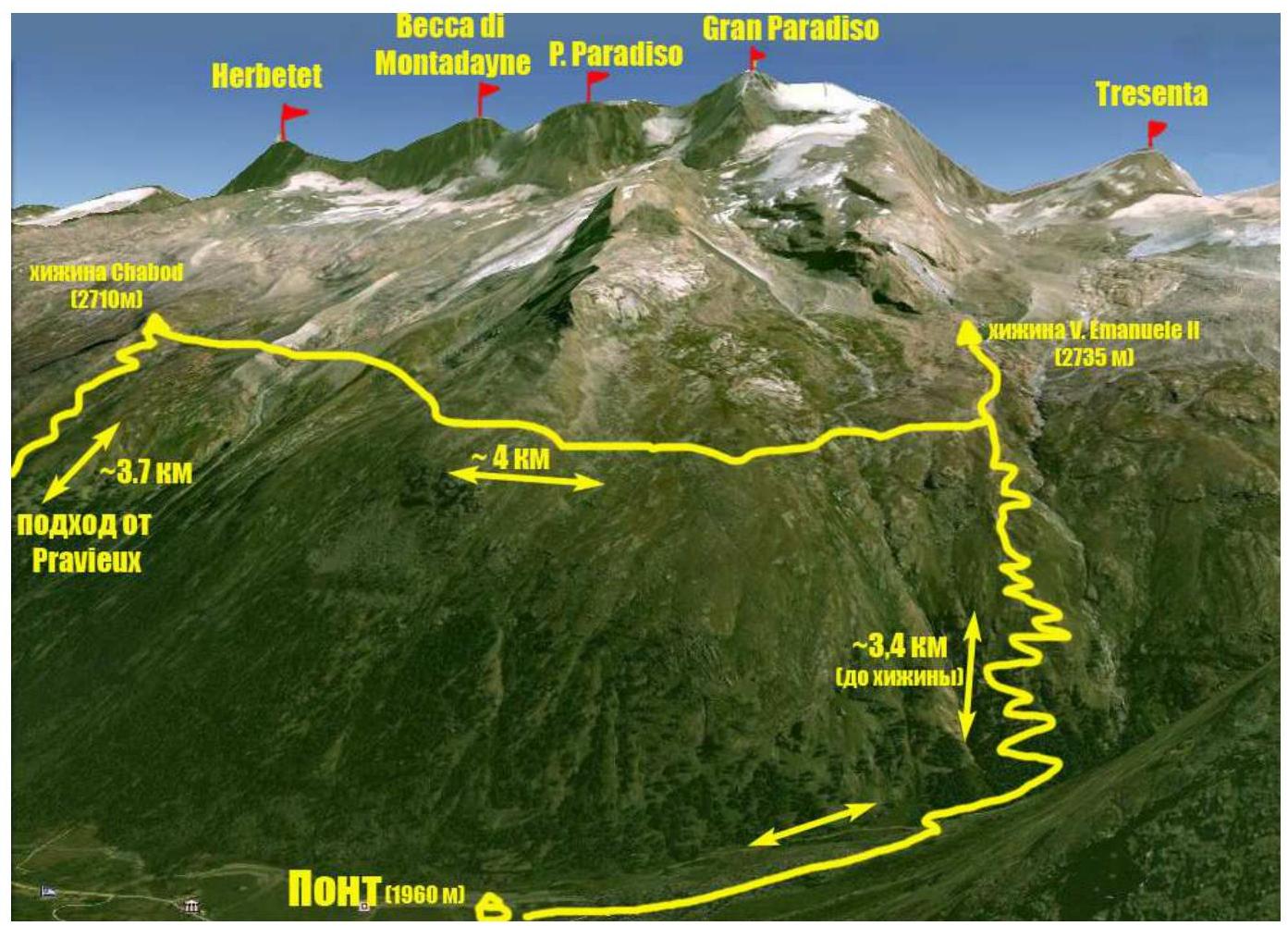
The ascent of Ciarforon was part of the CSKA training camp named after Demchenko (Moscow) in June and early July 2012. The base camp was located in the Pont campsite, the highest and last settlement in the Valsavaranche valley, at an elevation of 1950–2000 m.
The route was accessed from the Vittorio Emanuele II hut, located at the foot of Gran Paradiso at 2732 m. The approach from Pont takes about 2 hours via a convenient trail.
Ciarforon is situated in the ridge between the peaks of Tresenta (3609 m) and Becca di Monciair (3544 m). The summit's geographical coordinates are 45°29′35.09″ N, 7°14′53.47″ E. In the Italian classification, the route via the 3rd wall has a category of PD.
Approach route from Base Camp (Pont campsite) to Vittorio Emanuele II hut.
Technical photo of the route.
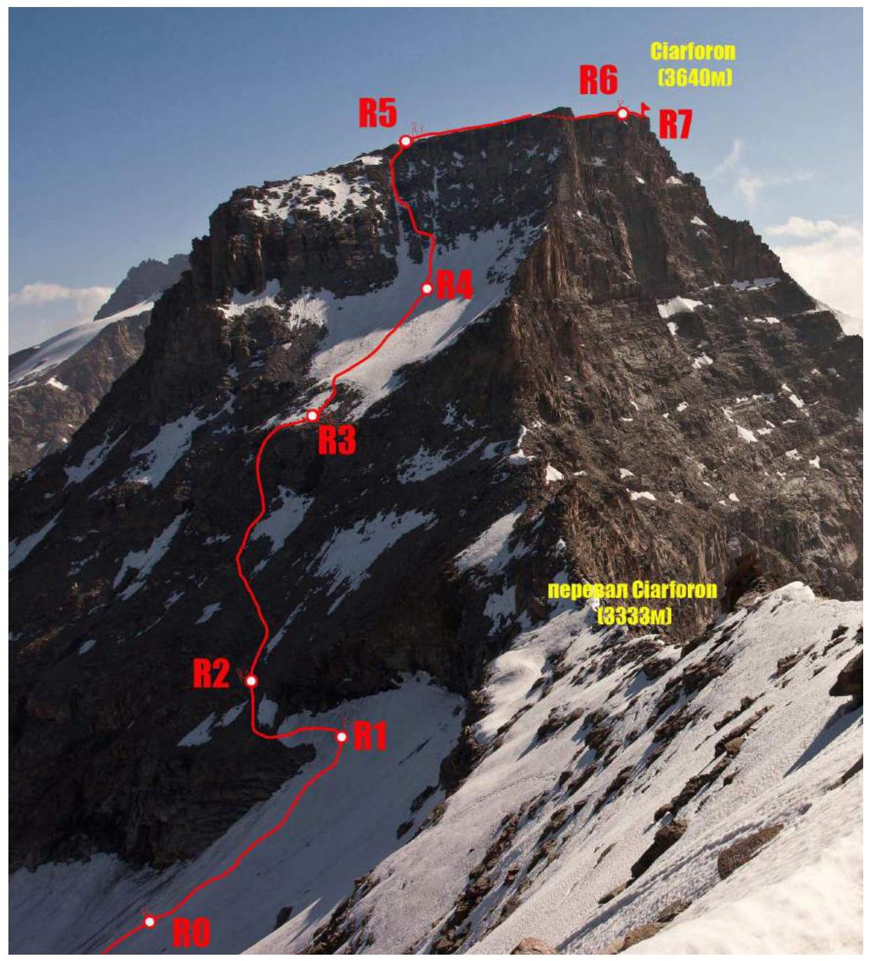
| Section | Length, m | Slope, ° | Terrain type | Category | Number of pitons |
|---|---|---|---|---|---|
| R0–R1 | 150 | 25 | snow | 1 | |
| R1–R2 | 100 | 30–45 | rock – snow | 2 | |
| R2–R3 | 150 | 50 | rock – snow | 2 | |
| R3–R4 | 100 | 30 | snow | 2 | |
| R4–R5 | 150 | 50 | rock – snow – ice | 3 | complex |
| R5–R6 | 300 | 25 | rock – snow | 2 | |
| R6–R7 | 50 | 20 | rock | 1 |
Brief description of the route by sections.
Approach.
The approach to the route from the hut is best viewed the evening before, as the glacier under Ciarforon can be crossed at multiple points. The target is to reach two control cairns on the moraine continuing the NW ridge, visible directly from the hut. Our initial approach via the upper glacier with a traverse along the peak was not ideal due to melting snowfields with numerous streams and puddles, risking soaked feet at the start.
A better approach is to traverse the glacier lower down on rock ledges to the moraine of the NW ridge and then ascend the moraine. From the control cairns, descend to the glacier between Ciarforon and Moncorvè. Following the west wall of Ciarforon, ascend to the col and into the upper glacier. From Vittorio Emanuele II hut, it takes 1.5–2 hours. We needed to access the last ledge on the West wall, marking the route's start.
R0–R1 100–150 m, 20–25°, category 1. Ascend a snow-ice slope to reach a ledge. R1–R2 100 m traverse along the ledge at the boundary between snow and rock (or on snow, depending on conditions) to reach the scree slopes of the West wall.
R2–R3 On scree slopes, 100–150 m, ascend left upwards to reach a rock belt dividing the wall into two parts. Then, on easier rocks (50 m, 40–50°), ascend to the upper wall's cirque. There are many options for this section; we found the left part simpler and less rockfall-prone.
R3–R4 150 m, category 2. The upper West wall's cirque is a snowfield with potential small avalanches from above. We saw two wet avalanches. Ascend straight up the center, avoiding avalanche debris, until two snow-ice couloirs onto the summit plateau are visible from the left.
R4–R5 150 m, 40–50°, category 3. The most logical ascent is via the left couloir straight up (crampons and protection via ice axe or pitons), but due to avalanche debris, we initially took the right couloir and then transitioned to the left via simple to moderately difficult rocks, then straight up to the summit plateau. (Later in the summer, the couloir may be entirely icy. Ascent is also possible entirely on rocks between the two couloirs).
R5–R6. Turn right, traverse along the edge of the south wall for 300 m on a snow-covered ridge. Reach a large snow bowl with a lake. Bypass the lake on the right. Total time from the start: 4 hours.
R6–R7. 50 m, 20°, category 1. Ascend gentle rocks to reach the summit plateau.
Descent was via the ascent route. The first two ropes from the descent point into the couloir were rappelled. 2 hours back to the start and about an hour more to the hut via the moraine.
Photo illustrations of the report.
 Photo 1. Approach from Vittorio Emanuele II hut
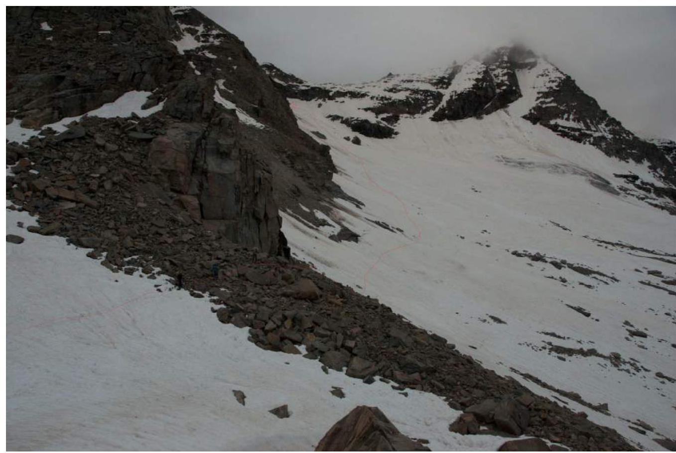
Photo 2. Accessing the route from the glacier between Ciarforon and Monciair
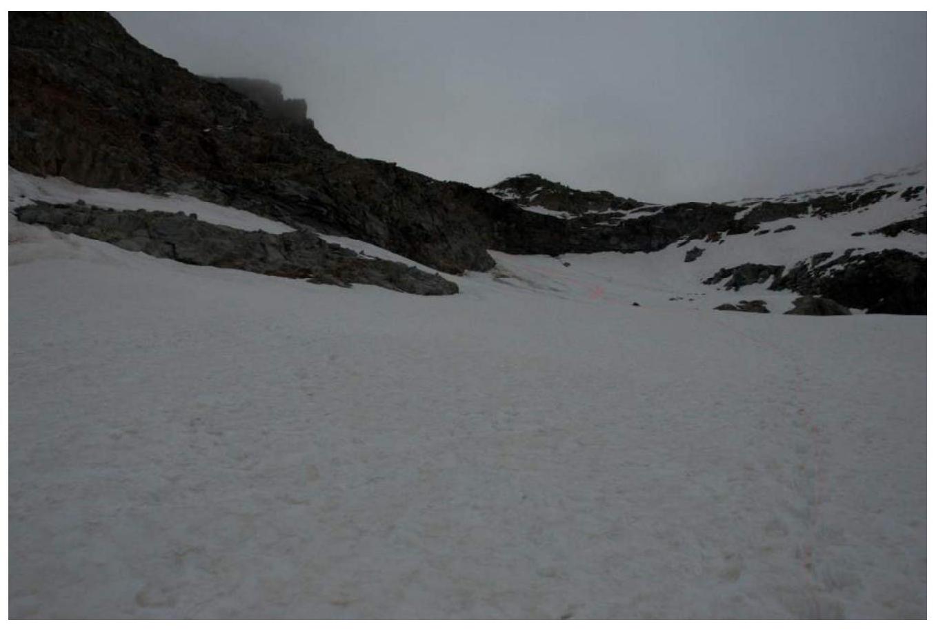
Photo 3. Section R0–R1

Photo 4. Section R1–R2
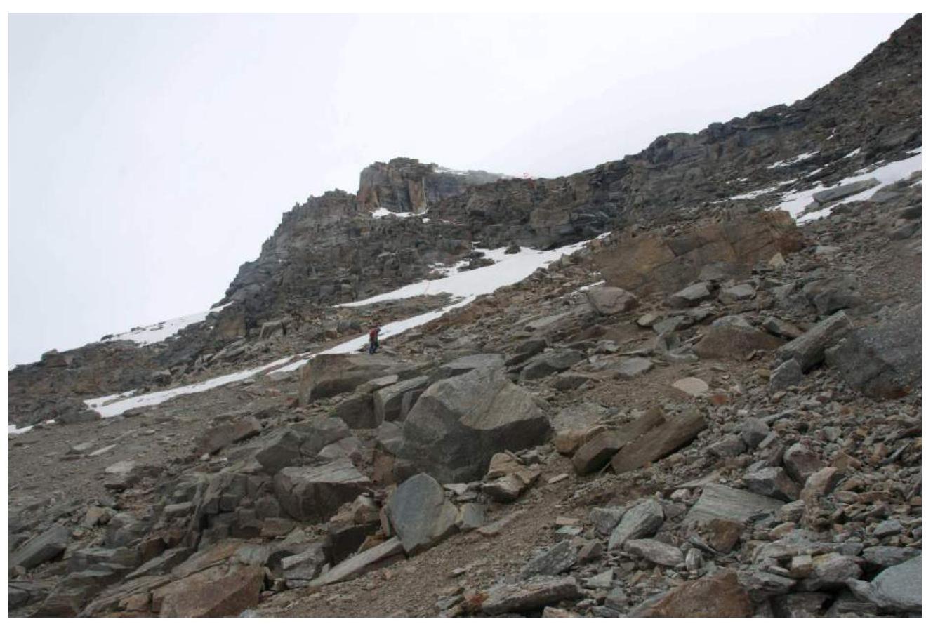
Photo 5. Section R2–R3
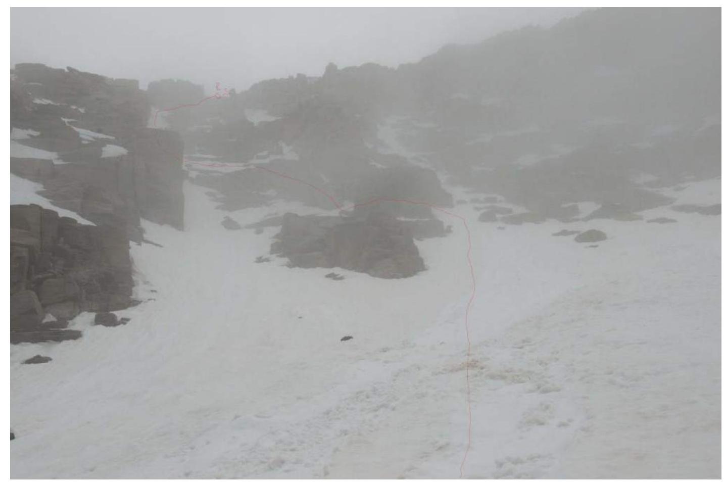
Photo 5. Section R4–R5
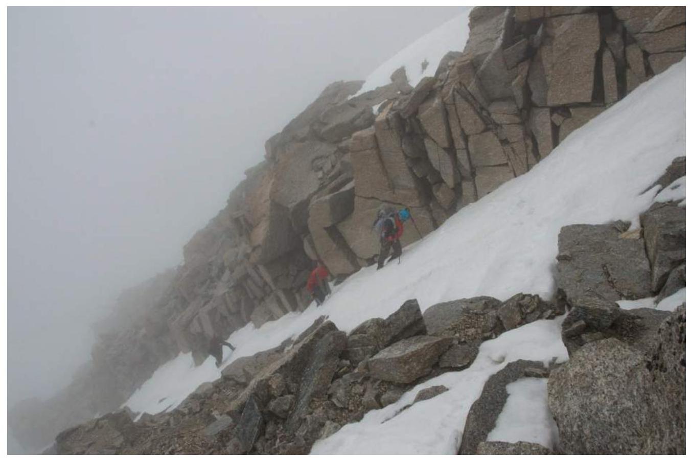
Photo 6. Start of the ice-snow couloir on section R4–R5
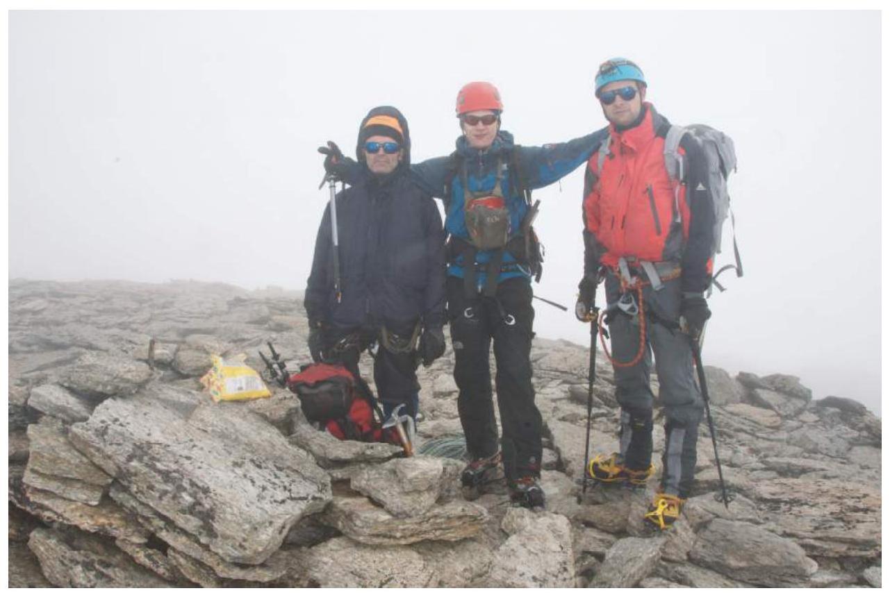
Photo 7. Team on the summit
Comments
Sign in to leave a comment