Report
On the ascent of the CSKA team named after Demchenko to the summit of Petit Forche (3513 m) via the N slope and NW ridge, 1B category of difficulty, Savoy Alps, Chamonix region
Climbing Passport
- France. Savoy Alps, Chamonix region. Section №10.3 (according to KGBM 2013)
- Summit Petit Forche (Petit Forche) 3513 m.
Via N slope and NW ridge (E. Dufour, H. Whitehouse, H. Copt, 1876)
- Proposed category of difficulty — 1B,
- Route type: combined
- Height difference of the route: 700 m
Route length: 2500 m. Length of sections:
- V category of difficulty — m.
- VI category of difficulty — m.
Average steepness:
- main part of the route — 35 degrees.
- entire route — 23 degrees.
- Pitons left (used) on the route:
total 0; including bolted pitons —
- Team's climbing hours: 6 hours (excluding descent)
- Team leader: Volodin V.G. MS
Team members:
Piskulova P. br Bojkova A. br Belozerov I. br Tikhonova V. br
- Coach: Volodin V.G. MS
- Departure to the route from the "Albert 1" refuge: 6:00, June 27, 2014. Summit reached: 10:00, June 25, 2014. Return to the refuge: 16:15, June 25, 2014. Descent from the summit: via the ascent route
- Organization: CSKA named after Demchenko (Moscow)
- Report responsible: Volodin V.G.
Email: vikvolodin@mail.ru
General information about the climbing area
The summit of Petit Forche 3513 m, which was the objective of the ascent, is located in the Chamonix valley region. This valley is territorially situated in the Savoy Alps system in southern France. Chamonix is known for its developed mountain infrastructure, rich alpinist traditions, and history. The highest point in the Chamonix region and the Savoy Alps is Mont Blanc 4808 m, which is the highest peak in the Alps.
The ascent to Petit Forche was part of the CSKA training camp named after Demchenko (Moscow) in June — early July 2014. The base camp of the training camp was located in the Montroc campsite. Montroc is the highest settlement in the Chamonix valley after Le Tour (which is slightly higher but off the main road to the pass from Chamonix to the neighboring valley). The elevation is 1300–1400 m above sea level.
Most climbing routes of interest are located in the Mont Blanc massif. Since the peak elevations in the area are around 3500–4000 m, almost all forms of relief are present:
- rocks
- ice
- snow
There are many combined routes. The area offers a wide variety of:
- rock routes
- ice and snow routes
- combined routes from 1B to 6A category of difficulty.
The immediate approach to the route was made from the "Albert 1" refuge. The refuge is located in the lower reaches of the Glacier du Tour at an elevation of 2702 m. The route via the NW ridge to the summit of Petit Forche was first ascended by E. Dufour, H. Whitehouse, and H. Copt on August 16, 1876. Some GPS coordinates along the route: Summit Petit Forche: 45°58′49.76″ N, 7°1′17.25″ E; Col du Tour: 45°59′18.62″ N, 7°0′42.60″ E; Signal Reily: 45°59′40.18″ N, 6°59′54.40″ E; "Albert 1" refuge: 45°59′48.36″ N, 6°59′11.66″ E
Photopanorama of the area.
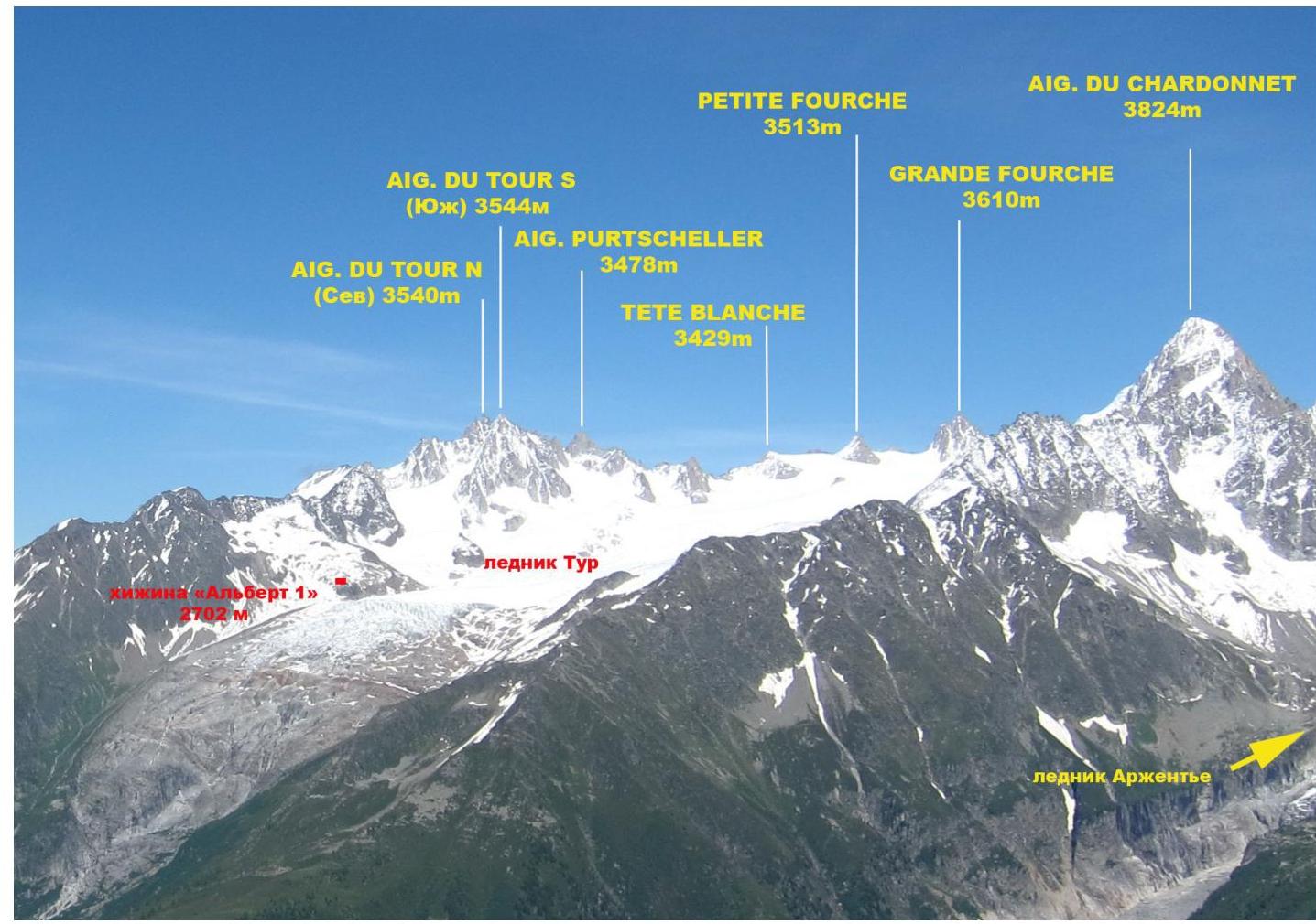
Photo of the Glacier du Tour area. Taken from the White Lake on July 3, 2014
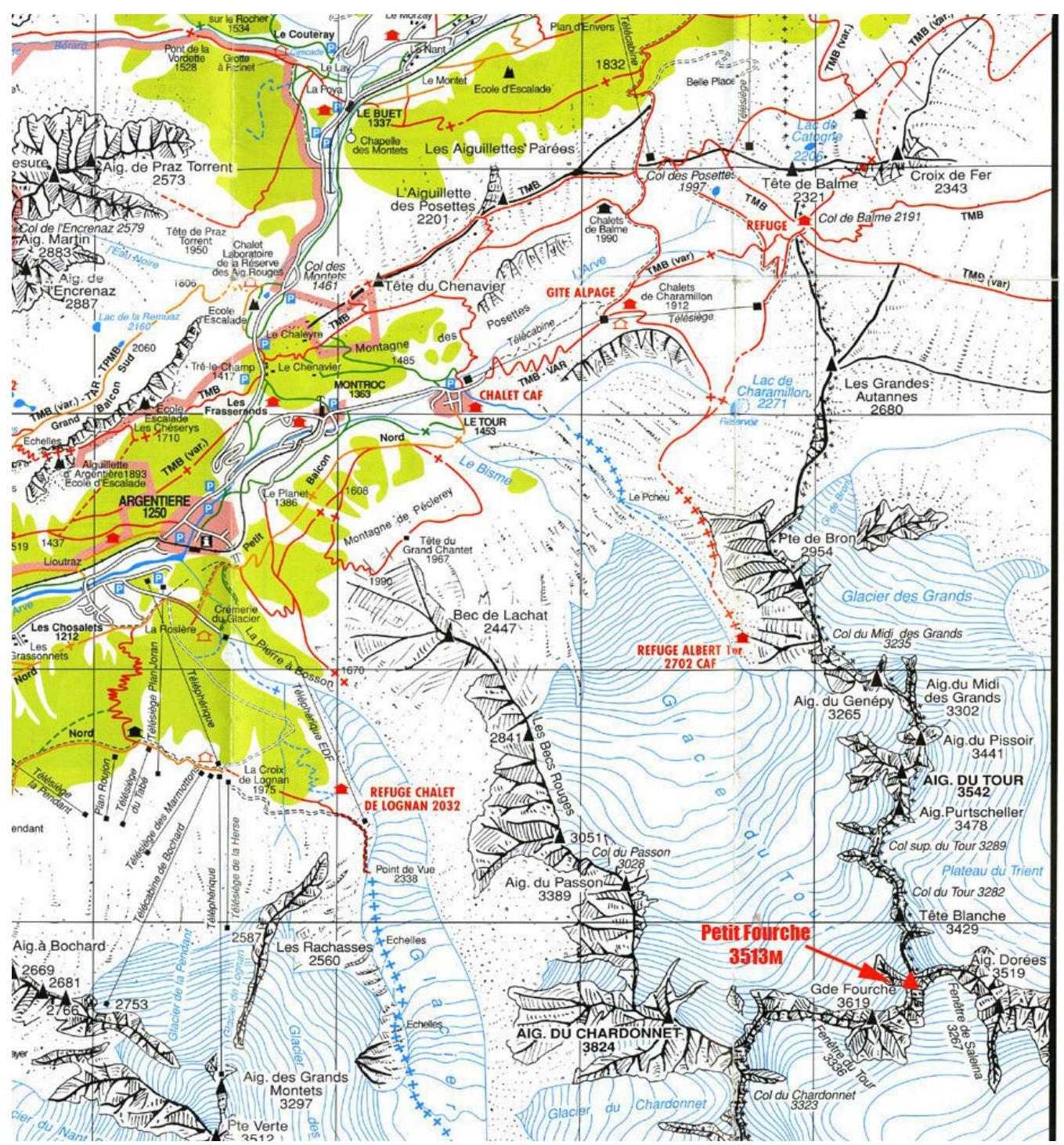
Map of the area
Approach to the "Albert 1" refuge
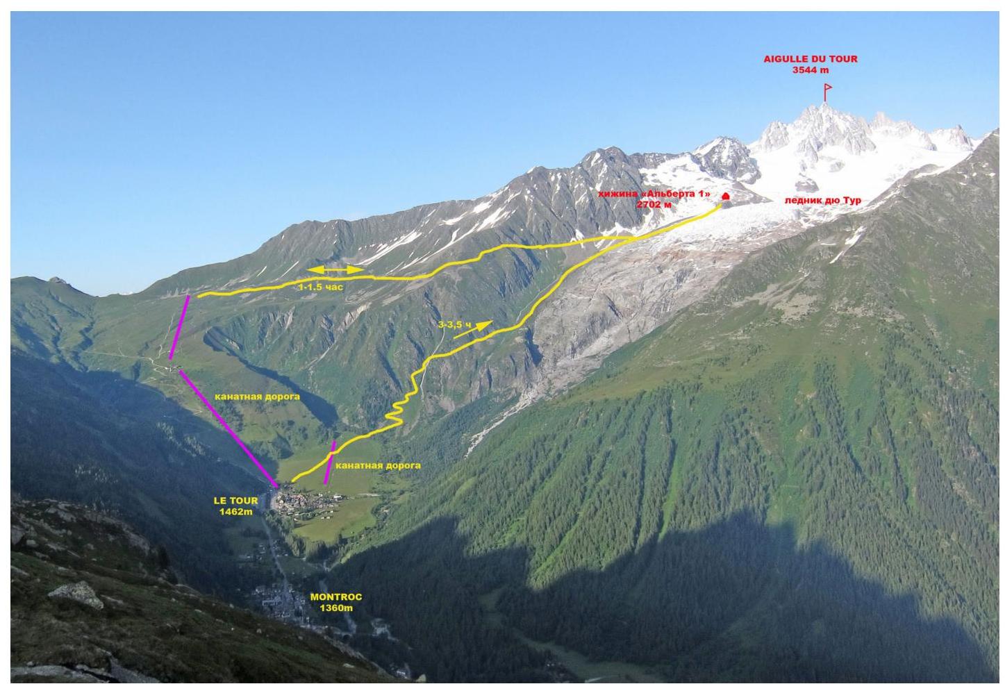
Approach route from Le Tour to the "Albert 1" refuge
Almost all ascents in the Glacier du Tour area start from the "Albert 1" refuge. The approach can be made via two paths.
- From Le Tour village, take the two-stage cable car to the start of the trail to the refuge. Then follow the trail to the right with a gentle ascent, following the signs, to reach the refuge. The travel time from the cable car is 1–1.5 hours.
- From the outskirts of Le Tour village, cross a large field with a small cable car towards the Glacier du Tour. From the edge of the field, the trail will start to wind its way up on the left side of the rocky outcrops and glacier debris. On the rocky sections of the trail, there is red paint marking. In the middle of the ascent, there is a helicopter landing pad where you can rest. From there, the path continues along the moraine part of the trail. The total ascent time from the village to the "Albert 1" refuge is 3–3.5 hours.
General photo
of the summit.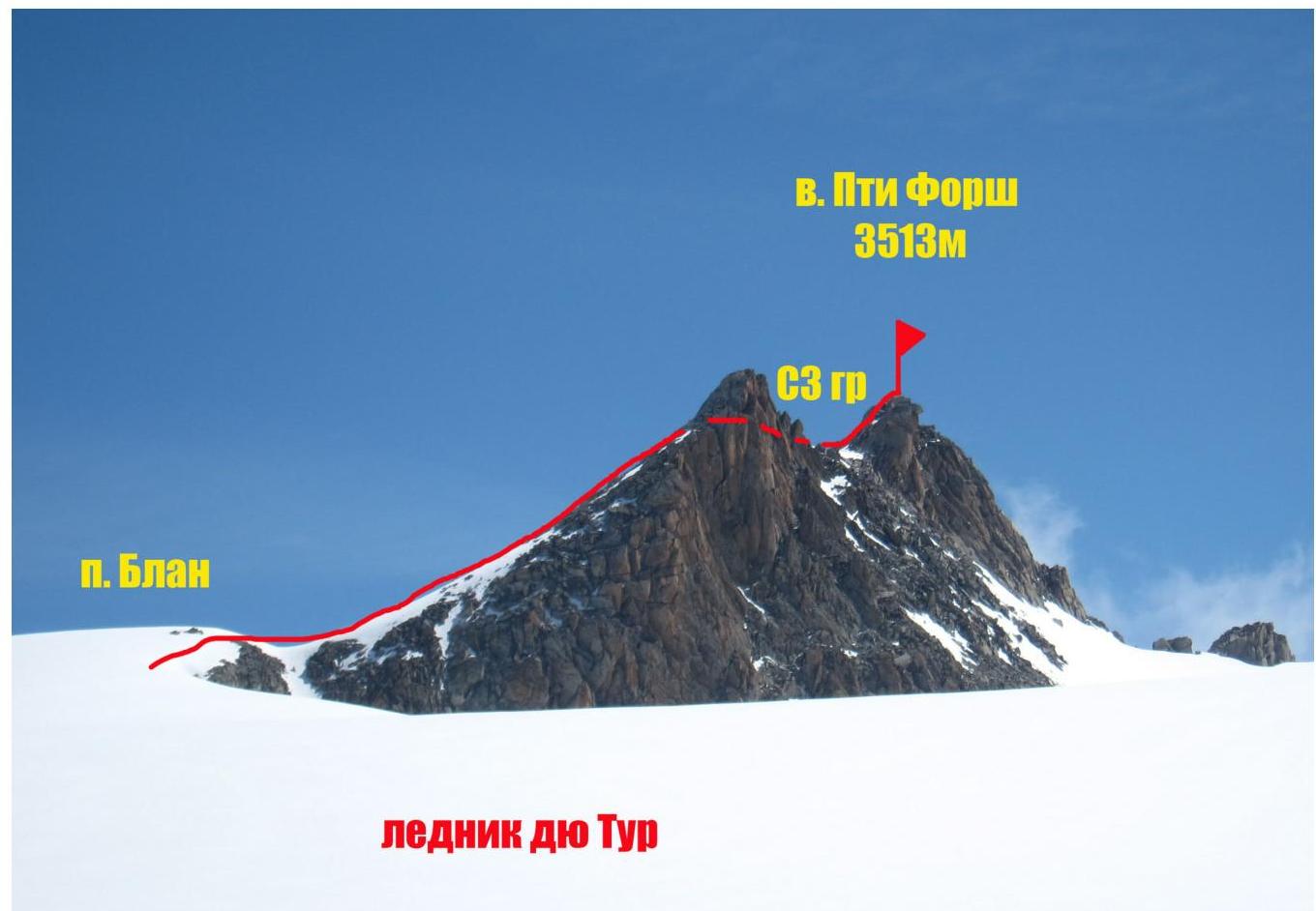
Photo of Petit Forche summit. Taken from the Glacier du Tour. June 2014. Photo of the route profile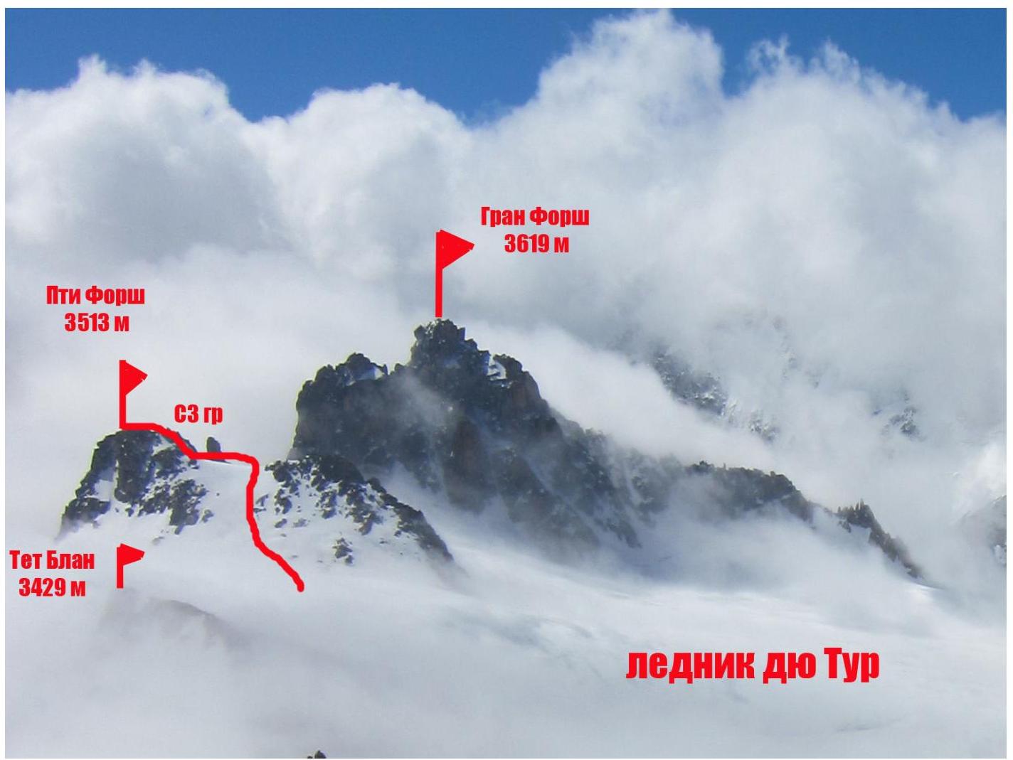
Technical photography of the route
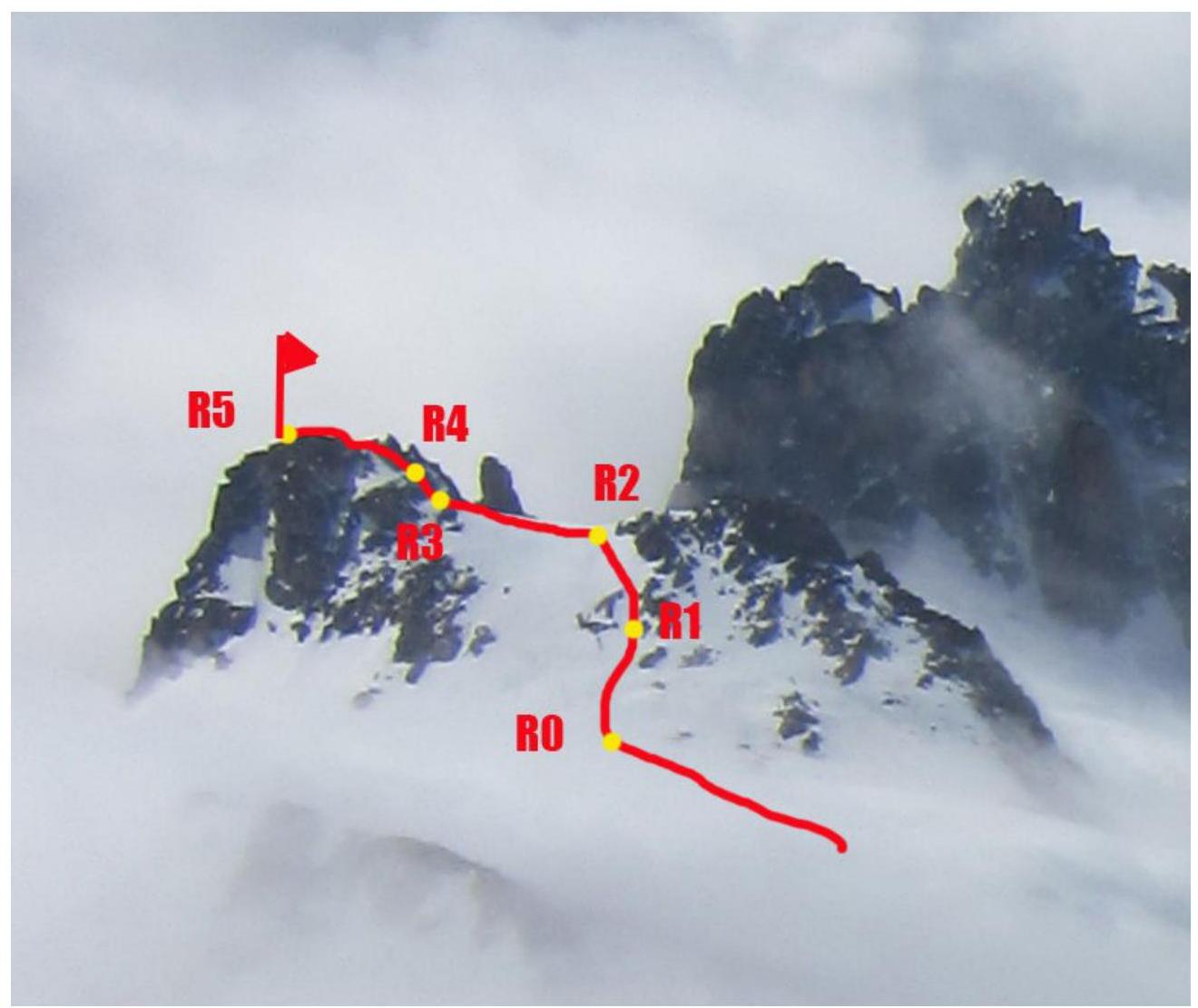
Photo of Petit Forche summit. June 27, 2014.
Description of the route's difficulty sections
| Section № | Length | Steepness | Relief type | Category of difficulty | Number of pitons |
|---|---|---|---|---|---|
| R0–R1 | 50 | 15° | Snow-ice slope | I | |
| R1–R2 | 40 | 30° | Snow-ice slope | I | 0 |
| R2–R3 | 150 | 30° | Snow-ice slope | II | 0 |
| R3–R4 | 15 m | 65° | Rocky ridge | II | |
| R4–R5 | 250 | 20° | Rocky ridge | II |
Brief description of the route's passage by sections.
From the refuge, follow the rocky moraine along the glacier, turning left. Reach the glacier. Here, it is recommended to put on climbing gear (20 minutes)
Then, traverse the glacier, bypassing a cirque to the left, to reach the foot of Signal Reily (2883 m). Follow the glacier in the direction of the large reddish "gate" — the approach to the Col du Tour. Move along the rocky ridges on the glacier with a gentle ascent.
Reach the Col Blanc (3400 m):
- 2000 m R0–R1: on the col, take the path to the right
- Start ascending Petit Forche via a snow-ice slope: I, 30°, 50 m, R1–R2
- Move along the rocks to reach the snowy ridge: II, 30°, 40 m, R2–R3
- Traverse the ridge. Snow — ice. Insurance via ice axes: II, 30°, 150 m, R3–R4
- Ascend несложn rocks to reach the NW ridge: II, 65°, 15 m, R4–R5
- Traverse the rocky ridge to the summit: II, 20°, 250 m
Descent
Descent from the route is made via the ascent path.
Route recommendations
The route can be considered relatively safe overall. Insurance can be organized without significant problems. The route is suitable for training purposes and acclimatization exits. Key hazardous moments on the route:
- Glacier travel on the approach, partially covered (crevasses!)
- Large glacier area where it's easy to get lost in poor visibility (recommended to bring a GPS or compass and follow the trail)
Photo illustration of the report
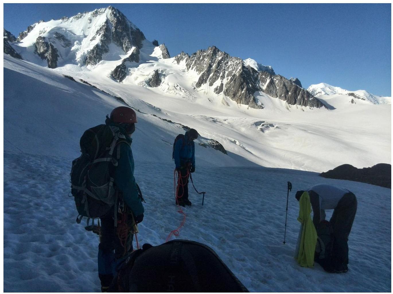
Start of the route from the "Albert 1" refuge.
14
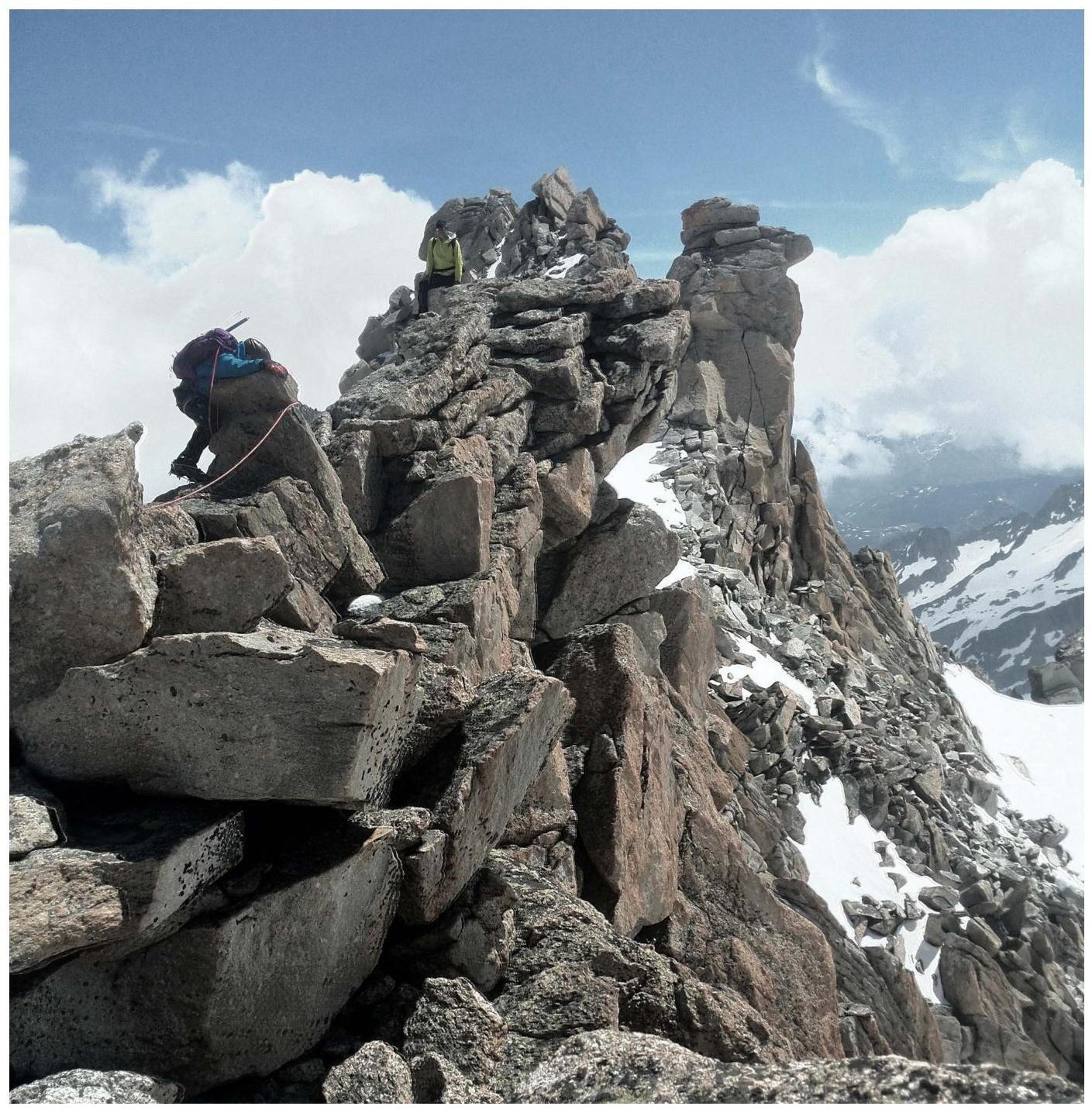
Pre-summit ridge (section
R4–R5)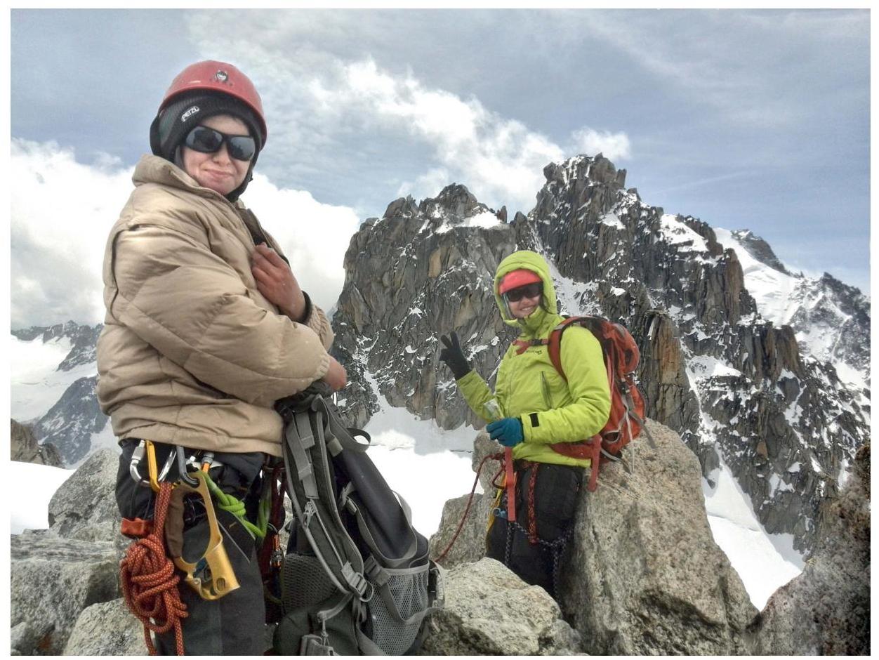
On the summit (in the background
Grand Forche)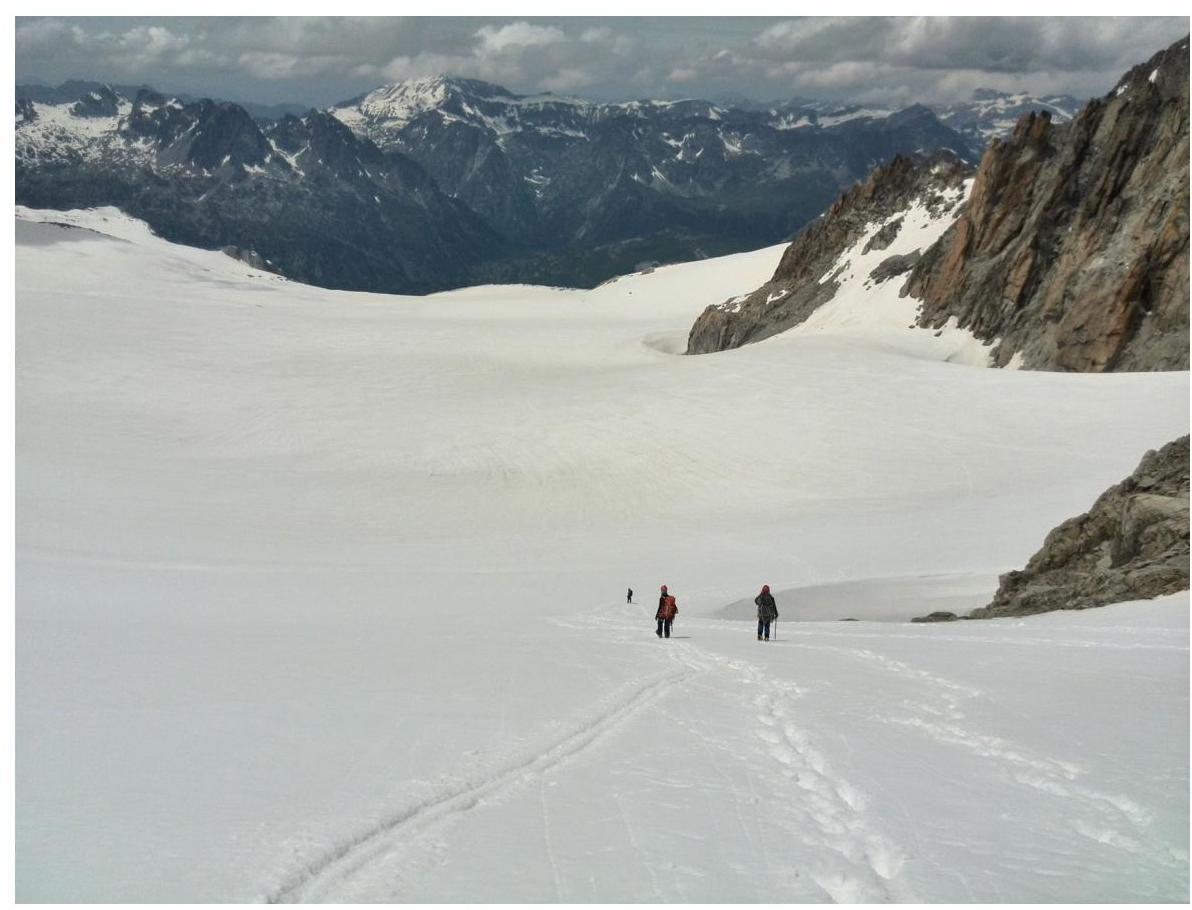
Ascent and descent path to Col Blanc


