REPORT
ON THE ASCENT TO THE SUMMIT OF MONT BLANC DU TACUL VIA THE NW SLOPE "CLASSIC" 2A CATEGORY OF COMPLEXITY BY THE TRAINING DEPARTMENT OF AK POLITEKHNIK UNDER THE GUIDANCE OF DUPLIAC A.K. August 2, 2018
I. ASCENT DOCUMENTATION
| № | 1. General Information | |
|---|---|---|
| 1.1 | Full Name, Sports Rank of the Leader | Dupliak A.K. 3rd sports rank |
| 1.2 | Full Name, Sports Rank of Participants | Molodozhen V.A. Master of Sports, Fineeva A.A. 3rd sports rank, Sadovskiy S.V. 3rd sports rank, Dupliak A.K. 3rd sports rank, Limanyuk A.Yu. 3rd sports rank, Bakharev N.N. 3rd sports rank |
| 1.3 | Full Name of Coach | Molodozhen V.A. |
| 1.4 | Organization | a/c Polytechnik St. Petersburg |
| 2. Characteristics of the Ascent Object | ||
| 2.1 | Region | France, Upper Savoy, Chamonix valley |
| 2.2 | Valley | Giant (Glacier du Géant) |
| 2.3 | Number of Section According to the 2013 Classification Table | 10.3.21a |
| 2.4 | Name and Height of the Summit | Aiguille du Tacul, 4248 m |
| 2.5 | Geographical Coordinates of the Summit (latitude/longitude), GPS Coordinates | GPS: 45°51′24″ N, 6°53′17″ E. Geographical: 45.856667°, 6.888056° |
| 3. Characteristics of the Route | ||
| 3.1 | Name of the Route | Mont Blanc du Tacul via NW slope "classic" |
| 3.2 | Proposed Category of Complexity | 2A |
| 3.3 | Degree of Route Exploration | - |
| 3.4 | Nature of the Route Terrain | Snowy |
| 3.5 | Height Difference of the Route | Height of campsite 3532 m; Height at the start of the route 3600 m; Summit height – 4248 m; Height difference from campsite to summit 716 m; Height difference from the base of Triangle du Tacul to summit – 800 m. |
| 3.6 | Length of the Route | Distance from campsite to the base of the rocky ascent (length of approach) 1000 m; Distance from the start of the route to the summit 1158 m; Descent from the summit — 1158 m; Total length of the route 2158 m; Distance from descent from the route to campsite 1000 m; Total length of the route including approach and return to campsite 4316 m |
| 3.7 | Technical Elements of the Route | 1st category snow — 400 m; 2nd category combined — 858 m |
| 3.8 | Descent from the Summit | Via the ascent route |
| 3.9 | Additional Characteristics of the Route | - |
| 4. Characteristics of the Team's Actions | ||
| 4.1 | Time of Movement | 0 d. 6 h 00 min |
| 4.2 | Overnight Stays | Campsite |
| 4.3 | Departure for the Route | 4 h 30 min August 2, 2018 |
| 4.4 | Arrival at the Summit | 8 h 30 min August 2, 2018 |
| 4.5 | Return to Base Camp | 10 h 30 min August 2, 2018 |
| 5. Person Responsible for the Report | ||
| 5.1 | Full Name, e-mail | Dupliak A.K., dupliaka@gmail.com |
II. DESCRIPTION OF THE ASCENT
1. Characteristics of the Ascent Object
1.1. General Photo of the Summit
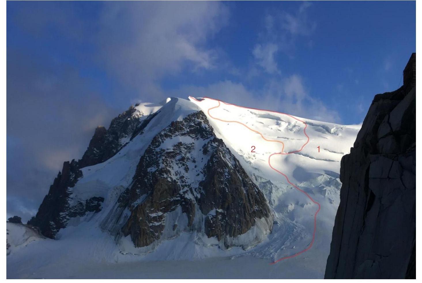
Photo 1. Date of photography July 31, 2018. Location of photography – north-eastern edge of Aiguille du Midi, France, view of the north-western slope of Mont Blanc du Tacul. Routes:
- Mont Blanc du Tacul via north-western slope – 2A category;
- Variation of Mont Blanc du Tacul via north-western slope bypassing the shoulder – 2A category;
1.2. Profile of the Route
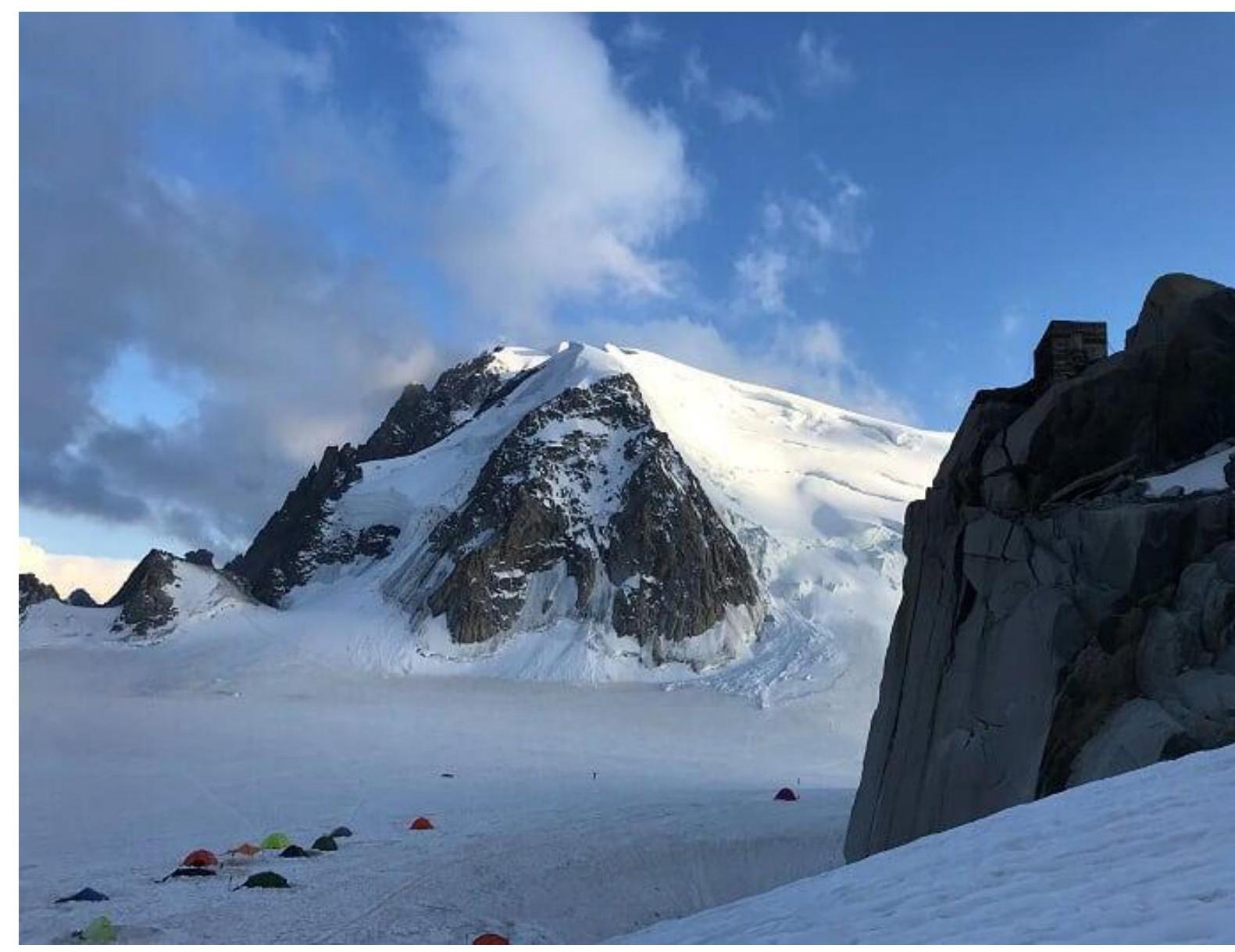
Photo 2. Date of photography July 31, 2018. Location of photography north-eastern edge of Aiguille du Midi, France, view of the north-western slope of Mont Blanc du Tacul.
1.3. Photopanorama of the Area
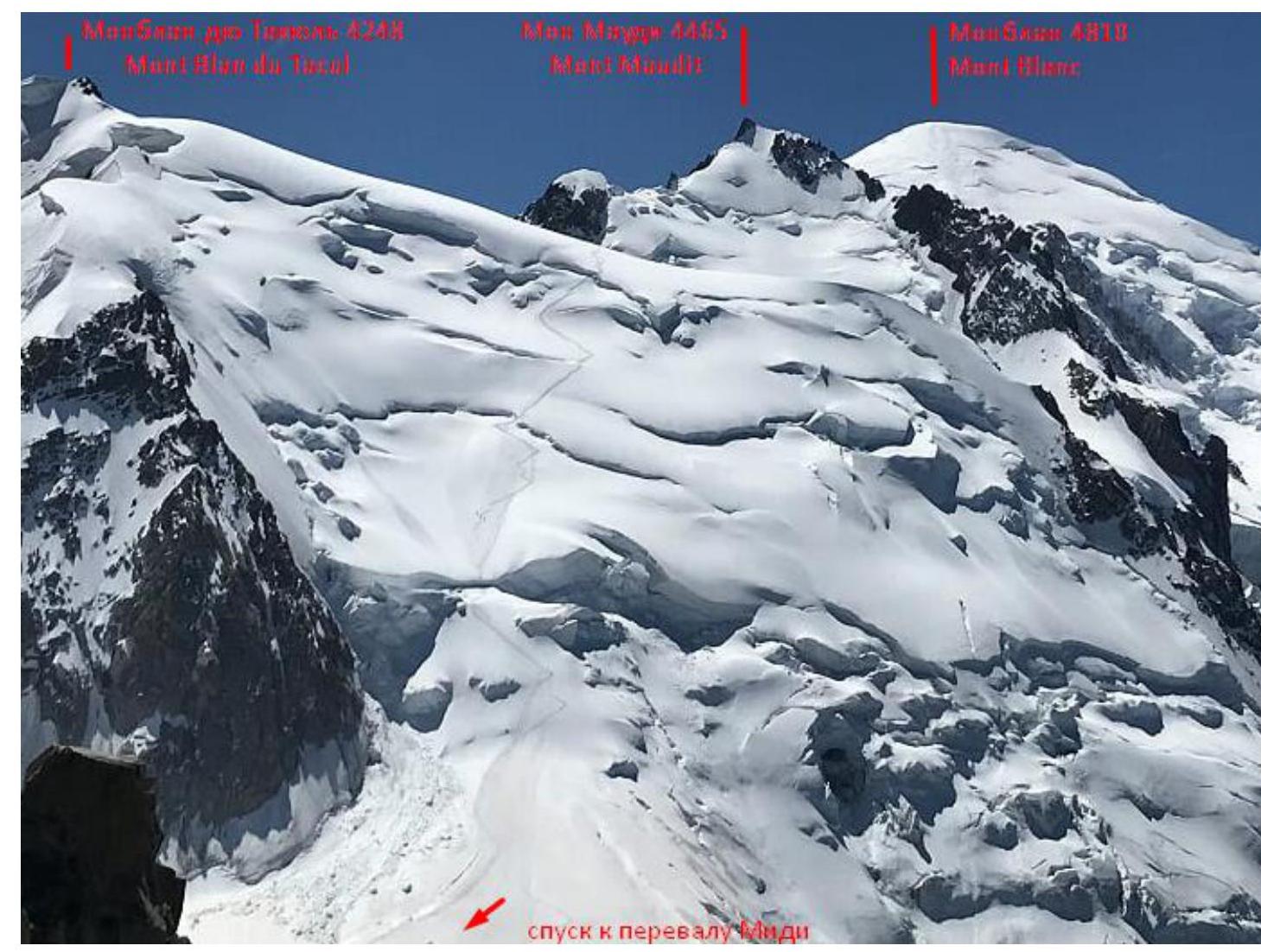
Photo 3. Date of photography August 2, 2018. Location of photography south-western ridge of Aiguille du Midi. View of the south-western slope of Mont Blanc du Tacul.
1.4. Map of the Area

The area where the summit is located is in France. Vallée Blanche (Vallee Blank) is a snowfield that is part of the Mer de Glace glacier, located south of Chamonix. The campsite can be reached by trail or by using a funicular. The trail takes 2 days with a total ascent of 2807 m. From the funicular station to the camp is 40 minutes (2 km) walk with a descent of 310 m. From Plan du Midi station:
- follow the eastern ridge through closed glaciers to the snowfield on Vallée Blanche;
- walk along the snowfield towards Aiguille du Midi to the south-west until a rocky outcrop with the "Cosmic" hut. 40 m from the base of the outcrop are the overnight stays. To approach the route:
- Move from the overnight stays 40 minutes in a south-westerly direction across the Glacier du Géant;
- Pass through the Col du Midi;
- Orient towards the right side of the Triangle du Tacul;
- Start the route 100 m to the right of the base of the Triangle du Tacul. Descent from the route is via the ascent path.
2. Characteristics of the Route
2.1. Technical Photograph of the Route
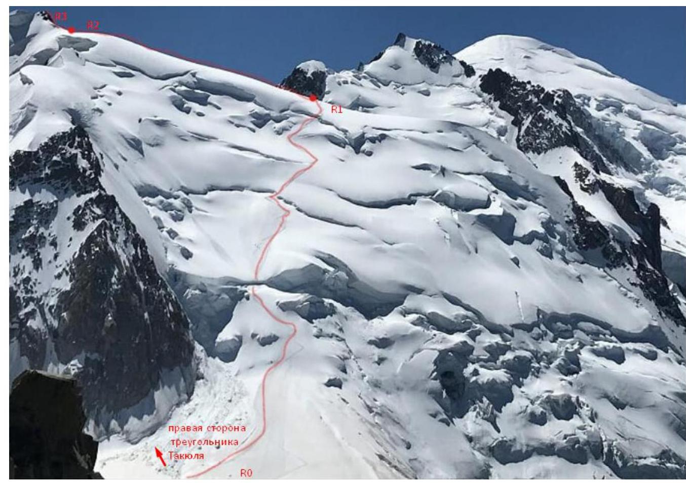
Photo 5. Date of photography August 2, 2018. Location of photography south-western ridge of Aiguille du Midi. View of the south-western slope of Mont Blanc du Tacul.
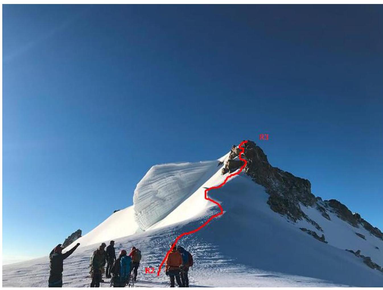
Photo 6. Date of photography August 2, 2018. Location of photography ridge of Mont Blanc du Tacul, view of the pre-summit ascent to the south-eastern ridge.
| Section № | Nature of Terrain | Category of Complexity | Length | Type and Number of Anchors |
|---|---|---|---|---|
| R0–R1 | Snowy | 2 | 700 | Anchors |
| R1–R2 | Snowy | 1 | 400 | 0 Anchors |
| R2–R3 | Rocky | 2 | 150 | 0 Anchors |
3. Characteristics of the Team's Actions
3.1. Brief Description of the Route Passage
| Section № | Description | Photo № |
|---|---|---|
| R0–R1 | 35° slope, simultaneous movement, overcoming first a large crevasse, then depending on the route condition can choose to go along the shoulder or bypass it (caution! Risk of serac collapse). Above the large crevasse there is a safety loop. If moving along the first option, there will be another horizontal crevasse. After that, the ascent to the shoulder of Tacul begins | 6,7 |
| R1–R2 | Simultaneous movement along a snowy slope with a 20–25° incline. | 8 |
| R2–R3 | Simultaneous movement using natural protection on snowy rocks, occasionally ice. | 9 |
| Descent | Descent is via the ascent route, moving simultaneously, except when crossing crevasses and the pre-summit rocky section. On the rocky section, protection is organized using the terrain, and on crevasses — via ice axe. | - |
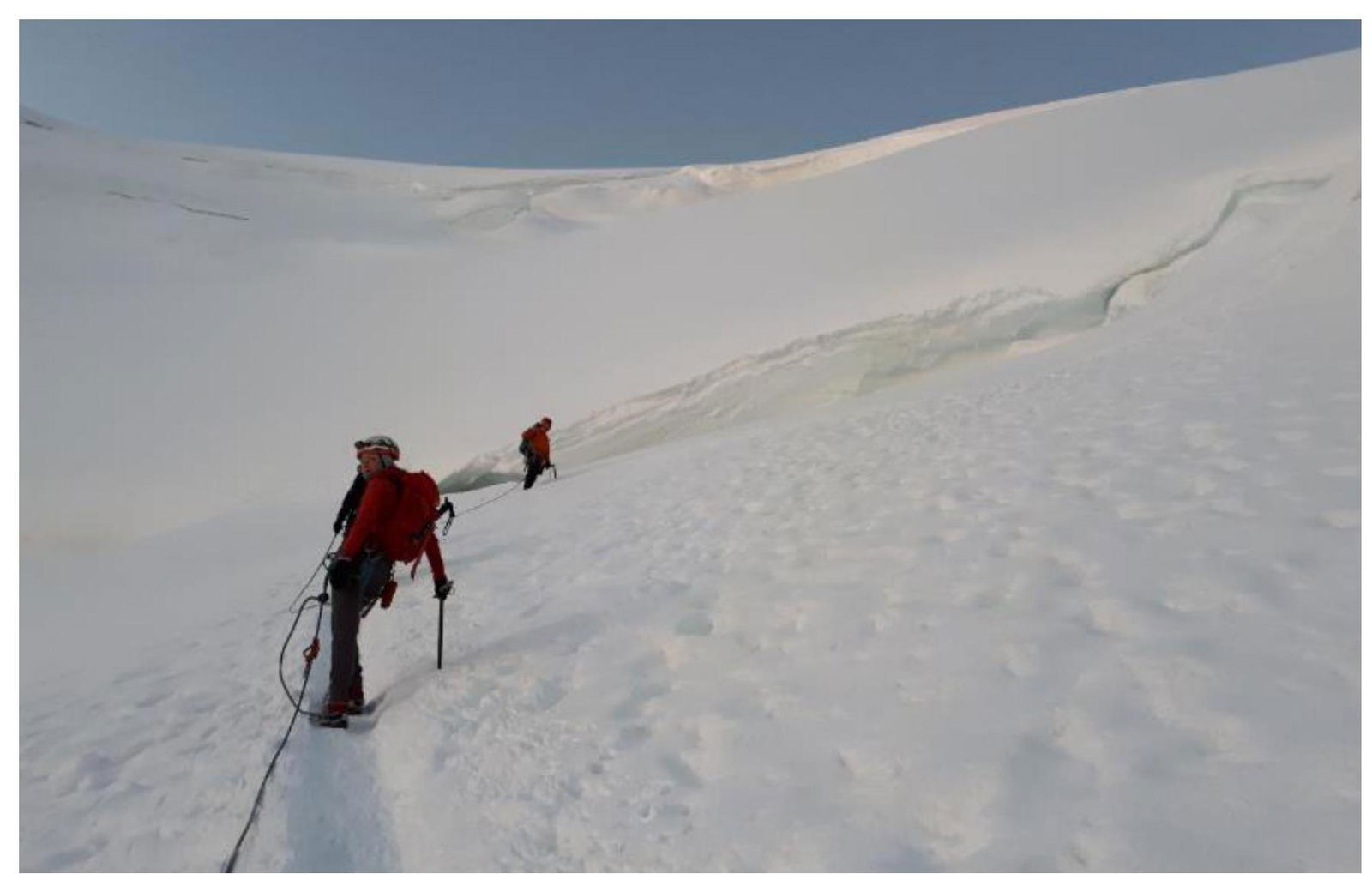
Photo 6. R0–R1. Participants approaching the first crevasse.
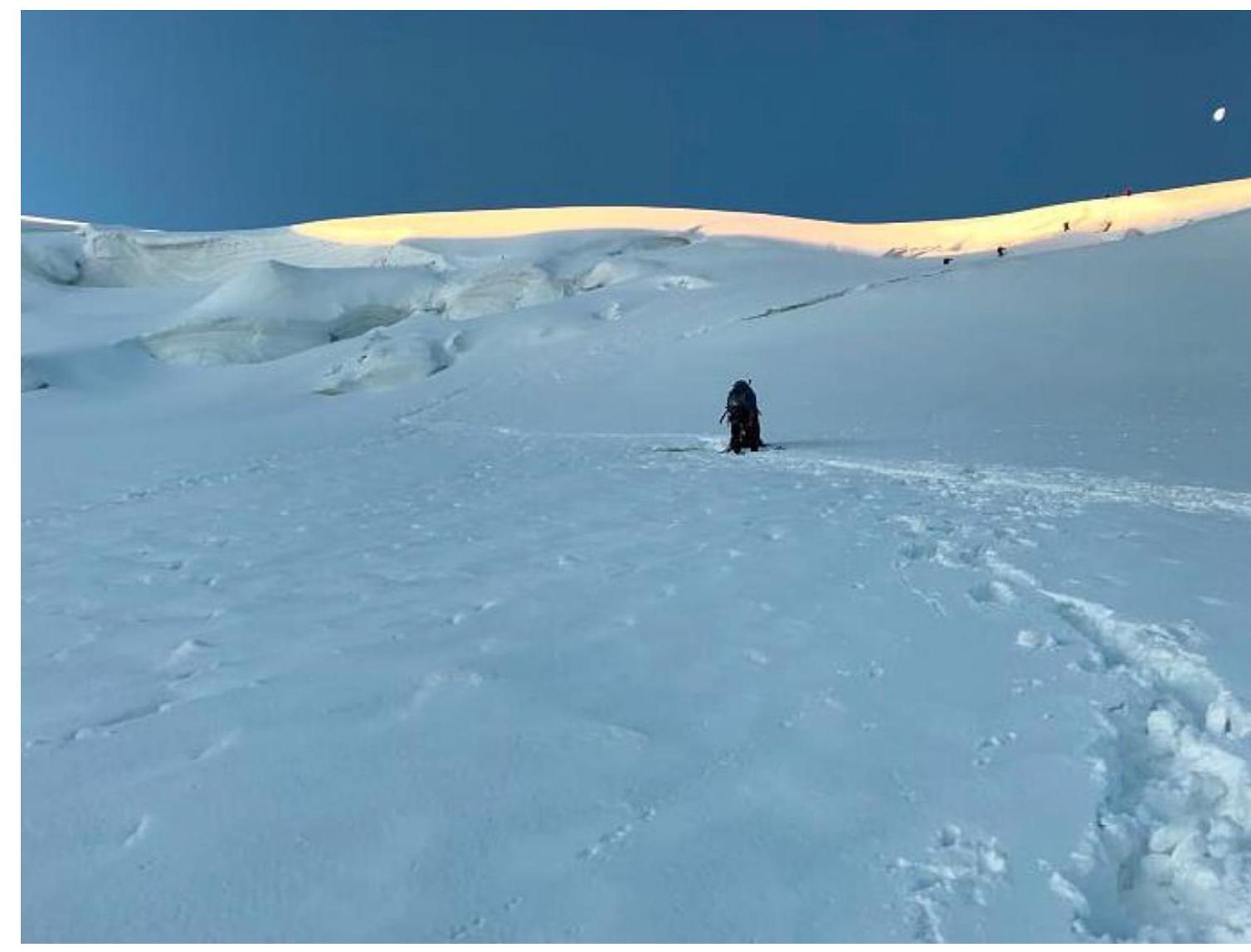
Photo 7. R0–R1. Participants approaching the second crevasse.
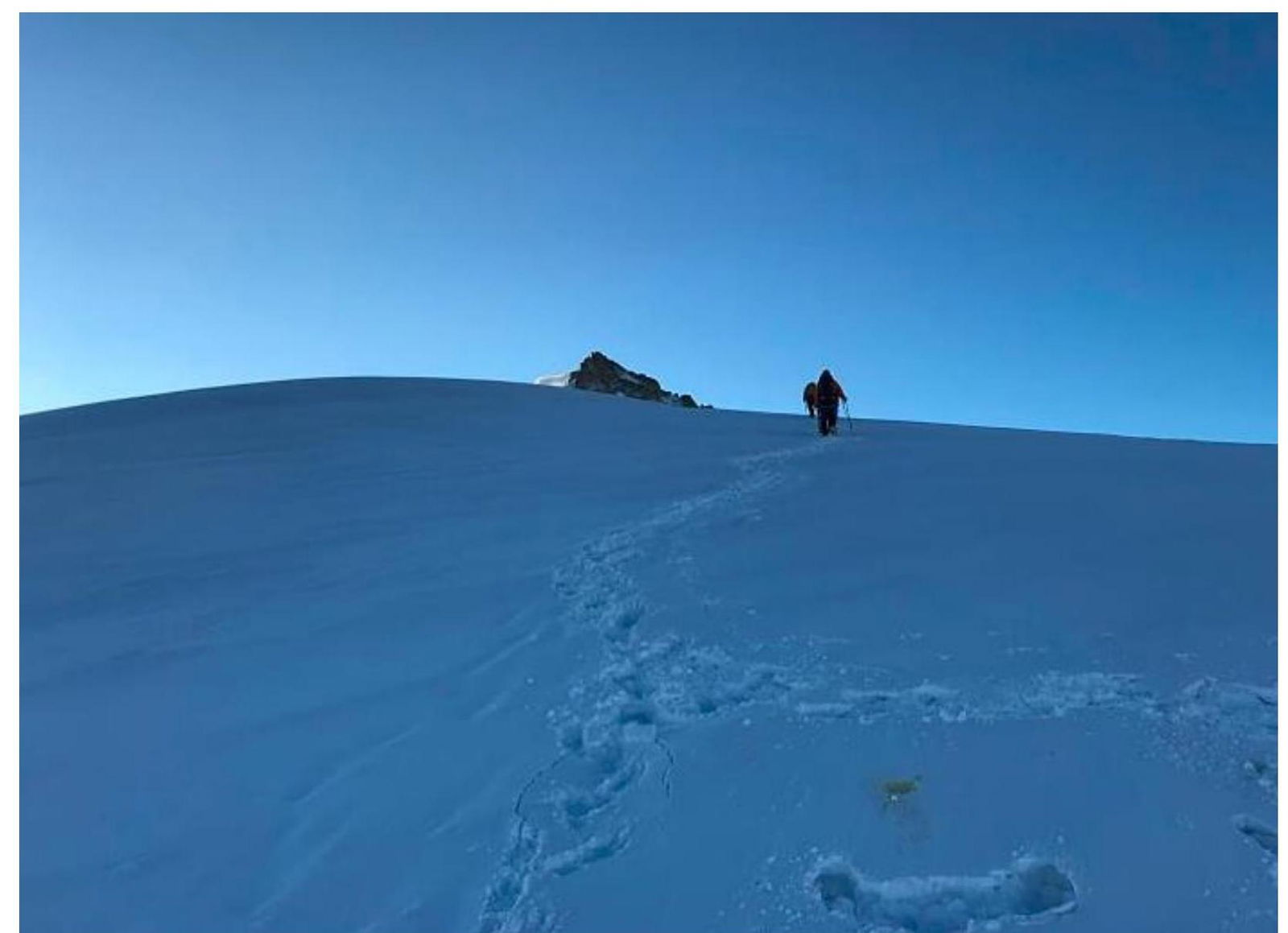
Photo 8. R1–R2. Participants moving along the north-western shoulder of Tacul.
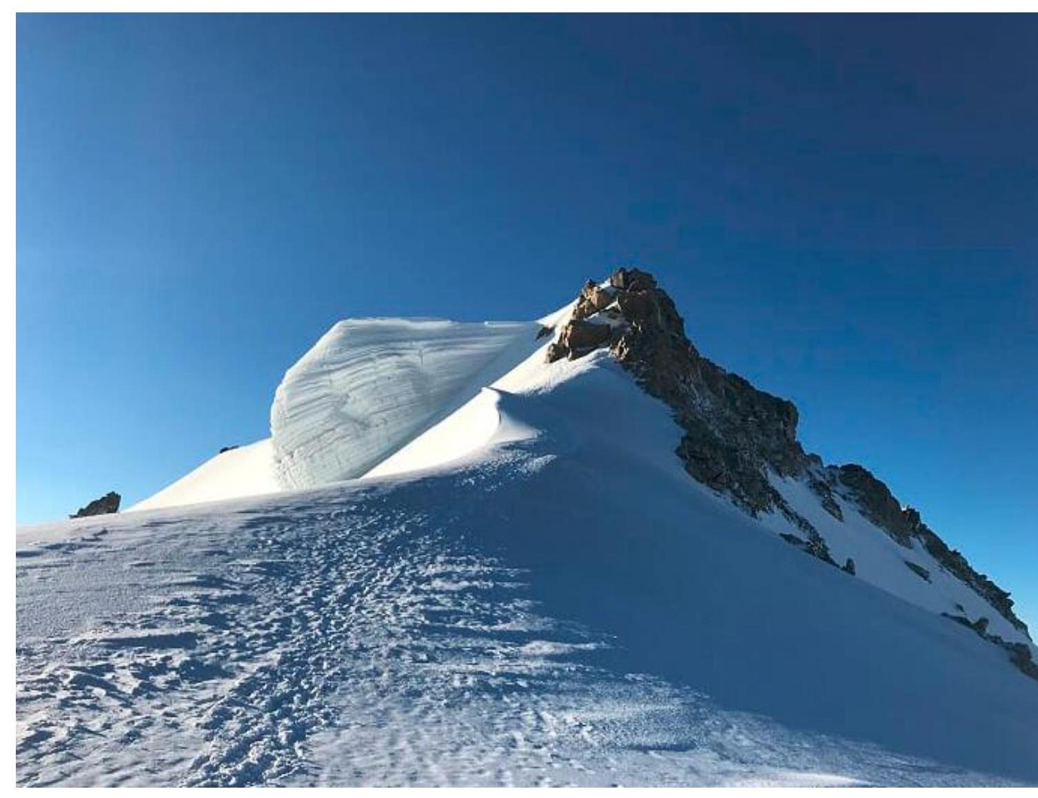
Photo 9. R2–R3. View of the rocky part of the route.
3.2. Photo of the Team at the Summit with the Control Pole
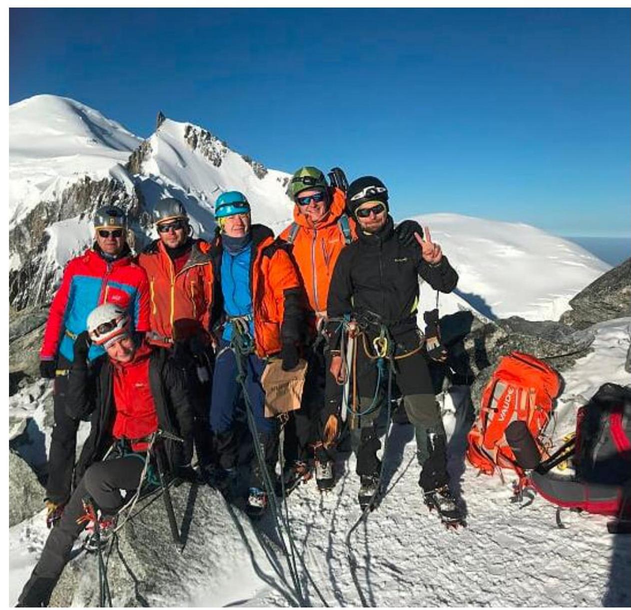
Photo 10. Team at the summit. View to the west: Mont Blanc Maudi and Mont Blanc.
3.3. Assessment of Route Safety
The route is very popular but changes significantly depending on the conditions. It is used as a descent route for many other routes on Tacul. It is advisable to start the route as early as possible: it is easier to walk on frozen snow, and the flow of descending climbers is not as large, which avoids queuing when crossing crevasses. The route can be completed in any snow condition except very dry and fine. Then there is a high risk of serac collapse; it is necessary to check the avalanche situation very carefully.


