Report
On the ascent of the CSKA Demchenko team to Mont Blanc (Monte Bianco), 4808 m, via the "Italian Classic from Gonella Hut" route, 2B cat. diff. (G. Bonin, L. Grasselli, A. Ratti, J. Gradin, A. Proment, 1890)
Team leader: A. V. Yurkin Senior coach: E. V. Kuznetsova
Ascent Details
- Alps (Italy, Val d'Aosta region), Val Veny, Courmayeur area. № 10.3 (according to KGBM 2011)
- Mont Blanc (Mont Blanc (French), Monte Bianco (Italian)) 4808 m from Gonella Hut (G. Bonin, L. Grasselli, A. Ratti, J. Gradin, A. Proment, 1890)
- Category: 2B cat. diff.
- Route type: combined
- Elevation gain: 1740 m Route length: 5700 m Average slope: main part of the route — 45°, entire route — 40°
- Pitons left on the route: total — ; including pitons —
- Team's total climbing time: 12 hours (excluding descent)
- Team leader: Yurkin A. V. CMS Team members: Zorin K. G. 3rd sports category, Vershinin V. N. 2nd sports category, Vovk S. V. 2nd sports category, Mishina N. V. 2nd sports category
- Coach: Yurkin A. V.
- Departure from Base (hut): 3:00, July 12, 2012 Summit arrival: 14:20, July 12, 2012 Return to Base: 19:30, July 12, 2012 Descent from the summit: via the ascent route
- Organization: CSKA Demchenko Training Camp (Moscow)
- Report author: Yurkin A. V. Email: S2_aleks@mail.ru
Summit Photo
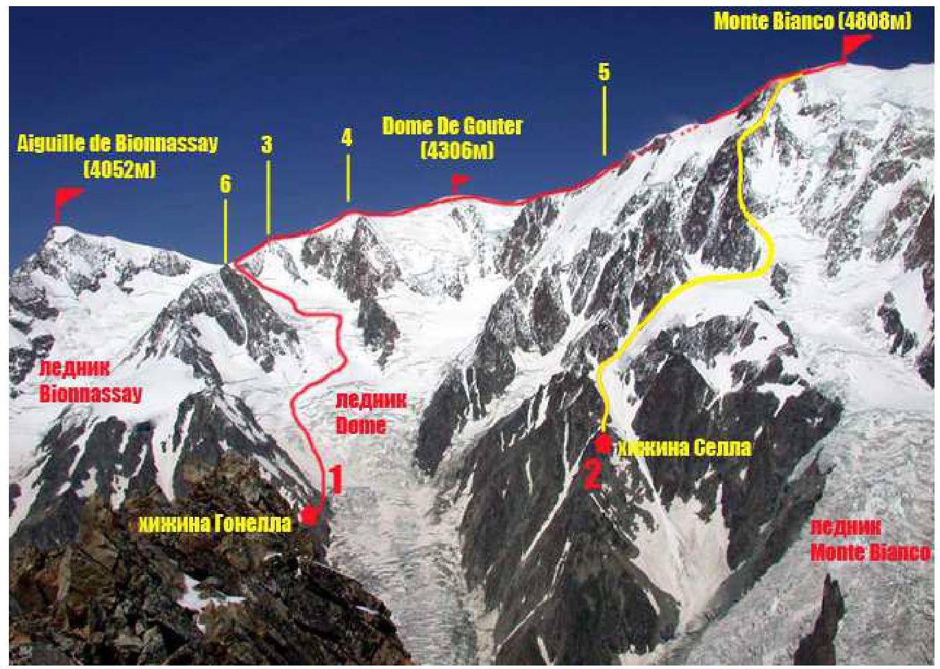
Annotations on the photo:
- Ascent route. "Italian Classic". From Gonella Hut and Bosses ridge (G. Bonin, L. Grasselli, A. Ratti, J. Gradin, A. Proment, 1890), 2B cat. diff.
- Tournette Spur route from Sella Hut (rif. Quintino Sella) 3A–3B cat. diff. (T. S. Kennedy, J. A. Carrel, J. Fisher, 1872)
- Des Italiens pinnacle (4003 m)
- 4154 m pinnacle
- Vallot Refuge (Bivacco Vallot) 4362 m
- Tour Des Aiguille Grises 3836 m
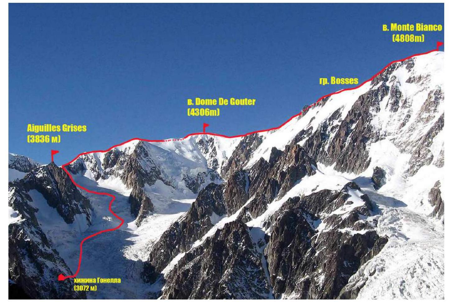
Photo of the route profile
Panorama of the area 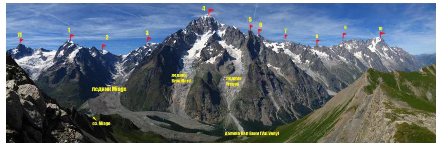
Annotations on the photo:
- Aiguille de Tré la Tête (3920 m)
- Dômes de Miage (3673 m)
- Aiguille de Bionnassay (4052 m)
- Monte Bianco de Courmayeur (4769 m)
- Aiguille Noire de Peuterey (3772 m)
- Mont Blanc du Tacul (4248 m)
- Tour Ronde (3794 m)
- Grand Flambeau (3559 m)
- Dent du Géant (4013 m)
- Grandes Jorasses (4202 m)
- Aiguille de Glacier (3818 m)
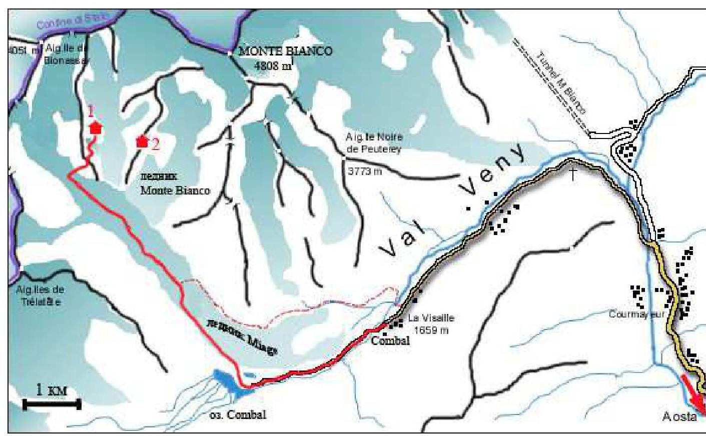
Area and Approach Description
Annotations on the diagram:
- Gonella Hut (rifugio Gonella) 3072 m
- Sella Hut (rif. Quintino Sella) 3363 m
The route to Gonella Hut from La Visaille is marked in red. An alternative route is shown with a dashed line.
Mont Blanc (Monte Bianco) is the highest peak in Western Europe. It is located in the Alps on the border between the French region of Haute-Savoie and the Italian autonomous region of Val d'Aosta. Ascents to the summit can be made from both France and Italy. The entire Mont Blanc massif is very popular among mountaineers and tourists and is also known as a ski resort. Therefore, the infrastructure around the massif is well-developed, with roads, campsites, hotels, high-altitude huts, cable cars, and many ski slopes. There is a tunnel connecting Italy and France, which runs under Mont Blanc and is 11.6 km long. The Mont Blanc massif consists of three main peaks: Mont Blanc (4807–4810 m), La Tourette (4747 m), and Monte Bianco di Courmayeur (4769 m).
There are many different mountaineering routes to the main summit of Mont Blanc, or Monte Bianco as the Italians call it. Most climbers approach from the French side. The routes are well-known and well-trodden. However, the routes from the Valle d'Aosta (Italy) side are less known and less popular. The classic route is from Gonella Hut. According to the Italian classification, it is rated PD+, which roughly corresponds to 2B cat. diff. according to the Russian classification.
The first ascent of this route was made on August 1, 1890, by Giovanni Bonin, Luigi Grasselli, and Achille Ratti, with the help of Joseph Gradin and Alexis Proment.
The first winter ascent was made by Graziadio Bolla, Joseph Creux, Alexis Creux, Cyprien Savoye, Albert Savoye, and Laurent Petigax.
This is the route our team followed. The ascent was part of a training camp organized by the CSKA Demchenko mountaineering club (Moscow).
Approach to Gonella Hut
First, take a bus to the village of La Visaille (Plan Lognan), the final stop for buses from Courmayeur. Then, walk up the road. It takes about an hour (3 km) to reach Plan Combal (a large, grassy valley with a lake). Here, turn right towards the Miage Glacier (ghiacciaio del Miage). The trail to Gonella Hut is marked "S15" and is signposted in yellow. Follow the trail through the forest to the steep moraine wall of the glacier, climb it, and continue along the upper part for 700 m. After the moraine meets the rocky ridge, descend onto the glacier and move along the edge. In July-August, the glacier is open, so the path is not particularly difficult, as all crevasses are visible and the glacier is relatively flat. Near the confluence of the Monte Bianco and Miage glaciers (about 50–60 minutes (2.5 km) from the moraine), start heading towards the middle of the Miage Glacier. From here, Gonella Hut is visible. It is located on the slope of the Grises ridge. Cross the glacier and follow the trail. Landmarks: the right turn on the Miage Glacier is at 45°48′49.1″N, 006°49′30.2″E (elevation 2620 m). The trail starts near the first large snow couloir on the left side of the Grises ridge. The lower part of the trail goes up to the right along grassy rock terraces, with chains for safety. The middle and upper parts are more challenging, with steep rock sections and snowfields. Metal ladders, ropes, and chains are installed for easier passage. The journey from La Visaille to Gonella Hut takes 4–6 hours, depending on the state of the glacier and the group's physical fitness.
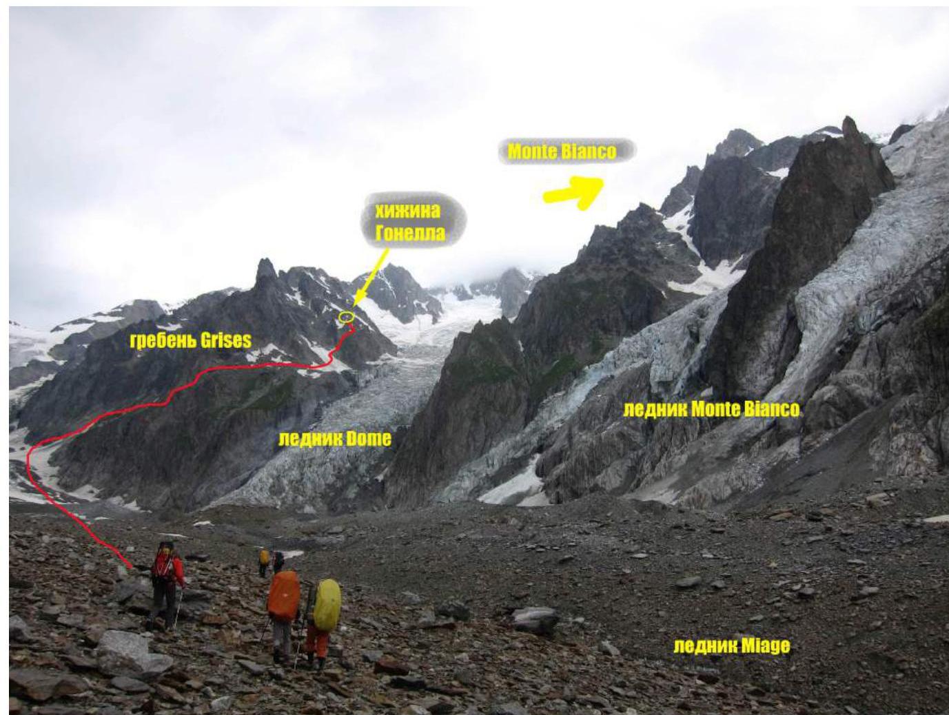
Photo of the approach. Taken from the middle part of the Miage Glacier on July 3, 2012.
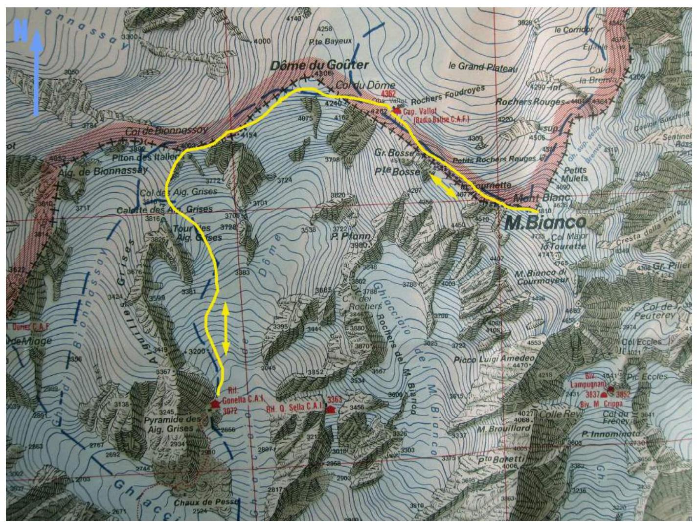
Route Map
Technical Photo of the Route

Route Description by Sections
| Section | Length, m | Slope, ° | Terrain | Category | Pitons |
|---|---|---|---|---|---|
| R0–R1 | 150 | 20–25 | Snow-rock | I | |
| R1–R2 | 1500 | 25–35 | Snow-ice | II | |
| R2–R3 | 200 | 20 | Snow-ice | I | |
| R3–R4 | 200 | 35–45 | Snow-ice-rock | II–III | |
| R4–R5 | 300 | 35 | Rock-snow | II | |
| R5–R6 | 500 | 40 | Snow-ice | II | |
| R6–R7 | 350 | 15 | Snow-ice | I | |
| R7–R8 | 400 | 40 | Snow-ice | II | |
| R8–R9 | 700 | 20 | Snow-ice | I | |
| R9–R10 | 1400 | 45 | Snow-ice | II |
R0–R1 — 150 m, 20°, I
From Gonella Hut, follow the trail up to the right. The terrain consists of rocky scree and small snowfields.
R1–R2 — 1500 m, 35°, II
Cross from the rocks to the glacier. Be aware of crevasses! Move up the glacier, initially on the left side, gradually shifting towards the center. Avoid small crevasses and bergschrunds, and pass three glacier rises. Reach the cirque under the Tour Des Aiguille Grises (3836 m).
R2–R3 — 200 m, 20: I
Move through the flat part of the cirque towards the snow-ice wall below the ridge between Tour Des Aiguille Grises and the SW ridge of Dôme De Gouter.
R3–R4 — 200 m, 45°, III
Cross a small bergschrund and ascend the snow-ice wall to the rocky belt under the ridge. Use alternating belays to climb onto the ridge (10 m rock section). Be cautious of loose rocks!
R4–R5 — 300 m, 35°, II
Continue up the ridge. Traverse simple rocks, sometimes snow and ice, to reach the Piton des Italiens pinnacle (4003 m).
R5–R6 — 500 m, 40°, II
Follow the narrow snowy ridge to the 4154 m pinnacle. Be aware of snow cornicing and overhangs!
R6–R7 — 350 m, 15°, I
Traverse the flat part of the ridge to the ascent towards Dôme De Gouter.
R7–R8 — 400 m, 40°, II
Climb up, initially on a less defined ridge, then on a snowy slope towards the summit. After passing a small drift, which runs along the western and southern sides of the summit, reach the flat part of Dôme De Gouter (4306 m).
R8–R9 — 700 m, 20°, I
Descend slightly to the right of the summit into a large depression before the Bosses ridge. The route converges with the French classic route from Gouter Hut. The first ascent on the ridge features the Vallot Refuge (Bivacco Vallot) 4362 m. Move towards the refuge.
R9–R10 — 1400 m, 45°, II
From the refuge, ascend the snowy ridge to Mont Blanc. The climb takes 1.5–2 hours. Be aware of snow cornicing and overhangs on the ridge! The summit is a flat snowy ridge.
The descent was made via the ascent route.
Additions and Recommendations for the Route:
The route is logical and relatively safe. Compared to the classic routes from the French side (via the SE face through Aiguille du Midi and the NW slope and Bosses ridge (through Dôme du Goûter)), which are rated 2A, this route has a greater elevation gain, is longer, and more technically challenging.
Before attempting the ascent, climbers are advised to undergo acclimatization.
To prepare for the ascent: — Ensure you have reliable and properly fitted personal snow and ice equipment (crampons, ice axes).
At Gonella Hut, you can: — Get advice on the route and its current condition; — Check the weather forecast; — Book accommodation and obtain route information by phone +39 016588101 or on the website: www.rifugiogonella.com↗.
In case of deteriorating weather, there is a risk of losing orientation, especially during descent. It is recommended to have: — Radio communication; — Navigation devices (GPS, compass, etc.).
The Vallot Refuge has an emergency communication system with rescuers.
Some GPS coordinates for the route: Gonella Hut (Rifugio Gonella) — 45°49′09.60″N, 006°49′55.60″E; Vallot Refuge (Vallot) 4362 m — 45°50′20.60″N, 006°51′07.78″E; Aiguilles Grises saddle (pass) — 45°50′05.50″N, 006°49′43.8″E; Dôme De Gouter summit — 45°50′32.89″N, 06°50′35.49″E; Junction near Vallot Refuge on the Italian-French routes — 45°50′26.80″N, 06°50′51.30″E; Mont Blanc summit (4808 m) — 45°49′57.00″N, 06°51′51.84″E.
Photo Illustrations

Photo 1. Section R0–R1. Gonella Hut. Taken on descent from the summit.
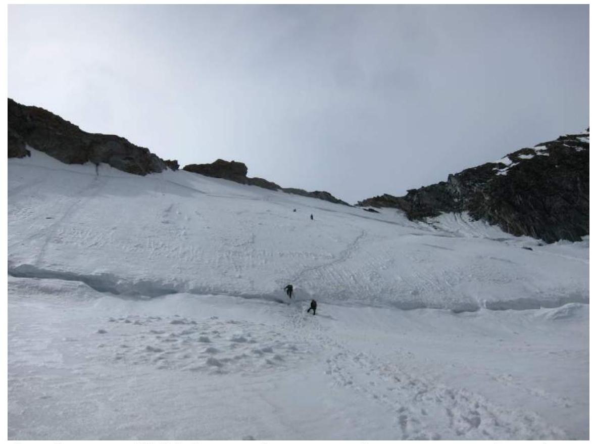
Photo 2. Section R3–R4. Bergschrund and snow-ice wall before reaching the ridge between Tour Des Aiguille Grises and the SW ridge of Dôme De Gouter.
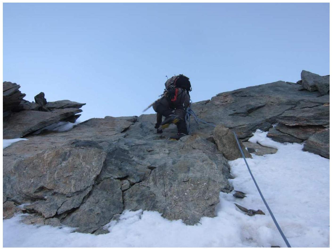
Photo 3. Section R3–R4. Crossing the rocky belt before reaching the ridge.
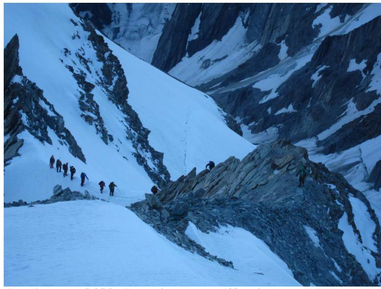
Photo 4. Section R4–R5. Traversing the start of the SW ridge of Dôme De Gouter.
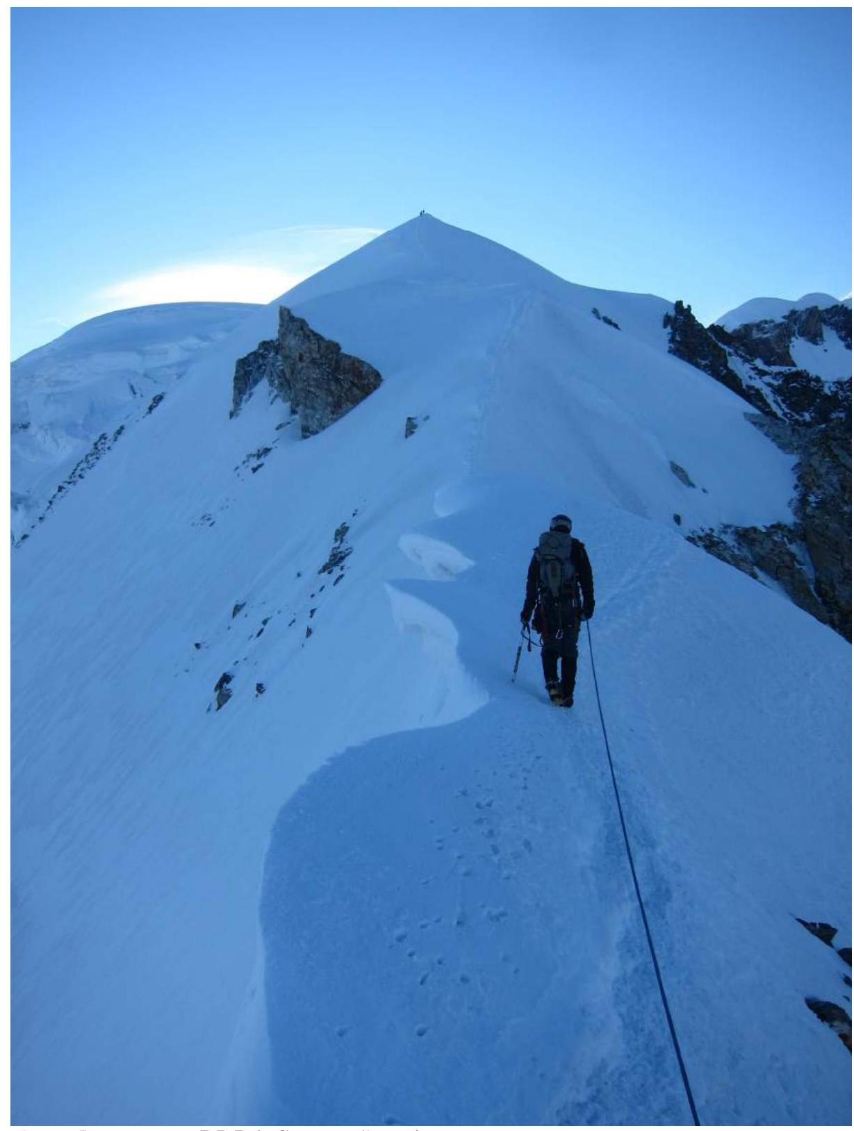
Photo 5. Section R5–R6. Snowy ridge with cornicing.
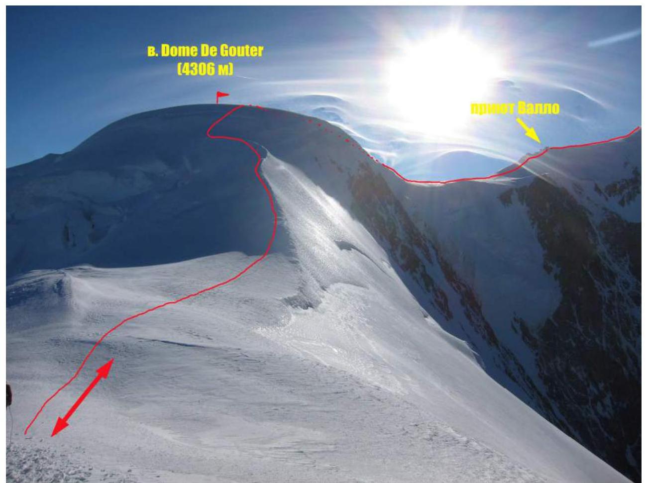
Photo 6. Section R6–R8. Approaching Dôme De Gouter summit along the ridge.
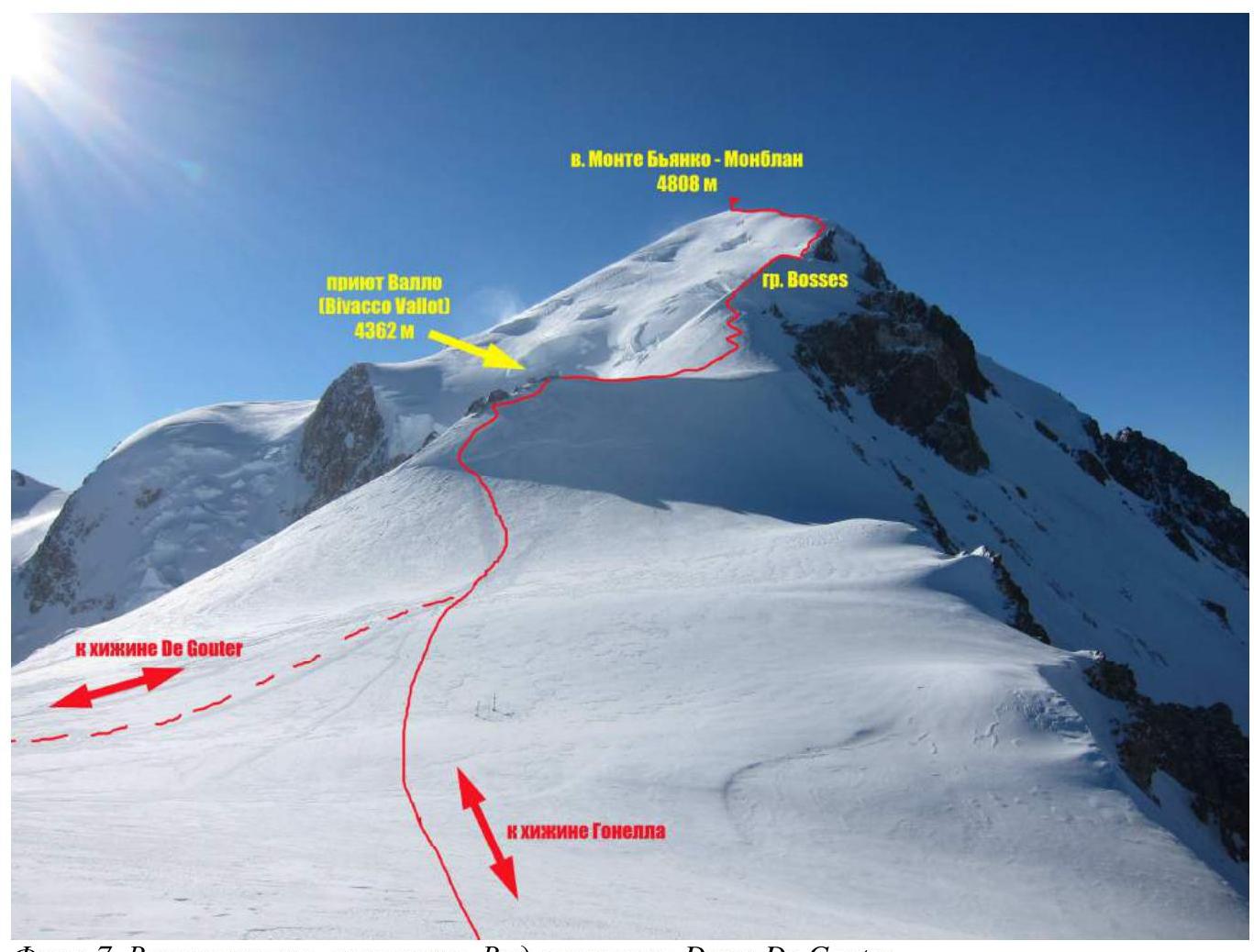
Photo 7. Upper part of the route. View from Dôme De Gouter summit.
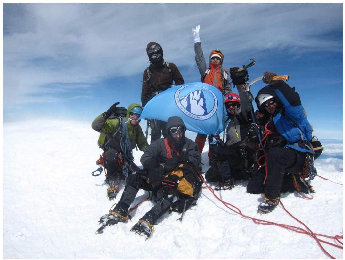
Photo 8. Team on Mont Blanc summit. Joint photo with another CSKA Demchenko team (led by E. Korol), who summited simultaneously with our group.


