
Report
On the ascent via the classic route through the SE ridge to Mönch (4107 m), 2A–2B cat. sl. Jungfrau region. Bernese Alps, Switzerland.
Moscow, 2013
Ascent Passport
- Alps. Bernese Alps. Switzerland. Section according to KMGV 2013 — 10.3.
- Peak Mönch (Mönch). Height 4107 m. Via SE ridge. Route name: classic route via SE ridge.
- Proposed category: 2A–2B cat. sl. First ascent: Christian Almer, K. Kaufmann, U. Kaufmann, and S. Porges. August 15, 1857.
- Route type: combined.
- Route elevation gain: 500 m (by altimeter)
Route length: 910 m, average slope: entire route — 37°
- Pitons left on the route: 0, used: friends-nuts — 0
- Team's moving hours: 2 hours, descent 1 hour
- Leader: A.V. Yurkin — MS
Team members:
- A.E. Volkov — MSMK
- Coach: A.E. Volkov — MSMK
- Departure to the route from BL: hour, day, month, year
Route started: 4:00, July 24, 2013. Reached the summit: 6:00, July 24, 2013. Returned to BL: 7:00, July 24, 2013. Descent from the summit: via the ascent route
-
Organization:
-
Responsible for the report: Yurkin A.V. Email: s2_aleks@mail.ru
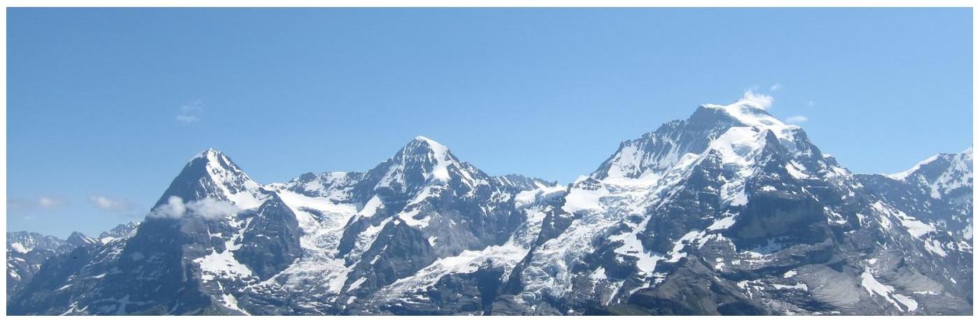
General photo of the summit.
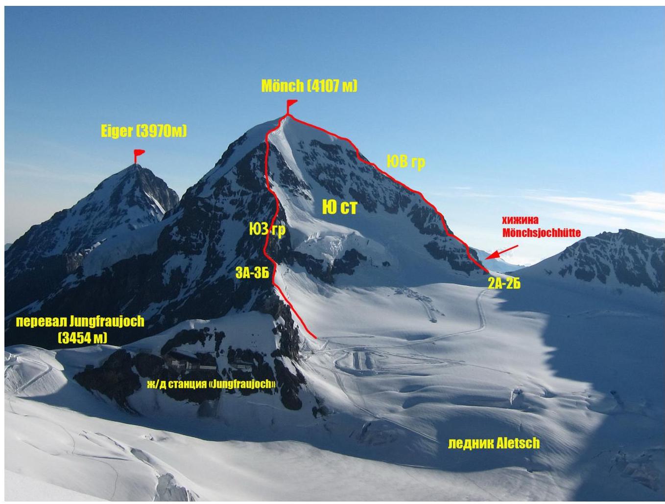
Photo of Mönch summit from the slopes of Rottalhorn. Photo taken on August 23, 2013.
Photo of the route profile
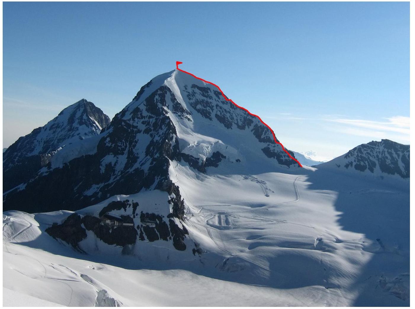
Photo of the route profile. Photo taken from the slopes of Rottalhorn. August 23, 2013.
Overview of Jungfrau region
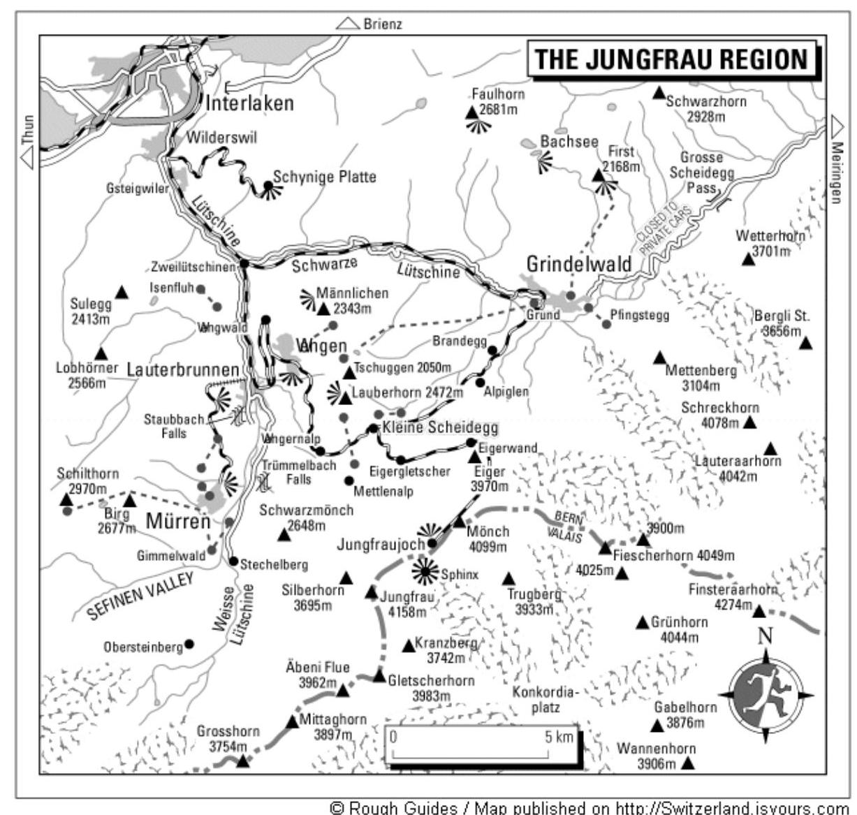
Map-scheme of Jungfrau region. Scheme taken from Switzerland.isyours.com
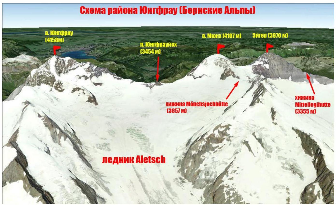
Scheme of Mönch (Ger. Mönch — monk) — a mountain peak in the Bernese Alps. It is the third peak in the trio (along with Eiger and Jungfrau) of the most recognizable mountains in the Bernese Alps. The border between the cantons of Bern and Valais in Switzerland runs along Mönch. This peak is part of the mountain ridge between:
- Jungfrau and Jungfraujoch pass to the west,
- Eiger to the east.
The mountain is located west of:
- Mönchsjoch pass (Ger. Mönchsjoch),
- Mönchsjochhütte alpine refuge (3657 m),
and north of:
- Jungfraufirn (Ger. Jungfraufirn),
- Ewigschneefäld (Ger. Ewigschneefäld) — two tributaries of the Great Aletsch Glacier.
The north side of Mönch forms a ledge wall above the Lauterbrunnen valley.
The Jungfrau cog railway tunnel passes right under the summit at a height of about 3300 m.
The first ascent to the summit was made on August 15, 1857, by:
- Christian Almer (Ger. Christian Almer)
- Christian Kaufmann
- Ulrich Kaufmann
- Sigismund Porges
Geographic coordinates of the summit: 46°33′30.24″ N 7°59′50.41″ E. The team's ascent to Mönch summit started from Mönchsjochhütte hut (3627 m), which served as a base for the entire cycle of ascents in the region. The hut is located on the Aletsch Glacier under the slopes of Mönch (4107 m). The approach to the hut was made by train to Jungfraujoch station on the eponymous pass (3454 m). Then on foot along a well-trodden road to the hut (1 hour). The ascent route is a classic path to this summit. It was first traversed by C. Almer, K. Kaufmann, U. Kaufmann, and S. Porges in 1857. According to the European classification, the route has a category of PD (French).
Technical photo of the route
| Section № | Length, m | Slope, ° | Relief type | Cat. sl. | Number of pitons |
|---|---|---|---|---|---|
| R0–R1 | 200 | 30 | rocks | II | |
| R1–R2 | 100 | 35 | Rocks-snow-rocks | II | |
| R2–R3 | 100 | 35 | rocks | II | |
| R3–R4 | 100 | 30 | rocks | II | |
| R4–R5 | 60 | 40 | Snow-ice | II | |
| R5–R6 | 50 | 50 | rocks | III | |
| R6–R7 | 50 | 45 | snow | II | |
| R7–R8 | 250 | 30 | snow | II |
Brief description of the route passage by sections.
Approach
From Mönchsjochhütte hut, move down the glacier to the rocky beginning of the SE ridge. In season, a trail is trodden here, and numerous groups follow the route (10 minutes).
R0–R1 — Ascend the rocks up the ridge. Snow-ice is encountered in places. Exit to a meteorological precipitation gauge on the left side of the ridge.
- 200 m
- 30
- II
R1–R2 — Up the ridge to a small rocky wall. Bypass from the left side on snow-ice, exit to the first snowy ridge. Insurance through folds. 100 m, 35°, II
R2–R3 — Up the ridge. Insurance through ice axes. 100 m, 35°, II R3–R4 — Move along the rocky ridge, a metal pin with a ring-eyelet is installed at the beginning of the ridge for insurance. Insurance through folds. 100 m, 30°, II
R4–R5 — Second snowy ridge. Insurance through ice axes. 60 m, 40°, II R5–R6 Movement along the rocky ridge. "Key to the route." There are two equivalent options for exiting to the insurance station: one option is from the left — first on snow, then on a short vertical wall; the second option is along the rocks of uniform complexity on the ridge (center-right). Metal pins are installed for insurance. 50 m, 50°, III
R6–R7 — Snowy ascent, insurance through ice axes and metal pins. 45 m, 45°, II. R7–R8 — After a small dip, exit to the pre-summit snowy ridge. The summit is a snowy-icy plateau, the junction of SE, SW, and N ridges. Attention! Be cautious of cornices while moving along the ridge! 250 m, 35°, II
Descent via the ascent route.
General recommendations for the route
The route is logical and safe. It is one of the most popular in the region. Interesting for training ascents, as it includes practically all types of relief. For training groups, it is recommended to bring a set of friends-nuts for organizing intermediate points.
At key points on the route (before exiting to the pre-summit ridge), insurance anchors are installed on stations every 40–50 m (anchors in the form of metal pins 1 m high with an eyelet at the top).
The route is often climbed "from the wheels":
- arrive by the first train to Jungfraujoch final station,
- then on foot along a well-trodden road to the beginning of the ridge,
- ascent and return back to the station by train.
In case of bad weather, it is possible to stay at Mönchsjochhütte hut.
In the lower part of the ridge, there are often icy patches on the rocks; in this case, it is recommended to wear crampons.
Photoillustration of the report.
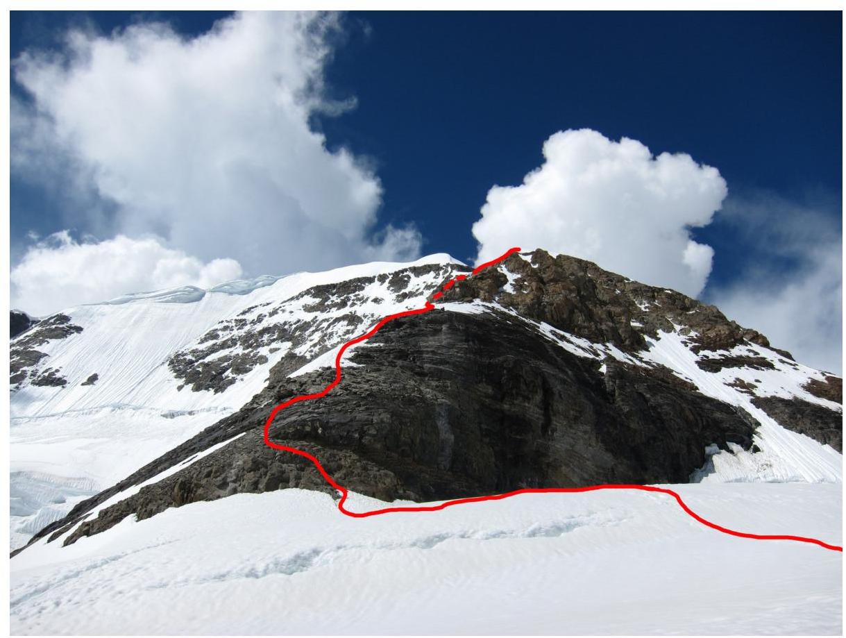
Photo 1. Lower part of the route. Photo from the road to Mönchsjochhütte hut. July 22, 2013.
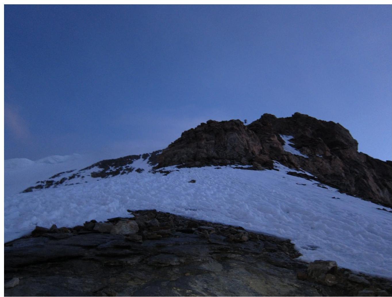
Photo 2. Section R0–R1. The precipitation gauge is visible on the ridge.
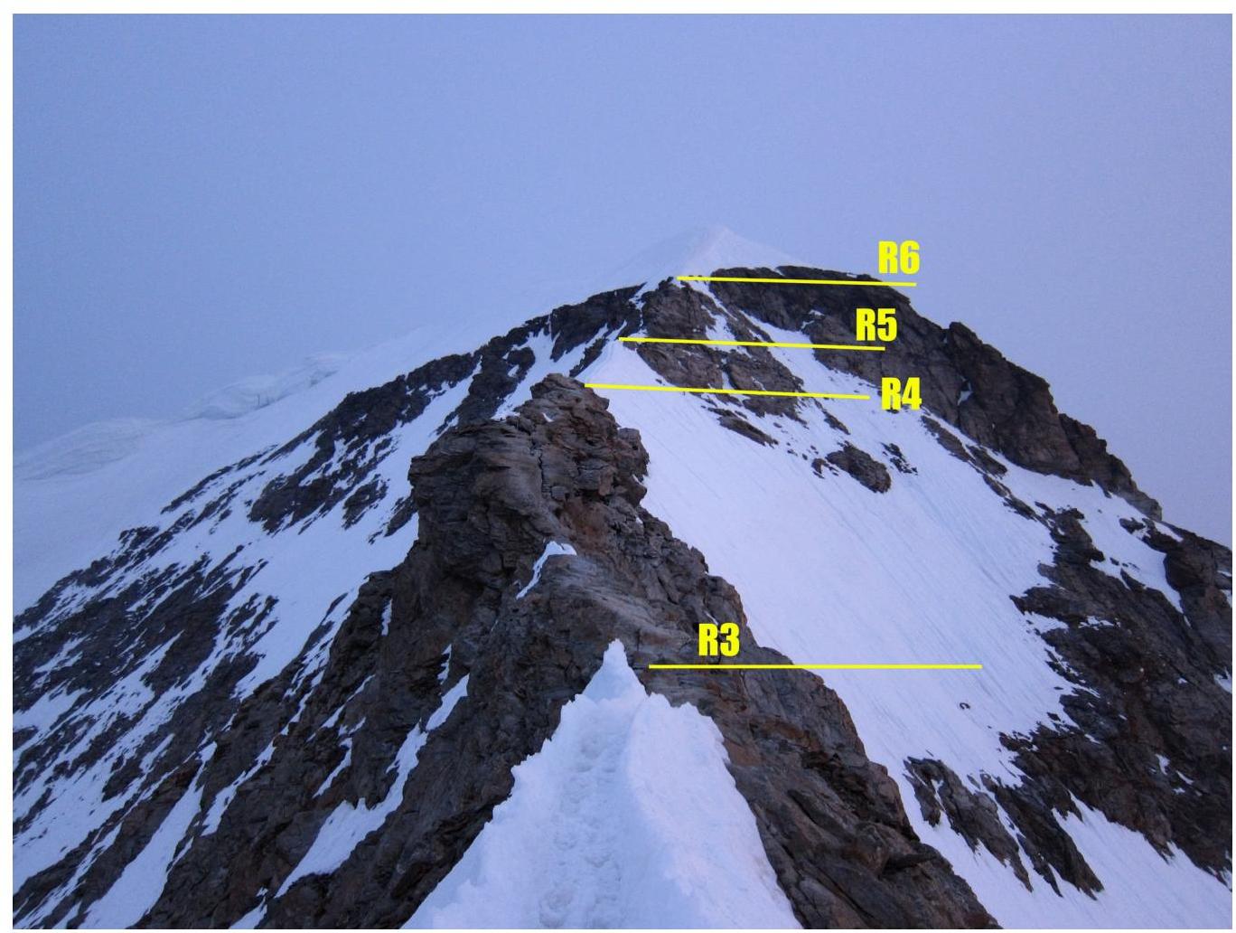
Photo 3. Section R3–R6. Beginning of the rocky ridge.

Photo 4. Section R5–R6. "Key point of the route. Passage options"
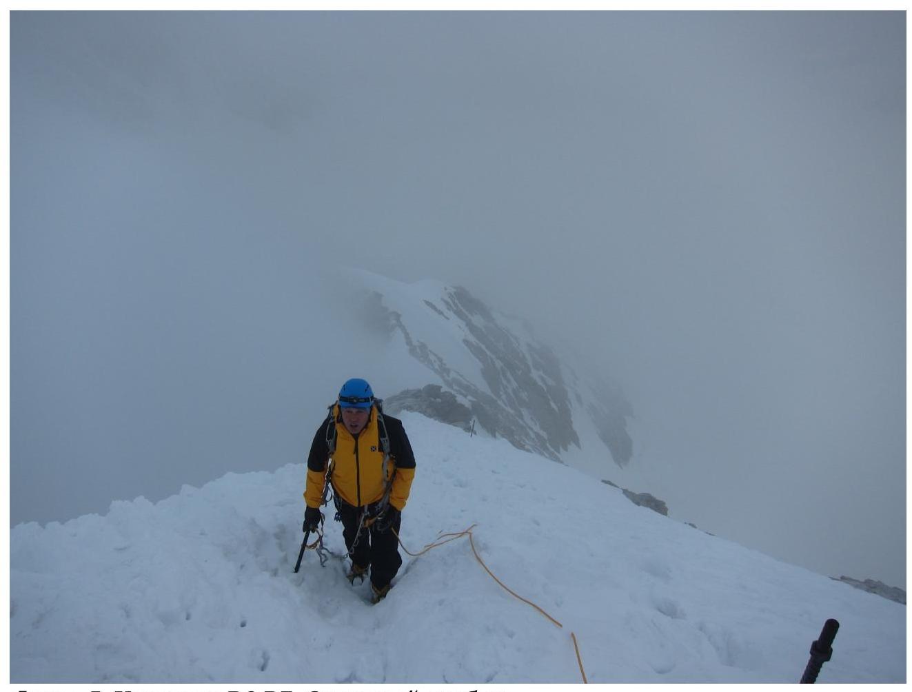
Photo 5. Section R6–R7. Snowy ridge
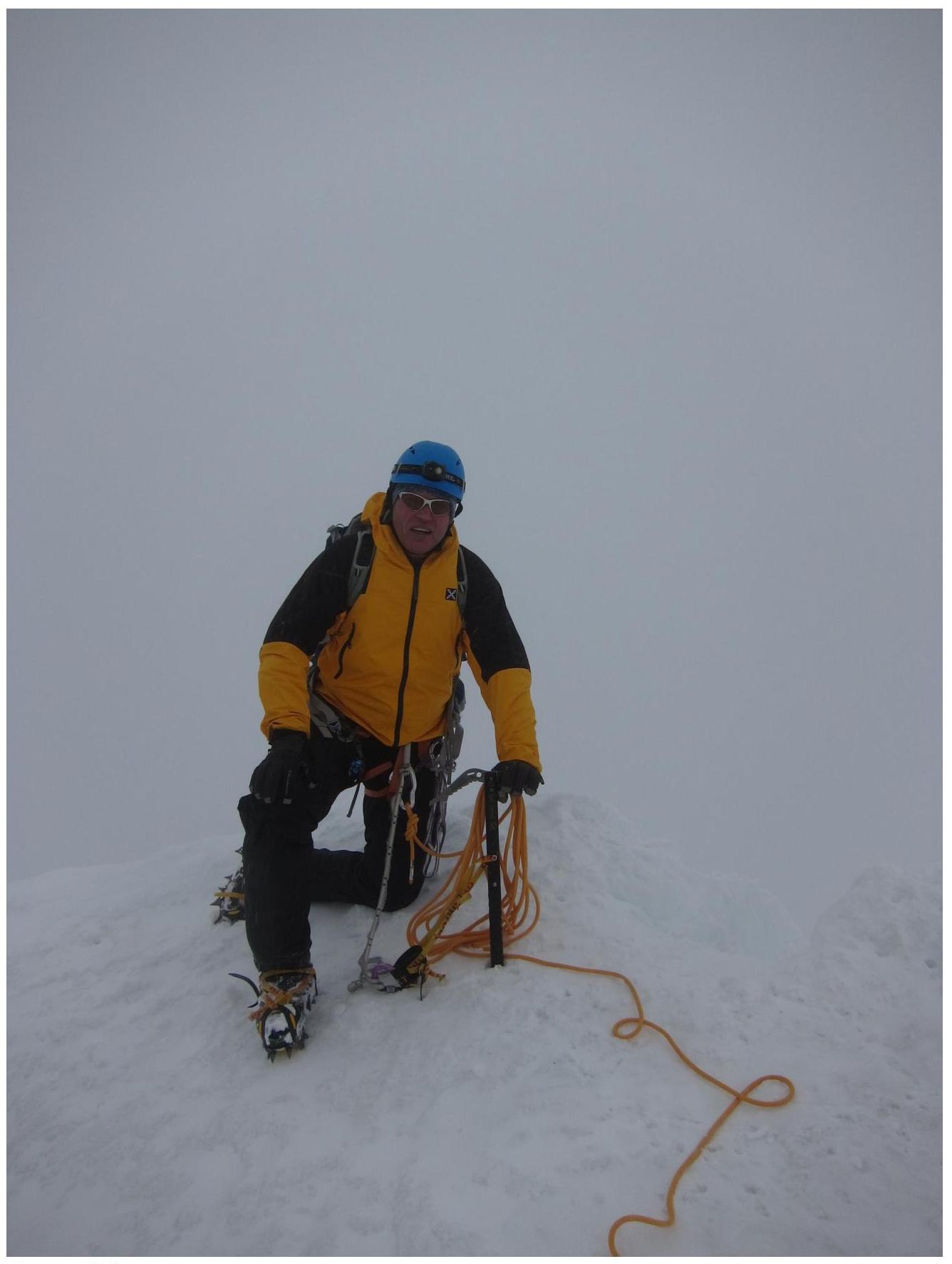
Photo 6. At the summit.
Comments
Sign in to leave a comment