
REPORT ON THE ASCENT OF INDEX PEAK (2595 m) VIA THE BRUNAT-PERRIN ROUTE OVER THE EASTERN RIDGE OF 3A CATEGORY BY THE TRAINING DEPARTMENT OF "POLITECHNIK" ALPINE CLUB ON JULY 29, 2018
Leader: V. A. Molodozhen Coach: V. A. Molodozhen
1. Ascent Passport
1. Ascent Passport
| №№ | 1. General Information | |
|---|---|---|
| 1.1 | Full name, sports rank of the leader | Molodozhen V. A. — Master of Sports |
| 1.2 | Full name, sports rank of participants | Fineeva A. A. — 3rd sports rank, Sadovsky S. V. — 3rd sports rank, Duplyak A. K. — 3rd sports rank, Lymanyuk A. Yu. — 3rd sports rank, Bakharev N. N. — 3rd sports rank |
| 1.3 | Full name of the coach | Molodozhen V. A. |
| 1.4 | Organization | "Politechnick" Alpine Club |
| 2. Characteristics of the Ascent Object | ||
| 2.1 | Region | France, Upper Savoy, Chamonix valley, Aiguilles Rouges |
| 2.2 | Valley | Éboulement d'Arolles (erroneously translated; most likely refers to a different location) / Égaux de Roux / likely correct is: Égaux or Egui des Rouges |
| 2.3 | Classification table section number for 2013 | 10.3 |
| 2.4 | Name and height of the peak | L'Index. Height 2595 m. |
| 2.5 | Geographical coordinates of the peak (latitude/longitude), GPS coordinates | 45.96839°N / 6.86654°E |
| 3. Route Characteristics | ||
| 3.1 | Route name | Brunat-Perrin route via the East ridge |
| 3.2 | Proposed category of difficulty | 3A |
| 3.3 | Degree of route exploration | Well-trodden, all stations are bolted, with some bolts on the route itself |
| 3.4 | Route terrain | Rock |
| 3.5 | Route elevation gain (data from altimeter or GPS) | Camp elevation — 1035 m; Elevation at the base of the rock ascent — 2380 m; Peak elevation — 2595 m; Elevation gain from camp to peak — 1560 m; Elevation gain from the base of the rock ascent to peak — 215 m. |
| 3.6 | Route length (in meters) | Distance from camp to the base of the rock ascent (approach length) — about 5 km, possibly using a cable car; Distance from the base of the rock ascent — 250 m; Descent from peak to the base of the rock ascent — 300 m; Total rock climbing length — 215 m; Total route length including approach and return to camp — 5250 m |
| 3.7 | Technical elements of the route (total length of sections with different difficulty categories, indicating terrain type (ice-snow, rock)) | III category, rocks — 55 m; IV category, rocks — 120 m; IV+/V- category, rocks — 30 m; |
| 3.8 | Descent from the peak | Rappelling from the peak to the NE towards Col de L'Index 45 m, then descent using simple climbing to the col 50 m, descent to the cable car via a scree slope |
| 3.9 | Additional route characteristics | — |
| 4. Team Action Characteristics | ||
| 4.1 | Movement time (team's walking hours, in hours and days) | 10 hours |
| 4.2 | Overnight stays | Campsite |
| 4.3 | Departure from overnight stays | 07:30, July 29, 2018 |
| 4.4 | Start of the route | 10:00, July 29, 2018 |
| 4.5 | Arrival at the intermediate ledge | 11:30, July 29, 2018 |
| 4.6 | Arrival at the north peak | 14:00, July 29, 2018 |
| 4.7 | Descent from the route | 16:00, July 29, 2018 |
| 4.8 | Return to overnight stays | 17:30, July 29, 2018 |
| 5. Report Responsibility | ||
| 5.1 | Bakharev Nikolai Nikolaevich | mrkoliaska@gmail.com |
2. Ascent Description
1. Ascent Object Characteristics
1.1 General photo of the peak
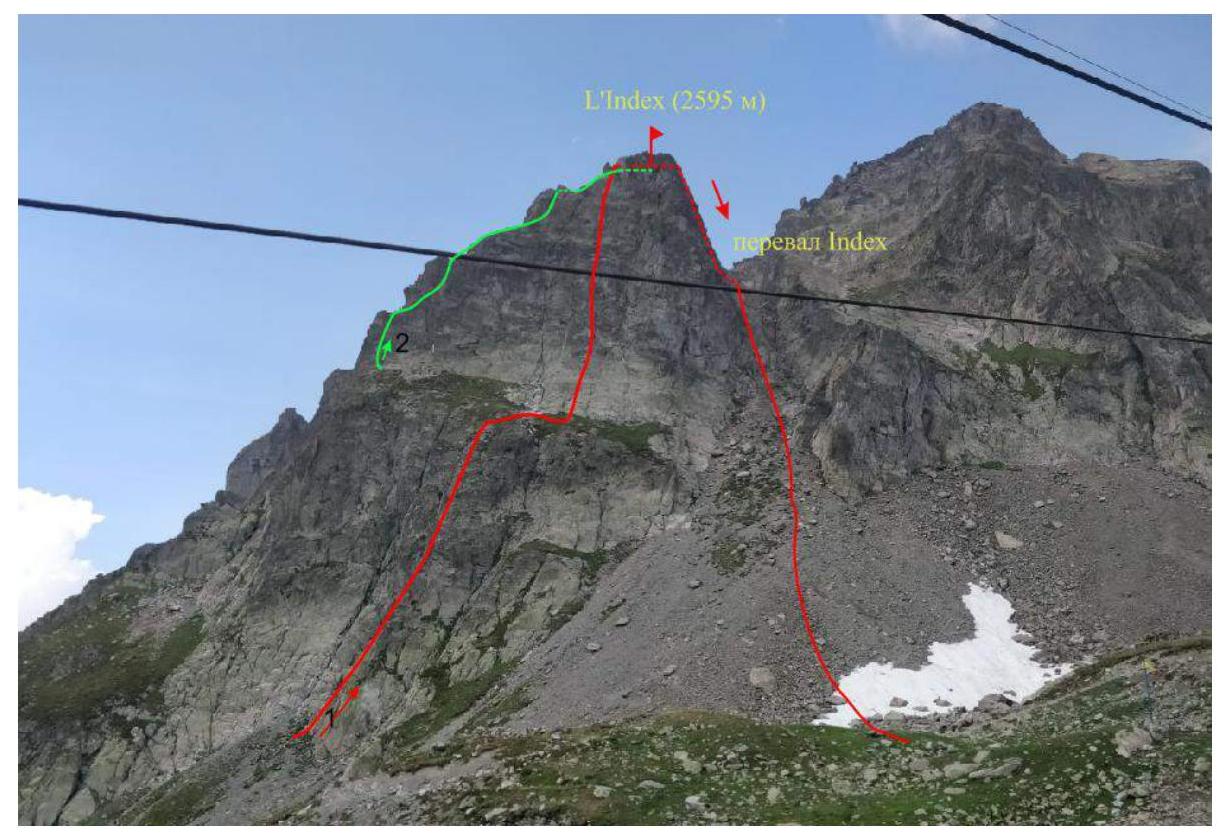
Photo taken on July 29, 2018. Location: Index cable car, France, Chamonix, view of Col de L'Index and the eastern slope of L'Index peak.
Routes:
- Brunat-Perrin route via the East ridge 3A category.
- Route along the South-East edge 2A category.
1.2 Photo of the route profile
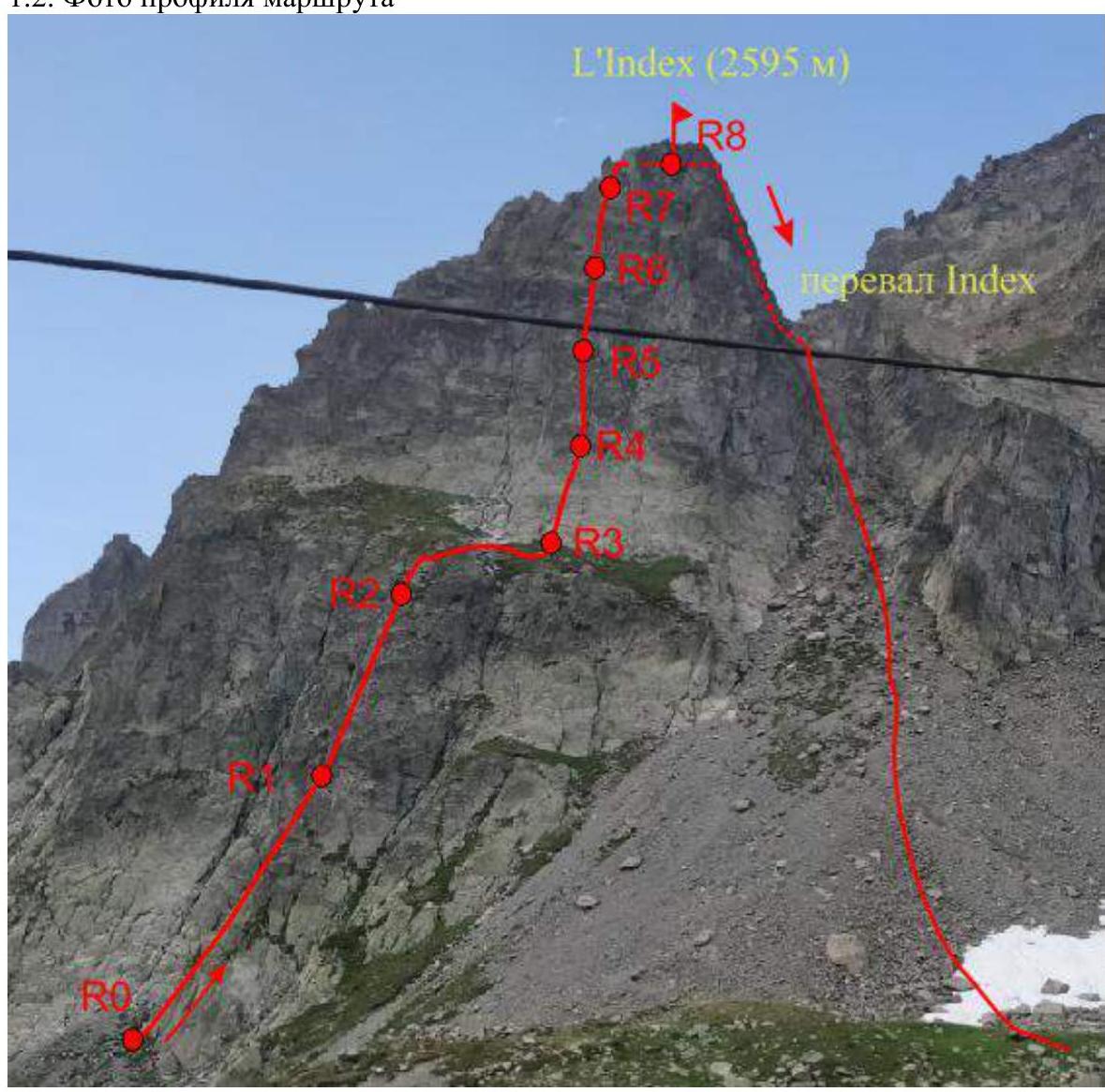
Photo taken on July 29, 2018. Location: Index cable car, France, Chamonix, view of Col de L'Index and the eastern slope of L'Index peak.
1.3 Photopanorama of the area
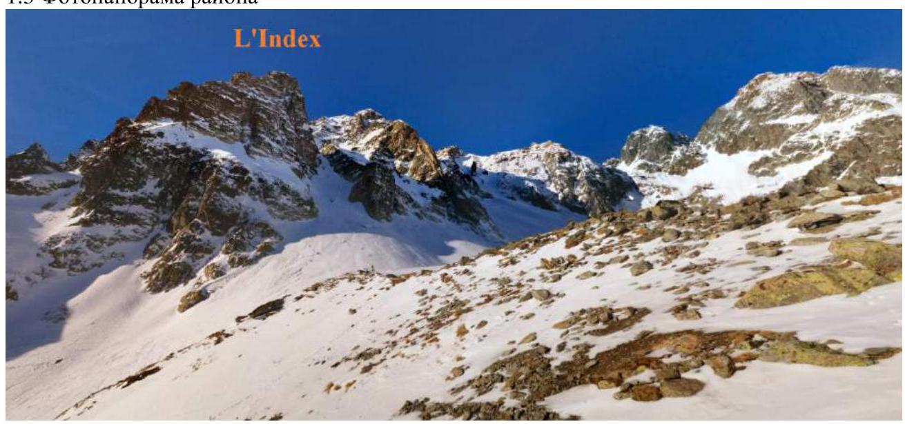
Photo taken in January 2015. Author: Fabio Tosato. Location: Index cable car, France, Chamonix, view of Col de L'Index and the eastern slope of L'Index peak.
1.4 Area map
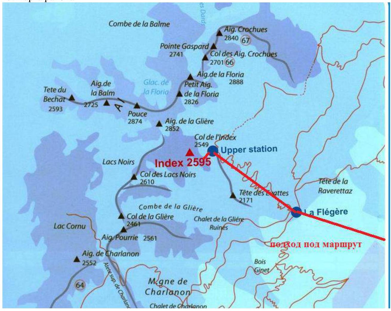
The area where the peak is located is in the Chamonix valley (Upper Savoy, France) in the area called Aiguilles Rouges, north of Chamonix. The route and approach are completed in one day. From the campsite, take the Flegere cable car, the second section of which goes to L'Index peak. To start the ascent, move along the cable car or the ski slope nearby. From the upper cable car station, move along the trail to the left for 5 minutes. The distance to the start of the route is about 5 km. The travel time is 3 hours. You can also use the cable car (operation starts at 08:00, it's recommended to buy tickets in advance). In this case, the ascent time is 20 minutes.
2. Route Characteristics

| Section № | Terrain | Category of difficulty | Length |
|---|---|---|---|
| R0–R1 | Rocks | IV/5b | 45 m |
| R1–R2 | Rocks | III/4c | 35 m |
| R2–R3 | Rocks | - | 45 m |
| R3–R4 | Rocks | IV/5b | 30 m |
| R4–R5 | Rocks | IV+/V-/5c | 30 m |
| R5–R6 | Rocks | IV/5b | 20 m |
| R6–R7 | Rocks | IV/5b | 25 m |
| R7–R8 | Rocks | III/3c | 20 m |
| Descent from the route | Rocks | 250 m |
3. Team Action Characteristics
| Section № | Description | Photo № |
|---|---|---|
| R0–R1 | Climbing difficulty category IV/5b. Overcome a 45 m slab, with the crux being a steep section approximately in the middle. | 1, 2 |
| R1–R2 | Move along the edge 35 m to a bolted station under a ledge, category III/4c. | |
| R2–R3 | Exit onto a wide ledge, 45 m. Simultaneous movement is possible. Move right on the ledge to the start of the third rope. An emergency descent from the route is possible from this ledge by simple climbing. | 3 |
| R3–R4 | Climb the slab upwards, slightly right, then back left. The first bolt is about 15 m high; it's recommended to organize additional protection. 30 m, IV/5b. | |
| R4–R5 | Continue climbing the slab along a crack. This section is the crux: difficulty category IV+/V-/5c, 30 m. | |
| R5–R6 | Climb upwards on slabs 20 m, V-/5b. The station is clearly visible. If the route is crowded and participants' qualifications allow for more challenging terrain, it's possible to move upwards and left, overcoming a V/6a section, 20 m, to reach a grassy ledge, from which it's relatively easy (III instead of IV on section R6–R7) to reach point R7. | |
| R6–R7 | Climb upwards on a steep wall divided by a crack. Ignore the ascent leading right. 25 m, IV/5b. From point R6, you can deviate right: initially, this seems easier (IV, 5a), but you'll need to overcome a (V, 6a) section, about 20 m, to reach the summit. | |
| R7–R8 | Climb III-/3c to reach the ridge 15 m. Then traverse to the summit 5 m. The summit is a narrow ridge. It's convenient to use slings for protection on large outcrops. | 4 |
| Descent from the route | Traverse along the ridge 10 m to the right, descend 5 m to a ledge, and traverse 10 m to rappelling stations. Two rappelling options are available. The optimal one is towards Col de L'Index on the ridge — 45 m. The main difficulty is reaching a point from which you can continue moving by simple climbing in one rope (see photo 5 for the most suitable descent point). Then descend by simple climbing to the col and continue moving along the scree slope to the cable car. If this rappel is occupied, a descent to the NW is possible. The descent is done in two ropes of 25 m each, with an intermediate station bolted. Then climb to Col de L'Index and continue moving along the scree slope to the cable car. | 4–6 |
Along with the route along the South-East ridge, it's one of the most popular routes to L'Index peak. All stations, including the rappelling one, are bolted. There are also bolted protection every 10–15 m on the route, but it's recommended to bring a set of medium-sized stoppers for additional protection. The bolted protection allows for easy navigation on the route. Due to the route's popularity, it's recommended to start before 08:00, as most people take the cable car. If using the cable car, it's advisable to buy tickets in advance to catch the first car. The path to the route is clearly visible. The route is not rockfall-prone. The proposed route category is 3A.

Photo 1. Approach to the route. The start of the route (R0) is marked.
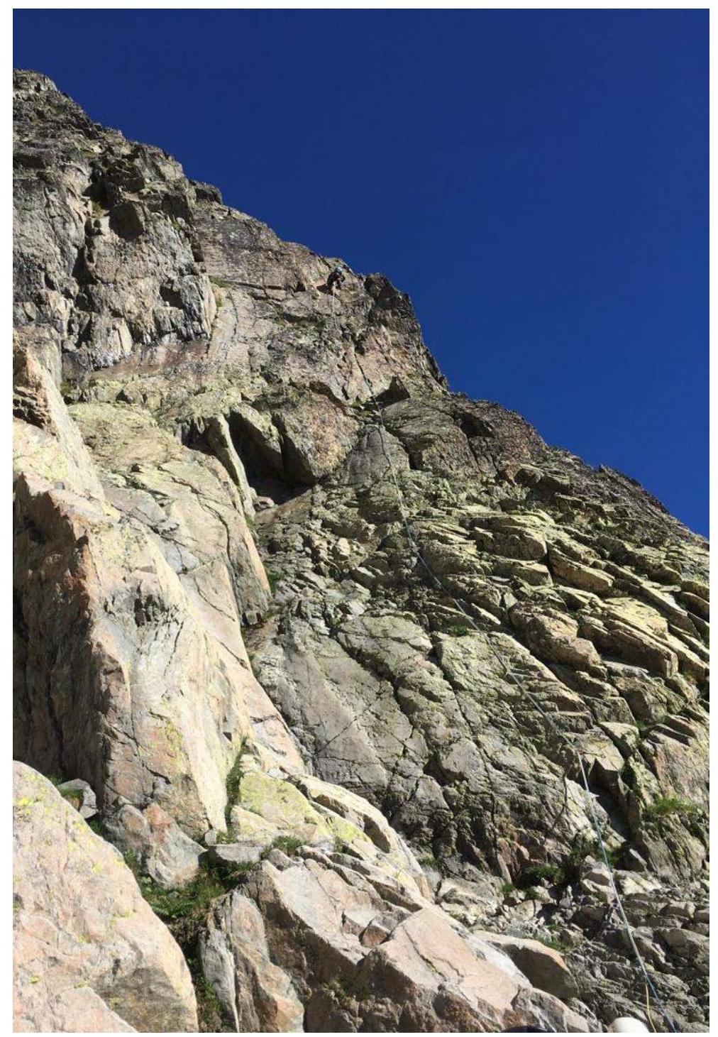
Photo 2. View from the route start. Section R0–R1.
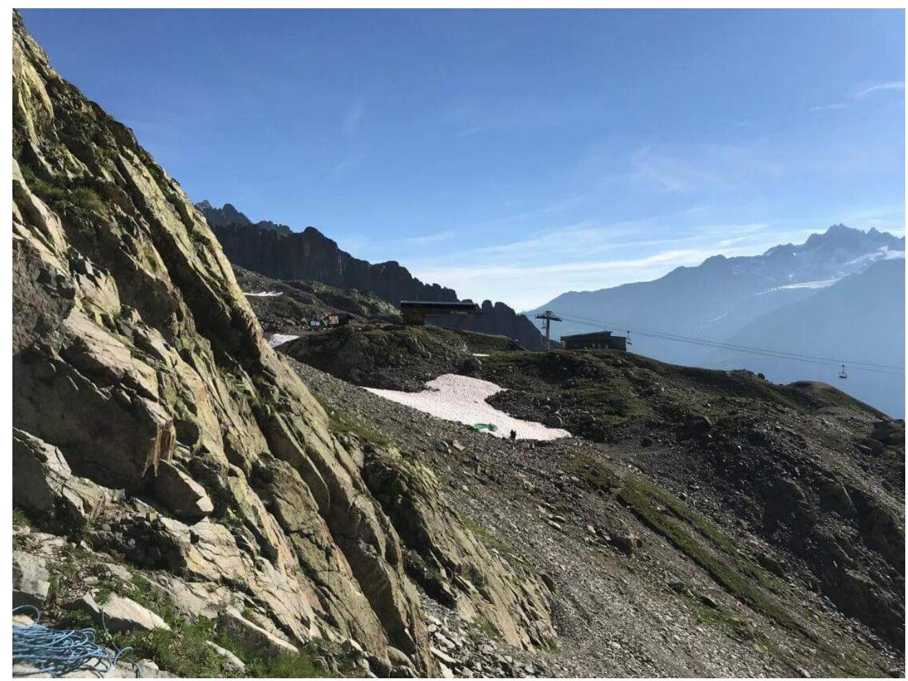
Photo 3. View from R3 towards the cable car.
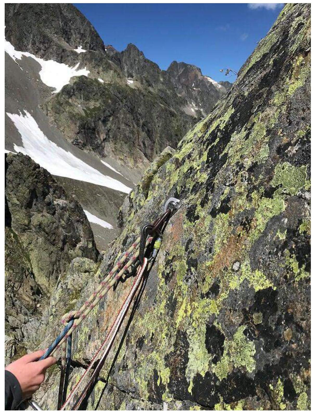
Photo 4. View from a ledge near one of the stations around point R8.

Photo 5. Rappelling towards Col de L'Index.
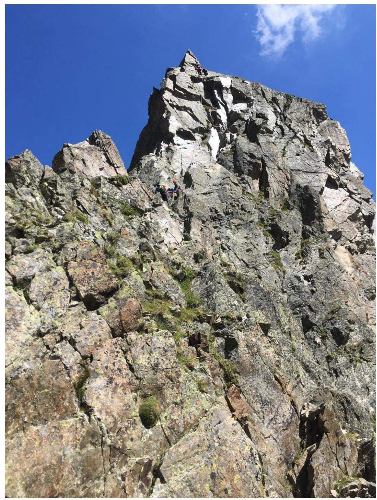
Photo 6. Alternative rappelling option (to the NW). People are on the intermediate and upper stations.
Comments
Sign in to leave a comment