
Report
On the ascent of the peak
"Gran Fourche" via the "Western ridge from the north" route, category 3A, by the team "Bodrye rebyata" for the period from 6:00 August 6, 2018 to 18:00 August 6, 2018
(France. "Haute-Savoie" area, "du Tour" Glacier) (3619 m)
Team leader: Olennikov S.A. Coach: Olennikov S.A.
Table of Contents
I. Ascent Passport — 3 II. Description of the Ascent — 5
- Characteristics of the Climbing Object — 5 1.1 General photo of the peak and route profile — 5 1.3 Photopanorama of the area — 6
- Route Characteristics — 7 2.1 Technical photo of the route — 7 2.2 Technical characteristics of route sections — 7
- Team Actions Characteristics — 8 3.1 Brief description of the route passage — 8 3.2 Team photo at the summit — 13 3.3 Route safety assessment — 13
I. Ascent Passport
| № | 1. General Information | |
|---|---|---|
| 1.1 | Full name, sports rank of the team leader | Olennikov Sergey Alexandrovich, Candidate Master of Sports |
| 1.2 | Full name, sports rank of the participants | Sharapova E.V., 3rd sports rank. Nesterova V.O., 3rd sports rank. Andriash A.A., novice. Teslenko S.V., novice. Tsybyrnak D.G. |
| 1.3 | Full name of the coach | Olennikov Sergey Alexandrovich, Candidate Master of Sports |
| 1.4 | Organization | Alpine Club "Polytechnic" |
| 2. Characteristics of the Climbing Object | ||
| 2.1 | Area | France, Alps, "Haute-Savoie" area |
| 2.2 | Valley/Glacier | "du Tour" Glacier |
| 2.3 | Classification table section number (2013) | - |
| 2.4 | Name and height of the peak | "Gran Fourche" ("Grande Fourche" in French). Height 3619 m |
| 2.5 | Geographical coordinates of the peak (latitude/longitude), GPS coordinates | 45.97631, 7.02119167 |
| 3. Route Characteristics | ||
| 3.1 | Route name | Western ridge from the north |
| 3.2 | Proposed category of difficulty | 3A (AD+) |
| 3.3 | Degree of route exploration | - |
| 3.4 | Nature of the route terrain | Combined |
| 3.5 | Route elevation gain (altimeter or GPS data) | 3320 m / 3619 m |
| 3.6 | Route length (m) | 1300 m |
| 3.7 | Technical elements of the route (total length of sections of various difficulty categories with terrain type indication) | Category I: ice/rock/combination — 100 m. Category II: ice/rock/combination — 650 m. Category III: ice/rock/combination — 650 m. Category IV: ice/rock/combination — 0 m. Closed glacier travel — 100 m. Rappelling (on descent) – 2 ropes, 100 m |
| 3.10 | Descent from the summit | Via the ascent route |
| 3.11 | Additional route characteristics | Water on descent |
| 4. Team Actions Characteristics | ||
| 4.1 | Time in motion (hours) | 8.5 hours (including 4.5 hours descent) |
| 4.2 | Overnight stays | No |
| 4.4 | Route start date | August 6, 2018 |
| 4.5 | Summit date | August 6, 2018 |
| 4.6 | Return to Albert Premier overnight stay | August 6, 2018 |
| 6. Person responsible for the report | ||
| 6.1 | Full name, e-mail | Andriash A.A. aandriyash@gmail.com |
II. Description of the Ascent
1. Characteristics of the Climbing Object
1.1 General photo of the peak and route profile
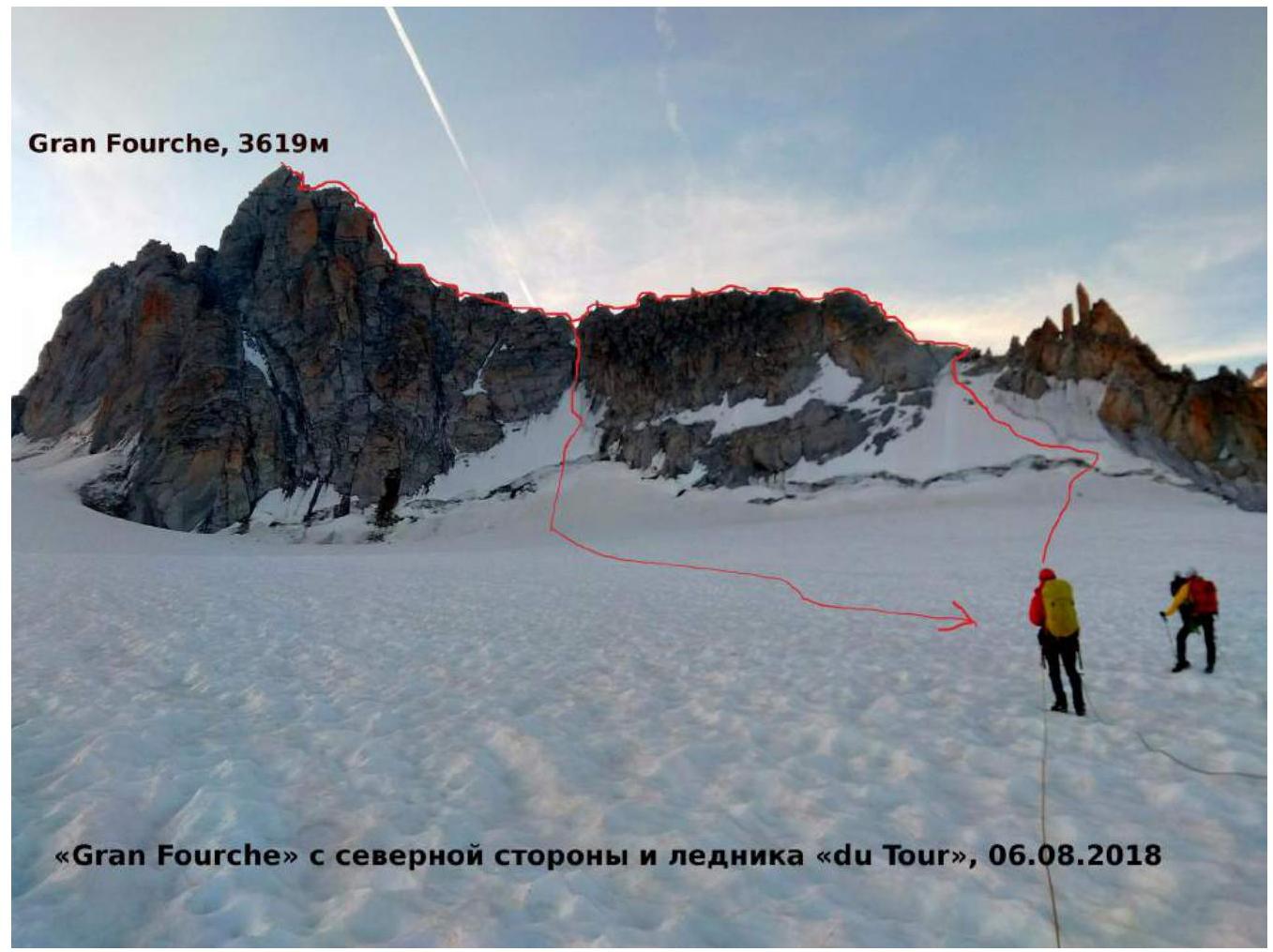
Photo 1. "Gran Fourche" peak from the north and "du Tour" Glacier, August 6, 2018
1.3 Photopanorama of the area
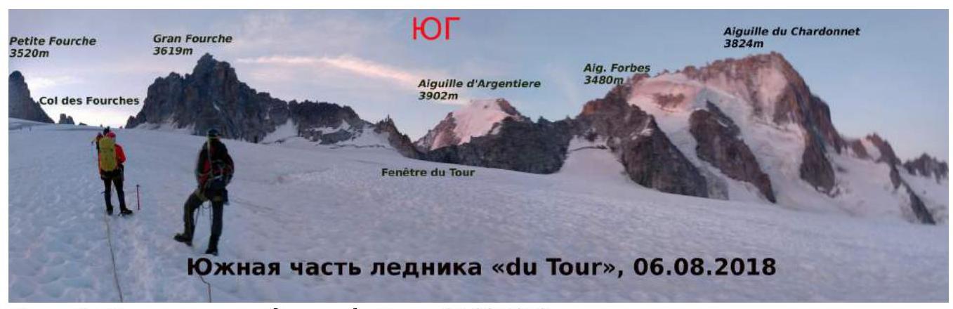
Photo 2. Southern part of "du Tour" Glacier, August 6, 2018
2. Route Characteristics
2.1 Technical photo of the route

Photo 3. Technical photo of the route
2.2 Technical characteristics of route sections
| Section № | Length (m) | Steepness (°) | Terrain characteristics | Difficulty category | Number of pitons |
|---|---|---|---|---|---|
| R0–R1 | 150 m | 37–90° | Snow/Ice/Average scree | III | - |
| R1–R2 | 300 m | 0–80° | Good rocks | II | - |
| R2–R3 | 150 m | 0–75° | Broken rocks/Average scree | III | - |
| R3–R4 | 350 m | 0–90° | Heavily broken rocks/Large scree | III | - |
| R2–R5 | 200 m | 45–90° | Average scree/Snow/Ice | III | Rappelling loop |
3. Team Actions Characteristics
3.1 Brief description of the route passage
Approach — from Albert Premier hut traverse by rocks to the start of the snowfield, direction towards Aiguille du Tour. Then follow the path up the glacier, bypass Signal Reilly rock outcrop from the north, after the last rocks move to the right, towards Gran Fourche and Chardonnet, gaining altitude. At the end of the ascent, the start of the route is clearly visible. Crevasses are possible on the way.
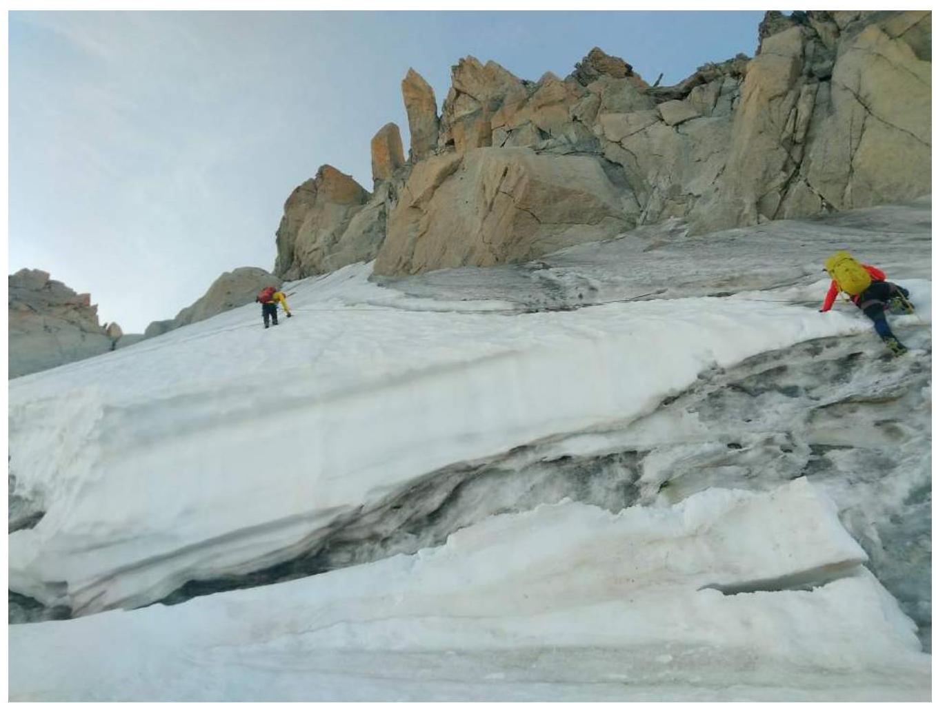
Photo 4. R0–R1
R0–R1 — Overcome the bergschrund, then move left up the snow and ice to the scree. Belaying via ice screws. 150 m, 37–90°, III

Photo 5. R1–R2 — Move left up the ridge to the descent couloir, pay attention to the descent path. Rocks are quite solid. Many passage options, varied terrain. Belaying via natural features. 300 m, 0–80°, II
R2–R3 — Continue moving along the ridge. When bypassing obstacles, prefer the right side. Various scree is present, rocks are relatively monolithic. Belaying using terrain features. 150 m, 45°, III
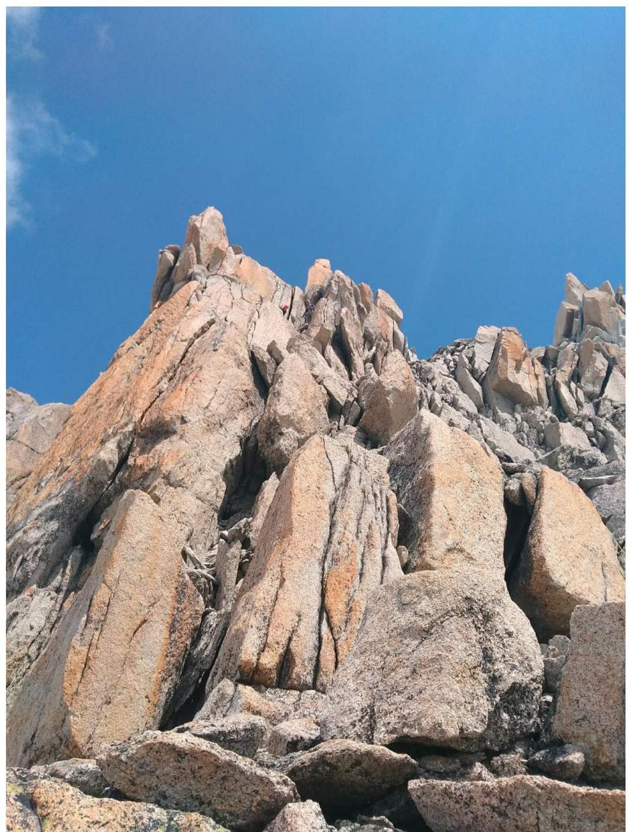
Photo 6. R3–R4 R3–R4 — The summit is bypassed on the right. A large amount of loose rock, many chimneys. Climbing alternates with movement along narrow and medium-sized ledges.
Requires utmost care in climbing due to rock fragility.
"Key to the route". Belaying using terrain features. 300 m, 60°, III
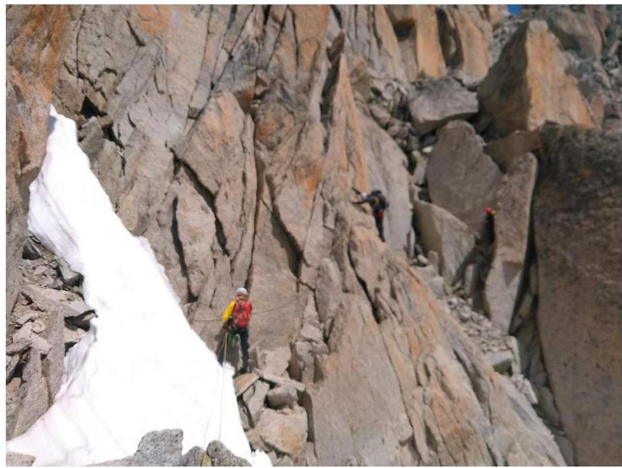
Photo 7. Descent on R3–R4 Descent — down R3–R4 by climbing down, then two rappels on R2–R5. On R3–R4, belaying using terrain features with slings, R2–R5 requires ice screws for intermediate anchor organization. Ice condition is poor. Other descent options are subject to rockfall.

Photo 8. R2–R5
3.2 Team photo at the summit
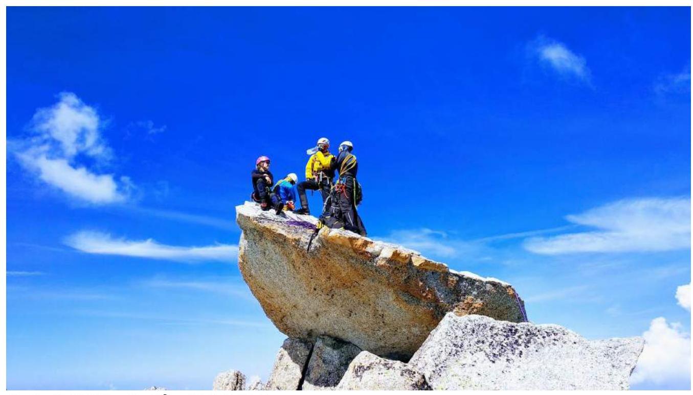
Photo 9. Team photo at the summit
3.3 Route safety assessment
The route undoubtedly requires careful climbing and attention due to rockfall hazard. There is a large amount of unstable rock and scree of various sizes. Requires a good understanding of belaying on descent. There is a single safe descent option, other options are subject to rockfall.
On section R3–R4 to the summit, there is no communication: radio does not reach Argentiere, mobile communication is unstable, on other sections of the route there were no complaints about communication.