Report
On the ascent of the CSKA team named after Demchenko to the summit of Gran Paradiso (4061 m) via the NW slope, category 1B difficulty.
Graian Alps, Valle d'Aosta region, Gran Paradiso National Park
Team leader: A. K. Popov Senior coach: E. V. Kuznetsova
Ascent Passport
- Graian Alps (Italy). Gran Paradiso area. № 10.3 (according to KGVМ 2011)
- Mt. Gran Paradiso 4061 m via NW slope (first ascent – M. Payot, J. Tairraz, 1860)
- Proposed category – 1B difficulty
- Route type: combined
- Route elevation gain: 1300 m
Route length: 4050 m.
Average slope angle:
- main part of the route – 30°
- entire route – 25°
- Pitons left on the route:
total — _______; including bolted pitons —
- Team's total climbing time: 5 hours (not including descent)
- Team leader: surname, name, sports rank — Popov A., 2nd sports rank. Team members: surname, name, sports rank Kuznetsova Yu. P., 1st sports rank, Bonchuk A. N., 2nd sports rank, Shcheglov I. E., 2nd sports rank, Turbin N. V., 2nd sports rank
- Coach: Kuznetsova E. V.
- Departure from Base Camp:
Route started: 7:00 AM, June 26, 2012.
Reached the summit: 2:00 PM, June 26, 2012.
Return to Base Camp: 5:00 PM, June 26, 2012.
Descent from the summit: via the ascent route down to Vittorio Emanuele II hut;
-
Organization: CSKA training camp named after Demchenko (Moscow)
-
Report responsible: Shcheglov I. E., A. V. Yurkin.
Email addresses:
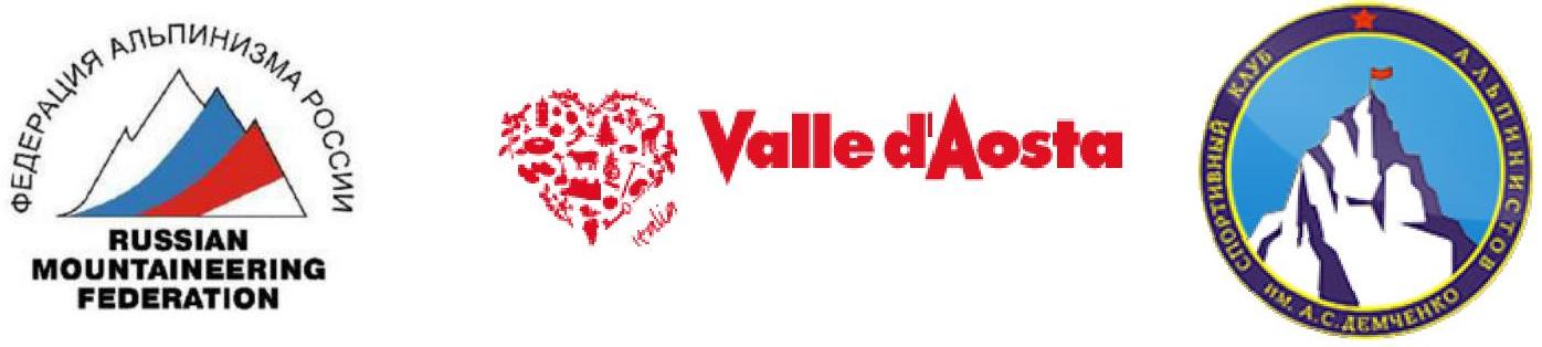
General photo of the summit.
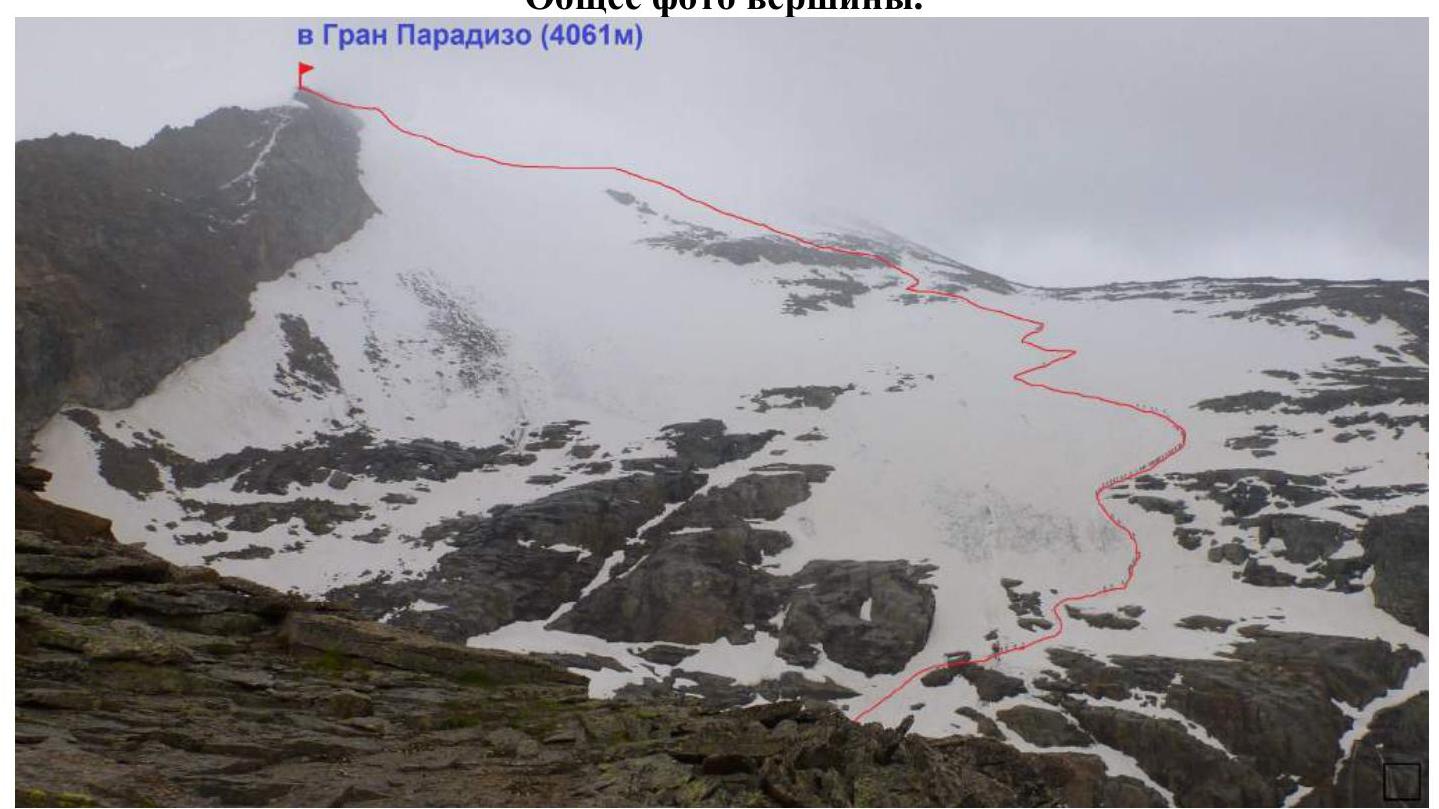
Classic route to Mt. Gran Paradiso via the western slope. Photograph taken from the NW ridge of Gran Paradiso on July 8, 2012
Upper part of the route to Mt. Gran Paradiso. Photo taken from Monchrové glacier on June 27, 2012
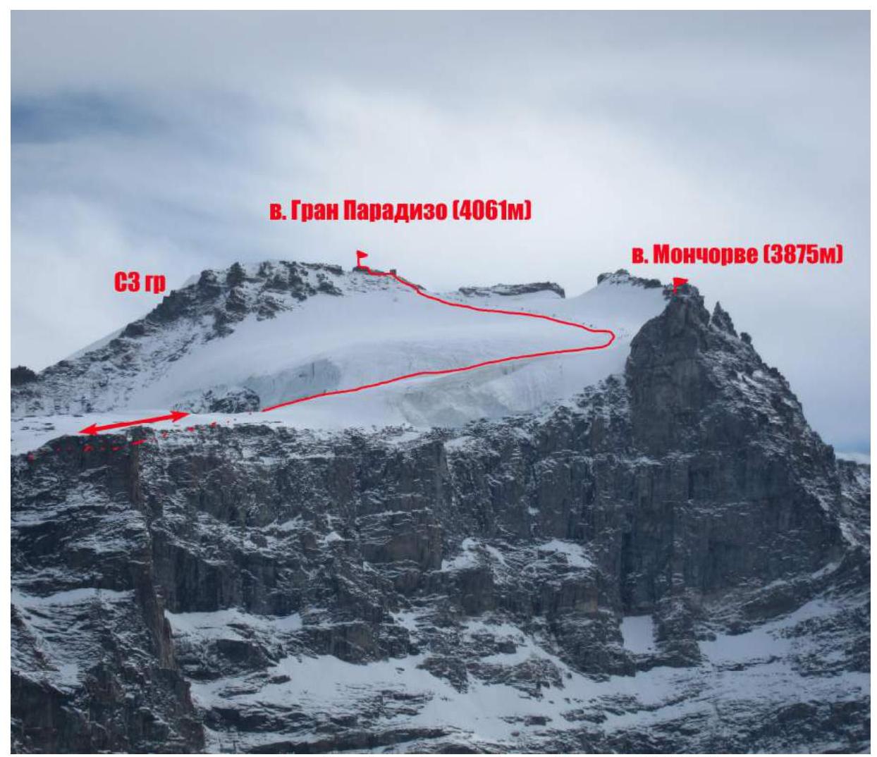
Panorama of the area.
 Overview of the Gran Paradiso area.
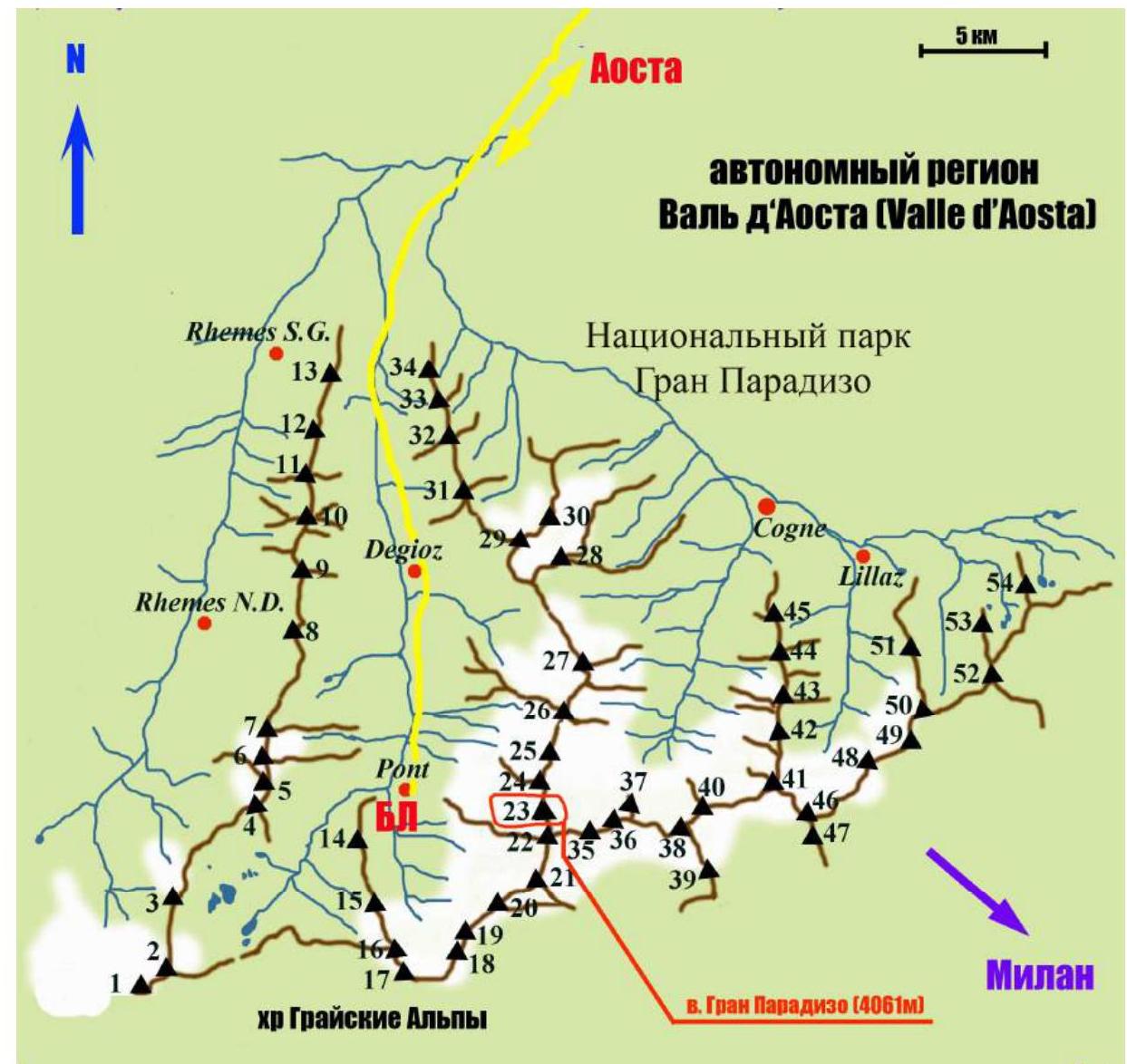
Peak labels (with elevations) on the map:
1 Punta Galisia 3346 m, 2 Punta Basei 3338 m, 3 Punta Gran Vaudala 3272 m, 4 Taou Blanc 3438 m, 5 Aouillé 3440 m, 6 Cima di Entrelor 3430 m, 7 Punta Percià 3227 m, 8 La Roletta 3384 m, 9 Punta Bianca 3427 m, 10 Punta Bioula 3414 m, 11 Punta del Ran 3272 m, 12 Punta Chamoussière 2942 m, 13 Monte Paillasse 2414 m, 14 Cima dell'Arolley 2996 m, 15 Cima di Seiva 3075 m, 16 Punta Fourà 3411 m, 17 Mare Pércia 3385 m, 18 Denti del Broglio 3454 m, 19 Becca di Monciair 3544 m, 20 Ciarforon 3642 m, 21 La Tresenta 3609 m, 22 Becca di Moncorvè 3875 m, 23 Gran Paradiso 4061 m, 24 Piccolo Paradiso 3923 m, 25 Becca di Montandayné 3838 m, 26 Herbetet 3778 m, 27 La Gran Serra 3552 m, 28 Punta Rossa della Grivola 3630 m, 29 La Grivola 3969 m, 30 Grivoletta 3514 m, 31 Gran Nomenon 3488 m, 32 Mont Favret 3173 m, 33 Punta Valletta 2793 m, 34 Becca Piana 2271 m, 35 Punta Ceresole 3777 m, 36 Testa della Tribolazione 3642 m, 37 Testa di Valnontey 3562 m, 38 Becca di Gay 3621 m, 39 Becco Meridionale della Tribolazione 3360 m, 40 Roccia Viva 3650 m, 41 Torre del Gran San Pietro 3692 m, 42 Punte Patri 3581 m, 43 Punta Valletta 3356 m, 44 Punta di Valmiana 3244 m, 45 Punta Fenilia 3053 m, 46 Punta d'Ondezana 3452 m, 47 Becco di Valsoera 3369 m, 48 Punta delle Sengie 3408 m, 49 Monveso di Forzo 3322 m, 50 Grande Arolla 3246 m, 51 Punta della Tsesère 3117 m, 52 Torre di Lavina 3308 m, 53 Punta di Acque Rosse 2952 m, 54 Punta Nera 3064 m
Approach route from the base camp (Pont campsite) to Vittorio Emanuele II hut and Chabod hut.
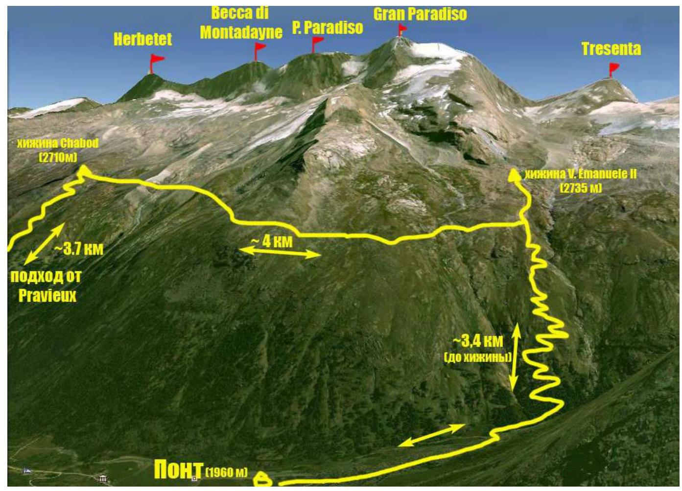
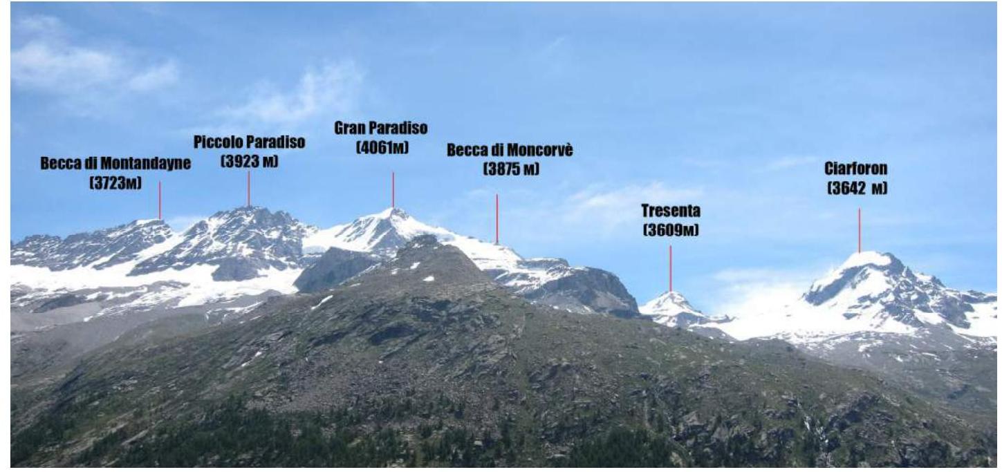
The summit of Gran Paradiso (4061 m), which was the destination of the ascent, is located within the Gran Paradiso National Park. The park is situated in the Graian Alps in the autonomous region of Valle d'Aosta, northern Italy. The highest point in the Gran Paradiso area is 4061 m, making it the seventh highest peak in the Alps (Mont Blanc being the first). The Valle d'Aosta region is heavily mountainous, featuring iconic Italian and Alpine peaks such as Monte Bianco (Mont Blanc), Grand Jorasses, Cervino (Matterhorn), and Gran Paradiso. Most climbing routes of interest are found in the Gran Paradiso range. With peak elevations between 3500–4000 m, the area features a variety of terrain including rock, ice, and snow. Many combined routes are available, with difficulties ranging from 1st to 4th category, and some 5th category routes. The ascent to Gran Paradiso was part of the CSKA training camp named after Demchenko (Moscow) in June – early July 2012. The base camp was located in the Pont campsite, the highest and final settlement in the Valsavaranche valley, at an elevation of 1950–2000 m. The direct ascent began from the Vittorio Emanuele II hut, situated at the foot of Gran Paradiso at 2732 m. The approach from Pont takes about 2 hours via a convenient trail. Gran Paradiso is situated between the peaks of Piccolo Paradiso (3923 m) and Becca di Moncorvè (3875 m). The geographical coordinates of the summit are 45°31′6.25″ N, 7°16′1.19″ E. The route is classified as F in the Italian difficulty grading system. The first ascent was made on September 4, 1860, by guides Michel Payot and Jean Tairraz from Chamonix, along with two English clients, John J. Cowell and William Dundas.
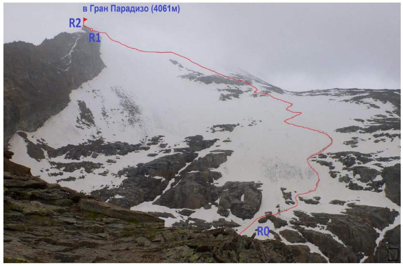
Route Section Description
| Section № | Length, m | Angle, ° | Terrain type | Difficulty category | Number of pitons |
|---|---|---|---|---|---|
| R0–R1 | 4000 m | 20–30 | Snow-ice | 1 | |
| R1–R2 | 50 m | 0–60 | Rock | 3 | 3 |
Technical photograph of the route
Brief Description of Route Passage by Sections
From Vittorio Emanuele II hut, follow the trail (partly on large scree) towards the Western ridge, with rock outcrops directly above the hut. Bypass the start of the ridge on the left and reach the lower part of the Gran Paradiso glacier. Continue up the gully formed by the NW and W ridges until the "ram's foreheads," where a steep ascent begins ("First ascent") on snow ( местами лёд). Crampons are recommended here.
R0–R1: From the "ram's foreheads," move up and to the right. Rock outcrops of the Western ridge are on the right. Reach a more gentle slope. Before the second steep section, there will be a small ridge of rock outcrops. Cross these and continue straight up the snow-ice slope at 25–30°. After 300 m, the slope becomes more gentle, and the summit of Moncorvè is visible on the right. Ascend to a large depression behind Moncorvè (3875 m). Continue on a long ascent up the slope of the SE ridge. Climb the 20–30° snow slope to the pre-summit rocks.
R1–R2: From the large rock (gendarme) with memorial plaques, traverse left for 50 m. The statue of the Madonna is visible from here. Bypass the rocks on the right, traversing along the wall. Three stationary bolted pitons are present for protection. Additional protection points can be organized (terrain allows). The summit area can accommodate 6–8 people. At the metal base of the statue, there are designated areas for securing ropes and organizing protection. The highest point of Gran Paradiso (4061 m) is 50 meters further, beyond a dip in the NW ridge, but the height where the Madonna statue stands (4056 m) is traditionally considered the final point of the route.
Descent is via the ascent route. Descent time is 1–1.5 hours. The team's ascent was in poor visibility conditions. The route can be considered safe.
Photo Illustration of the Report

Photo 1. Section R0–R1 (lower part and first ascent). Photo by A. Yurkin during the CSKA team ascent on June 29, 2012.
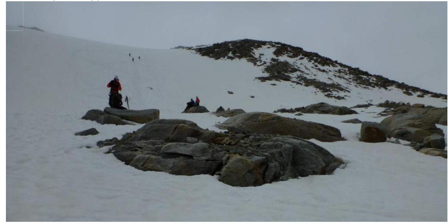
Photo 2. Section R0–R1 (second ascent). Photo during A. Popov's team ascent on June 26, 2012.
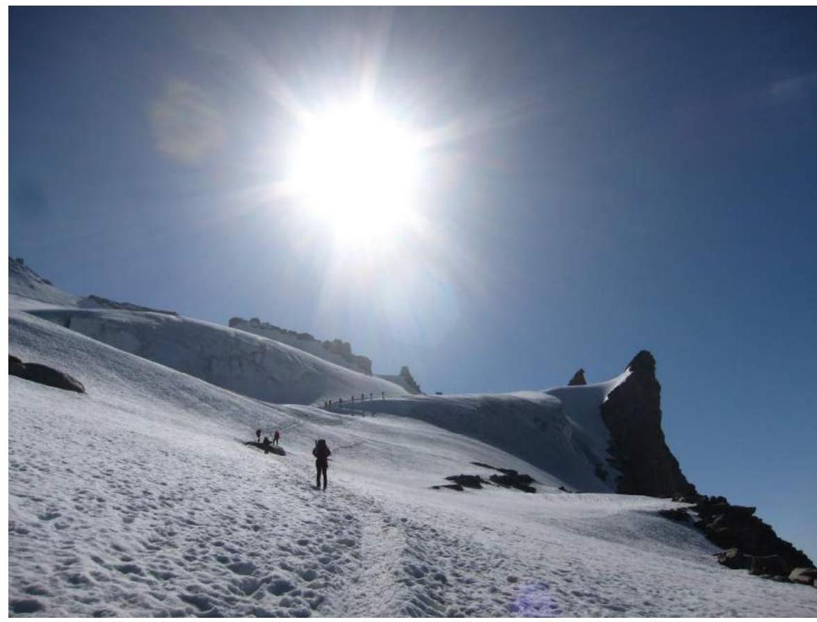
Photo 3. Approaching Mt. Moncorvè (Becca di Moncorvè) 3875 m. The peak is on the right. Photo by A. Yurkin during the CSKA team ascent on June 29, 2012.
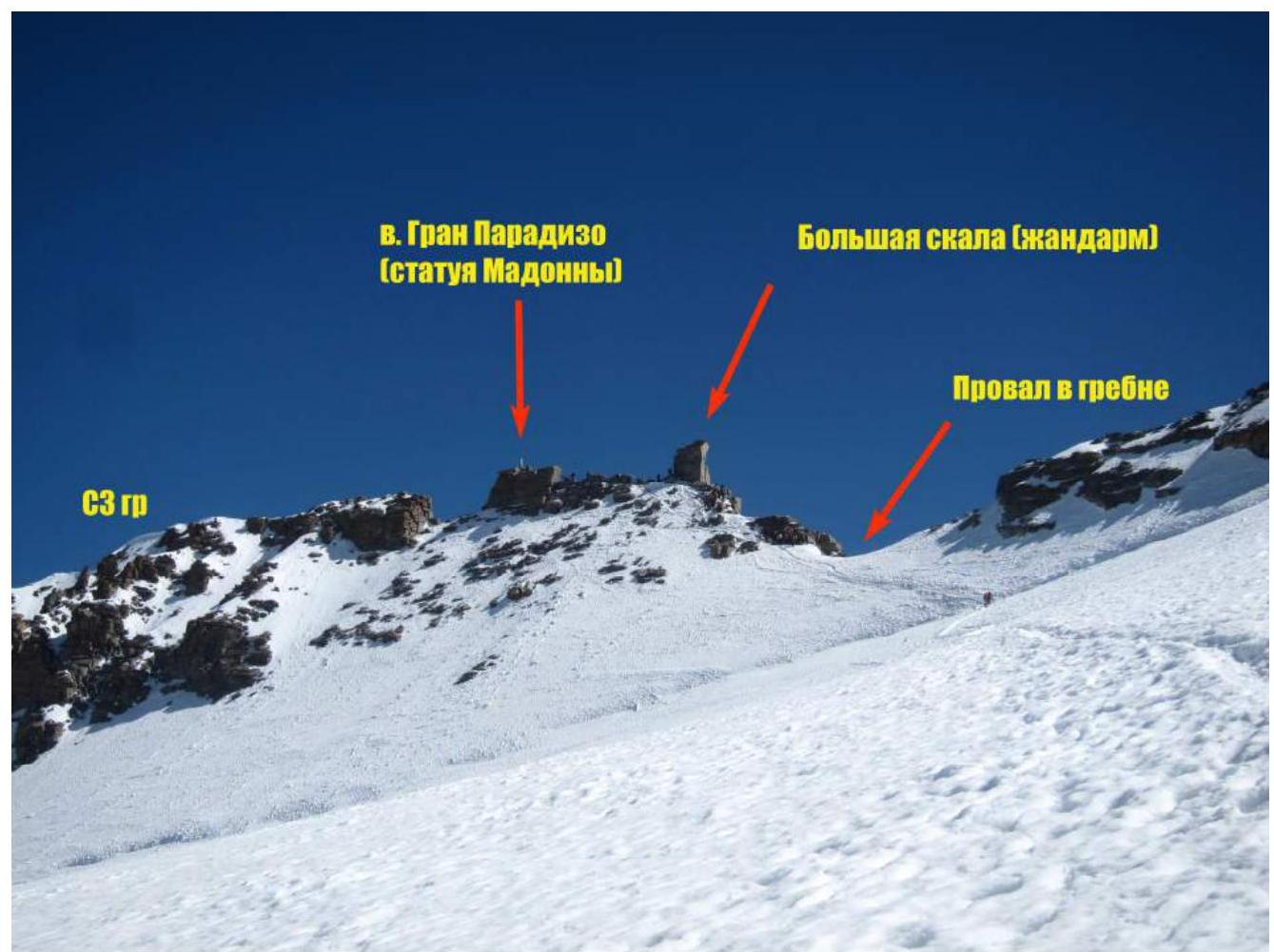
Photo 4. Upper part of the route, pre-summit ascent. Photo by A. Yurkin during the CSKA team ascent on June 29, 2012.
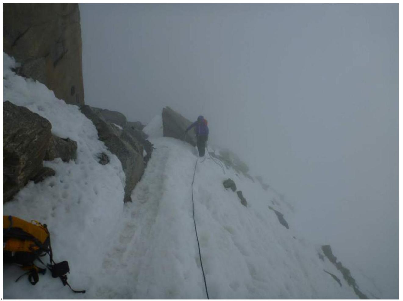
Photo 5. At the large rock (gendarme) with memorial plaques. Photo during A. Popov's team ascent on June 26, 2012.
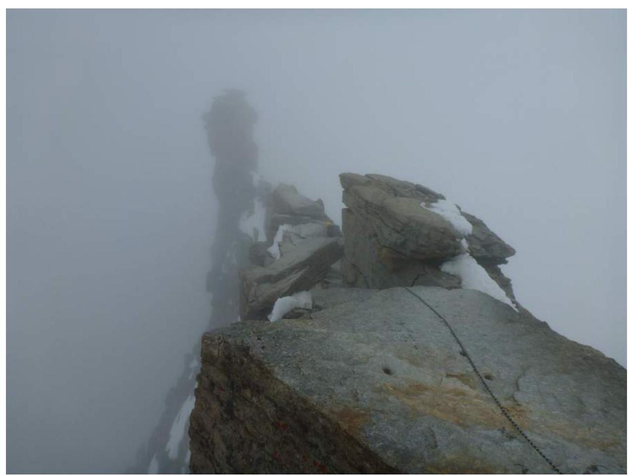
Photo 6. Section R1–R2 (view from the summit). Photo during A. Popov's team ascent on June 26, 2012.
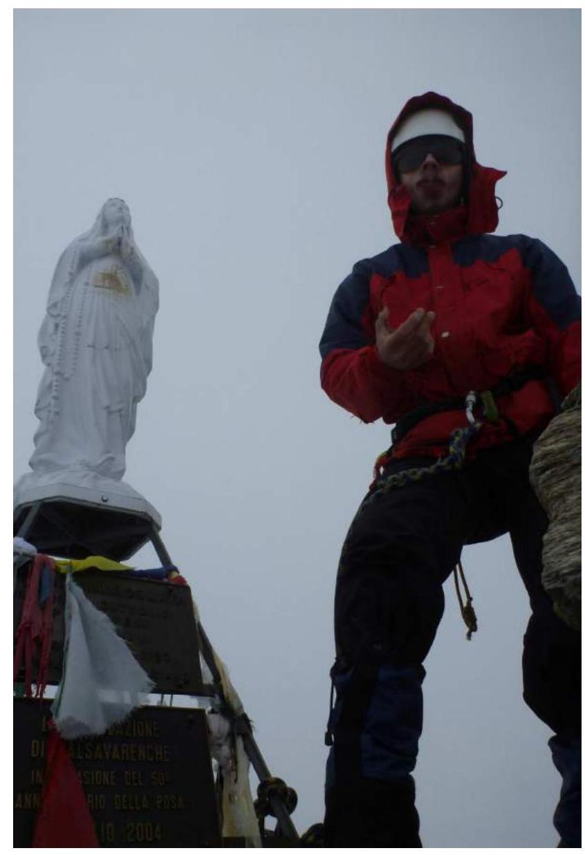
Photo 7. Ascent participant I. Shcheglov at the Madonna statue on the summit of Gran Paradiso. Photo during A. Popov's team ascent on June 26, 2012.


