Ascent Passport
-
Ascent class: technical
-
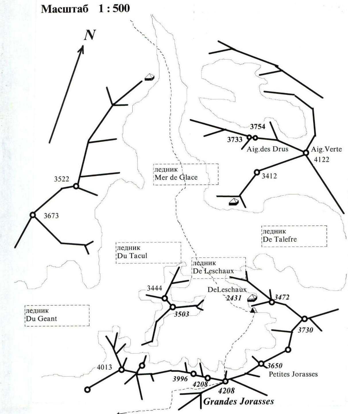
Region: Alps, Chamonix (France)
-
Route: via the left buttress of the North face (Cassin–Walker)
-
Difficulty category: not classified, proposed 6B
-
Height difference: 1708 m, length: 2100 m
length of sections with 5th category difficulty – 620 m length of sections with 6th category difficulty – 550 m average steepness of the route: 75°
-
Pitons used:
Rock Bolt Nuts Ice 132 / 4 0 / 0 324 11 / 0 -
Team's total climbing hours: 31 h, days: 3
-
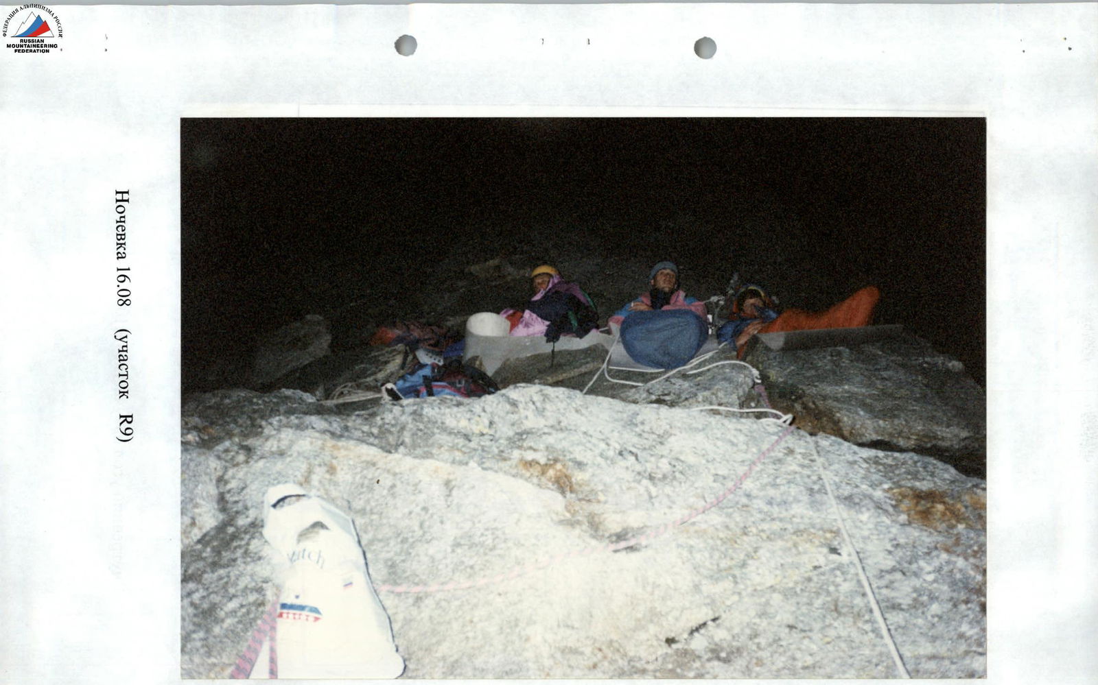
Overnight stays: "sitting" – 2
-
Leader: Gennadiy I. Lebedev — Master of Sports
participants: Nikolay S. Goryunov — Candidate for Master of Sports, Vladimir I. Gorbach — Master of Sports, Gleb B. Linetskiy — Candidate for Master of Sports, Vasily A. Popov — Master of Sports
-
Coach: Viktor I. Grishchenko, International Master of Sports
-
Departure to the route: August 15, 1995
Summit: August 17, 1995 Return: August 18, 1995
-
Ascent made by the team of ASC "EuroPolis" from Kiev
Map-Scheme of the Ascent Region
General Photograph of the Route
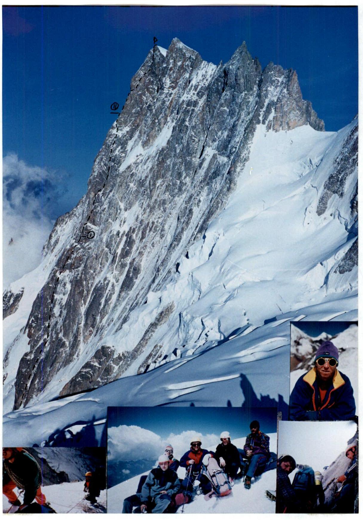
The team's ascent route:
- (1) — overnight stay — R1 (sitting)
- (2) — overnight stay — R2 (semi-sitting)
Ascent Graph
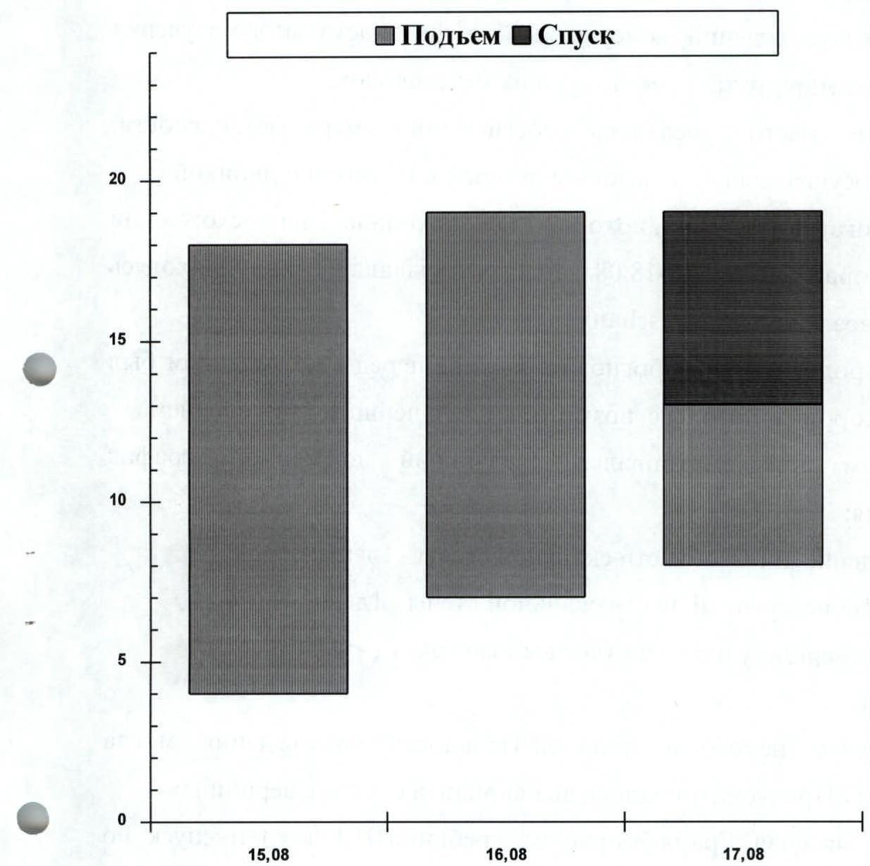
- August 15. Passing the first rock belt.
- August 16. Passing the second rock belt.
- August 17, 1995. Summit ascent and descent to Courmayeur (Italy).
Tactical Actions of the Team
The tactical plan for the ascent was based on the experience of previous ascents, consultations, and a detailed study and observation of the route, as well as current weather forecasts. A significant emphasis was placed on safety measures. Radio communication was maintained with the base camp in Chamonix and the "Kiev-2" team (Pigarev – Velmik), which was ascending Mt. Petit Joras on August 15, and then backed up the team from August 16 to 18, staying at a bivouac near the Leschaux hut. The weather forecast at the hut before the ascent predicted two days of good weather with possible deterioration afterwards. The plan included the following timeline for the ascent:
- passing the lower part of the rock wall — 1 day;
- passing the middle part of the rock wall — 1 day;
- reaching the summit and descending to the base camp — 1 day.
Total: 3 days. In case of bad weather, the ascent duration could be extended. Two descent options from the summit were considered:
- traversing the Grand Joras massif along the ridge (III–IV category difficulty) and descending via the Mont Mallet glacier to the bivouac near the Leschaux hut — a more complex option;
- descending from the summit to the southwest into Italy via a simple rock ridge, then via the glacier to the hut (about 6 hours), and through the resort town of Courmayeur back to Chamonix via a tunnel under Mt. Mont Blanc (approximately 20 km).
Preliminary processing of the route sections was not planned. To ensure safety during the lead climbing, a rope meeting UIAA requirements was used, along with a wide range of modern rock climbing gear tested during preparation.
The ascent was organized as follows:
- the first climber moved without a backpack on a double rope. Belaying the first climber — through a Sticht brake or an "8" descender;
- on complex wall sections, the first climber wore rock shoes or, if there was verglas, crampons;
- the second and subsequent participants ascended using jumar ascenders on fixed ropes anchored to at least three linked pitons or nuts;
- the fixed rope was secured at two to three intermediate points;
- the team worked with a daily change of lead climber;
the team had two first-aid kits, and each participant was equipped with bandages and emergency rations.
There were no falls or injuries on the route. The route was mostly climbed using free climbing techniques.
Communication with the base was regular via a Motorola VHF radio station at 8:00, 12:00, 18:00, 20:00, with monitoring at the base camp and by the "Kiev-2" team every two hours.
The weather remained good throughout the ascent and deteriorated only during the descent. The route was completed as planned with two overnight stays.
Due to worsening weather, the Italian side descent option was chosen.
The tactical plan was executed without deviations.
Description of the Route by Sections
R1 Glacier, ice slope, crossing a bergschrund, moving in crampons in teams through ice screws.
R2 From the bergschrund, exit in crampons onto a steep rock slab with small holds, then via a complex internal corner and slab along a crack. The entire range of rock climbing gear was used.
R3 Complex internal corner, iced over, followed by a monolithic wall with small holds.
R4 Combination of slabs and blocks. Broken rocks.
R5 Wall with a cleft. Passed by free climbing.
R6 Monolithic rock walls with small holds, slabs passed by free climbing.
R7 Complex monolithic wall with small holds. Verglas. Passed by free climbing along a wide crack. Friends worked well.
R8 Broken rocks. Snow-covered slabs. Traverse right along ledges.
R9 Inclined monolithic slabs with small rock walls with small holds. Sitting overnight stay on two small ledges.
R10–R11 Complex internal corner, with verglas in the cracks. Complex climbing. The first two overhangs are passed on the right wall of the corner, the third is bypassed on the right.
R12 Complex monolithic wall with small holds. The overhang is passed by free climbing.
R13 Monolithic slabs and walls with small holds. Verglas.
R14 Ascent along a complex internal corner. Complex climbing. Then exit onto a narrow rock ledge.
R15 Traverse right along a 10 m ledge above overhanging rocks. Descent via a diagonal rappel to the right onto a ledge.
R16 Ascent along a complex wall under an overhang, passed directly "head-on" via a cleft using free climbing. Verglas. Then traverse right along an inclined slab.
R17 Along slabs and small walls, exit onto a small ledge under a complex rock wall.
R18 Ascent along a steep complex wall with an overhang in the middle section under a corniche.
R19 The corniche is bypassed on the right via a steep internal corner.
R20 Along a steep complex wall under an overhang in the upper part, which is bypassed via a complex wide crack.
R21 Steep wall with small holds. Diagonal traverse left under the overhang and up the wall onto a rock shoulder.
R22 Simple broken rocks with small walls.
R23 Ascent along a steep complex wall with an overhang.
R24 Steep monolithic slabs like "ram's foreheads" and walls with small holds. Verglas.
R25 Steep fracture with internal corners and small walls. Cracks are iced over. Piton belay.
R26 Along snow-covered slabs and an internal corner, exit onto a steep ice slope at the base of a rock tower.
R27 Along a steep ice slope (belay via ice screws), ascent under a rock wall.
R28 Exit via broken rocks onto a snow-ice inclined ledge. Sitting overnight stay.
R29 Complex internal corner, iced over, overhang, followed by a monolithic wall with small holds.
R30 Complex rock walls, overhang, clefts passed by free climbing.
R31 Along a steep complex wall with an overhang in the middle section, which is bypassed on the left via an internal corner. Complex climbing in crampons on verglas with a layer of ice.
R32 Along a steep wall under a corniche, passed by free climbing.
R33 Steep wall with a cleft. Traverse along a ledge to the right to an internal corner.
R34 Long internal corner. Broken rocks of medium difficulty, partly iced over.
R35 Complex internal corner, iced over, followed by a monolithic wall with small holds.
R36 Ascent along a steep ice gully with pockets of broken rocks (ice screws, crampons).
R37 Internal corner. Broken rocks of medium difficulty, partly with verglas.
R38 Heavily snow-covered summit ridge. Exit onto the snow cap of the summit.
Route Scheme in UIAA Symbols
Total climbing hours of the team: 31 h
| Section Number | Number of Rock Pitons | Nuts | Ice Pitons | UIAA Symbols | Difficulty Category | Section Length, m | Steepness, ° |
|---|---|---|---|---|---|---|---|
| Number of pitons 140 | |||||||
| Climbing time 6 h | |||||||
| R38 | 0 | 0 | 0 | ++++++ | III | 20 | 30 |
| R37 | 5 | 15 | 0 | IV | 80 | 65 | |
| R36 | 5 | 10 | 3 | V | 80 | 60 | |
| R35 | 5 | 20 | 0 |  | VI | 80 | 75 |
| R34 | 5 | 15 | 0 | IV | 80 | 70 | |
| R33 | 2 | 5 | 0 |  | V– | 30 | 70 |
| R32 | 6 | 10 | 0 |  | VI | 35 | 85 |
| R31 | 7 | 10 | 0 |  | VI | 30 | 95 |
| R30 | 7 | 10 | 0 |  | VI | 40 | 90 |
| Number of pitons 188 | |||||||
| Climbing time 12 h | |||||||
| R29 | 5 | 10 | 0 |  | VI | 35 | 95 |
| R28 | 1 | 4 | - |  | IV | 30 | 50 |
| R27 | 0 | 0 | 4 |  | V | 35 | 60 |
| R26 | 2 | 10 | 1 |  | IV | 45 | 65 |
| R25 | 5 | 24 | 0 |  | V– | 120 | 70 |
| R24 | 10 | 20 | 0 |  | V | 120 | 65 |
| R23 | 3 | 6 | 1 |  | VI | 35 | 85 |
| R22 | 1 | 4 | - |  | III | 20 | 40 |
| R21 | 5 | 12 | 0 |  | VI | 45 | 85 |
| R20 | 1 | 8 | 0 |  | VI | 30 | 90 |
| R19 | 1 | 4 | 0 |  | VI | 35 | 80 |
| R18 | 2 | 5 | 0 | VI | 15 | 85 | |
| R17 | 1 | 4 | 0 | IV | 25 | 60 | |
| R16 | 2 | 5 | 0 | VI | 20 | 95 | |
| R15 | 2 | 1 | 0 | V | 10 | 85 | |
| R14 | 1 | 4 | 0 | V | 20 | 80 | |
| R13 | 2 | 4 | 1 | V | 35 | 65 | |
| R12 | 1 | 5 | 0 | V | 30 | 70 | |
| R11 | 2 | 10 | 0 | VI | 30 | 90 | |
| Number of pitons 135 | |||||||
| Climbing time 14 h | |||||||
| R10 | 5 | 10 | 0 | 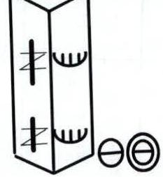 | VI | 45 | 95 |
| R9 | 3 | 7 | 0 | 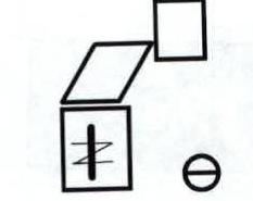 | IV | 60 | 60 |
| R8 | 5 | 5 | 1 |  | IV | 80 | 45 |
| R7 | 5 | 8 | 0 | 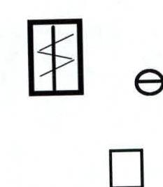 | VI | 35 | 85 |
| R6 | 3 | 7 | 0 |  | V | 30 | 70 |
| R5 | 4 | 8 | 0 |  | V+ | 30 | 70 |
| R4 | 10 | 20 | 2 | 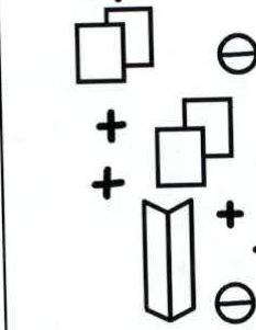 | IV | 240 | 60 |
| R3 | 7 | 13 | 1 | 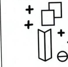 | V | 80 | 75 |
| R2 | 5 | 5 | 1 | VI | 40 | 85 | |
| R1 | 0 | 0 | 0 | III | 250 | 40 | |
| Total | 132 | 324 | 11 |
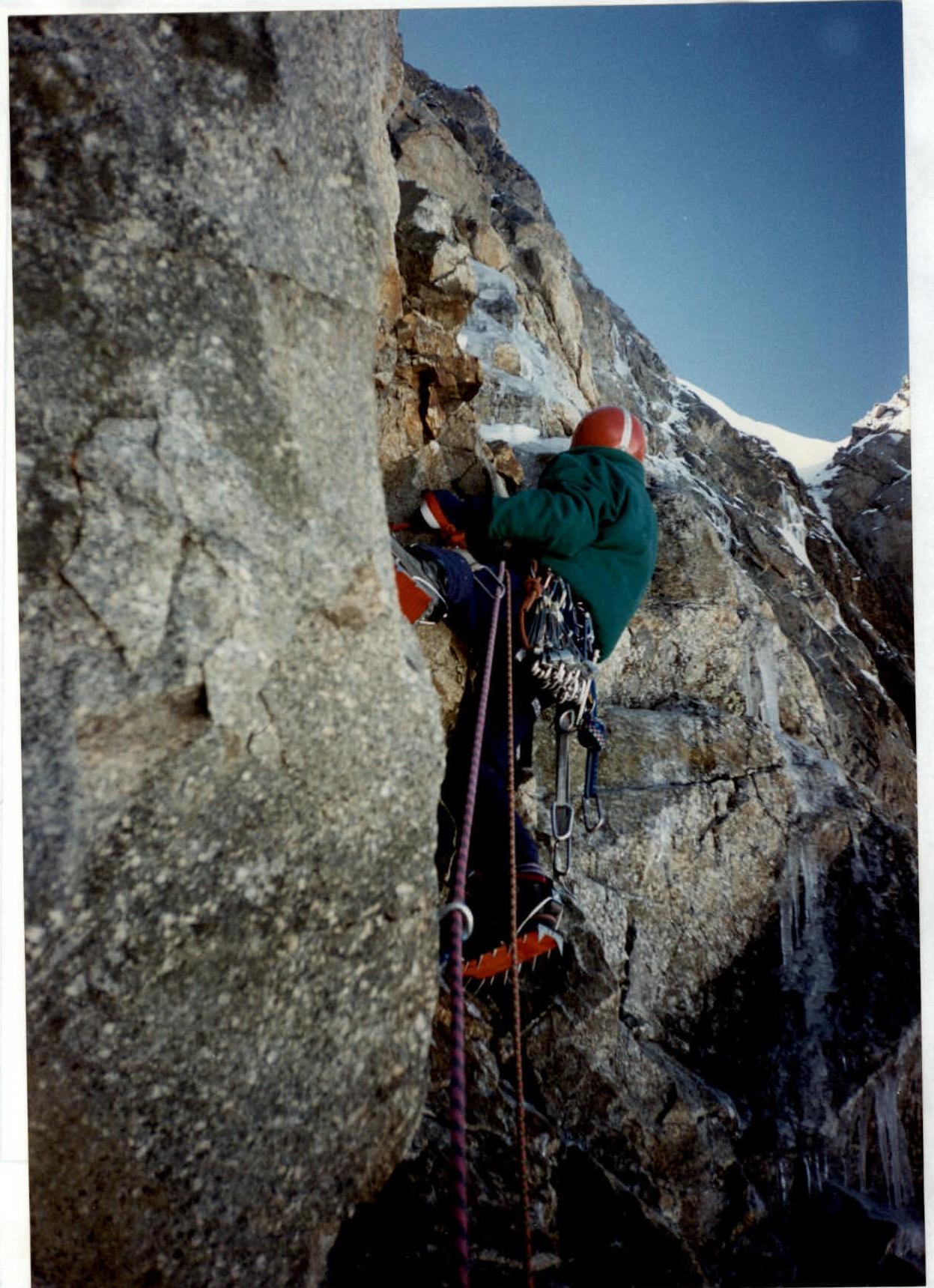
Internal corner on section R10
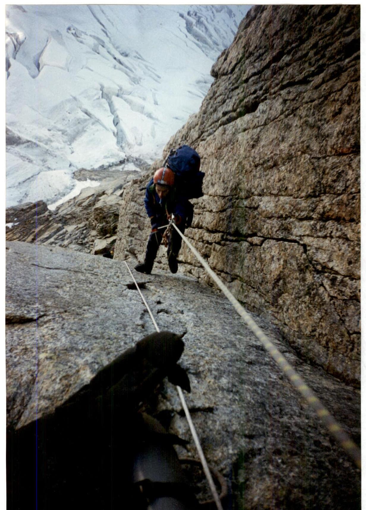
Goryunov N.S. passing section R14

Passing section R20
Footnotes
-
- August 16 (section R9)


