Report
ON THE FIRST ASCENT OF TRIDENT VIA THE WEST RIDGE, CATEGORY 6A, BY KONSTANTIN MARKEVICH'S TEAM, AUGUST 4-5, 2019
I. Ascent Report
| 1. General Information | ||
|---|---|---|
| 1.1 | Full Name, Sports Rank of the Leader | Markevich Konstantin Georgievich, Master of Sports |
| 1.2 | Full Name, Sports Rank of the Participants | Sushko Denis Sergeevich, Master of Sports; Semenov Valery Leonidovich, 2nd Sports Rank |
| 1.3 | Full Name of the Coach | — |
| 1.4 | Organization | — |
| 2. Characteristics of the Ascent Object | ||
| 2.1 | Region | Karakoram, Pakistan |
| 2.2 | Valley | Khane Valley |
| 2.3 | Section Number According to the 2013 Classification Table | 10.2 |
| 2.4 | Name and Height of the Summit | Trident — 5780 m |
| 2.5 | Geographical Coordinates of the Summit (Latitude/Longitude), GPS Coordinates | Latitude 35.341365 Longitude 76.462226 |
| 3. Characteristics of the Route | ||
| 3.1 | Route Name | Via West Ridge |
| 3.2 | Proposed Difficulty Category | 6A |
| 3.3 | Degree of Route Exploration | First Ascent |
| 3.4 | Terrain Type of the Route | Combined |
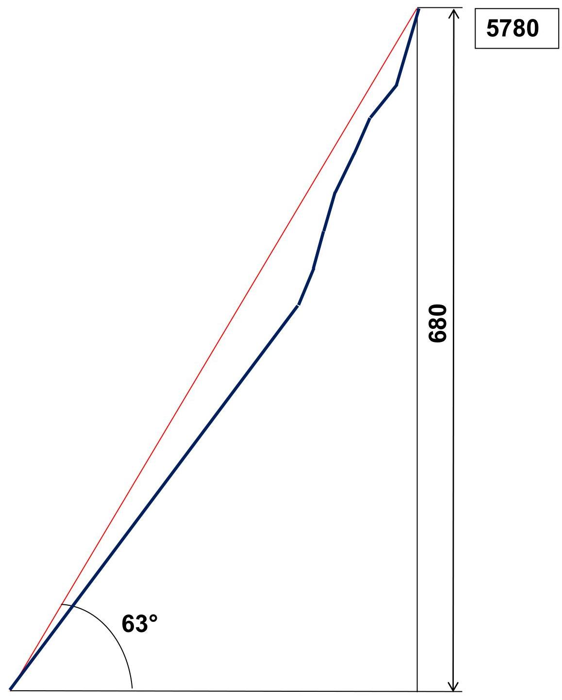
| 3.5 | Elevation Gain of the Route (Altimeter or GPS Data) | 680 m |
| 3.6 | Route Length (in meters) | 1070 m |
| 3.7 | Technical Elements of the Route (Total Length of Sections with Different Difficulty Categories and Terrain Type) | 1B cat. ice/rock/combination — 0 m. 2A cat. ice/rock/combination — 0 m. 3A cat. ice/rock/combination — 0 m. 4A cat. ice/rock/combination — 570/60/0 m. 5A cat. ice/rock/combination — 190/30/60 m. 6A cat. ice/rock/combination — 40/60/60 m. Rock VI, A3 — 0 m Rock VI, A4 — 0 m |
| 3.8 | Average Steepness of the Route, ° | 63° |
| 3.9 | Average Steepness of the Main Part of the Route, ° | 72° |
| 3.10 | Descent from the Summit | Via the Ascent Route |
| 3.11 | Additional Route Characteristics | Water Availability |
| 4. Characteristics of the Team's Actions | ||
| 4.1 | Time in Motion (Team's Climbing Hours, in Hours and Days) | 22 hours, 2 days |
| 4.2 | Overnight Stays | Campsite |
| 4.3 | Route Preparation Time | — |
| 4.4 | Start of the Route | 2:00 AM, August 4, 2019 |
| 4.5 | Summit Arrival | 6:30 PM, August 5, 2019 |
| 4.6 | Return to Base Camp | 8:00 AM, August 6, 2019 |
| 5. Weather Conditions | ||
| 5.1 | Temperature, °C | — |
| 5.2 | Wind Speed, m/s | — |
| 5.3 | Precipitation | — |
| 5.4 | Visibility, m | — |
| 6. Person Responsible for the Report | ||
| 6.1 | Full Name, e-mail | Sushko Denis Sergeevich, sushko_denis@mail.ru |
II. Ascent Description
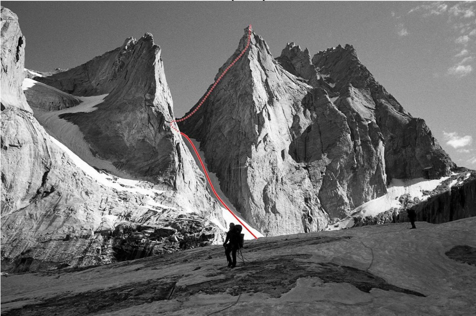
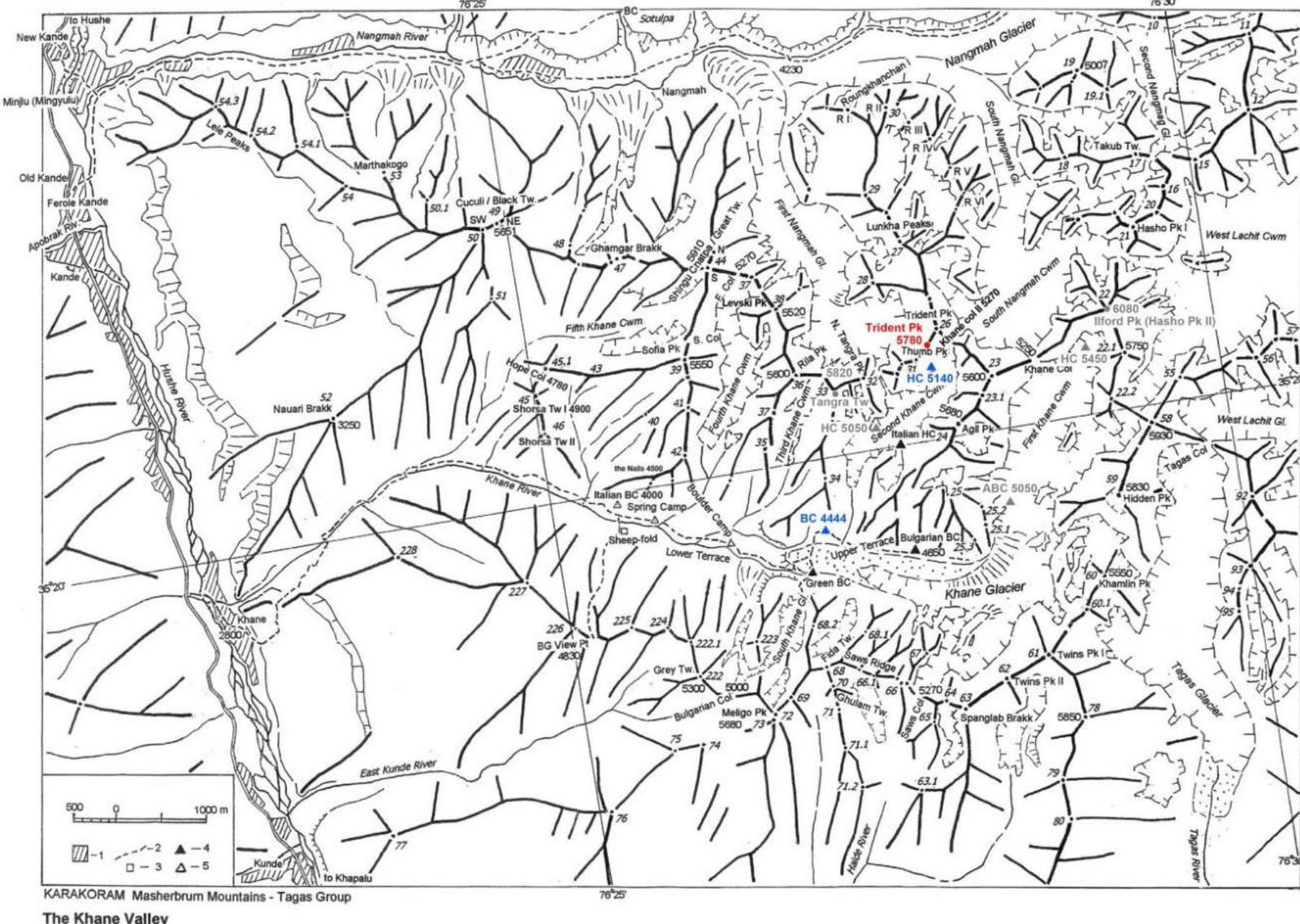
1.1. General Photo of the Summit.
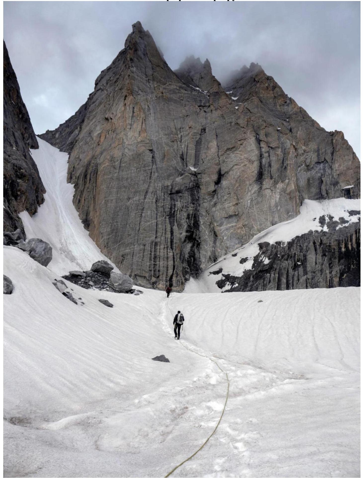
1.2. Photo of the Route Profile.
1.3. Hand-Drawn Profile of the Route
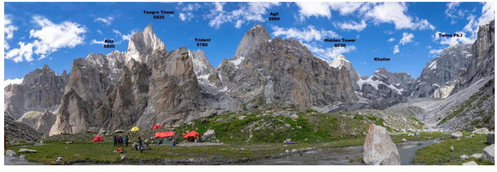
1.4. Panoramic Photo of the Area.
The summit is located in Pakistan, in the Khane Valley. From the regional center Skardu, one can reach the village of Khane by jeep in about 8 hours.
From the village, it takes 6–8 hours to reach the base camp at an altitude of 4444 meters above sea level via a trail.
From the base camp, it takes 3–4 hours to reach the foot of the mountain via moraine and glacier.
1.5. Map of the Area
2. Route Characteristics
2.1. Technical Photo of the Route.
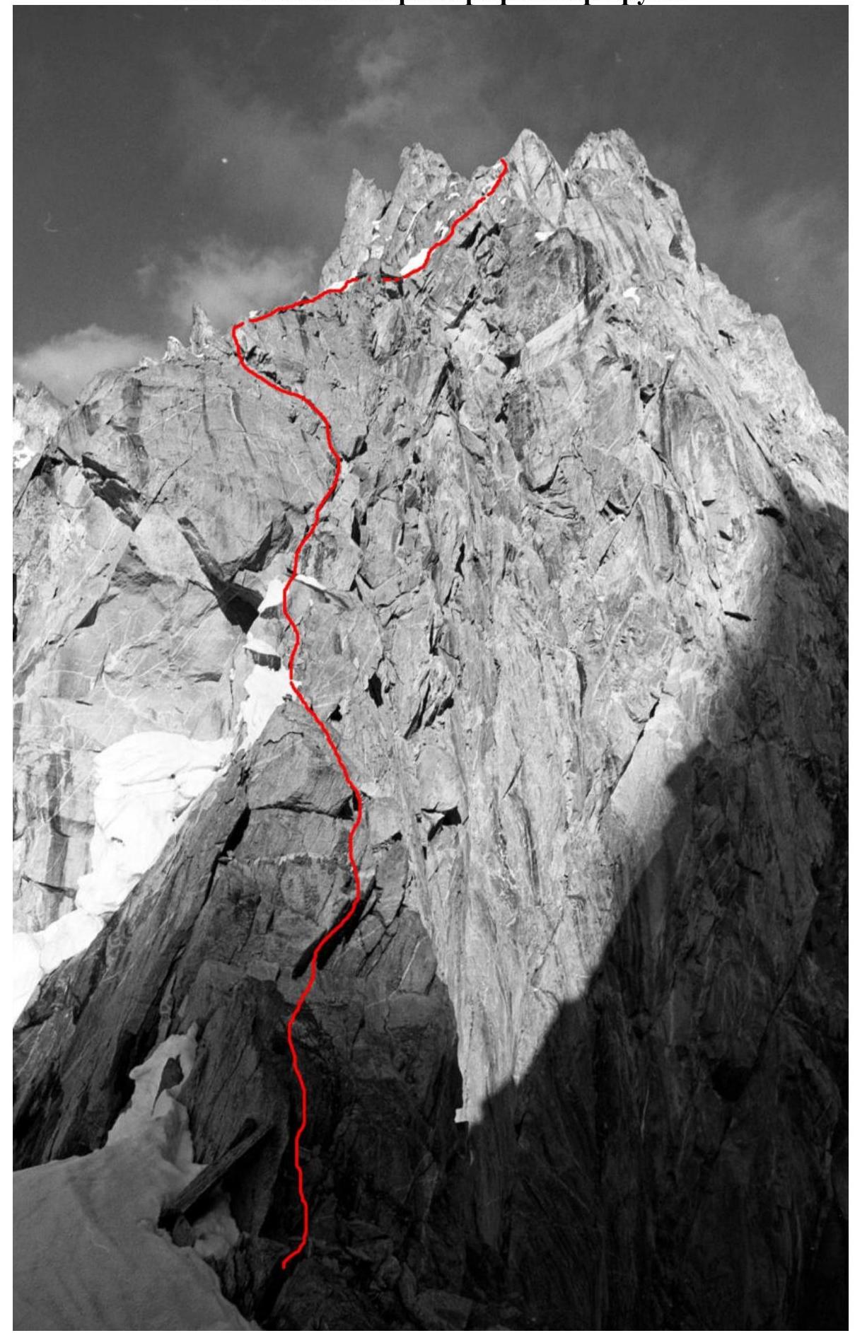
2.3. Route Diagram in UIAA Symbols.

3. Characteristics of the Team's Actions
3.1 Brief Description of the Route.
On August 3, 2019, at 3:00 PM, we left the base camp to approach the assault camp. At 7:00 PM, we reached the base of the route and went to sleep. At 2:00 AM, we started climbing the snow-ice slope, as during the day it is prone to rockfall and the snow becomes soft.
From the assault camp on the glacier to the col at 5550 m, there is a steep snow-ice slope of 50–60°. From the col, there is a wall section with 7 rock and mixed pitches of 60 m.
- At 6:30 AM, we reached the col.
- We waited out bad weather for the rest of the day.
- The next day, we climbed the rock section and descended to the col at 1:00 AM.
- We slept for a few hours.
- Early the next morning, we descended.
The entire route was climbed free, without using artificial aids; we assess the climbing difficulty as max 6B+ on the French scale, and the mixed difficulty as M6.
| Section | Description | Photo Number |
|---|---|---|
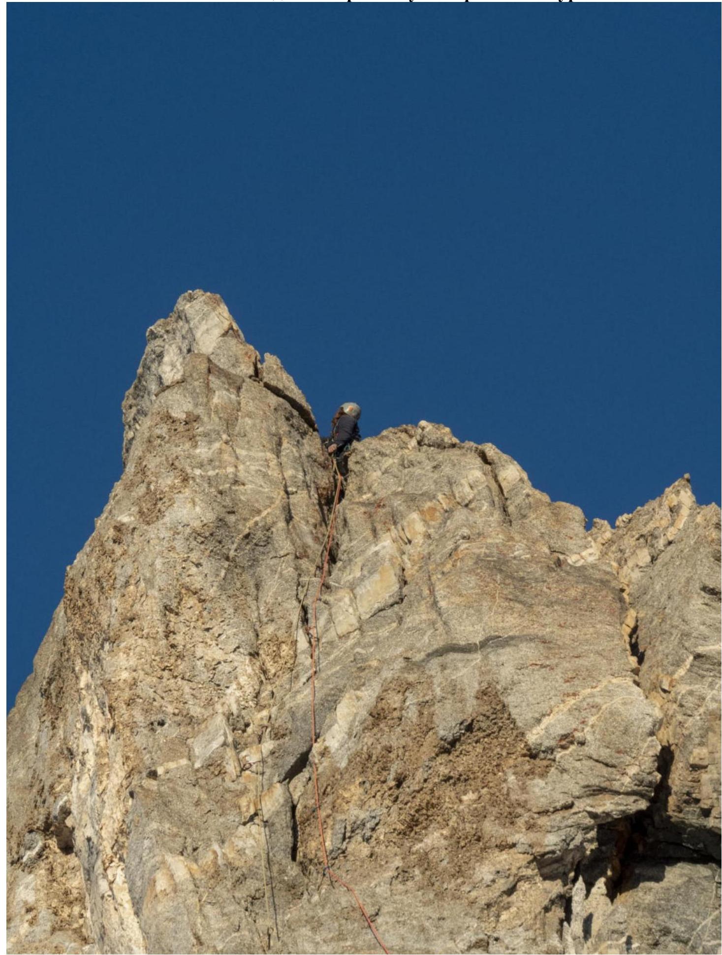
| R7–R8 | Traverse right for 2 m, then climb up the snow-ice slope. Then traverse left under the vertical rock wall. Climb up the wall to the summit. The rocks are very fragile, climbing is difficult, and protection is unreliable. At the summit, there is a station with a drilled bolt. | 10, 11, 12 |
| R6–R7 | From the ledge, climb up the snow to the start of the chimney filled with thin ice. Climbing the chimney is complicated by ice in the cracks and ice formations. Difficult mixed climbing. Water drips from hanging icicles, complicating the passage. Exit the chimney onto a ledge. Here is a station with a drilled bolt. | 9 |
| R5–R6 | Climb up the ice until the ridge starts to flatten. Then stay on the boundary between rocks and ice to a ledge. Here is a station with a drilled bolt. | |
| R4–R5 | Climb up the snow-ice slope, first up 15 m, then move right over a snow bridge. The snow is loose, slides off, and protection is impossible. Objectively dangerous and difficult spot. After moving right, there is good ice; climb straight up another 45 m, then traverse right to the rocks. Here is a station with a drilled bolt. | |
| R3–R4 | First, traverse left 5–7 m to reach the ridge. Then climb along the ridge and sometimes along the walls to the left of the ridge. There are snow-ice sections that complicate climbing and protection. But overall, it's a rock section. Climb to the start of the snow-ice slope on the left side of the ridge. Traverse right 4 m. Here is a station with a drilled bolt. | 6, 7, 8 |
| R2–R3 | Move up, enter the chimney with a plug to the right of the overhanging slab. Climb up the chimney under the cornice. Under the cornice, make a traverse left to a large, slightly overhanging slab. Here is a station with a drilled bolt. | 5 |
| R1–R2 | Right under the col, there is a good spot for a tent. From the tent, exit left up to the col, then move along the ridge, bypassing a jendarme on the right. Reach under a large overhanging slab; here is a station with a drilled bolt. | 4 |
| R0–R1 | Steep snow-ice slope of 50–60°; organizing protection is complicated due to the poor quality of the ice, making it hard to use ice screws. We climbed and descended without protection. | 1, 2, 3 |
3.2 Photo of the Team at the Summit with the Control Pole
3.3. Route Safety Assessment
Average.
- The snow-ice slope at the start of the route may be avalanche-prone.
- The snow-ice slope at the start of the route is prone to rockfall from neighboring walls.
- The final section involves difficult climbing on vertical, fragile terrain.
Communication options on the route: only satellite phone and radio communication.
Recommendations for Future Climbers.
Climb the section to the col at night or during cold weather. Use a 60 m rope, as all stations on the upper part of the route are drilled for 60 m ropes.
Detailed Information on the Descent from the Summit, Including Landmarks.
Descend via the ascent route, using stations with drilled bolts as landmarks. Be cautious on the descent due to the presence of loose rocks.
Conclusion on the Preliminary Assessment of the Route Compared to Classified Routes of the Same Difficulty Category in the Team's Climbing Experience.
The climbing difficulty is roughly equivalent to routes like:
- Warburton on Dalar
- Myshlyaev on South Ushba.
However, this route also includes a steep snow-ice slope and a significantly higher summit elevation compared to Caucasian mountains.
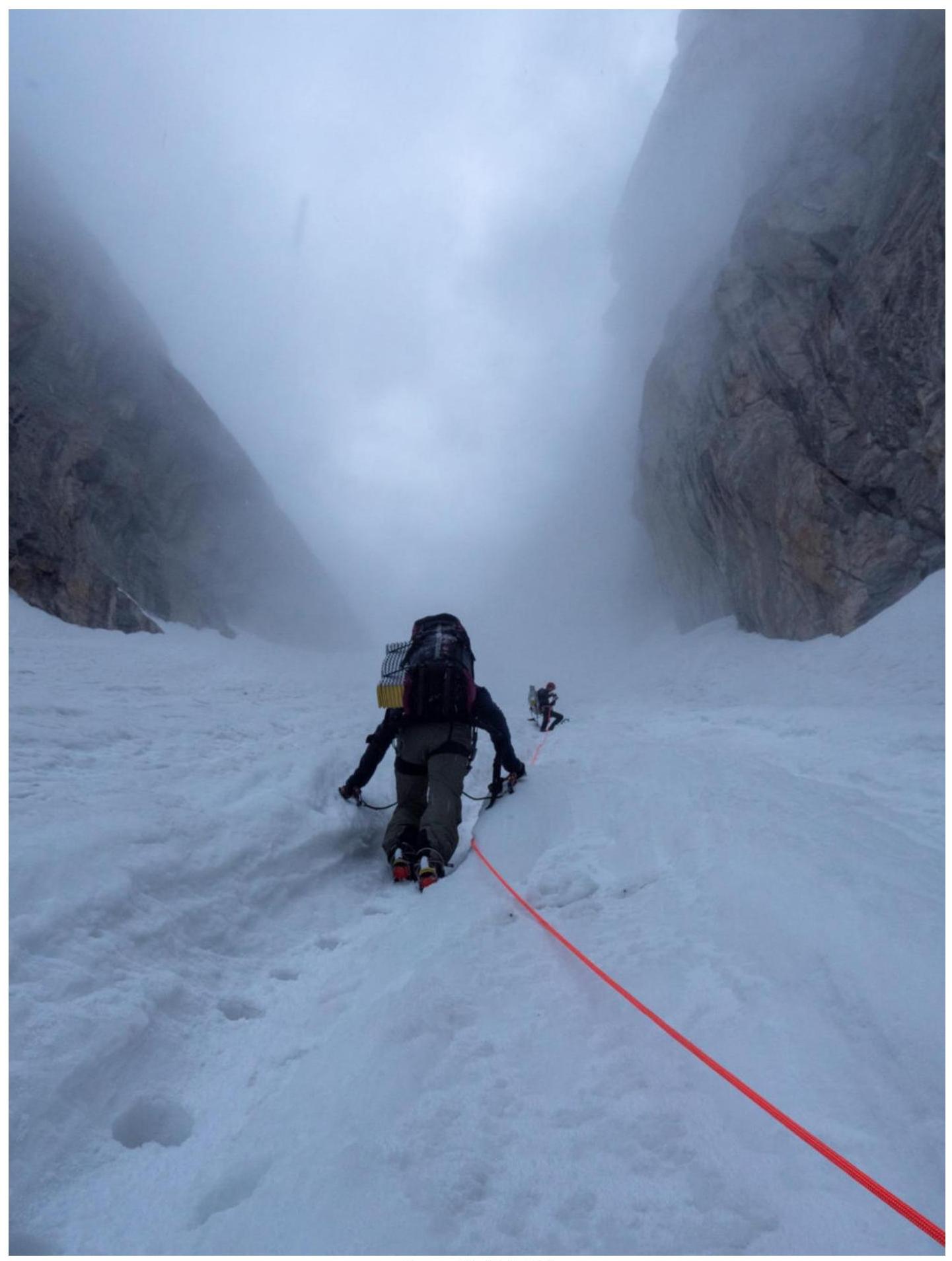
Photo 3, R0–R1
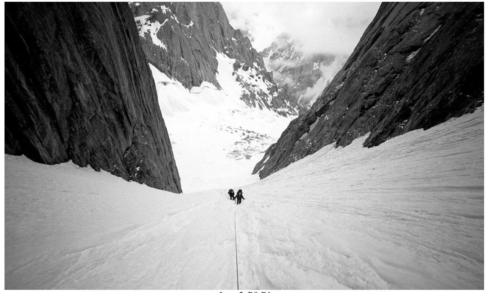
Photo 2, R0–R1
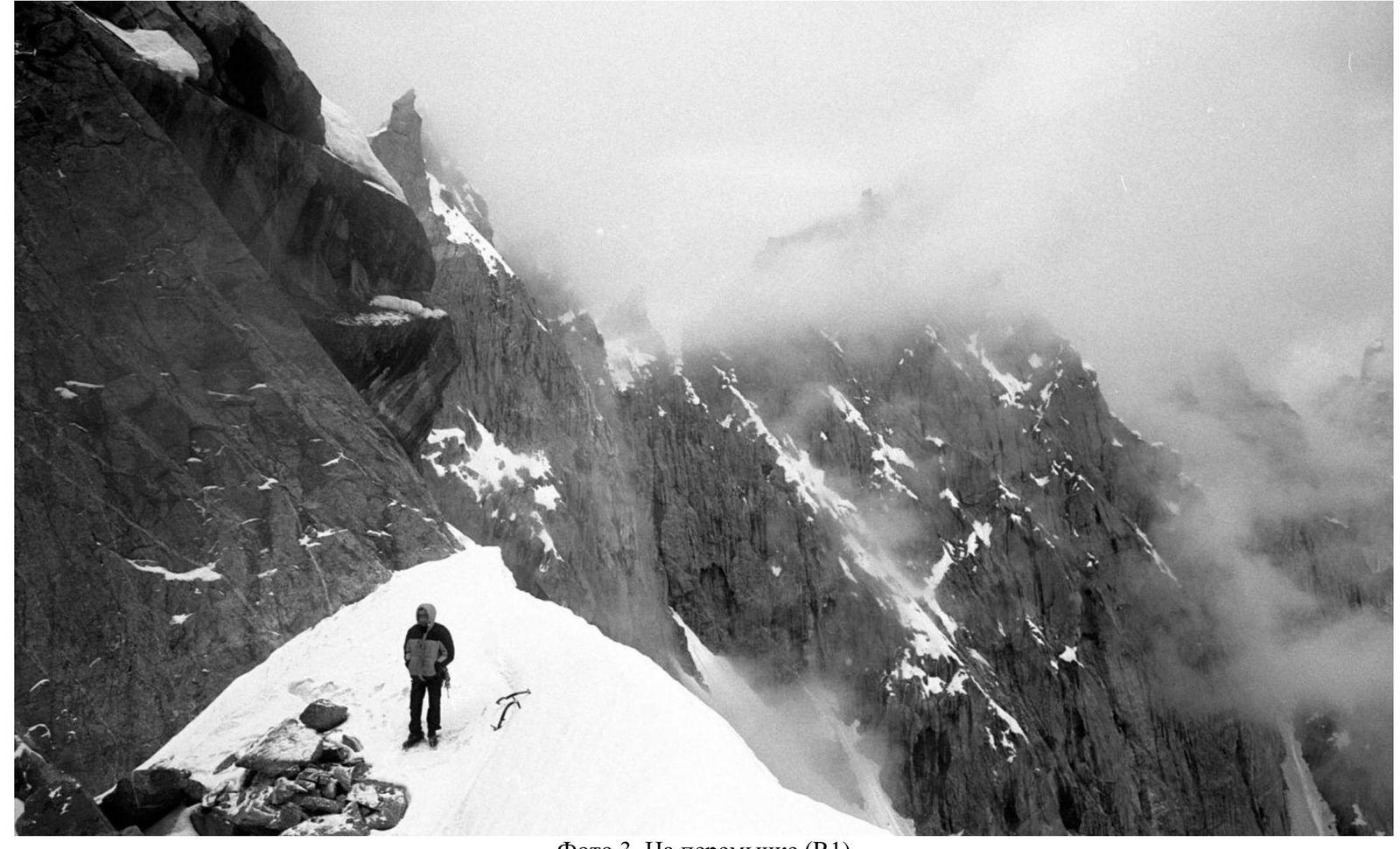
Photo 3, At the col (R1)
Photo 4, R1–R2
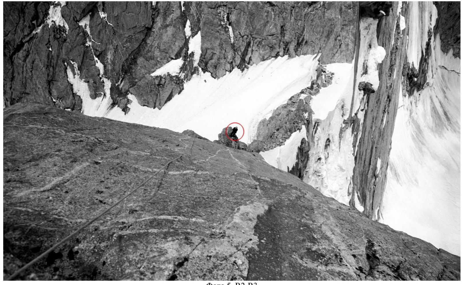
Photo 5, R2–R3
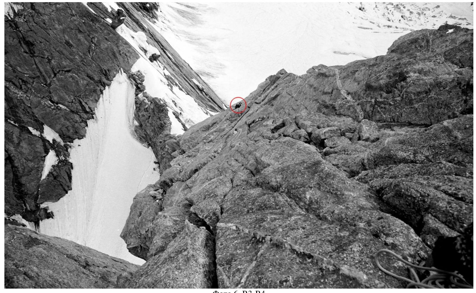
Photo 6, R3–R4
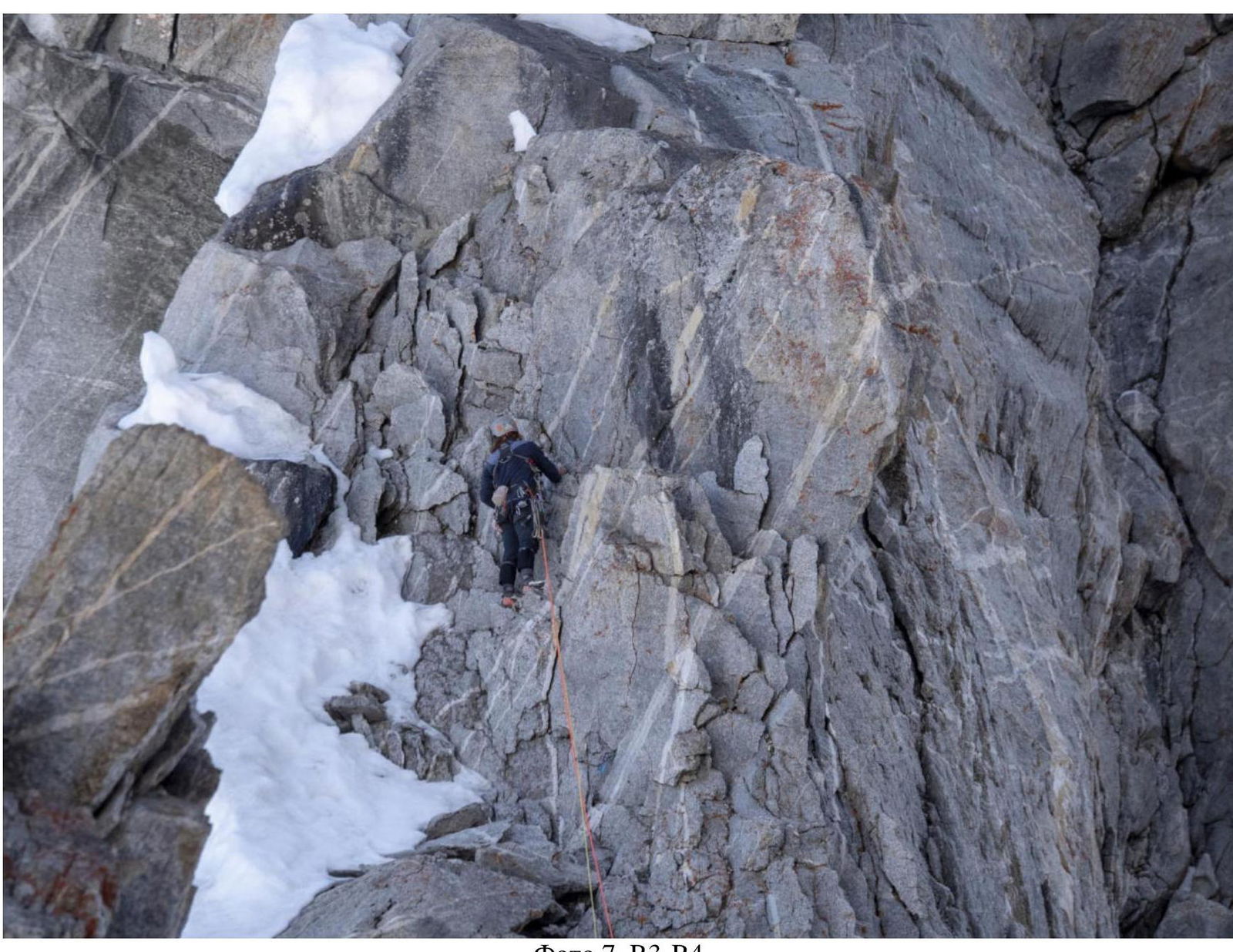
Photo 7, R3–R4
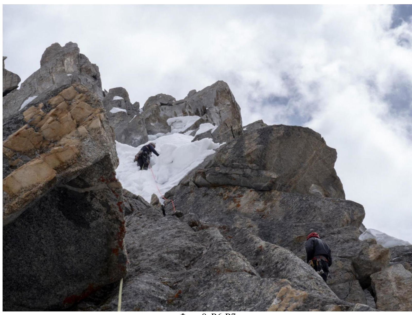
Photo 9, R6–R7
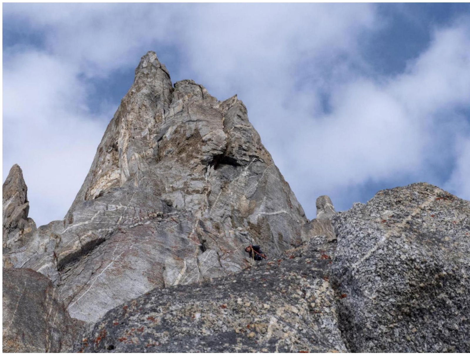
Photo 10, R7–R8
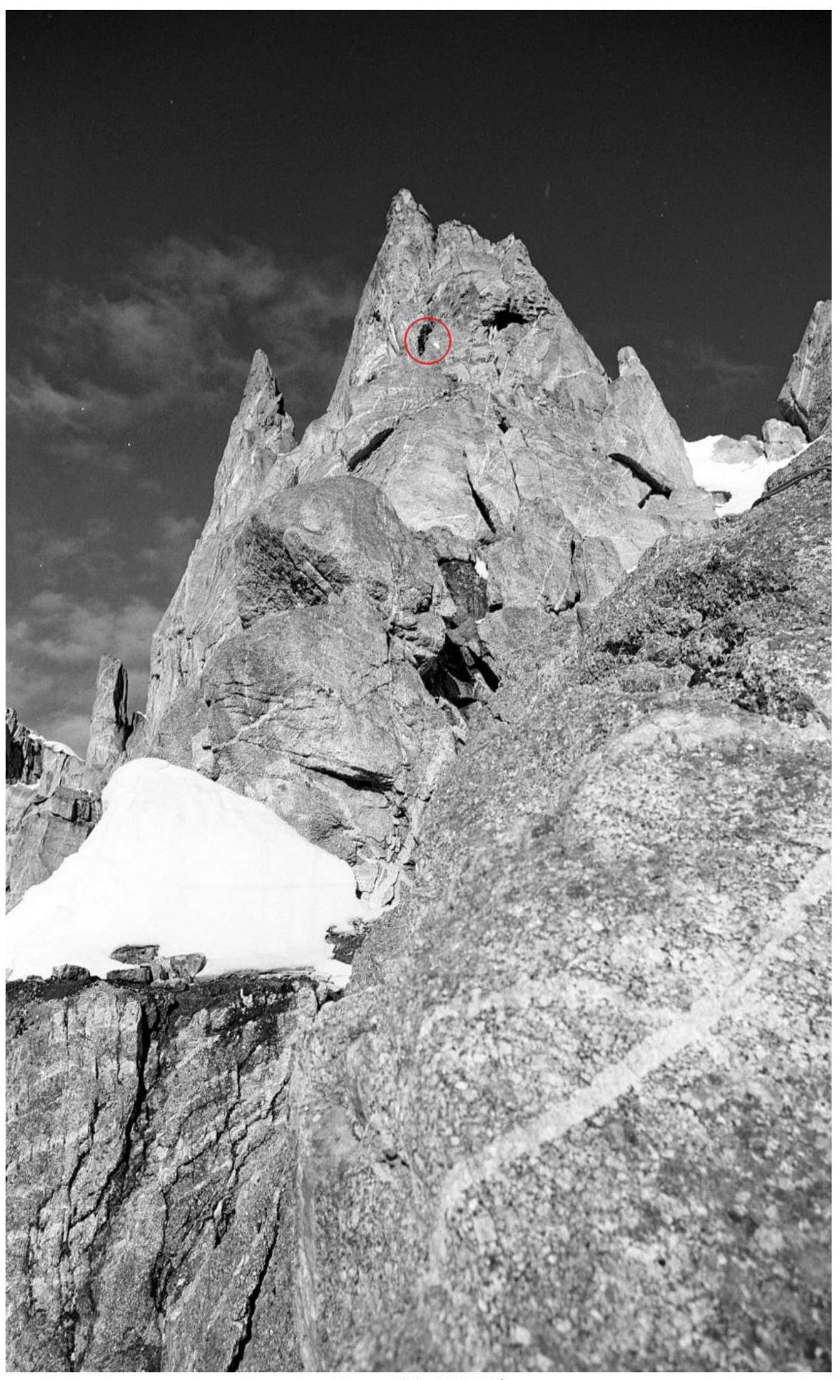
Photo 11, R7–R8