
Report
On the first ascent to the summit of Rowaling Kang Shar 6645 m, proposed 6A cat. sl., for the period from October 20, 2023 to October 23, 2023.
I. Climbing Passport
| 1. General Information | ||
|---|---|---|
| 1.1 | Full name, sports rank of the leader, date of birth | Koshilenko Yuri Vladimirovich, Honored Master of Sports in Alpinism, September 23, 1963 |
| 1.2 | Full name, sports rank of participants, date of birth | Lonchinsky Alexey Sergeevich, Master of Sports in Alpinism, October 1, 1982 |
| 1.3 | Full name of coach | Koshilenko Yu.V. |
| 1.4 | Organization | Federation of Alpinism of Moscow Region |
| 2. Characteristics of the Climbing Object | ||
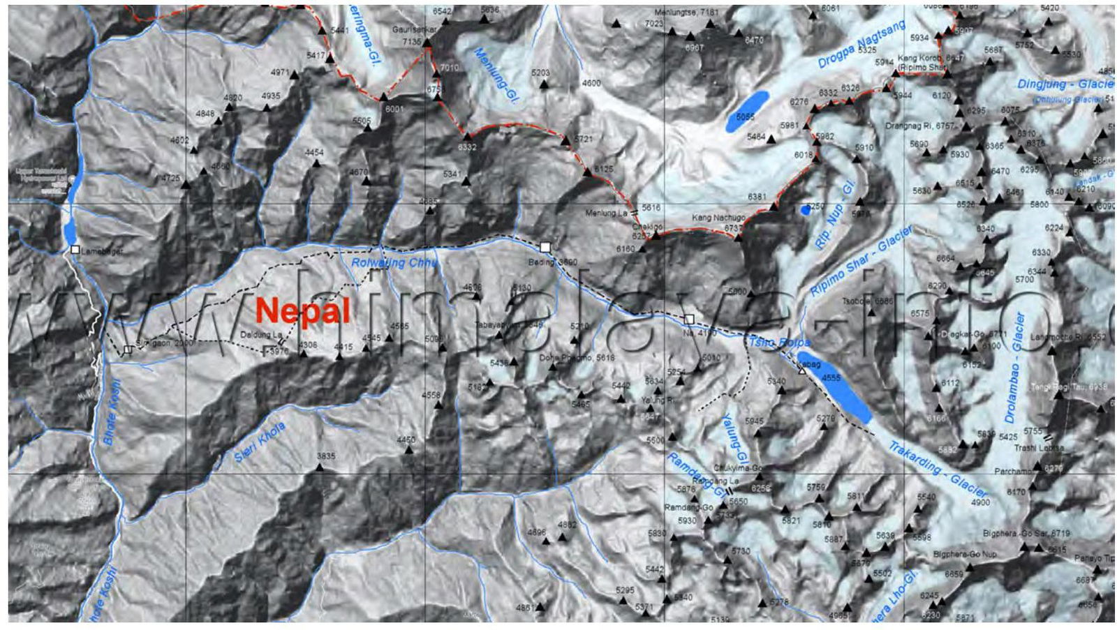
| 2.1 | Region | Nepalese Himalayas |
| 2.2 | Valley | Rowaling |
| 2.3 | Section number according to the classification table of 2013 | 10.1 |
| 2.4 | Name and height of the summit | Rowaling Kang Shar, 6645 m. |
| 2.5 | Geographical coordinates of the summit (latitude/longitude), GPS coordinates *(1) | 27.898231, 86.523672 |
| 3. Characteristics of the Route | ||
| 3.1 | Name of the route | Katana (SE buttress). |
| 3.2 | Proposed category of difficulty | 6A |
| 3.3 | Degree of route exploration | First ascent |
| 3.4 | Relief characteristics of the route | combined |
| 3.5 | Height difference of the route ( altimeter or GPS data) | 1045 m. |
| 3.6 | Length of the route (in meters) | 1730 m. |
| 3.7 | Technical elements of the route (total length of sections of various difficulty categories with indication of relief characteristics (ice-snow, rocky)) | 2 cat. sl. ice/rocks/combination – 200 m. 3 cat. sl. ice/rocks/combination – 400 m. 4 cat. sl. ice/rocks/combination – 340 m. 5 cat. sl. ice/rocks/combination – 590 m. 6 cat. sl. ice/rocks/combination – 200 m. |
| 3.8 | Average steepness of the route, (°) *(2) | 56° |
| :--: | :--: | :--: |
| 3.9 | Average steepness of the main part of the route, (°) *(2) | 72° |
| 3.10 | Descent from the summit | Along the South wall, 6A cat. sl. in Tolombane. |
| 3.11 | Additional characteristics of the route | |
| 4. Characteristics of the Team's Actions | ||
| 4.1 | Time of movement (team's walking hours, in hours and days) | Walking hours 21, full days 4, mainly spent on the 2nd and 3rd day. |
| 4.2 | Overnights | shelf, hollow |
| 4.3 | Route processing time *(3) | – |
| 4.4 | Exit to the route | 14:00, October 20, 2023 |
| 4.5 | Summit exit | 9:00, October 23, 2023 |
| 4.6 | Return to base camp | 14:00, October 24, 2023 |
| 5. Weather Conditions *(4) | ||
| 5.1 | Temperature, °C | –20–25 °C |
| 5.2 | Wind speed, m/s | 11–15 |
| 5.3 | Precipitation | Light at night |
| 5.4 | Visibility, m | 1000 m. |
| 6. Responsible for the Report | ||
| 6.1 | Full name, e-mail | Koshilenko Yu.V., ykoshelenko@gmail.com |
Description of the Area
The summit of Rowaling Kang Shar 6645 m is located in the upper reaches of the Tolomban Glacier. The area is mainly visited by tourists up to Tsho-Rolpa Lake. The exploration of the area by climbers began with the peaks of Ramdun and Farciamo. Later, the following peaks were climbed:
- Chekigo,
- Kang Nachugo,
- Tsoboche.
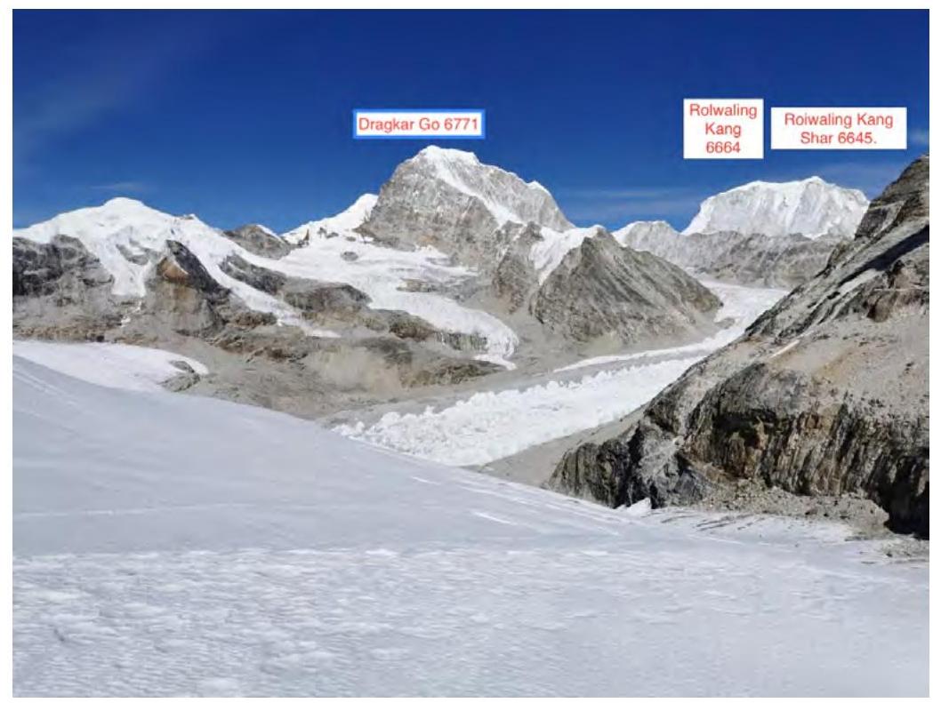
The peaks in the upper reaches of the glaciers are more difficult to access due to complex logistics. In 2016, a Japanese team attempted to climb Rowaling Kang via the SE buttress but gave up due to the complexity and climbed the 3rd, less complex and steep peak 6664 m instead. The area is characterized by extensive glaciers without trails; apparently, we are the first Russians to make a first ascent in this area.
 Photopanorama of the climbing area.
 Photopanorama of the area.
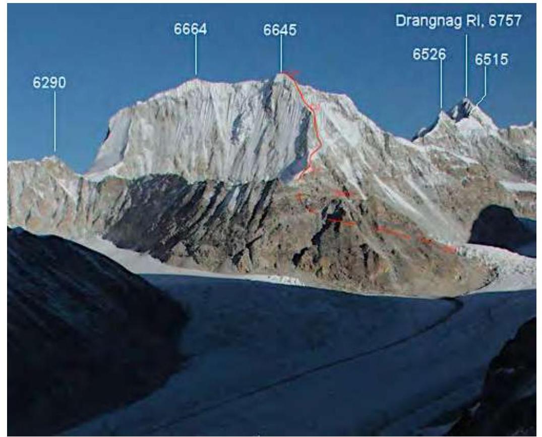
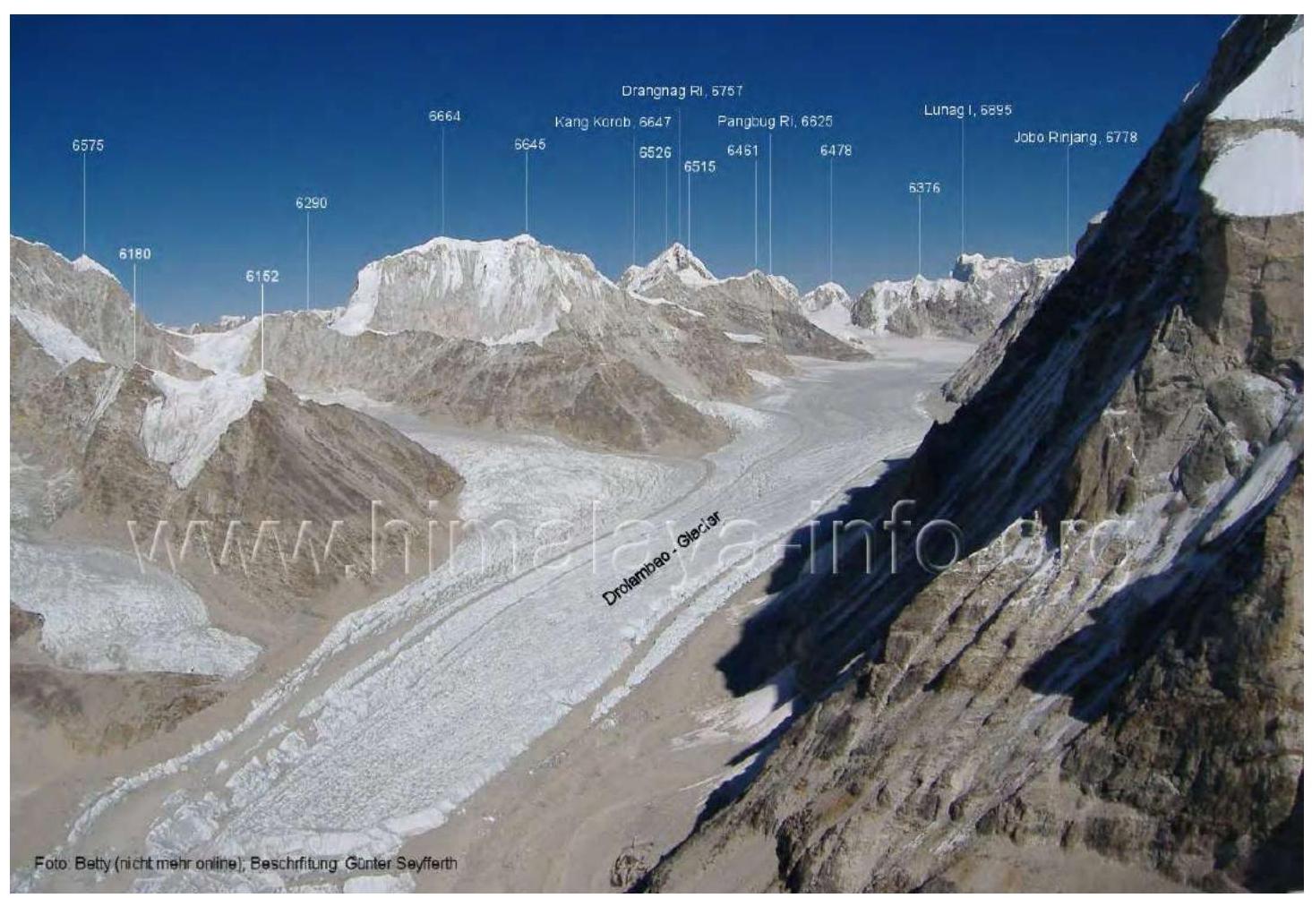 General photo of the summit, Rowaling Kang Shar 6645 m.
 Team's route.
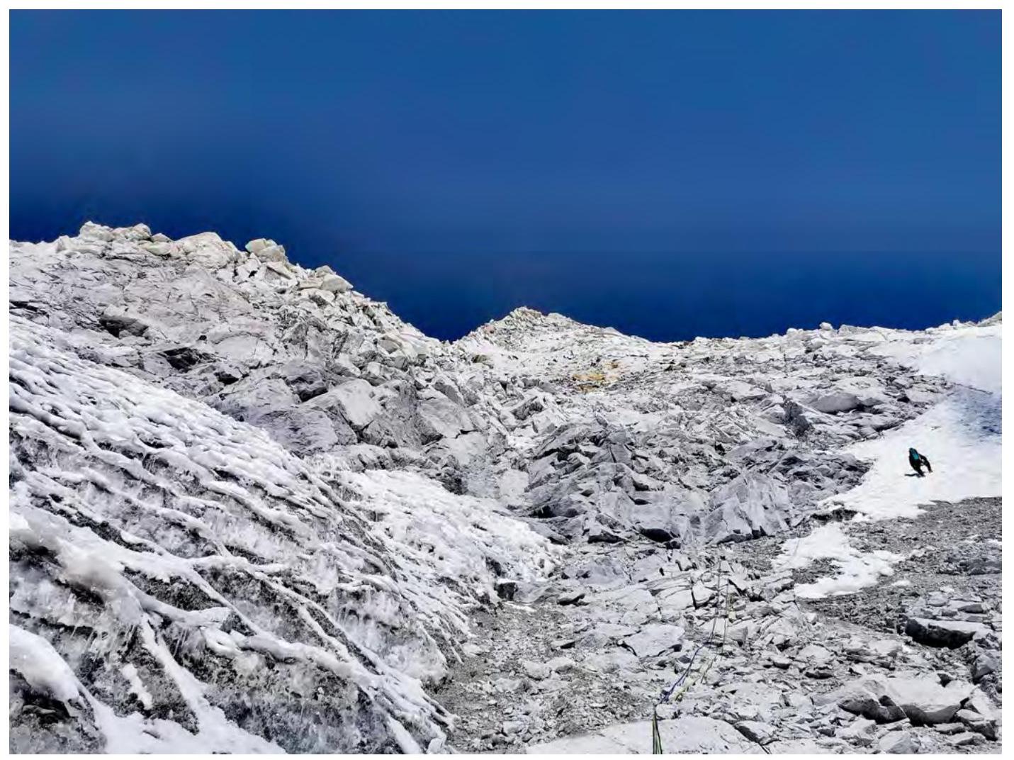
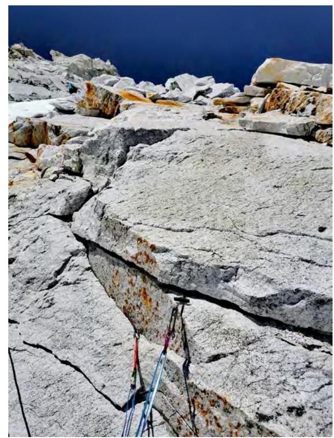
 Technical photo of the route.
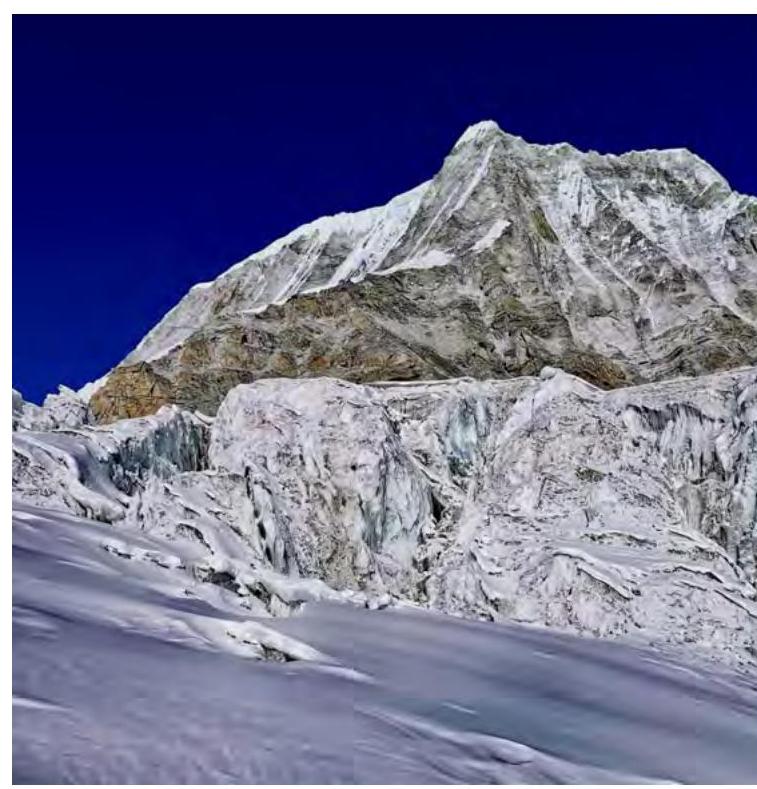
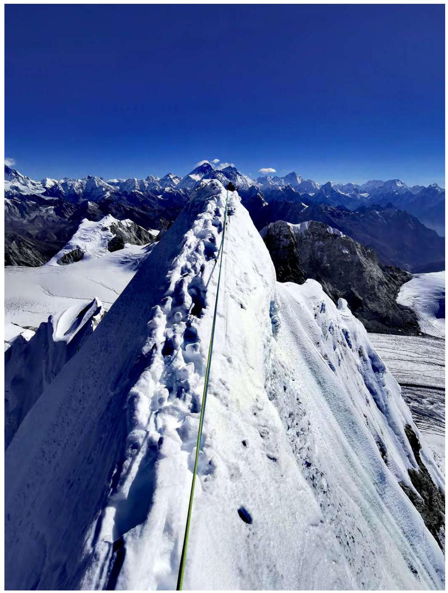
 Summit tower.
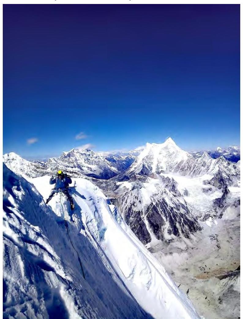
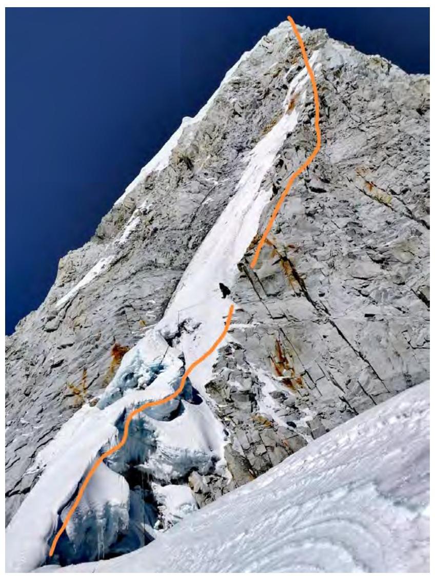 Photo of the route profile from the summit to the east.
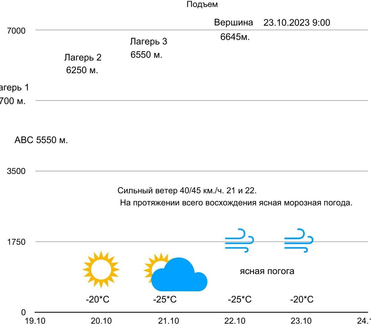
Climbing Schedule
Camp 1 – 5700 m. Camp 2 – 6250 m. Camp 3 – 6550 m. Summit – 6645 m. ABC – 5550 m. Ascent to the summit: October 23, 2023, 9:00. Strong wind: 40–45 km/h on October 21 and 22. Clear frosty weather throughout the ascent. Temperature: –20 °C (October 19) –25 °C (October 20) –25 °C (October 21) –25 °C (October 22) –20 °C (October 23)
Tactical Actions of the Team
Most mountain areas are well explored by climbers and commercial companies selling ascents. I practice classic creative alpinism and try to show by example that not everything is consumed by profit. Therefore, the priority is geographical discovery, ascent in a team of two (since a team of three is a significantly easier option), alpine style, and free climbing. This is the priority. We made the ascent in this style.
After carefully examining the buttress through optics, we:
- planned the locations of the intended bivouacs,
- drew up a tactical plan,
- and implemented it exactly.
We started from base camp on October 19 with everything necessary for ABC and the ascent, crossed the Tolomban Glacier in 8 hours 20 minutes. On October 20, we overcame the greasy belt in the lower part of the Rowaling Glacier, then found a passage between crevasses and began ascending the steep snow-ice slope, riddled with crevasses, to the base of the buttress. By evening, we only reached the site for Camp 1.
The next two days were challenging but interesting:
- Alexey worked first on the rocks and mixed terrain,
- I worked on the snowy ridges.
We didn't use any fixed ropes or climbing protection. The entire route was climbed free. On October 22, we organized 3 bivouacs on a snowy ridge. On October 23, we ascended to the summit of Rowaling Kang Shar 6645 m via sharp, knife-like snowy ridges.
Descent:
- Plan A – via the ascent route,
- Plan B – along the ridge towards the main summit, in case the ridge proved passable.
The ridge beyond the summit turned out to be very dangerous; after climbing a few rope lengths, we returned to Plan A. Descent was initially via the ascent route, then organically to the right of our ascent line along the wall. Descent with rope retrieval on rocks and ice. We were back in ABC by night.
The route we climbed reminded me of the Sviridenko route on Khan, which I climbed with Alexander Pogorelov. Our route is somewhat shorter, but the technical difficulties are similar.
Brief Description of the Route by Sections
- Section R0–R1: steep snow-ice slope with many crevasses, simultaneous movement. At the end of the section – Camp 1, on the ridge.
- Section R1–R2: ice ridge leading to the base of the buttress. Simultaneous movement.
- Section R2–R3: steep ice slope. Alternating movement.
- Section R3–R4: beginning of the buttress. Destroyed granites, tense climbing, alternating movement.
- Section R4–R5: crevice. Protection – cams. Many loose rocks. Variable...
- Section R5–R6: inner corner, difficult for free climbing, climbed without aid, protection – nuts, cams, pitons.
- Section R6–R7: shelf, wall with few holds, steep. Climbed.
- Section R7–R9: series of walls, similar relief:
- blocks,
- mini-ledges,
- flakes. Stations made with combined protection on cams and pitons.
- Section R9–R10: series of walls, shelves, and inner corners leading to a sharp rocky ridge with spires and gendarmes. The ridge is not simple, climbing is difficult.
- Section R10–R11: continuation of the ridge, under the ridge in a snow hollow – overnight, Camp 2, as planned.
- Section R11–R13: snow-ice ridge with "mushrooms". Snow bars, ice screws.
- Section R13–R14: steep ice couloir.
- Section R14–R15: complex mixed section. Steep walls and crevices with ice lenses, technical climbing.
- Section R15–R16: rocky wall supporting the ridge. Difficult climbing, but rocks are more monolithic.
- Section R16–R18: beginning of the pre-summit ridge. Sporadic protection: some ice screws on the south side, mostly snow bars and ice axe. At the end of the section – Camp 3, at the base of the next "mushroom".
- Section R18–R21: three sections of unstable ridge, with Svan-style protection.
- Section R21: summit – snowy "mushroom", October 23, 2023, 9:00 Nepal time. We looked beyond the summit for half a rope length further as part of the exploration. The ridge turned out to be very dangerous for further movement. We decided to descend according to Plan A.
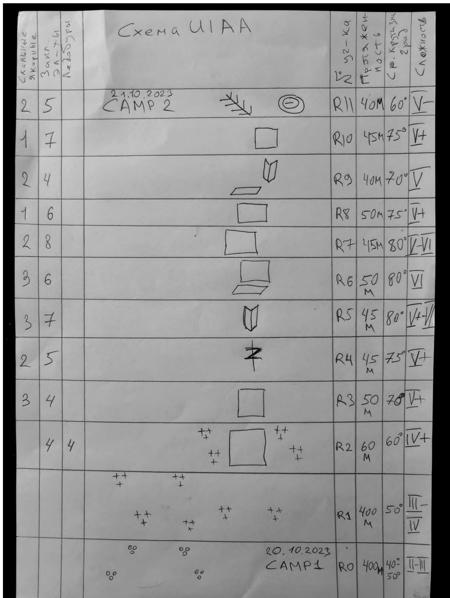 Route scheme in UIAA symbols.
 Route scheme in UIAA symbols, page 2.
 Drawn profile of the route.
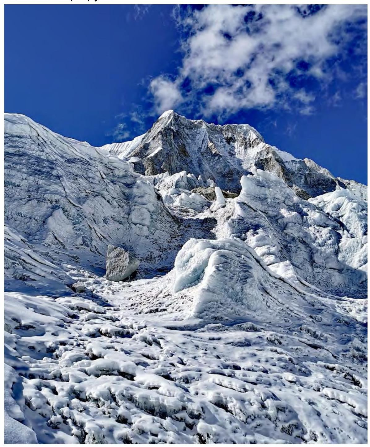 Photo illustration of the report. Beginning of the route.
 Section R1–R2 and beginning of R3.
 Section R3–R4.
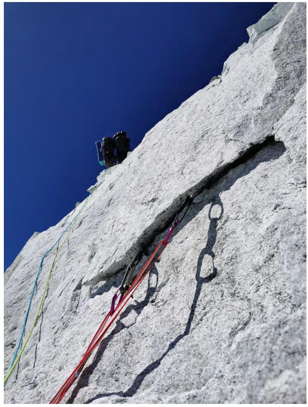 Section R6–R7.
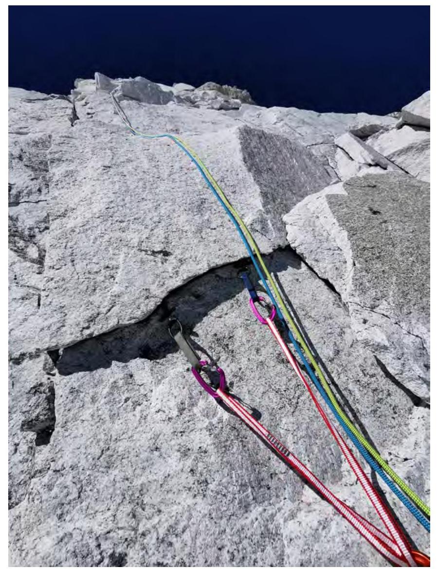 Section R8–R9.
 Camp 2, 6250 m.
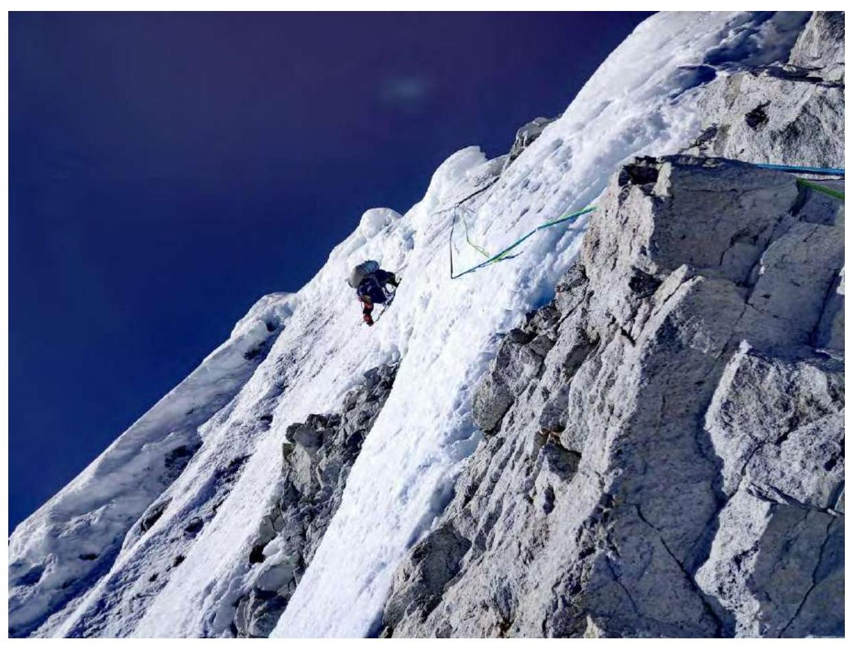
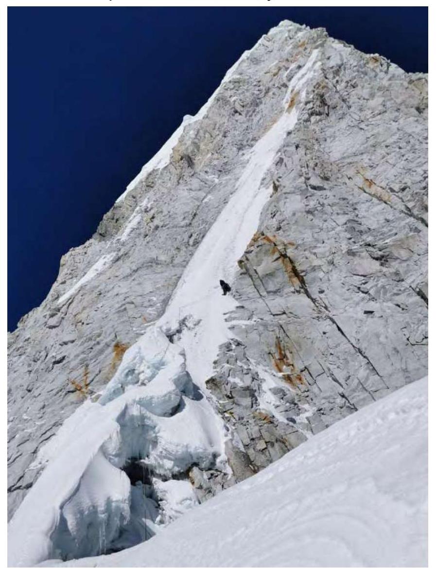 October 22, 2023. Summit tower, sections R12–R16.
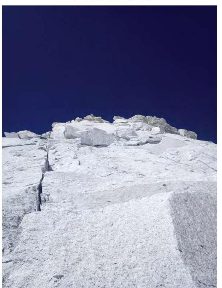 Section R15–R16.
 Exit to the ridge R16–R17.
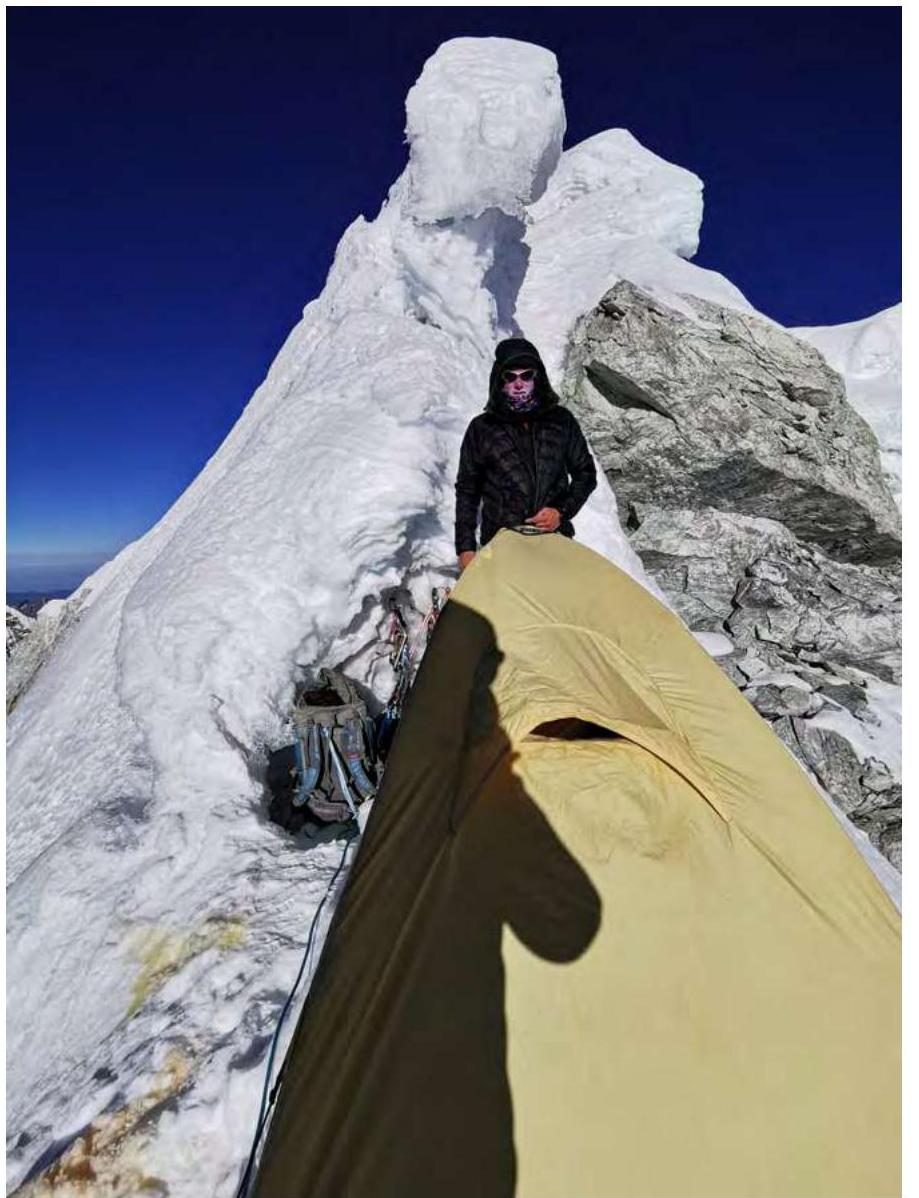 Bivouac 3, 6550 m.
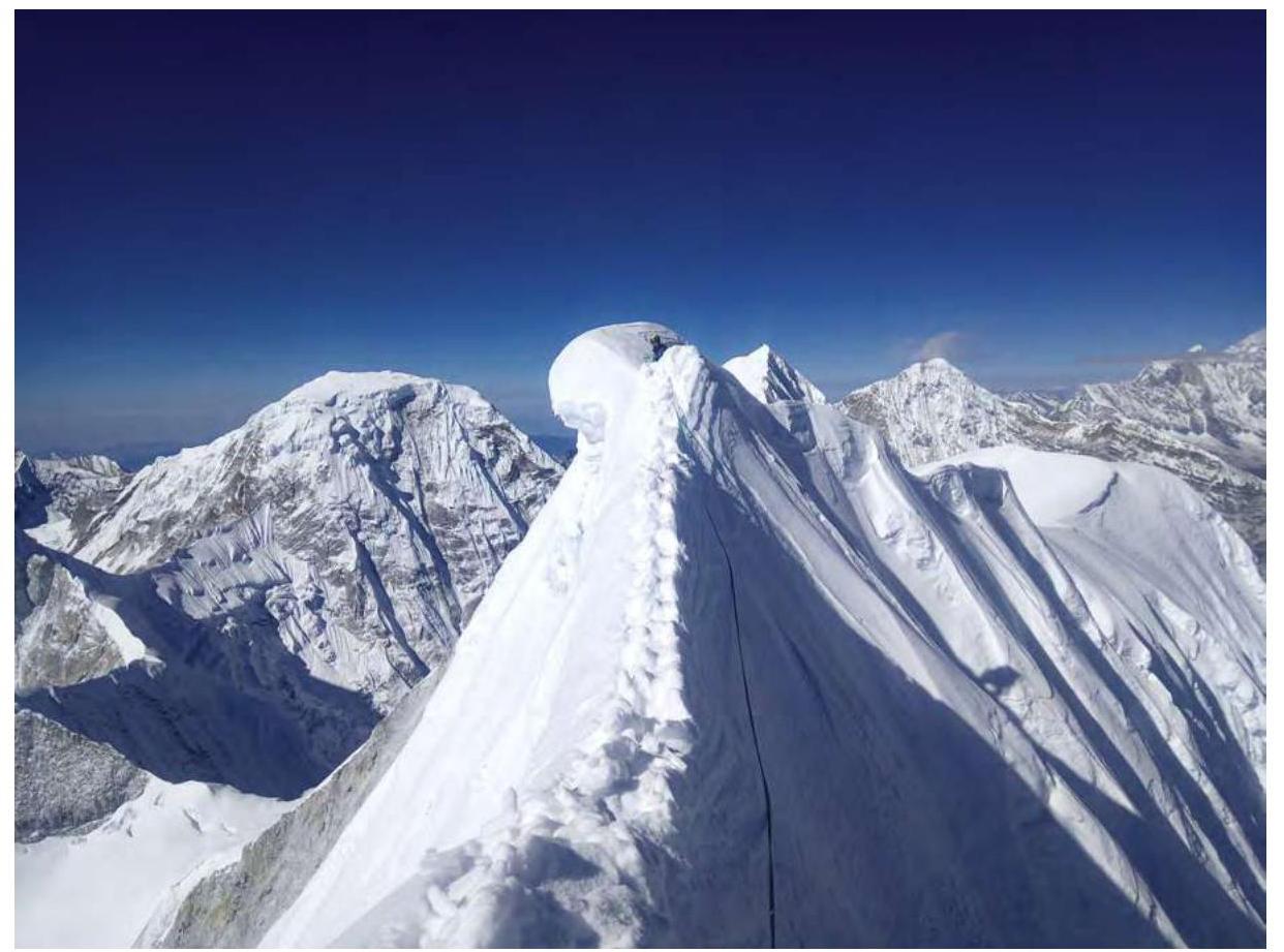 Pre-summit ridge and summit of Rowaling Kang Shar 6645 m.
 Ridge beyond the summit.
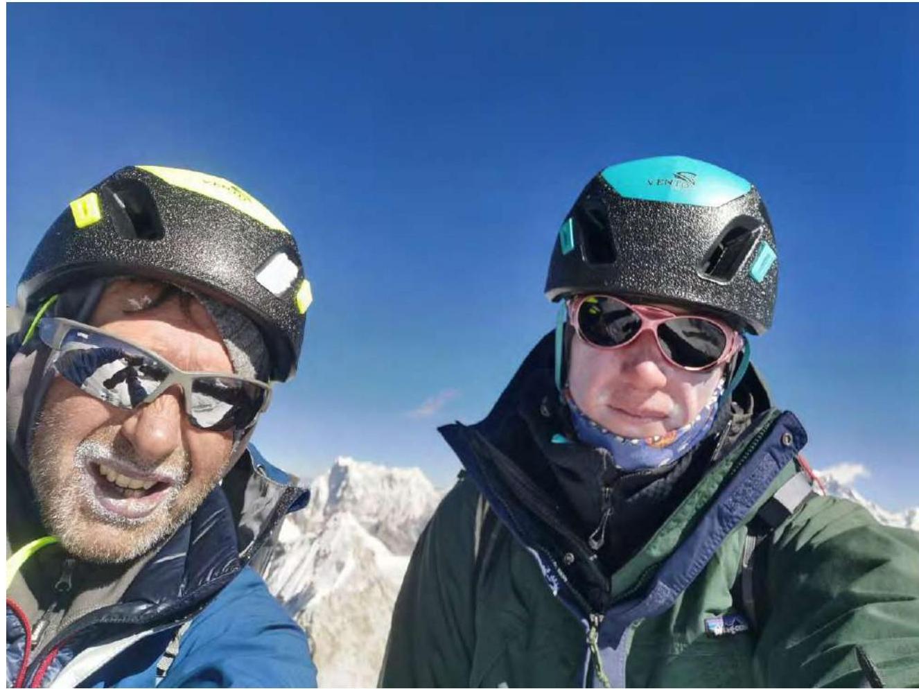 On the summit on October 23, 2023 at 9:00.
 Summit of Rowaling Kang Shar.
 6645 m.
Comments
Sign in to leave a comment