
Russian Alpine Championship
High-altitude category
Report
ON THE ASCENT TO MANASLU (8163 m) FROM THE NORTH ("CLASSIC") SNOW-ICE ROUTE, 5A category of difficulty, BY THE "FALENOBLASTI" TEAM, FROM 23.09.2023 TO 28.09.2023
2023
I. Ascent Passport
| 1. General Information | ||
|---|---|---|
| 1.1 | Full Name, sports rank of the leader | Dusheiko Alexander Sergeevich, 1st sports rank |
| 1.2 | Full Name, sports rank of participants | Kruglov Oleg Sergeevich, 1st sports rank, Cherdantsev Alexey Igorevich, 1st sports rank |
| 1.3 | Full Name of the coach | Dusheiko Alexander Sergeevich, 1st sports rank |
| 1.4 | Organization | RFSOO "FEDERATION OF ALPINISM OF LENINGRAD REGION" |
| 2. Characteristics of the ascent object | ||
| 2.1 | Region | 11.1 Himalayas |
| 2.2 | Valley | Manasri - Himal |
| 2.3 | Section number according to the 2013 classification table | 31 |
| 2.4 | Name and height of the peak | MANASLU - 8163 m |
| 2.5 | Geographic coordinates of the peak (latitude/longitude), GPS coordinates | 28°33′00″ N 84°33′35″ E |
| 3. Characteristics of the route | ||
| 3.1 | Route name | from the north ("classic") |
| 3.2 | Proposed category of difficulty | 5A |
| 3.3 | Degree of route exploration | - |
| 3.4 | Terrain characteristics | snow-ice |
| 3.5 | Height difference of the route (altimeter or GPS data) | 3263 |
| 3.6 | Route length (in meters) | 9850 m on the map (navigator 12000 m) |
| 3.7 | Technical elements of the route (indicated | II cat. diff. rocks - 30 m, IV cat. diff. ice - 150 m |
| summarized proportion of sections of different difficulty categories with specification of terrain characteristics (snow-ice, rocky)) | V cat. diff. ice - 40 m, VI cat. diff. ice - 5 m | |
| :--: | :--: | :--: |
| 3.8 | Average steepness of the route, (°) | 30° |
| 3.9 | Average steepness of the main part of the route, (°) | 25° |
| 3.1 0 | Descent from the peak | Via 5A cat. diff. by the ascent route |
| 3.1 1 | Additional characteristics of the route | Water (snow) available. |
| 4. Characteristics of the team's actions | ||
| 4.1 | Time of movement (team's walking hours, in hours and days) | 28 h, 5 days. |
| 4.2 | Overnight stays | C1, C2, C3, C4. All convenient, in a tent |
| 4.3 | Time spent on route processing | - |
| 4.4 | Start of the route | 8:30, September 23, 2023 |
| 4.5 | Reach the peak | 14:39, September 28, 2023 |
| 4.6 | Return to Base Camp | 19:45, August 29, 2022 |
| 5. Characteristics of weather conditions | ||
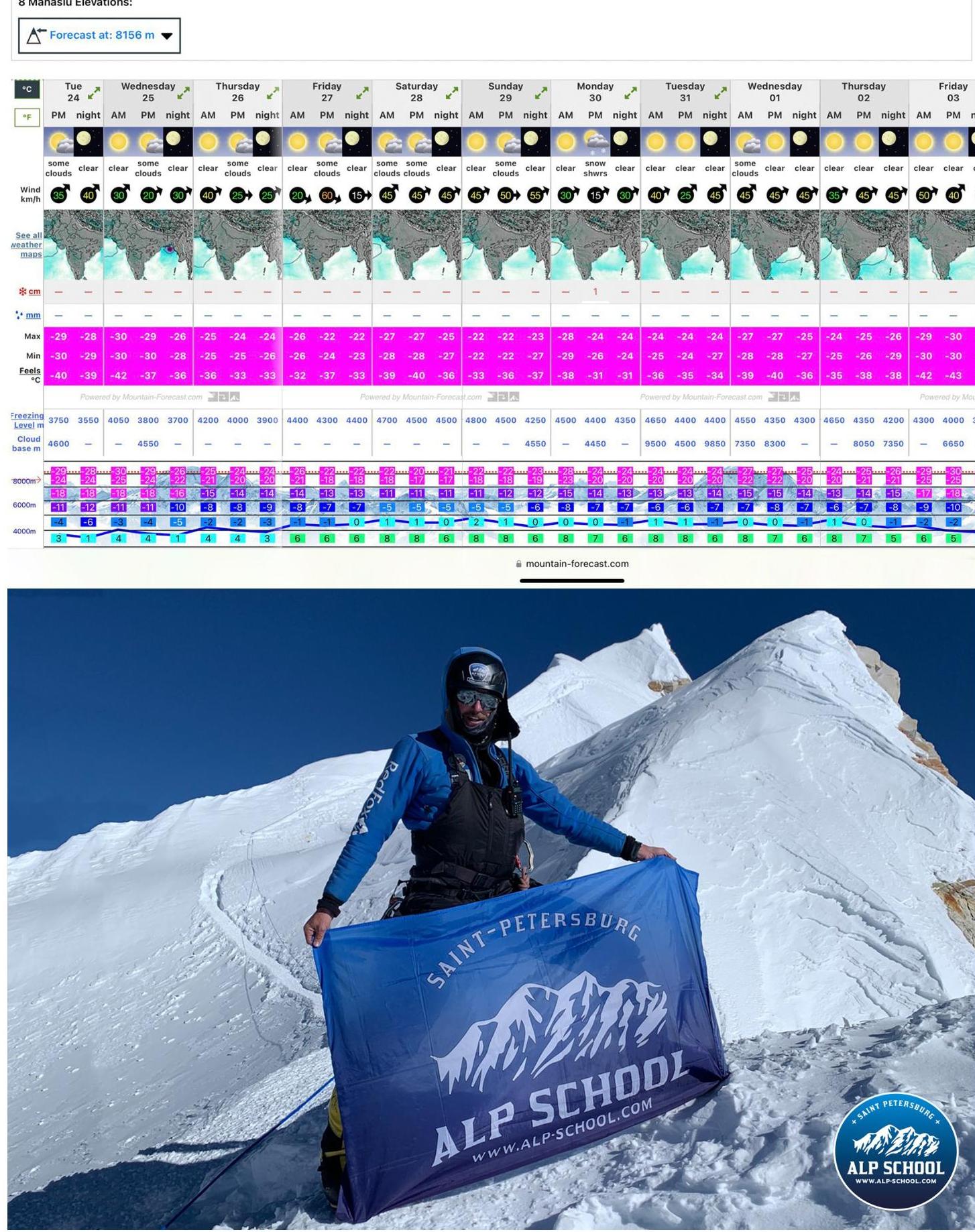
| 5.1 | Temperature, °C | −22°C (felt like −28°C at night) |
| 5.2 | Wind speed, m/s | 12 m/s on the day of the attack |
| 5.3 | Precipitation | About 20 cm of snow |
| 5.4 | Visibility, m | normal |
| 6. Responsible for the report | ||
| 6.1 | Full Name, e-mail | Dusheiko Alexander Sergeevich, info@alp-school.com |
.
II. Ascent Description
-
Characteristics of the ascent object
PEAK — 8167 m
General photo of the peak
Camps:
- C1 — 7450 m
- C2 — 6850 m
- C2 — 6300 m
- C1 — 5800 m
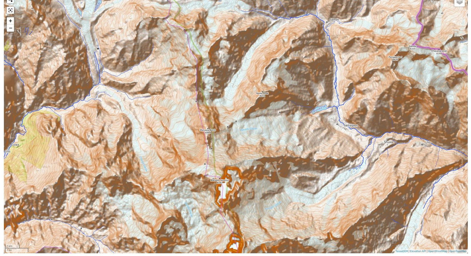
Map of the geographic location of the region. We reach the area by car to Dharapani, and from there:
- 3 days approach to BC (4900 m)
- Distance 51 km
- Characteristics of the route
Technical photograph of the route
C1–14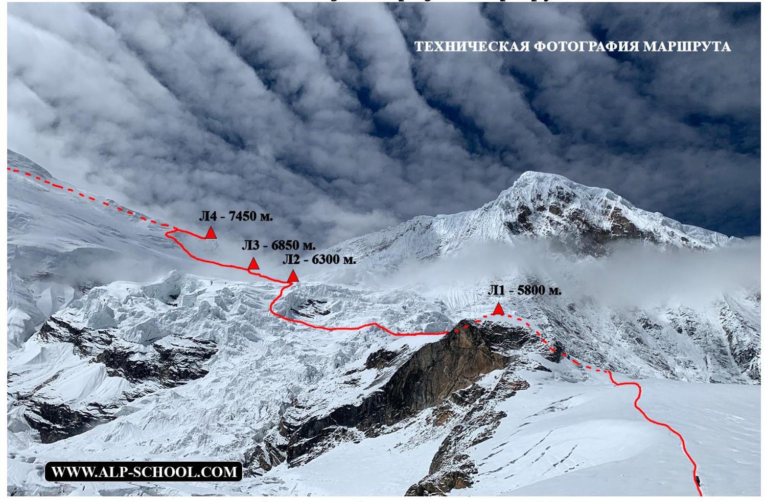
Technical photograph of the route C4–Peak
TECHNICAL PHOTOGRAPH OF THE ROUTE
PEAK — 8167 m
Technical photograph of the route R16–R21
3. Characteristics of the team's actions
| Section # | Description | Photo # |
|---|---|---|
| BC – C1 | About 20 minutes of walking on a beaten path and ascent via easy rocks of II cat. diff. about 30 m, then approach to the glacier via "ram's foreheads" about 10 minutes and exit to the closed glacier, movement strictly in ropes and organization of variable belays in some places to overcome bergschrunds and seracs. Total time 3 h 30 min. | |
| C1–C2 | We enter the route via a cornice on the left side, then move through a broken icefall, traversing left and finally climbing a small ice wall about 5-7 meters, creating a small cornice; as practice showed, it could have been bypassed 30 meters to the right. | Photo #2, 3, 4 |
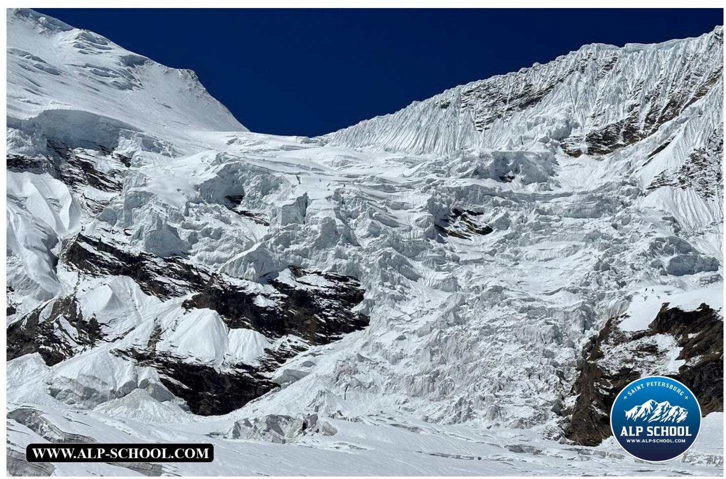
| C2–C3 | We move through the closed glacier, untangling seracs, and approach a large ice wall about 15 meters high, traversing it on the left via snow with a 40° slope; the ascent to the bergschrund is via snow at about 60°, 30 m. | Photo #5 |
| C3–C4 | We cross the closed glacier under a hollow on the right side and pass through the icefall between the crevasses, exiting to an ice "cushion" above 7200 m. | Photo #6, 7 |
| C4 — Peak | We ascend via snow-ice fields towards the main peak, bypassing the eastern peak of Manaslu (7992 m) on the right, and exit to the main ridge, traversing it on the right side, bypassing the false peak on the right and descending via snow below the rocky angle to avoid climbing rocks, and simply bypassing the complex section via covered but convenient snow, entering a small couloir (an inclined inner angle) leading directly to the true peak, adorned with various debris. After the ascent, we return to C4 via the ascent route. Descent took about 2 h 30 min. | Photo #8. Technical photograph of the route "C4 — Peak" |
| C4 — BC | We gathered leisurely after sunrise, a small wind of about 50 km/h made some adjustments to our gathering; on the descent, we collected equipment left by us and our "friends" (after rescue works), excess food, and trash. We descended to BC only by 19:00. |
Photo
#2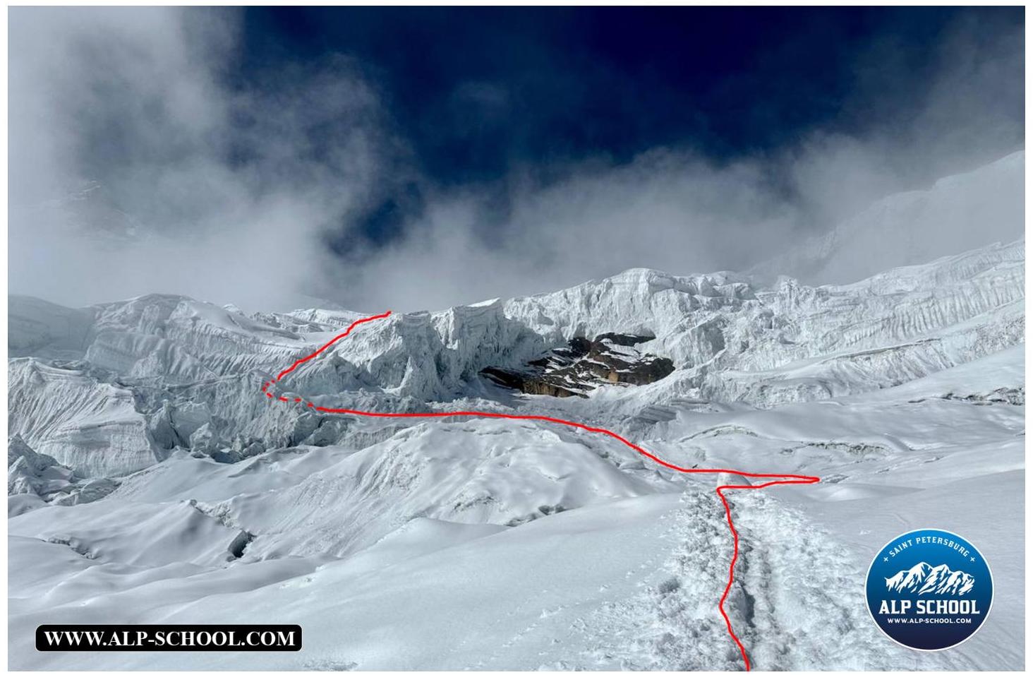
Photo
#3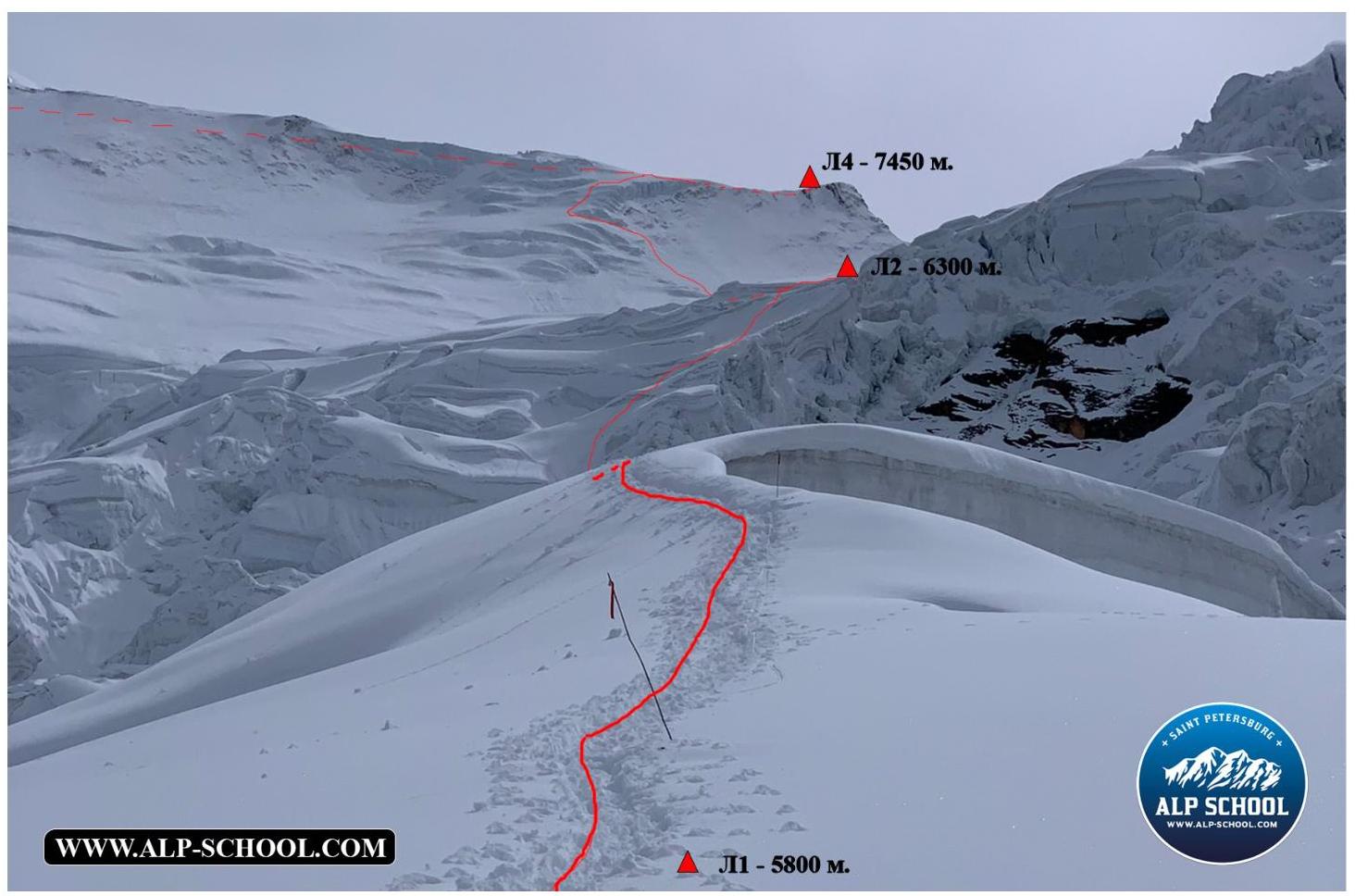 Photo
#4
Photo
#4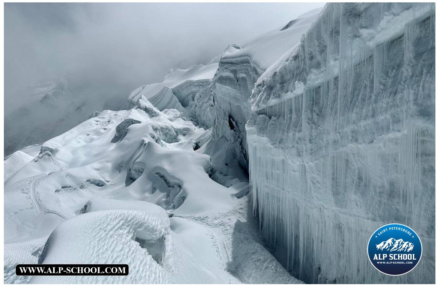
Photo
#5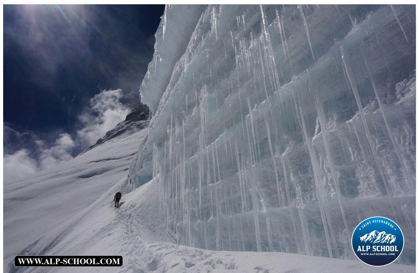
Photo #6
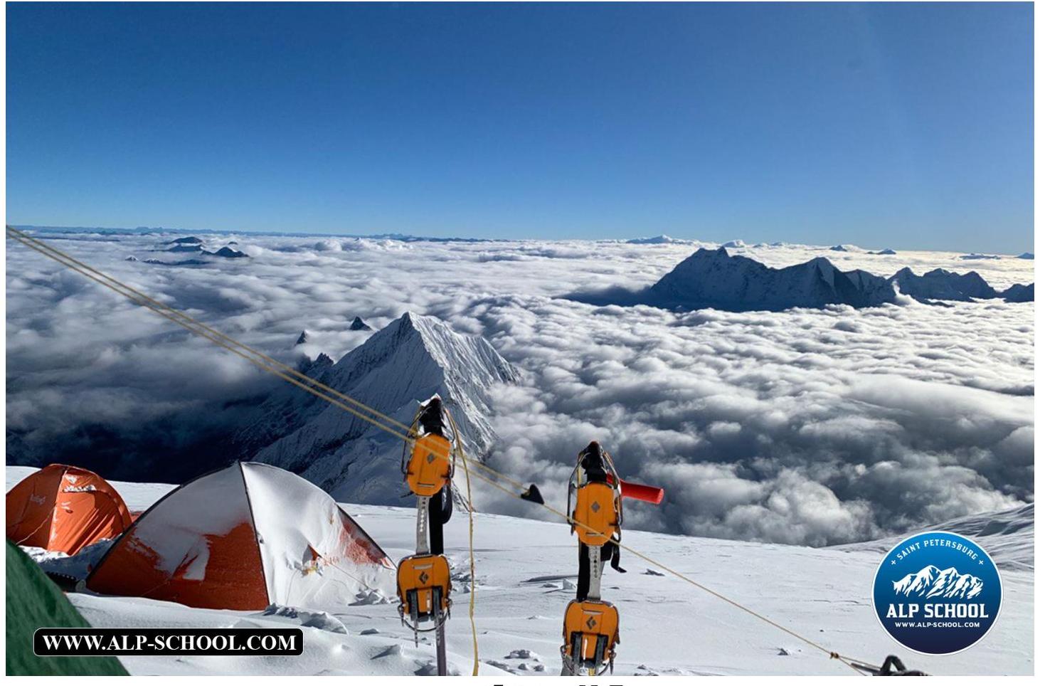
Photo #7
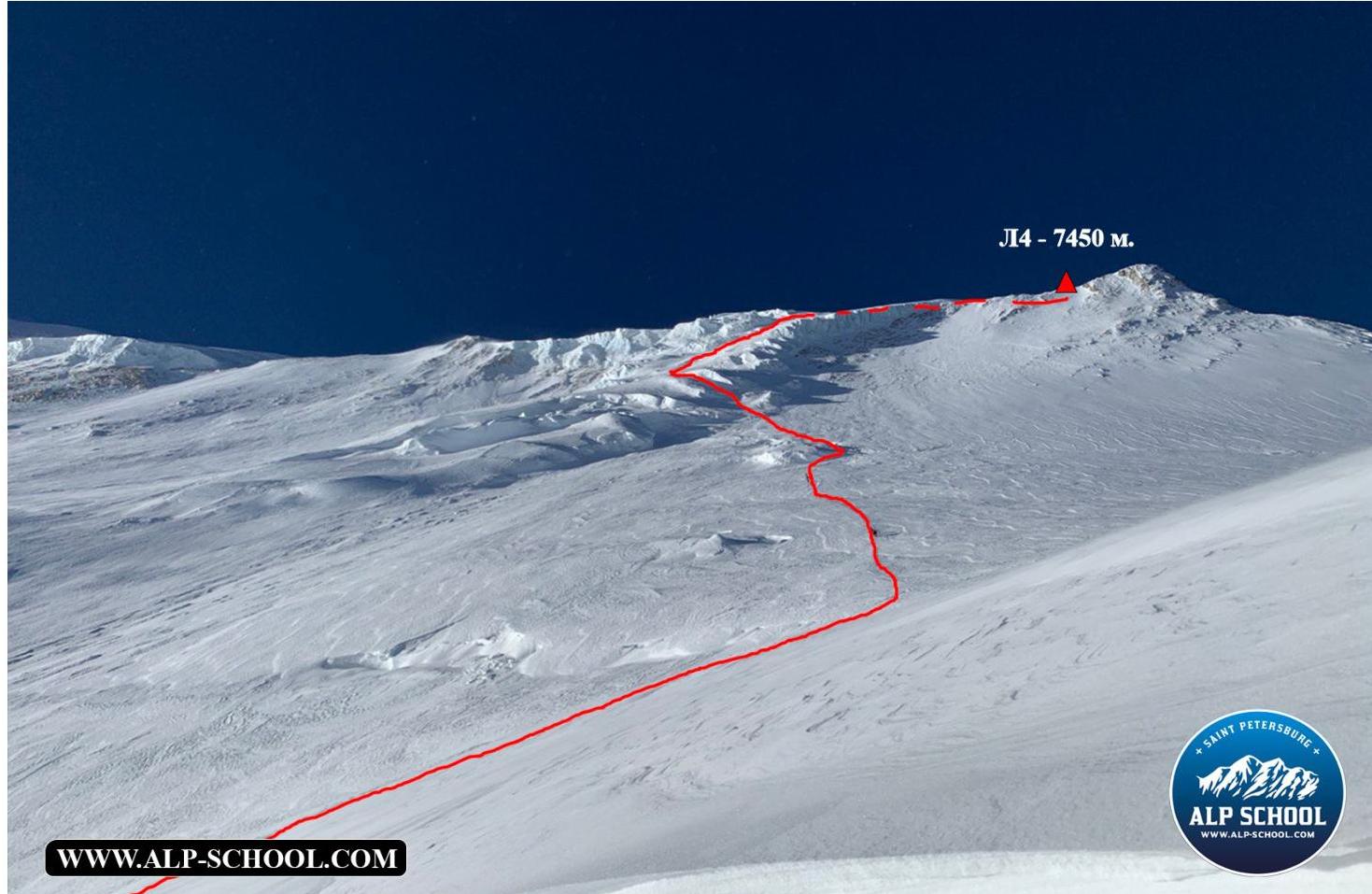
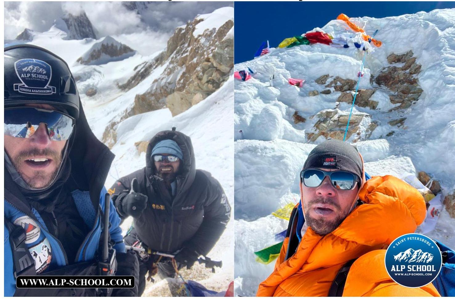
Photo #8 (team photo on the peak)
Tactics and team actions on the route. September 22, 2023 (day 0) — Overnight stay at 4900 m (BC)
- Team approach to the route above the standard BC (4900 m), where a previous delivery was made dur ing acclimatization. Early bedtime.
September 23, 2023 (day 1) — Overnight stay at 5800 m (C1)
- Early rise, start of the route at 6:00 to cross the glacier in the heat. Ascent above C1 (5800 m) at 9:30, decided not to ascend further, set up camp.
September 24, 2023 (day 2) — Overnight stay at 6300 m (C2)
- Ascent to 6300 m in 3 h (approximately 36 min per 100 m gain), ascended above the classic C2, decided not to rush and not to "skip" camps. And the decision was correct.
September 25, 2023 (day 3) — Overnight stay at 6850 m (C3)
-
Ascended above the standard C3 (6600 m) by 250 m, where the third camp was previously located, significantly reducing the time and effort of participants to reach the fourth camp. September 26, 2023 (day 4) — Overnight stay at 7450 m (C4)
-
Due to strong wind and involvement in rescue works, we were able to ascend to the fourth camp only by evening. Collected gear for the attack.
September 27, 2023 (day 6) — Overnight stay at 7450 m (C4)
- Due to general fatigue and late ascent to the fourth camp, decided to postpone the night attack to the next day.
September 28, 2023 (day 5) — Attack and overnight stay at 7450 m (C4)
- Originally planned to start the attack at 1:00, but due to weather conditions, we left at 3:15
Originally planned to start the attack at 1:00, but due to weather conditions, we left at 3:15
- In the morning, we left the fourth camp and descended to BC by 19:00.
The ascent was made without oxygen supplementation, without the help of high-altitude guides and porters, and without the establishment of intermediate camps. Belay on the route during the ascent was provided using personal equipment.
Conclusions
If there is no wind, then up to the third camp (6850 m) it is possible to climb in just a T-shirt and it is necessary to bring much more liquid. Ideally, movement between camps should be done in the morning.
Route safety assessment.
The route is generally safe. The most dangerous areas are located at its beginning. Therefore, an early start of the group on the route is recommended. Melting of the "starting" part of the route is a concern. With fresh snow, there is a high probability of avalanches above the third camp (6850 m).
Many convenient places for overnight stays on the slope.
- Do not give in to the desire to ascend too quickly
- If the weather permits, it is better to move at a leisurely pace through all camps
Radio communication along the route is stable up to the peak itself (8163 m).
Water in the form of snow is available along the entire route.
4. Characteristics of meteoconditions
If you need additional materials: video, photos, or consultation — feel free to contact us: https://vk.com/alp_school_spb ↗
Comments
Sign in to leave a comment