Ascent Passport
- Category — High-altitude technical
- Himalayas, Barun river gorge
- Makalu (8463 m) via Northwest Ridge
- Proposed category: 6A
- Elevation gain: 2663 m; Distance: 7950 m.
Average slope: main part of the route (above bergschrund) — 27°, entire route — 20°
| 6. Pitons driven: | rock | chocks | ice | snow |
|---|---|---|---|---|
| 15 | 20 | 30 | 12 | 0 |
| 0 | 0 | 0 | 0 | 0 |
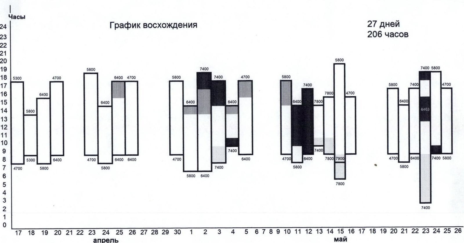
- Team's climbing hours: 206 hours and 27 days.
- Camps: 5800 m — moraine of the glacier
Snow platforms: 6600 m, 7400 m, 7800 m.
- Expedition leader: Savkov Vladimir Vladimirovich, 1st sports category, Novokuznetsk, 1st May St., 2 "A", apt. 68
Senior coach: Bashkirov Vladimir Leonidovich, International Master of Sports; coach: Zuev Sergey Vasilievich, Candidate for Master of Sports.
Team members:
-
Foigt Alexander Vadimovich, Master of Sports — group leader, Novokuznetsk, 25 Years of October St., 2, apt. 23
-
Stalkovsky Vladimir Viktorovich, Master of Sports, Kemerovo, Kuznetsky Ave., 96, apt. 35
-
Wegner Alexander Rudolfovich, Candidate for Master of Sports, Novokuznetsk, Grdina St., 16 "A", apt. 39
-
Bashkirov Vladimir Leonidovich, International Master of Sports, Korolev, Cosmonauts St., 45, apt. 76
-
Uteshev Yuri Vladimirovich, Candidate for Master of Sports, Mezhdurechensk, Lazo St., 35, apt. 45
-
Bogomolov Sergey Georgievich, Honored Master of Sports, Saratov, Barnaulskaya St., 20, apt. 73
-
Koroteev Vladimir Konstantinovich, Honored Master of Sports, May 19, 1996, Moscow, V. Syromyatnicheskaya St.
-
Sokolov Gleb Anatolievich, Master of Sports, Novosibirsk, Kropotkin St., 130/1, apt. 8
-
Departure to the route: April 17, 1996.
Summit: May 23, 1996.
Return to base camp: May 25, 1996.
- Organization name: Sport Club "Gran'", Novokuznetsk, Michurin St., 5
Team's Tactical Actions
During the ascent of Makalu via the Northwest Ridge, the team used the Himalayan climbing tactics. The first acclimatization period took 12 days during the trek from Hile settlement (approximately 1000 m) to the base camp (4700 m), which was established on April 15, 1988. The entire expedition team was divided into three groups. The main work on the route was done by the first, most experienced and strongest group, whose ascent schedule is presented in this report. The first camp (5800 m) was set up on April 18, 1953, on good and cozy sites protected from the wind. The path to it from the base camp takes 7–9 hours with good acclimatization and runs along the western slopes of Makalu, which are hazardous due to rockfall.
The path from camp 5800 m to 6600 m (section R0–R1) is not technically complex but is hazardous in the first part when crossing the icefall due to possible avalanches. In the second part, there is a snow plateau with closed crevasses, which was marked with poles in case of poor visibility. At the upper level of ice fractures, in a convenient and safe place, a 6600 m camp was established.
The most challenging section R1–R2–R3 was fully equipped with fixed ropes. During the processing of this section:
- An intermediate camp was established at an altitude of about 7100 m, which was later moved to 7500 m.
- Ice screws and snow anchors were used at belay points.
- Rock anchors and chocks were used on rocky sections.
On the saddle between Makalu and Makalu II (7450 m), a 7500 m camp was set up. The sites are convenient but constantly exposed to strong winds. Above the 7500 m camp, there are firn slopes with ice and rock sections. Up to 7800 m, the path is not steep but is lengthy, and the movement is simultaneous. This section was marked with poles.
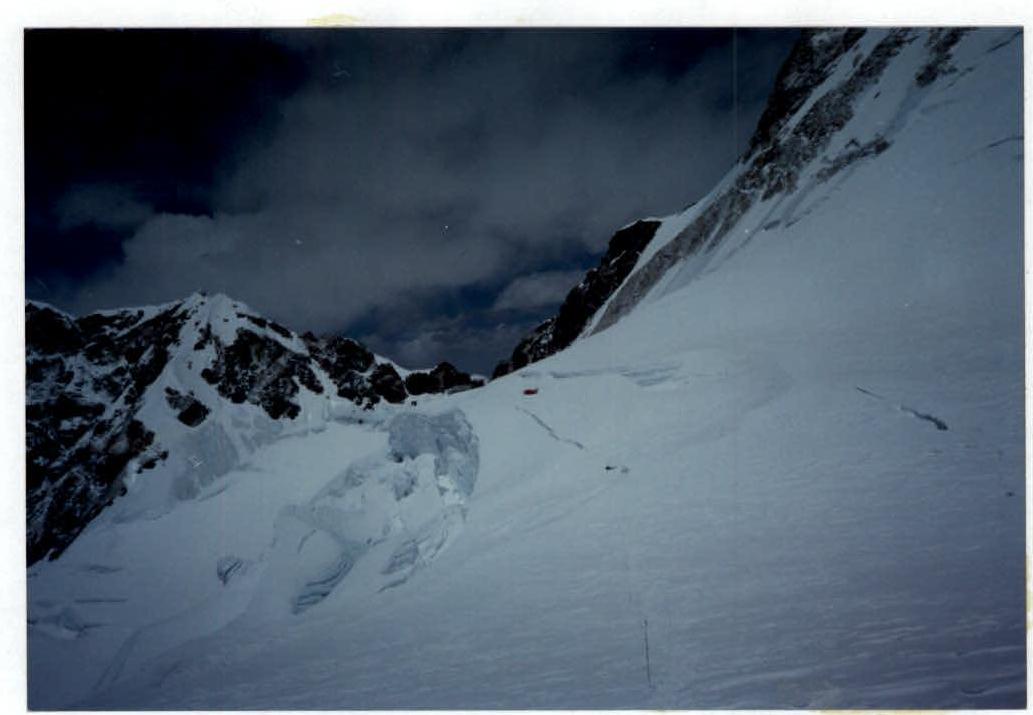
At 7800 m, a camp was established on the right side of the icefall flowing from under the summit, on a small but convenient snow platform protected from the wind. The icefall is traversed obliquely to the left (R4–R5). There are ice walls 5–10 m high with up to 70° steepness. About 350 m of fixed ropes were installed on this section.
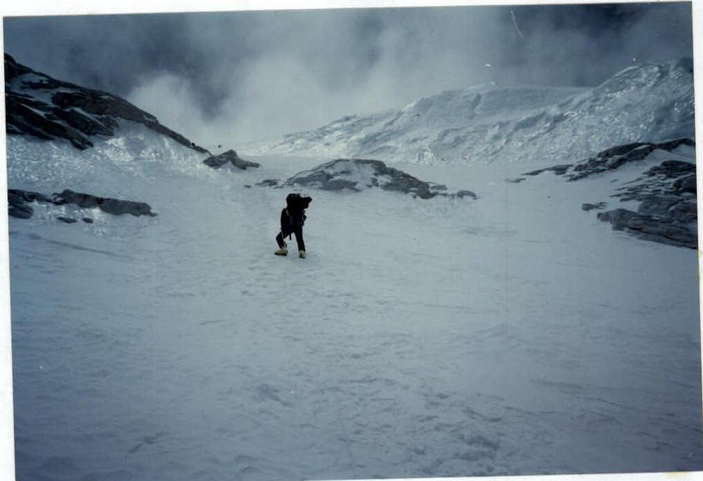
Further, the movement is simultaneous along the left side of the icefall to the exit to the couloir leading to the Northeast Ridge (R5–R6). The lower part of the couloir is an ice-firn slope, and further up to the exit to the ridge, there are snow-covered rocks (R6–R7). At this section, 250 m of fixed ropes were installed. The technical complexity and altitude above 8000 m make this section the most challenging.
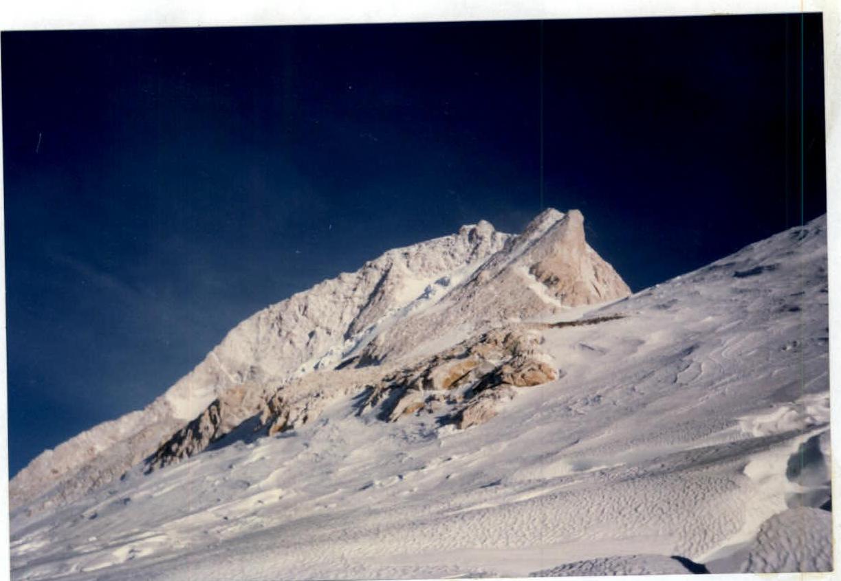
Then, the movement continues along the ridge to the gendarme and then along the sharp snow ridge with cornices, sticking to the right side (R7–R8). The movement is alternating, with belays through an ice axe.
When processing the route, each intermediate camp was provided with:
- high-altitude tents,
- sleeping gear,
- fuel and food supplies,
- stoves and gas burners.
In addition, camps at 7500 m and 7800 m were equipped with oxygen equipment in case of an emergency.
The team maintained stable radio communication with the base camp and its auxiliary groups. Considering that an extra night at 7800 m would not be beneficial and having good acclimatization, the group decided to start the summit push from the 7500 m camp at 3:00 on May 23, 1996. Around 13:00, all participants reached the summit and were back at the 7500 m camp by 18:00. All expedition members, except Uteshev Yuri, ascended to the summit without using oxygen.
Route Description by Sections
Section R0–R1: from camp 5800 m, the passage through the icefall (1–1.5 hours) is hazardous due to possible serac collapses and rockfall. In the middle of the section, there is an exit to the closed glacier along 150 m of ice with up to 30° steepness. Further, the path goes along the glacier with crevasses.
Section R1–R2: at the beginning of the section, there is a bergschrund (1.5 m). Then, the snow slope turns into hard firn with ice sections with up to 45° steepness.
Section R2–R3: firn slopes are interspersed with rocky outcrops. In the upper part, there is a belt of rocks up to the saddle of the Northwest Ridge. The rocks are snow-covered, with some sections having ice. Steepness in some areas reaches 60°.
Section R3–R4: starts from the 7500 m camp. Firn slopes alternate with rocky outcrops with up to 30° steepness. In the middle of the section, there is an ice slope 150 m, 25–30°, traversed obliquely to the left. It is possible to bypass it with a slight descent. Further, up to the 7800 m camp, the path does not present technical difficulties.
Section R4–R5: crossing the icefall obliquely from left to right. The section is 400 m long, with an average steepness of 50°. There are ice walls 5–10 m high with up to 70° steepness.
Section R5–R6: a snow slope 500 m long with up to 20° steepness, not presenting technical difficulties.
Section R6–R7: a couloir leading to the Northeast Ridge. In the lower part, there is an ice-firn slope, and in the upper part, there are snow-covered and icy rocks. The altitude above 8000 m complicates the passage of this section.
Section R7–R8: the pre-summit ridge. Movement along the ridge to the gendarme, then along the sharp ridge with cornices, leading to the summit. It is necessary to stick to the right side of the ridge when moving upwards.
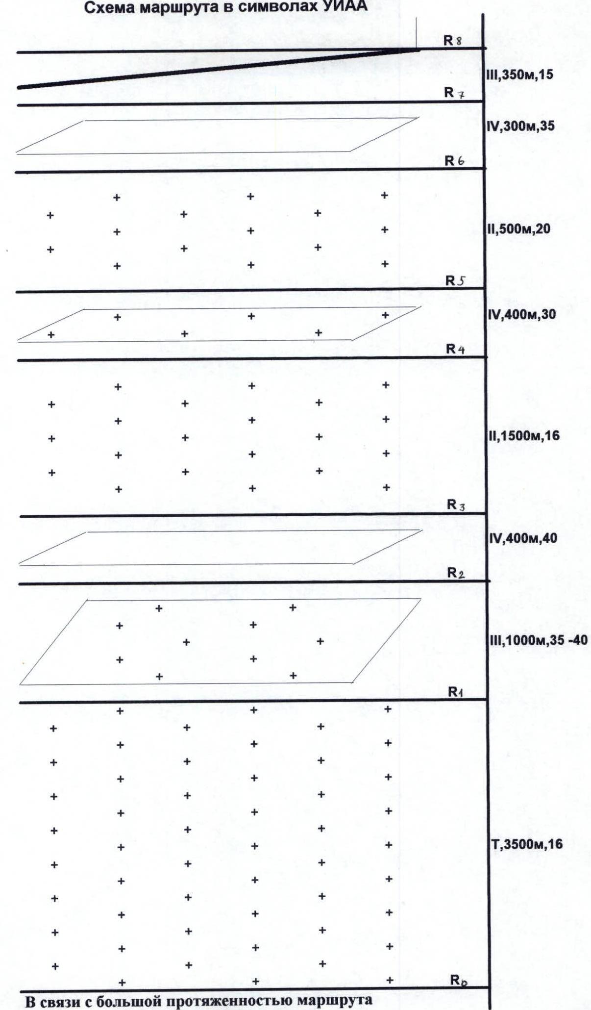
Due to the route's considerable length, the diagram is drawn to a scale of 1:10 000
Conventional signs:

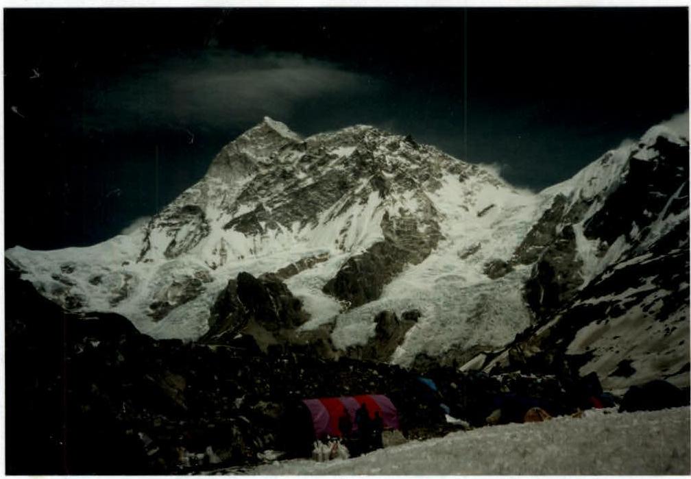
Makalu. General view from the base camp.

Base camp at 4800 m.
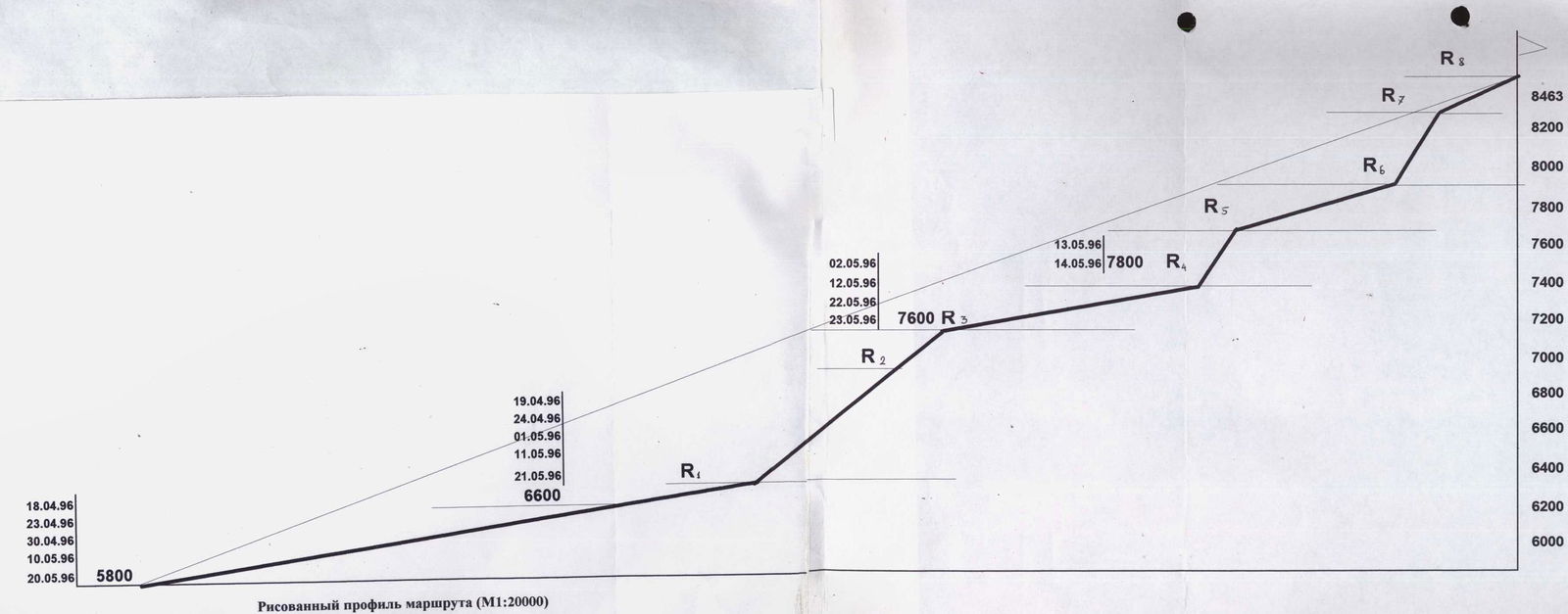
Hand-drawn profile of the route (M1:20000)
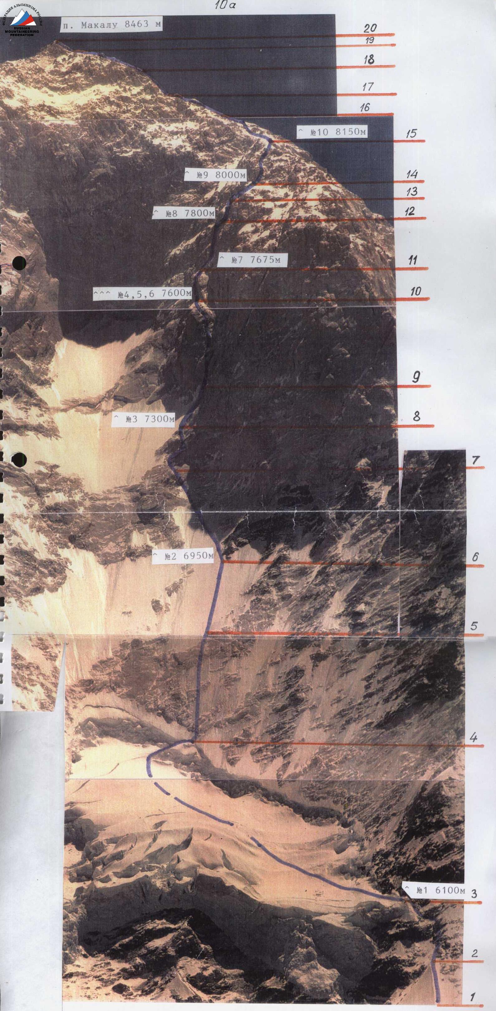

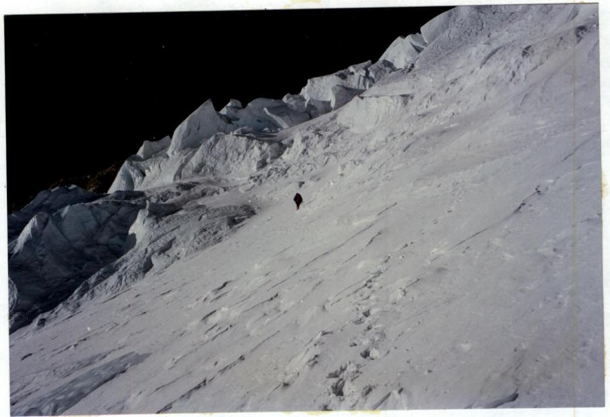
Icefall (5800–6600 m). Section R0–R4
Intermediate camp at 6600 m.
Snow-ice slope (6600–7000 m). Section R1–R3
Snow-ice slope (6600–7000 m). Section R1–R3
Icefall (7400–7700 m). Section R4–R5
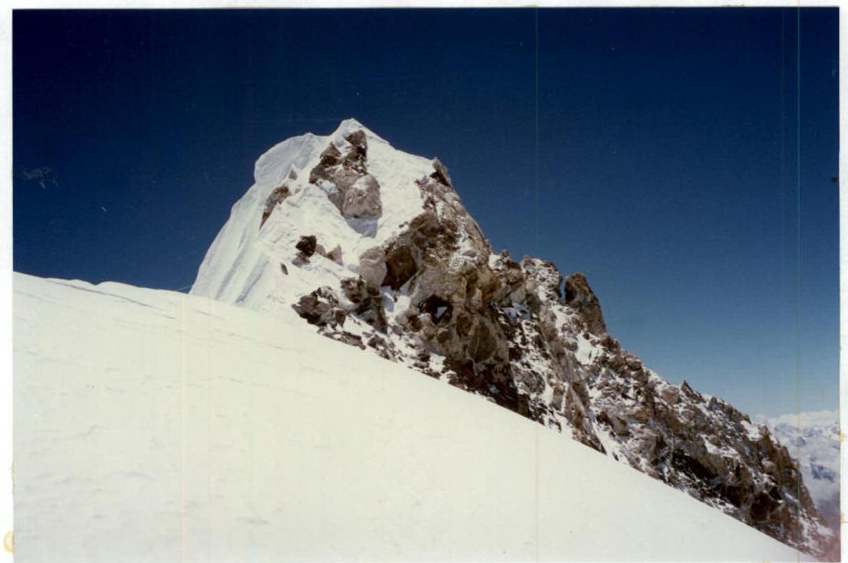
Pre-summit ridge (8200 m). Section R2–R2
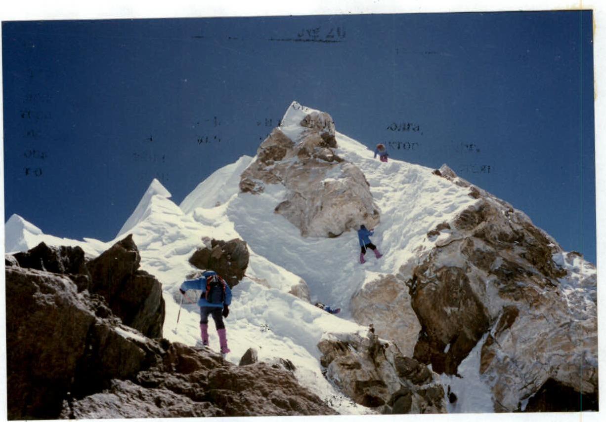
Pre-summit (8420 m). Section R2–R8

Summit — 8463 m.