
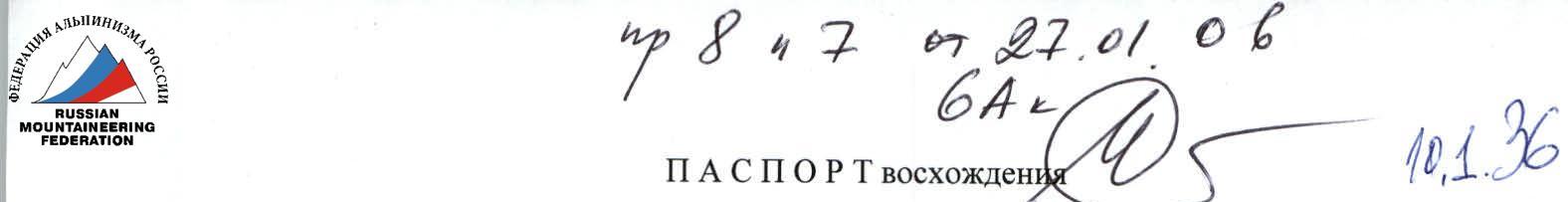
ASCENT DOCUMENT
- Main Himalayan ridge, Baruntze spur.
- Kali-Himal Peak (7044 m), ascent from Imja Glacier via the center of the North Face, first ascent.
- Submitted category: 6A.
- Route type: combined.
- Route height difference: 1744 m.
Route length: 2935 m. Section lengths:
- Category V: 135 m.
- Category VI: 15 m.
Average slope:
- Main part of the route (sections R4–R47): 62°
- Entire route: 49°
- Pitons left on the route: total — 26, drilled — 0.
Pitons used:
| Cam | Bolt | Ice | Chock Stone | Friend |
|---|---|---|---|---|
| 34 | 0 | 73 | 9 | 11 |
| 0 | 0 | 0 | 0 | 0 |
- Climbing hours on the route: 86 h 15 min.
- Team leader: Simone Moro.
Team members:
- Bruno Tassi
- Boris Korshunov
- Denis Urubko
- Team coach: none.
- Departure to the route: April 13, 2004 — 7:00.
Summit: May 4, 2004 — 11:15. Descent to Base Camp: May 5, 2004 — 22:30.
Route photo from Northwest, 2000 meters from the wall.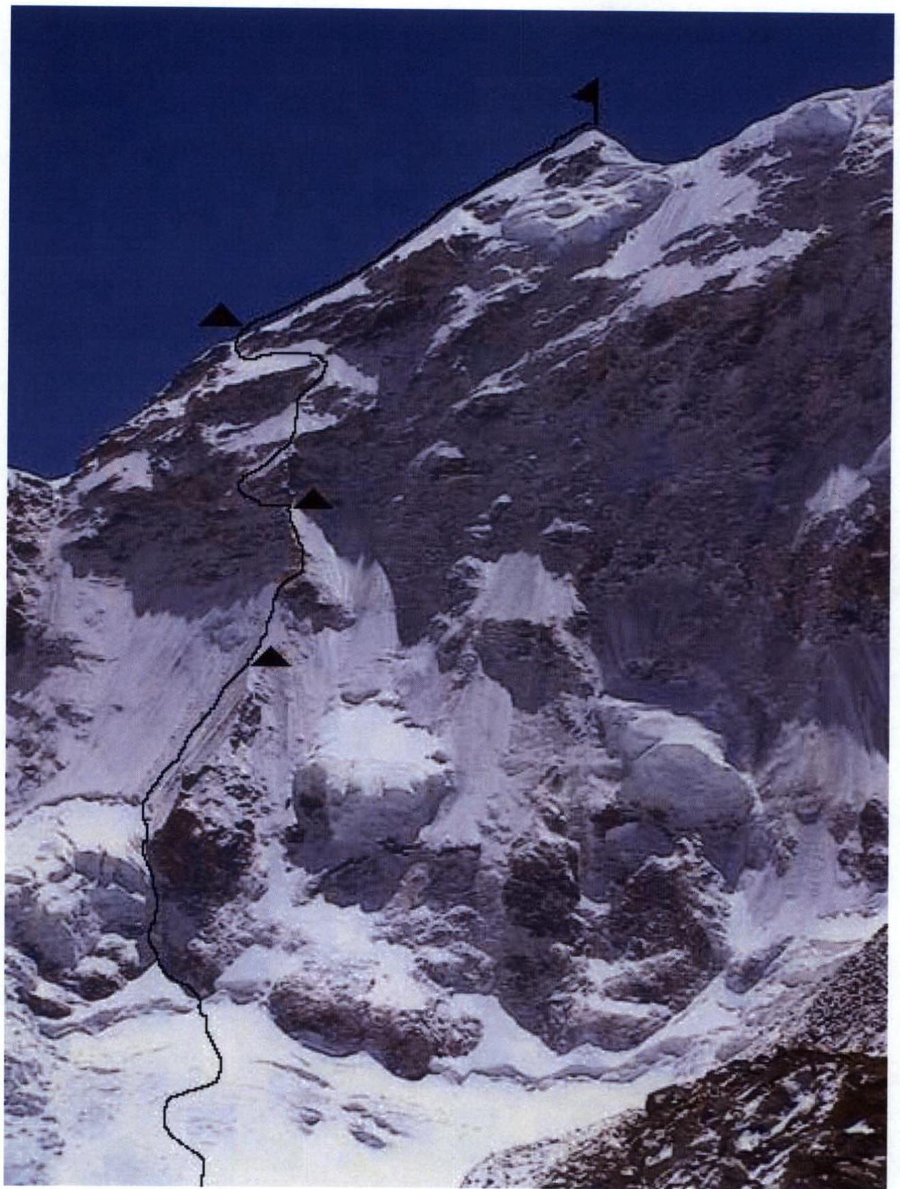 Area map
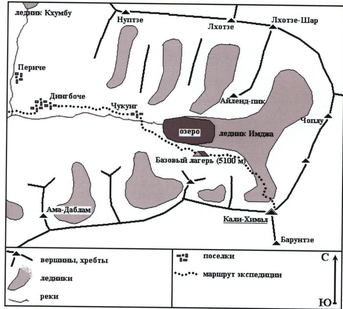
Brief Description of the Climbing Area
The Himalayas are the highest mountain system in the world. The highest mountains on the planet are located here, stretching from northwest to southeast. On one end, they logically transition into another mountain system — the Karakoram, and on the other side, they gradually degrade and flatten out, ending in the Minyak-Gonkar region, and then fan out into several secondary ridges, soon disappearing altogether.
The Himalayas are fold mountains. The ridge was formed as a result of the compression of two continental platforms — the Indian and Eurasian plates. Their global collision led to the rapid growth of sections of the earth's crust, and the uplift continues to this day. For example, Everest — the highest peak in the world — rises at a rate of 2 cm per year. This promises the emergence of a "nine-thousander" in the distant future.
The Himalayas border the arid Tibetan Plateau to the south, and thus act as a barrier to air masses coming from the Indian Ocean. This barrier absorbs almost all the moisture, and the area to the north has a desert-like character.
The climate in the Himalayas is divided into two periods — two monsoons:
- In summer, winds blow from the south. During this period, weather conditions are very harsh: it rains almost constantly in the foothills, and a huge amount of snow falls on the peaks. This is the summer monsoon.
- In winter, the situation changes: winds start blowing from Tibet, and cold weather sets in in the Himalayas. Snowfall is rare, but winds are very strong. This is the winter monsoon.
The main climbing seasons here are the inter-monsoon periods — in spring and autumn.
The summit of Kali-Himal (7000 m) is located in one of the most popular areas of the Himalayas — near Everest. The Imja Glacier, which it closes, runs parallel to the Khumbu Icefall but is located below the South Face of Lhotse.
The peak is situated in the southern spur of the main Himalayan ridge, in the watershed between the Khumbu-Himal and Makalu-Himal regions.
To the north of it are the Nuptse and Chhukung Ri mountains. To the south, a ridge connects Kali-Himal to Baruntze. It adjoins this mountain, sharing a common West Face and East slope.
Expeditions heading to the summit used the North Ridge for ascent. It was first climbed by a Danish expedition in 1982. However, the most characteristic feature of Kali-Himal is its North Face.
Characteristics of the North Face:
- Height difference — 1700 m.
- It has overhanging rock belts, some of which are ice-covered, with some ice being serac.
- The type of rocks varies greatly:
- On the ridge (sections R19–R26) — blocky, "broken" structure.
- On the overhangs (sections R30–R38) — layered rocks.
- The heterogeneity and layering of the rocks give the cliffs a very fragmented character, and the serac ice holds the debris in place.
- Light granite alternates with dark schist and porphyrite.
Climbing is quite intense. Problems with organizing protection points arose only on the rock belt at sections R35–R36, where there were many "blind" cracks.
Preparation for the Ascent
Team members trained using different systems and in various regimes. The Italians lived in different cities, the third team member lived in the Moscow region (Russia), and the fourth in Kazakhstan.
The main focus of training was on the technical aspect — on rocks and ice. However, functional training was also conducted in sufficient volume.
Urubko underwent training under the guidance of coach S. Samoilov from the Central Sports Army Club of the Republic of Kazakhstan — he made:
- ascents to the peaks of Trans-Ili Alatau,
- a winter ascent to Lenin Peak,
- ran cross-country on rugged terrain,
- climbed rocks with top and bottom rope.
Due to circumstances, only Moro made joint ascents with the other team members. He was the connecting link of the team and the main organizer of the project. Although, of course, everyone knew each other beforehand, for more than a year.
The route was chosen based on:
- visual observations in previous years,
- photographs.
A fairly clear logical line was traced. Based on the experience of previous high-altitude technical ascents in various mountain regions around the world, the team selected equipment. The character of the rocks forming the southern slopes of the Himalayas was also taken into account.
Ascent Details
A mixed Himalayan-Alpine tactic was employed. Preliminary processing of the route was done with fixed ropes, but the final push (4 days — 2 camps) was conducted autonomously. During the processing of the lower part up to 6200 m, Boris Korshunov worked in the team, but he did not reach the summit due to administrative reasons — lack of a permit from the Nepalese government.
On April 8, the Base Camp (BC) of the expedition was established at an altitude of 5100 m. Here, there is a source of drinking water and a convenient safe area for tents.
On April 9, the team set up an Advanced Base Camp (ABC) at the foot of the mountain at an altitude of 5250 m in the upper reaches of the left branch of the Imja Glacier.
On April 10, preparations were made for the departure, and final discussions were held on the route choice and tactics coordination.
On April 11, the pair Korshunov-Urubko ascended to ABC.
On April 12, the pair Korshunov-Urubko departed to lay out the route through the icefall at the base of the left part of the wall. They encountered ice gaps and seracs, making the route hazardous. At an altitude of about 5500 m, they reached a huge bergschrund, which was impassable, and turned back. On this day, the pair Moro-Tassi arrived at ABC. Everyone spent the night at the foot of the mountain.
On April 13, the group set off on the route. It was decided to start at the foot of the rock buttress. Moro-Tassi worked ahead, while the pair Korshunov-Urubko carried equipment and provided backup. The group's path went between the rock buttress and the icefall. A 20-meter rock wall (section R7) proved challenging, and only 300 meters of fixed ropes were set up that day. The edge of the ice plateau was reached. By evening, all participants descended to BC.
April 14 was a rest day.
On April 15, the pair Urubko-Korshunov continued working on the route, departing from BC. From the ice plateau (section R10), they turned right and moved along a system of ice gullies, fixing ropes (sections R11–R15). Steep ice sections were climbed using ice hooks. At 5900 m, they reached a ridge (section R16), fixed another 75 meters of ropes, and descended to ABC.
April 16 was a rest day.
On April 17, the pair Tassi-Moro moved to ABC.
On April 18, Tassi and Moro, following the fixed ropes, reached 5900 m, carved out a platform in the ice-snow ridge, and set up a tent.
On April 19, they continued processing the route. After an ice slope, they climbed a series of steep rock walls and reached a rock ridge (sections R18–R23). The climb was complicated by bad weather. The climbing was mostly on mixed terrain, and after a bastion "Iron" (section R22), the pair worked until 6150 m and returned to their overnight stay. Their condition was normal.
On April 20, everyone rested in BC.
On April 21, the pair Urubko-Korshunov moved to ABC.
On April 22, Urubko and Korshunov ascended to the tent on the wall, dismantled it, and moved higher. After the end of the fixed ropes, they climbed another 50 meters (sections R24–R27) and found a suitable place for a bivouac for two people (section R27). They set up a tent and spent the night. The weather worsened, and it snowed after lunch.
On April 23, in bad weather, they began processing the route. Here, the ridge abutted a belt of overhanging rocks with about 70 meters of height difference, which was broken to the left by a semblance of a couloir. It was decided to try this direction. Moving 80 meters to the left along a series of slabs covered in ice (sections R28–R31), the pair Urubko-Korshunov overcame a 15-meter overhanging wall (section R32). The climbing was mostly on mixed terrain. Only the overhang was climbed without ice axes. It was decided to stop there, and by evening, the participants returned to the tent. The whole day was marked by severe bad weather. Their condition was normal.
On April 24, a two-day snowfall caused significant snow accumulation on the upper part of the mountain, making movement into the couloir very hazardous. All night, avalanches fell around the tent. The first half of the day was spent waiting for the weather to clear. However, after receiving a bad weather forecast via radio, the decision was made to descend. By evening, they arrived at ABC.
On April 25, the pair Korshunov-Urubko returned to BC.
On April 26, the group descended to the valley to the village of Chukung at an altitude of 4700 m.
April 27 was a rest day.
On April 28, the group returned to BC.
On April 29, preparations were made for the departure. An increase in wind at altitude led to an improvement in the weather.
On April 30, the trio Moro-Tassi-Urubko moved to ABC. Korshunov, not having a permit for the ascent from the Ministry of Tourism of Nepal, had to stay in BC for radio communication and backup.
On May 1, the climbers ascended via fixed ropes to the tent at 5200 m, and the pair Urubko-Moro continued processing the route. They had to climb in strong wind and cold on slabs. In an hour and a half of work, they covered 25 meters. The rocks here were less steep but heavily destroyed (sections R33–R35). After this, the belayer froze significantly, and the participants returned to the camp.
On May 2, the pair Urubko-Tassi worked on the route. Strong wind and cold in clear skies. Through an overhanging wall (section R36) and a destroyed corner (section R38), after 25 meters of climbing, the pair reached an ice gully (section R41). They worked another 60 meters along it to the "roof" of the "mountain", and at this point, the working ropes ended. After lunch, the pair returned to the tent. Their condition was good.
On May 3, the group moved forward. On an ice axe, the leader worked on ice at 60–65° with two 8 mm ropes (section R42). After 100 meters, they had to overcome a 20-meter rock belt (section R43). The further path also went on ice. By lunchtime, Tassi began to feel unwell, moving heavily and slowly. Intending to work straight up, the group had to divert to the left, to a backup option, towards the ridge. Along a firn terrace (section R48), after 150 meters, they reached a couloir (section R49), and from there, already in the dark, they climbed out onto the ridge at an altitude of about 6700 m. They set up a tent.
On May 4, the summit push was conducted in a team along the firn ridge (sections R50–R52). Moving simultaneously, they reached the summit at 11:15 local Nepalese time. The descent followed the ascent route — to the tent.
On May 5, the descent was made along the North Ridge of the mountain to the col. Here, they had to organize a 200-meter rappel through overhanging rocks — with a rope pull. From the col, they found traces of previous expeditions, and following old pitons and remnants, the trio descended to the foot of the mountain after 23 rappels. Here, they met a support group led by Korshunov and arrived at the Base Camp of the expedition at 22:30.
There were no falls or injuries. Radio communication was conducted regularly.
Ascent Review
Denis Urubko — Overall, the route corresponds to category 6A. Despite the fact that all participants came from different climbing schools, each found their place in the team and worked towards the common success.
Of course, Boris Korshunov's participation significantly strengthened our expedition, and it's a pity he didn't get to the summit.
I gained valuable experience from the Soviet school of mountaineering. It's also nice that Kazakhstani athletes were able to work on a new route in the Himalayas after a 13-year break.
Bruno Tassi — Good work on a good mountain. All participants are well-prepared. You can feel the reliability and safety margin of the group. The main thing is that the values of the people coincided.
Boris Korshunov — It was great to work on the wall with this team. Of course, there were difficulties in communication due to the lack of knowledge of English or Italian, but that's a minor thing.
Simone Moro (team leader) — By my principle, I am always ready to work first or last. To solve both technical and tactical tasks. It's good that we coped together with what the peak threw at us. The route is very impressive, and it's likely one of the best routes climbed in the Himalayas in spring 2004. I am very grateful to Boris Korshunov for his support with his experience and skill; it's a great pity that due to administrative reasons, such an outstanding athlete had to suffer.
Route diagram in UIAA symbols (no AIT was used)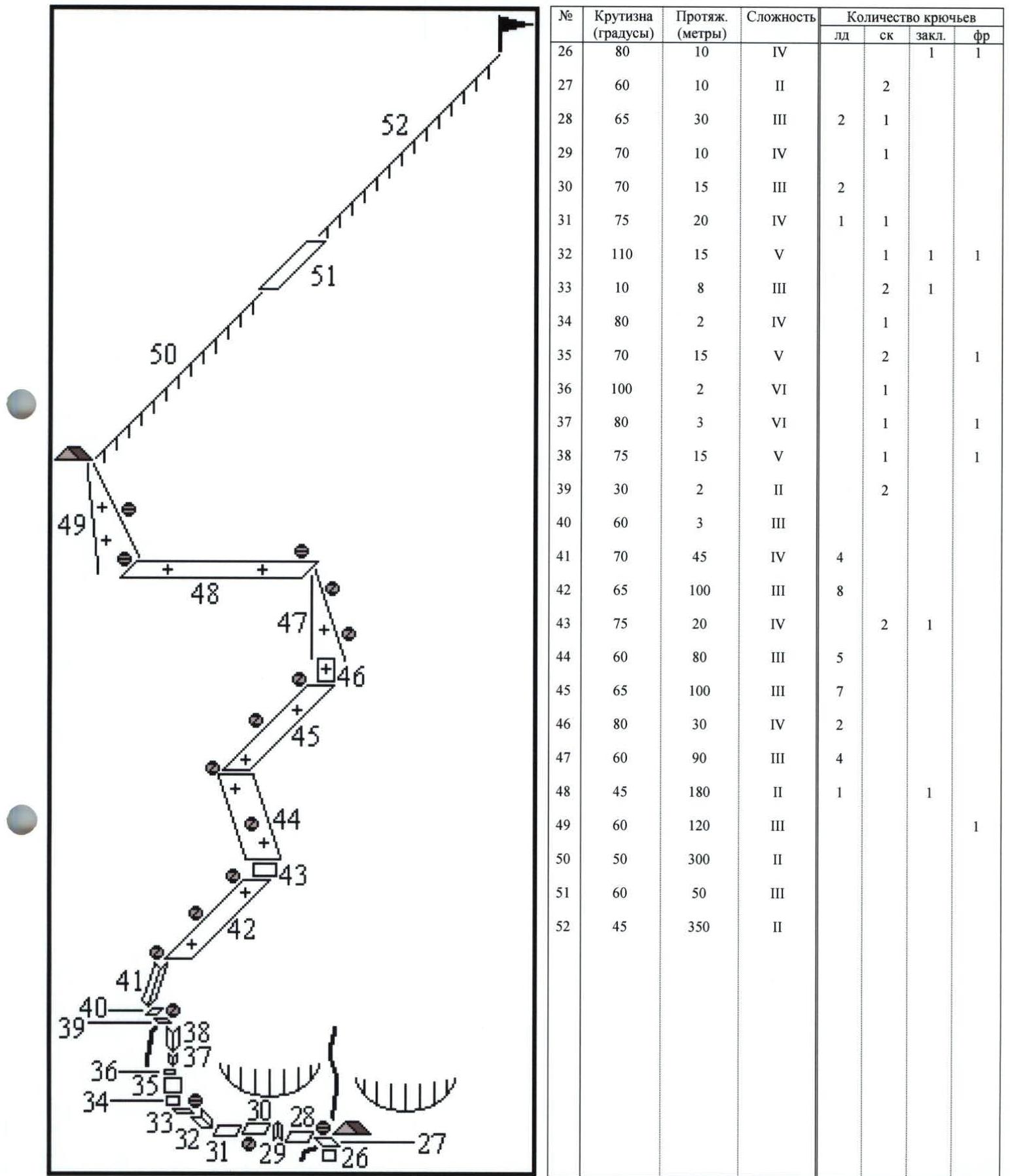

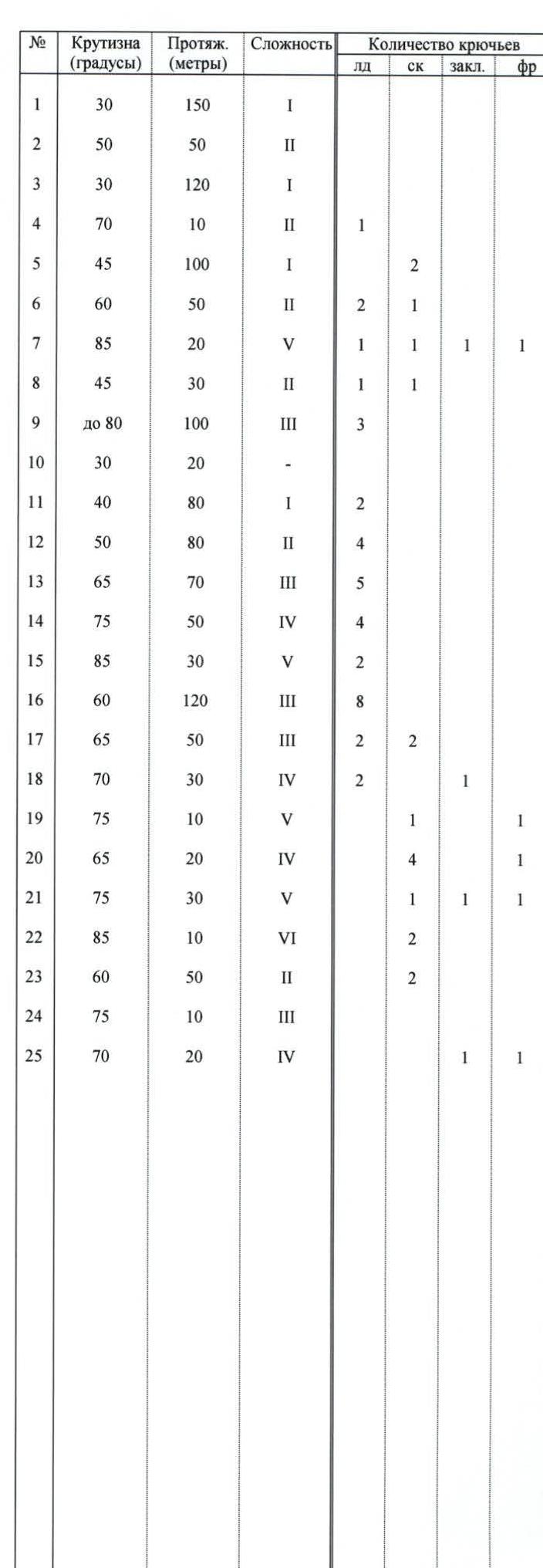
Photo Report on the Route

Base Camp of the expedition at an altitude of 5100 m. Kali-Himal peak in the background.
Start of the route (section R1). The entire wall is ahead.
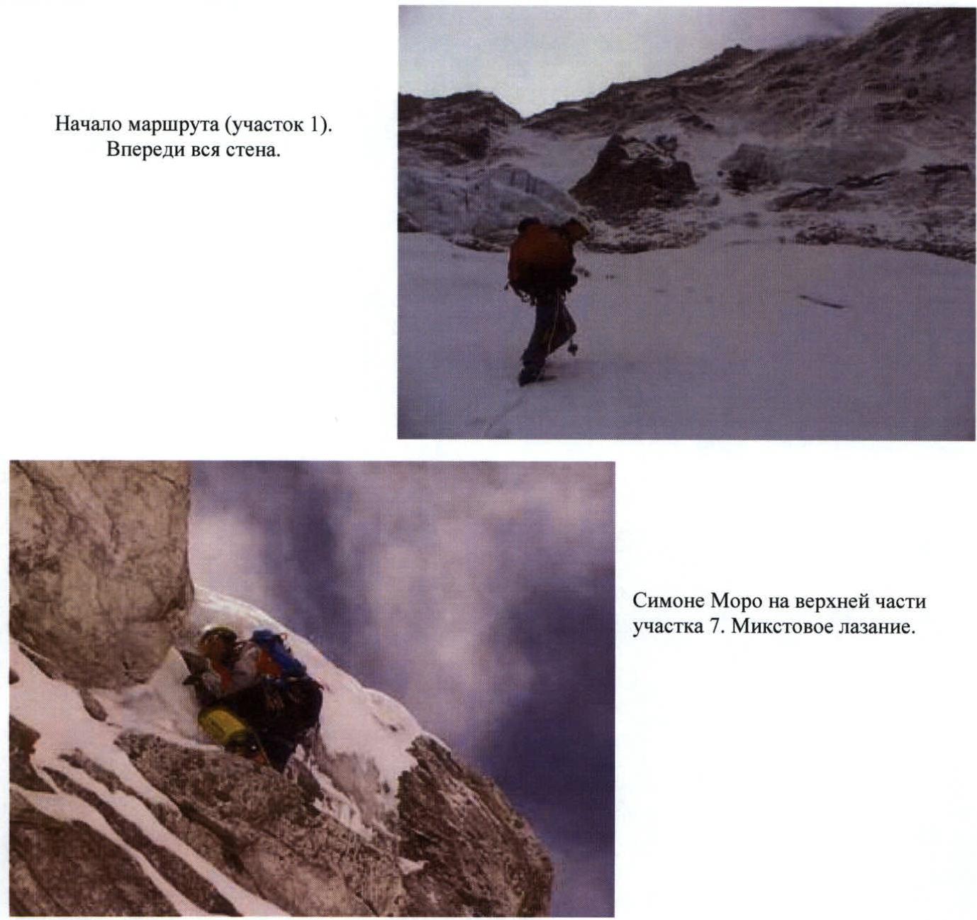
Simone Moro on the upper part of section R7. Mixed climbing. Strong wind on the wall. At the end of section R16, Bruno Tassi is working. In the center of the photo, the bastion "Iron" is highlighted with a black triangle.
Bastion "Iron" — section R22. Bruno Tassi on the rock.
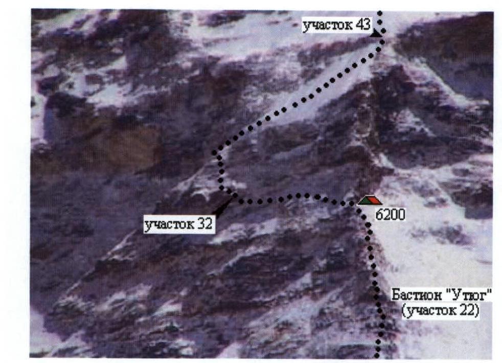
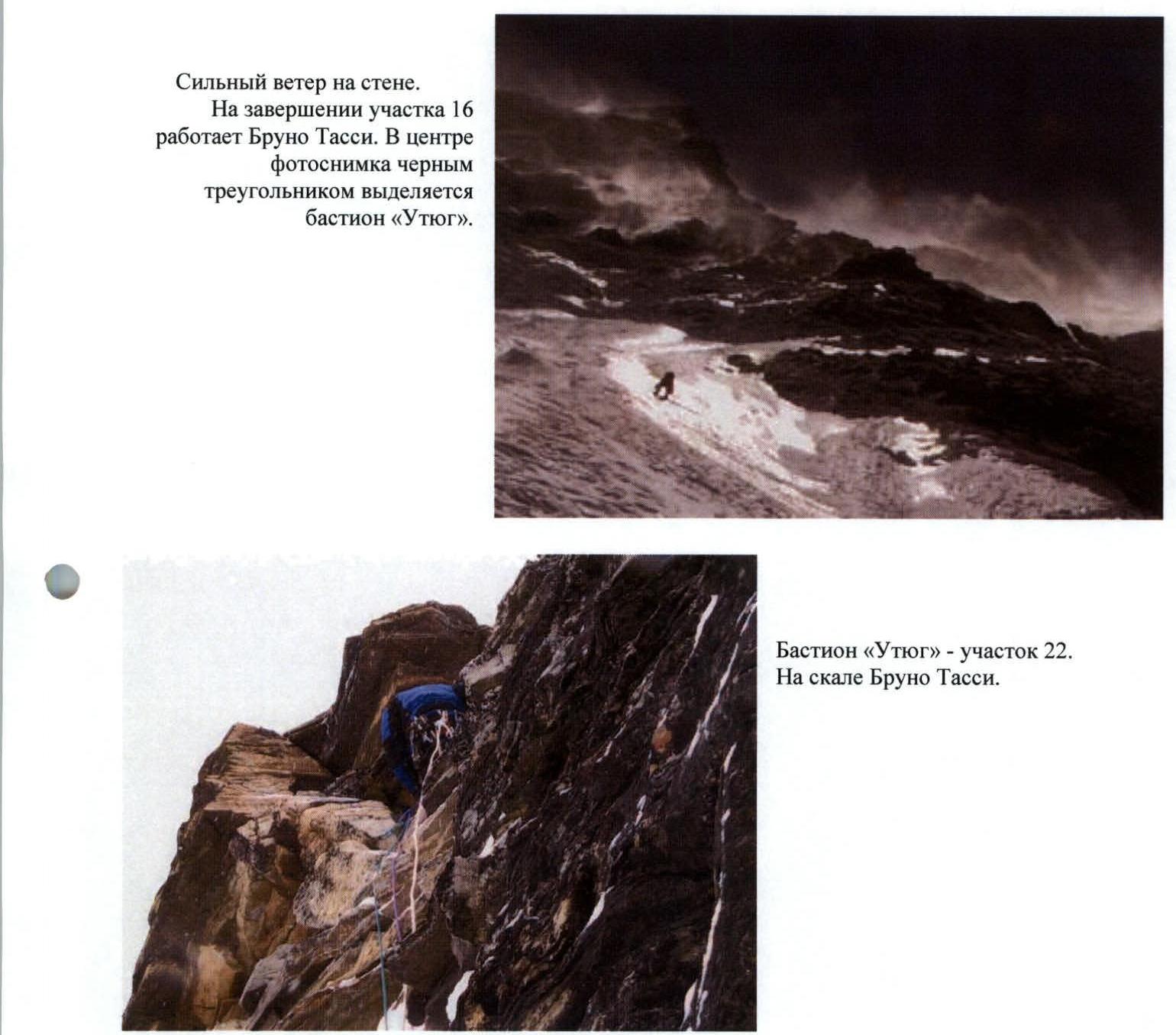
Tent at 6200 m (section R27) after snowfall.
Key sections of the route — center of the wall.
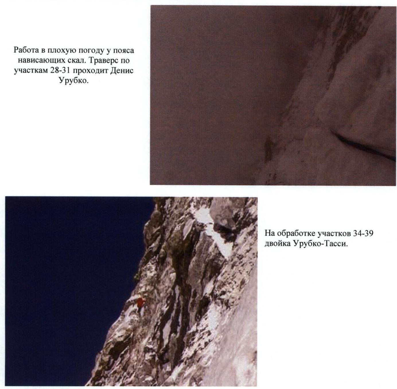
Working in bad weather near the belt of overhanging rocks. Denis Urubko is traversing sections R28–R31.
Working on sections R34–R39, pair Urubko-Tassi. "Roof" of the mountain. Denis Urubko is the first to climb on ice on section R42 with an ice axe. Bruno Tassi is on belay.
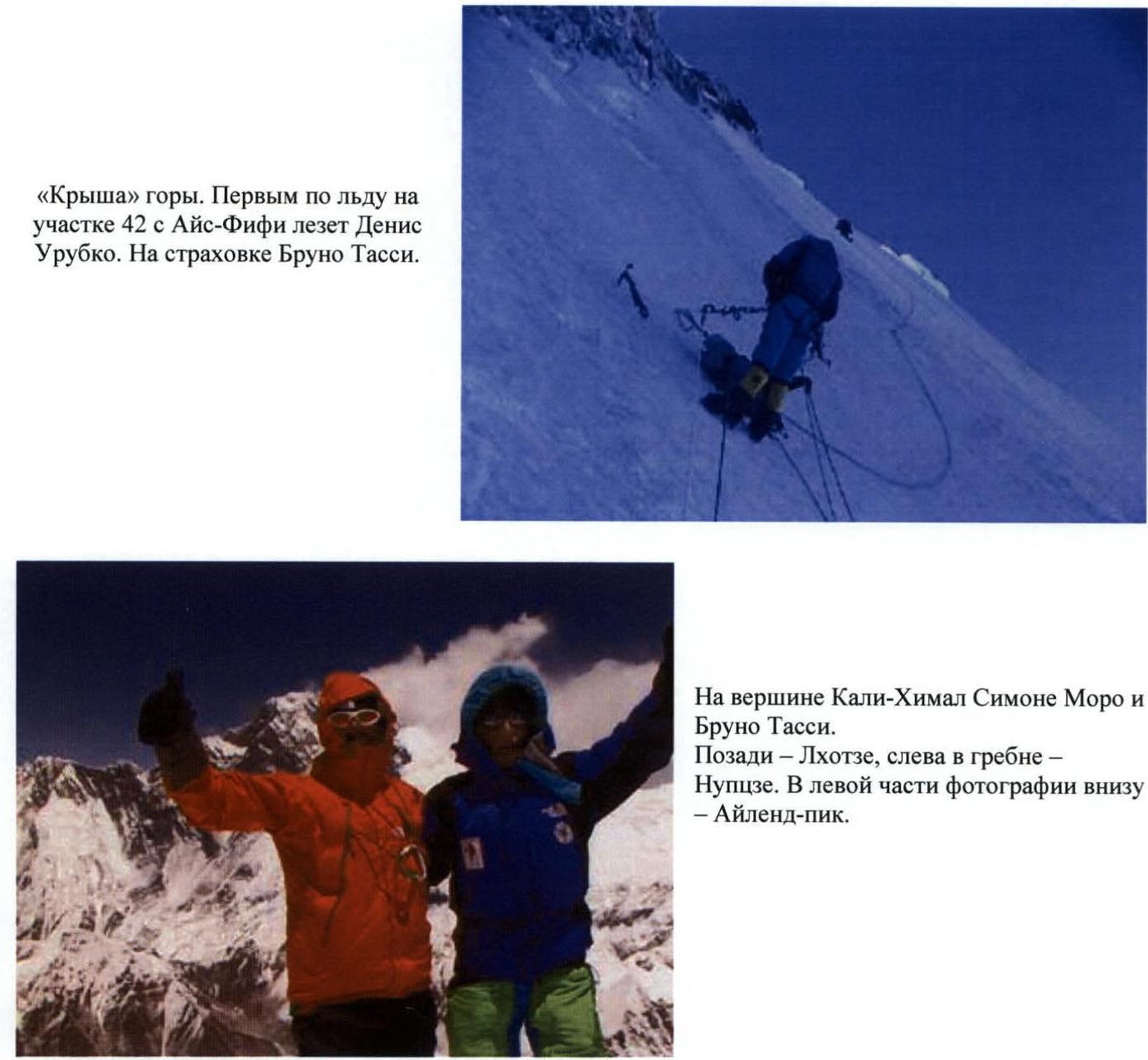
On the summit of Kali-Himal, Simone Moro and Bruno Tassi. Behind them — Lhotse, to the right in the ridge — Nuptse. In the lower left part of the photo — Island Peak.
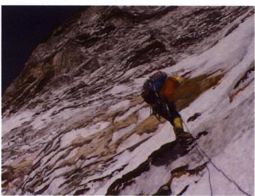
Simone Moro descending the couloir on a double rope.
Comments
Sign in to leave a comment