
REPORT
ON ASCENDING THE PEAK 100-LETIIA OTECHESTVENNOGO ALPINISMA VIA THE CENTER OF THE SOUTH FACE, 6A DIFFICULTY CATEGORY BY THE TEAM OF UAL MOUNTAIN CLUB, FROM August 30, 2023 TO August 31, 2023.
Moscow
| 1. General Information | ||
|---|---|---|
| 1.1 | Full Name, Sports Rank of the Team Leader | Kergin Ivan Vasilievich, 1st sports rank |
| 1.2 | Full Name, Sports Rank of the Participants | Bobrinskiy Konstantin Igorevich, 1st sports rank Chikin Artem Borisovich, 1st sports rank |
| 1.3 | Full Name of the Coach | Yakovenko Alexander Nikolaevich |
| 1.4 | Organization | MC "UAL" |
| 2. Characteristics of the Ascent Object | ||
| 2.1 | Region | Magadan Oblast, Big Thresholds Ridge |
| 2.2 | Area | Tok Creek Gorge |
| 2.3 | Number of the Section According to the 2013 Classification Table | new ascent |
| 2.4 | Name and Height of the Peak | 100th Anniversary of Russian Climbing 2112 m |
| 2.5 | Geographical Coordinates of the Peak (Latitude/Longitude), GPS Coordinates | N 61° 47.599′, E 150° 24.362′ |
| 3. Characteristics of the Route | ||
| 3.1 | Route Name | via the center of the South Face |
| 3.2 | Proposed Difficulty Category | 6A |
| 3.3 | Degree of Route Exploration | First Ascent |
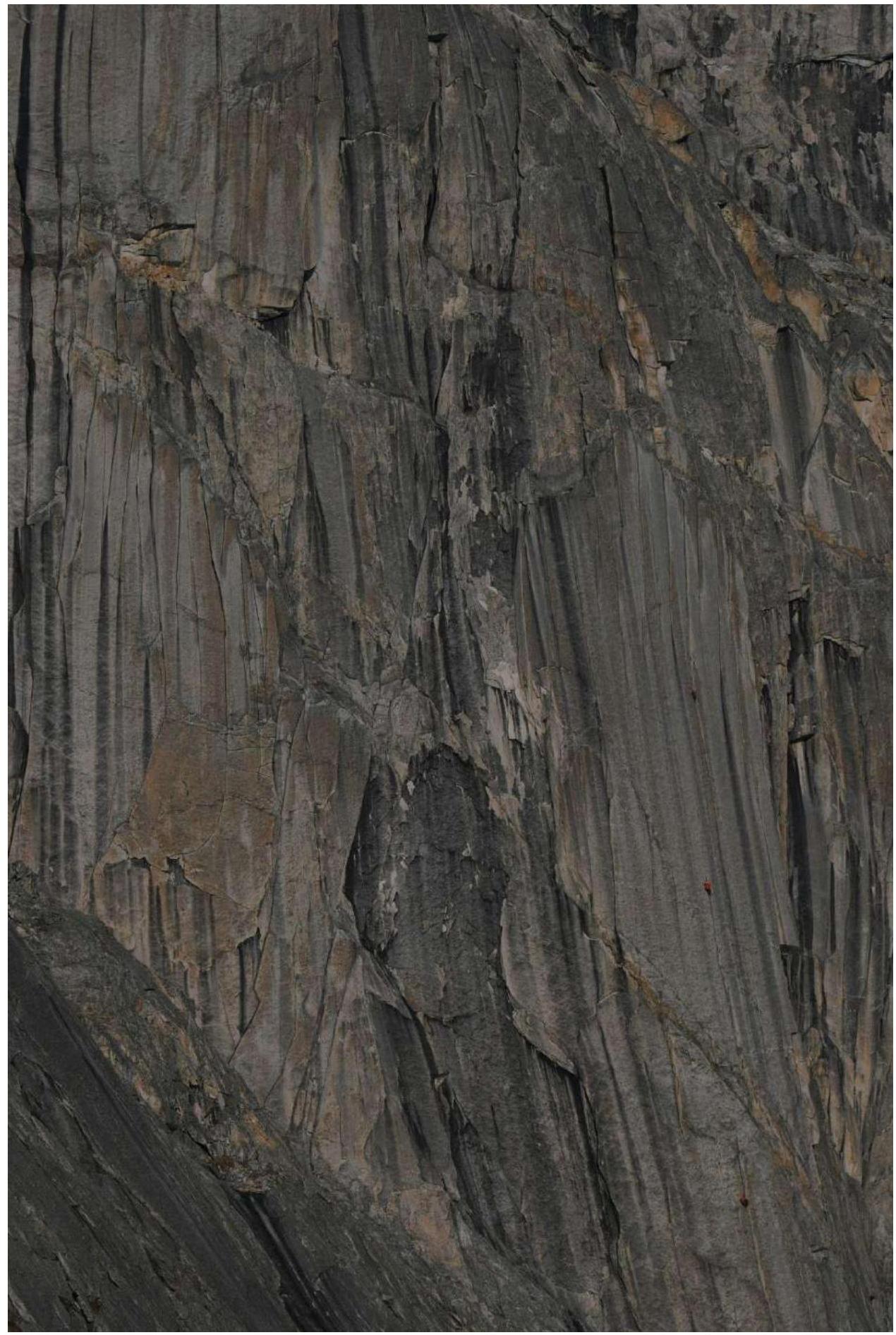
| 3.4 | Relief Characteristics of the Route | rock |
| 3.5 | Route Elevation Gain | 508 m |
| 3.6 | Length of the Wall Climbing Section | 805 m |
| 3.7 | Technical Elements of the Route | 1st diff. cat. – 20 m. 2nd diff. cat. – 100 m. 3rd diff. cat. – 280 m. 4th diff. cat. – 220 m. 5th diff. cat. – 230 m. 6th diff. cat. – 62 m. A1 – 5 m, A2 – 160 m, A3 – 43 m |
| :--: | :--: | :--: |
| 3.8 | Average Steepness of the Route, (°) | 60° |
| 3.9 | Average Steepness of the Wall Climbing Section, (°) | 80° |
| 3.10 | Descent from the Summit | 2A |
| 3.11 | Additional Route Characteristics | no water, carried with us |
| 4. Characteristics of the Team's Actions | ||
| 4.1 | Time in Motion (in hours and days) | 20 hours, 2 days |
| 4.2 | Overnights | no |
| 4.3 | Time Spent on Route Preparation | 6 hours, 100 m, 2 ropes |
| 4.4 | Start of the Route | 7:00, August 31, 2023 |
| 4.5 | Reaching the Summit | 18:00, August 31, 2023 |
| 4.6 | Return to Base Camp | 21:20, August 31, 2023 |
| 5. Characteristics of Weather Conditions | ||
| 5.1 | Temperature, °C | From 0° to +10° |
| 5.2 | Wind Speed, m/s | Moderate, 1–2 m/s |
| 5.3 | Precipitation | None |
| 5.4 | Visibility, m | Good 10,000 m |
| 6. Person Responsible for the Report | ||
| 6.1 | Full Name, e-mail | Chikin A.B. artem.chikin@mail.ru |

Area Map
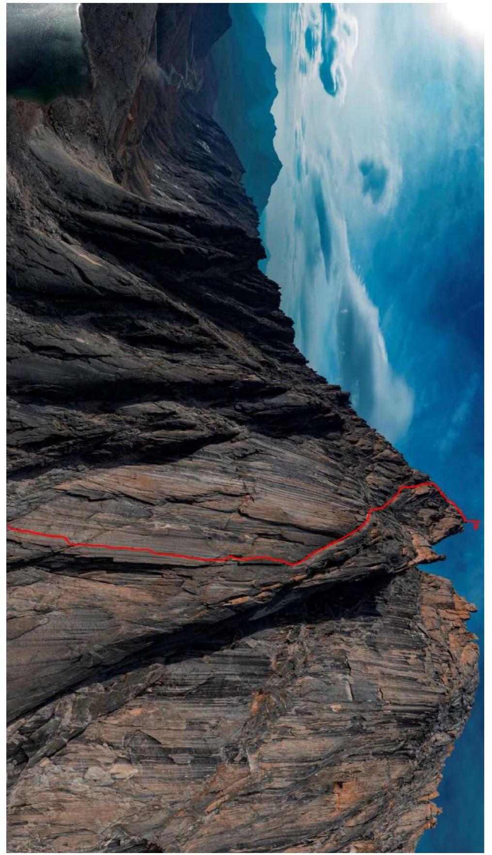
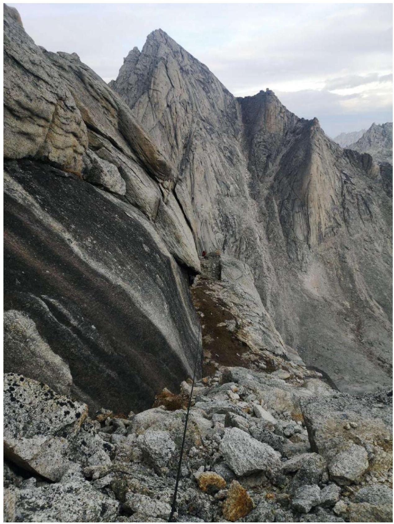
General View of the Peak

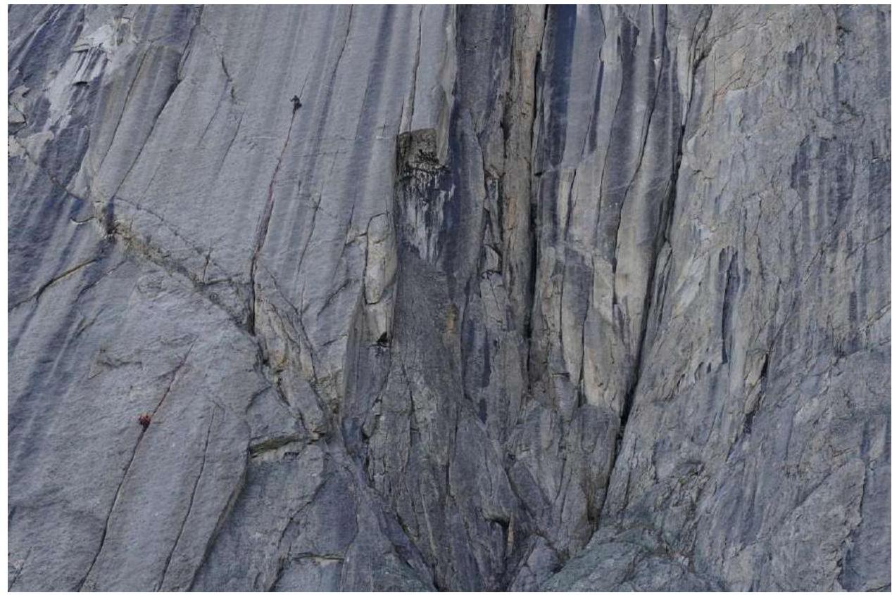
Technical Photograph of the Route. UIAA Scheme
Route Description
R0–R1
100 m 30° 2 Approach to the start of the gullies via scree shelves and wall-corners
R1–R2
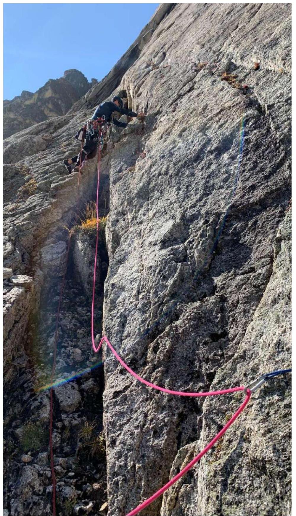
50 m. 75° 6, f6a+ 10 m, A2 40 m Approach to the wall via shelves towards the gully. Initially, climbing on loose holds 10 m. Then A2 on fifi hooks with a bend, friends, and anchors 40 m. The gully is overgrown with grass and filled with earth. Station on a lug (left a hole 8 mm for a retriever and anchors).
R2–R3
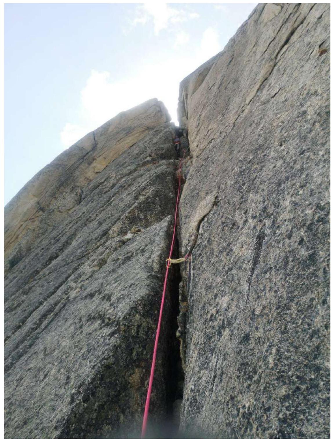
50 m. 80° 6, f6a 7 m, A2 33 m, A3 10 m. Pendulum 10 m. The gully becomes blind and ends with A3 10 m, from here a pendulum about 10 m to the right, into a chimney. Up the chimney 7 m 5 f5b. Further 35 meters up the gully on A2. The gully is also overgrown with grass.
R3–R4
50 m. 80° A3 10 m, A2 40 m The gully ends, becomes blind, anchors are hammered 1–2 mm. Need to climb higher to pendulum to the bottom of the gully on the right, about 5 m. A3. The gully on the right is initially also blind, "GIVI" anchors go well. Up another 4 m A3, then A2 40 m.
R4–R5
30 m. 80° 6, f6a 5 m; A2 5 m, A3 20 m. Up the gully on A2 15 m, then climbing 5, f6a 5 m, then several anchors hammered only with the tip into blind gullies – 5 m – and exit left to the first shelf.
R5–R6
50 m. 70° A2 30 m, 6, f6b 10 m, 6, f6c 10 m From the shelf up the internal corner, climbing 6B 10 m, exit to the top of a large spall, then up gullies 10 m on A2, then up the internal corner climbing 6C 10 m, then up the left wall and gullies A2 17 m, to the level of another spall on the right, pendulum 3 m to grab the spall and climb to its top, a bit higher 3 m — station.
R6–R7
50 m 55° 5+, f5c 47 m, A1 3 m. Up a wide, sloping chimney to the left. In the middle, had to hold onto points to climb out onto a flake.
R7–R8
50 m 50° 4–5+, f5c Up a wide chimney, many loose rocks, blocks, need to climb very carefully as everything that falls goes down to the partner.
R8–R9
45 m 65° 5 Up the chimney to a large shelf, can set up a tent, walk forward on it to a large rock, station on it.
R9–R10
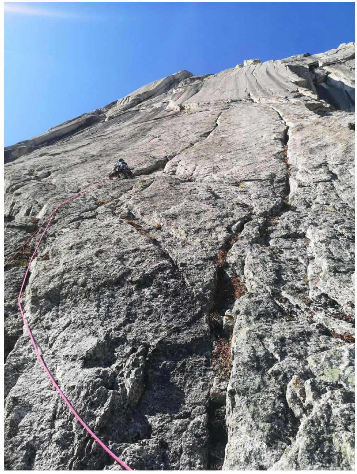
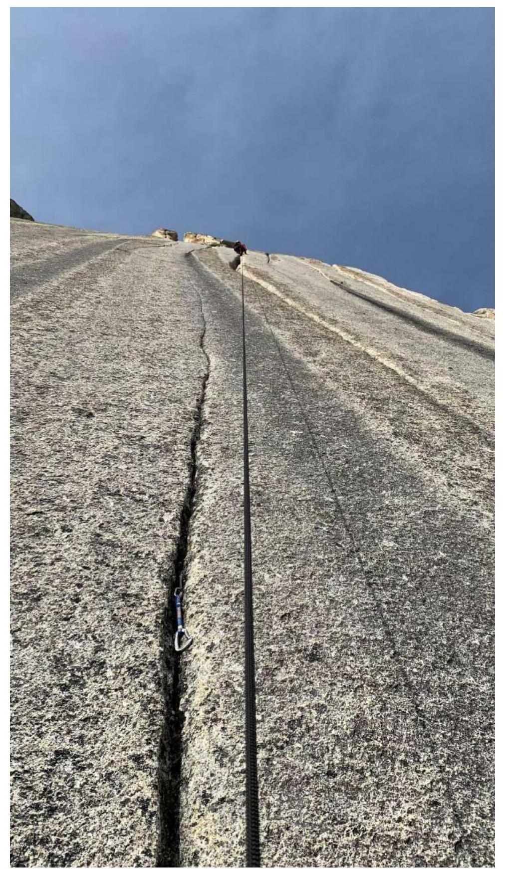
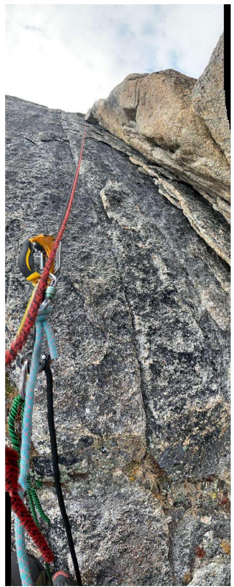
150 m 30° 3–4 Up shelves, walls, and internal corners, general direction up – left, approach to smoothed, sloping rocks with gullies, possible simultaneous climbing.
R10–R11
50 m 65° 5 38 m, 6 10 m, A1 2 m Left – up, right of a large rock – cornice, hold onto a friend and then up a spall – gully to climb onto shelves. Station on a ledge.
R11–R12
50 m 60° 4 30 m, 5 10 m, 6 f6b 10 m. Up walls and shelves left – up, in the middle a section with an internal corner, smoothed rocks 6B 10 m. Exit to a good shelf. Station on a ledge. Possible overnight stay.
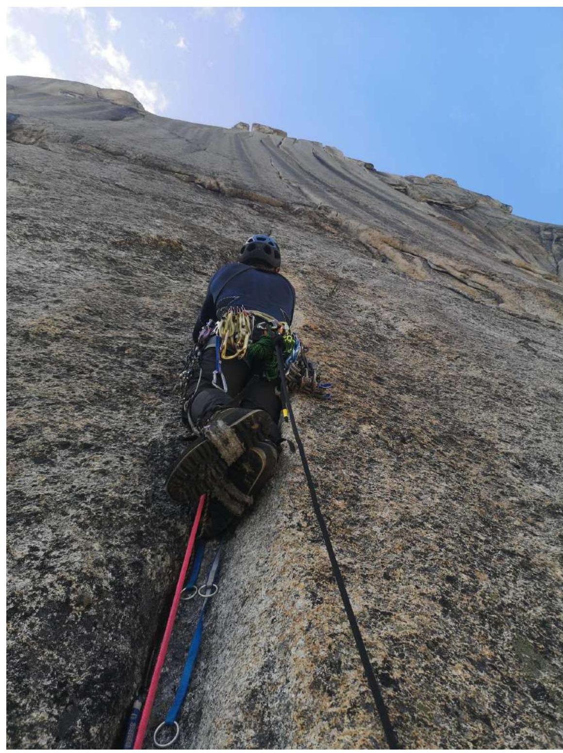
R12–R13
150 m 30° 3+ Simultaneous climbing. Short walls with shelves in the direction of the summit tower. Before the tower, move left along a shelf and a diagonal shelf – wall and approach the chimney.
R13–R14
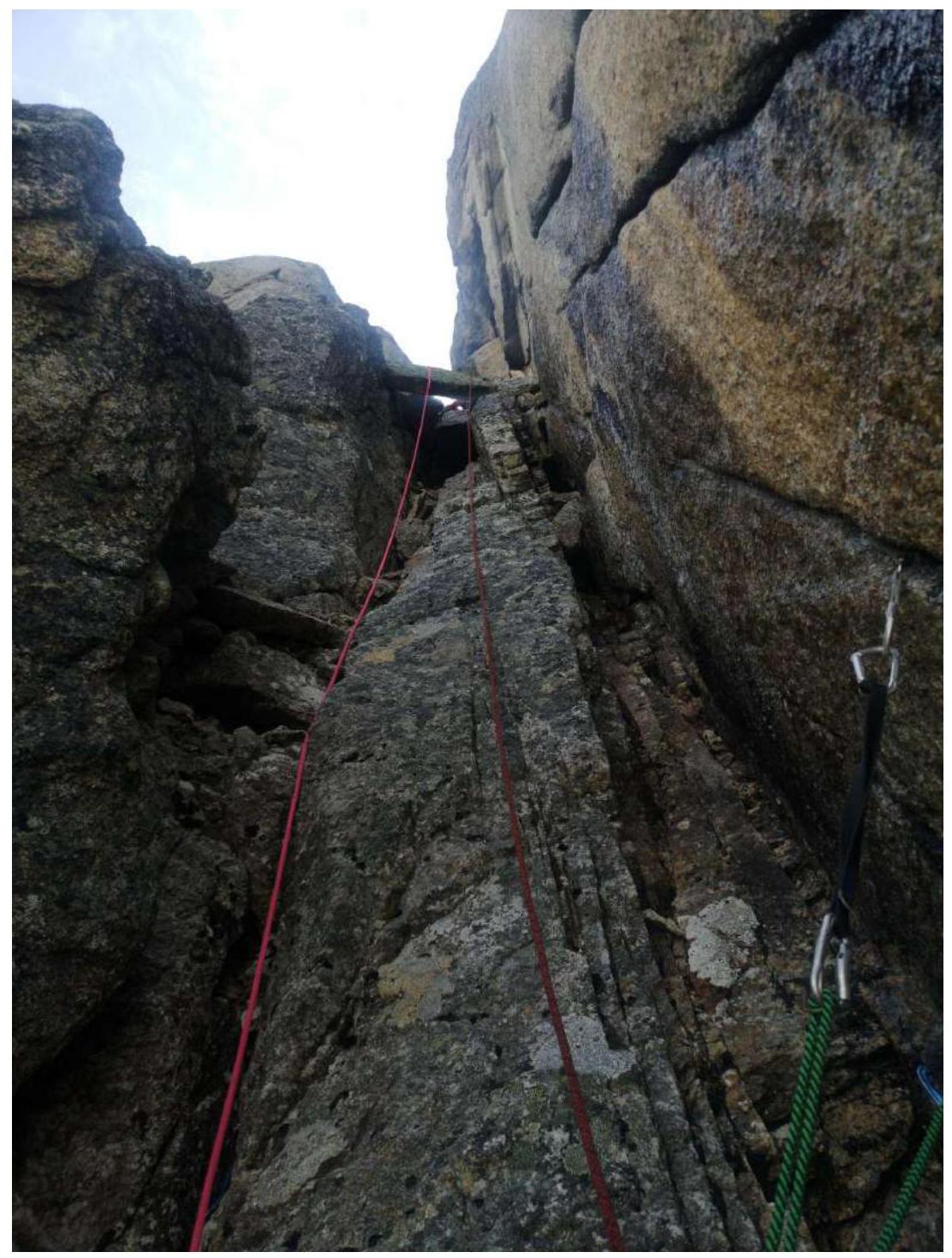
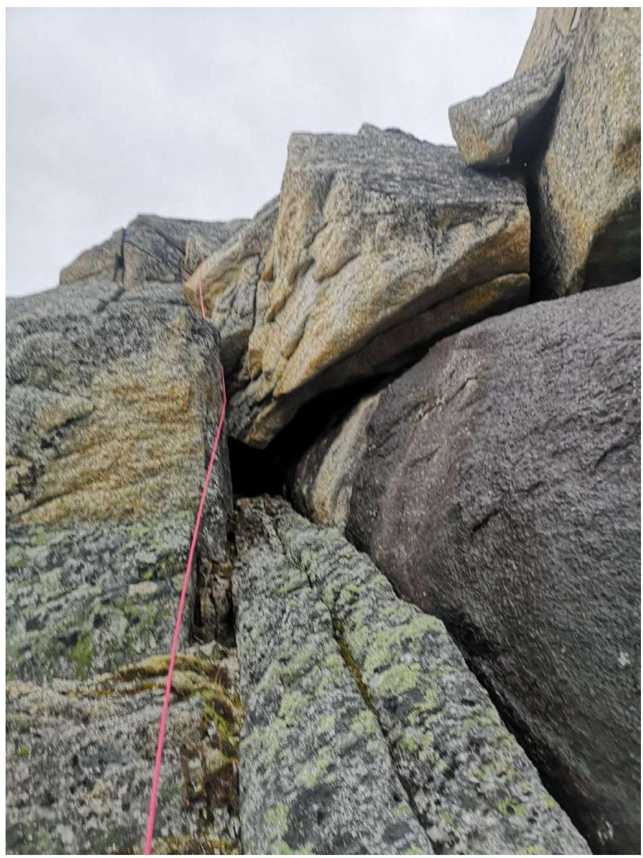
40 m 70° 5
Chimney with a plug – a large rock in the upper part. At the end, climb onto a shelf, summit to the left.
Start of the Route
Section R1–R2
Start of Section R2–R3
Pendulum on Section R2–R3
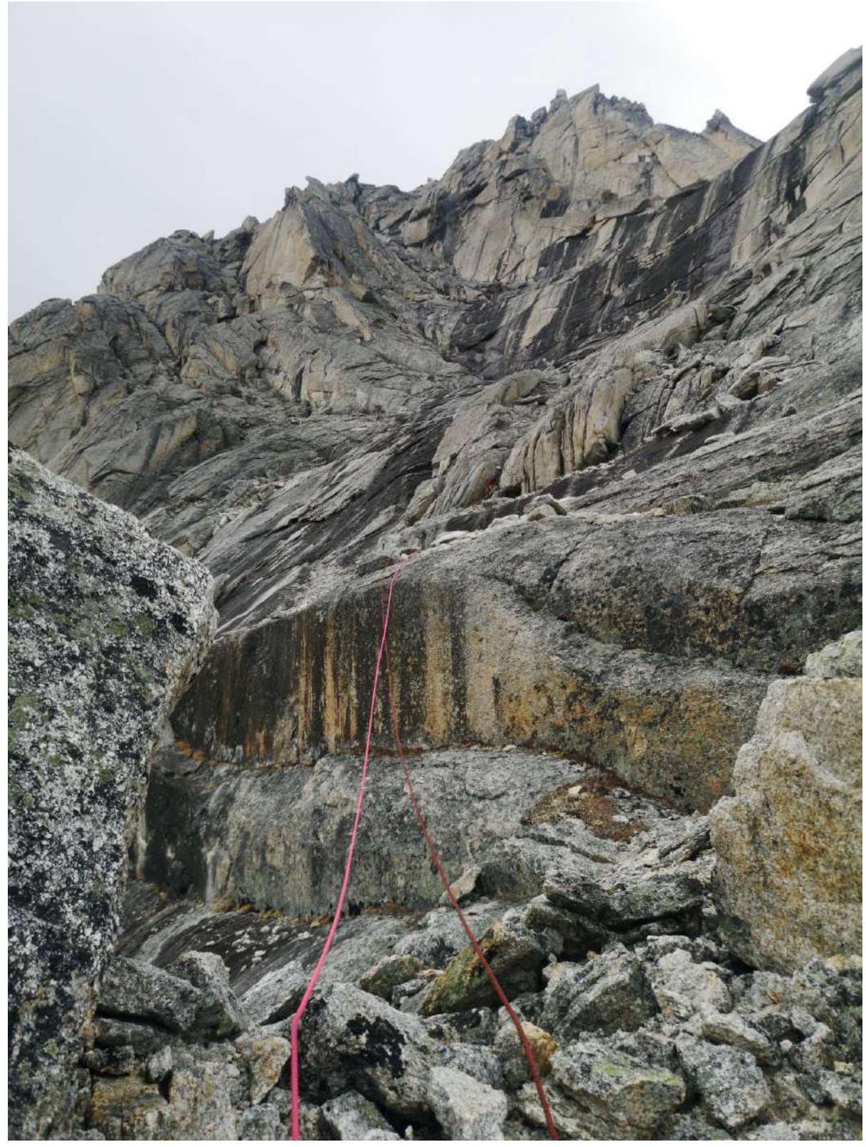
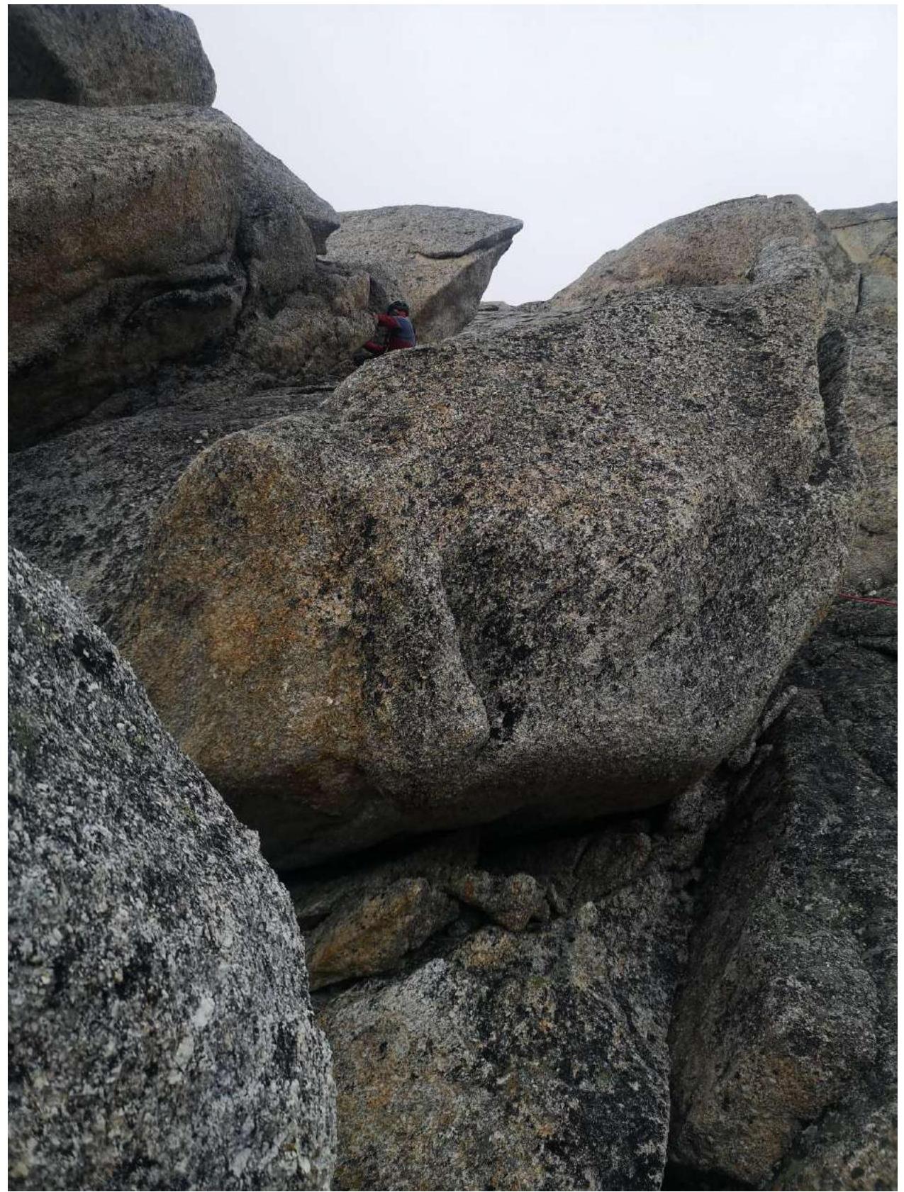
Section R2–R3
Section R3–R4
Section R4–R5. Photo from Station R5
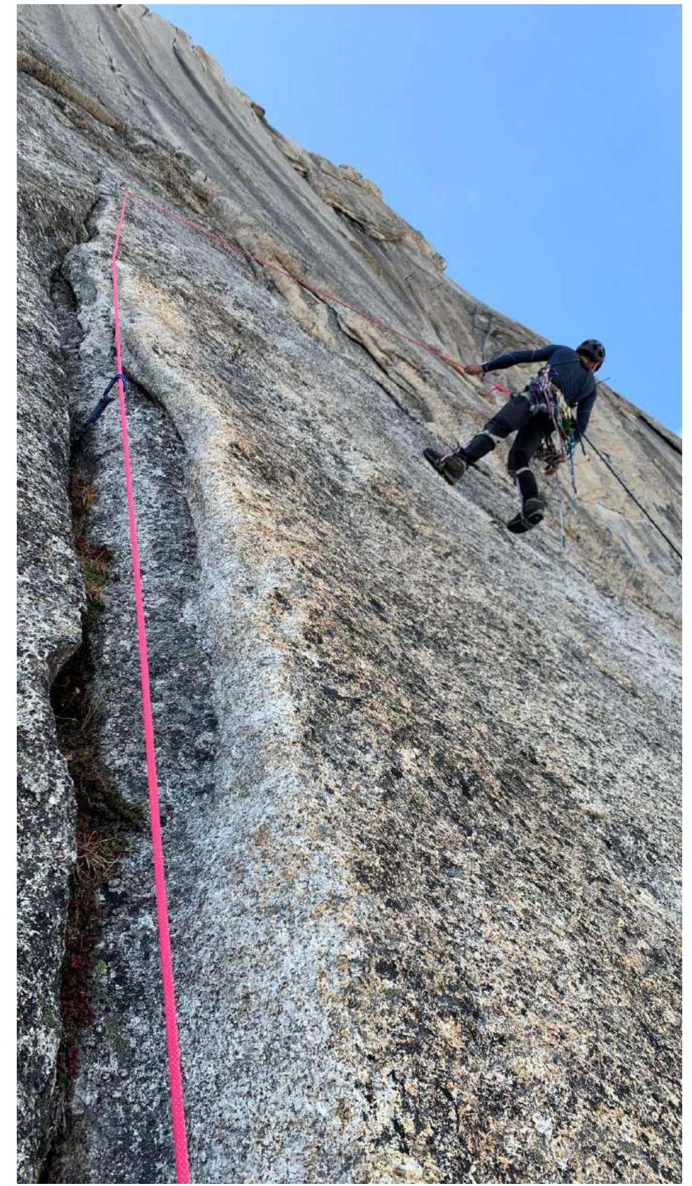
Team on the Wall

Start of Section R5–R6
Second Half of R5–R6

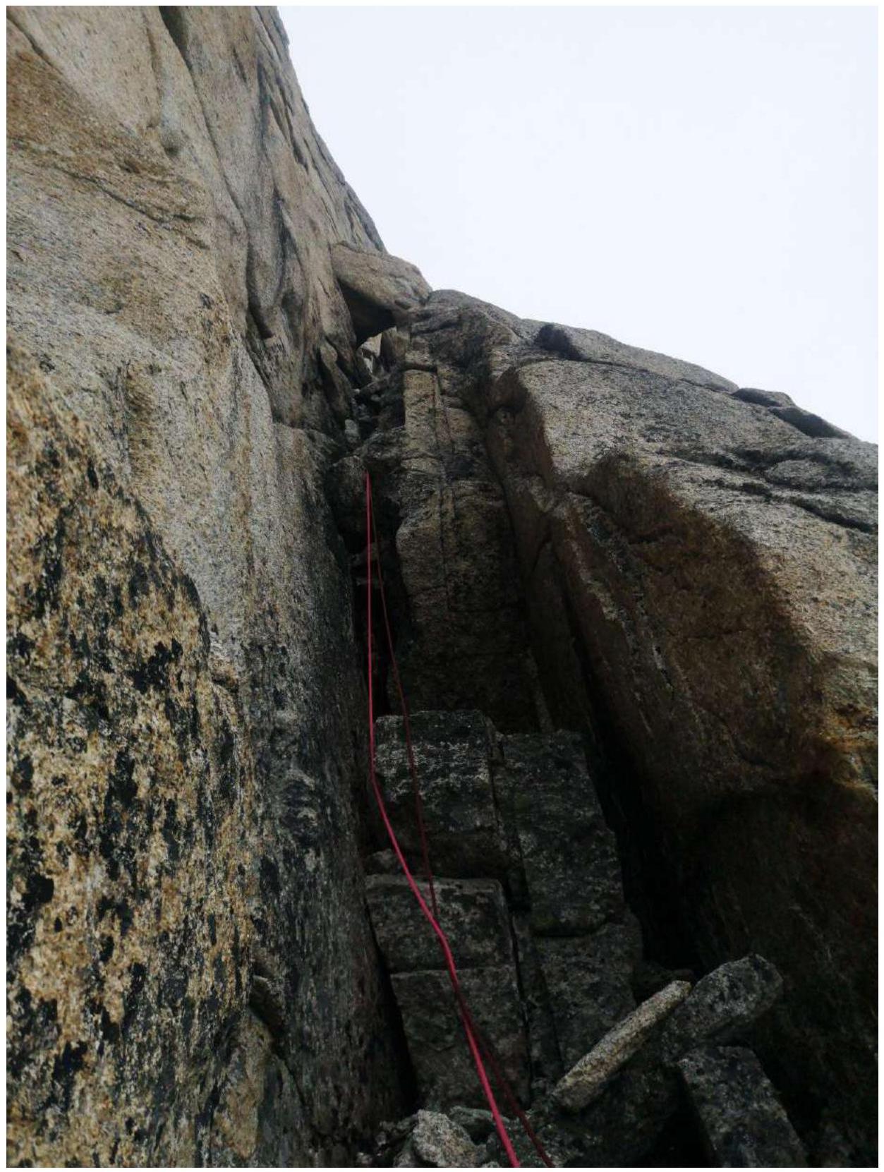
Start of Section R6–R7
Section R7–R8
Section R8–R9
Shelf on R9
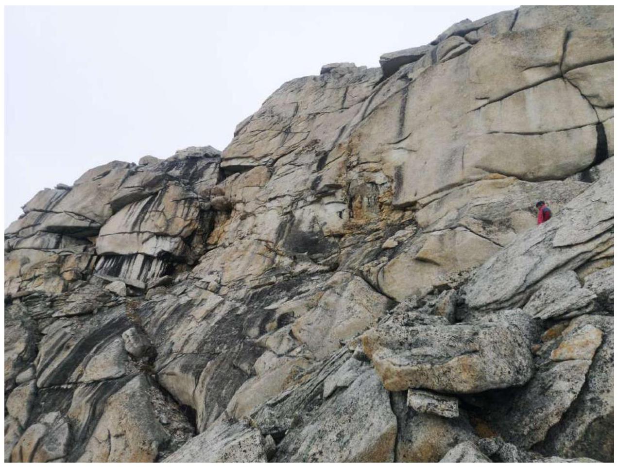
Section R9–R10
Station R10. Ahead is the start of R10–R11
Start of Section R10–R11
Section R11–R12
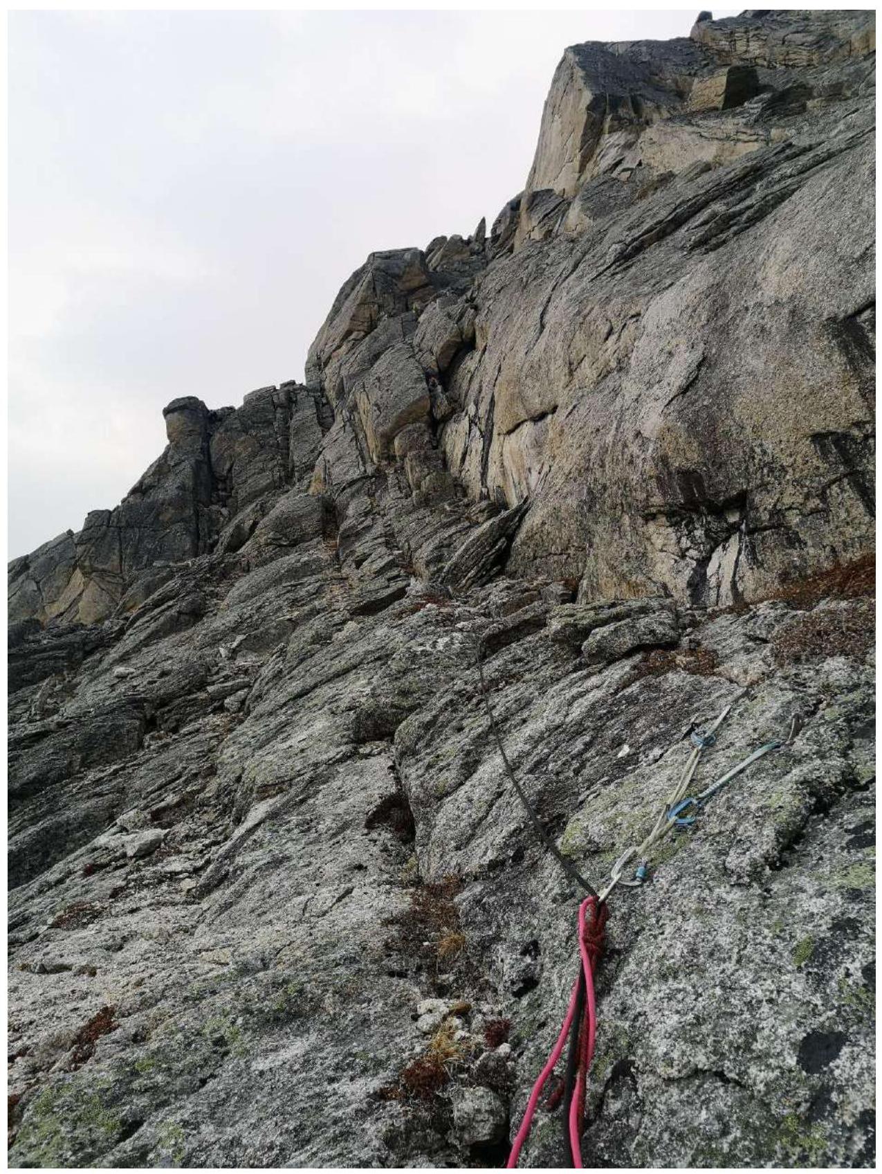
Shelf on R12
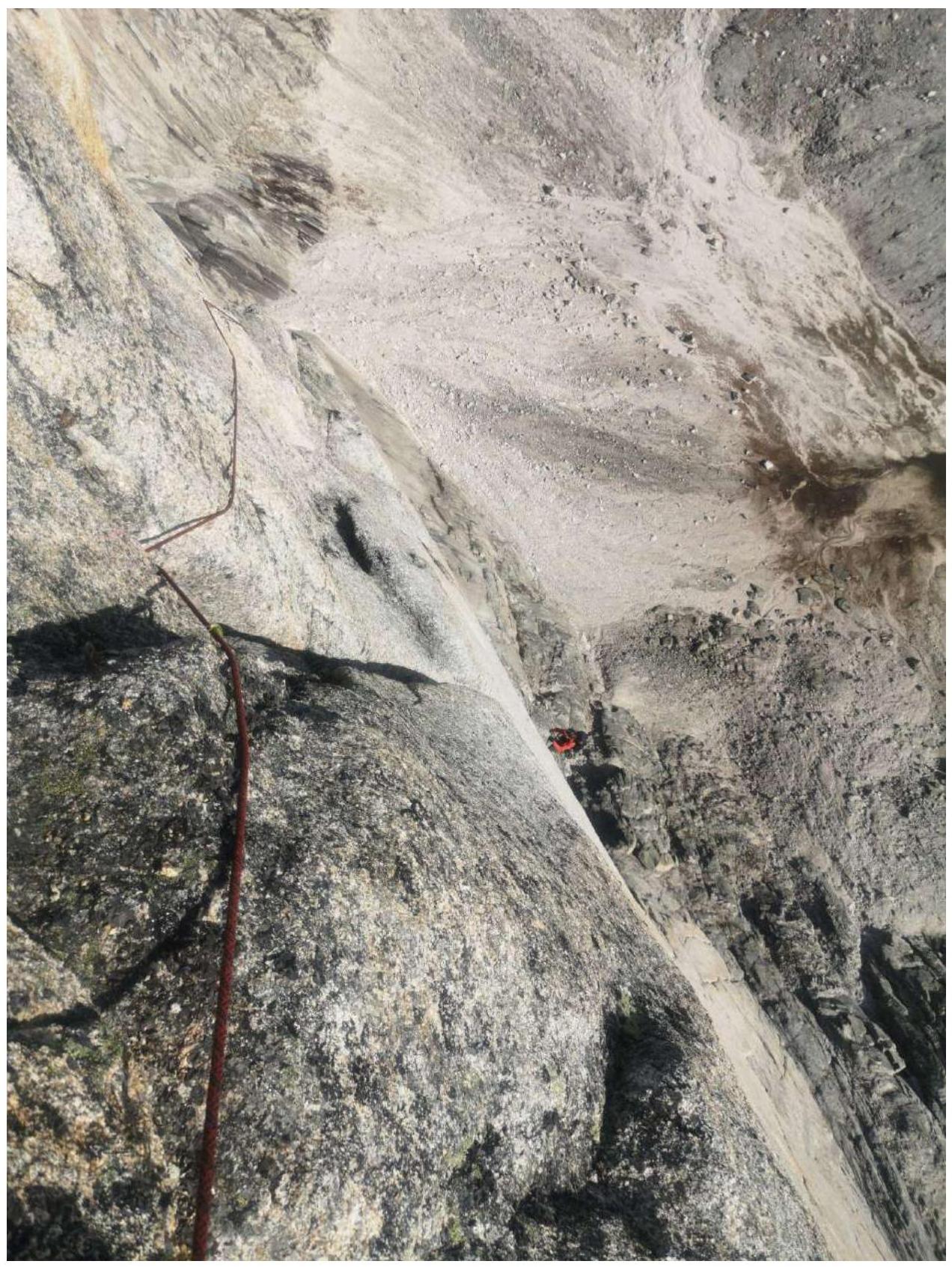
Section R12–R13. Bypassing the tower on the left
Section R13–R14
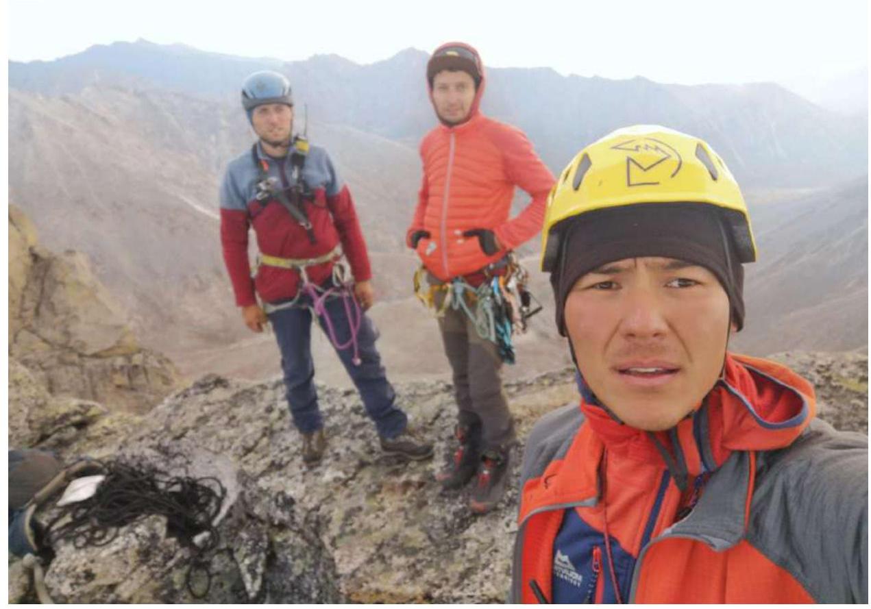
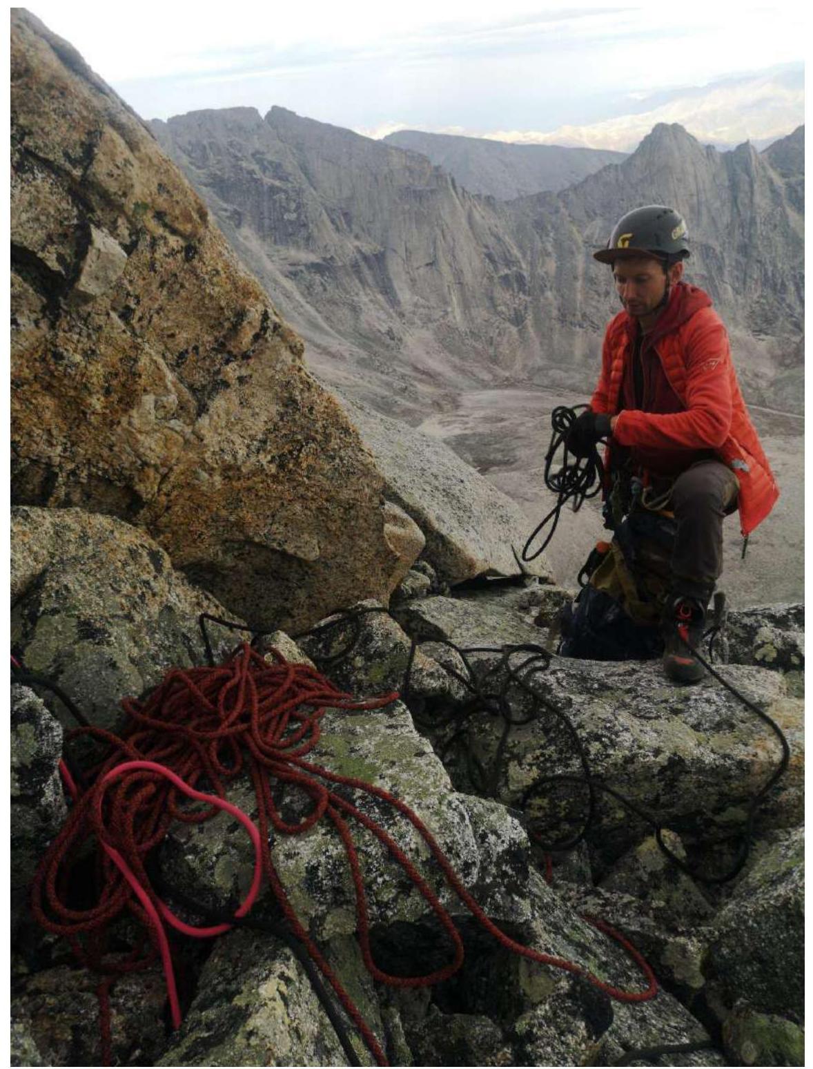
Team on the Summit.
Team's Actions
The approach to the base camp from the "Mars" mine took 1.5 hours. The area is hard to access, with boggy terrain in some places and obstructing vegetation in the form of dwarf pine.
On the first day, we processed 2 full ropes at the start of the route, 100 m. Almost entirely climbing on artificial aids (AIDs), so the progress was slow, about 2 hours per rope. Very poor points on the pendulum, had to block several anchors hammered 1–2 mm into a blind gully.
On the second day, we started working at 7:00. Jumarred the pre-pitched section. The third rope was also challenging due to the pendulum and poor points into blind gullies. 4th and 5th ropes were also mostly on AIDs. Overall, the rock is very crumbly, and climbing on such rock is very problematic both in rock shoes and boots. We climbed the main part of the wall, then the climb and slope became easier, but some sections were still not straightforward — up to 6B.
Reaching the summit at 18:00, we planned the descent route and were correct. The nearest, wide, scree gully:
- Most of it can be walked down zigzagging.
- Made 2 rappels of 50 m — in the middle and at the very end.
Results, Conclusions, Comments:
If we compare our route to Kurochkin's 5B route on Tsей-Loam in Ingushetia and 5B routes in Crimea, then in terms of labor costs and technical elements, it is:
- more challenging,
- more remote,
- objectively more dangerous due to the specifics of the rock.