
Report on the First Ascent
As part of the Russian Mountaineering Championship
High-Altitude Technical Class 2022
Peak Ostrog (2520 m) via the North Face verticals. Route name — "Water World". Route 6A cat. diff. (proposed), first ascent, Ikatsky Ridge, Barguzin River valley, 9.9
Team Leader: Kleptsov A.A. Participants:
- Lazarev S.A.
- Panova A.M.
The ascent took place on August 2–3, 2022.
I. Ascent Passport
| № | 1. General Information | |
|---|---|---|
| 1.1 | Full name, sports rank of the team leader | Kleptsov Alexander Alexandrovich, Master of Sports, 3rd category |
| 1.2 | Full name, sports rank of participants | Lazarev Stanislav Alexandrovich (Candidate for Master of Sports) Panova Alena Mikhailovna (Candidate for Master of Sports) |
| 1.3 | Full name of the coach | Afanasyev Andrey Evgenyevich, Master of Sports, 1st sports rank |
| 1.4 | Organization | FASIО, Baikal Alpine School |
| 2. Characteristics of the Ascent Object | ||
| 2.1 | Region | Ikatsky Ridge |
| 2.2 | Valley | Barguzin River valley |
| 2.3 | Section number according to the 2020 classification table | 9.10 |
| 2.4 | Name and height of the peak | Ostrog (2550 m) |
| 2.5 | Geographical coordinates of the peak (latitude/longitude) | 55°07′05.28″ N, 111°54′48.52″ E |
| 3. Characteristics of the Route | ||
| 3.1 | Route name | Via the North Face verticals ("Water World") |
| 3.2 | Proposed category of difficulty | 6A |
| 3.3 | Degree of route exploration | First ascent |
| 3.4 | Relief characteristics of the route | Rocky |
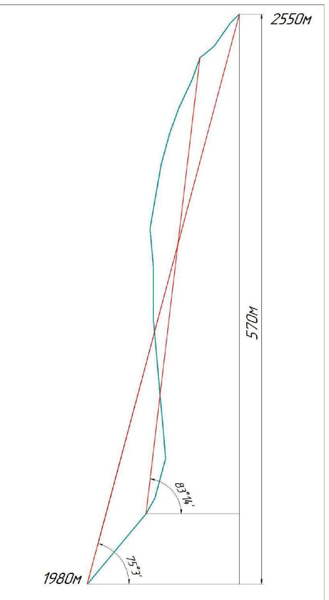
| 3.5 | Height difference of the route and main section | 570 (456) m |
| 3.6 | Length of the route and main section | 690 (525) m |
| 3.7 | Technical elements of the route (total length of sections of various complexity categories with indication of relief type (ice-snow, rocky)) | II cat. diff. rocks — 20 m. III cat. diff. rocks — 115 m. IV cat. diff. rocks — 30 m. V cat. diff. rocks — 20 m. VI cat. diff. rocks — 505 m. Dülfer descent (on descent) – (5 sections of 180 meters) |
| 3.8 | Average steepness of the route, ° | 75.3 |
| 3.9 | Average steepness of the main section of the route, ° | 83.14 |
| 3.10 | Descent from the peak | West along the "fault" of the Western face. |
| 3.11 | Additional characteristics of the route | In summer, there is usually no water on the route |
| 4. Characteristics of the Team's Actions | ||
| 4.1 | Time of movement (climbing hours) | 23 h 30 min climbing hours to the peak, 2 days |
| 4.2 | Overnight stays | None |
| 4.3 | Start of the route | 9:00, August 2, 2022 |
| 4.4 | Reach the peak | 8:30, August 3, 2022 |
| 4.5 | Return to the base camp | 16:00, August 3, 2022 |
| 5. Characteristics of Weather Conditions | ||
| 5.1 | Temperature, °C | 10 °C on the first day, 0 °C at the peak |
| 5.2 | Wind speed, m/s | 10–15 m/s |
| 5.3 | Precipitation | Rain in the upper quarter of the route for 3 hours |
| 5.4 | Visibility, m | More than 10 km on the first day, less than 50 m by the time we reached the peak |
| 6. Person Responsible for the Report | ||
| 6.1 | Full name, e-mail | Kleptsov A.A., Baikalteam@gmail.com |
General photo of the peak Ostrog 2520. (Photo taken from a lateral spur of the ridge on April 16, 2014. The shooting height is approximately 1800 m above sea level, the distance from the object is 2000 m).
RED – team route 6A

Photo of the route profile from the left. (Photo taken during the first ascent of the peak "Galkina Ivana", the shooting height is 2450 m above sea level).
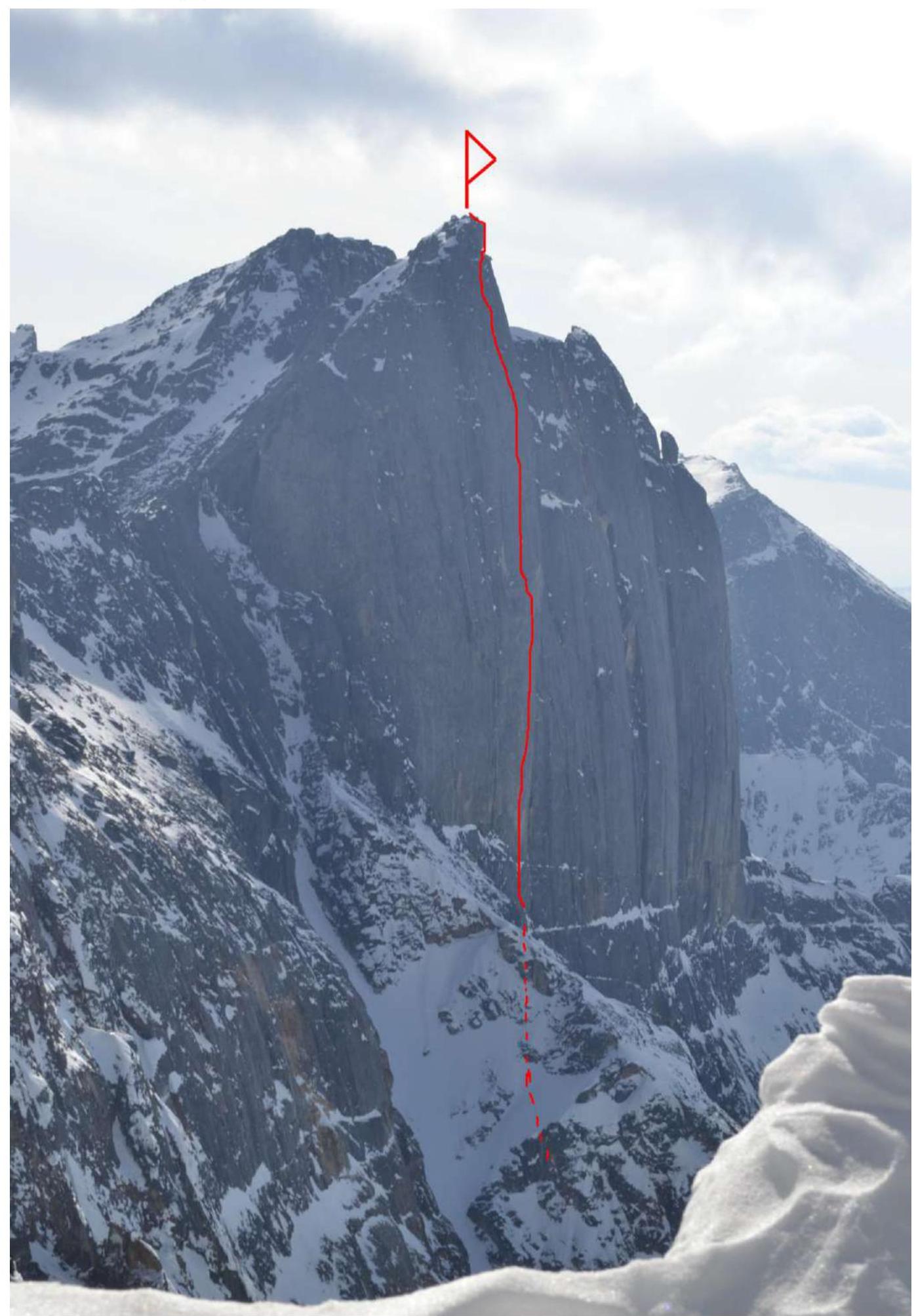
Photo of the route profile from the wall. (Photo taken during an attempt to ascend via the team's route in April 2015, lower third of the wall. The photo shows the steepness of the wall as a whole to the right of the route line; the route line has a greater angle of inclination and overhangs up to the upper third of the route).
Drawn profile of the route.
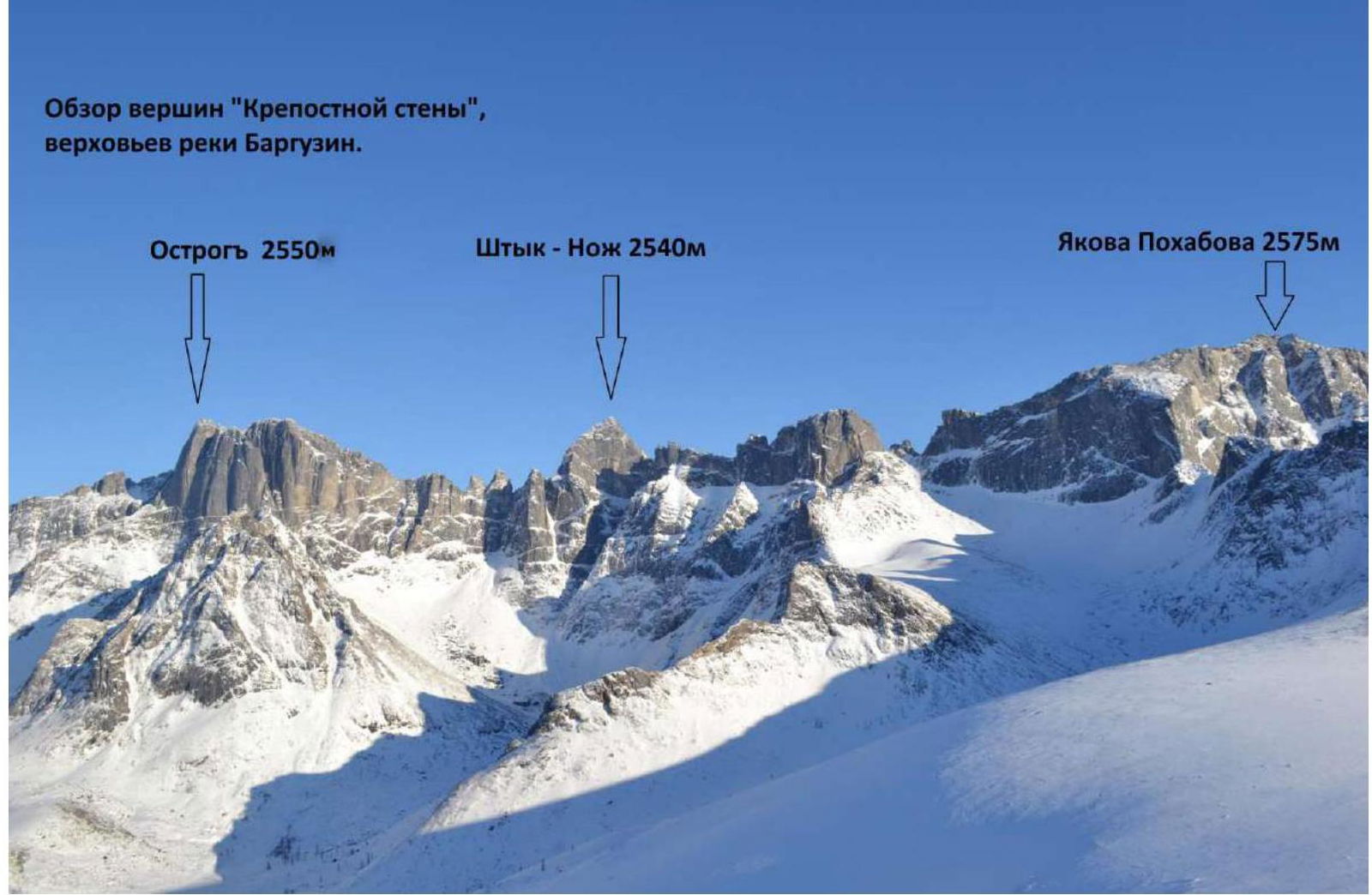
Photopanorama of Peaks in the Area of Mount Ostrog
(Photo taken on April 16, 2014, the shooting height is 1800 m above sea level.)
1.4 Map-Scheme of the Upper Reaches of the Barguzin River
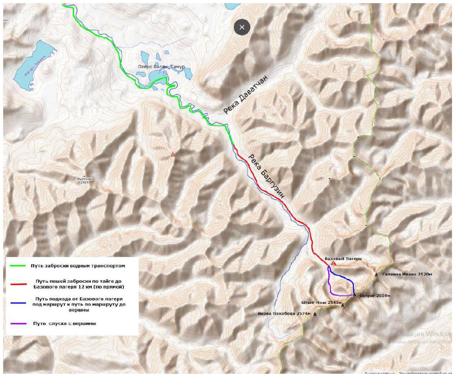
The peak Ostrog is located near the source of the Barguzin River, in its right tributary. The peak is in the most elevated part of the Ikatsky Ridge. The only accessible option for delivery due to the flood situation in the region was by water. The logistics were as follows:
- Irkutsk – Umhey resort in the upper reaches of the Barguzin valley – 900 km, 1 day.
- Umhey resort – Davatchan River – 120 km along the Barguzin River by aeroboat, 8 hours.
- Davatchan valley to the base camp at an altitude of 1600 m above sea level – 12 km along the Barguzin River through taiga, only animal trails are present, with Siberian dwarf pine, and windfall, 2.5 days.
- Base camp – start of the route – 2 km, 2 hours.
The descent from the peak to the base camp was carried out along the Western fault, through a neighboring cirque. The exit and evacuation from the area were carried out in reverse order. From the base camp to Davatchan, it took one day on foot. Then a raft was built, and a float was undertaken due to the deadline for the boat's arrival and food shortages. The group was picked up by a boat from the raft and taken to the Barguzin valley.
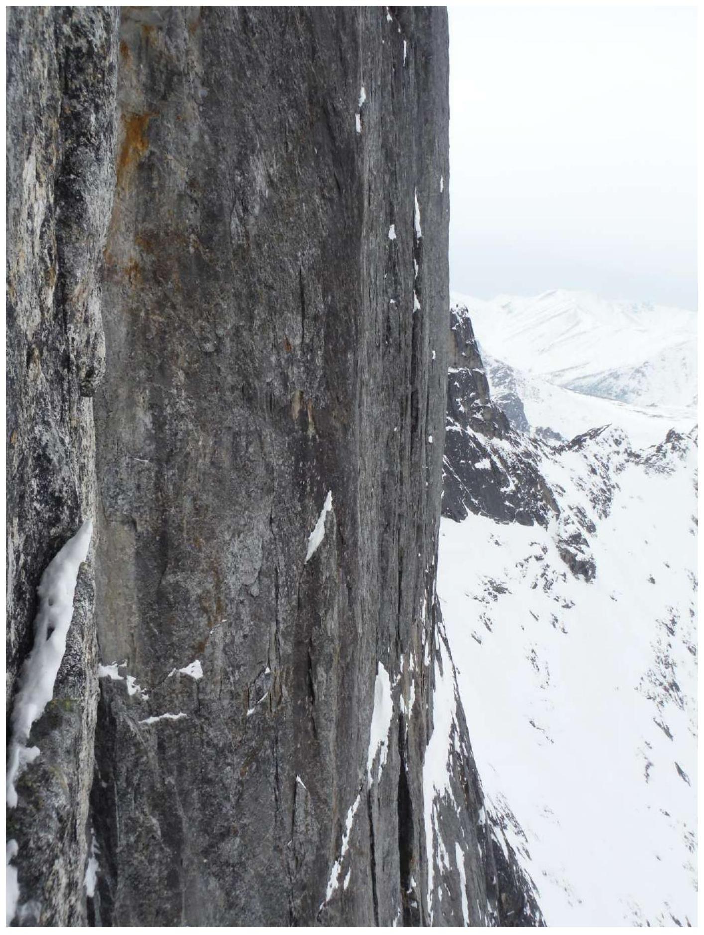
Technical Photo of the Route
The photo was taken from the opposite slope of the cirque located under the route. April 14, 2014.
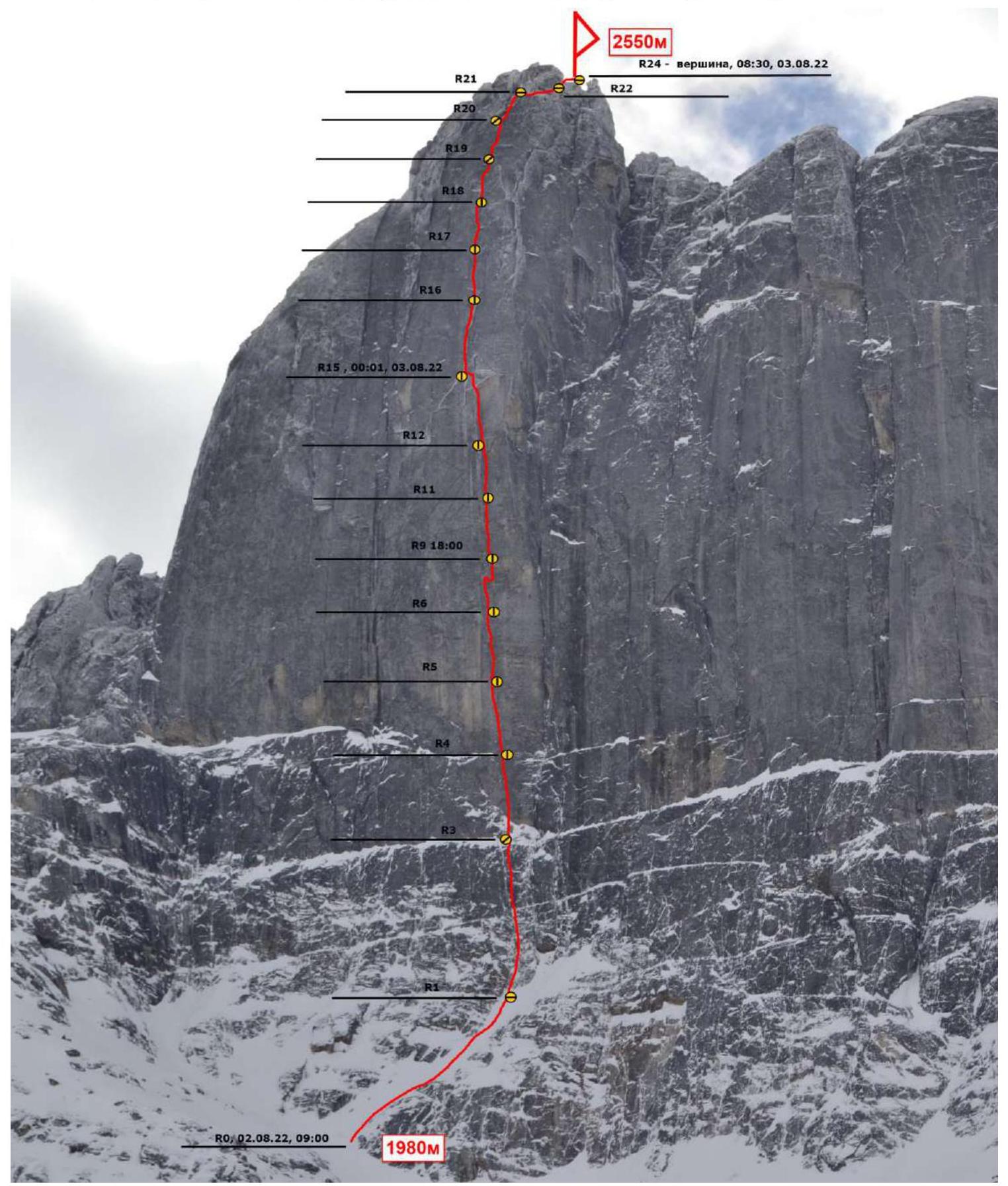
Scheme of the main part of the route, made in UIAA symbols at a scale of 1:2000. Sheet 1
| Section | Protection Elem. | Friend | Rock hook | Rock Hook Fifi | Bolts | Prot. in (m) | Steep. in (gr) | Lead | AID | Notes |
|---|---|---|---|---|---|---|---|---|---|---|
| R0–R1 | – | 4 | 4 | – | – | 100 | 50 | 3+ | – | Photo 1 |
| R1–R2 | – | 3 | 3 | – | – | 20 | 60 | 5– | – | – |
| R2–R3 | 2 | 7 | 4 | 5 | – | 45 | 75 | 6– | A2 | Photo 2 |
| R3–R4 | 1 | 8 | 7 | 6 | 2 | 35 | 95 | 6+ | A3 | Photo 3 |
| R4–R5 | 2 | 7 | 6 | 5 | 2 | 30 | 95 | 6+ | A3 | Photo 4 |
| R5–R6 | 2 | 8 | 5 | 8 | 2 | 45 | 95 | 6+ | A3 | Photo 5 |
| R6–R7 | 1 | 5 | 2 | 3 | – | 20 | 95 | 6+ | A3 | Photo 6 |
| R7–R8 | – | 1 | 1 | 1 | – | 5 | 95 | 6+ | – | – |
| R8–R9 | – | 3 | 2 | 2 | – | 15 | 95 | 6+ | A3 | – |
| R9–R10 | – | 3 | – | – | – | 0,5 | 180 | 6+ | A3 | – |
| R10–R11 | 2 | 12 | 4 | 2 | – | 31 | 90 | 6+ | A3 | Photo 7 |
| R11–R12 | 1 | 10 | 6 | 8 | – | 30 | 90 | 6+ | A3 | Photo 8, Photo 9 |
| R12–R13 | 1 | 12 | 3 | 3 | – | 30 | 95 | 6+ | A3 | Photo 10 |
| R13–R14 | 4 | 2 | 1 | – | – | 10 | 95 | 6+ | A3 | – |
| R14–R15 | 1 | – | – | – | – | 3 | 90 | 6+ | A3 | – |
| R15–R16 | 2 | 9 | 5 | 2 | – | 40 | 80 | 6–/6+ | A2/A3 | – |
| R16–R17 | – | 3 | 2 | – | – | 30 | 80 | 6–/6+ | A2/A3 | Photo 11 |
Scheme of the main part of the route, made in UIAA symbols at a scale of 1:2000. Sheet 2
| Section | Protection Elem. | Friend | Rock hook | Rock Hook Fifi | Bolts | Prot. in (m) | Steep. in (gr) | Lead | AID | Notes |
|---|---|---|---|---|---|---|---|---|---|---|
| R17–R18 | – | 8 | 5 | 2 | – | 35 | 75 | 6– | A2 | – |
| R18–R19 | – | 5 | 4 | – | – | 30 | 70 | 6– | A2 | Photo 12 |
| R19–R20 | – | 6 | 3 | 2 | – | 35 | 65 | 6– | A2 | Photo 13 |
| R20–R21 | – | 3 | 2 | 2 | – | 25 | 70 | 6– | A2 | – |
| R21–R22 | – | – | – | – | – | 20 | 40 | 2– | – | – |
| R22–R23 | – | 2 | – | – | – | 35 | 55 | 4+ | – | – |
| R23–R24 | – | – | – | – | – | 15 | 45 | 3– | – | – |
Description and Characteristics of the Relief
The starting point of the route is a characteristic diagonal ledge in the left part of the wall, leading under the steepest, overhanging bastion of the wall. The start of the route is at a height of 1980 m.
Rope 1 – 100 m. Simultaneously. R0–R1: 100 m, 50°, 3+. A series of oblique ledges alternating with walls from left to right. Photo 1.
Rope 2 – 65 m. Alternating, with fixed ropes.
- R1–R2: 20 m, 60°, 5–. Wet rocks, along a fissure in a large internal form.
- R2–R3: 45 m, 75°, 6–, A2. Wet rocks, internal corner. Photo 2.
Rope 3 – 35 m.
- R3–R4: 35 m, 95°, 6+, A3. Along a slit slightly to the right under an overhanging block (alive), and then up to the left along an overhanging slit. The station is hanging, rocks are wet. Photo 3.
Rope 4 – 30 m.
- R4–R5: 30 m, 95°, 6+, A3. Along a slit transitioning into an internal corner, where an outward-opening slit continues. The station is hanging to the right of the slit, rocks are wet. Photo 4.
Rope 5 – 45 m.
- R5–R6: 45 m, 95°, 6+, A3. Up an increasing internal corner, the slit periodically becomes blind, местами раскрыта, страховка достаточно проблематична. The station is hanging. Photo 5.
Rope 6 – 40 m.
- R6–R7: 20 m, 95°, 6+, A3. Along the corner under a cornice. Photo 6.
- R7–R8: 5 m, 95°, 6+. Pendulum to the right.
- R8–R9: 15 m, 95°, 6+, A3. Up along the internal corner, under a cornice. The station is hanging, rocks are wet.
Rope 7 – 32 m.
- R9–R10: 0.5 m, 180°, 6+, A3. Cornice.
- R10–R11: 31 m, 90°, 6+, A3. Up along the corner, crumbling slits, periodic blind ones, местами «штукатурка». The station is hanging, rocks are wet. Photo 7.
Rope 8 – 30 m.
- R11–R12: 30 m, 90°, 6+, A3. Slit along the internal corner, pendulum to the left. The station is hanging, a ledge under the foot. Photo 8, Photo 9.
Rope 9 – 43 m.
- R12–R13: 30 m, 95°, 6+, A3. Internal corner, approach under a large cornice, relief under the cornice is unreliable. Photo 10.
- R13–R14: 10 m, 95°, 6+, A3. Circumventing the cornice to the left into a hanging internal corner, alive blocks, along the internal corner under the next cornice and circumventing it in the same way to the left.
- R14–R15: 3 m, 90°, 6+. Pendulum to the left onto a more gentle spot. The station is hanging. Exit to the "roof".
Rope 10 – 40 m.
- R15–R16: 40 m, 80°, 6–/6+, A2–A3. Wet internal form of the internal corner/crack, narrowing towards the top and turning into a slit, crumbling blocks inside. Periodically, sections under large Camalot 5 and larger points. The station is hanging. Photo 11.
Rope 11 – 30 m.
- R16–R17: 30 m, 80°, 6–/6+, A2–3. Along the slit on anchors to the left and then up along the crack – flake, complicated by crumbling relief and wide-open slits. Rocks are wet. The station is hanging.
Rope 12 – 35 m.
- R17–R18: 35 m, 75°, 6–, A2. Wet crack and internal corners, wedged blocks, large protection points needed.
Rope 13 – 30 m.
- R18–R19: 30 m, 70°, 6–, A2. Movement upwards, rocks are wet, along slits and internal corners. The station is on a small ledge, inconvenient. Photo 12.
Rope 14 – 35 m.
- R19–R20: 35 m, 65°, 6–, A2. Up along slits, rocks are wet, exit into a hollow under an overhang. Photo 13.
Rope 15 – 25 m.
- R20–R21: 25 m, 70°, 6–, A2. Exit from the hollow from under the cornice, exit onto destroyed large-block relief.
Rope 16 – 30 m.
- R21–R22: 20 m, 40°, 2–. Circumventing a pinnacle to the right.
Rope 17 – 30 m.
- R22–R23: 30 m, 55°, 4–. Exit onto the ridge crest.
Rope 18 – 15 m.
- R23–R24: 15 m, 45°, 3–. Exit to the peak along the ridge. Photo 14.
Characteristics of the Route and Team Actions
Attempts to climb this route were made by our team over several expeditions, starting from 2011. However, harsh weather conditions and an accident in one of the expeditions prevented the realization of our plans.
Initially, the route was planned to be climbed with an overnight stay in hammocks. The experience gained from working on the lower part of the wall showed that the relief is very difficult to navigate: blind slits, lack of ledges, presence of cornices on the path, and a continuous overhang in the lower part of the wall. All these factors ruled out climbing the route using free climbing. The team's tactical plan involved climbing the lower overhanging part of the wall on the first day and organizing a bivouac after reaching the more gentle upper part of the wall. There were hopes for the presence of ledges, although they were not necessary for hammocks.
During the delivery and until the start of the ascent, the team spent 6 days under regular rain, waiting for a window of opportunity for the ascent. During these days, the team conducted:
- reconnaissance of summer approaches to the wall;
- delivery of equipment under the wall.
The weather window opened on August 2. On this day, at 9:00, the leader began working on the wall.
During the ascent, only dynamic ropes were used. The leader worked on two ropes, using both to ensure safety. The route was climbed without falls or emergencies. From 9:00 to 18:00, Lazarev Stanislav worked as the leader, climbing the route to point R9. Then Kleptsov Alexander took over as leader, managing to climb the steep part to the large cornice R15 by sunset.
Upon reaching the more gentle upper part, it was discovered that there were no ledges — the rocks were smooth. At the same time, a cloud front with a thunderstorm was approaching from the northwest: lightning discharges were visible, but thunder was not heard. It was decided to climb another rope in search of a suitable place for an overnight stay.
After another rope, no ledges were found, and the thunderstorm front drew closer, with distinct thunderclaps heard and a significant increase in lightning activity.
Our group has repeatedly encountered thunderstorm conditions in the mountains, including close lightning strikes. Given the situation, it was decided to:
- move as quickly as possible towards the peak;
- seek shelter on its opposite, significantly more gentle slope with many convenient ledges.
It was estimated that there were about two ropes of climbing left to the peak from point R16 (it turned out to be significantly more).
By dawn, the team was at the end of the technically complex part of the wall, and it became possible to continue using free climbing. At dawn, the team was enveloped in cloud cover with rare clearings, and rain began, accompanied by an increase in wind and a significant drop in temperature — it felt like it had dropped to zero.
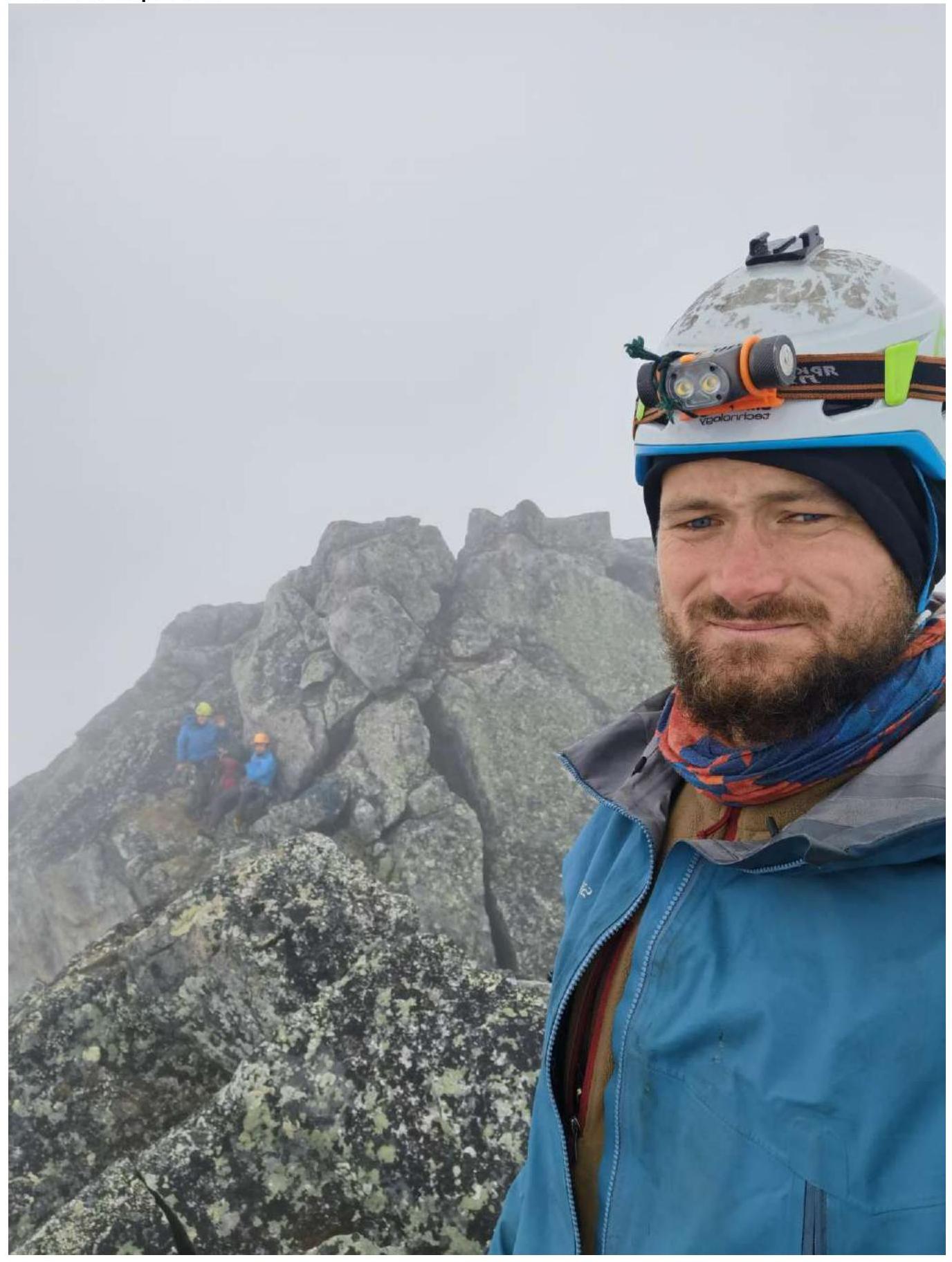
No notes were found at the peak, but a bent carabiner was found in the control tour, likely left by previous climbers.
The descent from the peak was carried out to the West along a previously identified fault:
- one rappel was made to the saddle between the peaks of Ostrog;
- followed by four rappels directly in the fault: two short ones of 20 m and two long ones of 50–60 m.
The team's experience with routes of the 6th category of difficulty at the time of the ascent:
- Kleptsov had 14 ascents on routes 6A/6B in the Sayan Mountains, Transbaikalia, Ergaki, Caucasus, and Karavshin.
- Lazarev had 7 ascents on routes 6A/6B in the Sayan Mountains, Caucasus, and Karavshin.
- Panova had 2 ascents of 6A category in Transbaikalia and Crimea.
The team unanimously concluded that this route is one of the most challenging routes climbed by the participants in the low mountains. The route, in their opinion, is more difficult than some Caucasian "sixes," such as Babitsky's 6A on Erydag and Kharitonov's 6A on Gaikomde. The peak Ostrog and the route are very reminiscent of the peak Slesova in Karavshin in terms of morphology, steepness, and subjective feeling during the ascent. The team has experience climbing Slesova via Pologerov's 6A and Moroz's 6A routes (taking one and a half days to reach the peak). The team unanimously believes that the route undoubtedly corresponds to the 6A category. Considering the remoteness and complex weather conditions in the mountain node, this ascent is one of the most challenging and labor-intensive in the team's practical experience.
Recommendations for equipment:
- 2 sets of friends; soft Totem Cams performed well on this route.
- In the lower, steep part of the route, in blind and open slits, anchors with a bend performed well.
- Large sizes are necessary in the upper part of the wall.
- It is recommended to have 1 Camalot #5 and 2 Camalots #4.
The route is climbed without the use of bolt climbing techniques. The bolts used by the team on the route were installed during a winter attempt and were used as stations during processing.
Photo 1. Start of the route. The leader is at point R1, easy rocks.
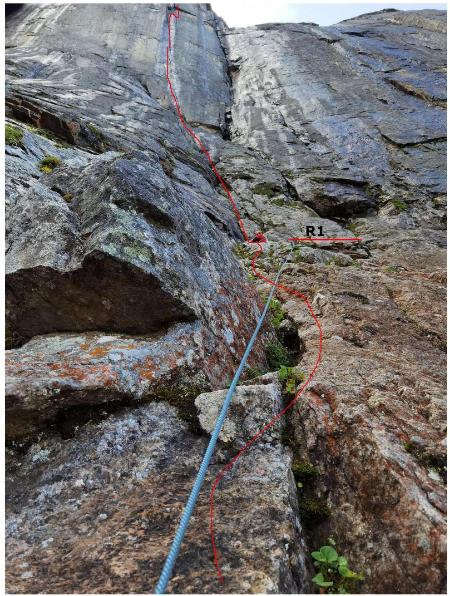
Photo 2. The leader is on section R2–R3. Wet internal corner. Initially, the leader tried to climb along a drier section to the right of the corner, where he is photographed; however, the relief became significantly more complicated, and the leader pendulumed to the left into the corner and continued moving along it.
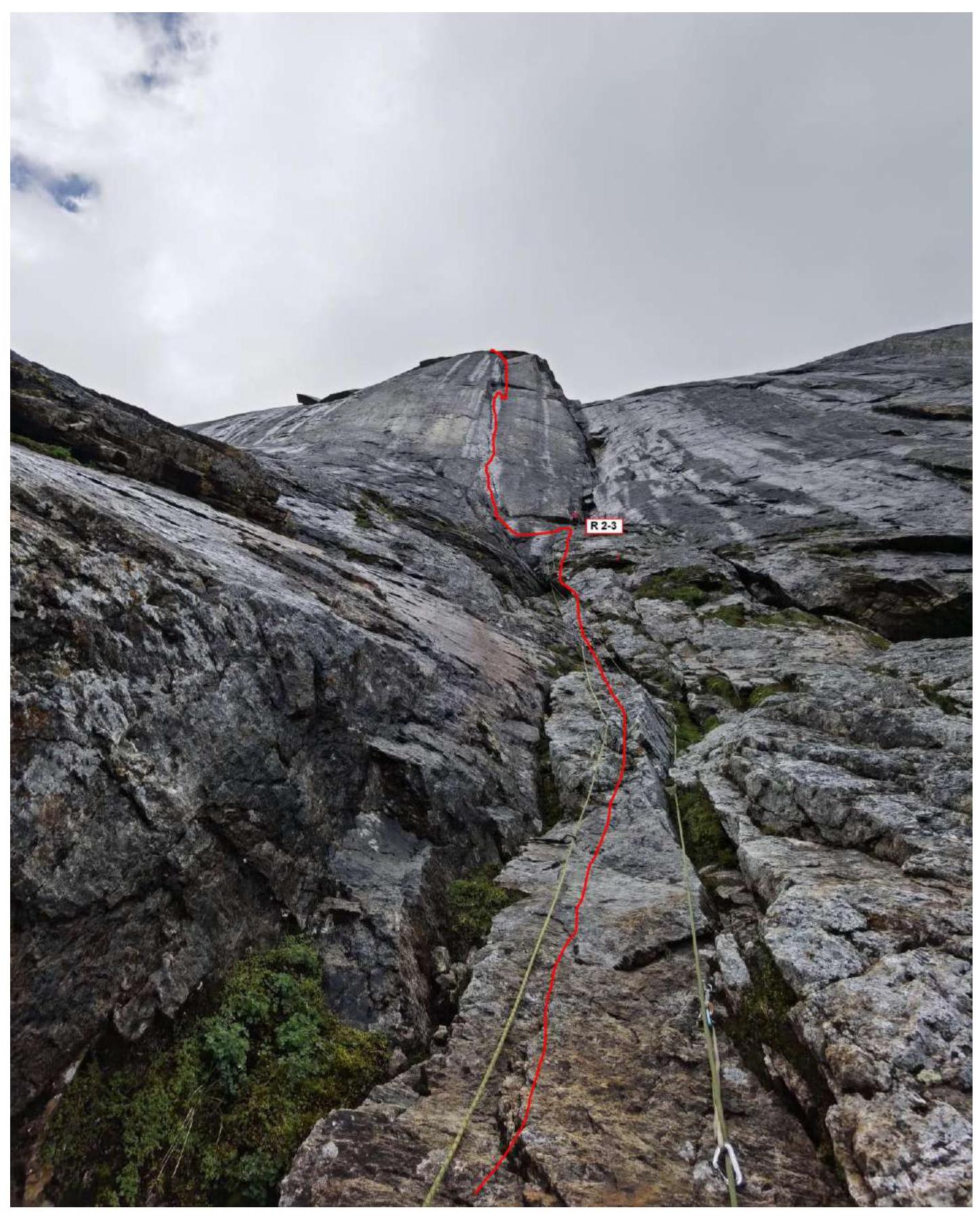
Photo 3. Beginning of the technically complex part of the wall: overhangs and verticals. Section R3–R4. Slit, periodically becoming blind with open walls. Ahead, a rectangular cornice is visible, from which the first pendulum was made.
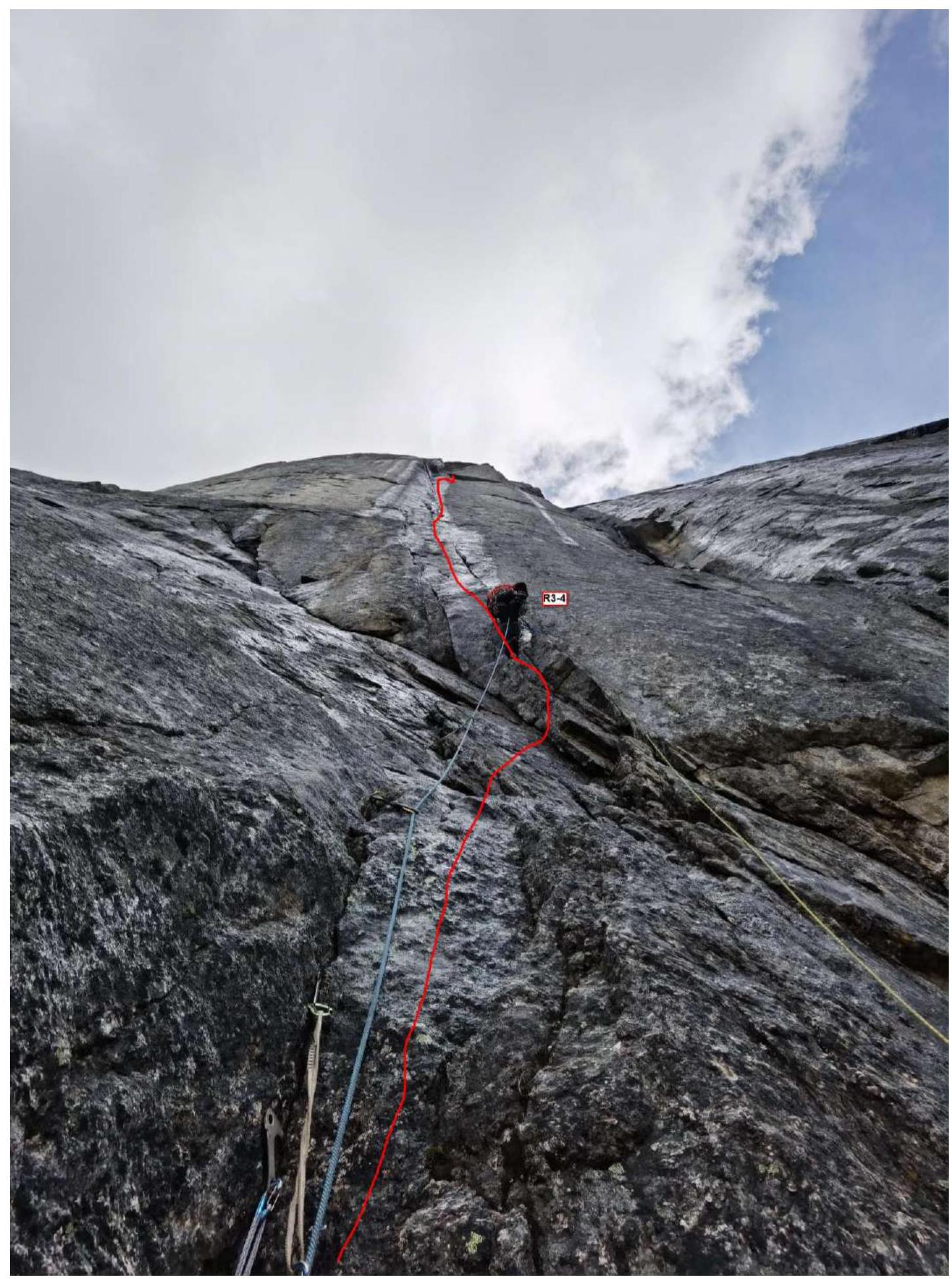
Photo 4. The leader is at the station at point R4. Organization of the station. The photo is taken with double zoom.
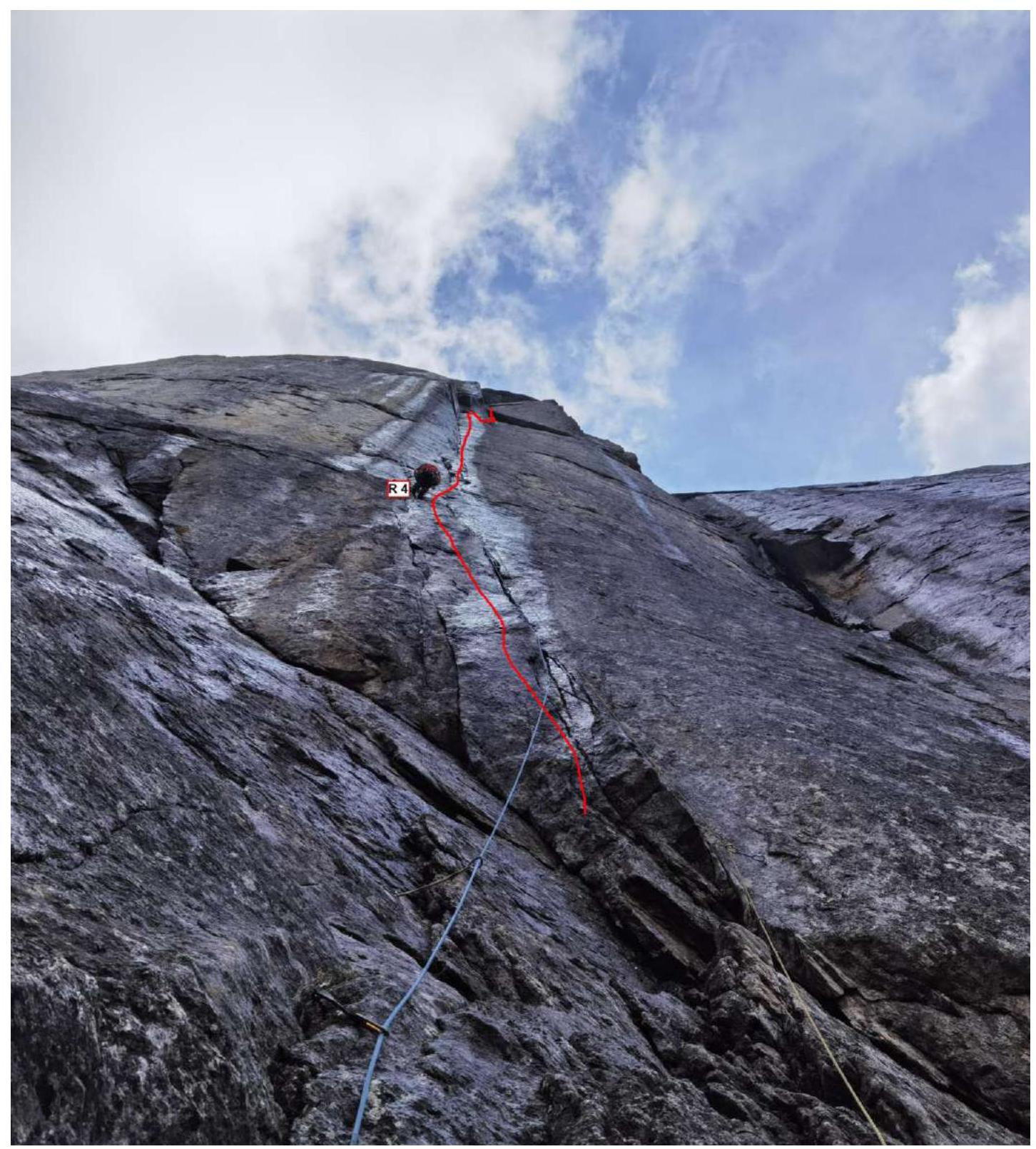
Photo 5. Section R5–R6. Increasing corner, rocks are wet, slit is periodically blind. Overhang.
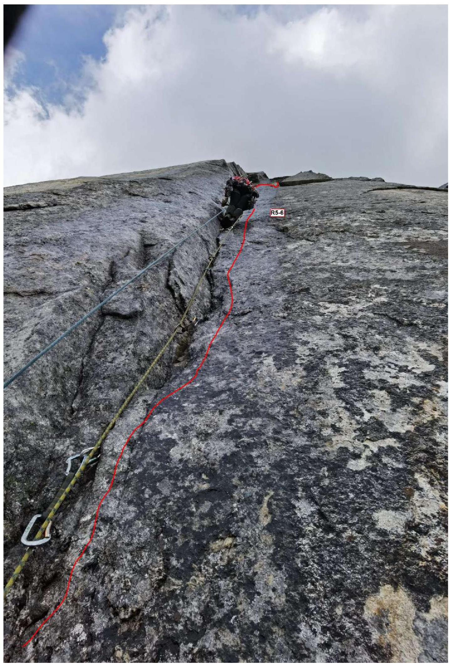
Photo 6. Section R6–R7. The leader, having worked along the cornice, descended slightly and prepared to make a pendulum to the right into the neighboring slit.
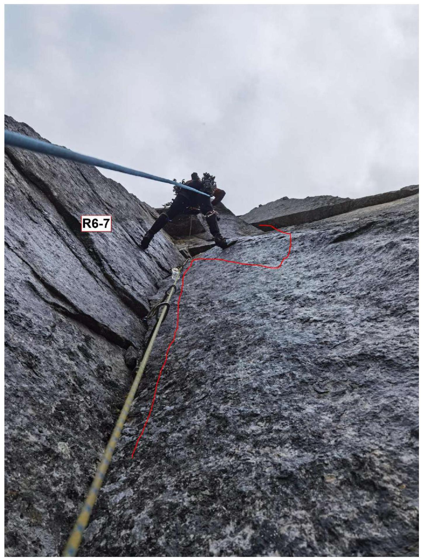
Photo 7. Section R10–R11. Photo down, open internal corner.
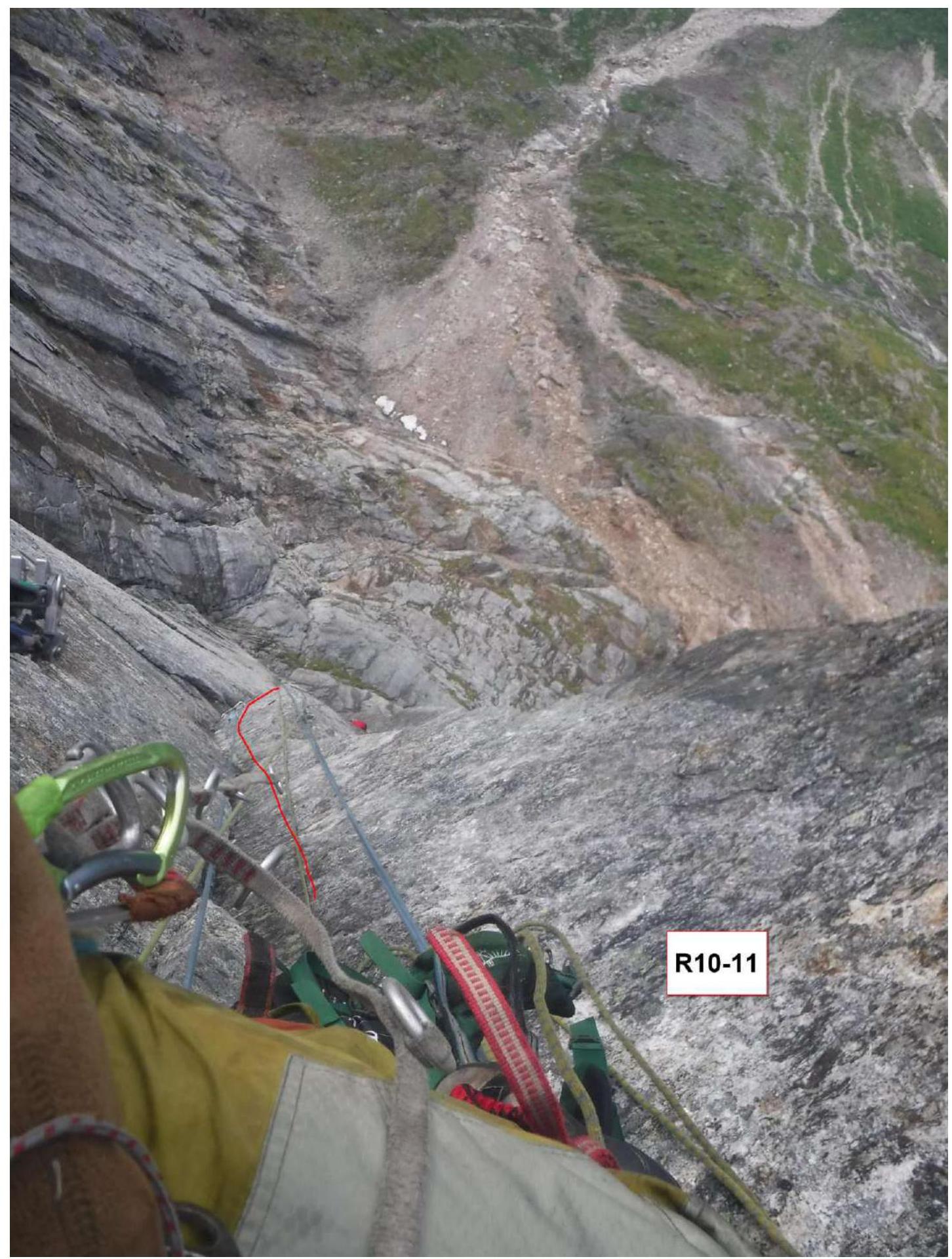
Photo 8. Section R11–R12. Photo down, open internal corner.
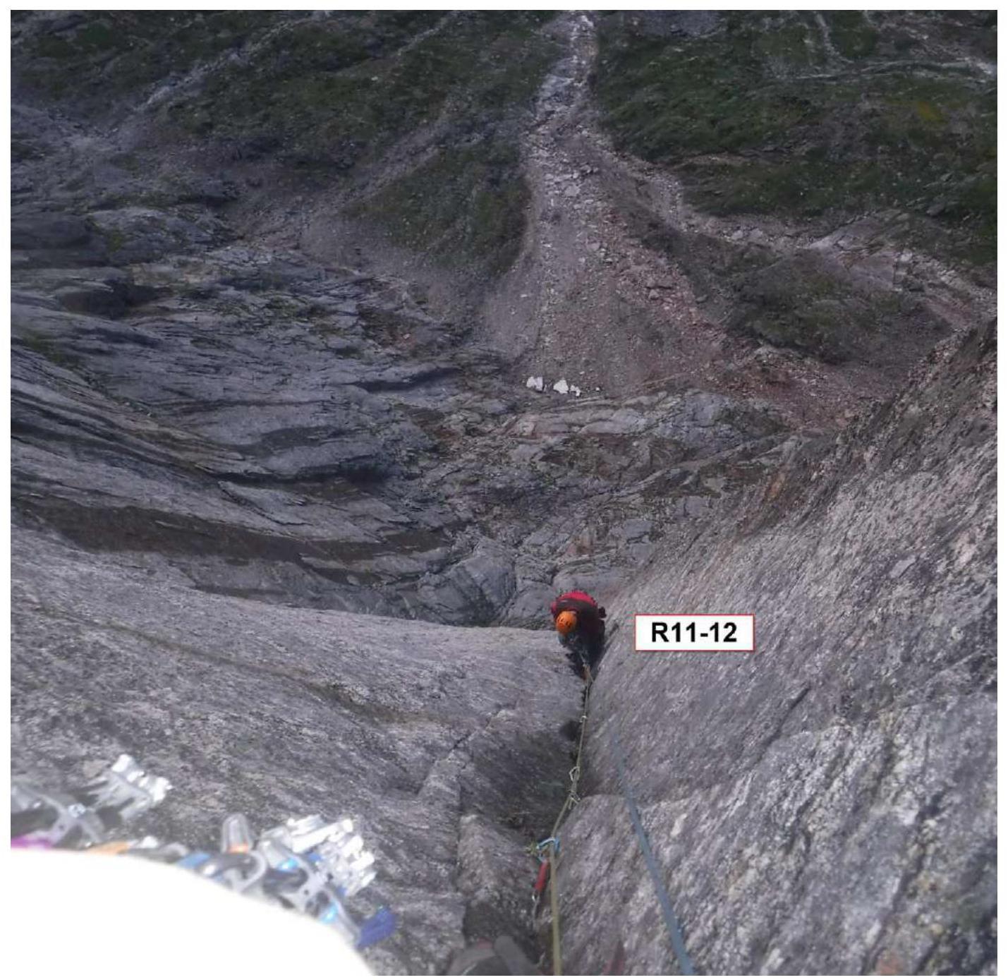
Photo 9. Section R11–R12. Photo down, open internal corner. Taken from the station at point R12.
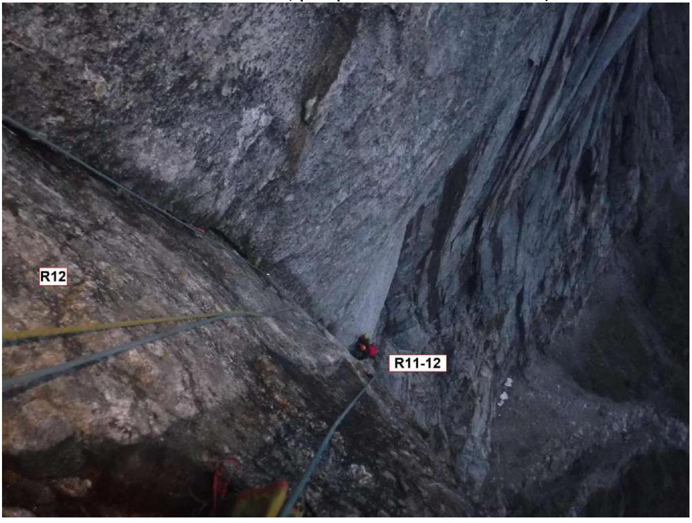
Photo 10. Section R12–R13. Photo up. A large cornice is visible, behind which the wall becomes more gentle. Taken from the station at point R12.
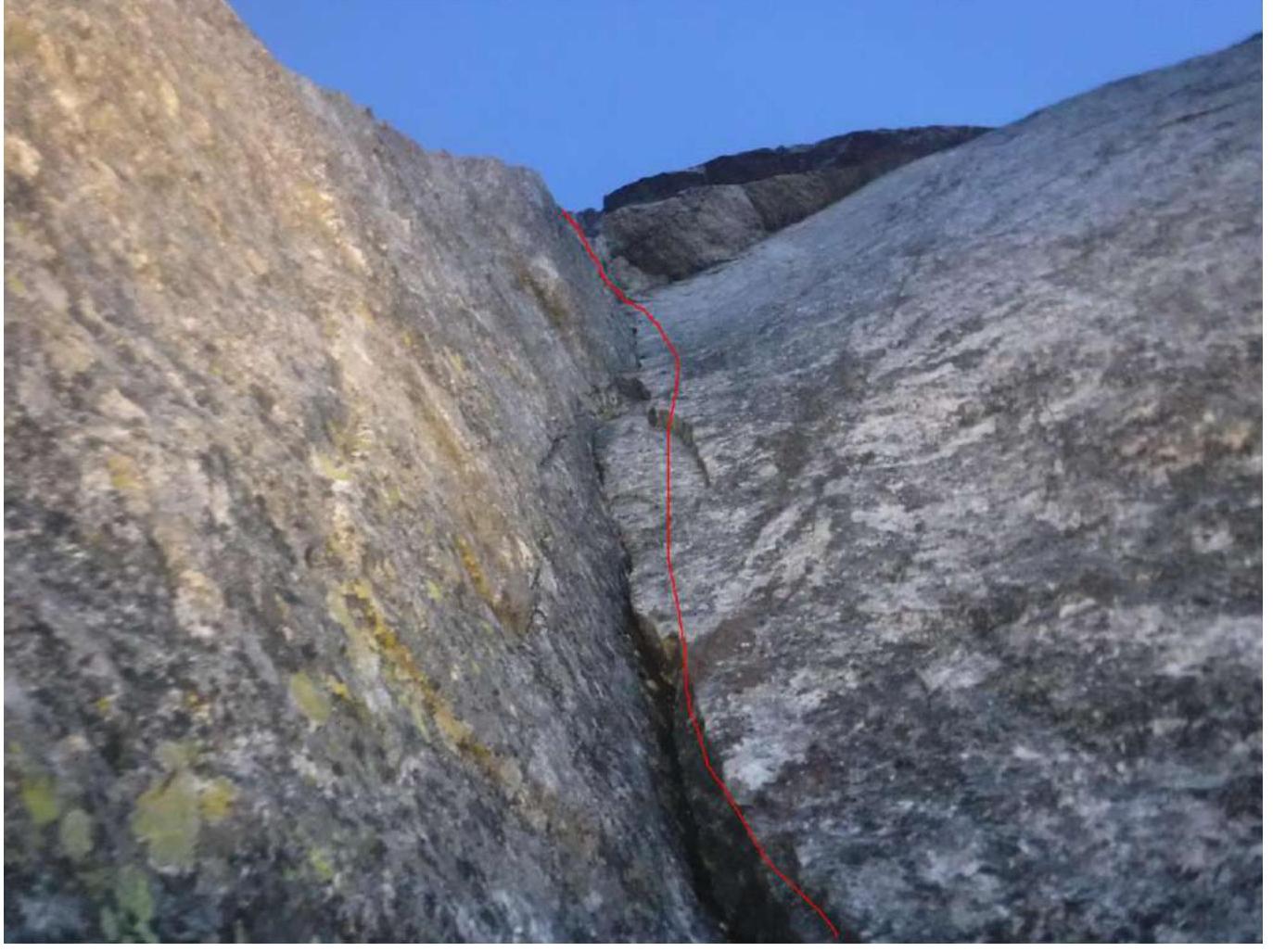
Photo 11. Section R16–R17. Photo down. Slit after an indistinctly expressed internal corner of the crack. Taken from the station at point R16.
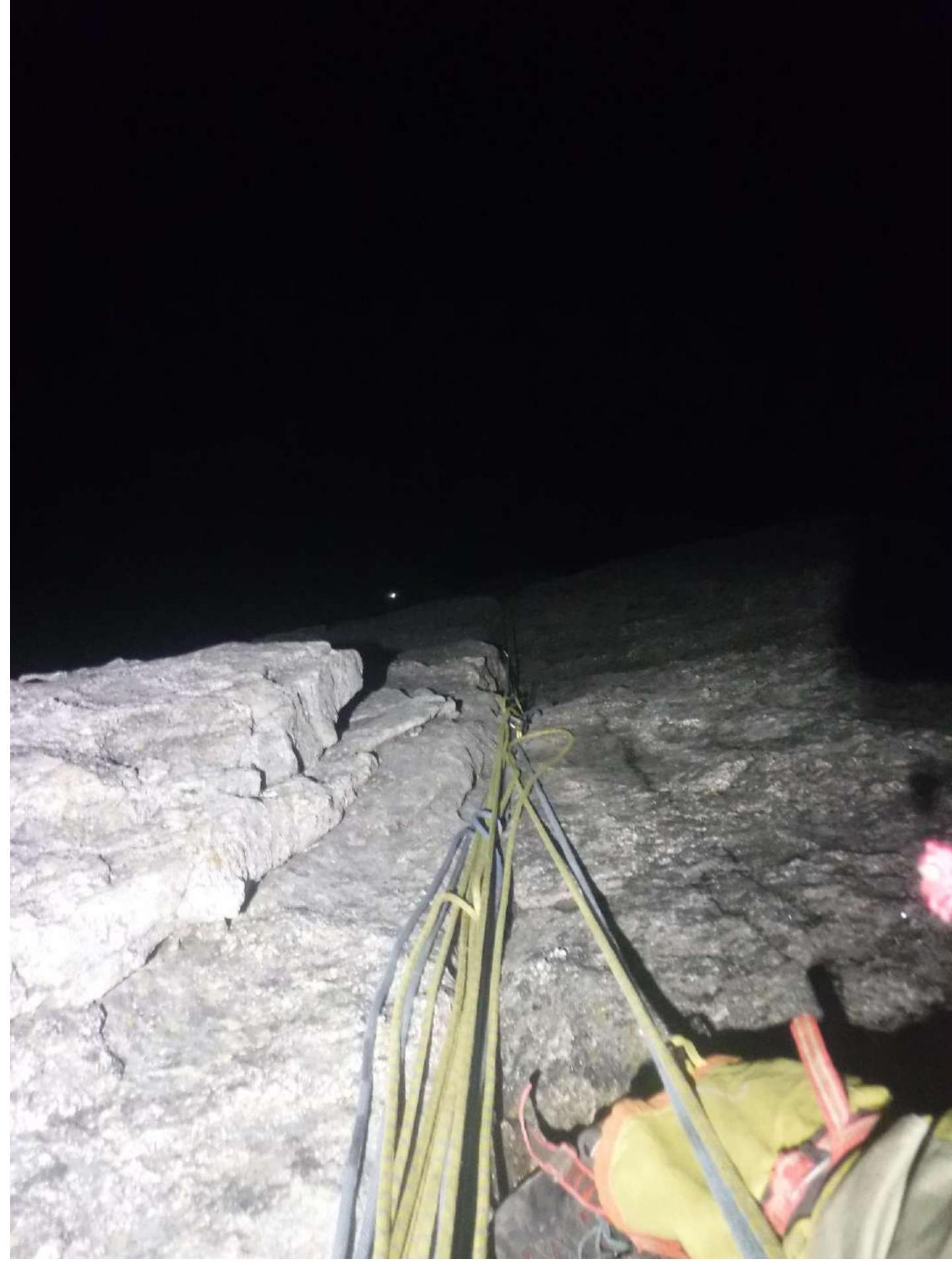
Photo 12. Section R18–R19. Photo down. Taken from the station at point R19.
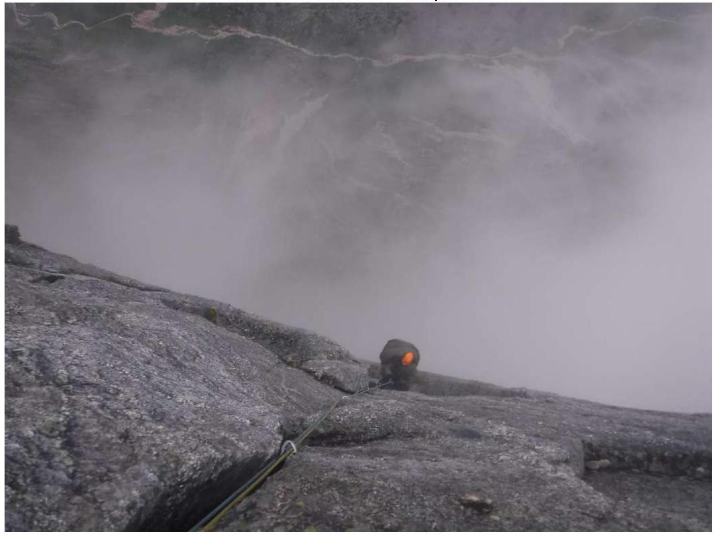
Photo 13. Section R19–R20. Photo down. Taken from the station at point R20.
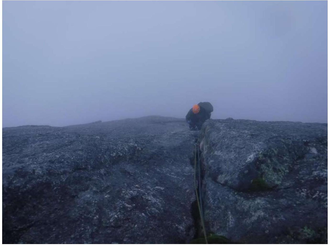
Photo 14. The peak.
Comments
Sign in to leave a comment