
Report
On the first ascent to the summit of Bagunda Glavnaya via the north-eastern edge, approximately 25 category of difficulty, by the team of the Baikal Alpine School on August 2, 2018.
Irkutsk 2020
I. Ascent Report
| № | 1. General Information | |
|---|---|---|
| 1.1 | Full name, sports rank of the leader | Afanasiev A. E. — Master of Sports |
| 1.2 | Full name, sports rank of the participants | Geidarov K. G. — 2nd sports rank; Nomokonov D. V. — 2nd sports rank; Sirotenko R. O. — 3rd sports rank |
| 1.3 | Full name of the coach | Afanasiev A. E. — Master of Sports |
| 1.4 | Organization | Baikal Alpine School |
| 2. Characteristics of the Ascent Object | ||
| 2.1 | Region | Ikatsky Ridge, Southern Massif |
| 2.2 | Valley | Bagunda |
| 2.3 | Section number according to the 2013 classification table | 9 |
| 2.4 | Name and height of the summit | v. Bagunda Glavnaya, 2501 m |
| 2.5 | Geographical coordinates of the summit (latitude/longitude), GPS | N 53°56′52″; E 111°06′35″ |
| 3. Route Characteristics | ||
| 3.1 | Route name | NE edge |
| 3.2 | Proposed category of difficulty | 26 |
| 3.3 | Degree of route development | First ascent |
| 3.4 | Route terrain character | Rocky |
| 3.5 | Route elevation gain (altimeter or GPS data) | 170 |
| 3.6 | Route length (in meters) | 239 m |
| 3.7 | Technical elements of the route (total length of sections with different categories of difficulty and terrain character) | 1st cat. diff. rocks — 175 m. 2nd cat. diff. rocks — 25 m. 3rd cat. diff. rocks — 20 m. 4th cat. diff. rocks — 14 m. 5th cat. diff. rocks — 5 m. |
| 3.8 | Descent from the summit | North to the base camp on the lake |
| 3.9 | Additional route characteristics | Presence of rain |
| 4. Team Actions Characteristics | ||
| 4.1 | Travel time (team hours, in hours and days) | 4 h 45 min, 1 day |
| 4.2 | Overnights | No |
| 4.3 | Route start | 7:00, August 2, 2018 |
| 4.4 | Summit arrival | 15:05, August 2, 2018 |
| 4.5 | Return to base camp | 17:30, August 2, 2018 |
| 5. Report Responsible | ||
| 5.1 | Full name, e-mail | Afanasiev A. E., anevg09@mail.ru |
II. Ascent Description
1. Characteristics of the Ascent Object
1.1. General photo of the summit.
v. Bagunda Glavnaya 2501 m
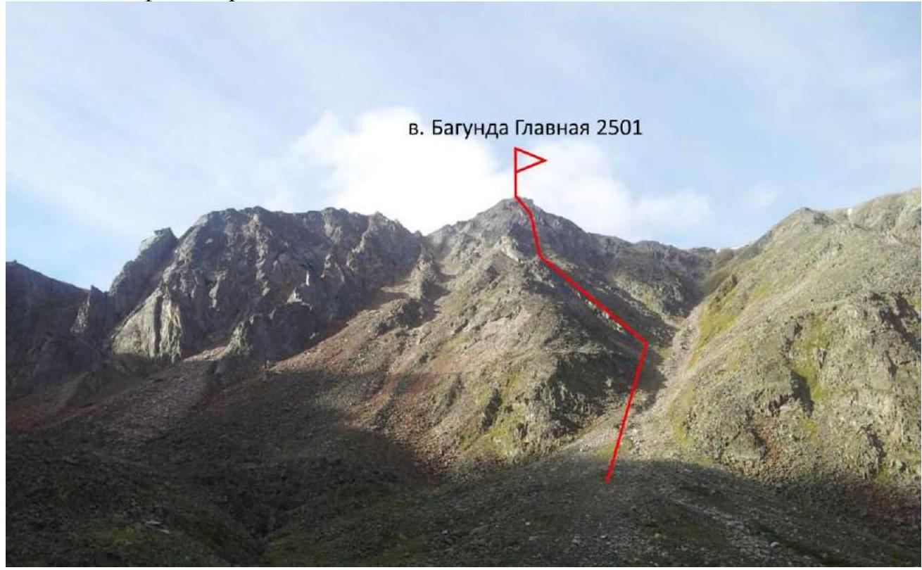
Photo 1. Taken from the Bagunda valley, August 2, 2018.
1.2. Photo of the route profile.
v. Bagunda Glavnaya 2501 m
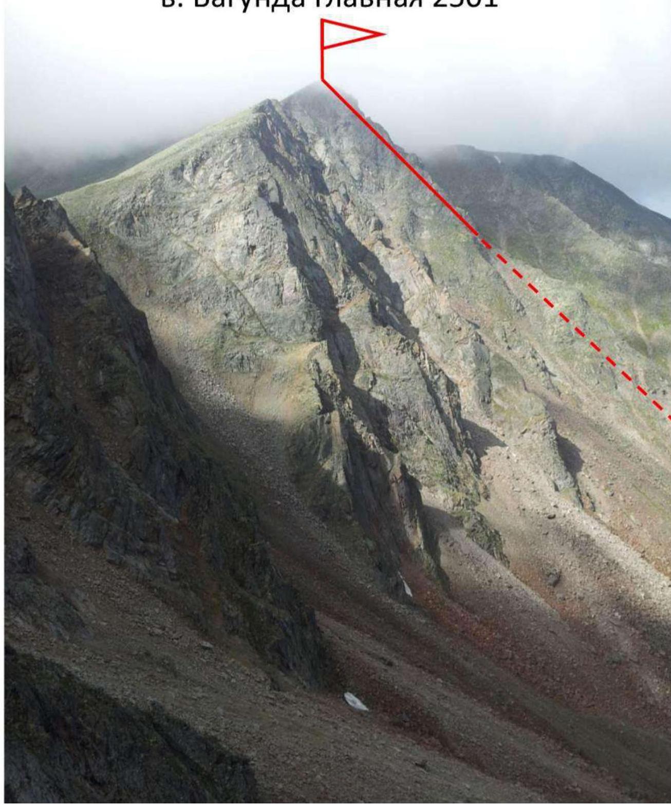
Photo 2. Taken from v. Zolotaya, July 31, 2018.
1.3. Photopanorama of the area
v. Bagunda Glavnaya 2501 m
2519 m
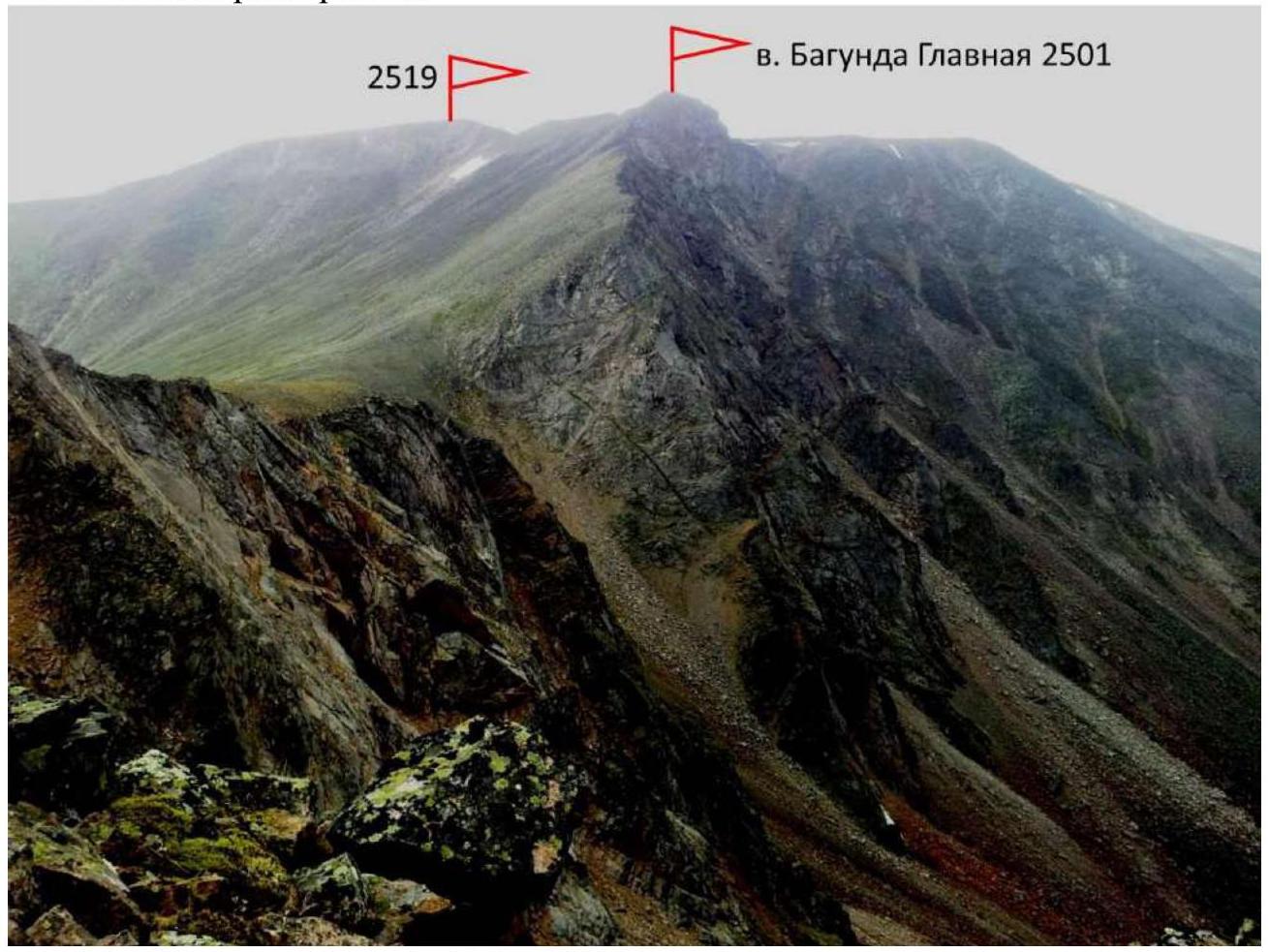
Photo 3. Taken from v. Zolotaya, July 31, 2018.
1.4. Area map.
The Bagunda valley is located in the Southern Massif of the Ikatsky Ridge, which is a part of the Stanovoye Highlands. Administratively, the object is situated in the Barguzinsky district of the Republic of Buryatia. It is 2 hours of flight time from Chita by helicopter. The base camp was set up at the landing site near the source of the river from Lake Bagunda. The Southern Massif is composed of gentle goltsy. However, there was significant glaciation in the area during the Quaternary period, as evidenced by the trough profile of the Bagunda valley and the lake dammed by a relict moraine. Due to this factor, the climbing area has all the characteristics of a training alpine terrain: elevation gain from the base camp is just over 1500 meters, and the approach to the routes takes at least 2 hours. Additionally, the area offers routes up to 4-6 category of difficulty.
One such route, with a category of difficulty 4-6-5A, was climbed on Bagunda Glavnaya via a counterfort to the left of the proposed route to this summit by Chita climbers in 2020, led by Geidarov K. G. The material is being compiled.
N 53°56′07″; E 111°07′08″
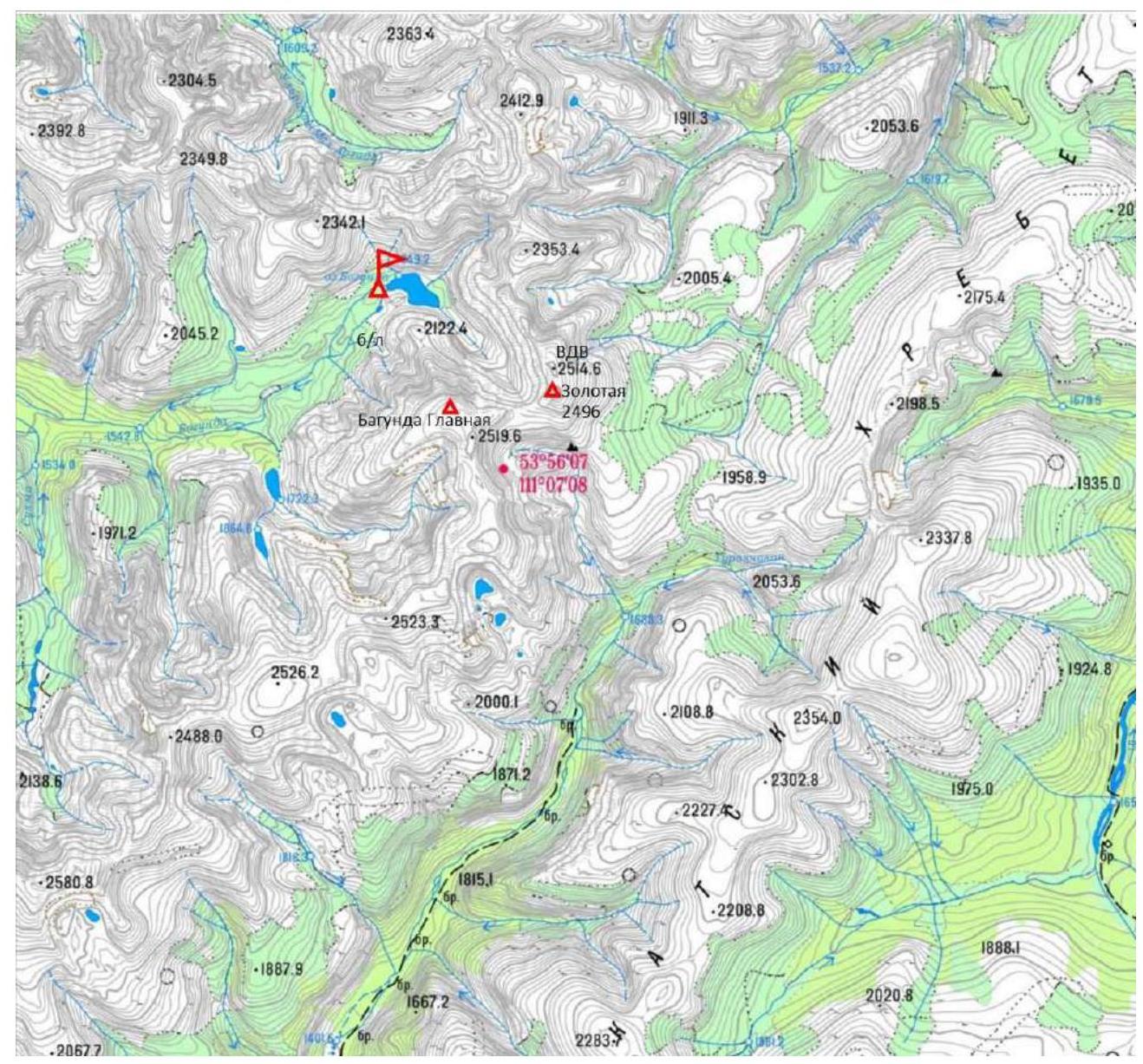
Photo 4. Area map: Ikatsky Ridge, Southern Massif.
N 53°56′07″; E 111°07′08″
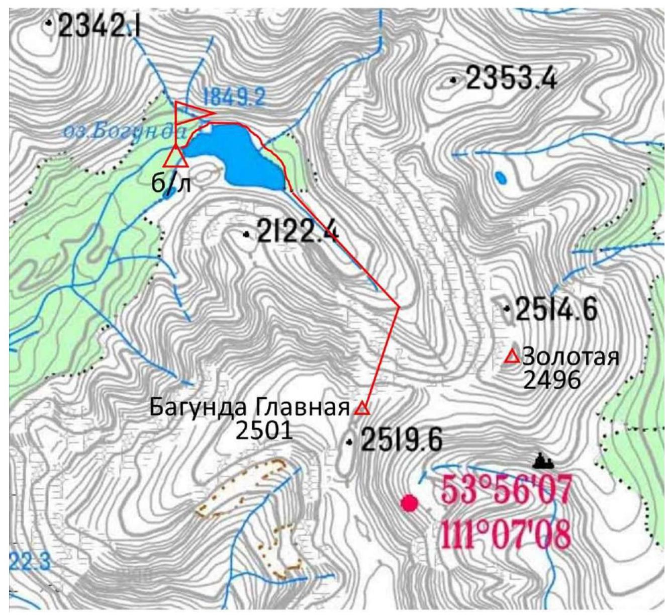
Photo 5. Route map to v. Bagunda Glavnaya.
2. Route Characteristics
2.1. Technical photo of the route.
v. Bagunda Glavnaya 2501 m
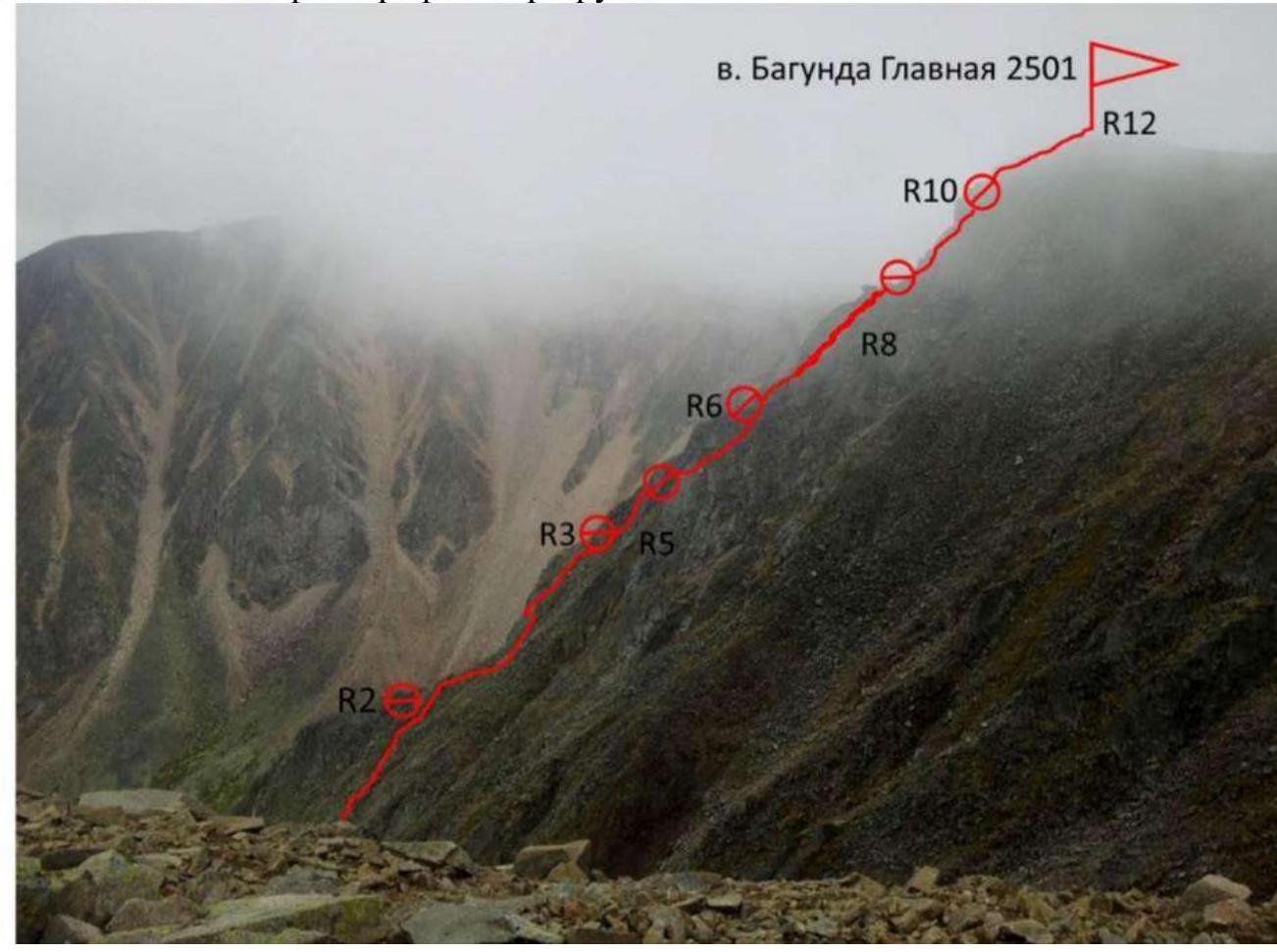
Photo 6. Technical photo of the upper part of the route on the right. Taken from the northern shoulder of v. Bagunda Glavnaya.
2.3. Technical characteristics of the route sections.
| Section № | Terrain character | Category of difficulty | Length, m | Number of pitons |
|---|---|---|---|---|
| R0–R1 | Rocks of the edge 45°. Passed on the right. Loose rocks! | 1 | 45 m | |
| R1–R2 | Ridge 40°. | 1 | 30 m | |
| R2–R3 | Large rocks. | 1 | 15 m | |
| R3–R4 | Internal angle to the right of the ridge 80°. Exit to the ridge. | 4 | 7 m | 2 |
| R4–R5 | Left-sided chimney 80° to the right. | 5 | 5 m | 2 |
| R5–R6 | Shelf to the right, to the right of the ridge. | 1 | 50 m | 2 |
| R6–R7 | Destroyed rocks. | 1 | 20 m | 1 |
| R7–R8 | To the right along the rocks 55°. To the right of the ridge. | 2 | 15 m | 1 |
| R8–R9 | To the left onto the ridge edge. | 2 | 10 m | 1 |
| R9–R10 | Crack in the wall 80°. To the left of the ridge. | 4 | 7 m | 2 |
| R10–R11 | Wall 60°. | 3 | 20 m | 3 |
| R11–R12 | Ridge 15°. Exit to the summit. | 1 | 15 m |
3. Team Actions Characteristics
3.1. Brief description of the route passage.
| Section № | Description | Photo № |
|---|---|---|
| R0–R1 | Rocks of the edge 45°. Passed on the right. Loose rocks! | |
| R1–R2 | Ridge 40°. | |
| R2–R3 | Large rocks. | |
| R3–R4 | Internal angle to the right of the ridge 80°. Exit to the ridge. | 7 |
| R4–R5 | Left-sided chimney 80° to the right. | 7 |
| R5–R6 | Shelf to the right, to the right of the ridge. | |
| R6–R7 | Destroyed rocks. | |
| R7–R8 | To the right along the rocks 55°. To the right of the ridge. | 8 |
| R8–R9 | To the left onto the ridge edge. | 9 |
| R9–R10 | Crack in the wall 80°. To the left of the ridge. | 10 |
| R10–R11 | Wall 60°. | 11 |
| R11–R12 | Ridge 15°. Exit to the summit. | 12 |
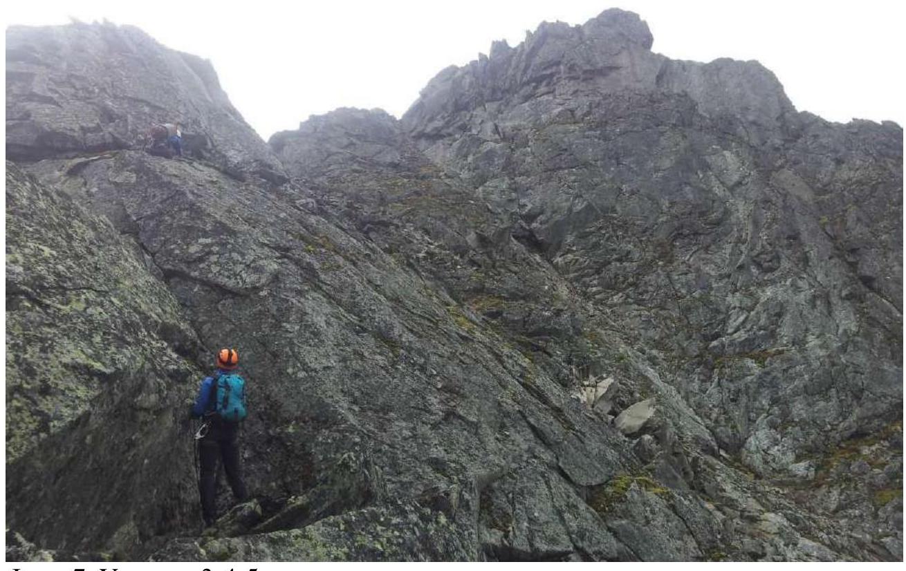
Photo 7. Section R3–R4–R5.
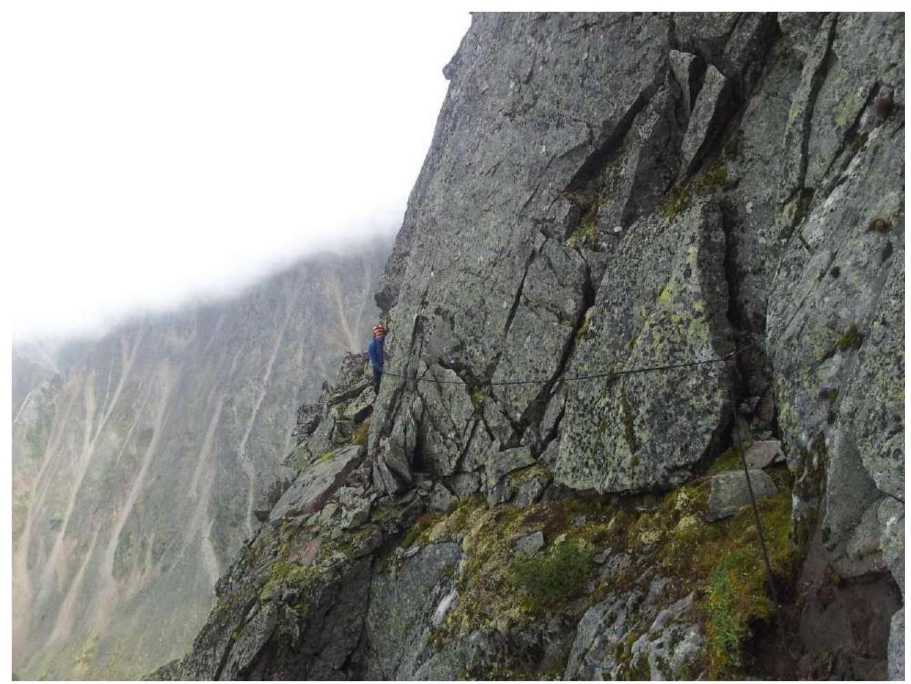
Photo 8. Section R7–R8.
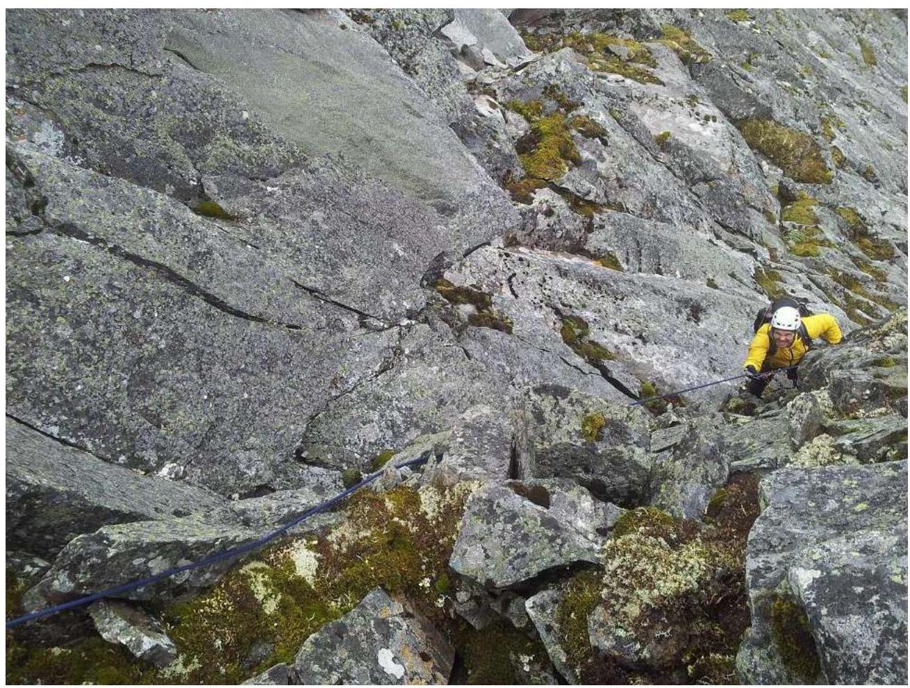
Photo 9. Section R8–R9.
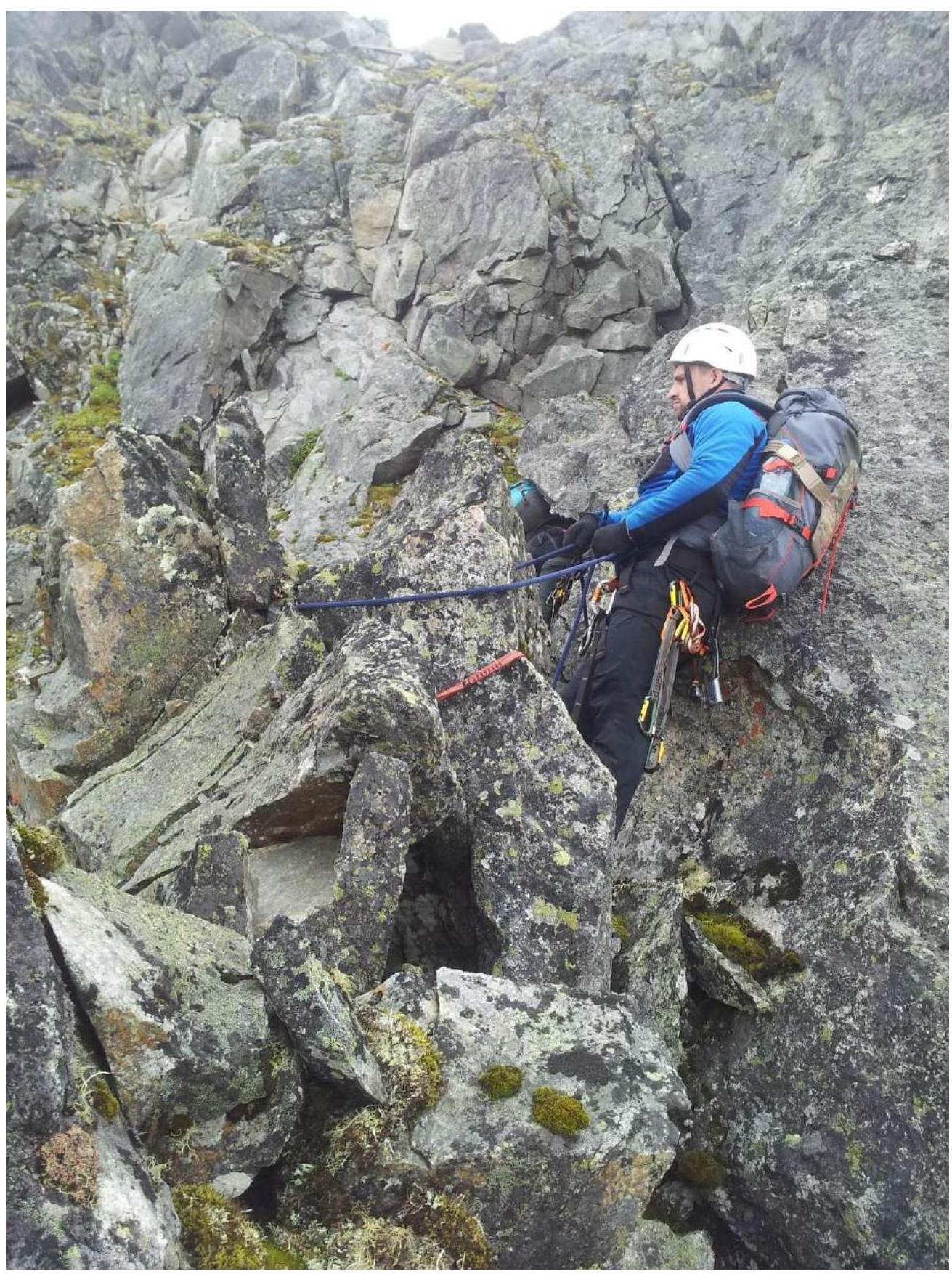
Photo 10. Section R10.
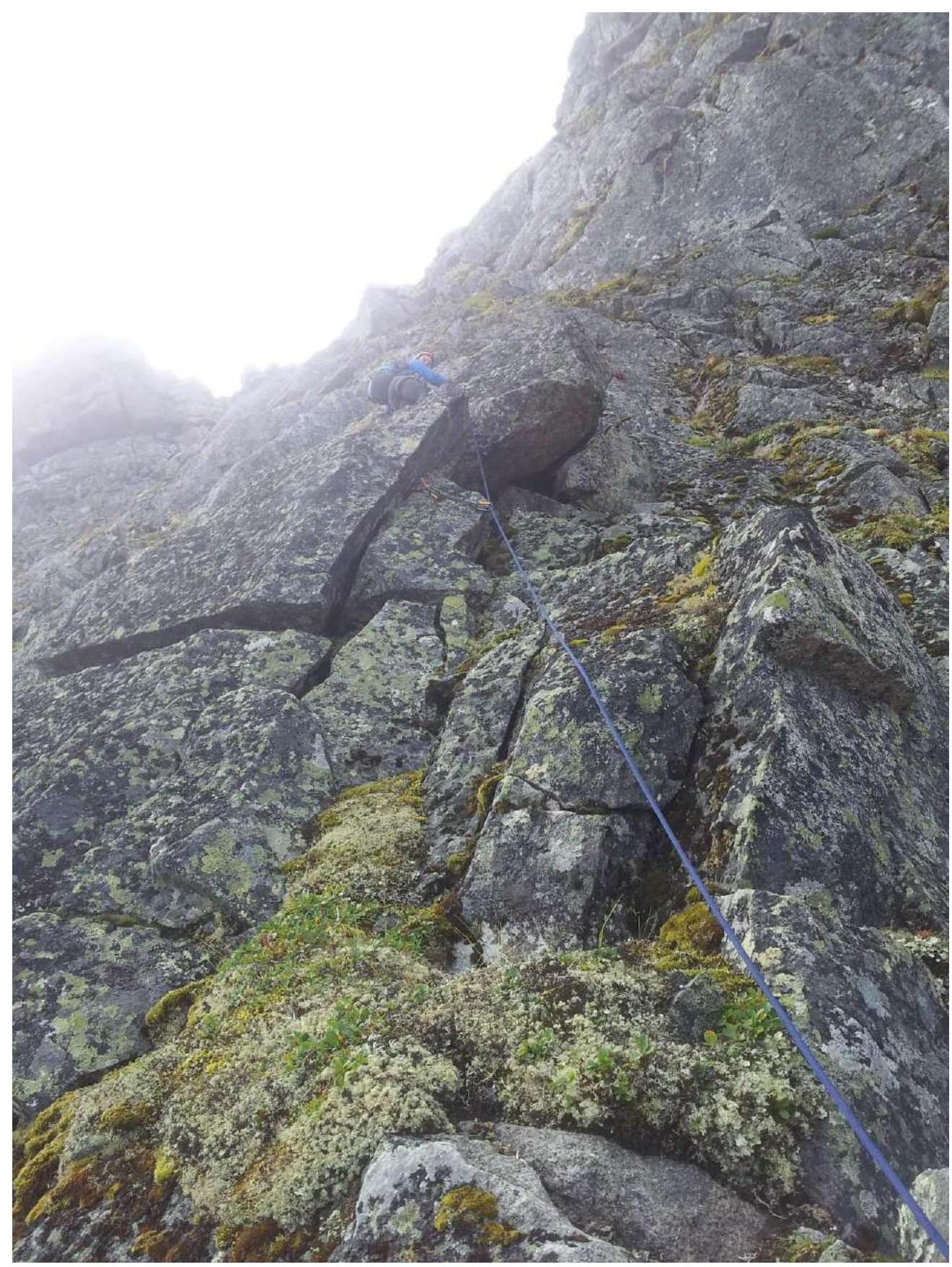
Photo 11. Section R10–R11.
3.2. Photo of the team on the summit with the control post.
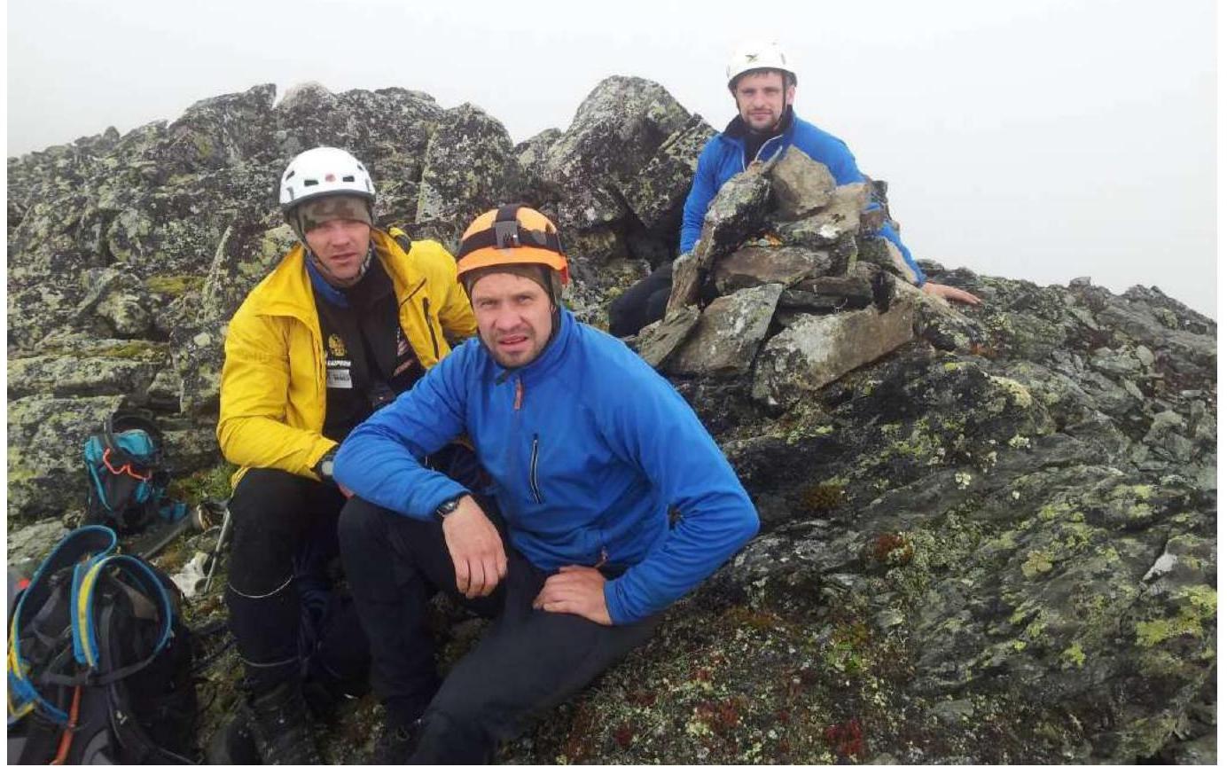
Photo 12. On the summit of Bagunda Glavnaya, August 2, 2018.
3.3. The approach to the mountain from the base camp takes 2 hours. The approach from the valley to the start of the route goes through a couloir to the right of the lower part of the edge, taking 1 hour. The route can be accessed at any point from the bottom, depending on the snow conditions. You can also reach the edge from the left couloir.
In the summer, it is logical to ascend the couloir to a height of 2330 m above sea level — this is at the top of the edge, before the rocky section. The route is relatively safe. The rocks are monolithic.
Descent:
- to the north,
- simple, long,
- steep in the final part,
- takes almost 2 hours.
The summit was named with a slight variation from the valley — Bagunda. And Glavnaya, as it appears most imposing from the side. Although the highest point along the cirque edge is v. VDV. A group of former paratroopers also ascended it on August 2, but there is insufficient material for classification submission.