
Report on the First Ascent of Mt. Afrodita (2060 m) via the Central Mirror of the Northeast Wall, Category 2A difficulty, by the team from the Federation of Alpinism and Rock Climbing of the Republic of Sakha (Yakutia)
July 11, 2021
I. Ascent Passport
| № | 1. General Information | |
|---|---|---|
| 1.1 | Full Name, Sports Rank of the Leader | Bogomolov Valery Alexandrovich, 1st sports rank |
| 1.2 | Full Name, Sports Rank of the Participants | Makarov Vasily Alexandrovich, 2nd sports rank Sayfulin Oleg Viktorovich, 2nd sports rank |
| 1.3 | Full Name of the Coach | Ivanov Vasily Ivanovich № 72 |
| 1.4 | Organization | Federation of Alpinism and Rock Climbing of the Republic of Sakha (Yakutia) |
| 2. Characteristics of the Ascent Object | ||
| 2.1 | Region | Oymyakonsky District, Republic of Sakha |
| 2.2 | Valley | Valley of Mt. Afrodita |
| 2.3 | Section Number according to the 2013 Classification Table | 9.7 |
| 2.4 | Name and Height of the Peak | Mt. Afrodita (local name) 2060 m |
| 2.5 | Geographical Coordinates of the Peak (latitude/longitude), GPS Coordinates *(1) | N 64° 28,719 E 143° 14,297 |
| 3. Characteristics of the Route | ||
| 3.1 | Name of the Route | Via the central mirror of the northeast wall |
| 3.2 | Proposed Category of Difficulty | Category 2A |
| 3.3 | Degree of Route Exploration | First Ascent |
| 3.4 | Nature of the Route Terrain | Rock |
| 3.5 | Elevation Gain of the Route (altimeter or GPS data) | 950 m (GPS) |
| 3.6 | Length of the Route (in meters) | 750 m |
| 3.7 | Technical Elements of the Route (total length of sections of varying difficulty with terrain type) | 1 – 400 m, 2 – 250 m, 3 – 100 m. |
| 3.8 | Descent from the Peak | Via Category 1B route in the same valley |
| 3.9 | Additional Characteristics of the Route | Possible presence of streams and ice in the couloirs |
| 4. Characteristics of the Team's Actions | ||
| 4.1 | Time of Movement (team's walking hours, in hours and days) | 4 h 20 min |
| 4.2 | Overnights | None on the route |
| 4.3 | Start of the Route | 7:00 July 11, 2021 |
| 4.4 | Summit Ascent | 11:20 July 11, 2021 |
| 4.5 | Return to Base Camp | 14:10 July 11, 2021 |
| 5. Person Responsible for the Report | ||
| 5.1 | Full Name, e-mail | Bogomolov V.A. bog_valera@mail.ru |
II. Description of the Ascent
1. Characteristics of the Ascent Object
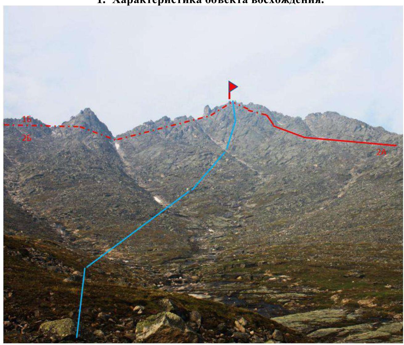
Photo 1. From July 11, 2021
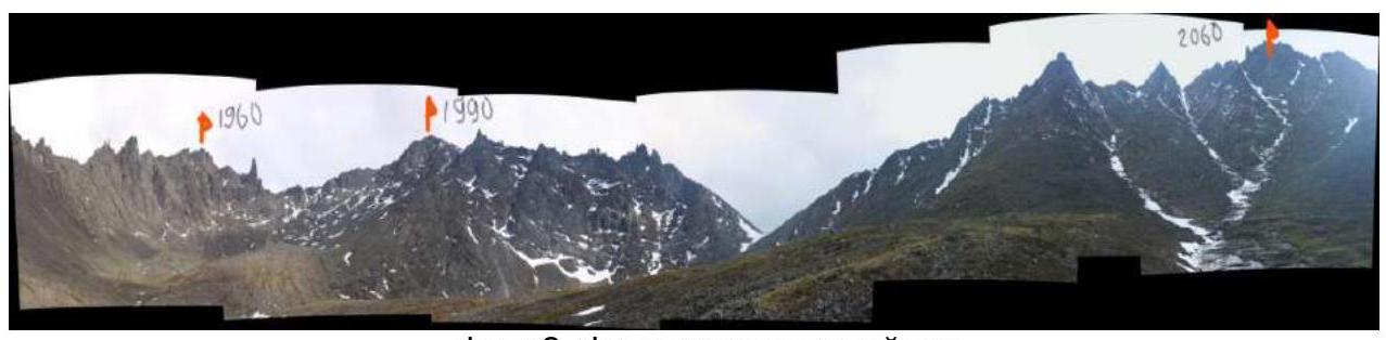
Photo 2. Panoramic view of the area. The cirque features three distinct peaks: p1960 m, p1990 m, p2060 m (Afrodita). Taken from the base camp area (photo from June 2019).
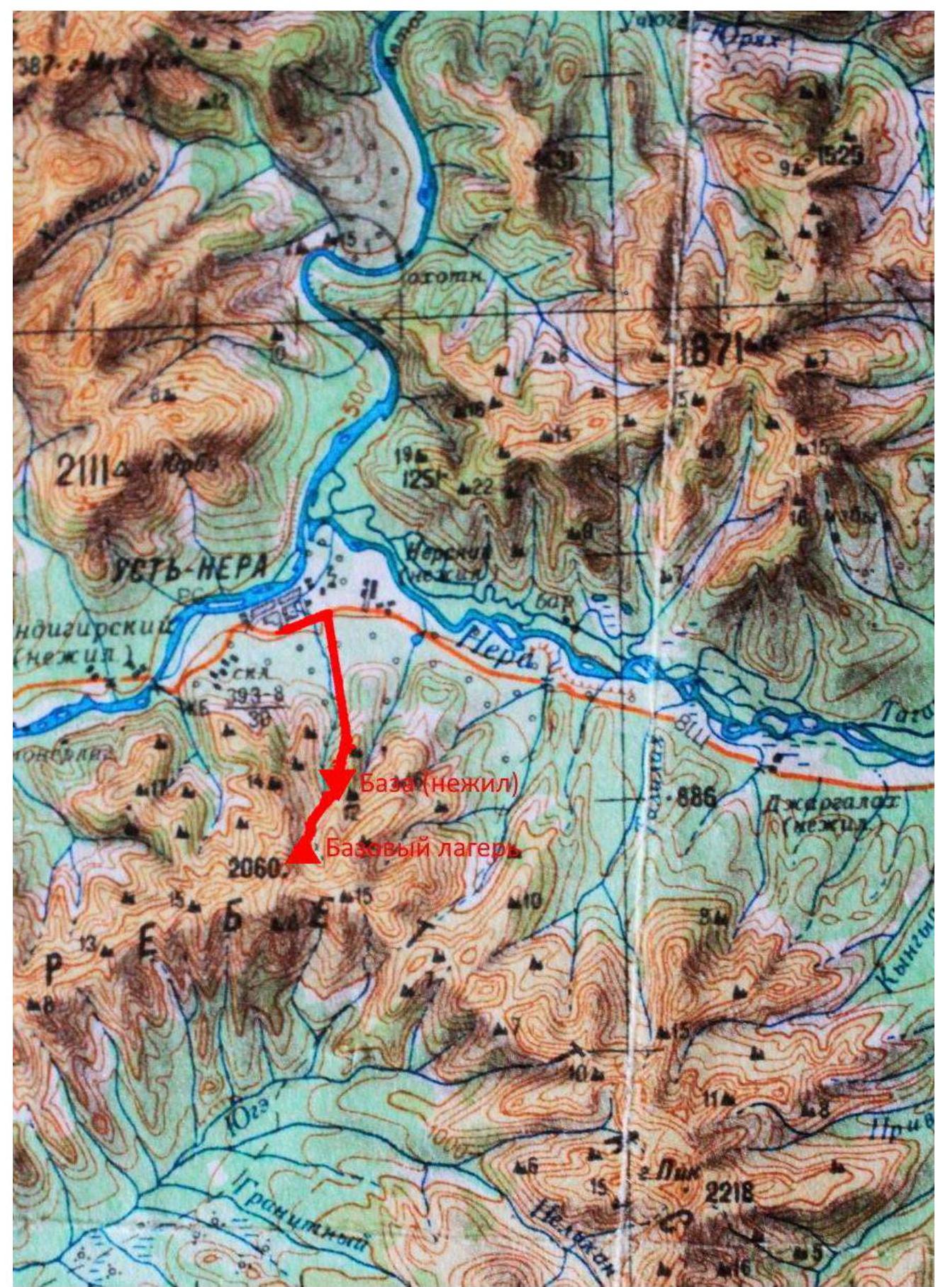
Photo 3. Map of the area.
1.1 Overview of the Area
The Federation of Alpinism and Rock Climbing of the Republic of Sakha (Yakutia) identified a mountain range near the settlement of Ust-Nera, located on the Nera River — a tributary of the Indigirka River — as a promising area for climbing. The region has harsh climatic conditions characterized by:
- low temperatures,
- high precipitation,
- smoke from forest fires (this year, visibility was sometimes reduced, see photo 5).
Access to Ust-Nera is possible by car from Yakutsk via the "Kolyma" highway (approx. 1000 km), involving:
- two ferry crossings (Lena River and Aldan River),
- a gravel road with significant dust after the Aldan River.
Alternatively, one can fly from Yakutsk to Ust-Nera. The airstrip is located in a mountainous area, making flights weather-dependent.
From Ust-Nera to the base camp is 11 km south. There is a road to an abandoned ski base (8 km), which is currently being restored with several cabins available. It is possible to arrange transport to the base. From the base to the camp is 3–4 km, with no defined trail. Travel involves crossing through dwarf pine, birch scrub, and mountain tundra, sometimes marshy. A semblance of a trail appears when passing through a canyon stream.
The best time for climbing is late June, July, and early August.
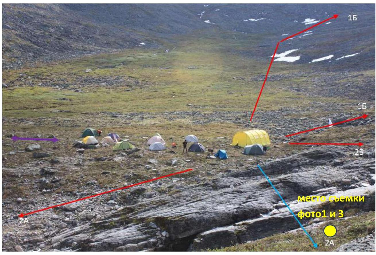
Photo 4. Base camp (photo from June 2019).
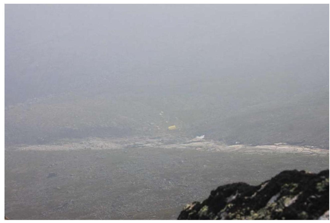
Photo 5. Base camp (photo from July 2021).
2. Characteristics of the Route
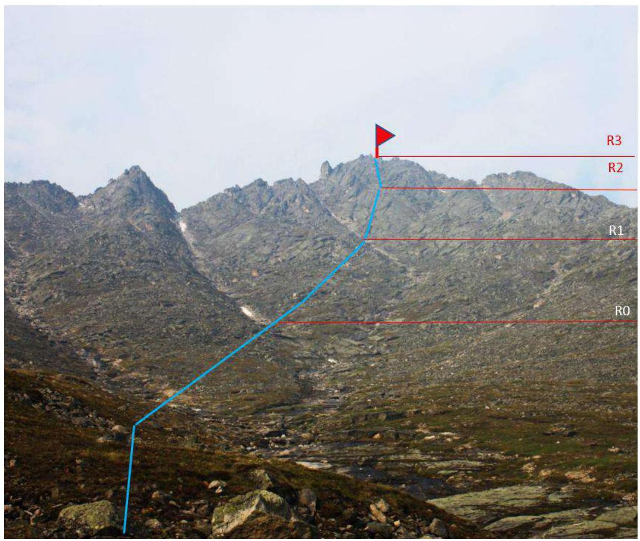
Photo 6. Technical photograph.
| Section | Terrain Characteristics | Category of Difficulty | Length, m | Type and Number of Pitons |
|---|---|---|---|---|
| R0–R1 | Broken rocks | 1 | 400 m | |
| R1–R2 | Broken slabs | 2 | 250 m | 3 |
| R2–R3 | Slabs | 3 | 100 m | 6 |
3. Characteristics of the Team's Actions
3.1. The route is clearly visible from the camp. The ascent begins from the camp by climbing a rocky ridge separating the camp from the stream (photo 4). Movement is along the right bank of the stream. The ridge crest consists of broken rocks and small scree covered with grass. This section is easily passable with a slope of 10–15°. As altitude is gained, the angle increases. A lateral stream from a couloir is crossed.
| Section | Description | Photo Number |
|---|---|---|
| R0–R1 | Across broken slabs and blocks, partially overgrown with grass, to the next lateral stream-couloir. The section is of easy difficulty, passed with free climbing, with large holds on the terrain. | |
| R1–R2 | Along inclined slabs with alternate belays to an inclined ledge. | Photo № 6 |
| R2–R3 | Up slabs via fixed ropes to the summit. | Photo № 7 |
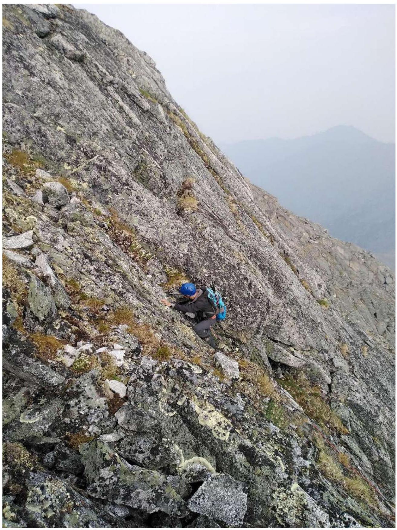
Photo 6. Photo of section R1–R2.
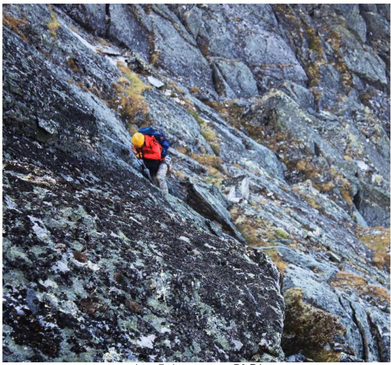
Photo 7. Photo of section R3–R4.
3.2. Descent is via a Category 1B route. Despite the presence of broken rocks, the route is not rockfall-prone.
Recommended for training ascents.
Comments
Sign in to leave a comment