
Report
on the first ascent to the summit of Maly Zub via the Taijesu pass route, category 1B difficulty level, by the team of the Kemerovo Region Alpine Federation on March 2, 2020
I. Ascent Passport
| № | 1. General Information | |
|---|---|---|
| 1.1 | Full name, sports rank of the team leader | Anikin Alexander Efimovich, 1st sports rank, instructor 3rd category (certificate № 1919) |
| 1.2 | Full name, sports rank of the participants | Tomilov Anatoly Grigorievich, 1st sports rank; Timofeev Nikolai Viktorovich, 1st sports rank; Trashkov Andrey Anatolyevich, 1st sports rank; Rodionov Alexey Valeryevich, 2nd sports rank; Dyakonov Sergey Vasilyevich, 2nd sports rank; Dyakonov Semyon Sergeyevich, 3rd sports rank; Ryabinin Viktor Vladimirovich, 3rd sports rank; Ivashov Evgeny Dmitrievich, 3rd sports rank; Borger Viktor Andreyevich, 3rd sports rank; Sibiryakov Sergey Alexandrovich, badge holder |
| 1.3 | Full name of the coach | Tomilov Anatoly Grigorievich |
| 1.4 | Organization | Kemerovo Region Alpine Federation |
2. Characteristics of the Ascent Object
| --- | --- | --- | | 2.1 | Region | MOUNTAINS OF SIBERIA AND THE FAR EAST. Kuznetsky Alatau (Kemerovo Region) | | 2.2 | Valley | Vysokogorny Creek Valley | | 2.3 | Section number according to the 2013 classification table | 9.5 | | 2.4 | Name and height of the summit | Maly Zub (1983 m above sea level) | | 2.5 | Geographical coordinates of the summit (latitude/longitude), GPS coordinates | Latitude 53.790853° Longitude 89.120369° |
3. Route Characteristics
| --- | --- | --- | | 3.1 | Route name | via Taijesu pass | | 3.2 | Proposed difficulty category | 1B | | 3.3 | Route exploration level | First ascent | | 3.4 | Route terrain type | Combined | | 3.5 | Route elevation gain (as per altimeter or GPS data) | 179 m (from Taijesu pass) | | 3.6 | Route length (in meters) | 1000 m (from Taijesu pass) | | 3.7 | Technical elements of the route (total length of sections with varying difficulty levels, specifying terrain type (ice-snow, rock)) | 1st difficulty level, combination — 940 m. 2nd difficulty level, rocks — 55 m. 3rd difficulty level, rocks — 5 m. Rappelling (during ascent) — 1 rope, 2 m. Rappelling (during descent) — 1 rope, 15 m | | 3.8 | Descent from the summit | Via the ascent route to Taijesu pass | | 3.9 | Additional route characteristics | Lack of water |
4. Team Actions Characteristics
| :--: | :--: | :--: | | 4.1 | Movement time (team's walking hours, in hours and days) | 1 day, 12 hours | | 4.2 | Overnight stays | none | | 4.3 | Route entry | 06:20, March 2, 2020 | | 4.4 | Summit attainment | 13:50, March 2, 2020 | | 4.5 | Return to base camp | 18:20, March 2, 2020 |
5. Report Responsible Person
| --- | --- | --- | | 5.1 | Full name, e-mail | Anikin Alexander Efimovich, anikin1985@rambler.ru |
II. Ascent Description
1. Ascent Object Characteristics
1.1. General photo of the summit
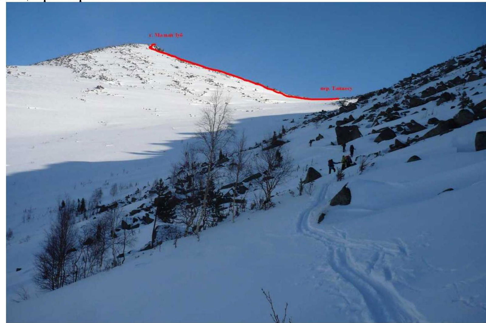
Photo 1 — Maly Zub summit with the route line, shot from under Taijesu pass, March 2, 2020
1.2. Route profile photo
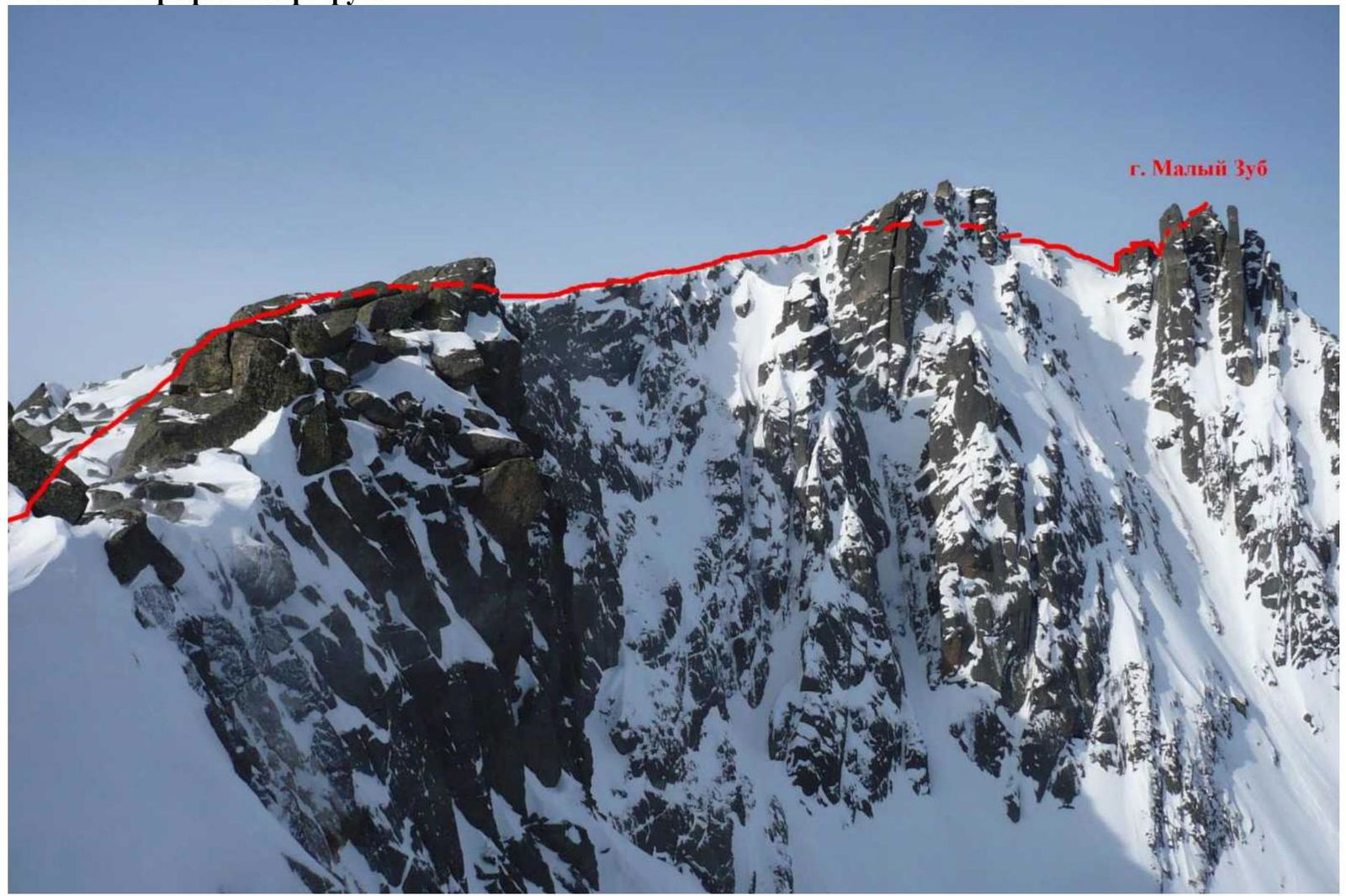
Photo 2 — Route profile, shot from Taijesu pass, March 2, 2020
1.3. Area photopanorama
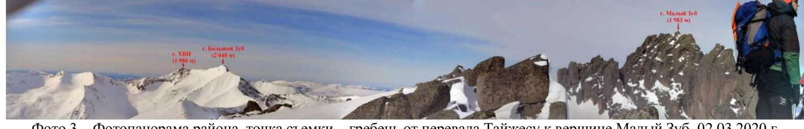
Photo 3 — Area photopanorama, shot from the ridge from Taijesu pass to Maly Zub summit, March 2, 2020
1.4. Area map
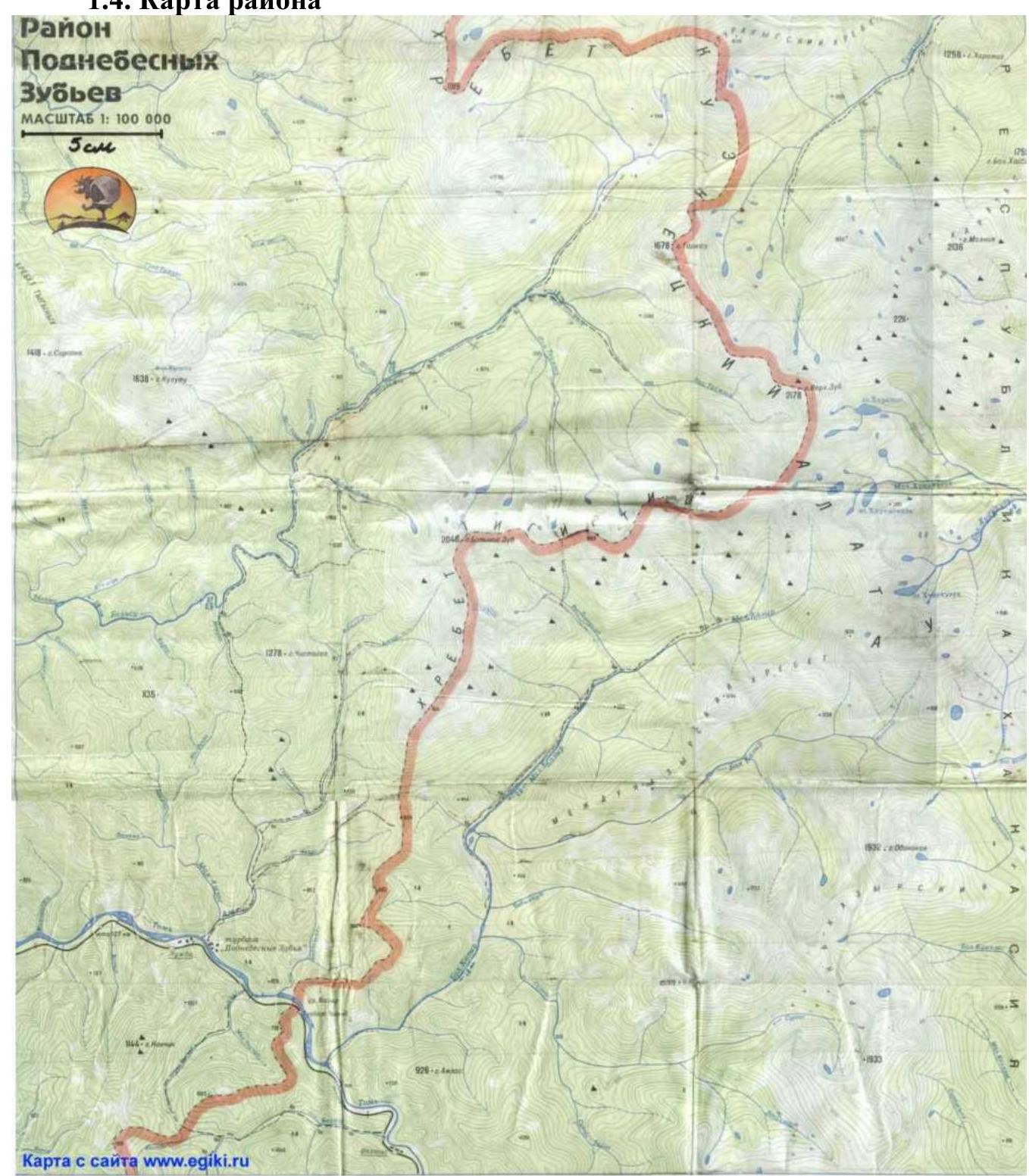
Photo 4 — Area map, scale 1:100 000, ascent object map
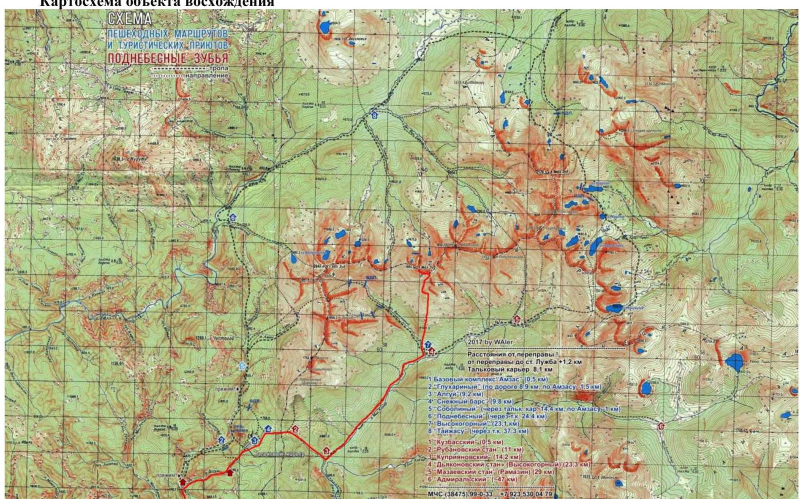
Photo 5 — Approach route map to Maly Zub summit
Geographical location and features of the area
The Podnebesnye Zubья area is located 80 km east of Mezhdurechensk (Kemerovo Region). It is most convenient to travel by electric train from Mezhdurechensk station to Luzhba station (approximately 1 hour 40 minutes). From Luzhba station, cross the Tom River and proceed to the Vysokogorny refuge (28 km) (see photo 5). In summer, travel on foot along the road and then along the trail (8–10 hours), in winter — on skis (usually along a snowmobile trail) (8–12 hours). In summer, it is possible to drive from the Tom River crossing to the Talcovy quarry by car (8 km). In winter, it is possible to take a snowmobile from Luzhba station to the Vysokogorny refuge. The Vysokogorny refuge is the most convenient base camp (BC). From BC to the start of the route, move along the southern slope of Maly Zub to a characteristic large stone on the left (lower stone in the starting rock ridge with southwest exposure). Cross to the left side of this rock ridge (west side), then proceed to Taijesu pass. In winter, it is most convenient to travel from BC to Taijesu pass on skis. The approach time from BC to the start of the route (Taijesu pass) is 4–5 hours. The elevation gain from BC (504 m above sea level) to Taijesu pass (1804 m above sea level) is 1300 m.
The approach route from BC to Taijesu pass is shown in photos 6–7.
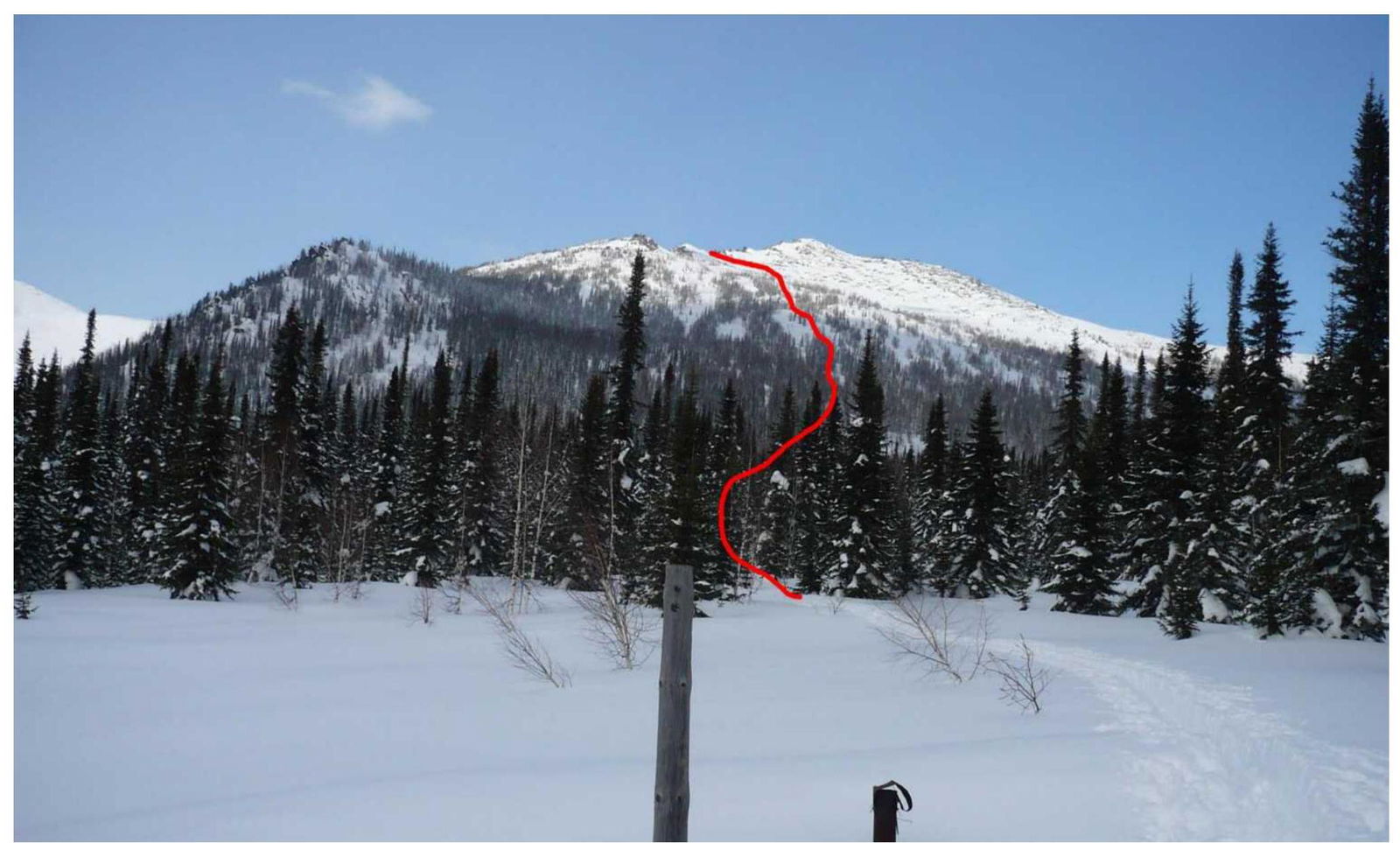
Photo 6 — Approach route from BC to the characteristic large stone on the left, shot from Vysokogorny refuge, March 1, 2020
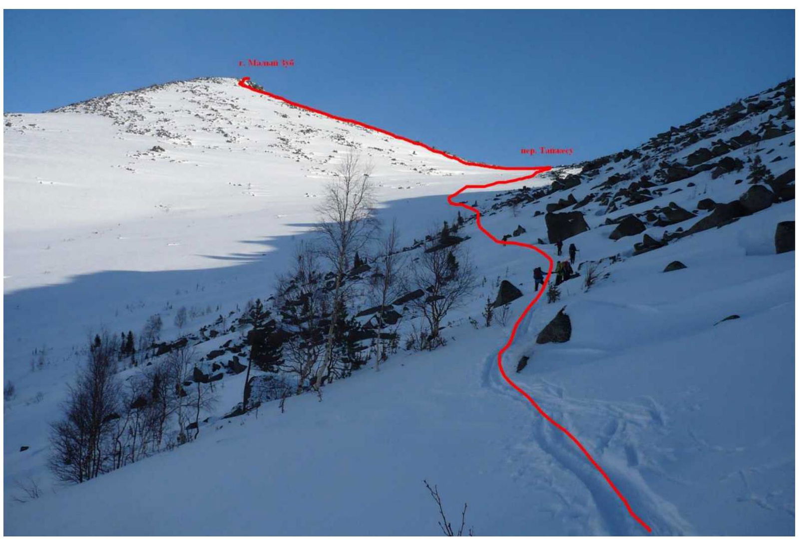
Photo 7 — Approach route from the rock ridge with southwest exposure to Taijesu pass, shot from the west slope of the rock ridge, March 2, 2020
2. Route Characteristics
2.1. Technical photo of the route
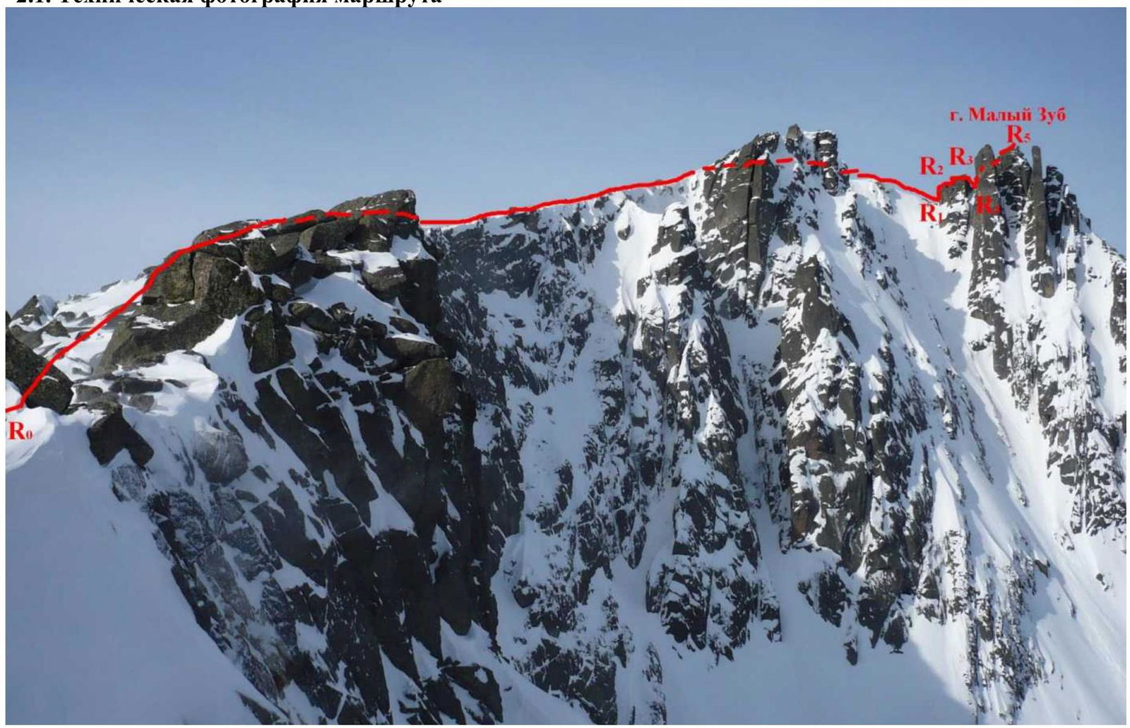
Photo 8 — Technical photo of the route, shot from under Taijesu pass, March 2, 2020
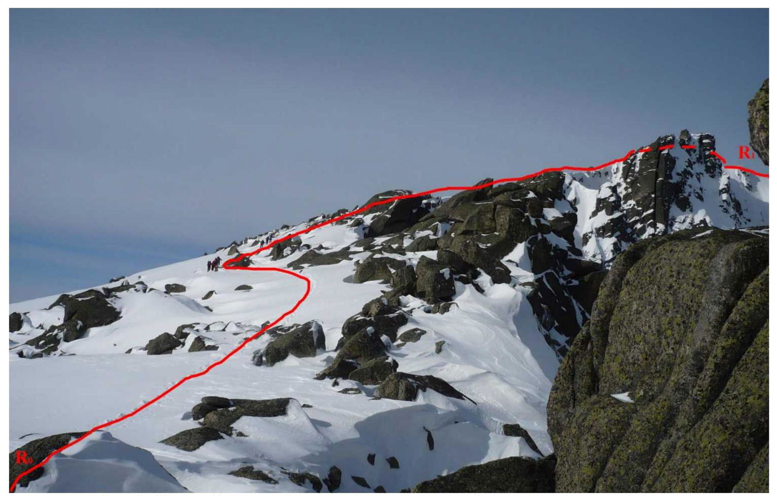
Photo 9 — Section R0–R1 — ascent along the ridge from Taijesu pass to the pre-summit tower
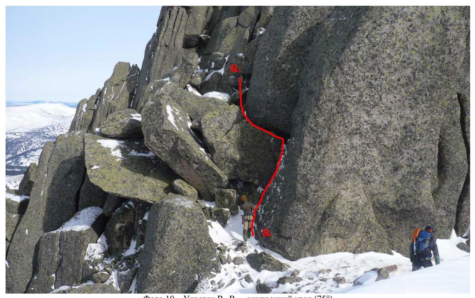
Photo 10 — Section R1–R2 — inner corner (75°)
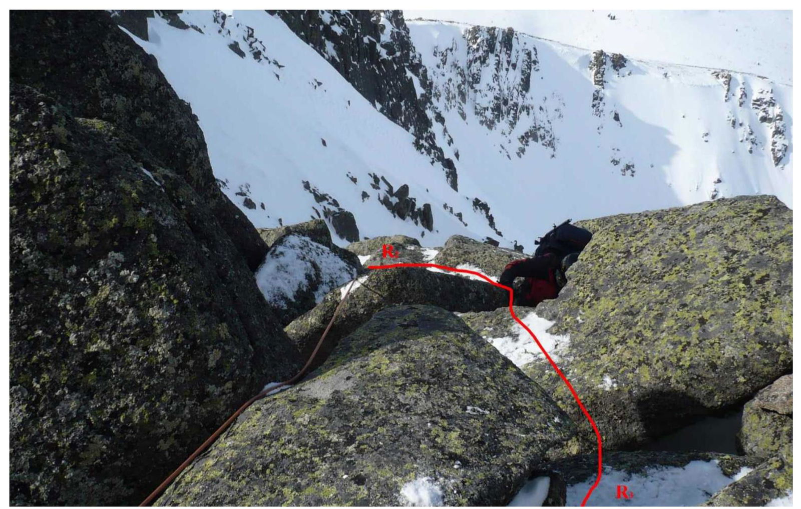
Photo 11 — Section R2–R3 — series of inclined slabs (50°)
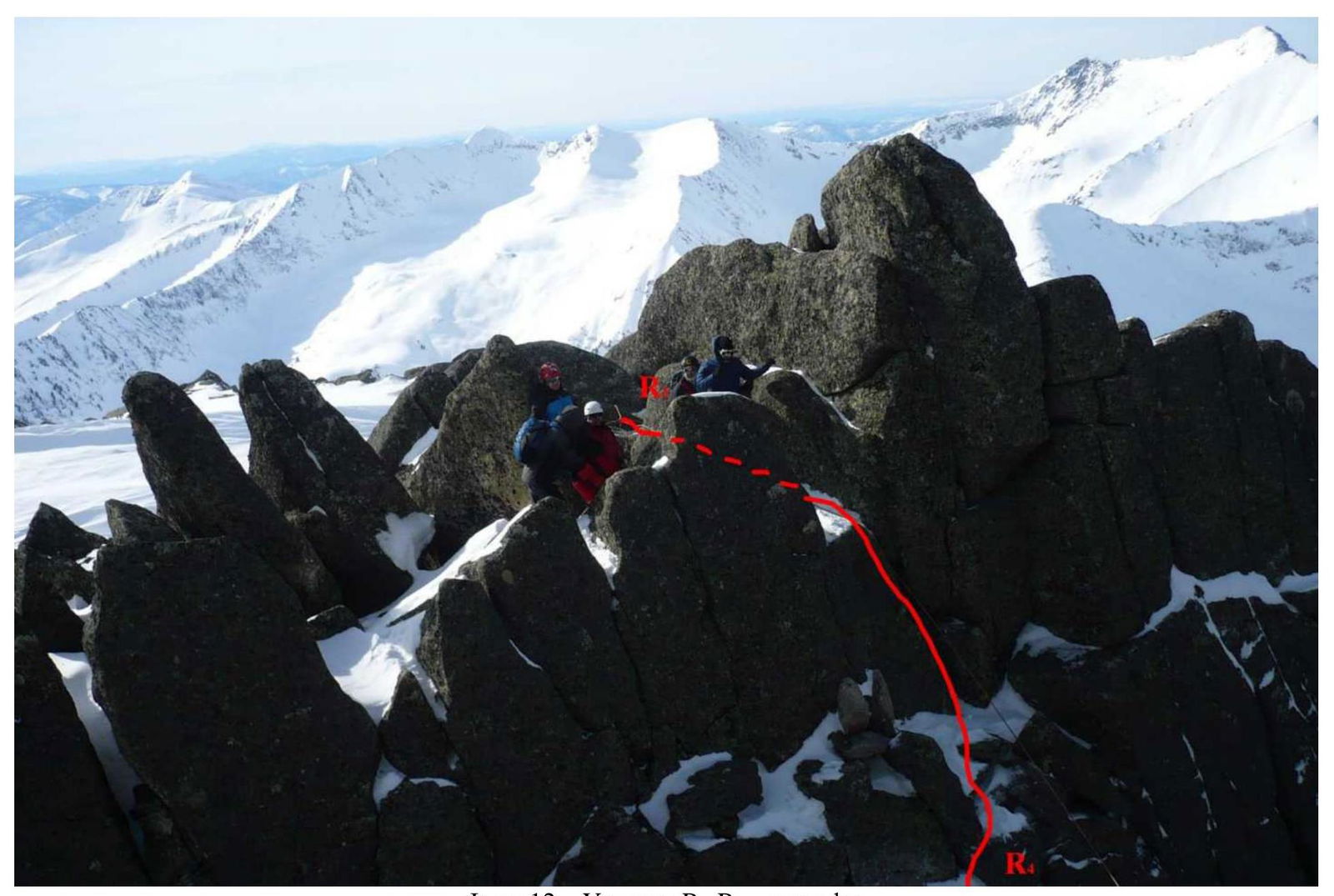
Photo 12 — Section R3–R4 — rappelling
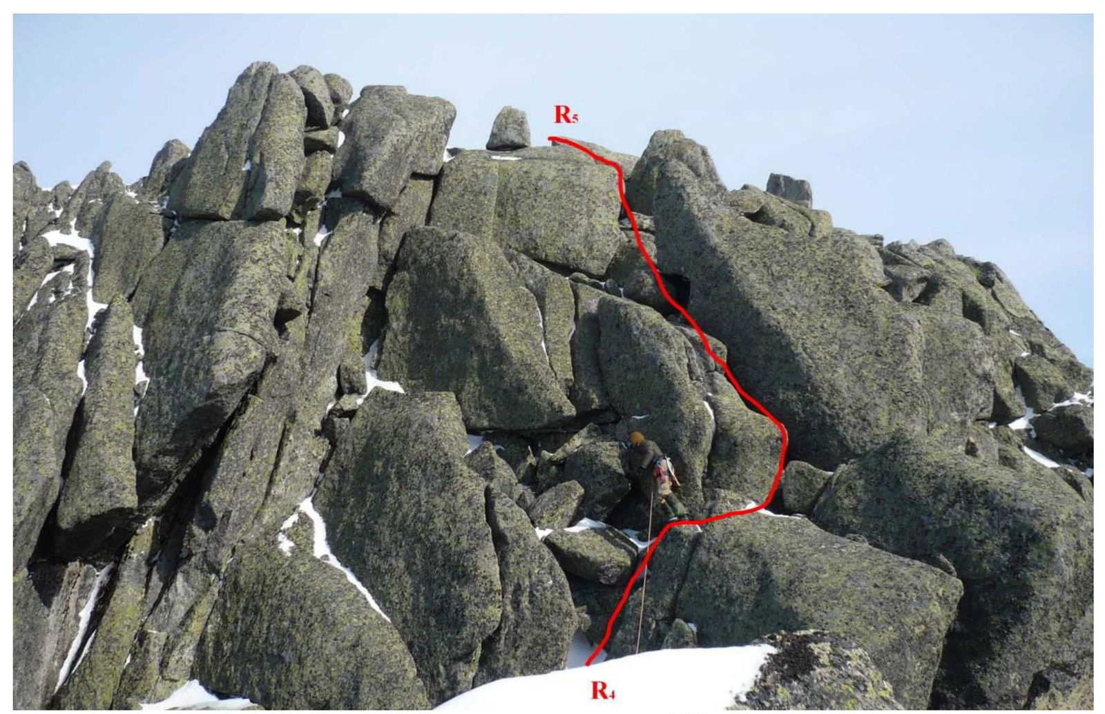
Photo 13 — Section R4–R5 — series of inclined slabs (45°), exit to the summit
2.2. Technical characteristics of route sections
| Section № | Terrain type | Difficulty level | Length, m | Type and number of pitons |
|---|---|---|---|---|
| R0–R1 | combined | 1 | 940 | – |
| R1–R2 | rock | 3 | 5 | – |
| R2–R3 | rock | 2 | 25 | – |
| R3–R4 | rock | 2 | 2 | – |
| R4–R5 | rock | 2 | 30 | – |

Photo 14 — Route diagram in UIAA symbols
3. Team Actions Characteristics
3.1. Brief description of the route passage
Departure from BC (Vysokogorny refuge) at 06:20. The approach to Taijesu pass took 5 hours.
| Section № | Description | Photo № |
|---|---|---|
| R0–R1 | Ascent along the ridge from Taijesu pass to the pre-summit tower. Caution! Snow cornices on the right! Simultaneous movement. Slope steepness varies, up to 25°. Section length 940 m. During the team's ascent — deep footprints in the snow among large stones. Equipment used — helmets, crampons, ice axes. For training purposes, the team moved in rope teams. 40 minutes. | 15 |
| R1–R2 | Key section of the route — ascent via an inner corner with a steepness of 75°, height 5 m. Passed by the first participant via free climbing in crampons without a backpack. After the inner corner — a ledge. Station on a rock, organization of belays. Other participants ascend via belays using Jumars. 15 minutes. | 16 |
| R2–R3 | Ascent via a series of inclined slabs with a steepness of up to 50° (25 m). Passed by the first participant via free climbing in crampons. After the series of inclined slabs — a ledge. Station on a rock, organization of belays. Other participants ascend via belays using Jumars. 15 minutes. | 17 |
| R3–R4 | Descent from the ledge via a vertical wall (2 m) to another ledge. Organization of rappelling. Use of belay devices. 15 minutes. | 18 |
| R4–R5 | Ascent via a series of inclined slabs with a steepness of up to 45° (30 m) with an exit to the summit. Alternating movement in a rope team with belay organization via rock outcrops. 15 minutes. | 19 |
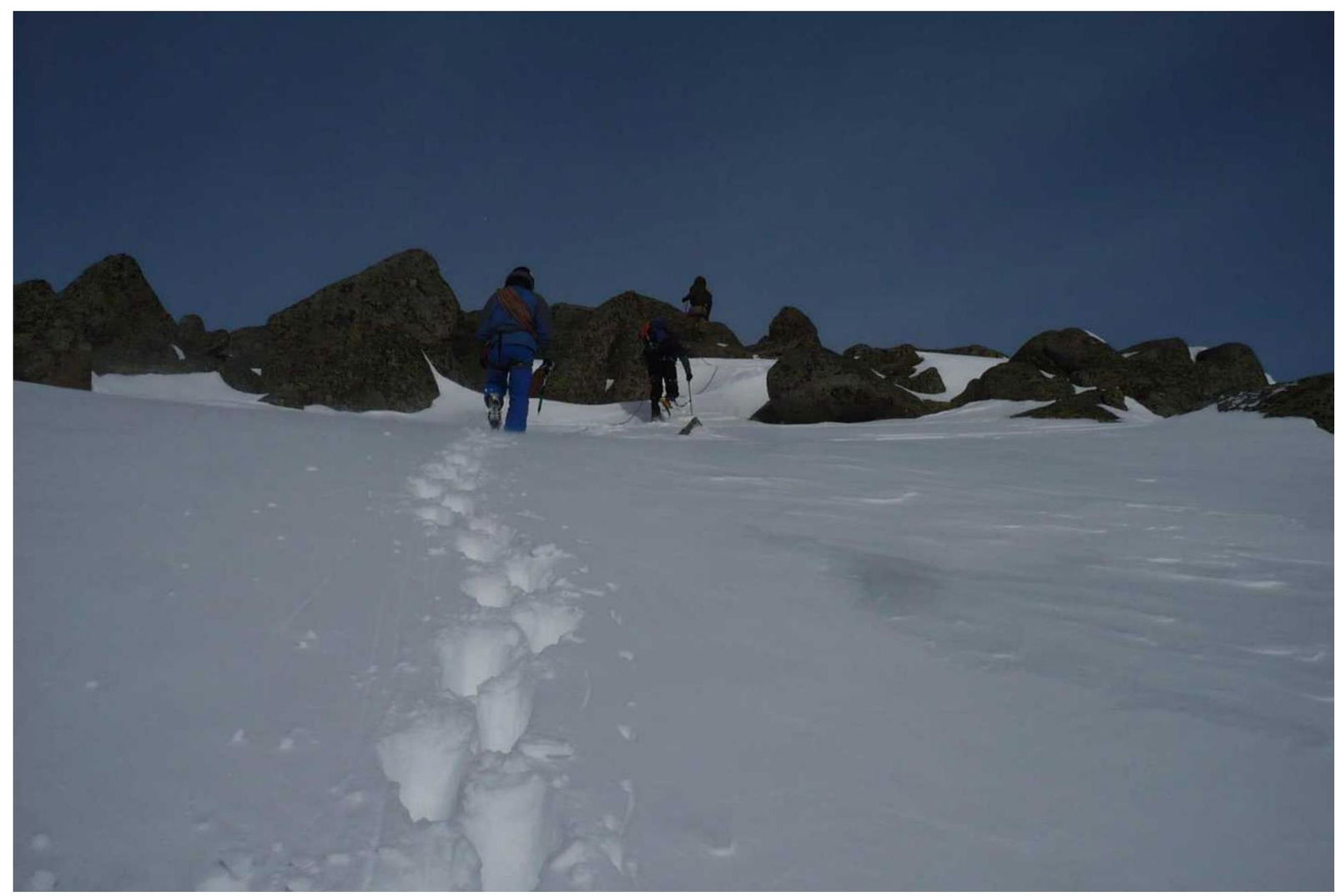
Photo 15 — Passage of section R0–R1
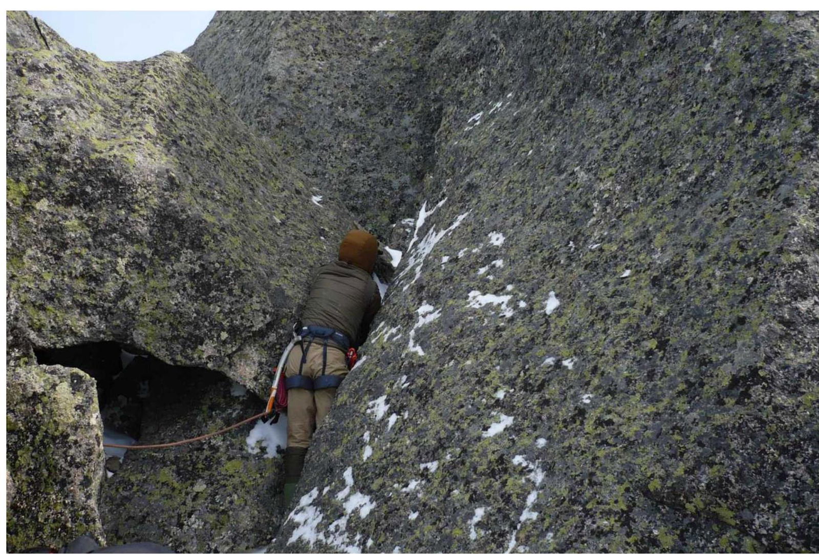
Photo 16 — Passage of section R1–R2
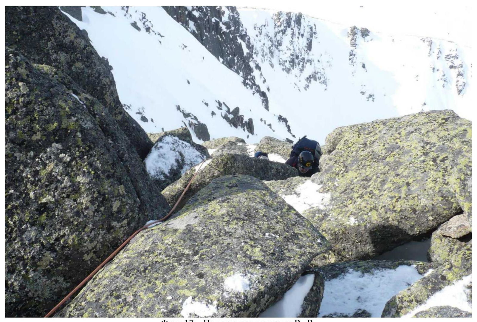
Photo 17 — Passage of section R2–R3
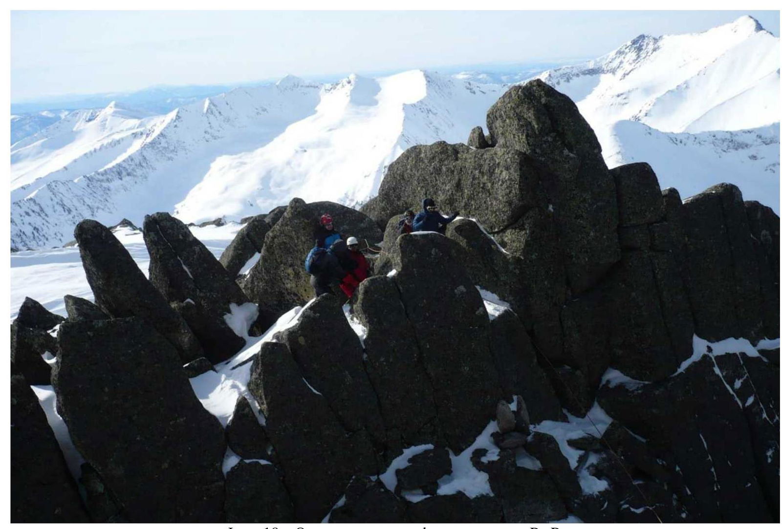
Photo 18 — Organization of rappelling on section R3–R4
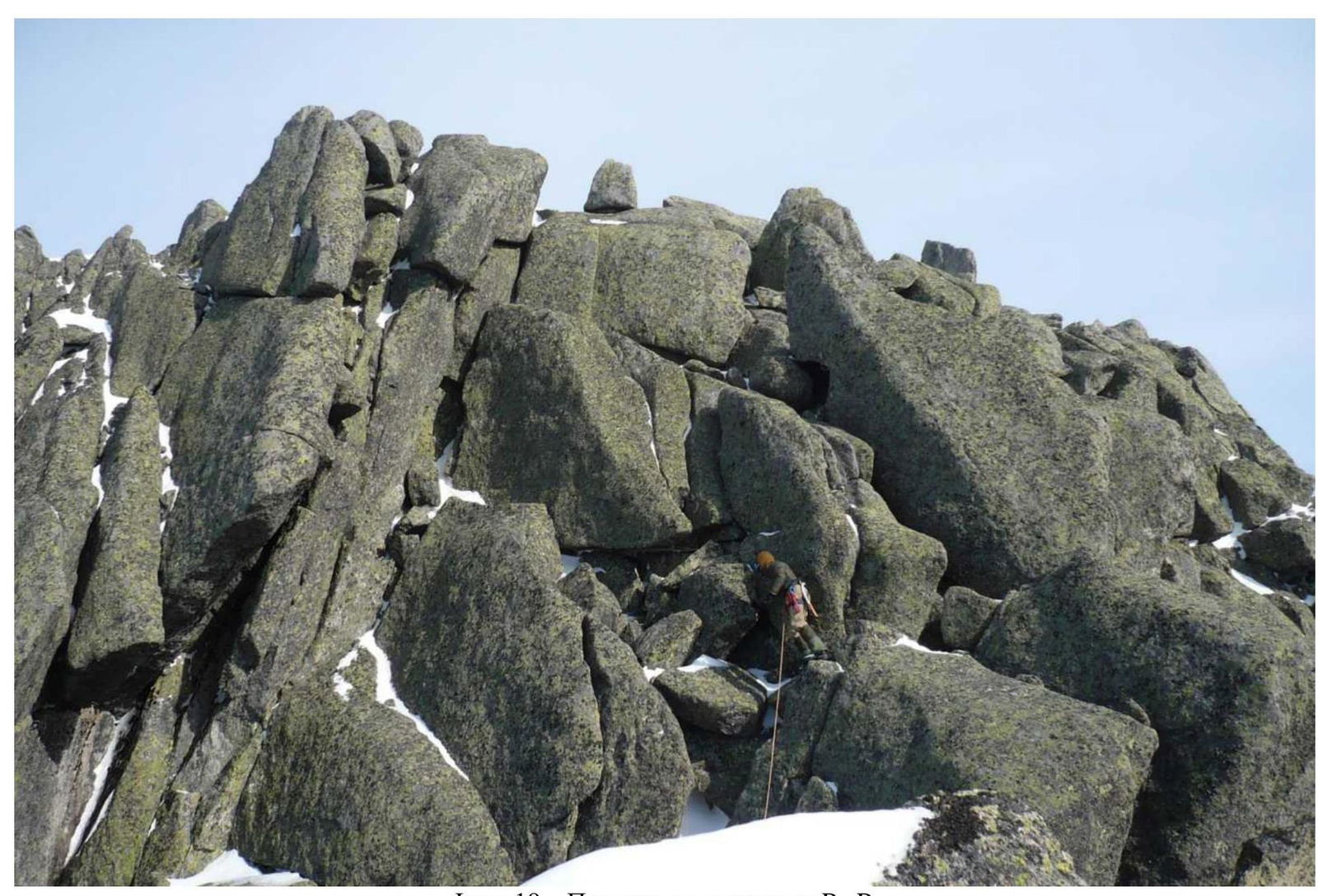
Photo 19 — Passage of section R4–R5
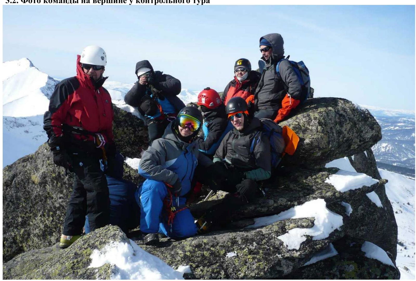
Photo 20 — Team photo on Maly Zub summit (1983 m), March 2, 2020
3.2. Team photo on the summit near the control pole
3.3. Route safety assessment
An interesting and logical route with a full set of technical difficulties for a category 1B route — movement in a rope team along a ridge with snow cornices, challenging rock climbing on key sections, organization of rappelling. The route requires significant physical effort due to the long approach from BC. Communication with BC is only possible with powerful radios due to the lack of direct visibility. The route passage does not require the use of pitons and chocks — there are many reliable belay points via rock outcrops. Organization of all stations — on reliable rock outcrops. Descent from the summit via the ascent route. For the descent on the key section 1B, R1–R2, rappelling is required, and therefore, a supply of re-rope (diameter not less than 7 mm) is necessary. The route is comparable in technical difficulty to the category 1B route on v. Kyzyl-Tash via per. Konтейнер in Aktru valley (Altai). The route to Maly Zub summit via Taijesu pass deserves a category 1B classification.