
Passport
- Climbing category — rock.
- Climbing area — Kuznetsky Alatau, Tegirtysh ridge.
- Peak — Bolshoy Zub (2045) via the North face.
- Anticipated category complexity — 3B, for winter conditions, the route is combined.
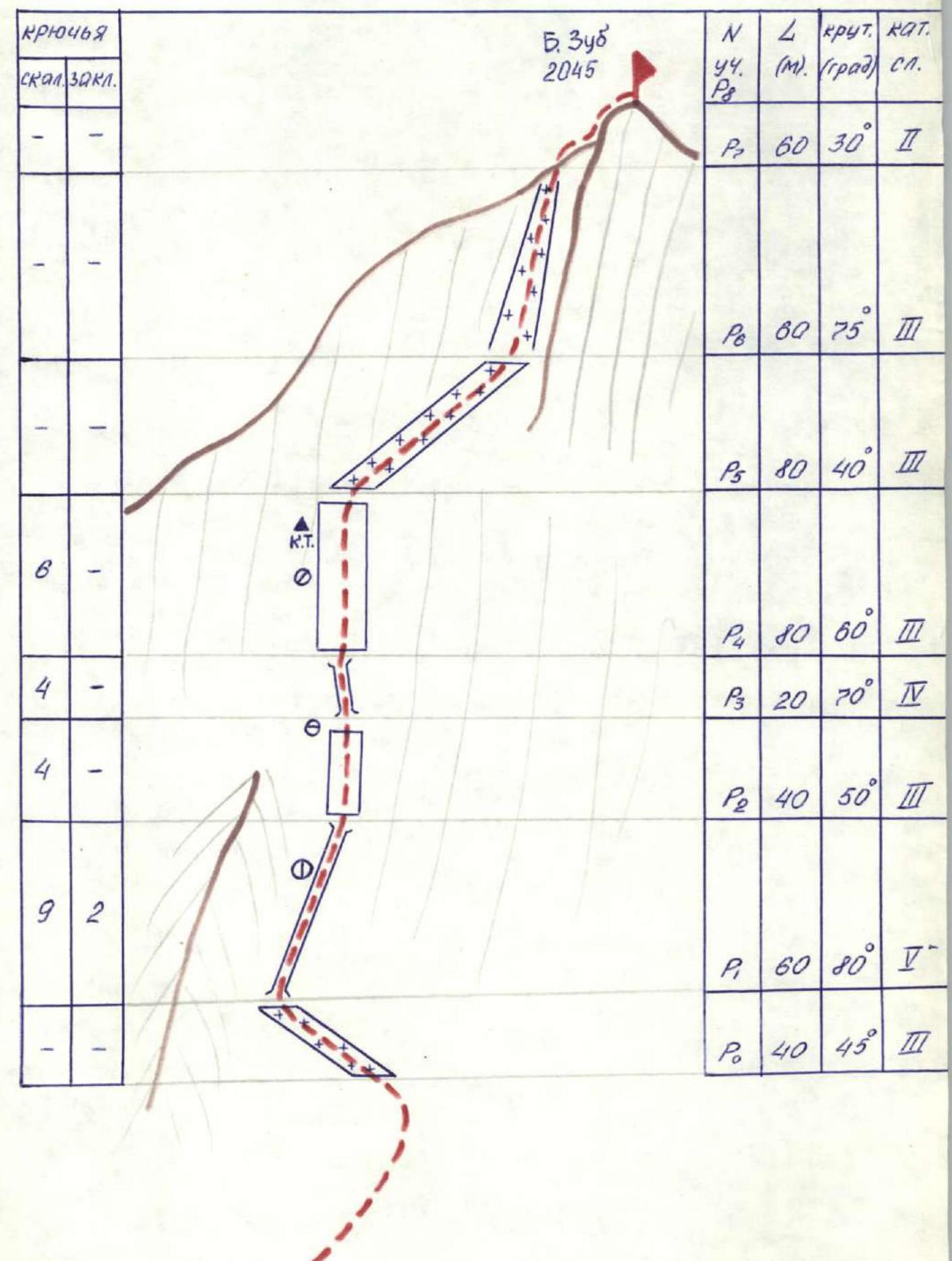
- Route length — 440 m Length of sections with 5th category complexity — 60 m. Height difference — 380 m. Average steepness of the wall section — 59°. Average steepness of the entire route — 53°.
- Pitons hammered:
- rock — 23
- chocks — 2
- Number of traveling hours for the group — 6 hours
- Overnight stays — none.
- Leader — Foigt Alexander Vadimovich, Master of Sports
Team members:
- Kozhemyako Nikolai Grigorievich, Master of Sports
- Muravyov Yuri Nikolaevich, 1st sports category
- Belkin Alexander Valentinovich, 2nd sports category
- Krotenko Oleg Borisovich, 2nd sports category
- Team coach: Andryushkevich Konstantin Ivanovich, Master of Sports
- Departure to the route — March 9, 1989
- Summit ascent — March 9, 1989
- Return to the camp — March 9, 1989
- Group — Alpinada of Novokuznetsk GorSportCommittee.
Description of the approach to the route
From the base camp on "Vypusknikov" lake, move upstream along the stream for 0.5 hours. Then turn left and ascend to the North spur of peak 1972. Cross over the spur and the plateau behind it, and descend into the North-East cirque of peak Bolshoy Zub. Then approach the North face of the peak. The approach to the route takes 2–2.5 hours from the base camp.
Scheme of the "Podnebesnye Zubya" area
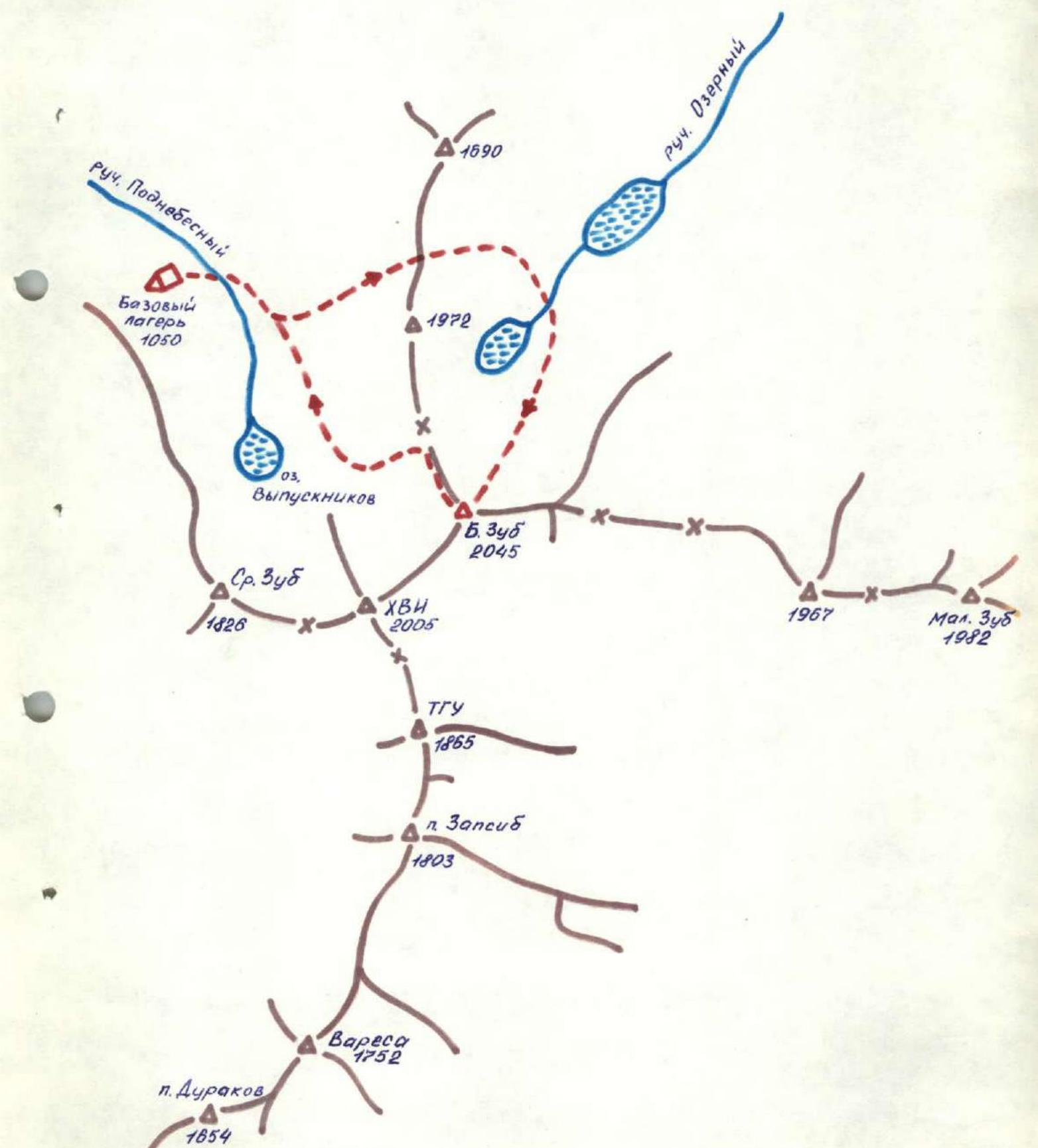
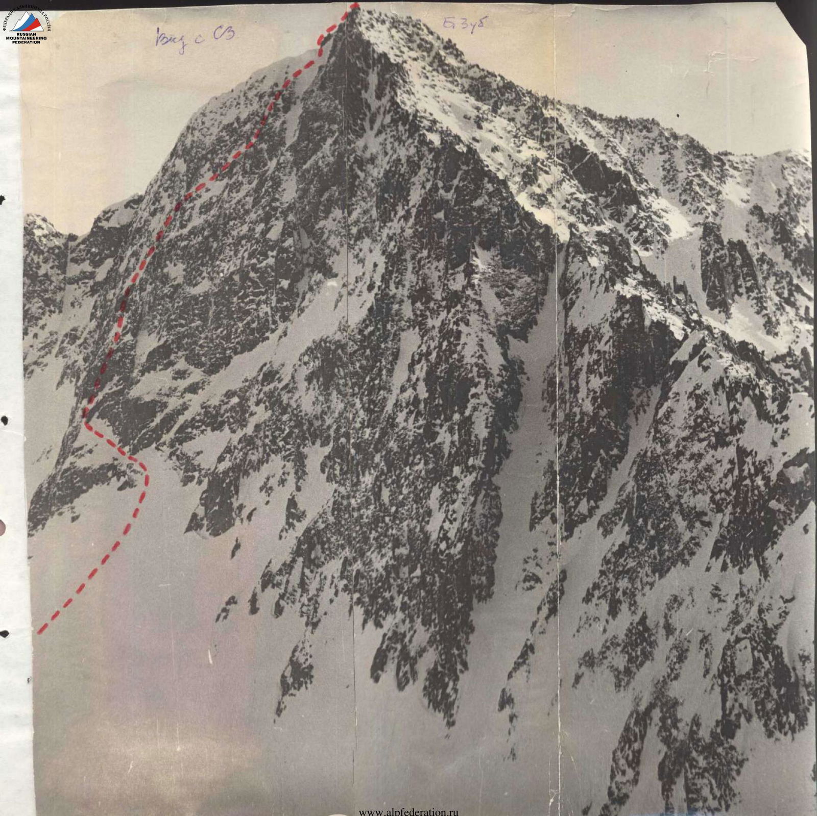
Fig. 68
Scheme of the route in SHA symbols
Description of the route to peak Bolshoy Zub via the North face, 3B category complexity.
Section R0–R1: The route begins from a steep snowy ledge. Movement is alternating. Protection through rock outcrops and ice axe.
Section R1–R2: From the end of the ledge, a steep (up to 80°) chimney goes upwards for 60 m, filled with ice. Climbing is complex. Protection is via pitons.
Section R2–R3: Further upwards — leftwards along rocks of medium difficulty, covered with snow. 40 m. Movement is alternating, protection is via pitons.
Section R3–R4: 20 m along a chimney with ice. Climbing is above medium difficulty. Protection is via pitons.
Section R4–R5: Straight up for 80 m along rocks of medium difficulty, covered with snow, to a snowy ledge. To the left, under a rock bastion — a control cairn. Protection is via pitons.
Section R5–R6: Along the snowy ledge to the right for 80 m to a steep snowy couloir. Protection is via ice axe.
Section R6–R7: Upwards along the snowy couloir for 60 m to the exit onto the North-East ridge of the peak. Protection is via ice axe.
Section R7–R8: Further to the right along the ridge for 60 m — to reach the summit. Movement is simultaneous, protection is via rock outcrops.
The entire route is climbed in crampons. Descent is via the North ridge, following the 1B category complexity route.
Comments
Sign in to leave a comment