
Passport
- Category — first ascent.
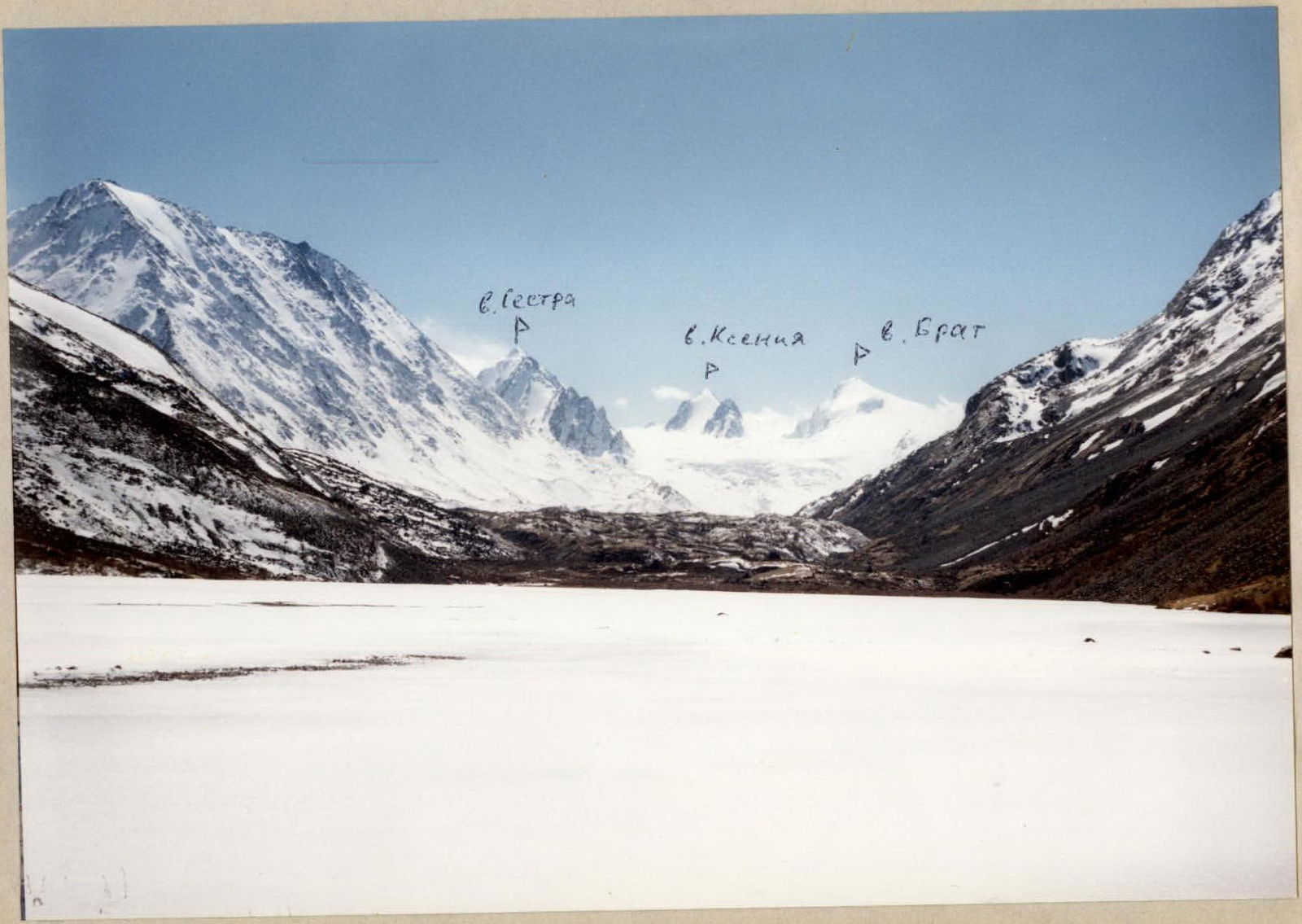
- Altai, South Chuya Ridge, Akkol river gorge.
- Peak Ksenia via NE ridge. 3633 m?
- Assumed category 2B.
- Elevation gain 350 m, distance 640 m.
- Ice screws 12 pcs.
- Climbing time — 7 hours (from bergshrund to bergshrund).
- Night bivouac on the upper Sofiysky Glacier field.
- Leader Drakin A.V. — Candidate Master of Sports
Participants:
- Astafurova N.N. — 2nd sports category
- Barnov S.I. — 2nd sports category
- Neyaskina O.M. — 2nd sports category
- Coach: Drakin A.V. — 1st category instructor
- Ascent made on May 3, 2001.
- Organization: ZTPSS
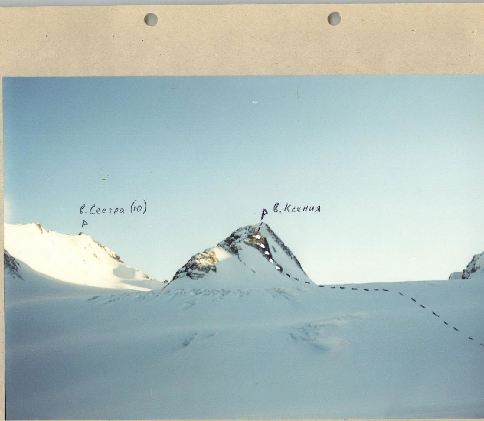
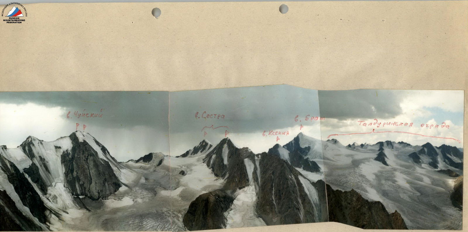
Panorama of the upper part of Sofiysky Glacier — Shot point # 4

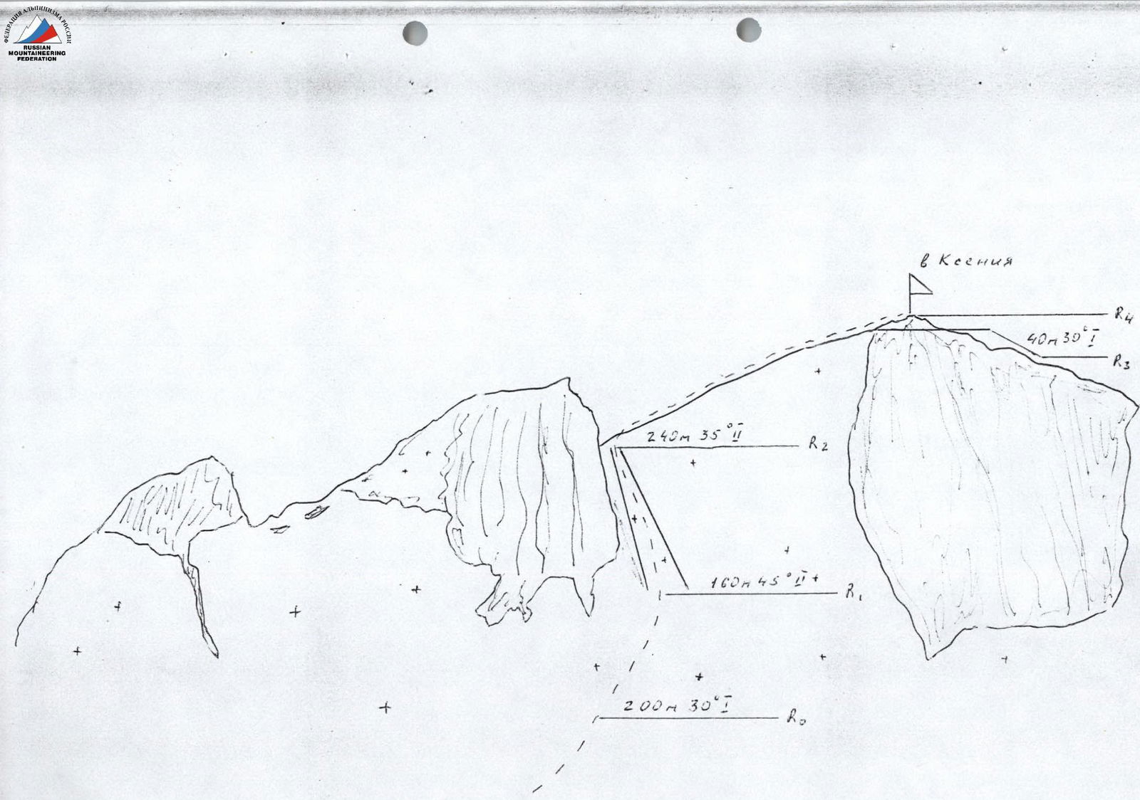
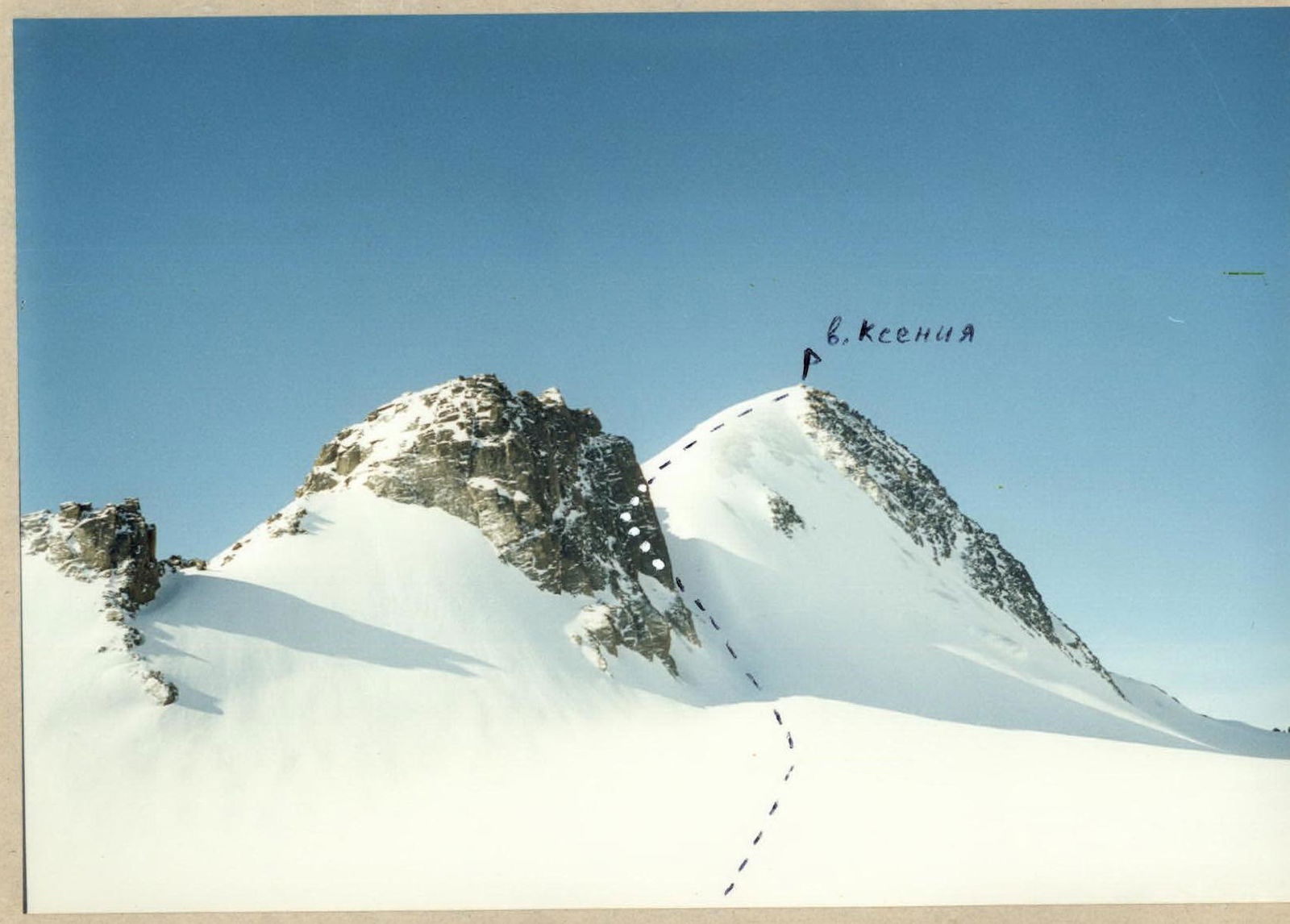
Peak Ksenia via North-Eastern Ridge
From the base camp, located at the confluence of the Turaoyuk river and the Akkol river, move in the direction of the Sofiysky Glacier along the Akkol river. The movement goes along the orographic left bank to the beginning of the glacier. Ascend to the tongue of the glacier and move along its central part in the direction of Peak Ksenia.
To ascend to the upper Sofiysky Glacier field, it is necessary to overcome the glacier serac zone, which is passed on the right-hand side. There are many crevasses on the glacier! The bivouac is organized on the upper field under the rocky ridge.
From the bivouac, cross the upper Sofiysky Glacier field in the direction of Peak Ksenia. Crevasses! Bypass two gendarmes of the north-eastern ridge on the right-hand side. Approach the couloir on the north-western slope behind the second gendarme. Ascend through it to the pass behind the gendarme.
The couloir is icy. Length 160–180 m, steepness 40–45 °. Alternating movement, protection via ice screws.
From the pass, move along the north-eastern ridge. The ridge is snow-ice. Steepness 30–35 °. Alternating movement with protection via ice screws or simultaneous movement with rope interaction. The ridge leads to the summit.
Descent via the ascent route.
Comments
Sign in to leave a comment