Report
of the Altai Regional Federation of Alpinism (ARFA) team on the first ascent of Peak Nikolai Bondarchuk, South Chuya Ridge, Elangash valley. "2B", (k)
Barnaul 2013
Leader: Vitaly M. Guselnikov — Master of Sports in Alpinism.
Participants:
- Pavel Badanov
- Valery Bogomolov
- Dmitry Bondarchuk
- Alexander Grebennikov
- Anton Grebennikov
- Dmitry Grebennikov
- Svetlana Dosaikina
- Evgeny Drugolev
- Anton Vedernikov
- Anton Karmyshev
- Gennady Komkov
- Vladimir Korneev
- Sergey Leshchenko
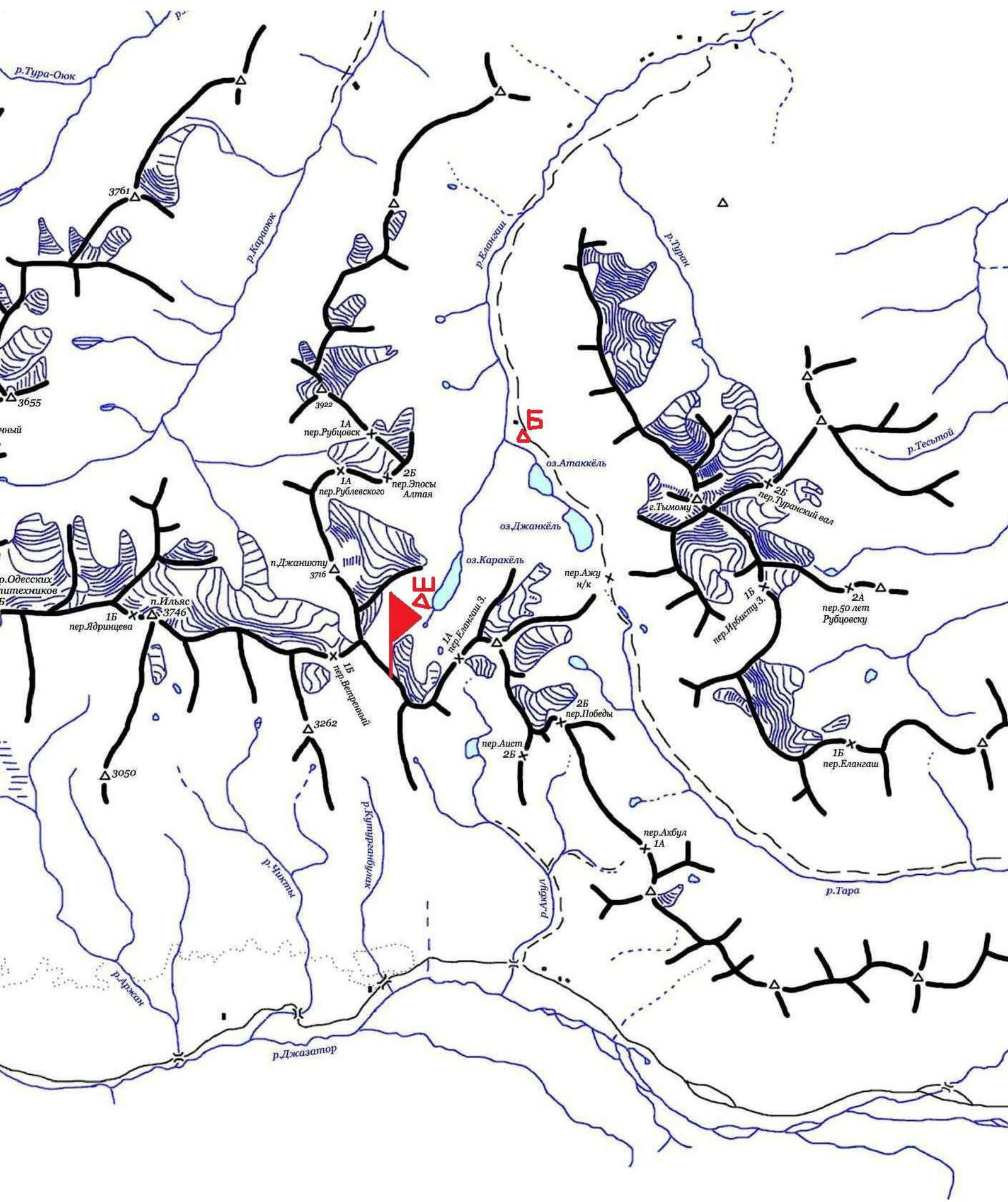
Area Map

Ascent Passport:
- South Chuya Ridge, Elangash valley.
- Peak Nikolai Bondarchuk, via the right part of the NW slope.
- First ascent, presumably 2B category of difficulty.
- Route type: combined.
- Route elevation gain — 500 m.
Route length — 1500 m.
Section lengths:
- 1st category difficulty — 550 m.
- 2nd category difficulty — 700 m.
- 3rd category difficulty — 170 m. Average steepness of the main route part — 40°.
- Equipment used on the route: Stationary slings: 5 pcs., ice screws: 2 pcs.
- Team's climbing hours: 1 day.
- Leader:
Vitaly M. Guselnikov — Master of Sports in Alpinism, 3rd category instructor, "Rescue Team" badge.
Participants:
- Pavel Badanov
- Valery Bogomolov
- Dmitry Bondarchuk
- Alexander Grebennikov
- Anton Grebennikov
- Dmitry Grebennikov
- Svetlana Dosaikina
- Evgeny Drugolev
- Anton Vedernikov
- Anton Karmyshev
- Gennady Komkov
- Vladimir Korneev
- Sergey Leshchenko
- Coach: K.N. Bondarchuk — 1st sports category, 3rd category instructor, "Rescue in Mountains" badge.
- Organization: Altai Regional Federation of Alpinism.
- Departure from the assault camp "Medvezhya" (Bear) standing: 7:15 AM, August 1, 2013. Start of work on the route: 9:30 AM, August 1, 2013. Reaching the ridge: 3:00 PM, August 1, 2013. Reaching the summit: 4:15 PM, August 1, 2013. Return to the assault camp: 6:50 PM, August 1, 2013.
- To get to the Elangash valley, follow the Chuya Highway to Kosh-Agach, then take the road (there are signs) to the Beltyr settlement. From the Beltyr settlement, turn left to the nomad camp, where you need to switch to a high-clearance vehicle provided by local residents. It is convenient to set up a base camp at the upper shepherds' stands.
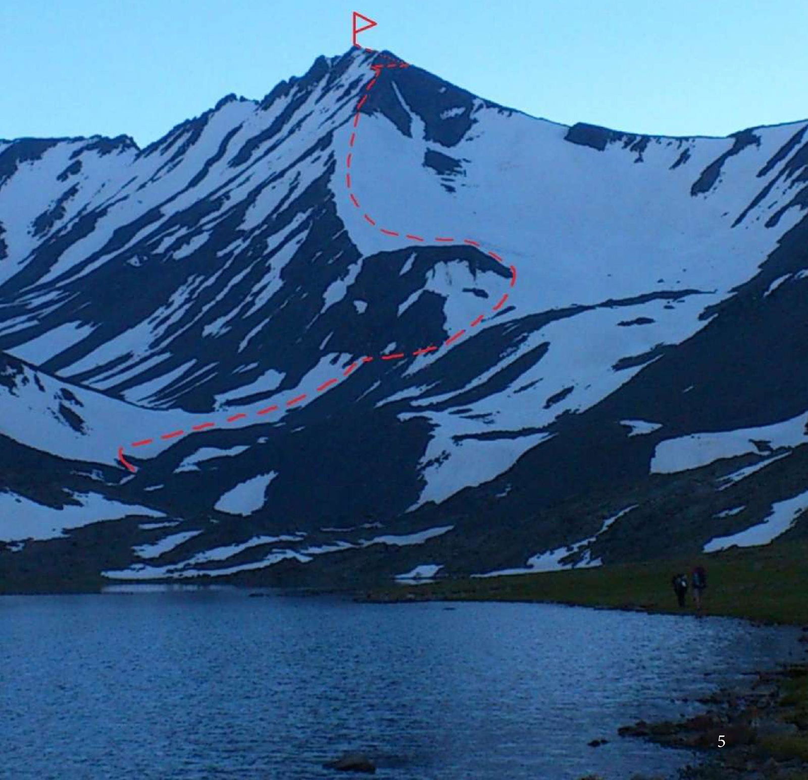
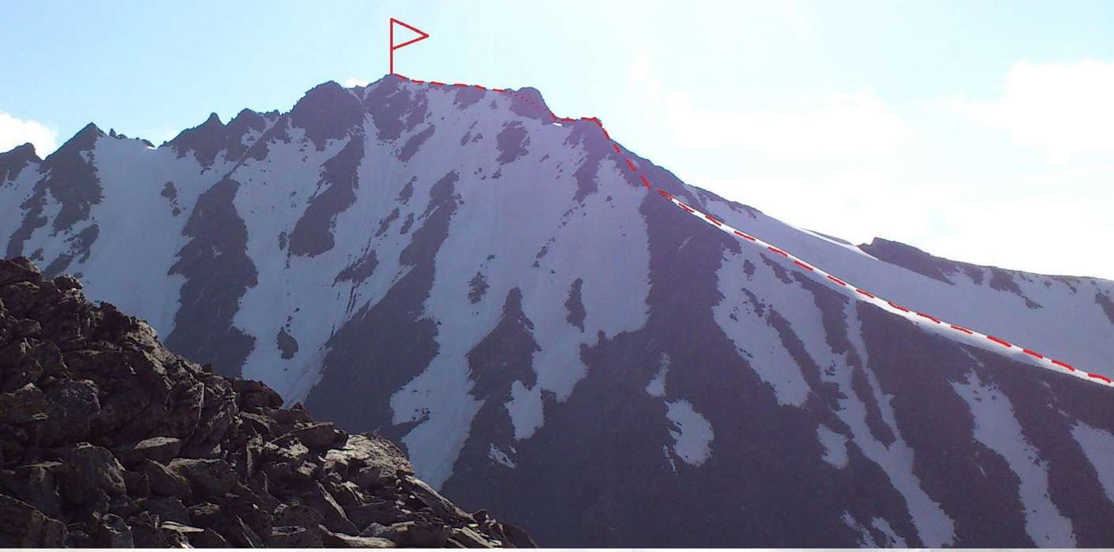
General View of the Route
Route Profile
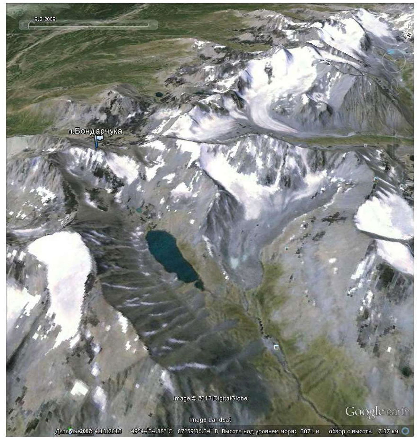
Panorama of the Area from v. Medvezhya
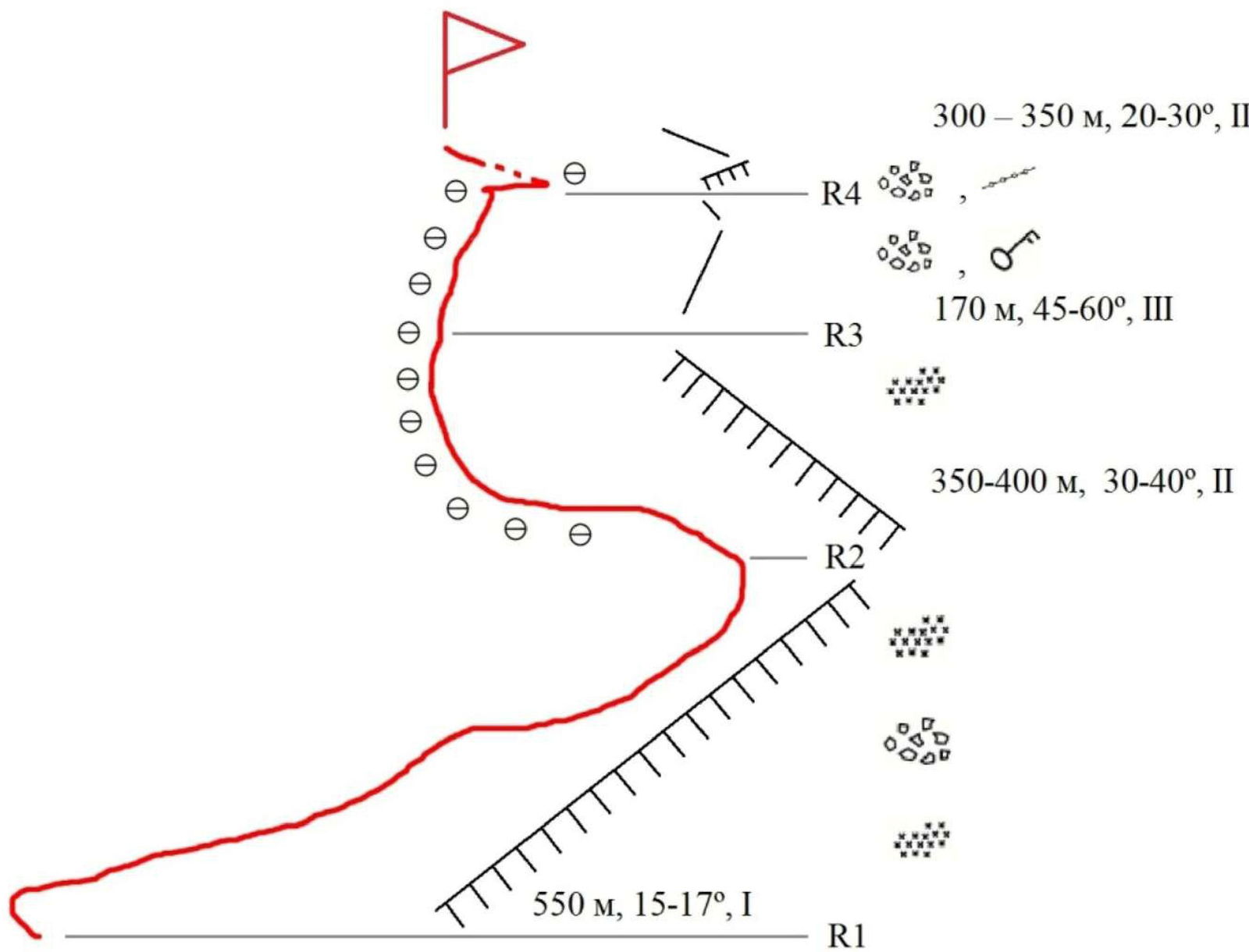
Route Diagram in UIAA Symbols
- R4: 300–350 m, 20–30°, 2
- R3: 170 m, 45–60°, 3
- R2: 350–400 m, 30–40°, 2
- R1: 550 m, 15–17°, 1
Route Description
From the base camp, located above the upper shepherds' stands in the Elangash valley, move with a slight elevation gain along the left (orographic) bank of the Elangash River to Karakul Lake (about 3 hours). Before reaching the lake, cross the river to the opposite bank. Go around Karakul Lake — there are grassy terraces on the right bank, a convenient place for an assault camp. By general agreement of the first ascenders, the standing near the lake was named "Medvezhya" (Bear), as they saw fresh bear tracks nearby. Here, you can pitch tents and leave unnecessary gear.
From "Medvezhya" standing:
- Move up a large moraine ridge scree for about 1–1.5 hours — this is the start of the route.
R1
550 m, 1, 15–17°. Here, to ensure safety, it is necessary to:
- rope up into teams;
- put on crampons. In icy conditions, it is recommended to use ice screws. Cross the snowfield in teams, in the direction of a clearly visible rock shoulder, bypassing the massif on the right along the snowfield, and exit onto the firn plateau.
R2
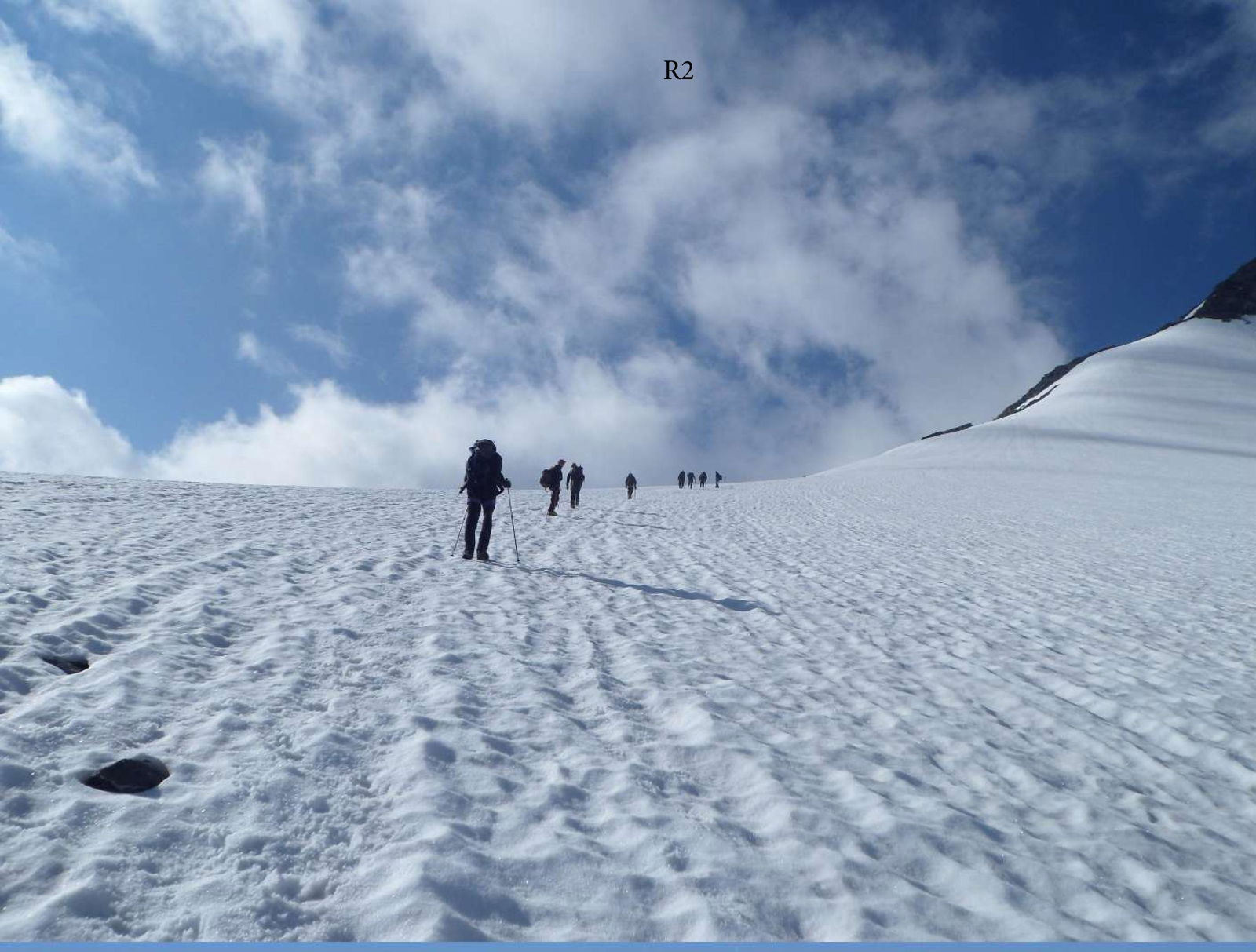
350–400 m, 2, 30–40°. Further movement:
- For teams of two or three people, simultaneous movement is recommended, with belaying through ice screws in the upper part.
- For a large group, movement with the organization of belays is recommended. Proceed to a clearly visible rock platform. The passage of the second section takes 1.5–2 hours.
R3
170 m, 3, 45–60°. The key section of the route, broken rocks, heavily loose! From the rock ledge, move up in the direction of the gendarme's summit with alternating belays. Use large-diameter slings as intermediate anchors. After passing two belay ropes, exit onto a sharp, broken ridge and organize movement in teams until the pre-summit tower.
R4
300–350 m, 2, 20–30°. Traverse the pre-summit massif from left to right — one rope to a clearly visible platform on the ridge. From the tower's summit, large rocks can fall, so move as quickly as possible, with alternating belays recommended. Exit onto a clearly visible platform, from which the path lies along the ridge towards the summit. Move simultaneously in teams with belaying through outcrops. The passage of the fourth section takes 1.5 hours. The summit is a clearly visible rock peak. Here, they built a cairn and placed a capsule with a note.
Descent from Peak Nikolai Bondarchuk (3403 m) follows the ascent route to the platform. Then, along the ridge to the scree, which is crossed in the direction of a fairly gentle firn slope leading to the assault camp.
Route Diagram by Sections
Peak Nikolai Bondarchuk (3403 m)

Peak Nikolai Bondarchuk (3403 m)
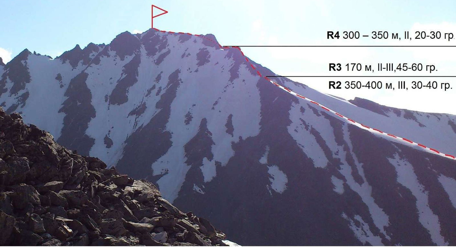
In the photo:
- part of R2
- R3
- part of R4 (photo taken on descent)
Approaching R3
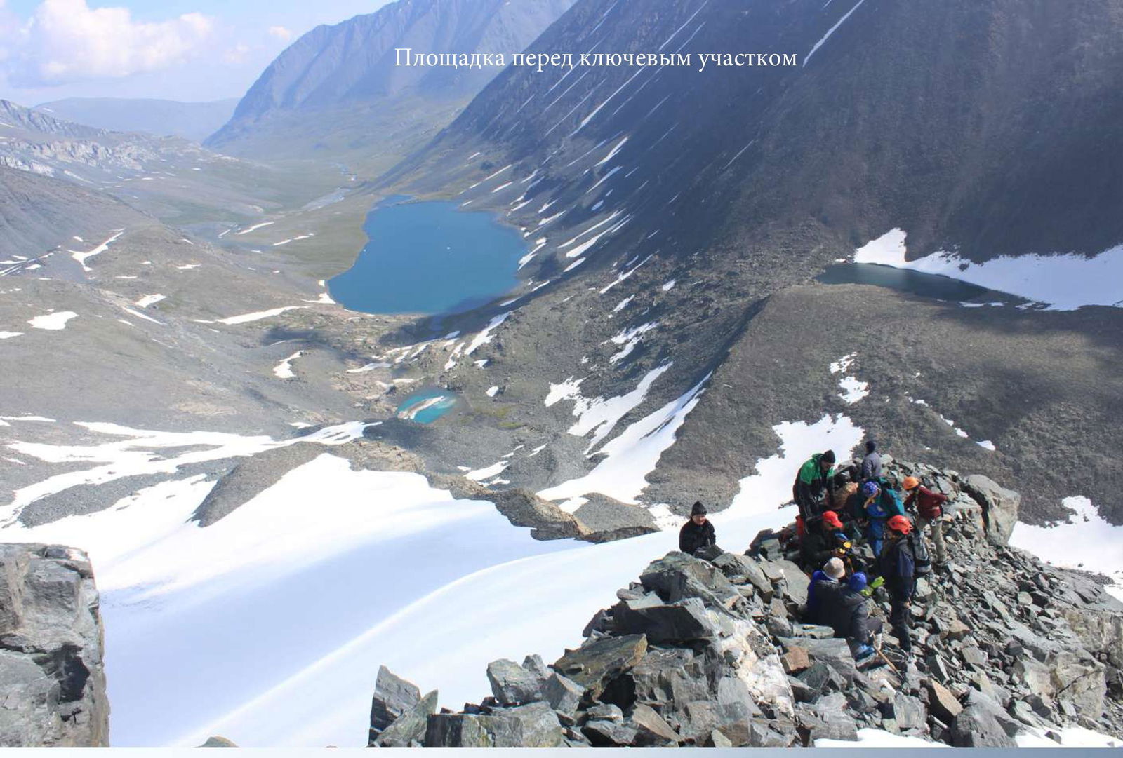
Platform before the Key Section
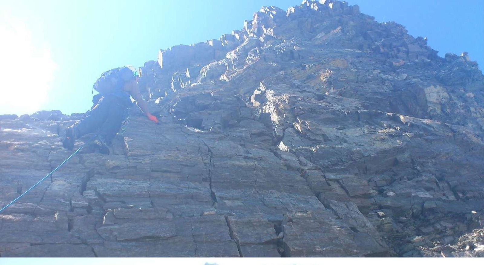
R3. Key Section
Exiting onto the Ridge after R3
R4. Traverse
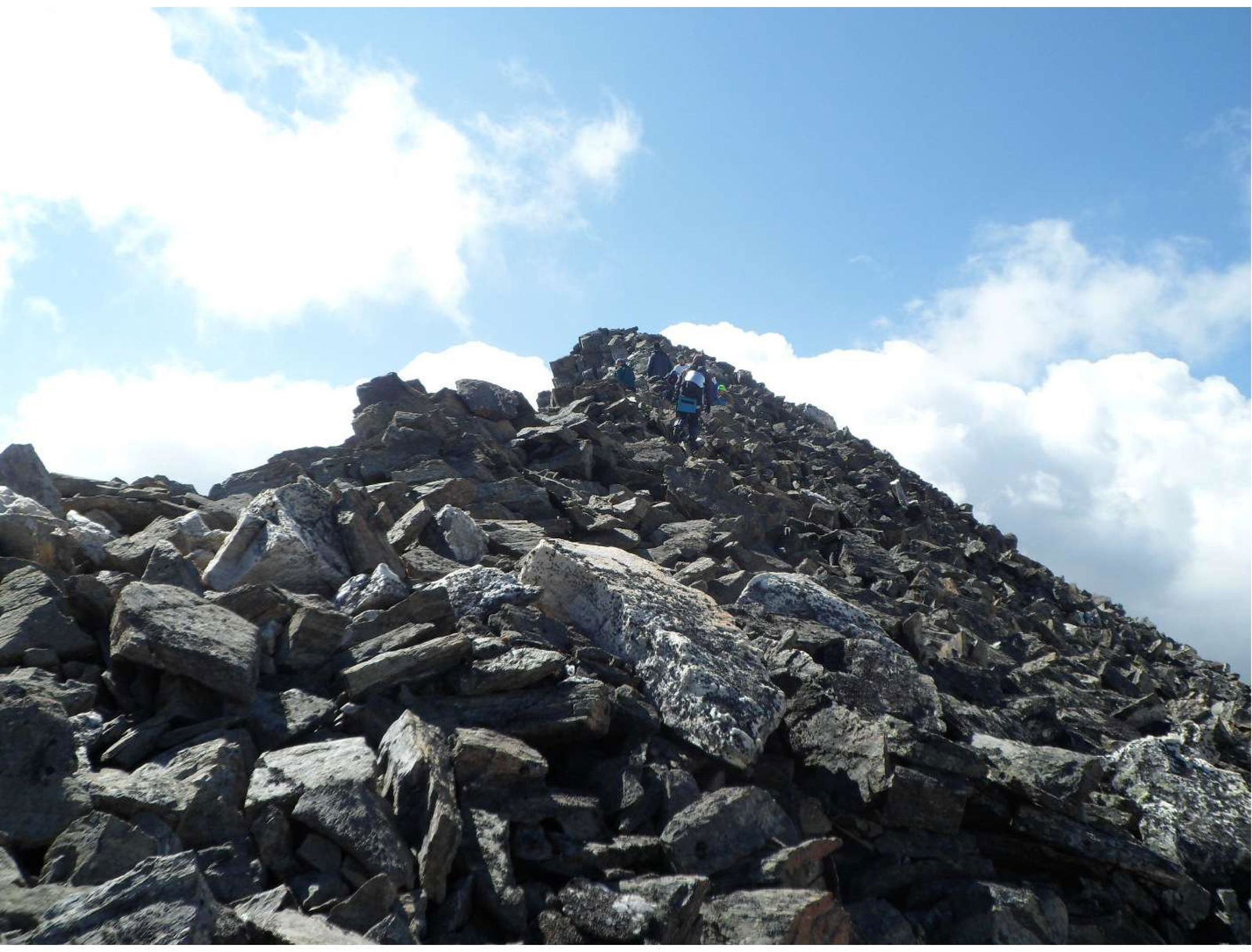
R4. Rocky Ridge Leading to the Summit
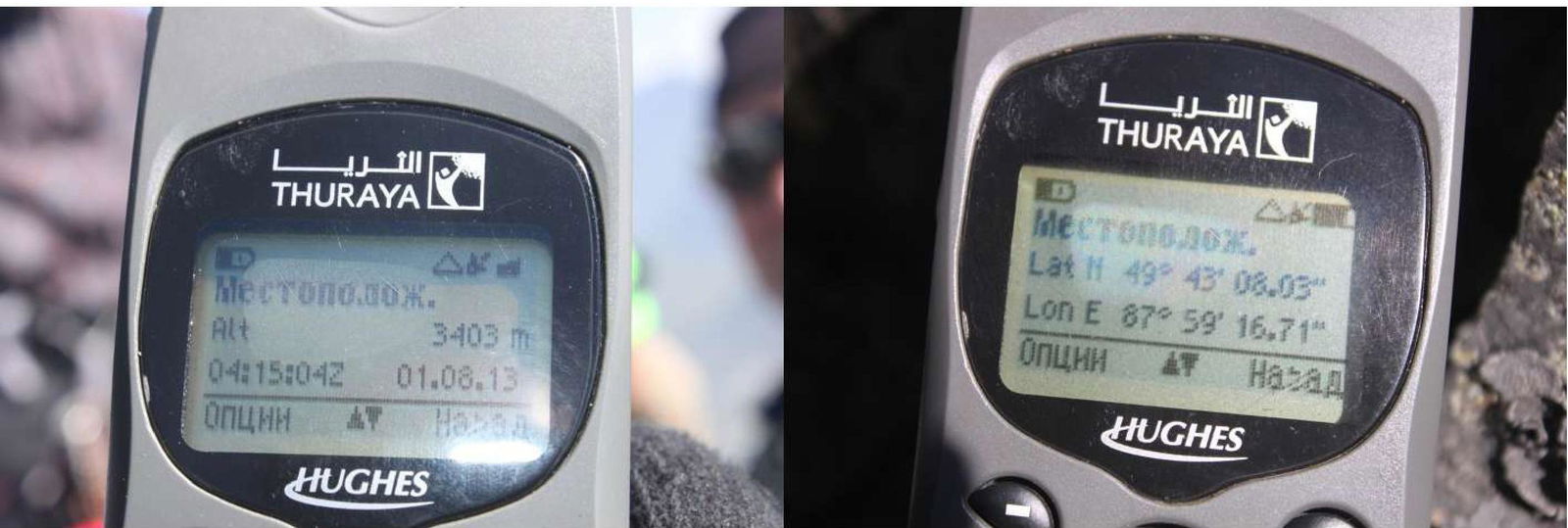
Summit Height and Coordinates (Data from a Satellite Phone)
- Height: 3403 m
- Date: August 1, 2013
- Coordinates: 49° 43' 06.03" N, 87° 59' 16.71" E
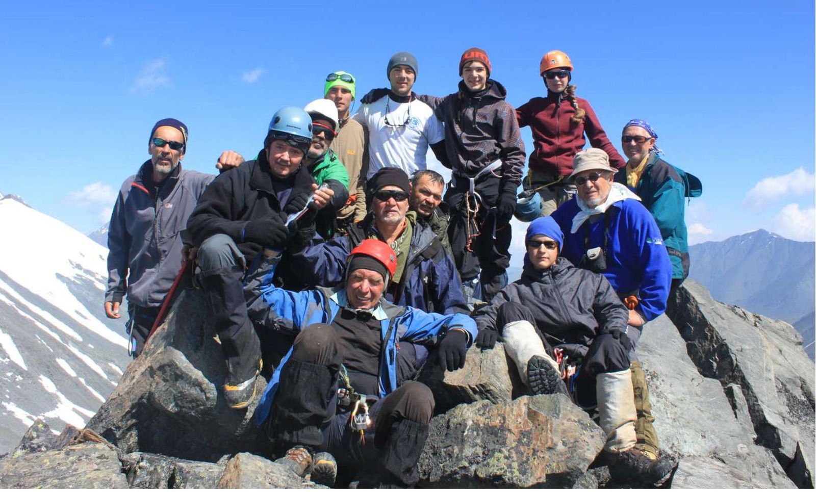
Team Photo on the Summit