Report
On the ascent of the assembled team to the summit of Alisher 3670 m.
via the North Ridge. Presumably 1B category of difficulty. First ascent.
Dolgov S. P. — team leader
Usanov I. V., Luzhetsky I. V.
Altai 2013 participants of the ascent
-
Team leader — Dolgov Sergey Pavlovich. CMS. Address: 656015, Barnaul, ul. Depotskaya, 12–38. phone: +7 903-073-98-18. Email: s_dolgov@mail.ru
-
Usanov Ivan Vladimirovich, 1st sports category, Gorno-Altaisk
-
Luzhetsky Igor Viktorovich, 2nd sports category, Novosibirsk
ASCENT DETAILS
-
Altai, Akkol valley, section 1.3 of the classifier of routes to mountain peaks.
-
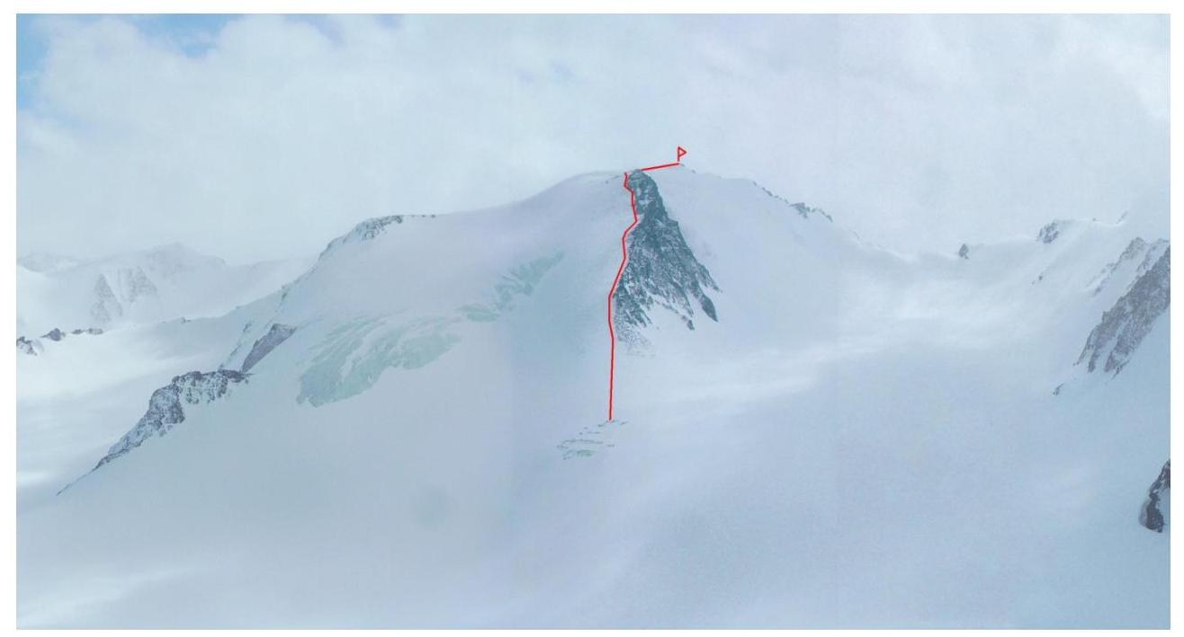
ALISHER 3670 m (49°45′45.60″N 87°48′29.52″E) via the North Ridge.
-
Proposed category of difficulty: 2B.
-
The route is ice and snow.
-
Height difference: 390 m (according to GPS)
Route length: 1070 m. Length of sections with I category of difficulty: 250 m. Length of sections with II category of difficulty: 770 m. Length of sections with III category of difficulty: 50 m. Average steepness: 40 degrees.
- Number of "pitons" left on the route: none
- Team's travel time: 10.5 hours, 1 day (no need for an overnight stay).
- Descent from the summit via the same route as the ascent.
- Team leader: Dolgov Sergey Pavlovich. CMS. Participants: Usanov Ivan Vladimirovich 1st sports category, Luzhetsky Igor Viktorovich. 2nd sports category
- Departure for the route: 6:30, July 27, 2013.
Arrival at the summit: 13:20, July 27, 2013. Return to the base camp: 19:00, July 27, 2013.
-
Organization: assembled team
-
Responsible for the report Dolgov S. P. phone: +7 903-073-9818. Email: s_dolgov@mail.ru
General photo of the summit
May 2010, view from the summit of Altai
Polytech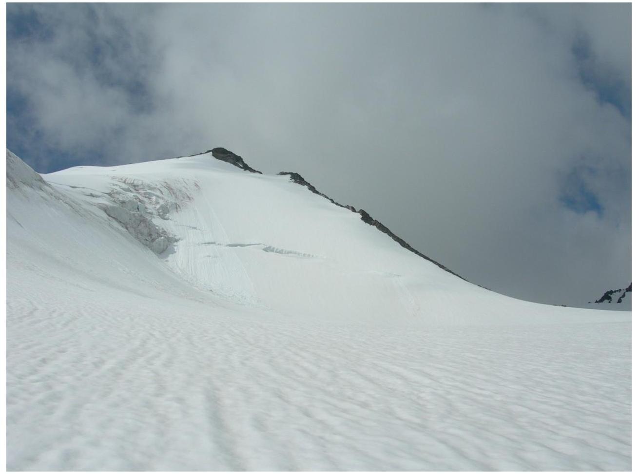
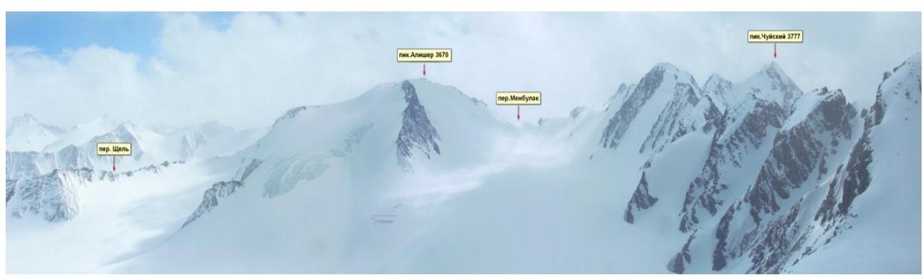
Photo panorama of the area
Description of the ascent area
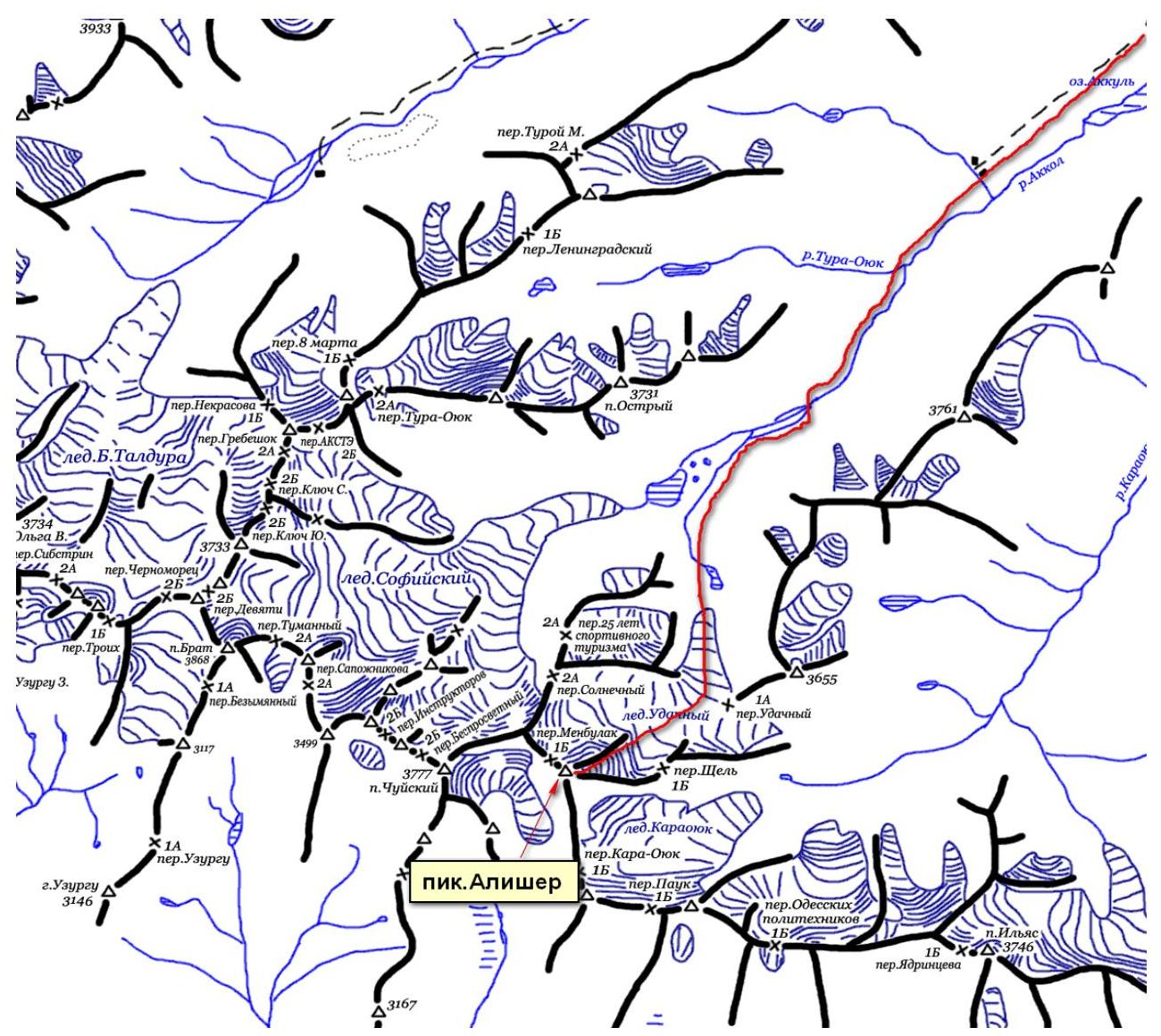
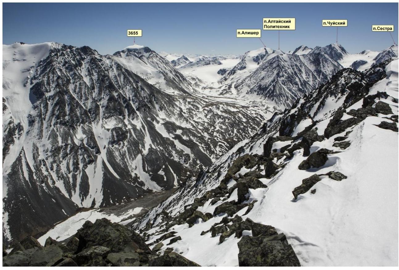
The summit of Alisher 3670 m (49°45′45.60″N 87°48′29.52″E) is located in the South Chuya Range of Altai. The South Chuya Range limits the southern chain of Central Altai to the east. It is separated from the eastern part of the Katun Range by the Argut gorges, from the North Chuya Range — by the Karagem valley, from the south — by the Jazator river valley, and from the east — by the Chuya river and its tributaries.
Our goal was to ascend the summit of Alisher, which is located in the Udachny glacier circus. The Udachny glacier is bounded:
- to the west — by the Akkol valley,
- to the east — by the Karaoyuk valley.
The summit of Alisher closes the Udachny glacier circus to the south. To the east, the summit is bounded by the Shchel pass with a decrease in the ridge of about 340 m. To the west — by the Menbulak pass with a decrease in the ridge of about 470 m.
Features of the summit:
- It does not have a clearly defined peak,
- It is a destroyed rock outcrop,
- To the south, it drops off with sheer walls with a height difference of up to 600 m,
- The northern slope is snow and ice with a rock ridge with a steepness of 40–45°.
You can reach the base camp by car from the settlement of Beltir along the Akkol river valley (about 36 km to the confluence of the Akkol and Tura-Oyuk rivers), then on foot along the Akkol valley in the direction of the old moraine to the Udachny glacier (about 3 hours).
The base camp is located on the lower moraine lake of the Udachny glacier. The approach to the glacier tongue from the base camp takes 30–40 minutes.
Ascent route:
- Ascent along the center of the glacier,
- Then to the right, in the direction of the Solnechny pass,
- Approach to the "North Ridge" route of the Alisher summit.
The glacier is closed, movement is in crampons and tied together. Ascent time — 1.5 hours.
| Section number | Length (m) | Steepness | Relief character | Category of difficulty | Number of pitons |
|---|---|---|---|---|---|
| R0–R1 | 770 | 45 | snow, ice | II | 12 |
| R1–R2 | 50 | 60 | ice | III | 6 |
| R2–R3 | 250 | 10 | snow | I | none |