
Report
on the first ascent to the summit of DVS, 3755 m, Altai Republic, Kosh-Agachsky district, North-Chuya Ridge, Aktru valley via the north-eastern wall 4A cat. diff. (combined) on October 14-15, 2022
Participants:
– Yakubovsky Ivan Alexandrovich, II sports category – Mikhalev Sergey Vasilievich, II sports category
I. Climbing Report
| 1. General Information | ||
|---|---|---|
| 1.1 | Full name, sports category of the leader | Yakubovsky Ivan Alexandrovich, II sports category |
| 1.2 | Full name, sports category of participants | Mikhalev Sergey Vasilievich, II sports category |
| 1.3 | Full name of the coach | Afanasyev Andrey Evgenievich |
| 1.4 | Organization | Altai Republic Alpinism and Rock Climbing Federation |
| 2. Characteristics of the Climbing Object | ||
| 2.1 | Region | Altai Republic, 1.2. North-Chuya Ridge |
| 2.2 | Valley | Aktru valley |
| 2.3 | Classification table section number (2013 edition) | 1. ALTAI |
| 2.4 | Name and height of the summit | DVS, 3755 m |
| 2.5 | Geographical coordinates of the summit (latitude/longitude), GPS coordinates *(1) | N 50°03′12.48″ E 87°41′58.27″ |
| 3. Route Characteristics | ||
| 3.1 | Route name | via the center of the north-eastern wall |
| 3.2 | Proposed category of difficulty | 4A |
| 3.3 | Degree of route exploration | first ascent, possible first ascent date 1957 (see Afanasyev's report 1993 "DVS — Krylya Sovetov") |
| 3.4 | Terrain characteristics of the route | combined |
| 3.5 | Height difference of the route (altimeter or GPS data) | 550 m |
| 3.6 | Route length (in meters) | 780 m |
| 3.7 | Technical elements of the route (total length of sections with different categories of difficulty, terrain type (ice-snow, rock)) | II cat. diff. ice – 180 m. III cat. diff. ice – 500 m. III-V cat. diff. rock – 100 m. Movement on closed glacier – 1.5 km. Rappelling (on descent) – 5 ropes, 300 m |
| 3.8 | Average steepness of the route, ° *(2) | |
| 3.9 | Average steepness of the main part of the route, ° *(2) | |
| 3.10 | Descent from the summit | Via 3A cat. diff. south couloir of NE ridge to Aktru valley |
| 3.11 | Additional route characteristics | Water is likely present during warm seasons. In cold seasons, be cautious of avalanche danger on the NE wall and summit cornice of DVS. |
| 4. Team Actions Characteristics | ||
| 4.1 | Time of movement (team's walking hours, in hours and days) | 24 hours, including approach to the assault camp 5 hours, approach to the route 3 hours, ascent 9 hours, descent and return to the base |
| camp 7 hours | ||
| :--: | :--: | :--: |
| 4.2 | Overnight stays | at the western end of Khitsan (nunatak separating Prav. B. Aktru glacier) |
| 4.3 | Time of route preparation *(3) | --- |
| 4.4 | Start of the route | 12:00 October 14, 2022 approach to the assault camp, 6:00 October 15, 2022 from the assault camp at the western end of Khitsan (nunatak separating Prav. B. Aktru glacier) |
| 4.5 | Reaching the summit | 17:20 October 15, 2022, 17:50 descent |
| 4.6 | Return to the base camp | 24:00 October 15, 2022 |
| 5. Weather Conditions Characteristics *(4) | ||
| 5.1 | Temperature, °C | |
| 5.2 | Wind speed, m/s | |
| 5.3 | Precipitation | |
| 5.4 | Visibility, m | |
| 6. Responsible for the Report | ||
| 6.1 | Full name, e-mail | Mikhalev Sergey Vasilievich serg-mih04@mail.ru |
II. Climbing Description
1. Climbing Object Characteristics
General photo of the DVS summit 3755 m a.s.l. is shown in photos 1, 2, 3, 4.
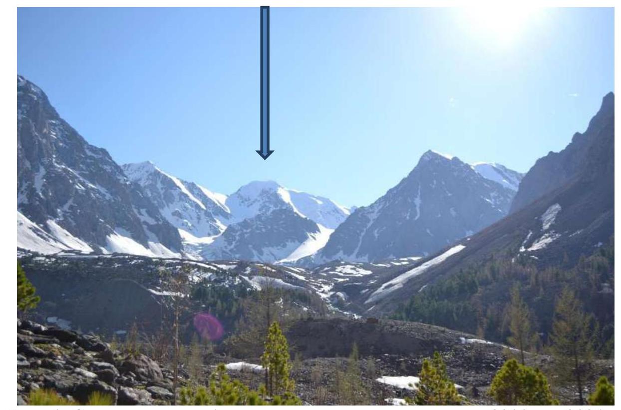
Photo 1. Taken from Aktru valley, approximately from 2300 m height in 2021.
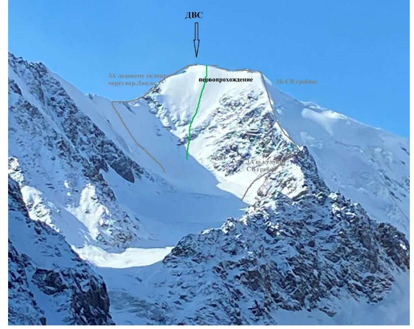
Photo 2. Taken from the slope of Kupol Trekh Ozyor peak, approximately from 3000 m height on October 11, 2022.

Photo 3. Author of the photo is Yu. Surikov, 2018, taken from https://pereval.online↗, shot from Pravy B. Aktru glacier.
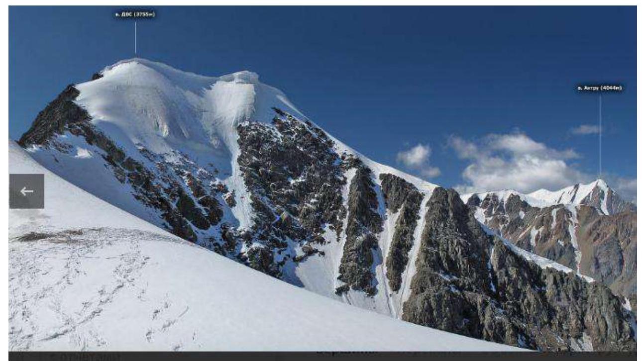
Photo 4. Author of the photo is Yu. Surikov, 2018, taken from https://pereval.online↗, shot from Dzhello pass.
1.2. Route Profile Photo
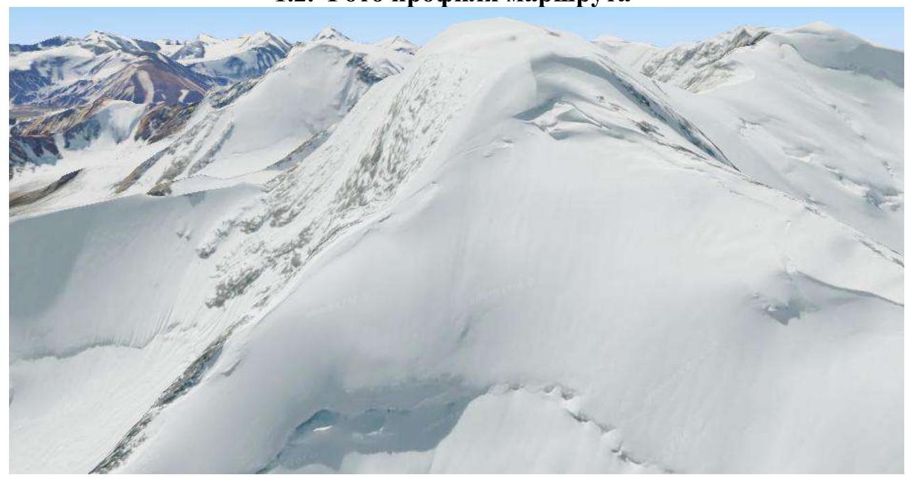
Figure 1. Screenshot of the profile of the NE wall on DVS peak. Screenshot taken from https://www.google.ru/maps↗.
1.3. Area Photopanorama
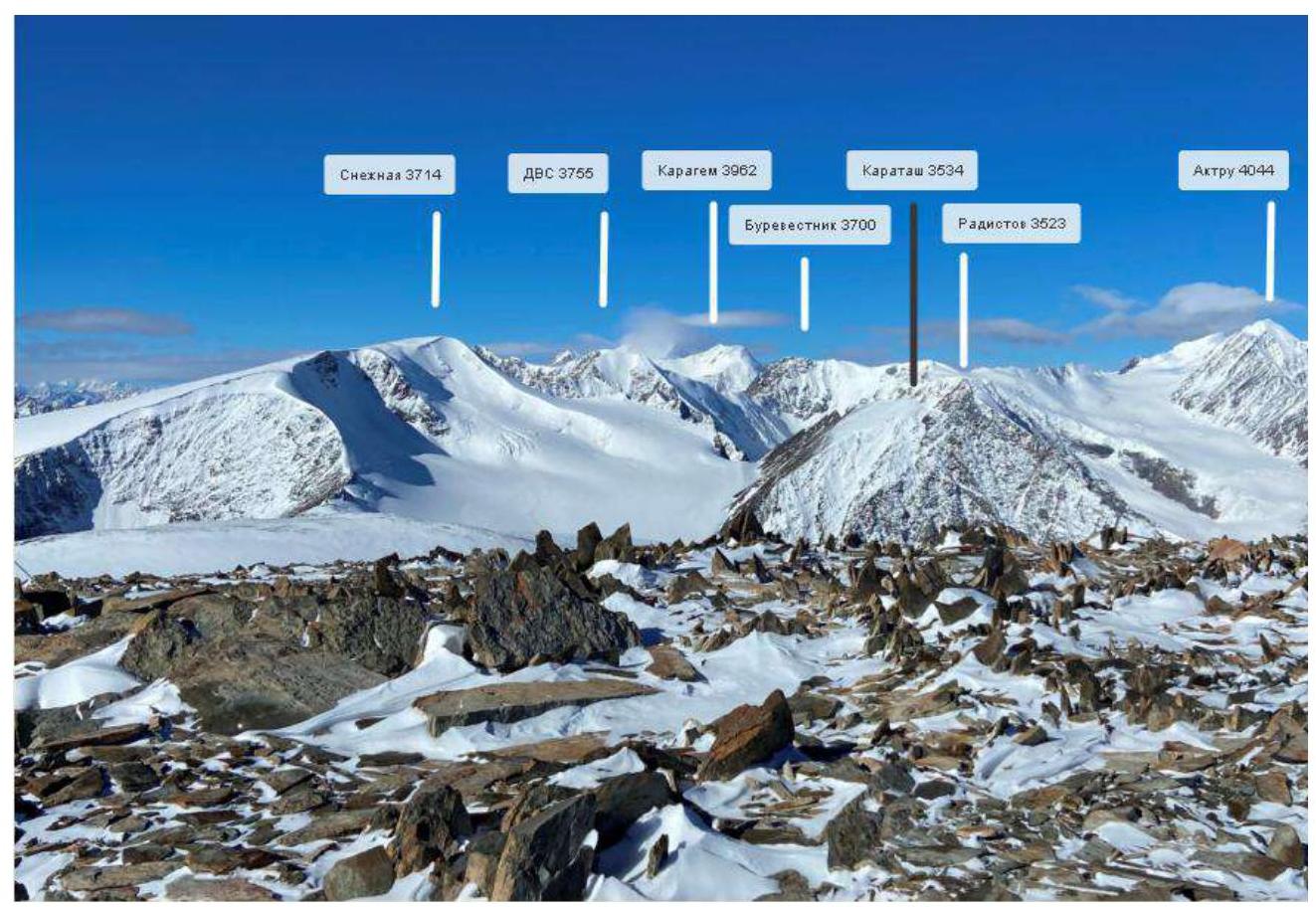
Taken from Kupol Trekh Ozyor peak on October 12, 2022.
1.4. Area Map-Scheme
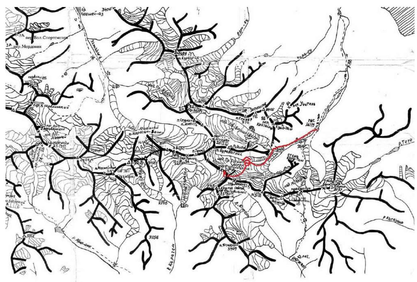
Taken from open internet sources.
1.5. Geographical location of the area, its features, remoteness with indication of distance and time of approach or travel from the nearest settlement to the base camp (BC) and from BC to the start of the route. Description of the approach is provided according to the scheme:
– city (village) – valley – glacier – pass – peak
DVS peak "Dalnevostochnykh Stroiteley" 3755 m a.s.l. is located between UPI and Burevestnik peaks (GPS: 50.05308, 87.69923), south of Aktru peak and southwest of Aktru alpine camp. In good weather, it is clearly visible from Aktru river from the alpine camp. Located in:
– Altai Republic – Kosh-Agachsky district – North-Chuya Ridge – Aktru valley
Aktru alpine camp can be reached from Kurai village (826 km of Chuya tract) by off-road vehicle – 32 km. By van it usually takes about 2.5 hours.
Distance from a/l Aktru to DVS peak is about 11 km.
The following describes the winter approach to the route:
– Follow the trail to Barany Lby. – From there descend to Aktru river and ascend to the moraine ramparts under the eastern slopes of Radiist peak. – Do not deviate too much to the left, and especially do not climb the isolated moraine hill of Tronov. – Even in a low-snow period, the valley can be quite deep. – Move towards Khitsan (under the nunatak separating Prav. B. Aktru glacier). – Pass along the glacier along Khitsan to its western end, where it abuts the main glacier. – There is a large mulde, where the assault camp was set up.
The approach from Aktru base camp with gear and bivouac took 5 hours.
We exit onto the glacier on the southern side of Khitsan and, overcoming ice crevasses in a rope team, move along the glacier between the western ridge of UPI and the northeastern ridge of DVS towards the NE wall of DVS peak. The glacier is closed and heavily crevassed, with many crevasses! In our case, it was more convenient to pass the crevasses to the right, closer to the slopes of DVS peak.
Then follow the old avalanche cone to the route. From Khitsan to the route, it took about 3 hours.
Currently, there are four routes to the summit.
| № | Region | Area | Summit | Route | Height, m | Cat. diff. | Terrain | Leader |
|---|---|---|---|---|---|---|---|---|
| 22 | 1. ALTAI | 1.2. North-Chuya Ridge | DVS | Via south couloir of NE ridge | 3755 | 3A | ice-snow | Andrey Evgenievich Afanasyev |
| 22A | 1. ALTAI | 1.2. North-Chuya Ridge | DVS | Via NE ridge | 3755 | 3B | mixed | Bazhenov N. |
| 22B | 1. ALTAI | 1.2. North-Chuya Ridge | DVS — Krylya Sovetov | Via south couloir of NE ridge, traverse | 3B | ice-snow | Andrey Evgenievich Afanasyev | |
| 121 | 1. ALTAI | 1.2. North-Chuya Ridge | DVS | Via ice slope through Dzhello pass | 3755 | 3A | mixed | Ivan Mikhailovich Temerev |
2. Route Characteristics
2.1. Technical Photograph of the Route
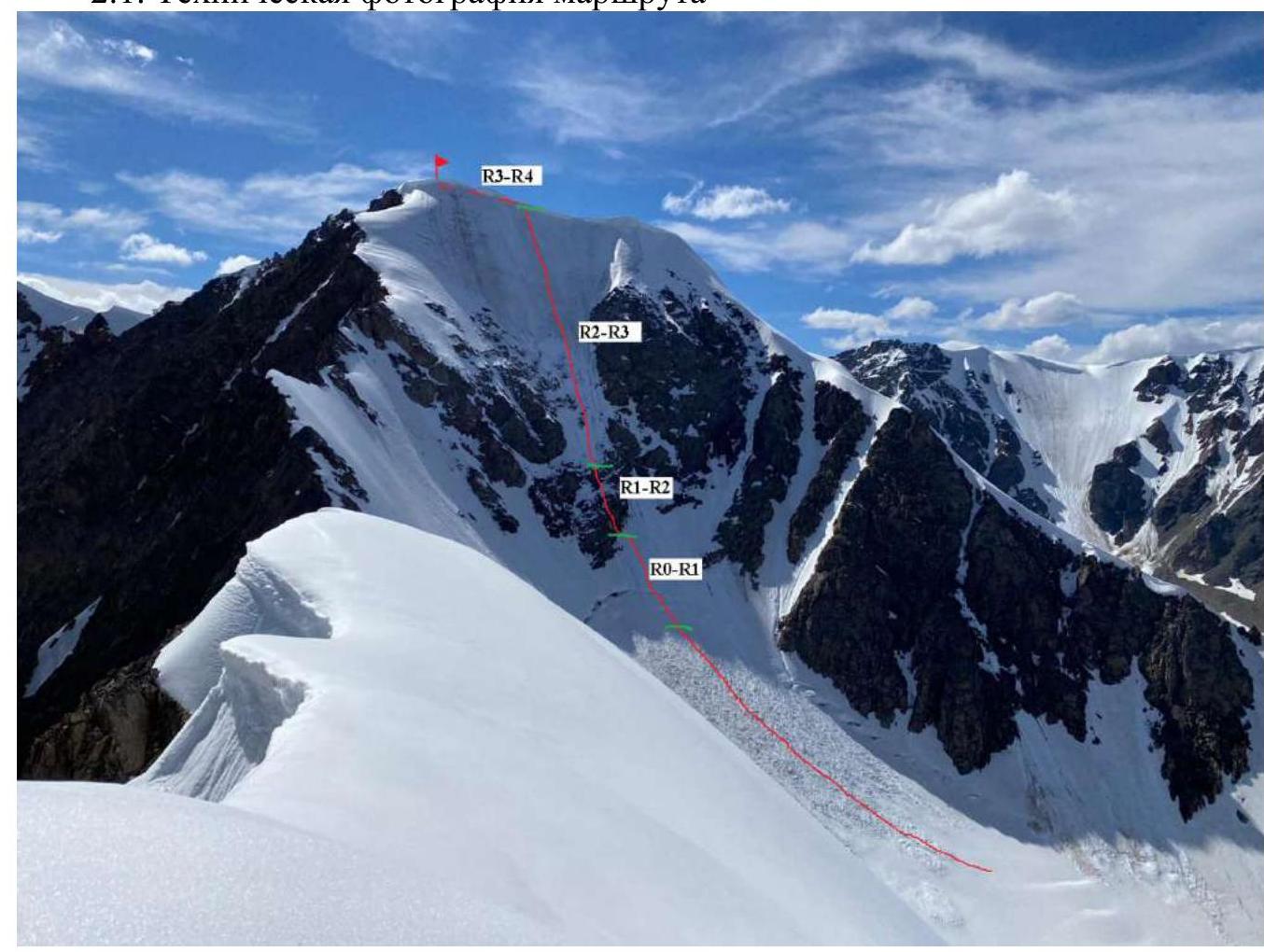
Photo #1. Taken from the ridge between UPI peak and Dzhello pass in July 2022, approximately from 3500 m height.
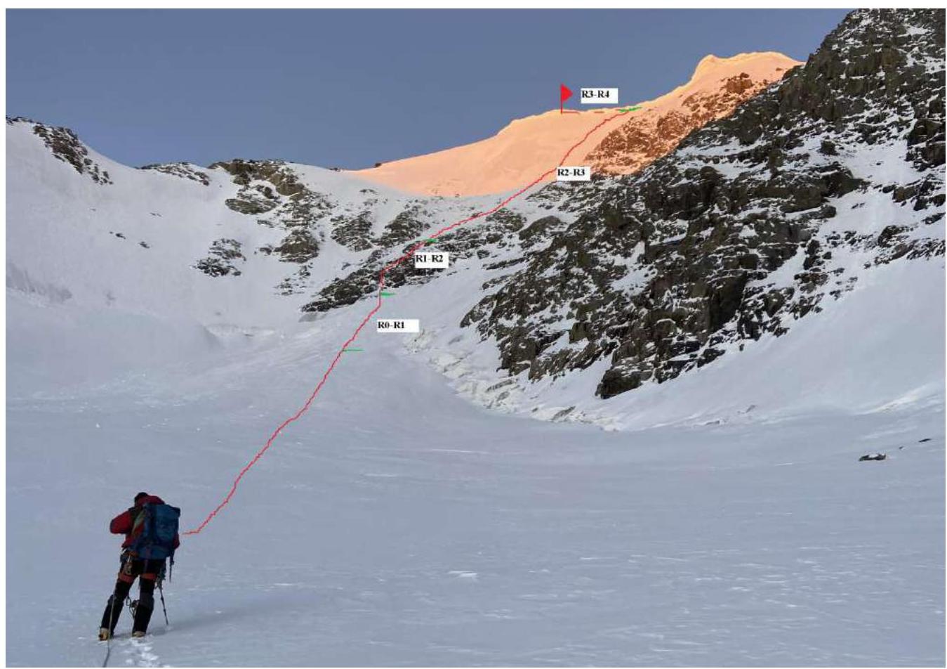
Photo #2. Taken at 8:10 on October 15, 2022 on the approach to the route, height 3200 m.
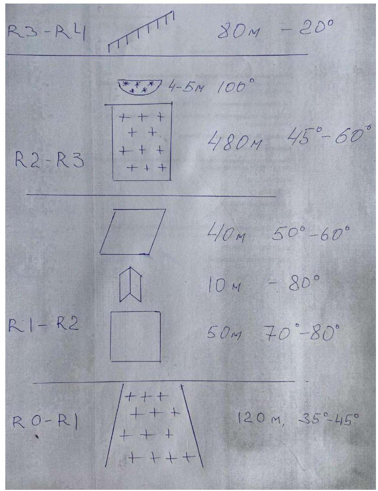
2.2. Route Diagram in UIAA Symbols
2.3. Technical Characteristics of Route Sections
| Section Number | Terrain Characteristics | Cat. diff. | Length, m | Type, Quantity |
|---|---|---|---|---|
| R0–R1 | Snow-ice slope, slope 35–45° | 2 | 120 m | Movement in rope teams |
| R1–R2 | Rock belt, местами стенки до 90°, скалы монолитные, местами обледеневшие, уклон 70–80°. Внутренний угол с натечным льдом 80°. Скальный склон, скалы монолитные, уклон 50–60° | 3–5 | 100 m | Movement alternate. Protection with rock protection |
| R2–R3 | Ice, covered with a thin layer of snow, slope 45–60° | 3 | 480 m | Porous ice, difficult to make stations, need to chop 10–20 cm, protection with ice screws every 7–10 m |
| R3–R4 | Summit plateau. Firn. местами лёд. Уклон 20° | 1 | 80 m | Movement in rope teams |
3. Team Actions Characteristics
3.1. Brief description of the route passage. Accompanied by photo illustrations (at least 4):
– photo 1 – photo 2 – photo 3 – photo 4
Distance from a/l Aktru to the summit is about 11 km. We draw your attention to the fact that the ascent was made in mid-October.
Follow the trail to Barany Lby. From there descend to Aktru river and ascend to the moraine ramparts under the eastern slopes of Radiist peak. Do not deviate too much to the left, and especially do not climb the isolated moraine hill of Tronov. Even in a low-snow period, the valley can be quite deep.
Move towards Khitsan (under the nunatak separating Prav. B. Aktru glacier) and pass along the glacier along Khitsan to its western end, where it abuts the main glacier. Here is a large mulde, where the assault camp was set up. Time of approach from Aktru base camp – 5 hours.
In the morning, exit onto the glacier on the southern side of Khitsan and, overcoming ice crevasses in a rope team, move along the glacier between:
– western ridge of UPI; – northeastern ridge of DVS
towards the beginning of the northeastern wall of DVS peak. In our case, it was more convenient to pass the crevasses to the right, closer to the slopes of DVS peak. From Khitsan to the route, it took about 3 hours.
| Section Number | Description | Photo Number |
|---|---|---|
| R0–R1 | Snow, slope 35–45°. Movement in a rope team and with crampons. Protection via ice axe. At the beginning of the slope, a large bergschrund — be extremely careful! In our case, it is covered by an avalanche cone. | Photo 1–2 |
| R1–R2 | Key section. Rock belt, местами стенки до 90°, скалы монолитные, местами обледеневшие, есть рельеф для лазания; уклон 70–80°. Protection with rock protection. Inner corner with flow ice 80°. Rock slope, rocks monolithic, местами обледеневшие, есть рельеф для лазания, местами снег, выполаживание, уклон 50–60°. Movement in a rope team is alternate. | Photo 3–5 |
| R2–R3 | Ice, covered with a thin layer of snow, slope 45–60°. Movement in a rope team and with crampons, using ice tools, protection with ice screws. Steepness of the slope increases as altitude is gained. Ends with a cornice. Second key section. | Photo 6–10 |
| R3–R4 | Summit plateau. Firn. местами лёд. Уклон 20°. | Photo 11 |
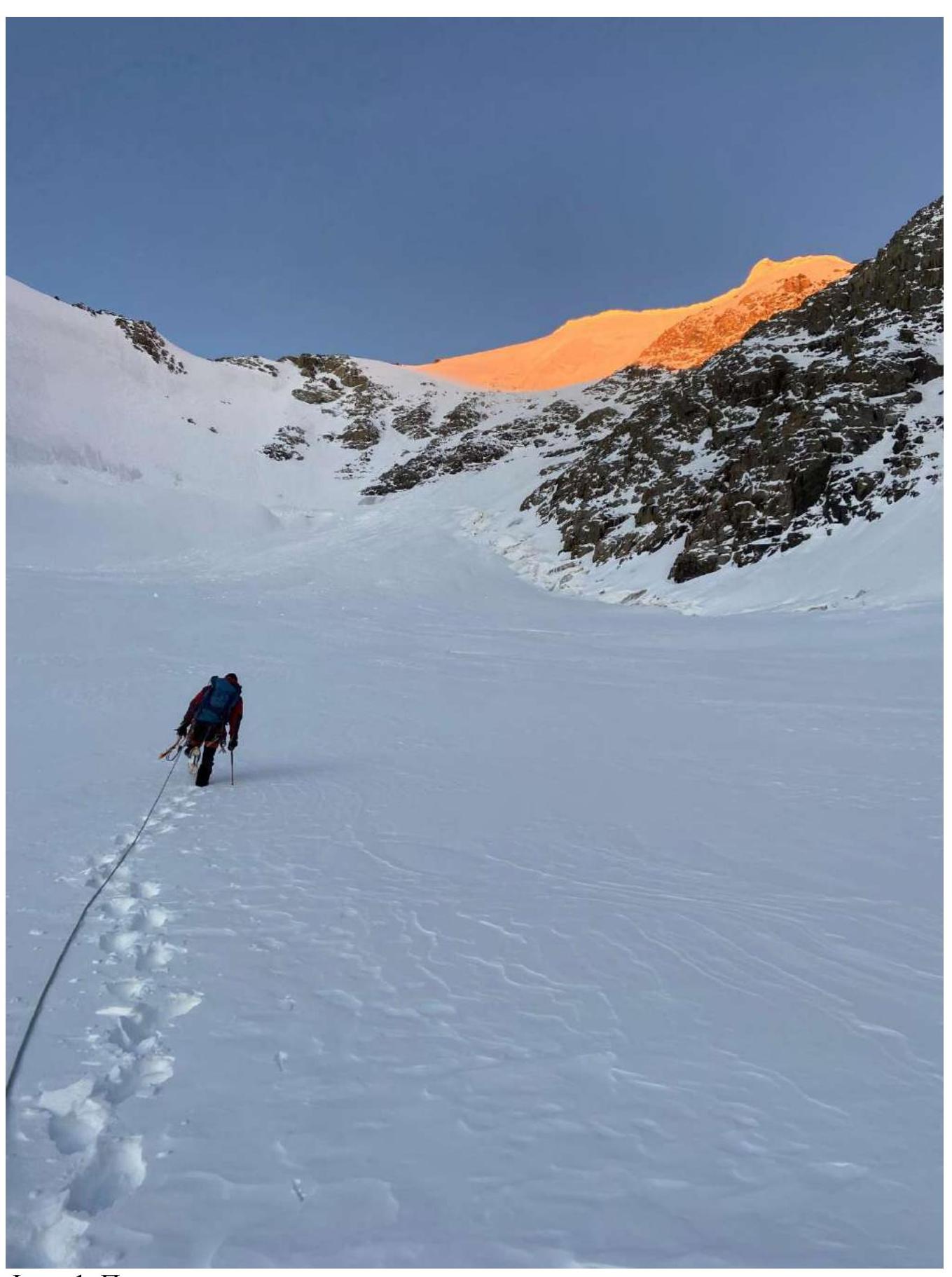
Photo 1. Approach to the route.
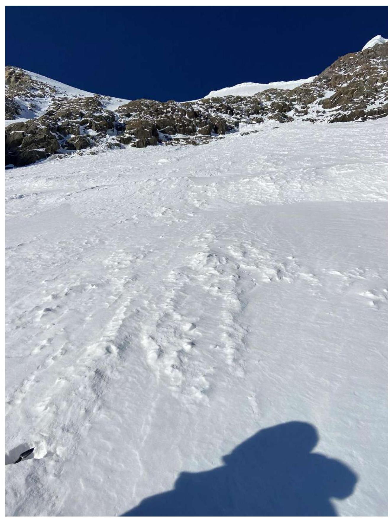
Photo 2. Beginning of section R0–R1.
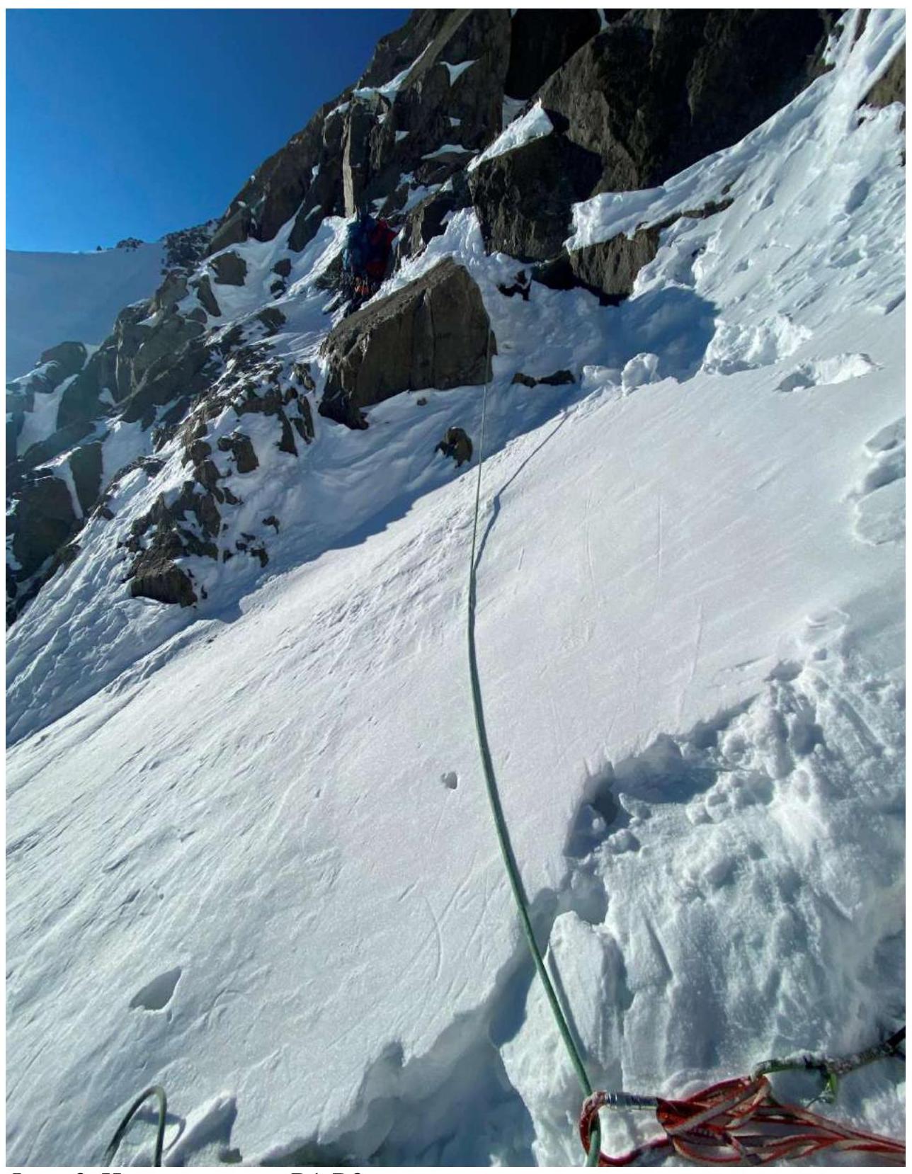
Photo 3. Beginning of section R1–R2.
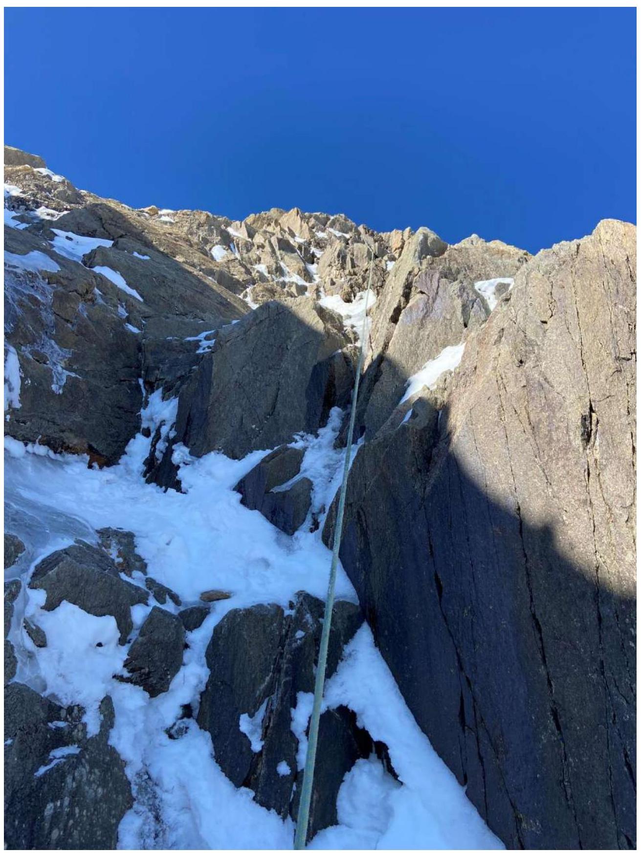
Photo 4. Beginning of the second rope on section R1–R2.
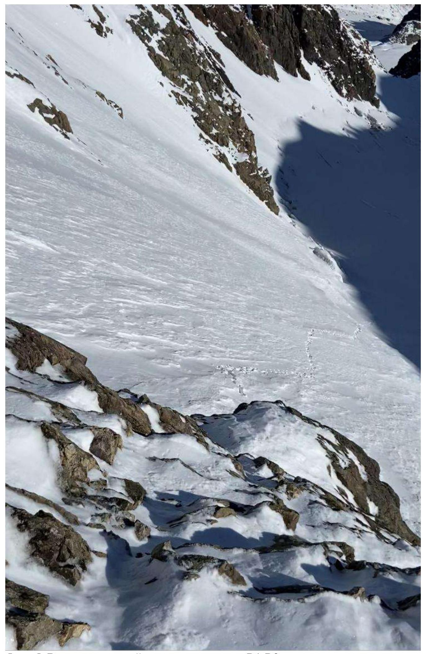
Photo 5. View down from the first station on section R1–R2.
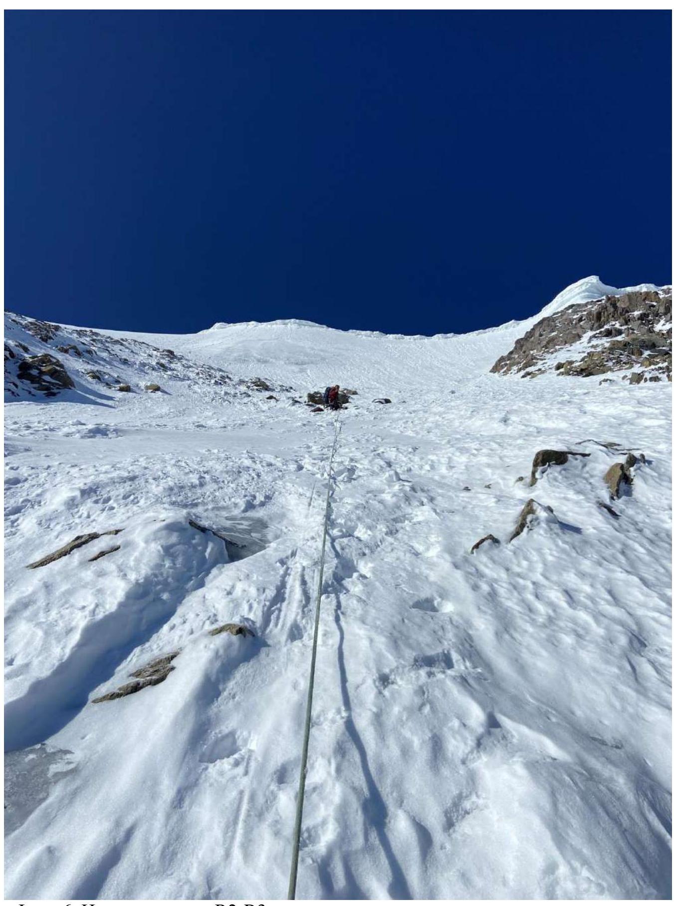
Photo 6. Beginning of section R2–R3.
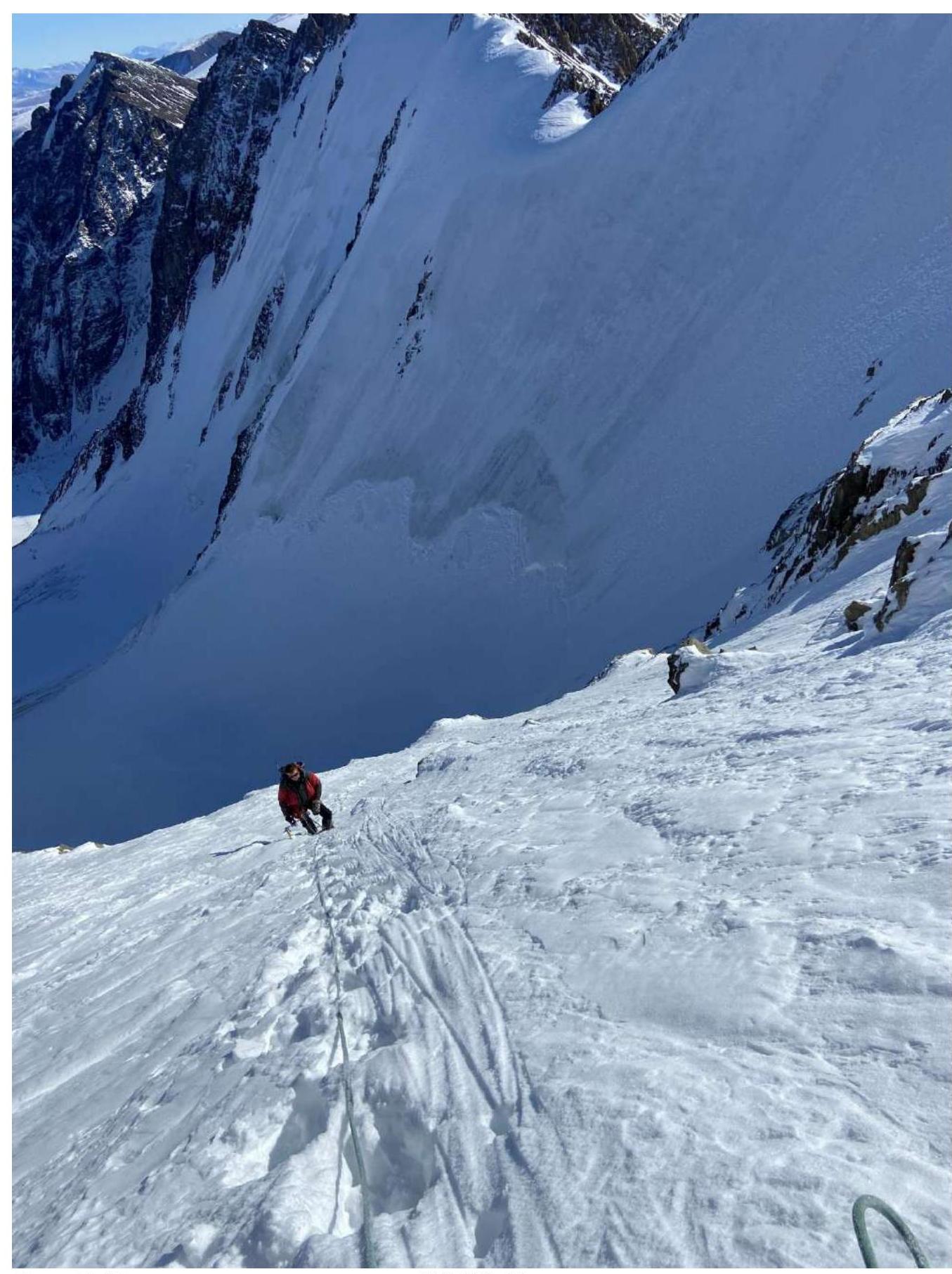
Photo 7. Second rope on section R2–R3. View down.
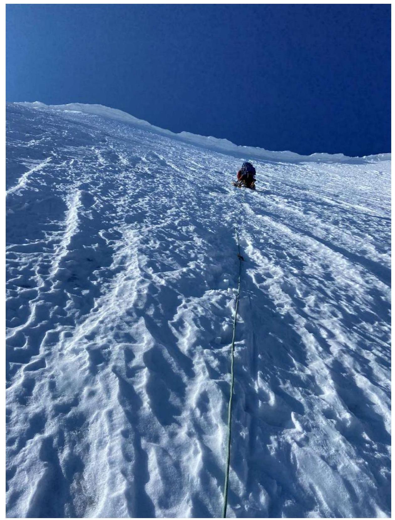
Photo 8. In the middle of section R2–R3.
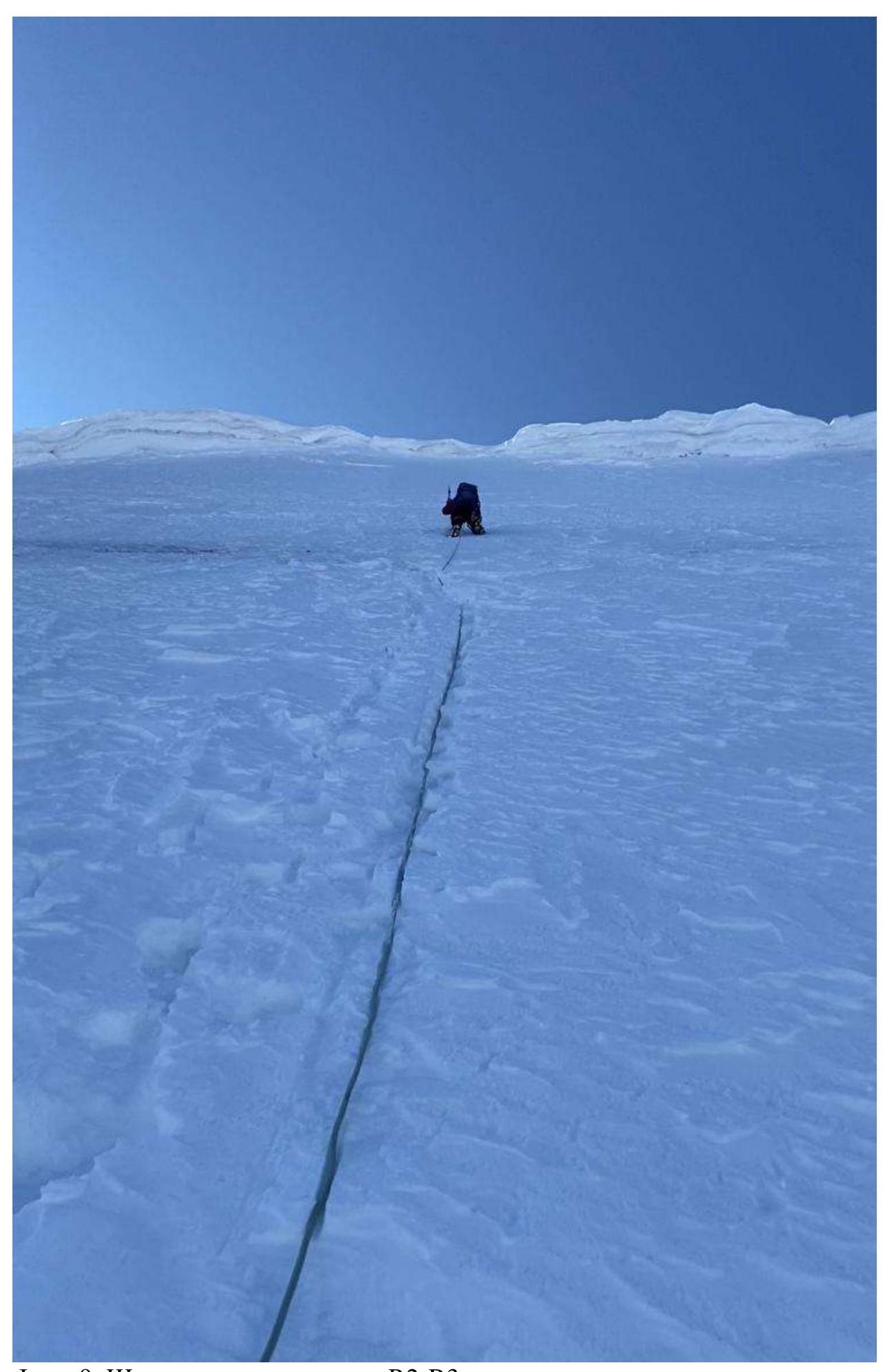
Photo 9. Sixth rope of section R2–R3.
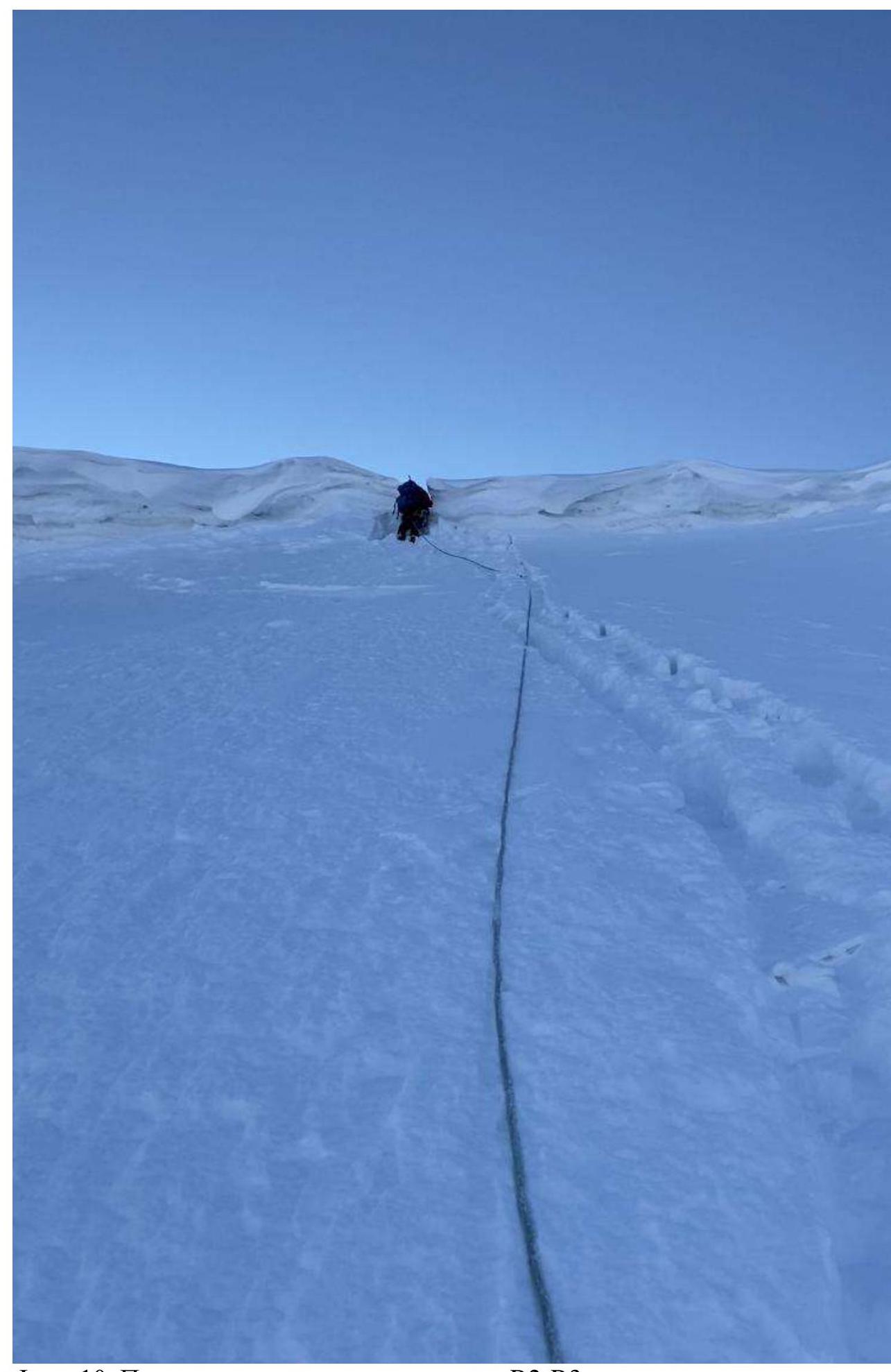
Photo 10. Passing the cornice on section R2–R3.
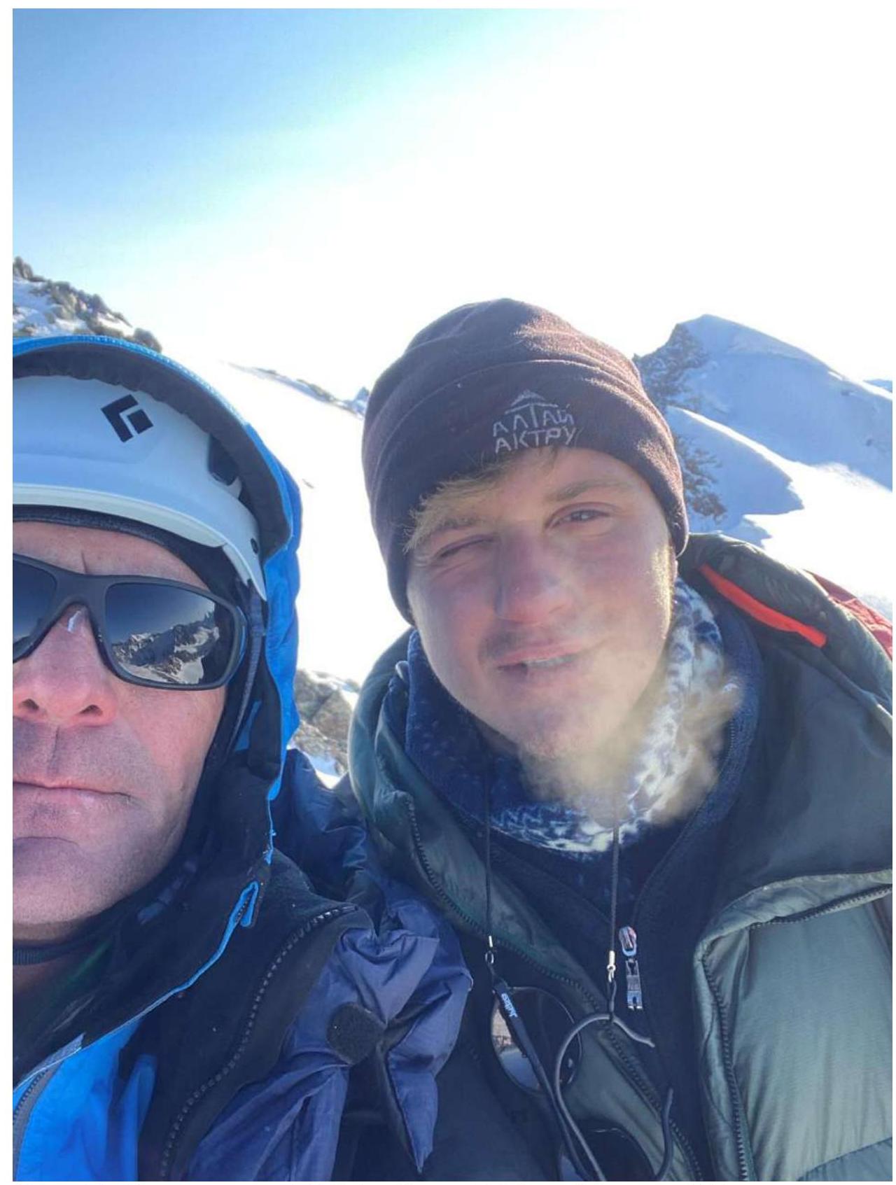
Photo 11. On the summit of DVS peak. Yakubovsky I. V. and Mikhalev S. V.
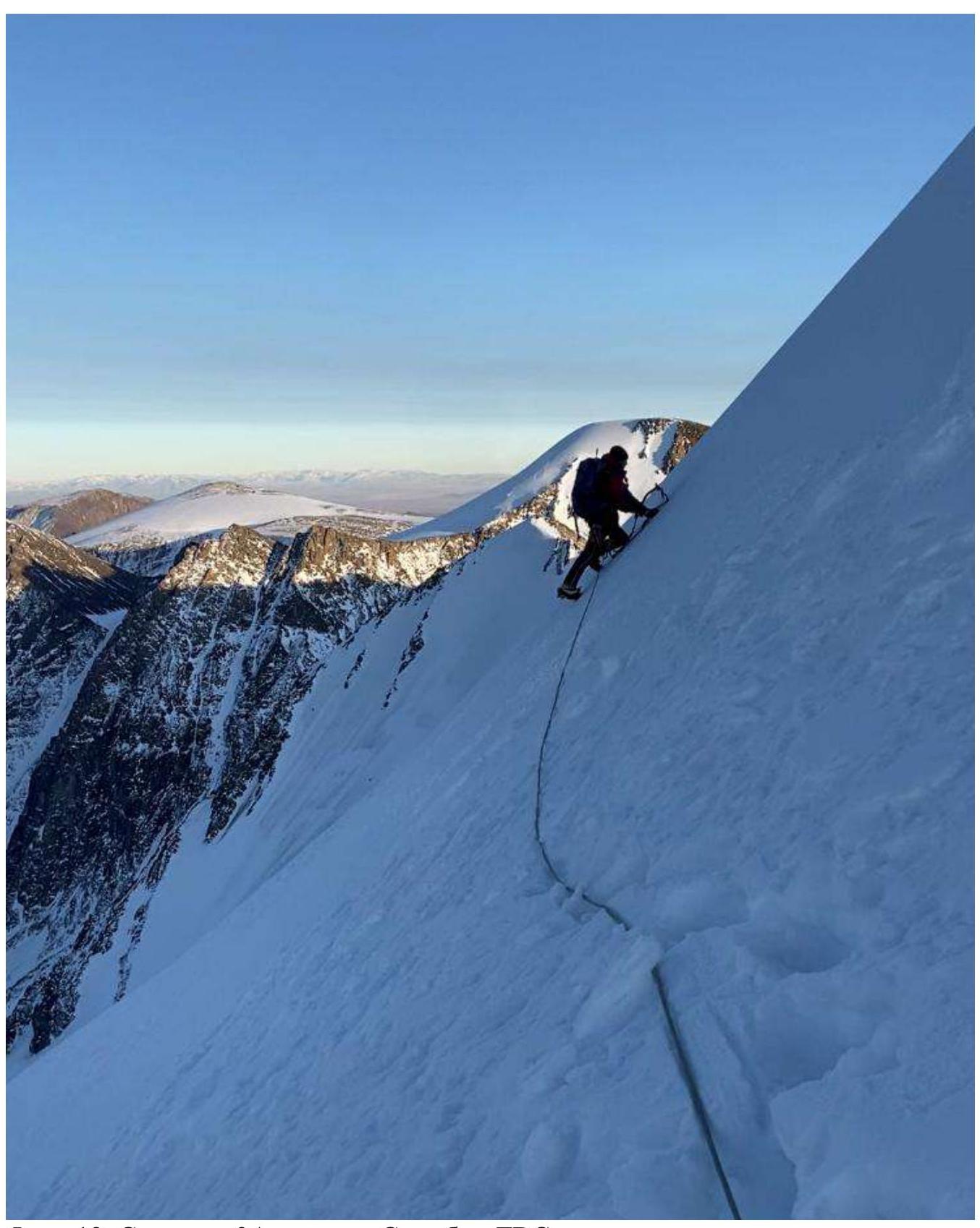
Photo 12. Descent via 3A couloir of NE ridge of DVS peak.
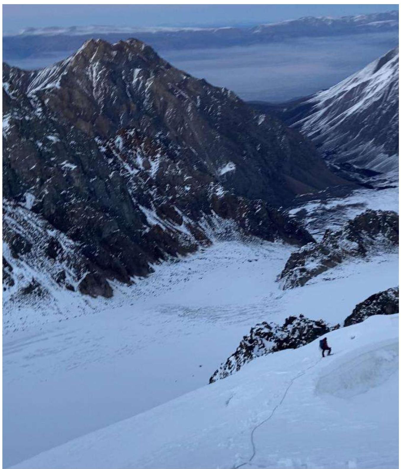
Photo 13. Descent via 3A couloir of NE ridge of DVS peak.
3.3.1. Route Safety Assessment.
The route seemed to us sufficiently safe, however, one needs to be cautious of avalanche danger. When reaching the summit, the leader needs to move to the left or right — depending on the situation, to avoid breaking the cornice onto the group.
3.3.2. Route Communication Options.
We used Baofeng radios with RHD-771 antenna for communication with a/l Aktru. Communication was stable. The route is almost entirely visible from the base camp in good weather. Our group was observed from the base camp with binoculars along the entire route until reaching the summit plateau. We conducted communication sessions every 3 hours. There is no cellular communication on the ridge and summit.
Recommendations for subsequent climbers:
– Use Baofeng radios with RHD-771 antenna for stable communication. – Conduct communication sessions every 3 hours. – Be aware of the lack of cellular communication on the ridge and summit.
It is comfortable to spend the night in the mulde at Khitsan. One needs to consider the possible avalanche danger of the route. After snowfalls, one needs to wait for the snow to settle on the NE wall.
3.3.4. Detailed Information on Descent from the Summit with Landmark Indications. There are three descent options:
– First option – Second option – Third option
- Via the eastern ridge to Dzhello pass 3A.
- To the west towards Burevestnik peak and then from Fiskulturnik pass. Not convenient in winter due to unknown pass conditions and subsequent need to trail on Pravy Aktru glacier and untangle crevasses around Khitsan.
- Via NE ridge 3A and then to the middle couloir to the south — we did this.
3.3.5. Conclusion on Preliminary Route Assessment Compared to Classified Routes of the Same Cat. Diff. in the Climbers' Experience.
Average 4A. Interesting due to the presence of combined terrain. More complex and richer than Kzyl-Tash via the NW slope icefall 3B. Ice section is significantly longer. Slightly more gentle, but significantly longer, and has combined terrain, compared to Akimova 4A on the cornice of Ala-Archa. Similar to the traverse 4A Kurumdu — Aktru. Approaches to Kurumdu are significantly more difficult. Approximately like 4A on Bokh by the N wall of Aitbaev Ala-Archa.