
Report
ON THE FIRST ASCENT, ASCENT TO THE SUMMIT KZYLTASH 3486 M VIA THE ICE SLOPE OF THE EASTERN PART OF THE NORTH-WEST WALL, CATEGORY 3B COMPLEXITY FOR THE PERIOD MAY 4, 2022
I. Ascent Passport
| №№ p.p. | 1. General Information | |
|---|---|---|
| 1.1 | Full Name, sports rank of the leader | Karlin Sergey Fedorovich, 1st sports rank |
| 1.2 | Full Name, sports rank of participants | Participants: Tokareva Margarita Andreevna — 2nd sports rank, Tokarev Vitaly Viktorovich — 2nd sports rank, Khabarov Dmitry Alexandrovich — 3rd sports rank, Ryabinin Viktor Vladimirovich — 3rd sports rank, Polivaeva Daria Andreevna — 3rd sports rank |
| 1.3 | Full Name, sports rank of the leader | Makarov Oleg Nikolaevich CMS |
| 1.4 | Full Name, sports rank of participants | Participants: Melekhov Mikhail Gennadievich — 3rd sports rank, Kharitonov Sergey Vladimirovich — 3rd sports rank |
| 1.5 | Full Name of the coach | Sokolov Gleb Anatolyevich MS |
| 1.6 | Organization | Novosibirsk, Alpine Federation of Novosibirsk Region. |
| 2. Characteristics of the Ascent Object | ||
| 2.1 | Region | Altai Republic, North-Chuya Ridge |
| 2.2 | Valley | Aktu, a/l Aktu |
| 2.3 | Section number according to the 2020 classification table | - |
| 2.4 | Name and height of the summit | Kzyl-Tash 3486 m |
| 3. Characteristics of the Route | ||
| 3.1 | Name of the route | Via the ice slope of the E part of the NW wall |
| 3.2 | Proposed category of complexity | 3B |
| 3.3 | Degree of route development | First ascent |
| 3.4 | Character of the route terrain | Combined |
| 3.5 | Height difference of the route (altimeter or GPS data) | 650 m |
| 3.6 | Length of the route (in meters) | 1500 m |
| 3.7 | Technical elements of the route (total length of sections of various complexity categories indicating the terrain character (ice-snow, rocky)) | II cat. sl. combination – 650 m. III cat. sl. combination – 560 m. IV cat. sl. combination – 75 m. |
| 3.8 | Descent from the summit | Via 1B cat. sl. to Aktu valley |
| 3.9 | Additional characteristics of the route | - |
| 4. Characteristics of the Team's Actions | ||
| 4.1 | Time of movement (team's walking hours, in hours and days) | 17 hours |
| 4.2 | Overnights | - |
| 4.3 | Start of the route | 5:30, May 4, 2022 |
| 4.4 | Reaching the summit | 18:30, May 4, 2022 |
| 4.5 | Return to the base camp | 22:30, May 4, 2022 |
| 5. Responsible for the Report | ||
| 5.1 | Full Name, e-mail | Polivaeva Daria Andreevna, polivaeva28@gmail.com, +79194936143 |
II. Ascent Description
1. Characteristics of the Ascent Object
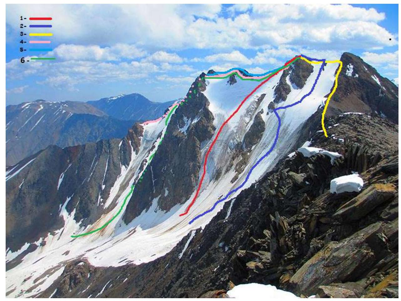
Photo 1. General view of the route
- 3B via the icefall of the northwest slope
- 3A via the S slope of the SW ridge, Moshkov.
- 1B from the Container pass, Kostryulev.
- 3A via the middle ridge of the S slope, Afanasiev.
- 3B via the right ridge of the S slope, Afanasiev.
- Passed route
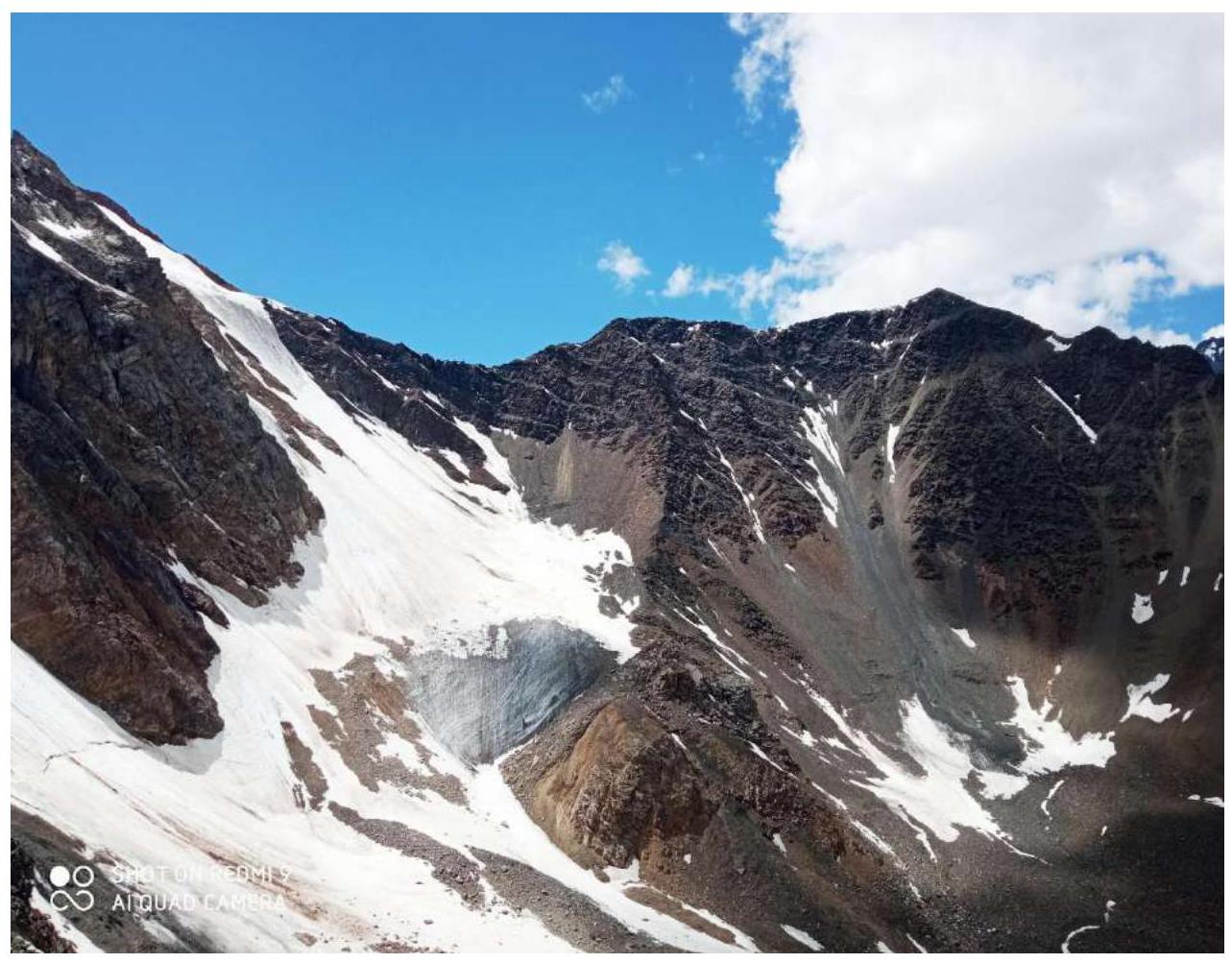
Photo 2. Photo of the route profile
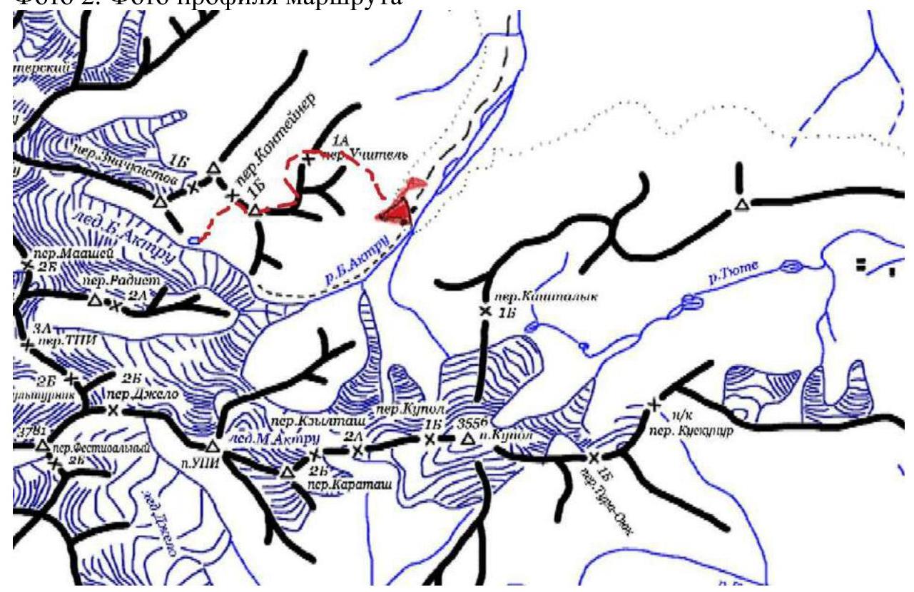
Photo 3. Route diagram
2. Characteristics of the Route
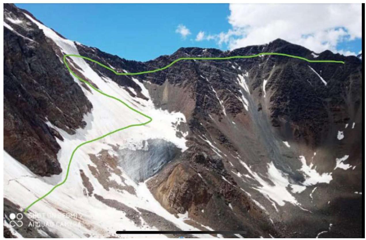
Photo 4. "Thread" of the route
Technical characteristics of route sections
Route diagram in UIAA symbols
| Sections | Length (m) | Steepness | Difficulty | UIAA | Belay |
|---|---|---|---|---|---|
| R0–R1 | 150 | 25–35° | II– | { + + + + } | Ice axes |
| R1–R2 | 300 | 40–45° | III– | { + + + + } | Ice screws |
| R2–R3 | 180 | 50–55° | III+ |  | Ice screws |
| R3–R4 | 50 | 60° | IV+ |  | Ice screws |
| R4–R5 | 65 | 65° | III+ |  | Anchor |
| R5–R6 | 400 | 15° | II– |  | Terrain |
| R6–R7 | 15 | 70° | III+ | 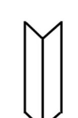 | Anchor |
| R7–R8 | 100 | 15° | II– | 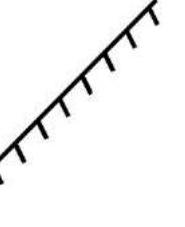 | Terrain |
| R8–R9 | 25 | 80° | IV– |  | Anchor |
Route diagram:
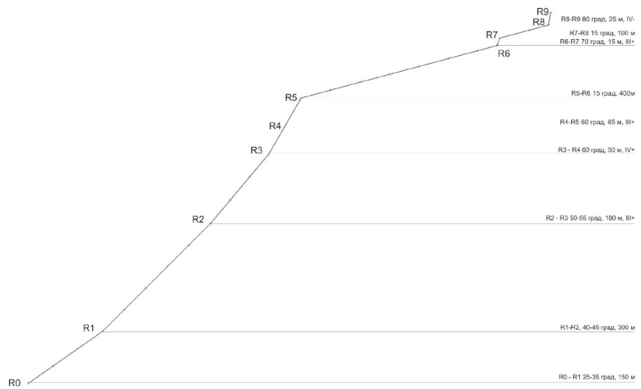
Diagram 1. Route diagram
3. Characteristics of the Team's Actions
From A/L "Aktu" move up along the wide couloir, on its right side along the old trail in the direction of Uchitel pass. The ascent to the northeast ridge on Uchitel pass takes 1.5–2 hours.
Beyond Uchitel pass, we move left down under the ice slope of the NW wall
| Section № | Description | Photo № |
|---|---|---|
| R0–R1 | Movement in rope teams, ~150 m (3 ropes), II– on a snow-ice slope 25–35° | 4 |
| R1–R2 | Movement in rope teams on a snow-ice slope, ~300 m (5 ropes), III– 40–45° | 5 |
| R2–R3 | Alternate movement on an ice slope, ~180 m (3 ropes), III+ 50–55° | 6 |
| R3–R4 | Alternate movement on an ice slope, ~50 m (1 rope), IV+ 60°, exit to the "knife", then along the knife we move to the right to the rocky internal angle | 7 |
| R4–R5 | Internal angle, 65 m, III+ climbing, 65°, belay with anchor and rock features, hook belay, exit to the ridge | 8 |
| R5–R6 | Movement along the ridge simultaneously or alternately in rope teams, approach to the gendarme, ~400 m, 15° | 9 |
| R6–R7 | Exit to the gendarme, ~15 m, III+ climbing, 70°, belay with anchor | 10 |
| R7–R8 | Simultaneous movement in rope teams along the ridge to the pre-summit ascent | 11 |
| R8–R9 | Cleft-chimney, exit to the summit. We bypass to the right, ~25 m, IV– climbing, 80°, alternate belay — anchor and rock features. | 12, 13 |
| Descent from the summit via route 1B cat. sl. to Container pass | 14 |
Note: The second group led by Makarov O.N. started the route two hours after the group led by Karlin S.F. On May 6, 2022, the alpclub "Voshozhdenie" from Barnaul, led by Trufanov Maxim Sergeevich MS in alpinism, made an ascent to the summit Kzyl-Tash via the route we pioneered. Trufanov M.S. confirms that the route we passed corresponds to the proposed cat. sl. 3B.
Route Photos:
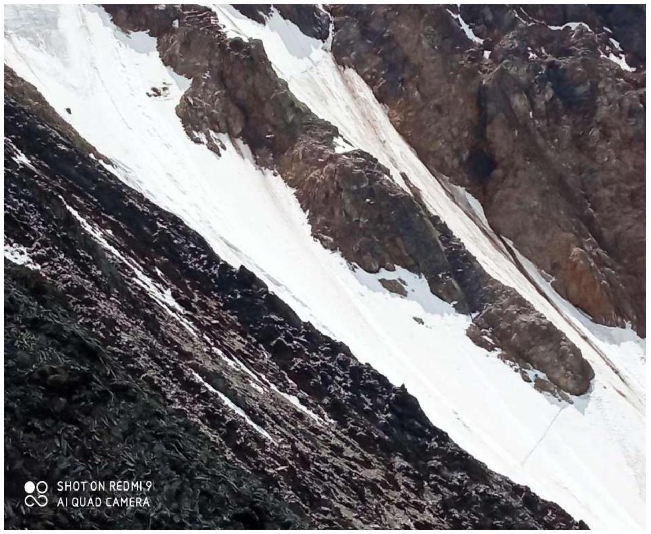
Photo 5. Route profile
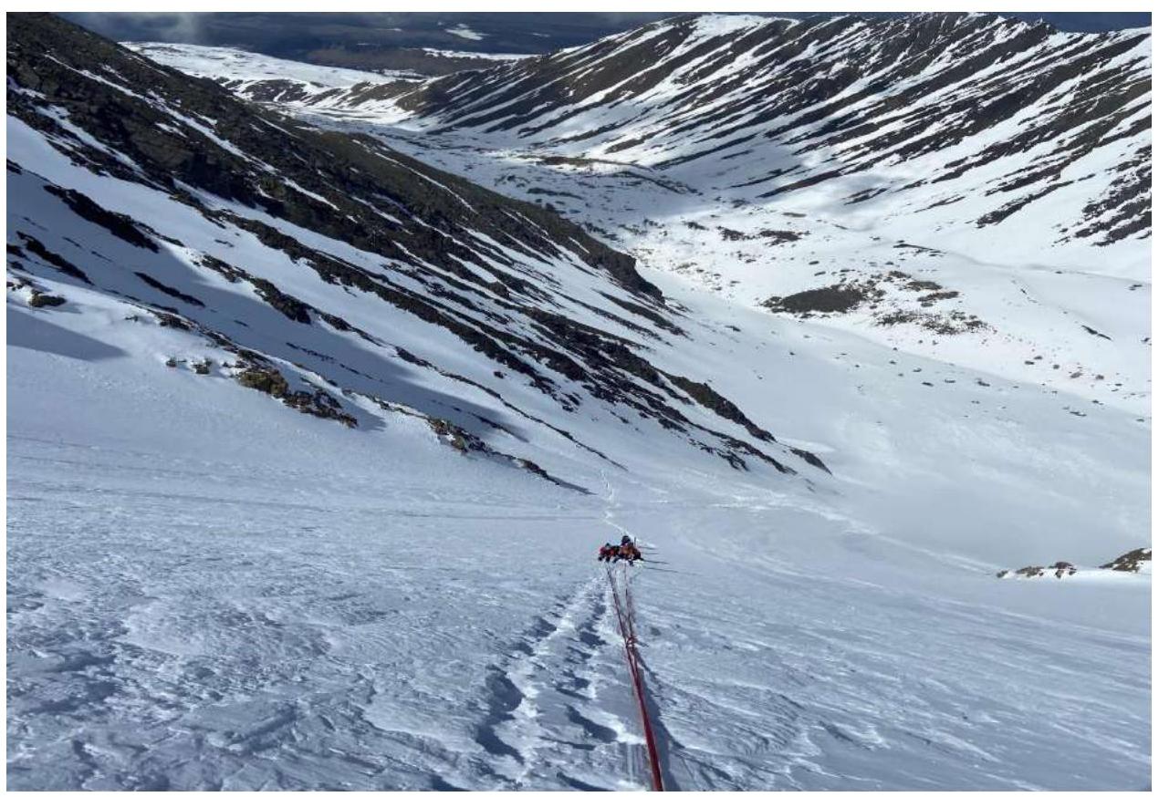
Photo 6. Section R2–R3. Work on the route.
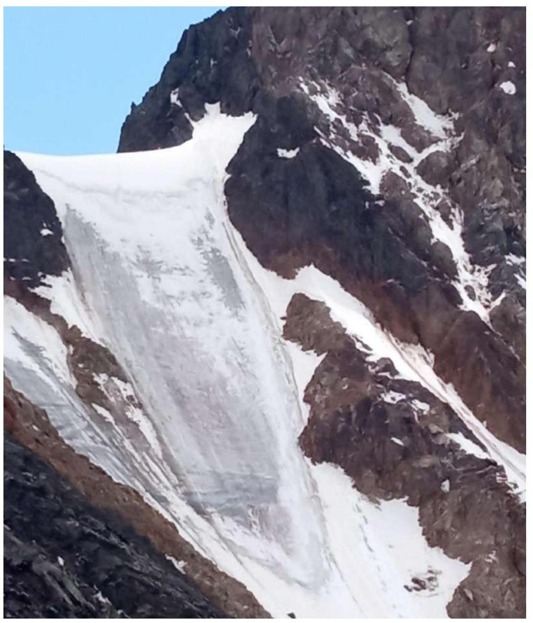
Photo 7. View of sections R2–R3 and R3–R4
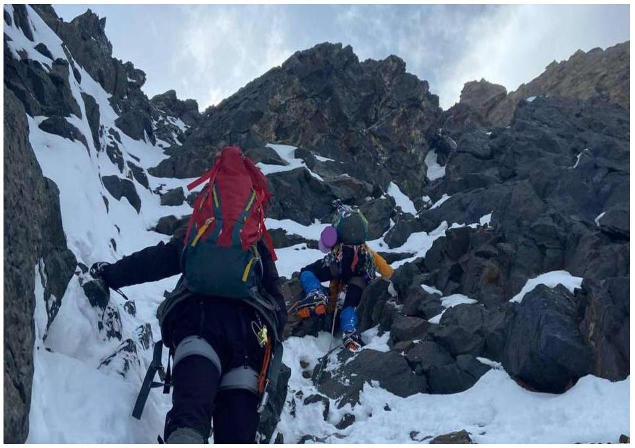
Photo 8. Rocky "key" along the internal angle.

Photo 9. R5–R6 movement along the ridge to the second gendarme (the first is bypassed on the right via loose rocks)
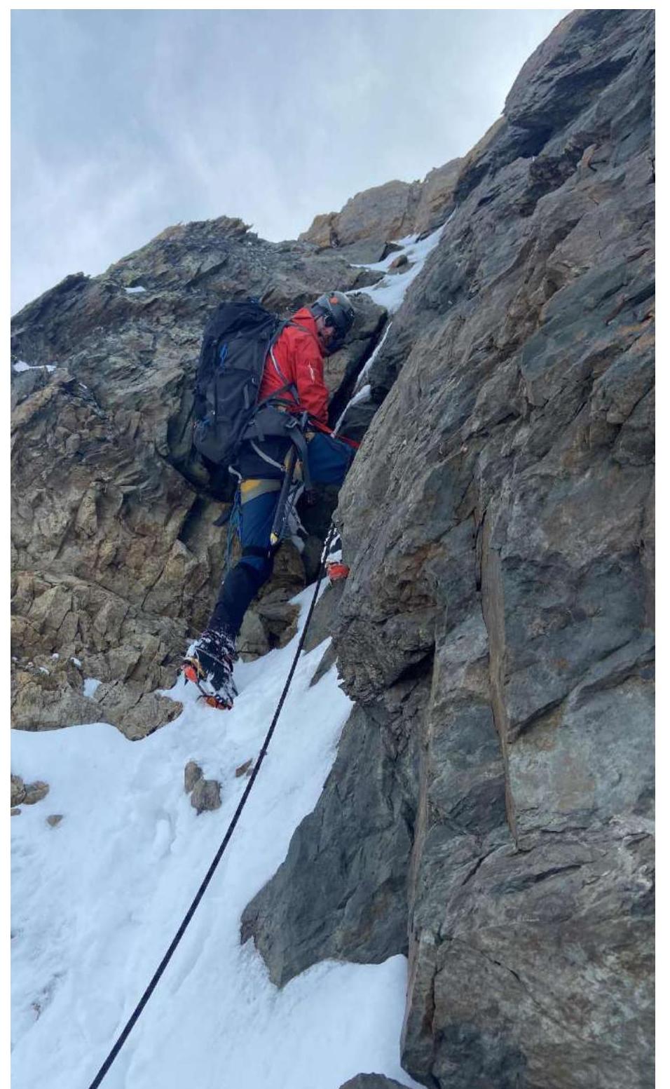
Photo 10. R6–R7 exit to the gendarme via a cleft (internal angle)
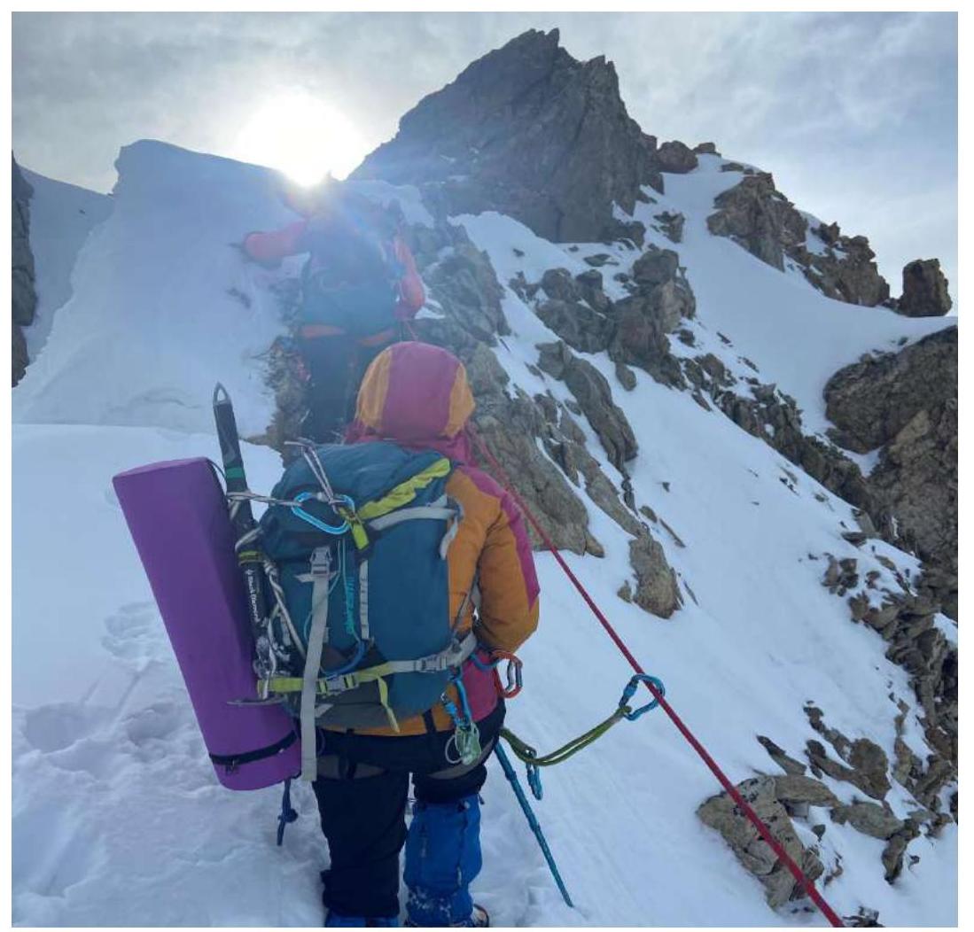
Photo 11. R7–R8 along the ridge approaching the summit.
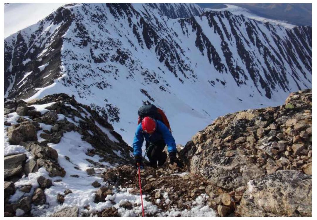
Photo 12. R8–R9 Exit to the summit.
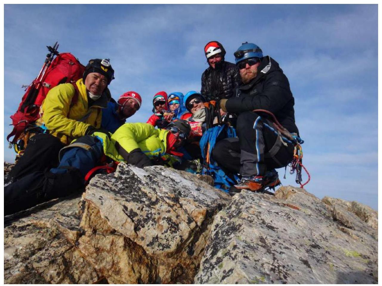
Photo 13. R9 — Summit Kzyl-Tash
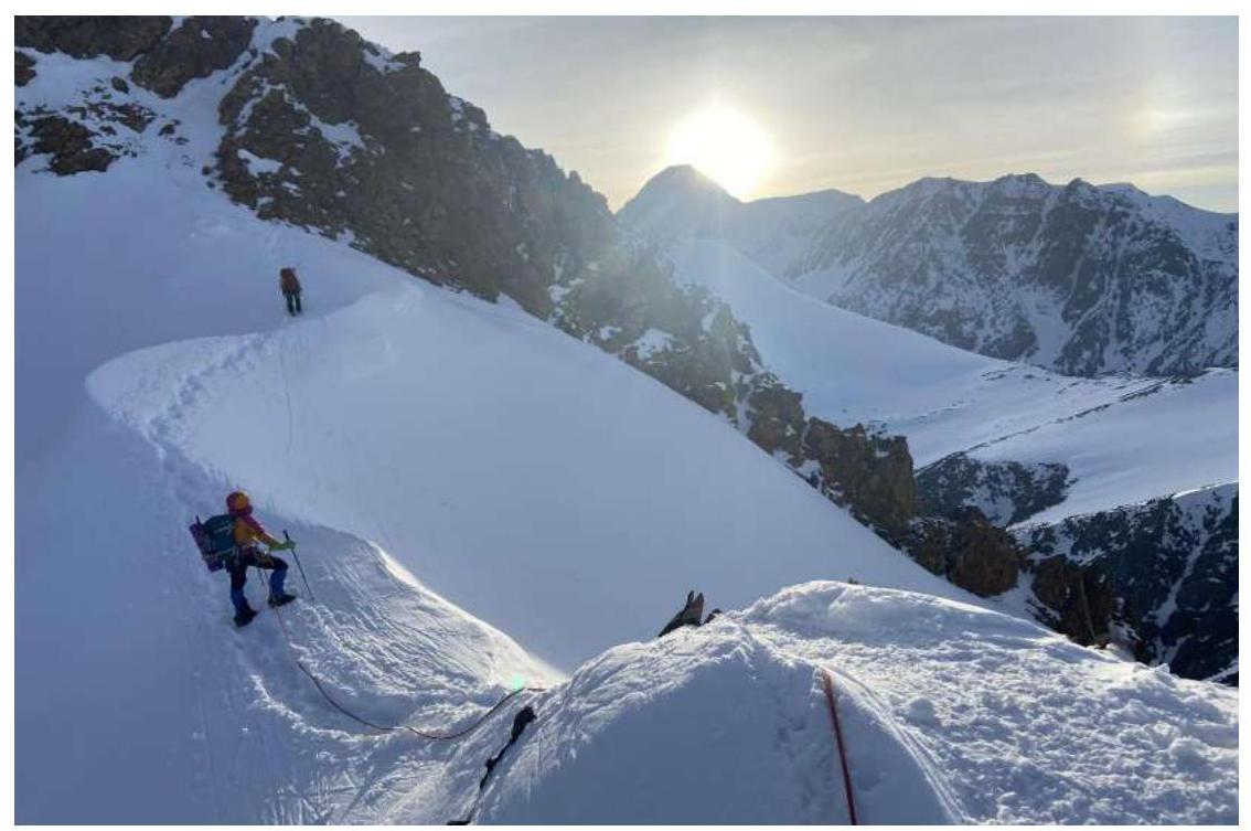
Photo 14. Descent via route 1B cat. sl.
Comments
Sign in to leave a comment