Ascent Record
- Altai, Severo-Chuysky Range, Korumdu valley, 1.2
- Rakhimova and Sibiryakova peaks via the south slope of the southeastern counterfort, 3823.1 m. Coordinates: southern summit — 50°06′43.7″ N, 87°39′46.9″ E, elevation 3855 m according to the navigator, 3823.1 m on the map. northern summit — 50°06′52.0″ N, 87°39′45.3″ E, elevation 3845 m according to the navigator, distance between the summits — 250 m.
- Proposed — 2A category of difficulty, first ascent.
- Route type: ice and snow.
- Elevation gain: 720 m (between the summit and the start of the avalanche chute, between the summit and camp 1: 830 m); length — 1700 m (between the summit and the start of the avalanche chute, between the summit and camp 1: 3500 m). Average steepness of the upper part of the route — 25–30 degrees (from camp 1 to the summit — 10–15 degrees). Elevation gain of the lower part of the route (from the top of the moraine to camp 1): 290 m, length — 800 m. Average steepness of the lower part of the route — 20–25 degrees.
- Pitons used on the route: ice screws — 7, left — 0. Of these, 3 ice screws were used on the section before camp 1.
- Team's travel time: 5 h 30 min from the start of the avalanche chute to the summit; 3 h 30 min from the "cushion" under the ridge to the summit; 7 h 50 min from camp 1 (50°06′53.1″ N, 87°41′04.1″ E) to the summit; 12 h 30 min from camp 1 to camp 1; 4 h 30 min from camp 1 to the base camp (50°07′58.8″ N, 87°42′34.0″ E).
- Team leader: Barnov Sergey Ivanovich, 1st sports category.
Team members:
- Shlyakhovoy Andrey Alexandrovich, 2nd sports category
- Drakin Andrey Valentinovich, Candidate Master of Sports
- Coach: Drakin Andrey Valentinovich, 1st category of difficulty (№68).
- Departure from the base camp: 10:30, June 24, 2018. Arrival at the glacier: 13:10, June 24, 2018. Arrival at the saddle in the counterfort gap to set up camp 1: 15:20, June 24, 2018. Departure from camp 1: 5:40, June 25, 2018. Arrival at the "cushion" under the ridge: 10:00, June 25, 2018. Arrival at the ridge: 12:00, June 25, 2018. Arrival at the summit: 13:30, June 25, 2018. Arrival at the northern summit: 14:00, June 25, 2018. Return to camp 1: 18:10, June 25, 2018. Descent via the ascent route. Departure from camp 1 to the base camp: 9:00, June 26, 2018. Return to the base camp: 13:30, June 26, 2018.
- Organization: Altai Regional Alpinism Federation gathering.
- Person responsible for the report:
Barnov Sergey. Email barnov@mail.ru, phone +7-983-555-1954.
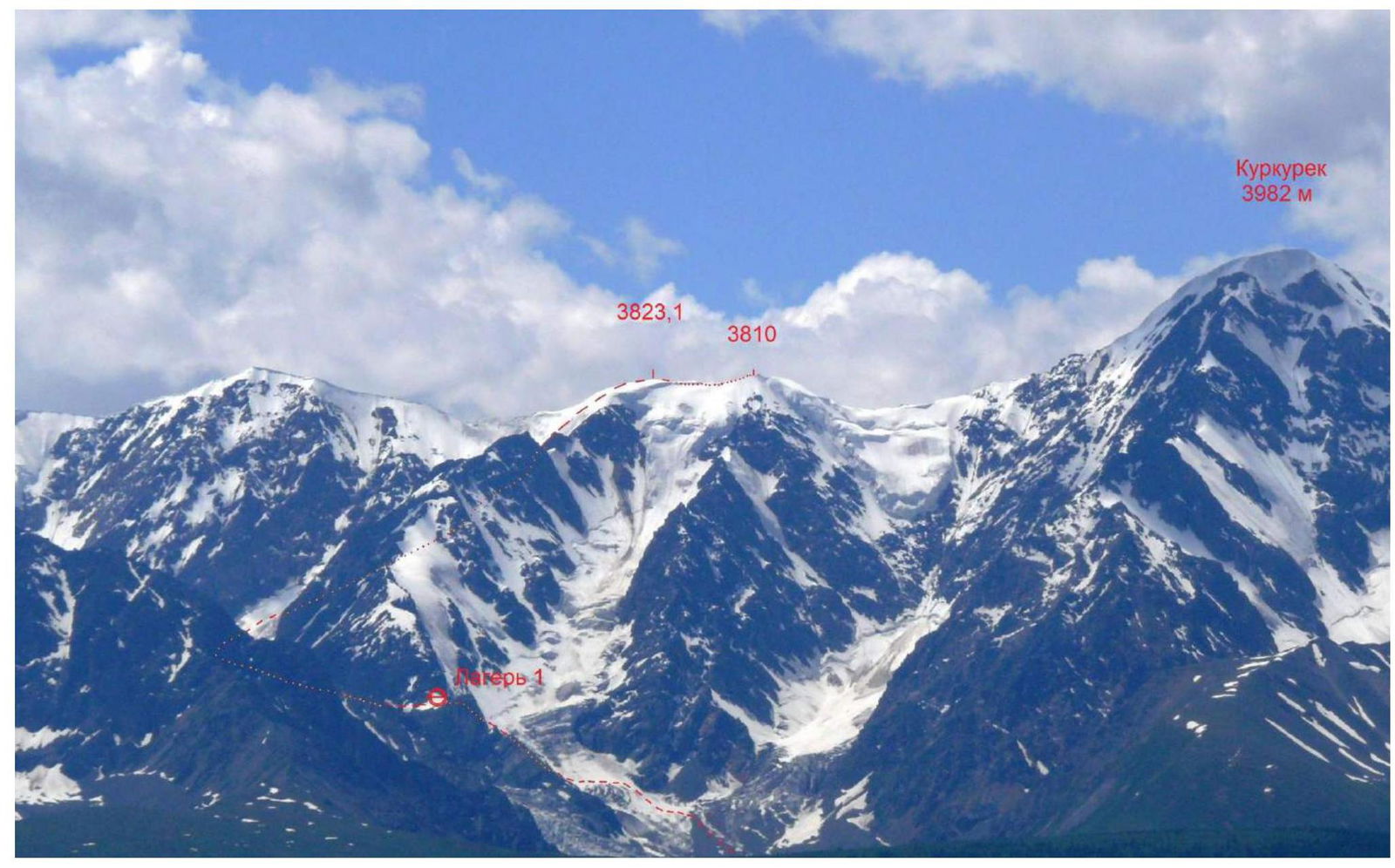
Route to Rakhimova and Sibiryakova peaks (3823.1 m) via the southeastern slope. View from the Chuysky tract. June 29, 2018, 13:27. To the right is the route to Kurkurek peak (3982 m) via the eastern ridge, category 3B.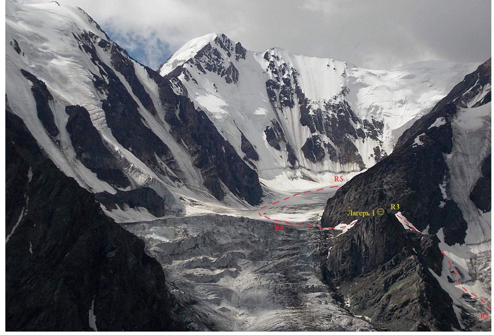
Route profile, sections R2–R3 and R3–R5.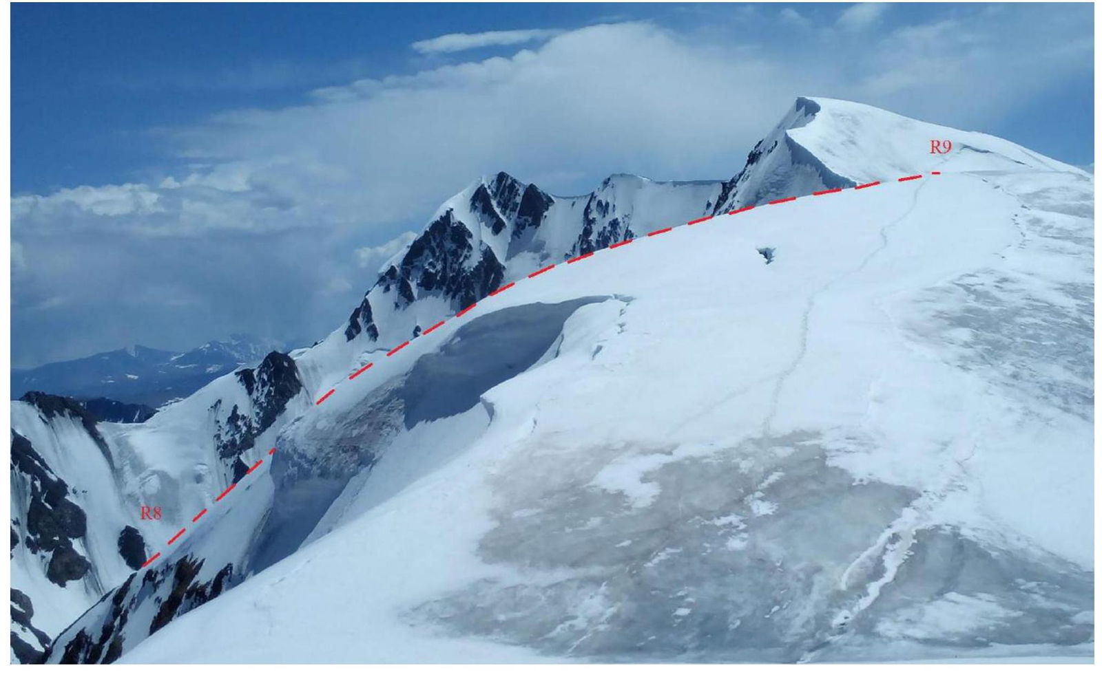
Route profile, section R8–R9.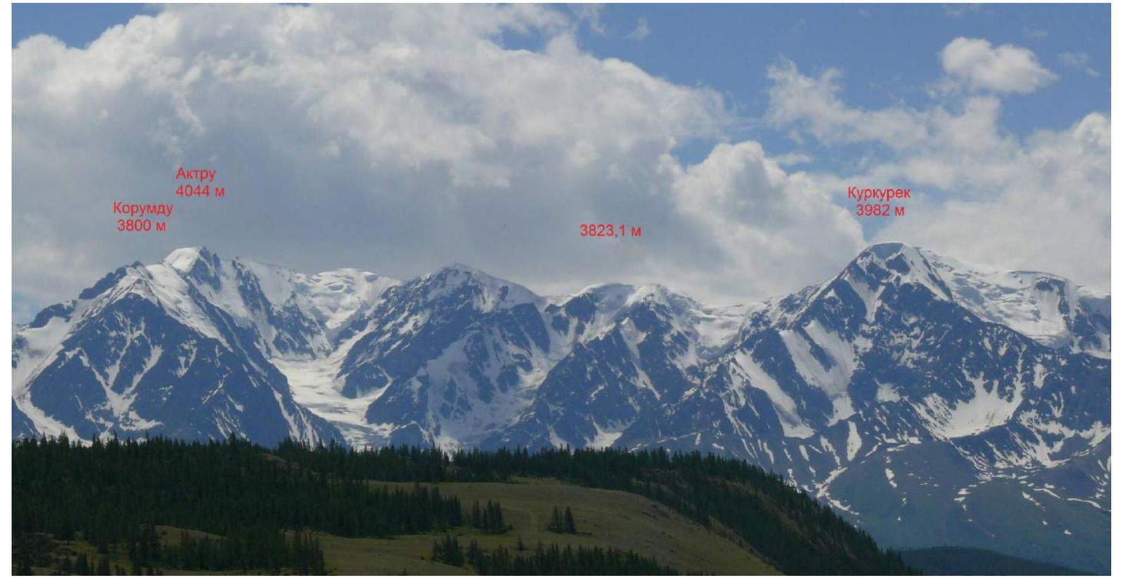
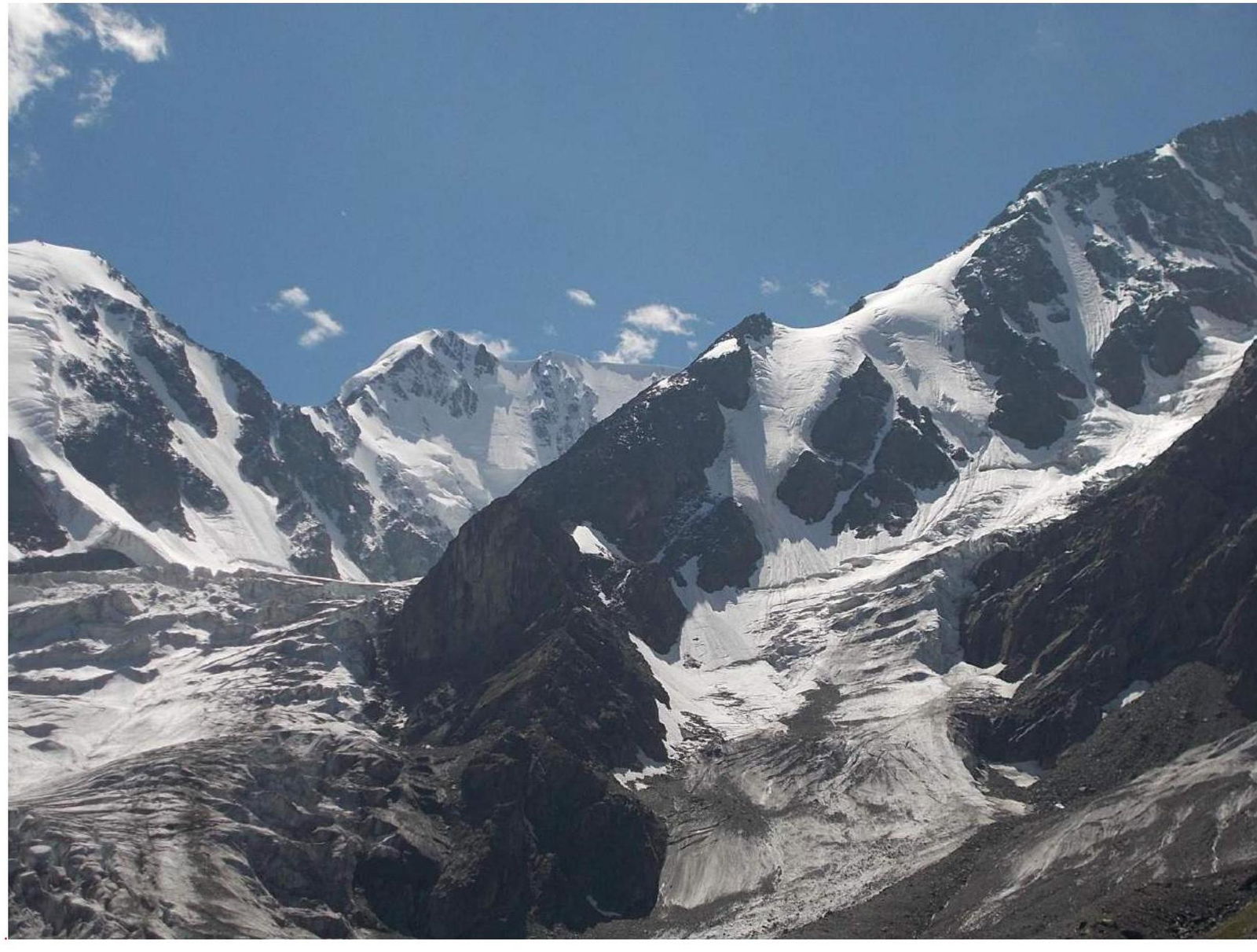
Photo panorama of the area. Korumdu (3800 m), Akturu (4044 m), Rakhimova and Sibiryakova (3823.1 m), Kurkurek (3982 m) peaks. View from the Chuysky tract. June 29, 2018, 13:42.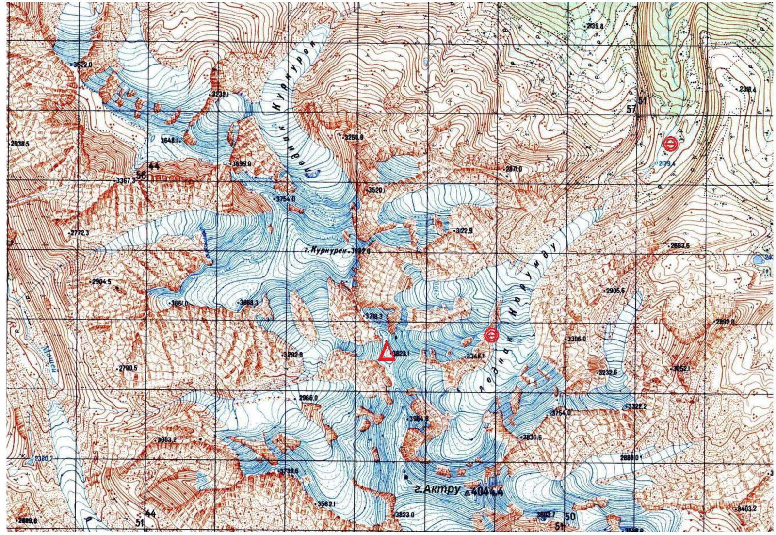
Area map, geographical coordinates of the summit (50°06′43.7″ N, 87°39′46.9″ E, elevation 3823.1 m).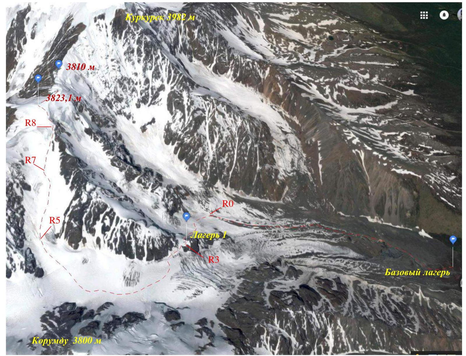
Ascent map.
| Section № | Length (m) | Steepness, degrees | Terrain characteristics | Category of difficulty | Number of pitons |
|---|---|---|---|---|---|
| R0–R1 | 250–300 m | 15–25° | Snow and ice slope, simultaneous movement, belay via ice screws | 2 | 1 |
| R1–R2 | 170–200 m | 5–10° | Snow and ice slope, simultaneous movement | 1 | - |
| R2–R3 | 300–350 m | 25–45° | Snow and ice slope, bergschrunds, increasing steepness from bergschrunds, simultaneous movement, belay via ice screws | 2 | 2 |
| Camp 1 | Elevation 3025 m. | Gap in the counterfort between the main (right) and central flows of the Korumdu glacier. | |||
| R3–R4 | 250–300 m | 0–5° | Traverse of the snow and ice slope, exit to the closed glacier, crevasses, simultaneous movement | 1 | - |
| R4–R5 | 1300–1500 m | 5–15° | Closed glacier, simultaneous belay | 1 | - |
| R5–R6 | 300–350 m | 15–20° | Closed glacier, movement along the edge of the avalanche chute, simultaneous belay | 1 | - |
| R6–R7 | 900–1000 m | 10–15° | Closed glacier, movement to the "cushion" under the ridge, simultaneous belay | 1 | - |
| R7–R8 | 200–250 m | 15–45° | Snow and ice slope, exit to the ridge above the gendarme, increasing steepness before the ridge, simultaneous movement, belay via ice screws | 3 | 2 |
| R8–R9 | 150–200 m | 15–25° | Snow and ice ridge, exit to the summit, simultaneous movement, belay via ice screws | 2 | 2 |
| R9–R10 | 250–300 m | 0–5° | Snow and ice ridge, exit to the northern summit, simultaneous movement | 1 | - |
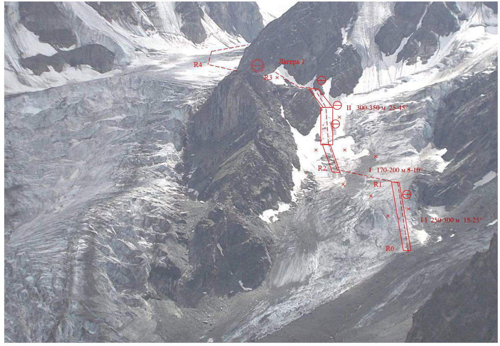
Route diagram in UIAA symbols. Sections R0–R1–R2–R3.
Route diagram in UIAA symbols. Section R3–R4.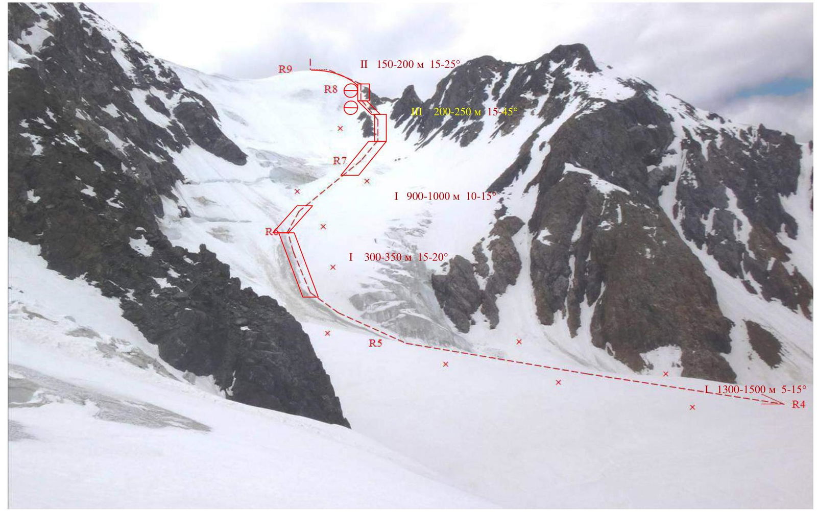
Route diagram in UIAA symbols. Sections R5–R6–R7–R8–R9.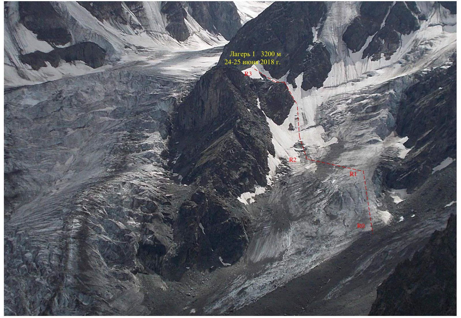
Technical photograph of the route. Sections R0–R1–R2–R3.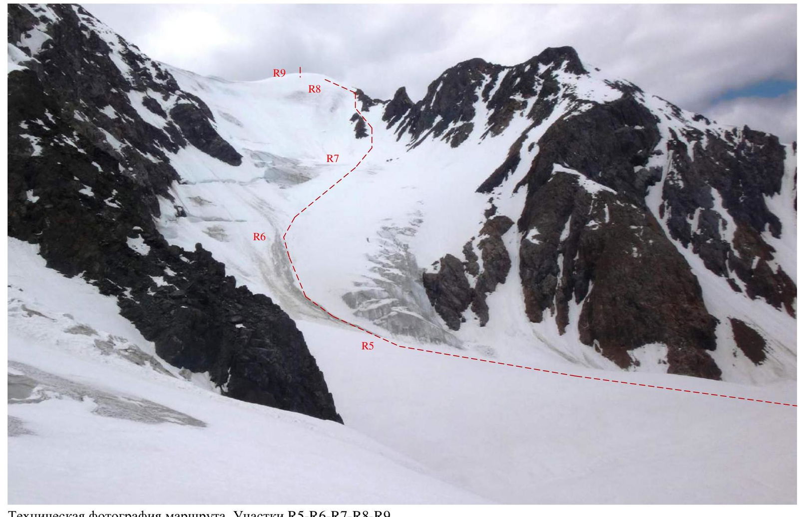
Technical photograph of the route. Sections R5–R6–R7–R8–R9. Brief description of the route passage. From the base camp, located on the left bank of the upper reaches of the Korumdu river (50°07′58.8″ N, 87°42′34.0″ E, elevation 2300 m), move towards the river source from under the glacier, then from the left moraine through the central part to the right part of the tongue of the central flow of the Korumdu glacier. At the top of the moraine (elevation 2640 m) is the start of the route. The approach from the base camp takes 3–4 hours. From here, move simultaneously upwards, leaving crevasses to the left, to the flattening of the glacier along the snow and ice slope, belay via ice screws, 300 m, steepness 15–25°. Then move left along the gentle part of the glacier to bypass crevasses from below-left and exit under the left edge of the bergschrunds, 170 m, steepness 5–10°. Then, between the rocks and bergschrunds, move simultaneously (bergshrunds and 50–100 m above, possibly in turns) towards the gap in the counterfort to the left, belay via ice screws. From the bergschrunds, there is an increase in slope steepness (attention!), then a gradual decrease to the saddle. Small bergschrunds are also found in the upper part of the slope and are bypassed on the left, along the rocks. 350 m, steepness 25–45°. Exit to a wide area, a saddle in the gap of the counterfort between the main (right) and central flows of the Korumdu glacier, a good place for an overnight stay (50°06′53.1″ N, 87°41′04.1″ E, elevation 3200 m). Camp 1.
From camp 1, transition to the right, main flow of the Korumdu glacier. Initially, traverse the snow and ice slope for about 250 m with an exit to the closed glacier, simultaneous movement. Attention, crevasses on the transition! Then move up-left along the closed glacier, first under the slopes of Korumdu peak, then along the center of the glacier, then to the right towards the mud-snow-rock chute, which is constantly replenished in the summer (several times a day), 1300–1500 m. For this reason, stay on the right edge of the dirty avalanche chute, 300–350 m, simultaneous movement. In the absence of visibility, there is difficult orientation and a danger of crevasses.
After the chute, move up-right towards the saddle in the ridge of the counterfort to the left and above the upper gendarme ("toad") to the characteristic "cushion" above the bend at an elevation of 3450 m, 900–1000 m, simultaneous movement. From the "cushion", exit to the ridge 200–250 m, before the ridge, a significant increase in steepness to 45°, nevertheless, simultaneous movement with belay via ice screws is possible.
From the saddle, move left along the ridge. Attention: on the saddle and a little above, there is a sharp steep drop to the north without the possibility of belaying through outcrops! Stay at a safe distance from the right edge.
Movement along the ridge is simultaneous with belay via ice screws 150–200 m to the summit. The summit is in the form of a snow and ice dome, there is no possibility to build a cairn; to do this, it is necessary to descend to the northern summit 250–300 m away, which is 10–15 m lower. Simultaneous movement. Attention – cornices to the east!
From the summit, Korumdu (3800 m), Akturu to the south (4044 m), Kurkurek (3982 m) to the north, Karagem (3962 m), and Maashay (4177 m) are clearly visible in good visibility.
Descent — via the ascent route. In poor visibility, there may be problems with orientation on the dome; do not wait for the tracks to be snowed under.
The main hazards on the route are closed crevasses, especially when transitioning to the glacier and back above camp 1, and difficulties with orientation in poor visibility on certain sections.
Preliminary assessment of the route — 2A. Photo illustration of the report.
To the left is Korumdu peak, to the right is Akturu peak. Photo taken on August 11, 2016. To the right are sections R0–R1–R2–R3.
Camp 1. Elevation 3025 m. Photo taken on June 24, 2018, from the Korumdu glacier (from the main, right flow, R4).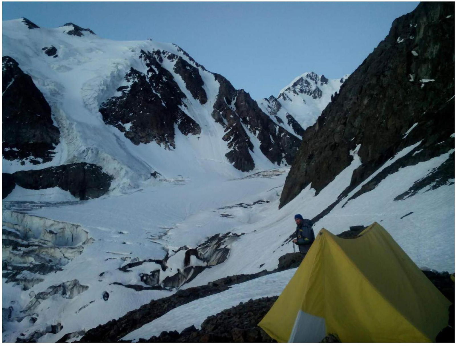
Camp 1. To the left is Korumdu peak, to the right is Akturu peak. In the center is the main (right) flow of the Korumdu glacier. Photo taken on June 25, 2018. Elevation 3025 m. Section R3–R4.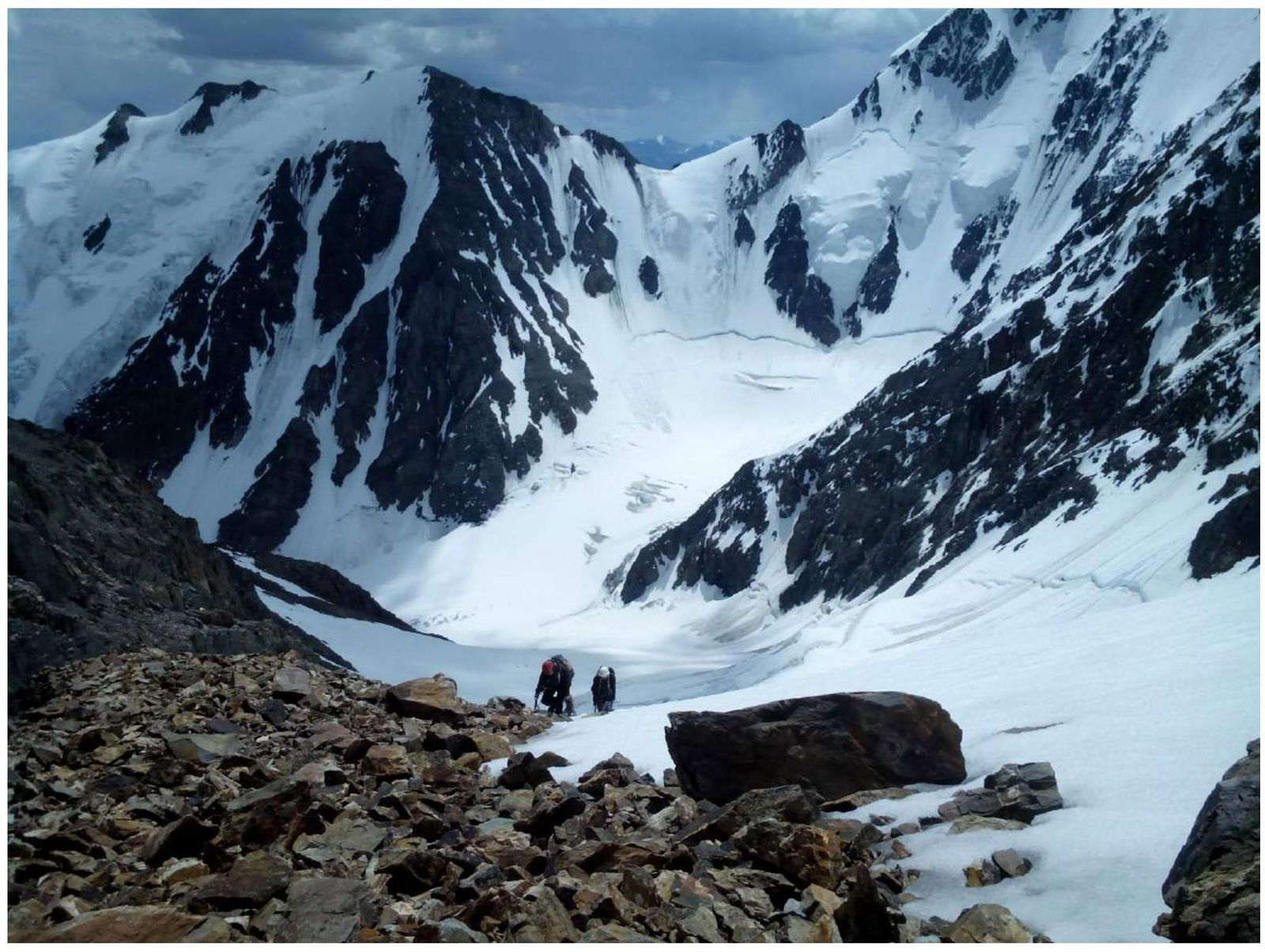
Exit to the ridge. To the left is Korumdu peak. Photo taken on June 25, 2018. Section R7–R8.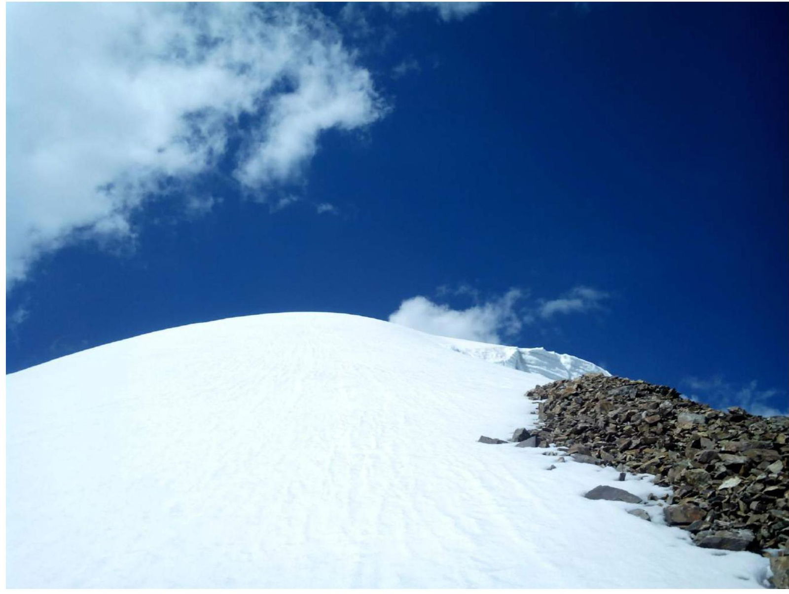
Sumit ridge. Photo taken on June 25, 2018. Section R8–R9.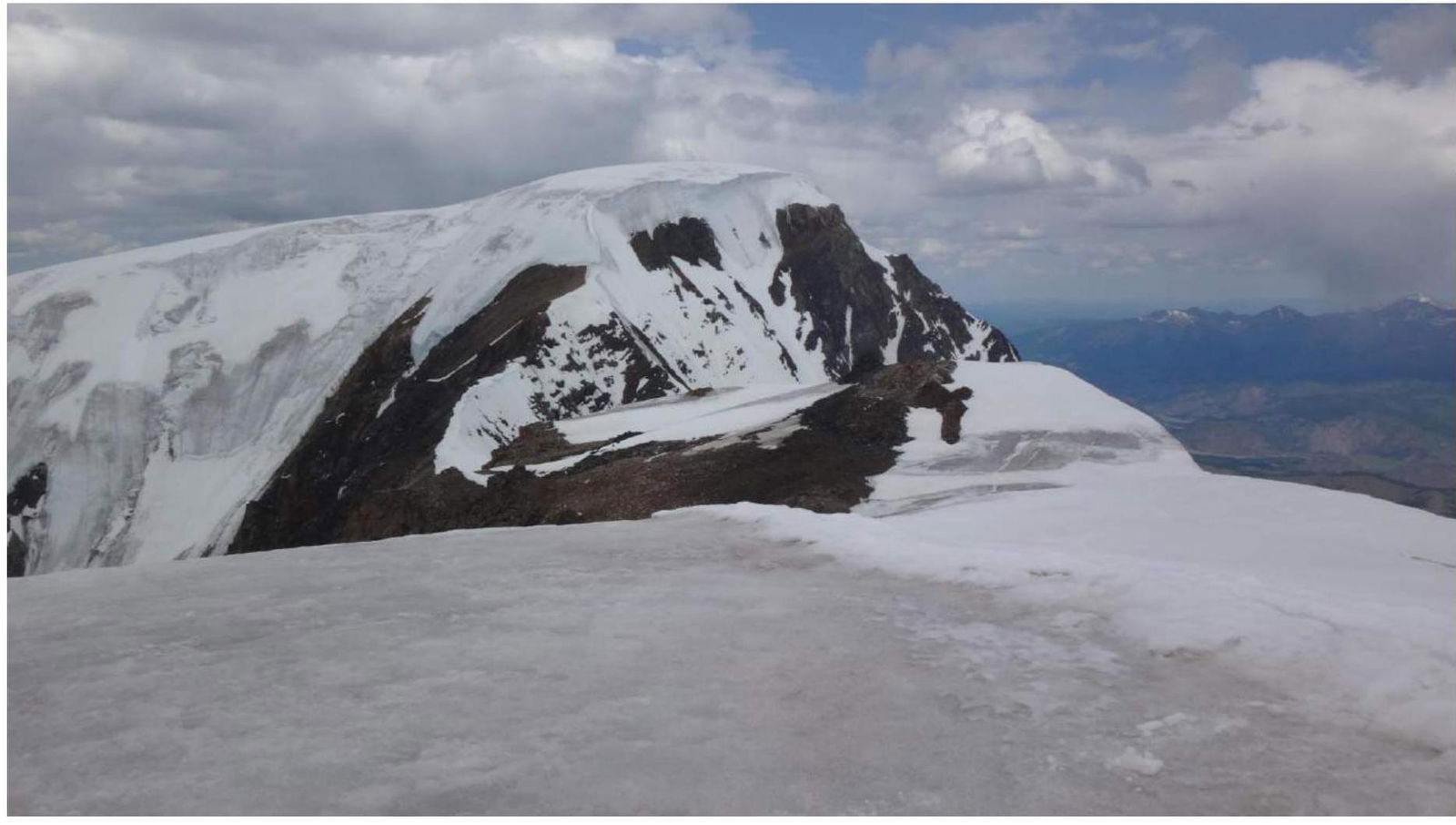
Kurkurek peak. Photo taken from the summit on June 25, 2018. Section R9–R10 to the northern summit.
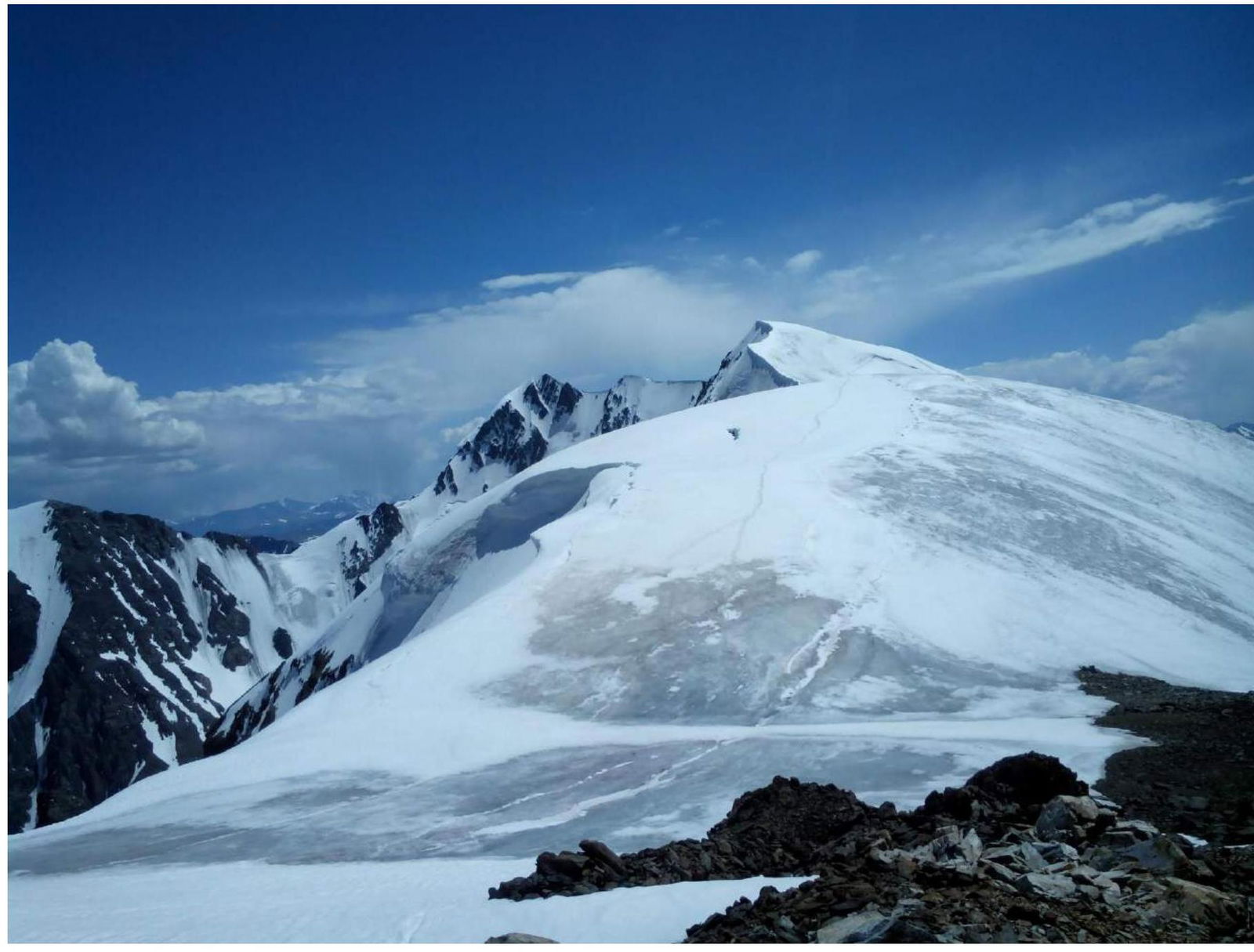
Ridge between the southern and northern summits of Rakhimova and Sibiryakova. Photo taken on June 25, 2018. Section R9–R10 from the northern summit. To the left is Korumdu peak, in the center is Akturu peak.
Notes:
Due to the route being passed from different sides of the southeastern counterfort, the route profile (sheet 2, page 3) is shown in sections on 2 pages.
For the same reason, the technical photograph of the route, which provides visibility of the main relief of the route (sheet 4, page 7), is also shown in sections on 2 pages. Both technical photographs are attached in two copies (with the route thread and without the thread, since the photograph with the thread is obtained by processing on a computer, and according to the requirements, it is necessary to attach an unprocessed computer file in special programs).


