
UPI Peak
3603 m
07451
Report of the Kemerovo Region team (FACO) on the ascent to UPI Peak via the right part of the NW slope "3B", (k)
Participants:
Gette V.M. Zubkov A.Yu.
Ascent Passport
- North-Chuya Ridge, Aktru valley.
- UPI Peak, via the right part of the NW slope.
- First ascent, proposed 3B category of difficulty.
- Route type: combined.
- Route height difference — 500 m.
Route length — 1000 m.
Section lengths:
- 2nd category of difficulty — 100 m.
- 3rd category of difficulty — 730 m.
- 4th category of difficulty — 170 m. Average steepness:
- main part of the route — 50°
- Pitons used on the route:
- ice screws — 56 pcs., incl. ITO — 0 pcs.
- Team's walking hours: 1 hour, 1 day.
- Leader:
- Gette Vyacheslav Maksimovich — 2nd sports category Participant:
- Zubkov Alexey Yuryevich — 2nd sports category
- Coach: Chashchina O.N.
- Departure from Aktru Base Camp: 5:00, July 7, 2012. Start of work on the route: 11:00, July 7, 2012. Reaching the ridge: 16:40, July 7, 2012. Reaching the summit: 17:00, July 7, 2012. Return to Base Camp: 20:00, July 7, 2012.
- Organization: Kemerovo Region Alpine Federation Public Organization.
Photo of the general view of the peak
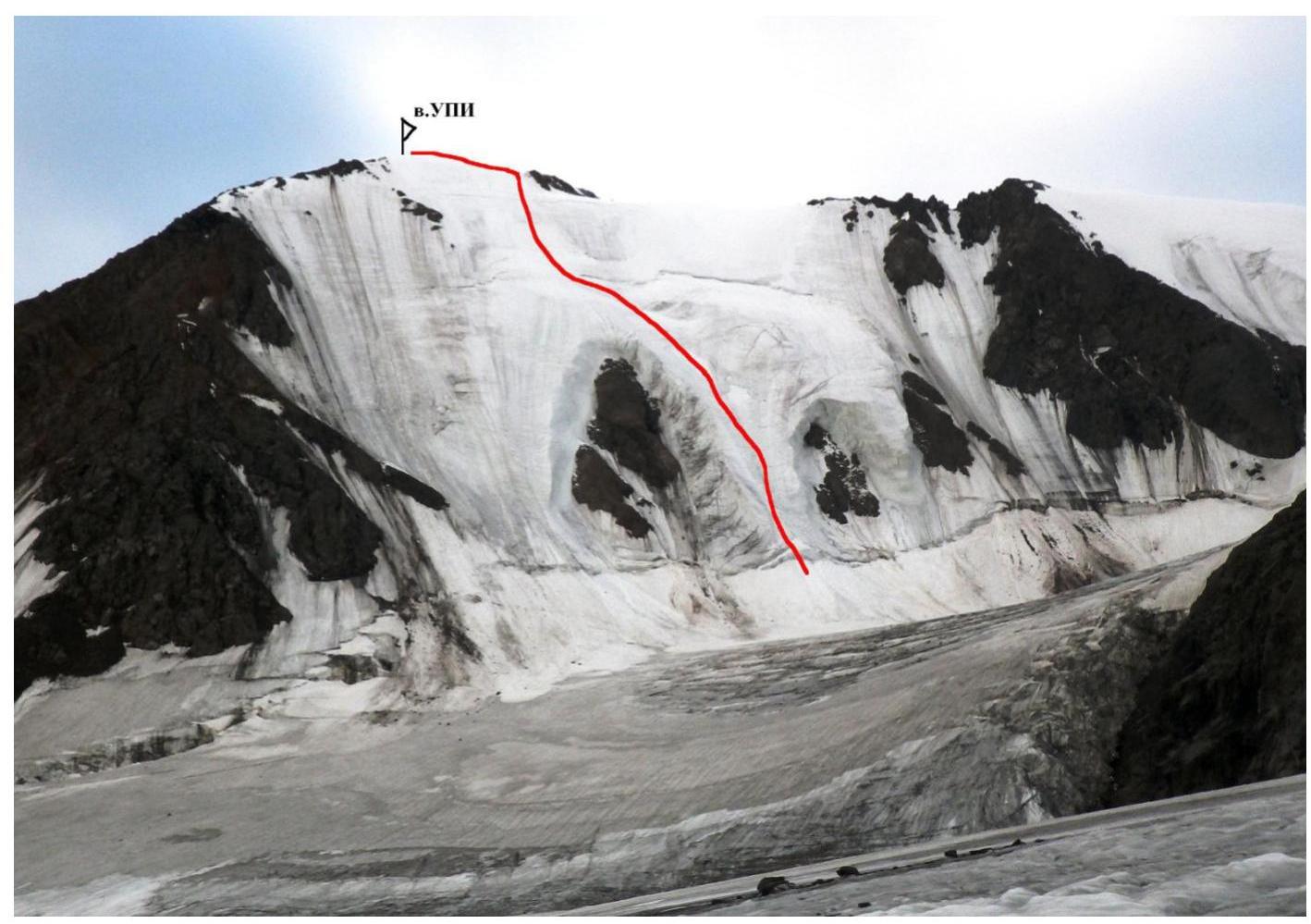
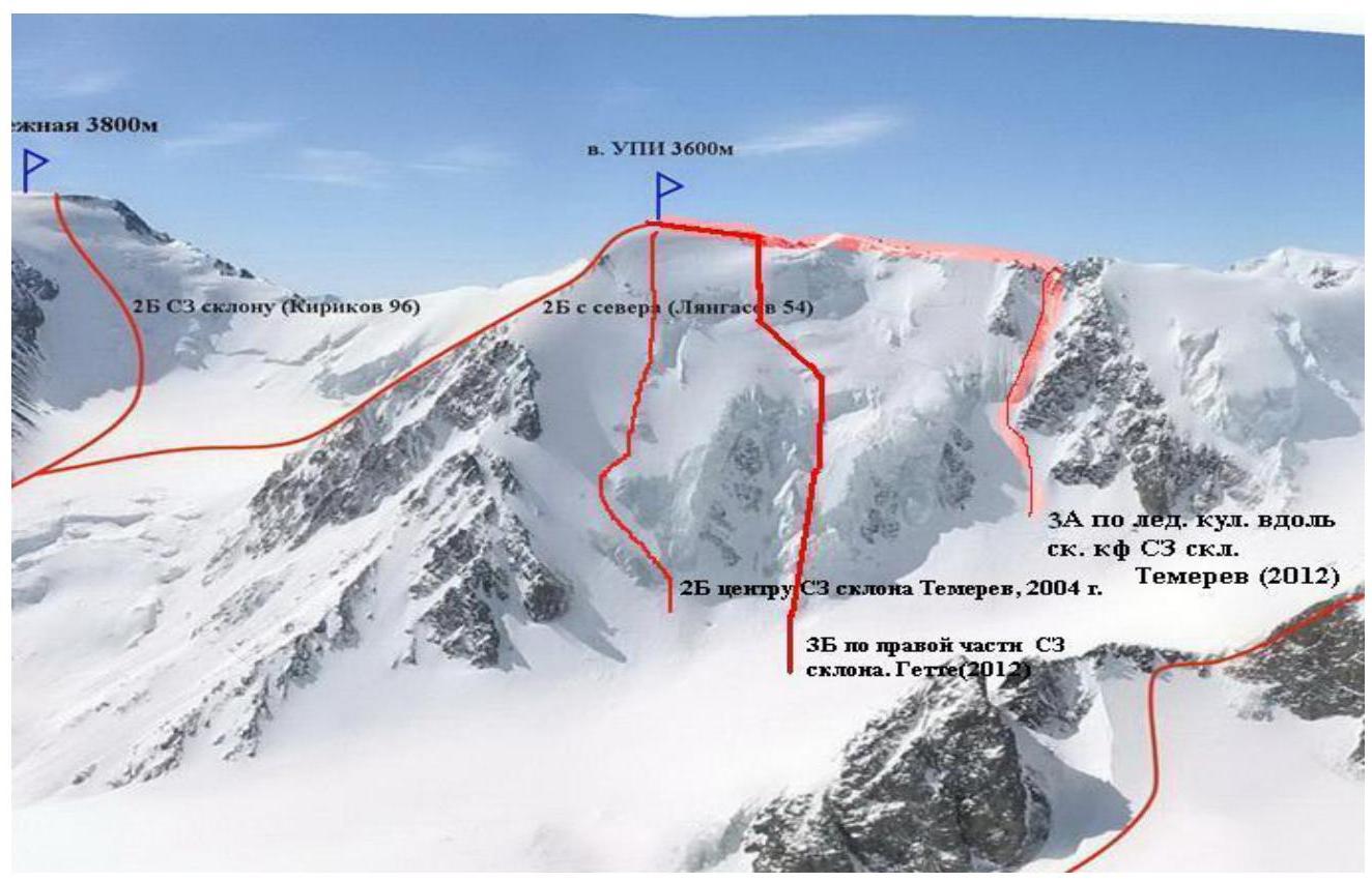 Photo of the route profile
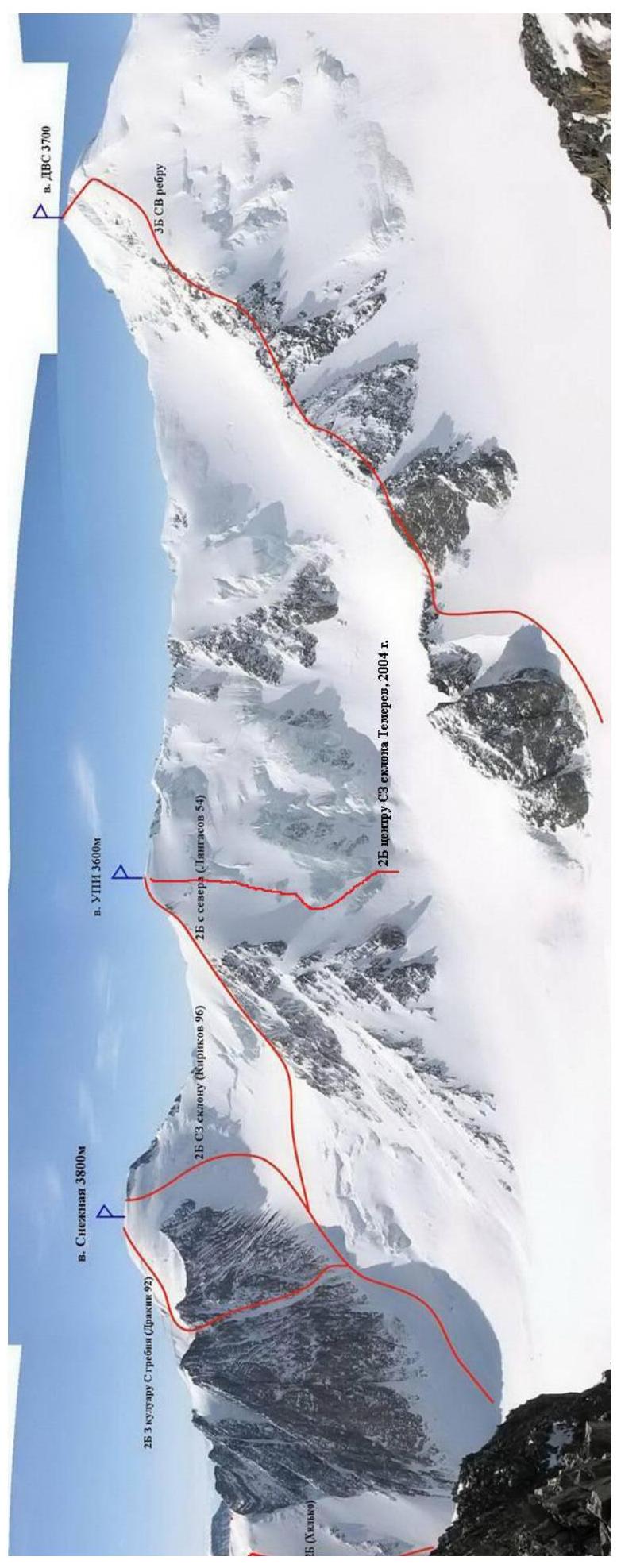
 Panorama photo of the area
 UIAA symbol diagram of the ascent route

Route description by sections
From Aktru alpine camp, move towards the "ram's foreheads" below Radistov Peak and Kyzyl-Tash Peak. (About 1.5 hours). Leave the trail, cross the river (recommended early in the morning when the water level is lower than during the day and does not exceed knee level) in summer, or via a snow bridge in winter, which flows out of Bolshoy Aktru glacier, and move along the moraine ridge under Radistov Peak's slope towards Khitsan on the left bank of Bolshoy Aktru glacier. Ascend the glacier to the western end of Khitsan (stay roped, as there are many crevasses). Here, you can leave excess gear. It takes about 2-2.5 hours from the "ram's foreheads". Cross the glacier while roped and approach the slope, which takes about 20-30 minutes. You will see a counterfort on your left and three groups of rocky outcrops; enter between the first and second outcrops — this is the start of the route.
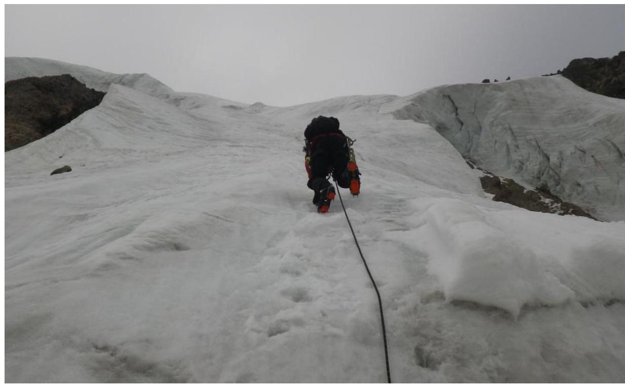
R1: 450 m, 3+, 45–50°. Overcome the bergschrund (filled with snow); further movement for sports groups of two is recommended to be simultaneous with protection via ice screws; for groups of more than three, movement with fixed ropes is recommended, up the center of the ice slope. The first section takes 2-2.5 hours.
R2: 180 m, 3, 35–40°. Diagonal traverse left across the ice slope with a gain in height. For sports groups, this is done on ice axes with protection via ice screws; for groups of more than three, movement with fixed ropes is recommended. Beyond this, the slope becomes steeper than the second section. The second section takes 1-1.5 hours.
R3: 170 m, 4, 55–60°. For sports groups, movement is recommended with lower protection via ice screws; the second climbs on a jumar. For groups of more than three, movement with fixed ropes is recommended. The third section takes 1-1.5 hours.
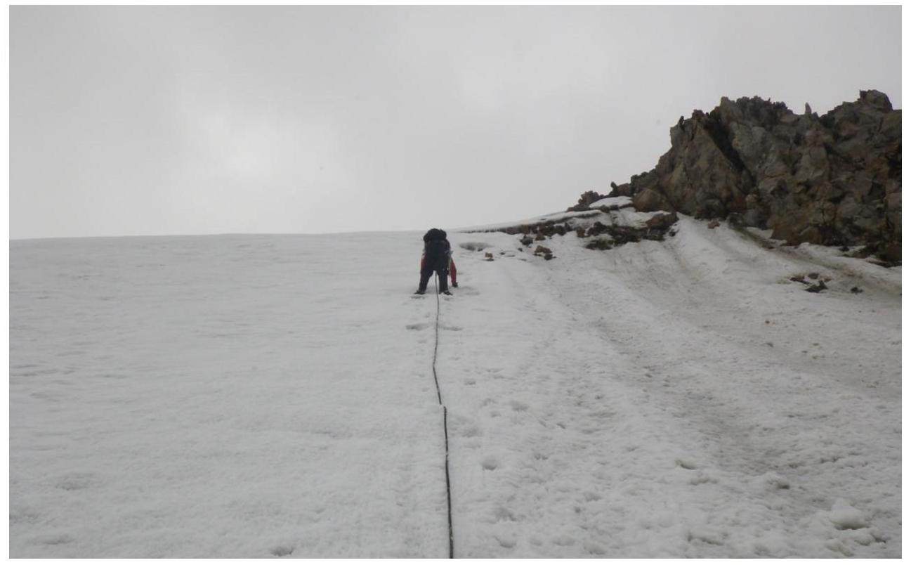
R4: 200 m, 2-3. Simultaneous movement in a rope team using crampons along the rocky-icy ridge. The fourth section takes 30-40 minutes.
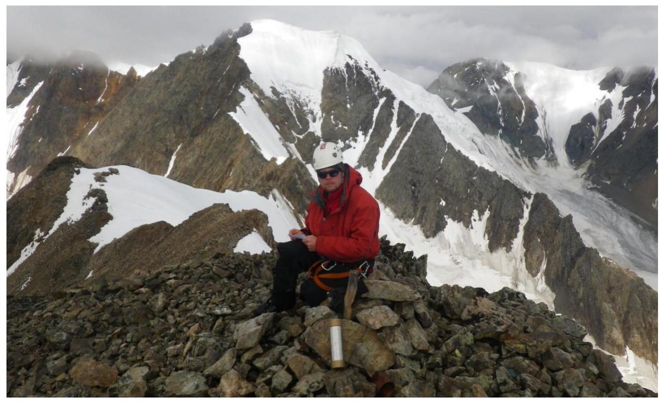
Descent from UPI Peak (3603 m) via route 2B, down the center of the NW slope as per Temereva 2004. Found the bank without a note in the summit cairn.
Photos of route sections
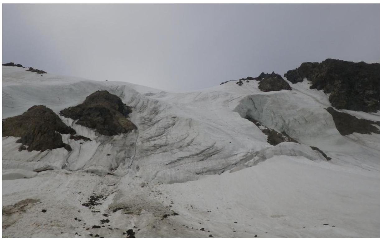
View under the start of the route
On R1

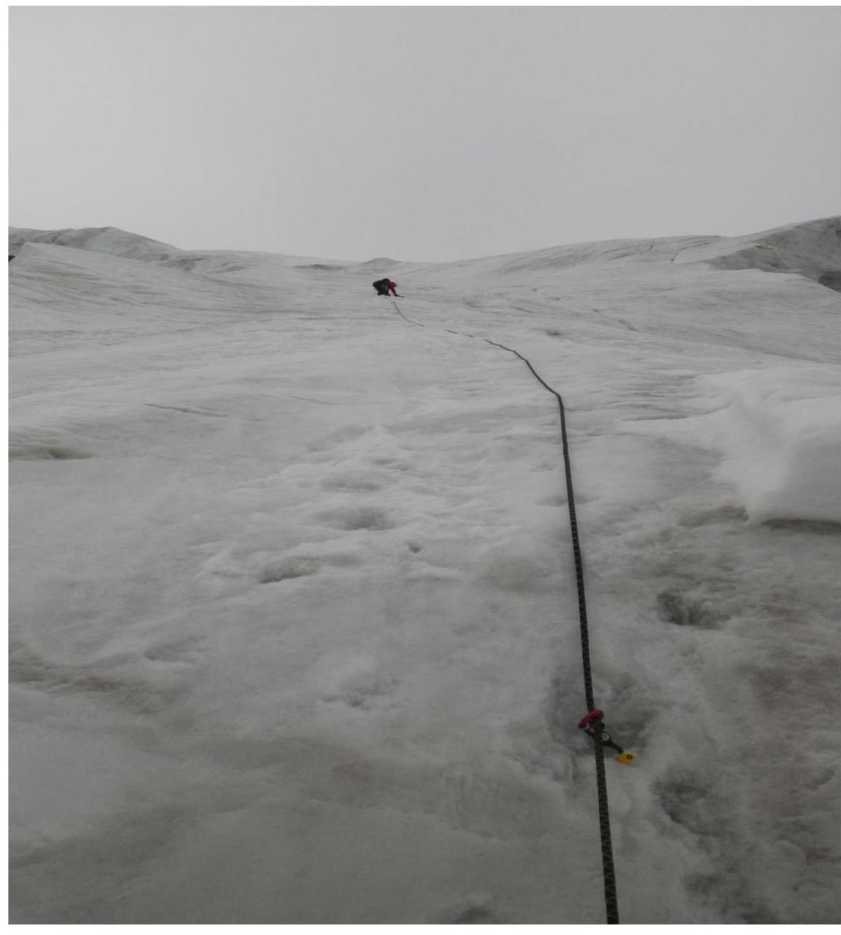
On R3
On UPI Peak

Comments
Sign in to leave a comment