
V. UPI
3603 m
REPORT
of the Tomsk Region team (TFA) on completing the ascent to v. UPI via the ice gully along the rock buttress on the NW slope "4A" (k)
Participants
Temerev I.M. Lizin I.S.
ASCENT DETAILS:
-
North-Chuya Ridge, Aktru valley, 102
-
Peak UPI, via the ice gully along the rock buttress on the NW slope.
-
First ascent, proposed category 4A.
-
Route type: combined.
-
Elevation gain: 453 m. Route length: 1120 m. Section lengths:
- Category III: 520 m
- Category IV: 250 m
- Category V: 30 m
Average slope: main part of the route (ice gully) — 50°
-
Pitons used:
- ice screws — 30 pcs, including ITO — 0 pcs;
-
Team's total climbing time: 1 day.
-
Leader:
- Temerev Ivan Mikhailovich — Candidate for Master of Sports Participant:
- Lizin Ilya Sergeyevich — 3rd sports category
-
Coach: Novoselova G.V.
-
Departure from Aktru base camp: 5:00, August 5, 2012. Start of work on the route: 11:00, August 5, 2012. Reaching the ridge: 15:40, August 5, 2012. Reaching the summit: 16:40, August 5, 2012. Return to base camp: 20:00, August 5, 2012.
-
Organization: Tomsk Alpinism Federation.
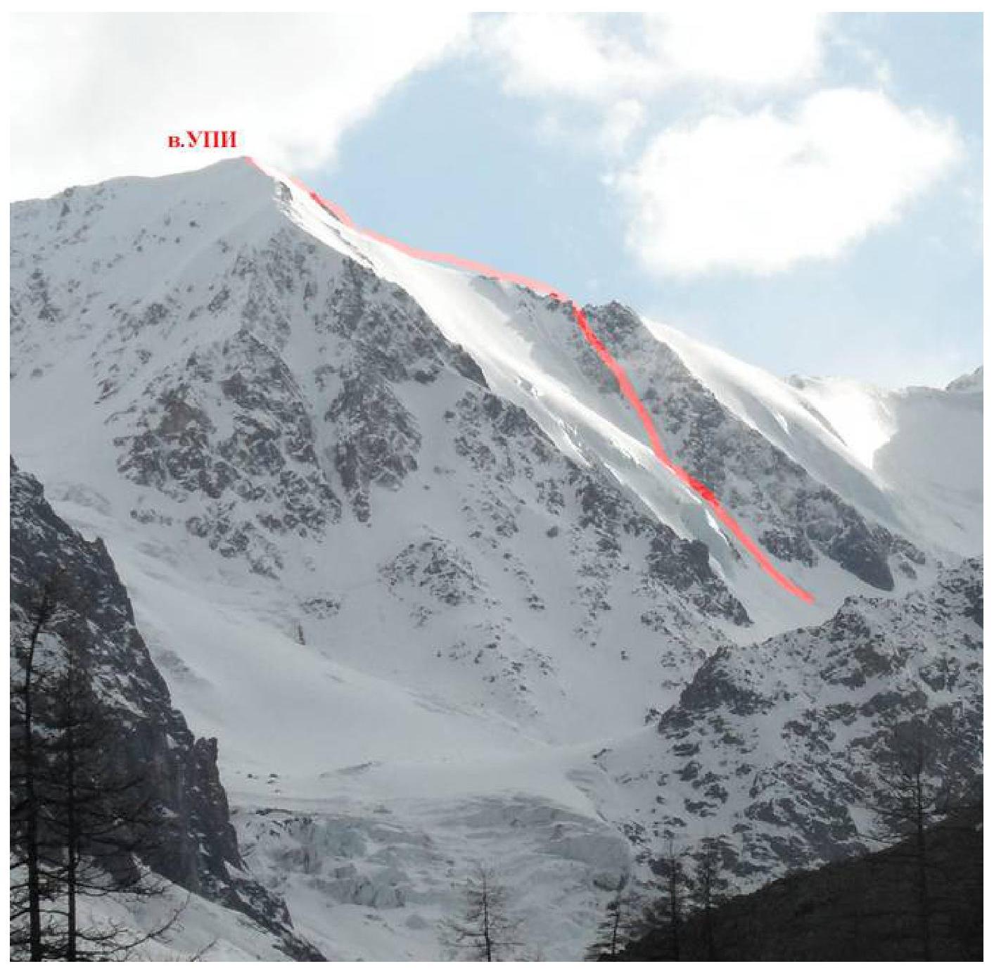
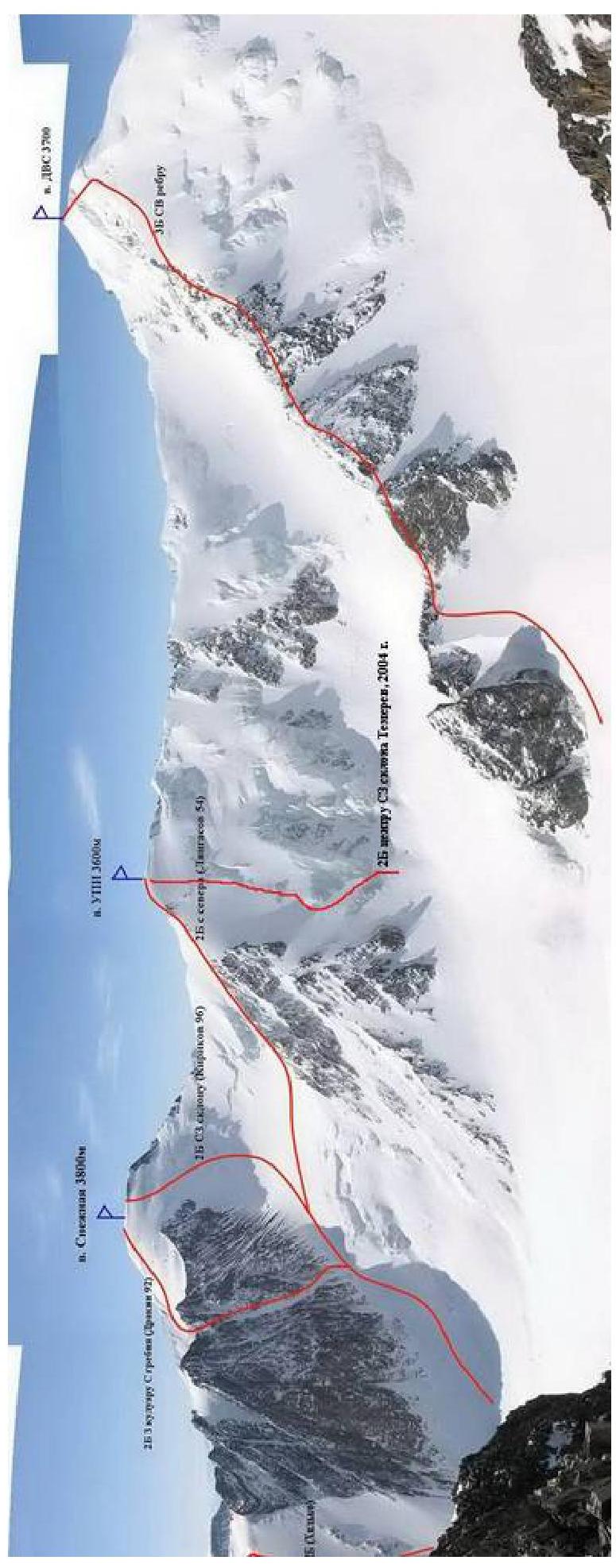
General view of the summit
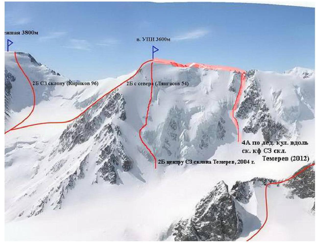
Route profile photo.
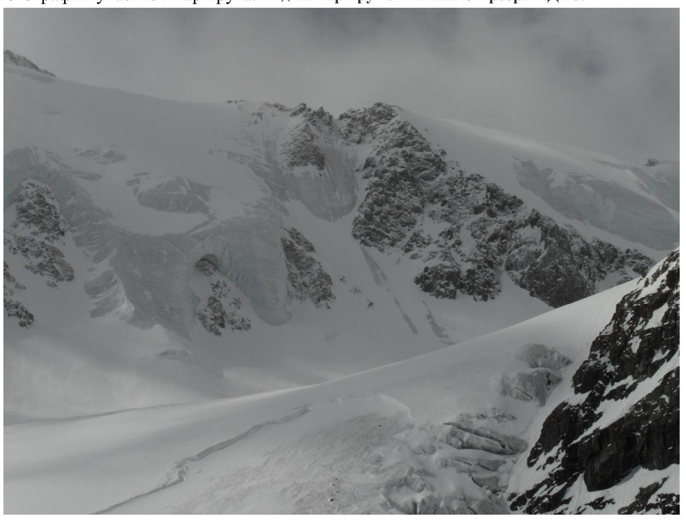
Panorama of the area.
Route diagram in UIAA symbols
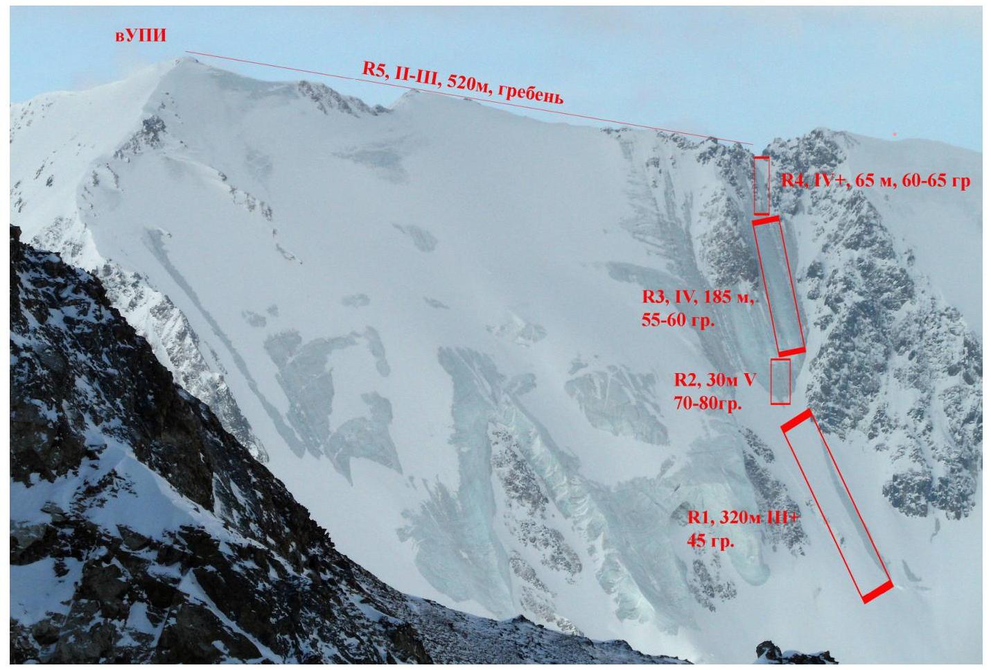
Route description by sections
From Aktru camp, head towards the "ram's foreheads" near peak Radistov and Kyzyl-Tash (about 1.5 hours). Leave the trail, cross the stream flowing from Big Aktru glacier, and move along the moraine under the slope of peak Radistov towards Khitcan on the left bank of Big Aktru. Ascend the Big Aktru glacier to the western end of Khitcan. This is where you can leave excess gear. It takes about 1.5–2 hours from the "ram's foreheads". Cross the glacier and approach the start of the ice gully running along the rock buttress to the ridge between peak UPI and peak DVS.
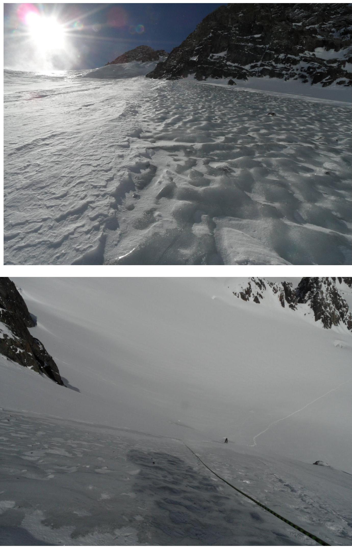
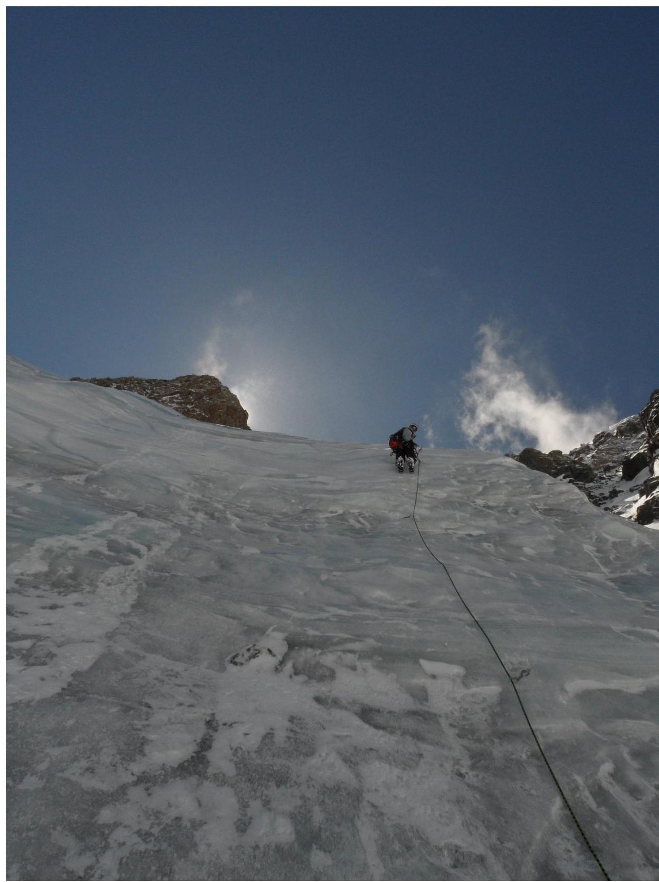
- R1 320 m, 3, 45°: Overcome the bergschrund and, shielded by the rock buttress "claw", ascend simultaneously with protection via ice screws up the ice gully. Closer to the rock "claw", there are many small stones in the ice — be careful when choosing a spot to screw in the piton.
- R2 30 m, 5, 70–80°: Ice face. Ascend using ice axes. The slope becomes less steep after this section but remains steeper than the first part.
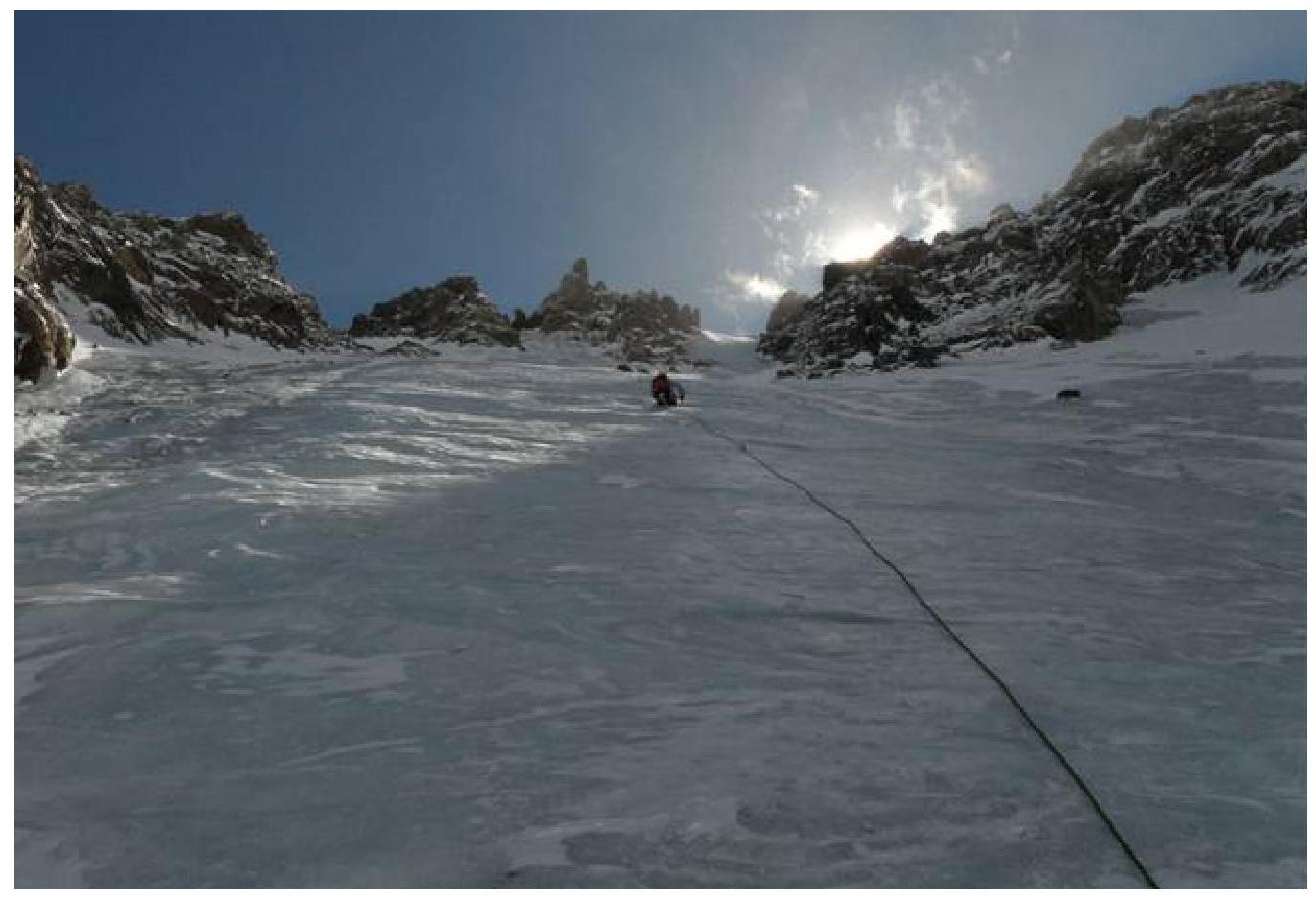
- R3 185 m, 4, 55–60°: Alternate climbing. Rocks lie in the ice under the cliffs above. There is a risk of stones thawing out in summer. It's recommended to observe the slope throughout the day before starting the ascent.
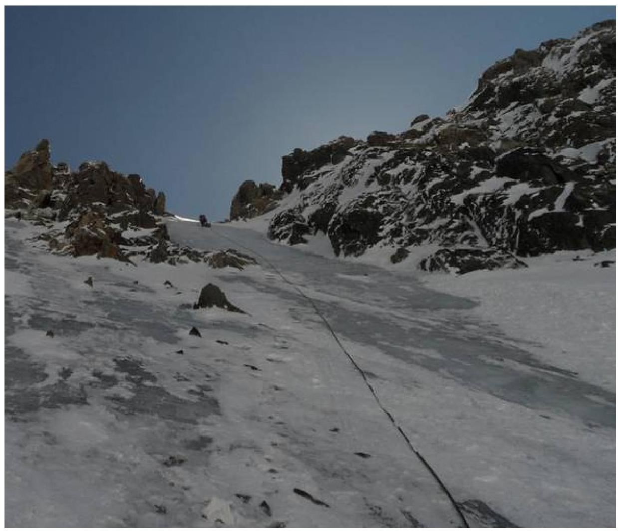
- R4 65 m, 4, 60–65°: Alternate climbing. The slope becomes steeper in the "gorge".
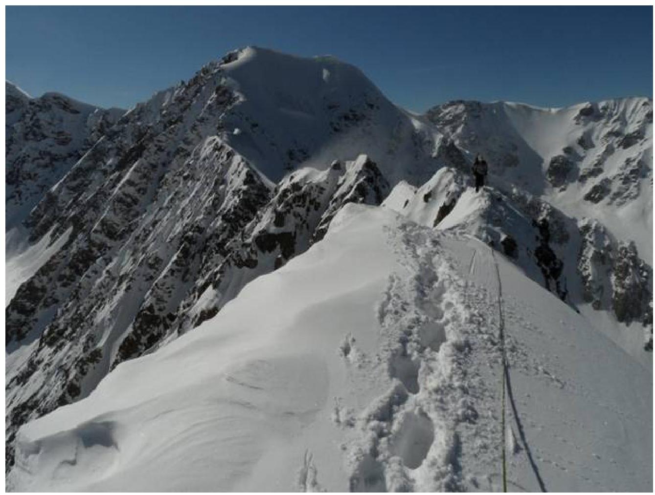
- R5 520 m, 2–3: Move in a rope team along the rocky and icy ridge, wearing crampons.
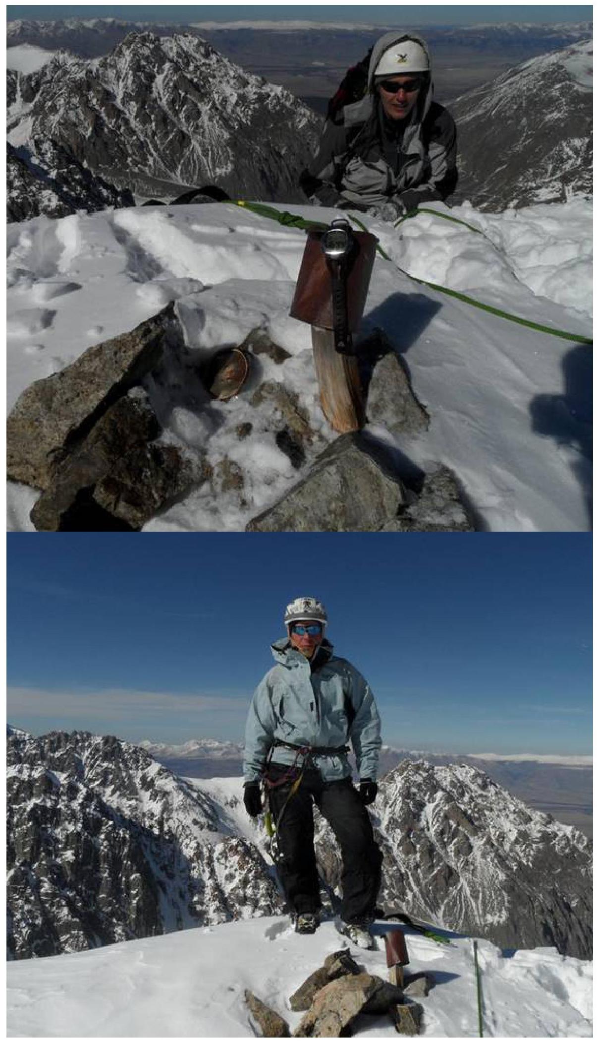
Found a can without a note in the summit cairn. Descent along the rocks via the NW snow-ice slope.
Photos of route sections:
View of the route from the start of the NE edge of peak DVS.
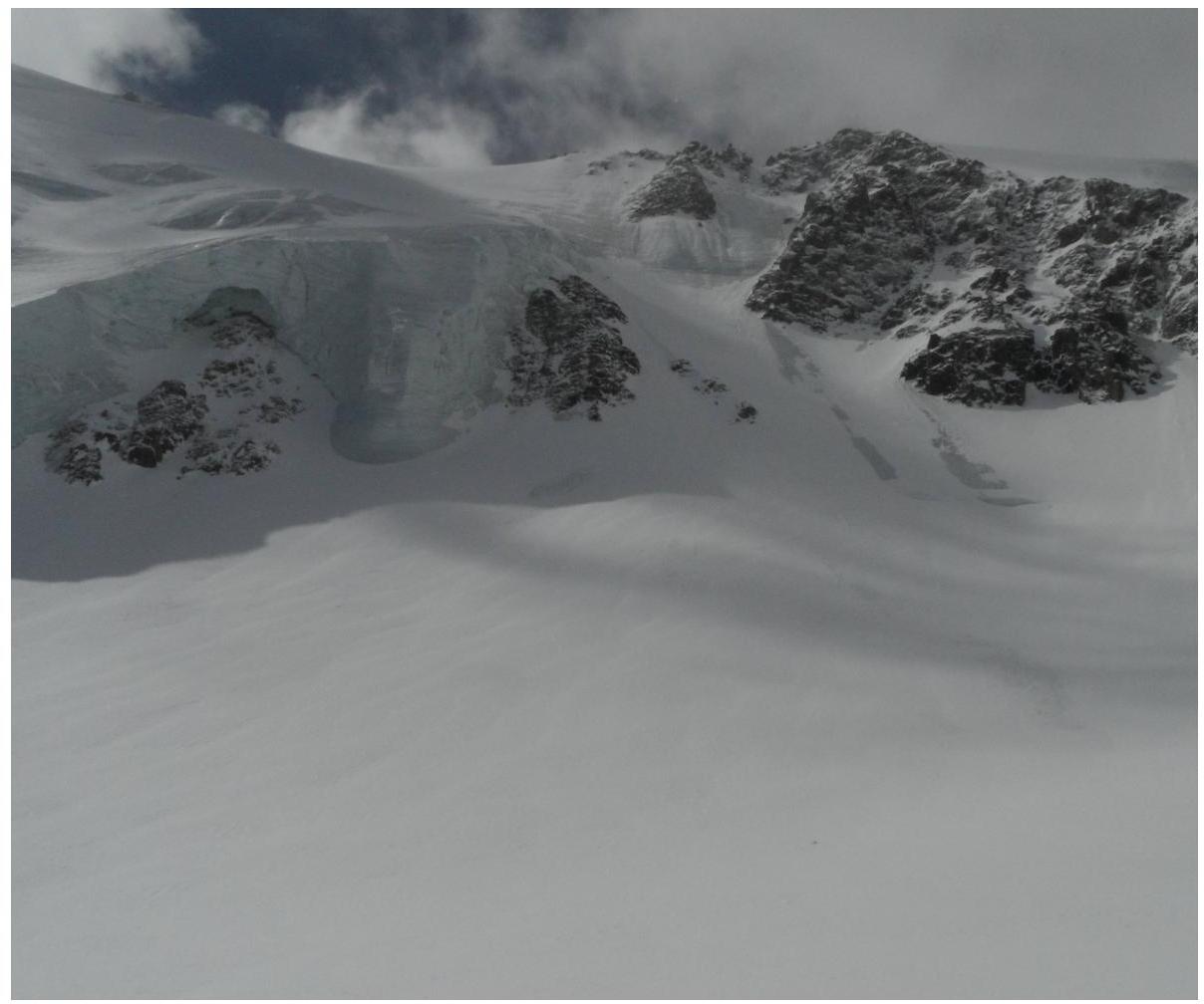
View of the ice gully on the approach to the route via the glacier.
On R1.
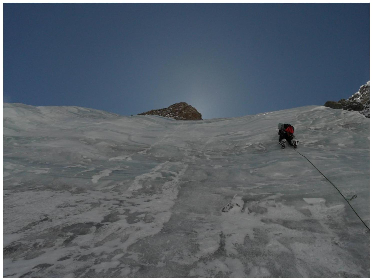
R2
R3
R4
R5
On the summit of UPI
Comments
Sign in to leave a comment