
- Gorny Altai, Severo-Chuysky Ridge.
- v. UPI, center of the NW slope.
- route 2B cat. sl., first ascent is proposed.
- Nature of the route: ice.
- Height difference of the route — 500 m. Route length — 1000 m. Length of sections:
- 2 cat. sl. — 550 m.
- 3 cat. sl. — 450 m. Average steepness:
- main part of the route — 35°
- whole route — 30°
- Hooks left on the route:
- total — 0; incl. shlyam — 0 Hooks used on the route:
- shlyam stationary — 0 pcs., incl. ITO — 0 pcs;
- shlyam removable — 0 pcs, incl. ITO — 0 pcs;
- rock — 0 pcs., incl. ITO — 0 pcs;
- закладок — 0, incl. ITO — 0 pcs;
- ice — 10 pcs. Total artificial support points (ITO) used — 0 pcs.
- Team's walking hours: 4 h 30 min, 1 day
- Participants:
- Temerev Ivan Mikhailovich — CMS
- Khazheev Alexander Raoulievich — 1st sp. razryad
- Coach: Novoselova G.V.
- Exit to the route: 7:00, May 26, 2004 Ascent to the summit: 14:30, May 26, 2004 Return to BL: 19:00, May 26, 2004
- Organization: OGU "Tomsk Regional Search and Rescue Service". Route profile photo
 Route ascent diagram in UIAA symbols
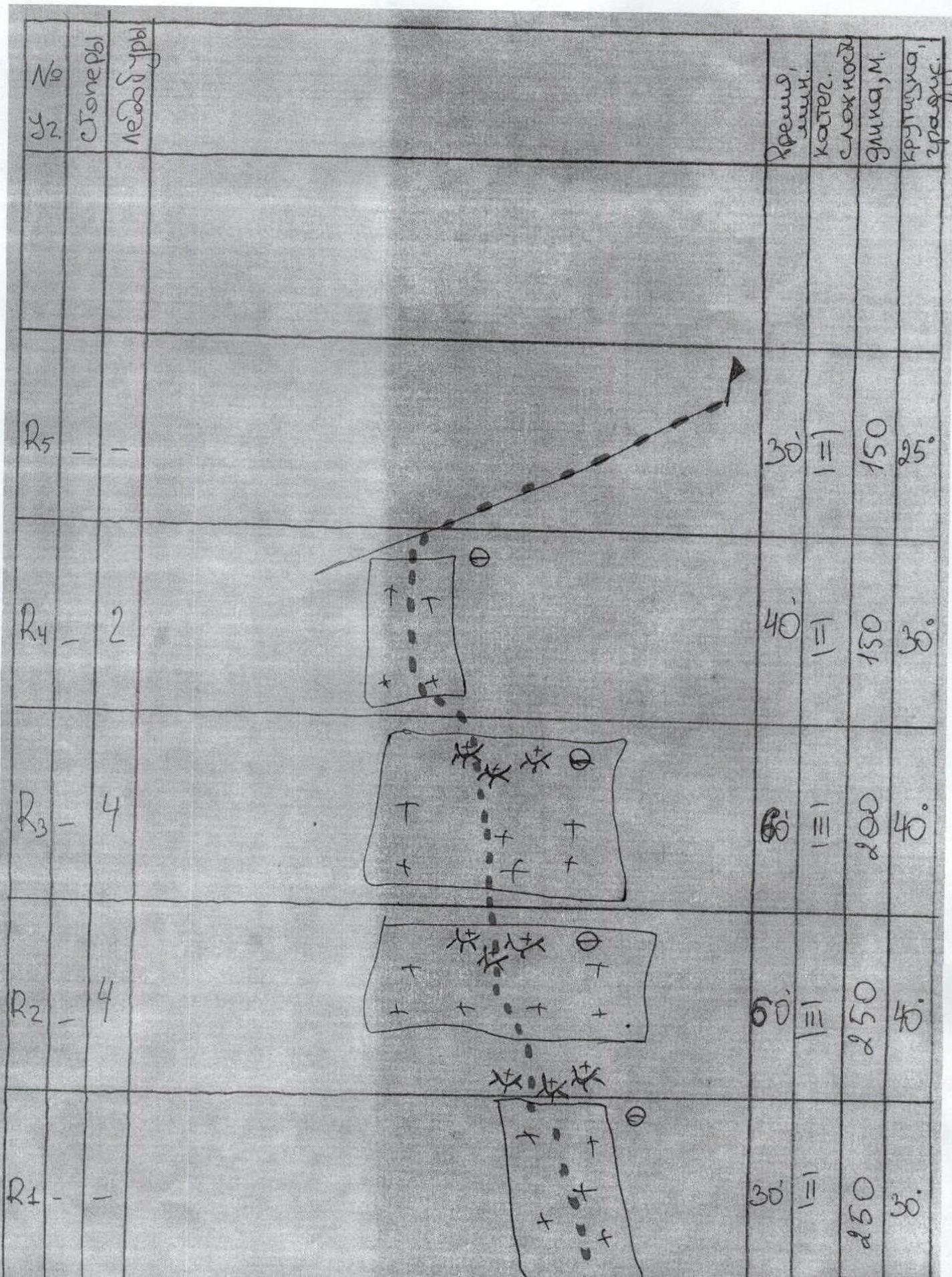
Route Description
7:00 left the camp
- 10:00 — under the route — got dressed
- 12:00 — passed 2/3 of the route, reached the steep snowy part
- 14:30 — reached the summit
- 15:00 — descent via 2A
From the camp, follow the trail to the icefall (first step "Khumbu"). With a small amount of snow on the hitosan, it is possible to pass along the left edge of the hitosan (along the way) and the edge of the icefall (you can go around the hitosan on the right along the glacier pr. B.Aktru). Then exit to the glacier above the 1st step of the icefall. Along the glacier to the right (along the way) along the hitosan under the beginning of the route. Here it is necessary to tie up.
There are about four clearly defined ice foreheads on the route. The route is chosen in the center, because:
- it is technically easier to climb along the couloir between the ice and the rocks on the left (along the way), but it is an objective rockfall zone, and there were also visible traces of avalanches that had come down. Above the central part, there are no cornices or rocks. However, the probability of an avalanche coming from above cannot be completely ruled out. Therefore, we chose a line of movement from one ice forehead to the next, they are at least some protection against snow coming from above. In this regard, the route cannot be laid "in a straight line". Movement is alternating. Insurance through ice screws and ice axe. In the upper part, the slope becomes noticeably steeper. Moving from forehead to forehead, we reached the rocks on the ridge. Then along the ridge for about 150 m to the summit of UPI.
Descent via 2A. Photo #4 (technical photograph of the route)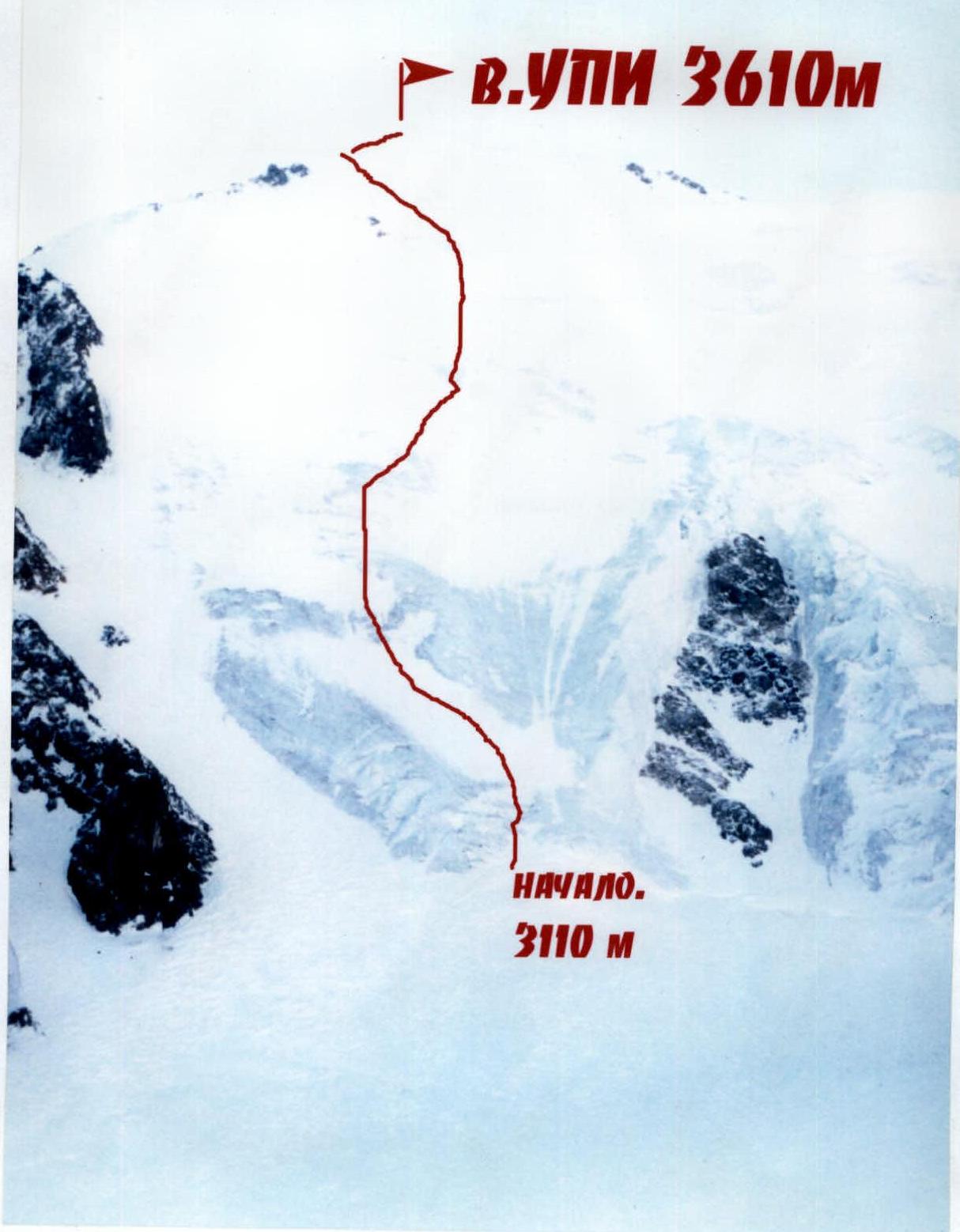
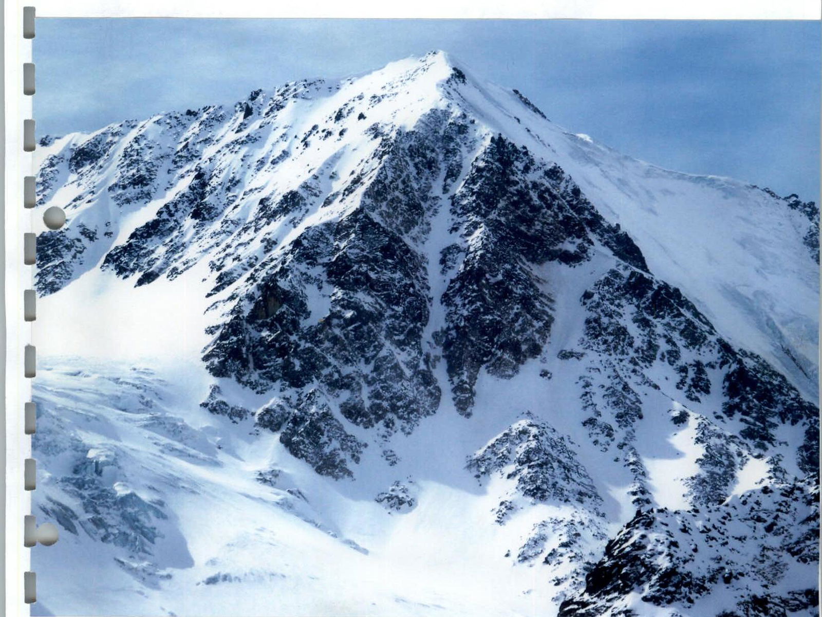
General view and thread of the route from the hitosan.
Comments
Sign in to leave a comment