Passport
- Class — first ascent.
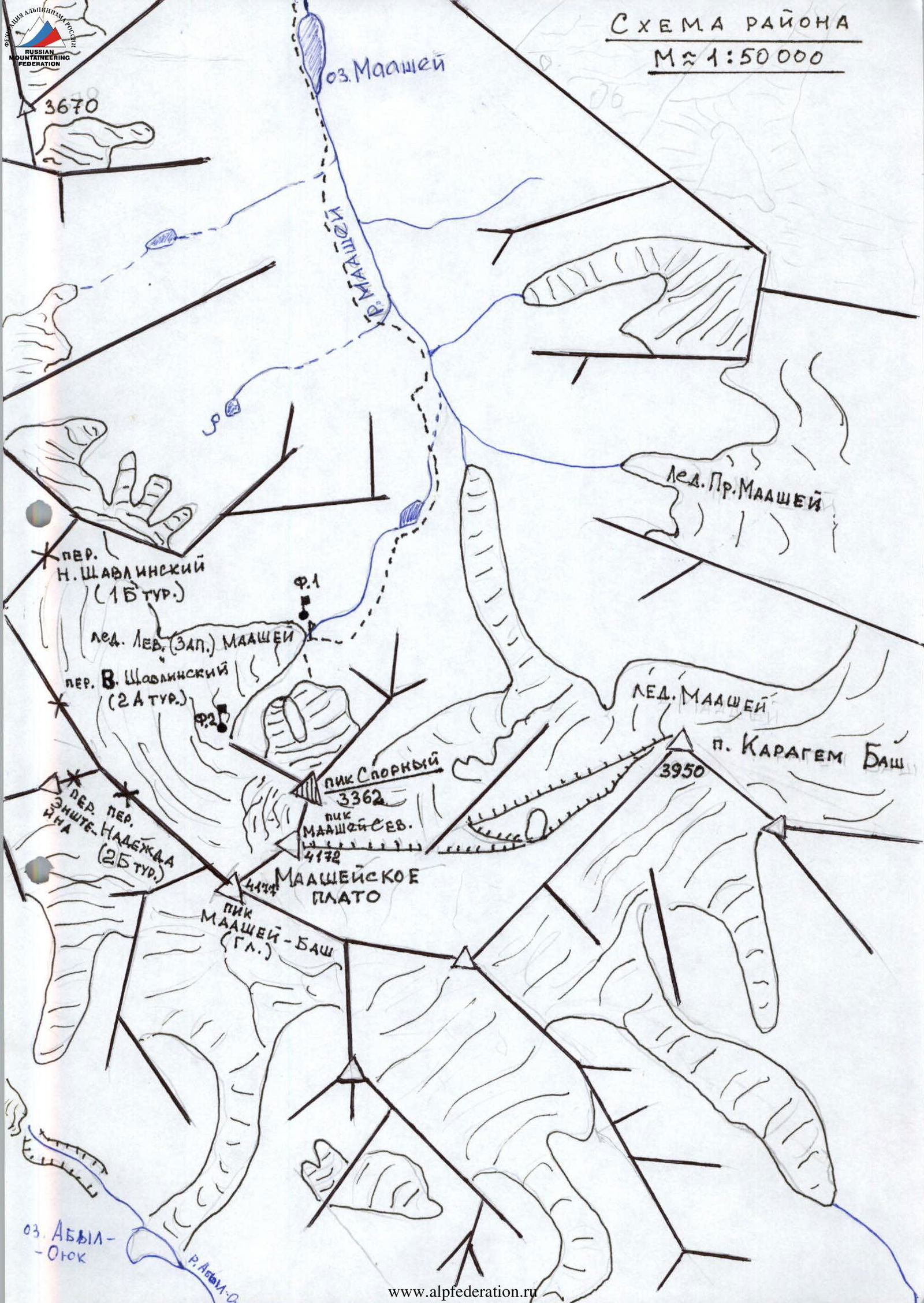
- Altai. Severo-Chuysky ridge, Maashey gorge, left glacial couloir of the northern slope.
- Proposed name — Pik Sporny (3362 m).
- Presumably — 3A category of difficulty, first ascent.
- Elevation gain — 700 m. Average steepness of the main part of the route is 40°.
- Ice screws were used on the route.
- Team's walking hours — 9.
- Nights stayed — none.
- Team members: Yeremin A.A. — 2nd sports category. Trush V.N. — 2nd sports category.
- Coach — Drakin Andrey Valentinovich, №68.
- Departure to the route July 20, 2001. Summit — Pik Sporny. Return — July 20, 2001.
- Organization — West Siberian Territorial Search and Rescue Service.
 Form №2.
Brief description of the route.
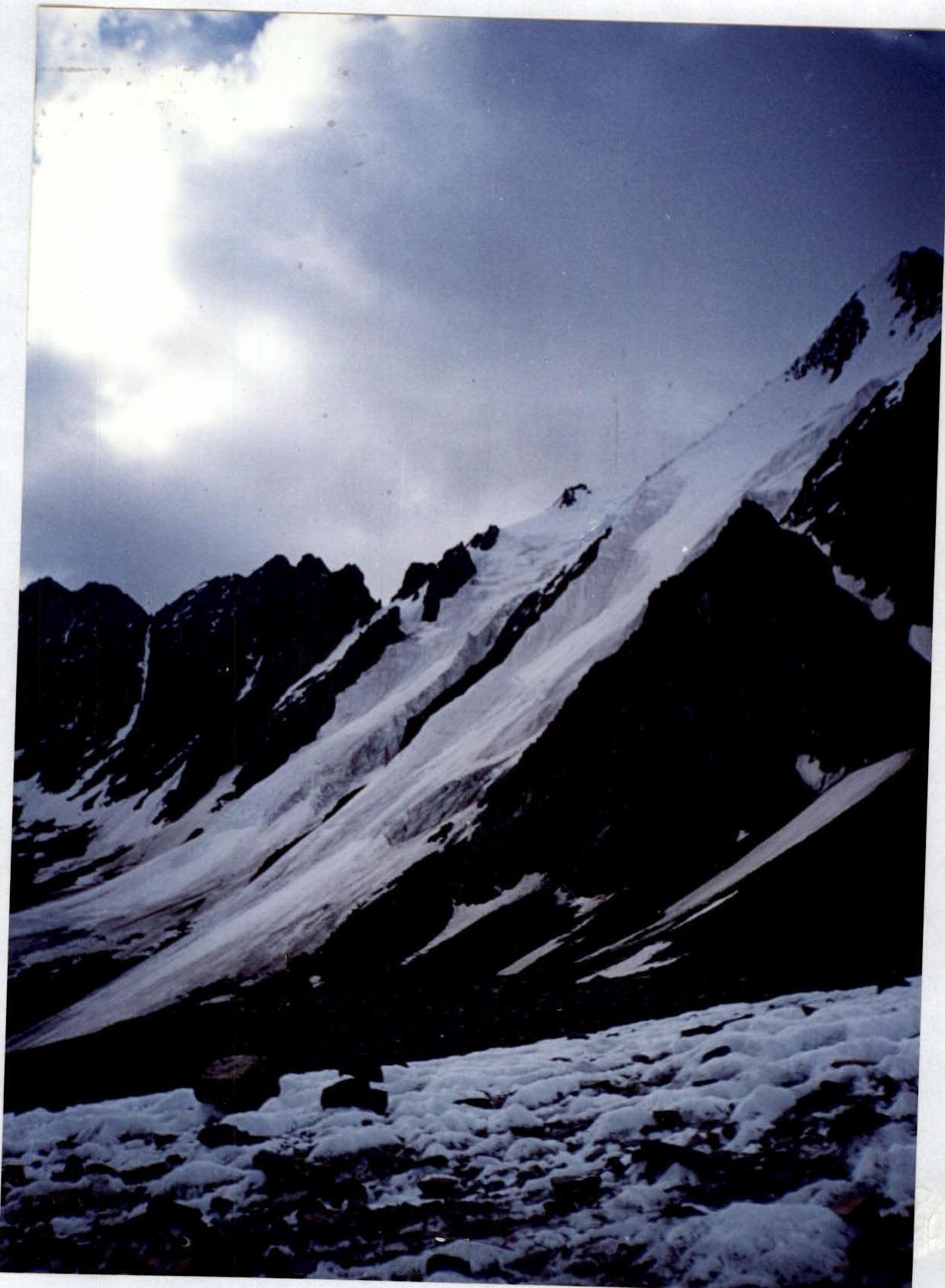
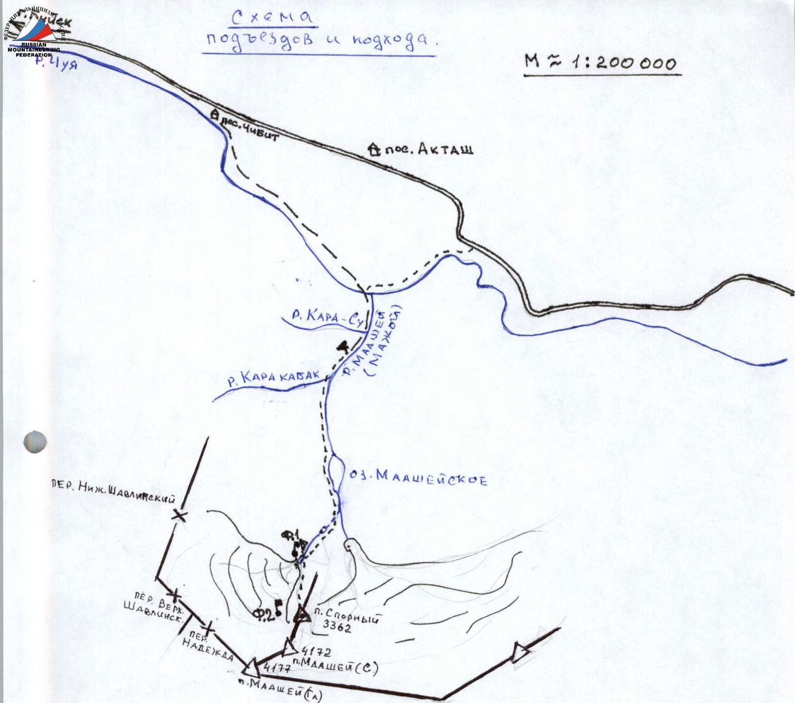
From the base camp, located 1.5 km below the confluence of the Karakabak river into the Maashey (Majo, Maazhoy) river, we ascend along the trail that follows the Maashey river, on the left (orographically) bank, to the Maashey lake (2 hours).
Passing the lake (1 hour), to the right of the direction of travel, after 1.5–2 hours, veering right, we ascend to a moraine rampart, along the top of which the trail goes. Then we descend to the right towards a small lake located at the entrance to the cirque of the western (left) Maashey glacier.
The general direction is towards the "Nadezhda" pass, popular among tourists. Bypassing it on the left along the trail, we ascend through moraine accumulations to the lake near the glacier tongue. Here we set up a campsite.
The total approach time is about 7–8 hours.
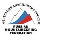
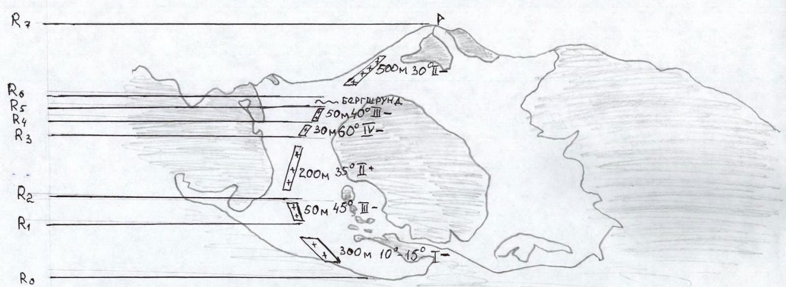
From the campsite, we ascend through moraines and scree to the start of the route. We rope up and ascend the lower part of the route: about 300 m, with a steepness of 10–15°. Then the steepness increases sharply to 45° over a section of about 50 m. There is a need for alternate belaying and use of intermediate belay points (ice screws).
After that, the slope eases to 30–35° over a distance of about 200 m. Movement is simultaneous, using intermediate ice screws. Then there is a section about 30–35 m long, with a steepness of about 60°. Movement is alternate, belaying through ice screws.
After that, the slope eases to 35–40° over a distance of 50–70 m, to the bergschrund. The bergschrund is overcome with the organization of piton belay. Then we exit onto the ridge and move along the ridge slope with a steepness of about 30° for 500–550 m, through deep snow. There are small crevices.
We reach a rocky section of the ridge. We move along it to the sub-summit. We descend 30 m to a snowy saddle. Then we ascend again 30–40 m along easy rocks to the summit.
Descent from the summit is via the ascent route.