PASSPORT
- Climbing category — technical.
- Region — Altai, Severo-Chuysky ridge.
- Peak Snezhnyaya (3800 m), via ice couloir on S wall, ice and snow route.
- Anticipated difficulty category — 5A–5B (winter), first ascent.
- Height difference: 1100 m. Wall height difference — 800 m. Length: 1700 m. Length of sections with 5th difficulty category — 655 m. Average steepness of the wall — 56° (2700–3500 m).
- Pitons used: rock 1, chocks 0, ice 108.
- Climbing hours: 17, days — 2.
- Overnight stay: on the pre-summit shoulder, comfortable.
- Leader: PAKHOMKIN Mikhail Vadimovich (Candidate for Master of Sports). Participant: PLASTININ Viktor Viktorovich (Candidate for Master of Sports).
- Coach: PLOTNIKOV Ivan Aleksandrovich (Master of Sports of International Class).
- Start of the route: May 1, 1991. Summit: May 2, 1991. Return: May 2, 1991.
- Organization: Alpkлуб "Sibvest" Barnaul.
Note on the passport: 3rd ascent: May 5, 1995 (Val. Plotnikov, Yuri Rusakov (Barnaul)). Total climbing time, days: 13.5 hours.
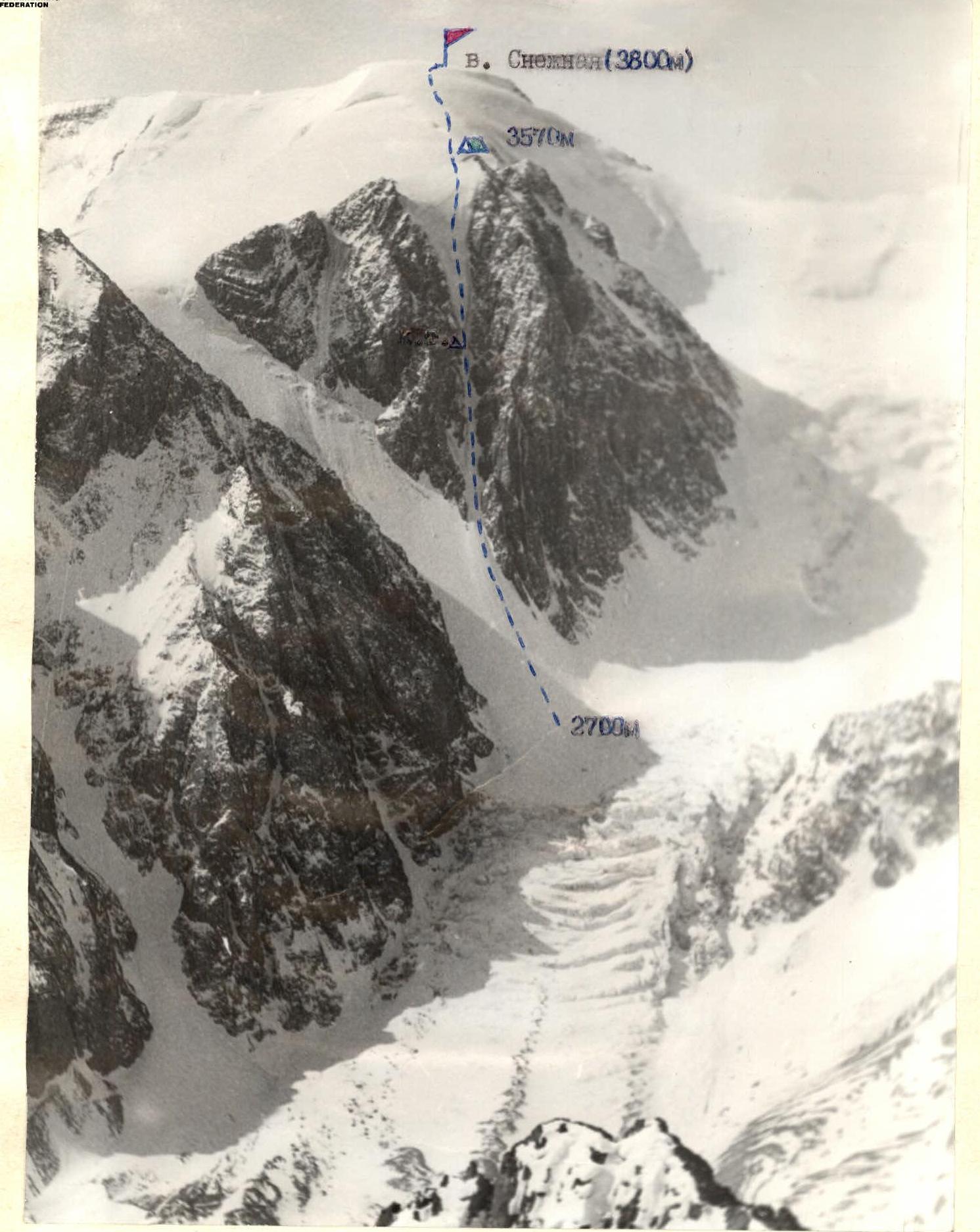
PHOTO #1. General photo of peak Snezhnyaya (3800 m). North wall. The photo was taken from the shoulder of peak DVS in May 1991. Height 2600 m.
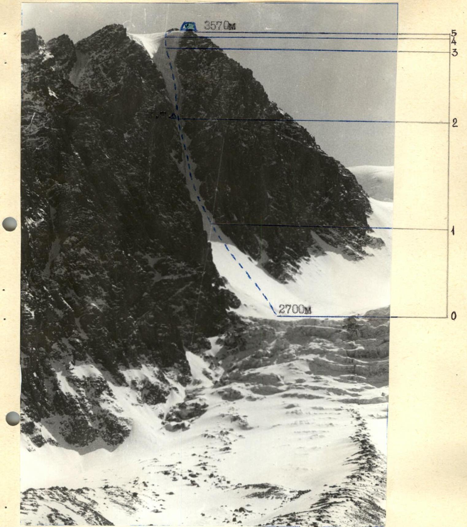
PHOTO #2. Profile of the wall on the left. The photo was taken from gl. Akturu in May 1992. Height 2400 m.
BRIEF OVERVIEW OF THE CLIMBING REGION
From the base camp located at PMS "Akturu" (currently the base of the search and rescue service of the Republic of Altai, EMERCOM of Russia), move along the Akturu river and then along the moraine of gl. Akturu (Right) to the icefall. Travel time 1–1.5 hours. The icefall is heavily broken, movement is in teams. Passage through the icefall along the slopes of peak Karatach under the start of the route. Travel time 1.5–2 hours.
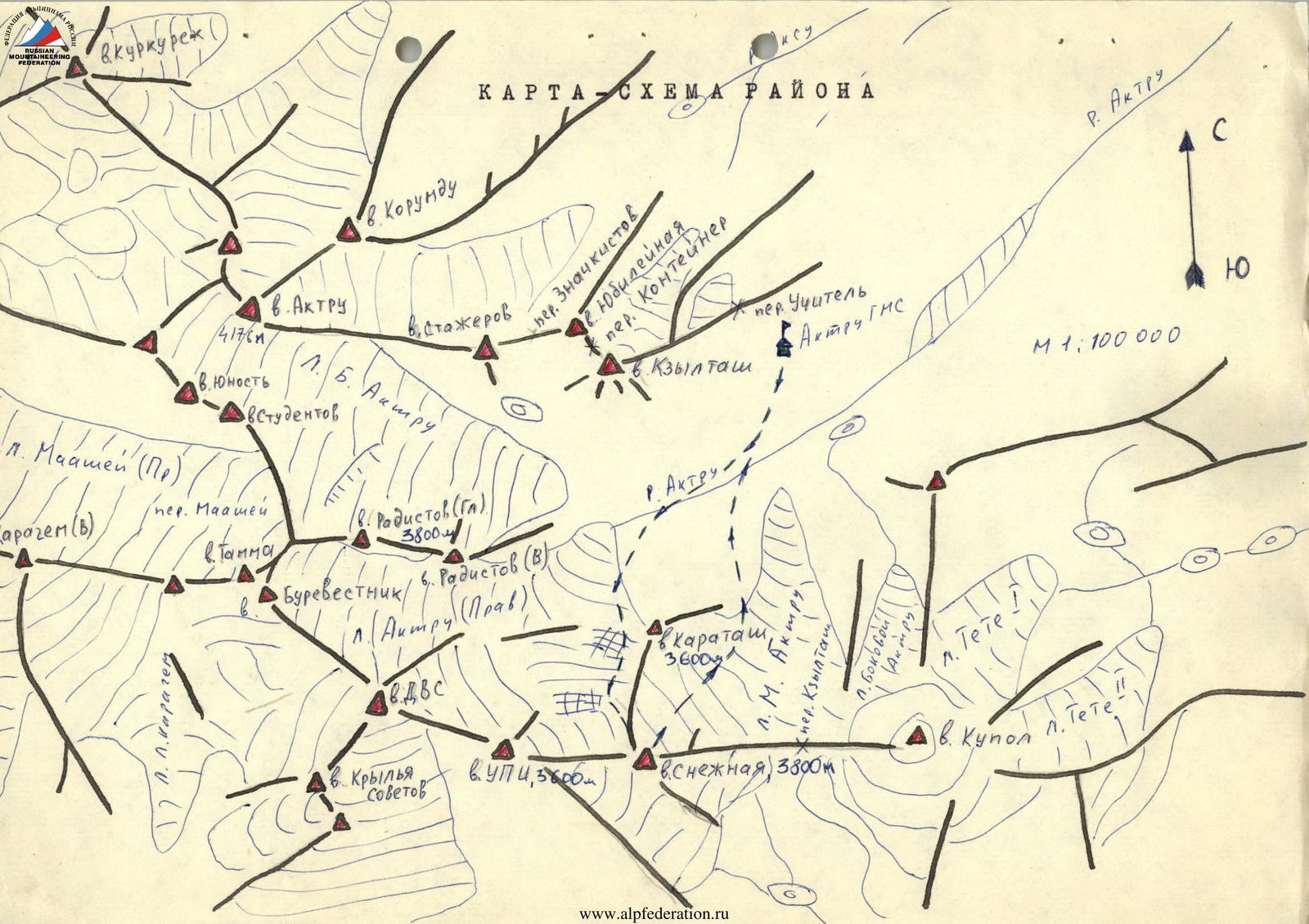
Map-scheme of the region
Scheme of the route in symbols (M 1:5000)
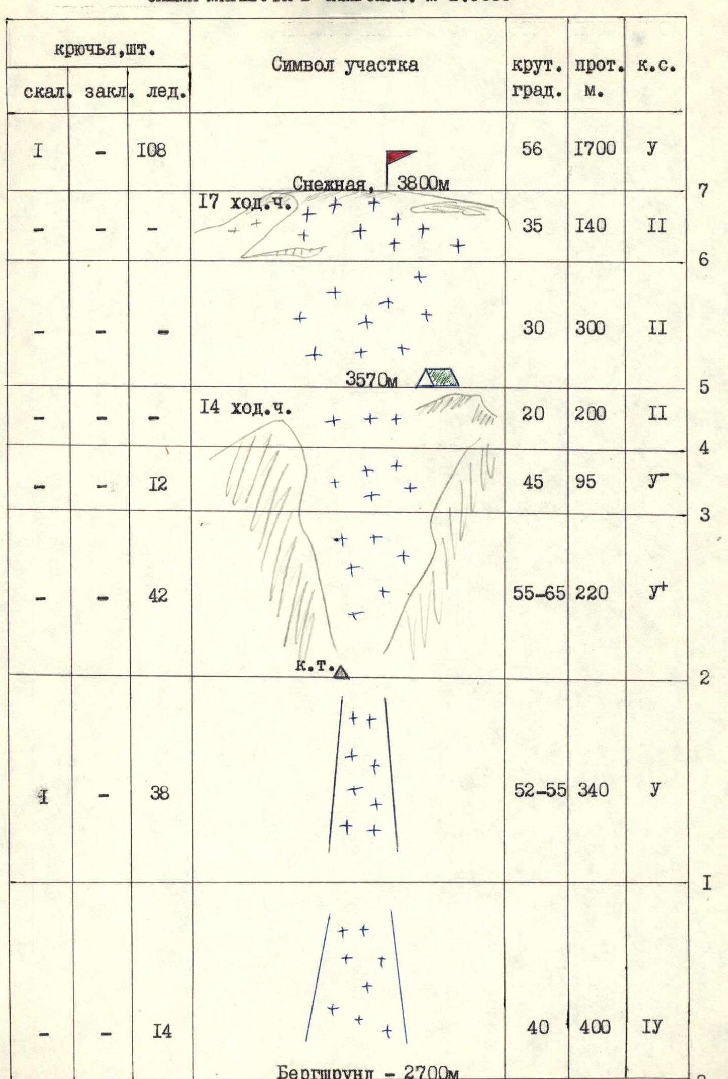
| Section | Pitons (rock, chocks, ice) | Steepness, degrees | Length, m | Difficulty category of the section |
|---|---|---|---|---|
| Total for the route | rock 1, chocks 0, ice 108 | 56 | 1700 | 3 |
| R0–R1 | ice 14 | 40 | 400 | 1 |
| R1–R2 | rock 1, ice 38 | 52–55 | 340 | 3 |
| R2–R3 | ice 42 | 55–65 | 220 | 4 |
| R3–R4 | ice 12 | 45 | 95 | 3 |
| R4–R5 | — | 20 | 200 | 2 |
| R5–R6 | — | 30 | 300 | 2 |
| R6–R7 | — | 35 | 140 | 2 |
DESCRIPTION OF THE ROUTE BY SECTIONS
R0–R1. The start of the route is on firm névé. The bergschrund is usually completely filled with snow. Movement is simultaneous and alternating, insurance through ice axes, in the upper part using ice screws and ice picks. Slope steepness up to 40°.
R1–R2. Gradually narrowing ice couloir with a steepness of 52–55°. Movement is alternating, insurance through ice screws, using ice picks. At the end of the section, on the left on the rocky side — a control cairn (in a tin can on a piton).
R2–R3. The key section of the route. Gradual expansion of the couloir, steep ice walls go in a series of cascades. Steepness of individual sections up to 80–85°. The ice is very hard "bottle" ice. Movement is alternating, when passing the section in a group, it is possible to organize ropes. Insurance through ice screws, using ice picks.
R3–R4. Ice slope, flattening in the upper part. Exit to the pre-summit shoulder. Movement is alternating, insurance through ice screws.
R4–R5. Pre-summit shoulder. Movement is simultaneous, along rocky outcrops. Convenient place for an overnight stay.
R5–R7. On firm névé and then on deep snow (depending on the condition of the route) approach under the summit dome. Gaps and crevices are possible. Exit to the summit.
Descent from the summit to gl. M. Akturu via route 2A difficulty category. Cramp ons are used throughout the entire route.
Recommendations: The route is safe when climbed in winter time for the Siberia region from October 1 to May 15. Time to start the route 4:00–5:00.
Reference:
- 2nd ascent made by the duo Pakhomkin M. V. — Plastinin V. V. in May 1992.
- 3rd ascent made by the duo Plotnikov V. G. — Rusakov Yu. V. also in May 1992.


