Passport
-
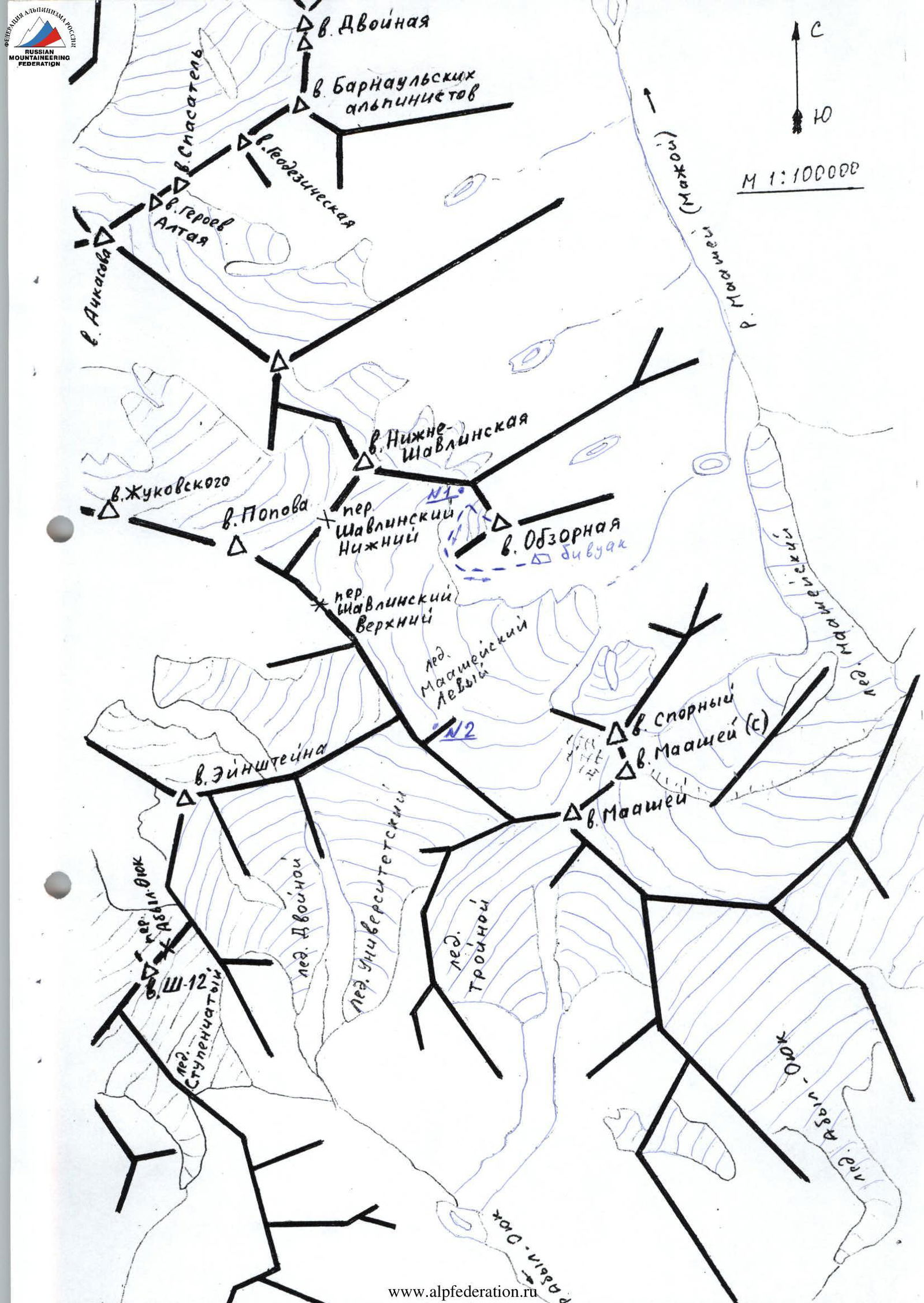
Altai, Severo-Chuysky ridge, Maasheyskoe gorge, 1.2
-
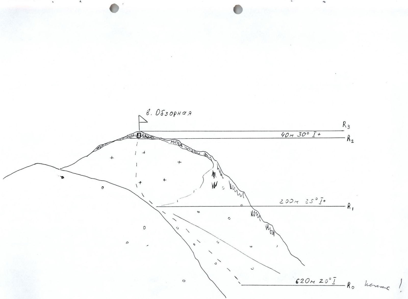
Obzornaya via the northern slope. Height 3150
-
Proposed category 1B (route previously climbed)
-
Route type — combined.
-
Height difference 300 m. Route length 860 m. Average steepness of the main part 26°, total route 21°.
-
Pitons used: not used.
-
Climbing hours — 4.5 (from foot to summit).
-
Leader: A. Drakin — Candidate Master of Sports. Participants: N. Astafurova — 3rd sports category, V. Penzev — 2nd sports category.
-
Coach: A. Drakin — 1st category № 68.
-
Departure to the route 5:00 August 3, 2002, summit 11:30 July 30, 2002, return to bivouac 14:30 August 3, 2002.
-
Organization: Siberian Regional Center for Civil Defense and Emergency Situations and Lifeguard Services.
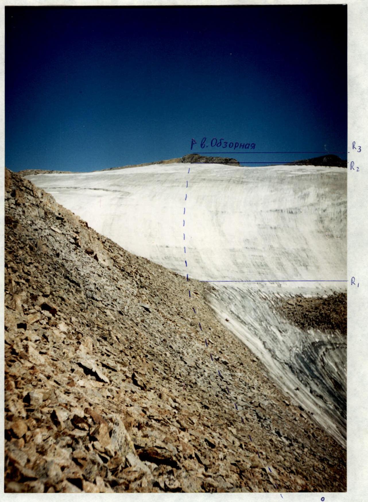
Technical photograph. Shooting point № 1

Photo of the general view of the summit. Shooting point № 2
Brief description of the route
From the bivouac located on a green meadow below Obzornaya peak, move along the moraine rampart in the direction of Shavlinsky Nizhny pass. Before reaching the glacier tongue, ascend the scree slope of Obzornaya peak, bypassing it in the direction between Nizhne-Shavlinskaya and Obzornaya peaks to the ice slope flowing from Obzornaya peak.
The ice slope is climbed simultaneously. For a training group — a convenient place to practice piton teamwork. The ice slope leads to a destroyed rock wall, which is climbed to reach the summit.
Descent is via the ascent route. The route is objectively safe. Follow the rules for:
- scree slopes
- ice slopes
All group members must have:
- crampons
- 5–6 ice screws for a training group