REPORT
ON THE FIRST ASCENT TO THE SUMMIT OF KZYLTASH VIA THE ROUTE "Icefall on the NW slope (from the left)" 4A category of complexity BY THE TEAM (RFSOO "FAiS NSO") FOR THE PERIOD FROM NOVEMBER 5 TO NOVEMBER 5, 2019
I. Ascent Passport
| 1. General Information | ||
|---|---|---|
| 1.1 | Full name, sports category of the leader | Shepelev Vladimir Aleksandrovich 1st sports category |
| 1.2 | Full name, sports category of the participants | Glazachev Danila Vyacheslavovich 2nd sports category; Mikhailov Artem Vyacheslavovich 2nd sports category |
| 1.3 | Full name of the coach | Sokolov G. A. |
| 1.4 | Organization | RFSOO "FAiS NSO" |
| 2. Characteristics of the Ascent Object | ||
| 2.1 | Region | Severo-Chuyskie Belki ridge |
| 2.2 | Valley | Ak-Tru |
| 2.3 | Section number according to the 2013 classification table | 1. ALTAI |
| 2.4 | Name and height of the summit | Kzyl-Tash 3486 m |
| 2.5 | Geographical coordinates of the summit (latitude/longitude), GPS coordinates *(1) | - |
| 3. Characteristics of the Route | ||
| 3.1 | Name of the route | Icefall on the NW slope (from the left) |
| 3.2 | Proposed category of complexity | 4A |
| 3.3 | Degree of route exploration | first ascent |
| 3.4 | Nature of the route terrain | ice-snow |
| 3.5 | Altitude difference of the route (data from altimeter or GPS) | 500 m |
| 3.6 | Length of the route (in meters) | 800 m |
| 3.7 | Technical elements of the route (total length of sections of varying complexity with indication of terrain type (ice-snow, rocky)) | I cat. complexity ice/rocks/combination – 100 m. II cat. complexity ice/rocks/combination – 200 m. III cat. complexity ice/rocks/combination – 0 m. IV cat. complexity ice/rocks/combination – 290 m. V cat. complexity ice/rocks/combination – 210 m. VI cat. complexity ice/rocks/combination – 0 m. Rocks VI, A3 – 0 m. Rocks VI, A4 – 0 m |
| 3.8 | Average steepness of the route, (°) *(2) | - |
| 3.9 | Average steepness of the main part of the route, (°) *(2) | - |
| 3.10 | Descent from the summit | Via 1B category of complexity to Ak-Tru valley |
| 3.11 | Additional characteristics of the route | Presence (absence) of water |
| 4. Characteristics of the team's actions | ||
| 4.1 | Time of movement (team's working hours, in hours and days) | 16 hours |
| 4.2 | Overnight stays | The route is completed without overnight stays |
| :--: | ||
| 4.3 | Time of route preparation *(3) | - |
| 4.4 | Departure on the route | 04:30 November 5, 2019 |
| 4.5 | Arrival at the summit | 16:52 November 5, 2019 |
| 4.6 | Return to the base camp | 19:30 November 5, 2019 |
| 5. Characteristics of weather conditions *(4) | ||
| 5.1 | Temperature, °C | |
| 5.2 | Wind speed, m/s | |
| 5.3 | Precipitation | |
| 5.4 | Visibility, m | |
| 6. Person responsible for the report | ||
| 6.1 | Full name, e-mail | Glazachev D. V. danil-glazachev@rambler.ru |
*(1) Filled in ONLY if the summit is not listed in the Electronic Russian Classifier of Routes to Mountain Summits. *(2) ONLY for routes with 5A category of complexity and above. *(3) If no preparation was done, a dash is placed. *(4) This section is filled in ONLY when submitting a report for participation in the Russian Championship and ONLY in case of unfavorable weather conditions. Specific values and duration are indicated.
II. Description of the Ascent
1. Characteristics of the Ascent Object
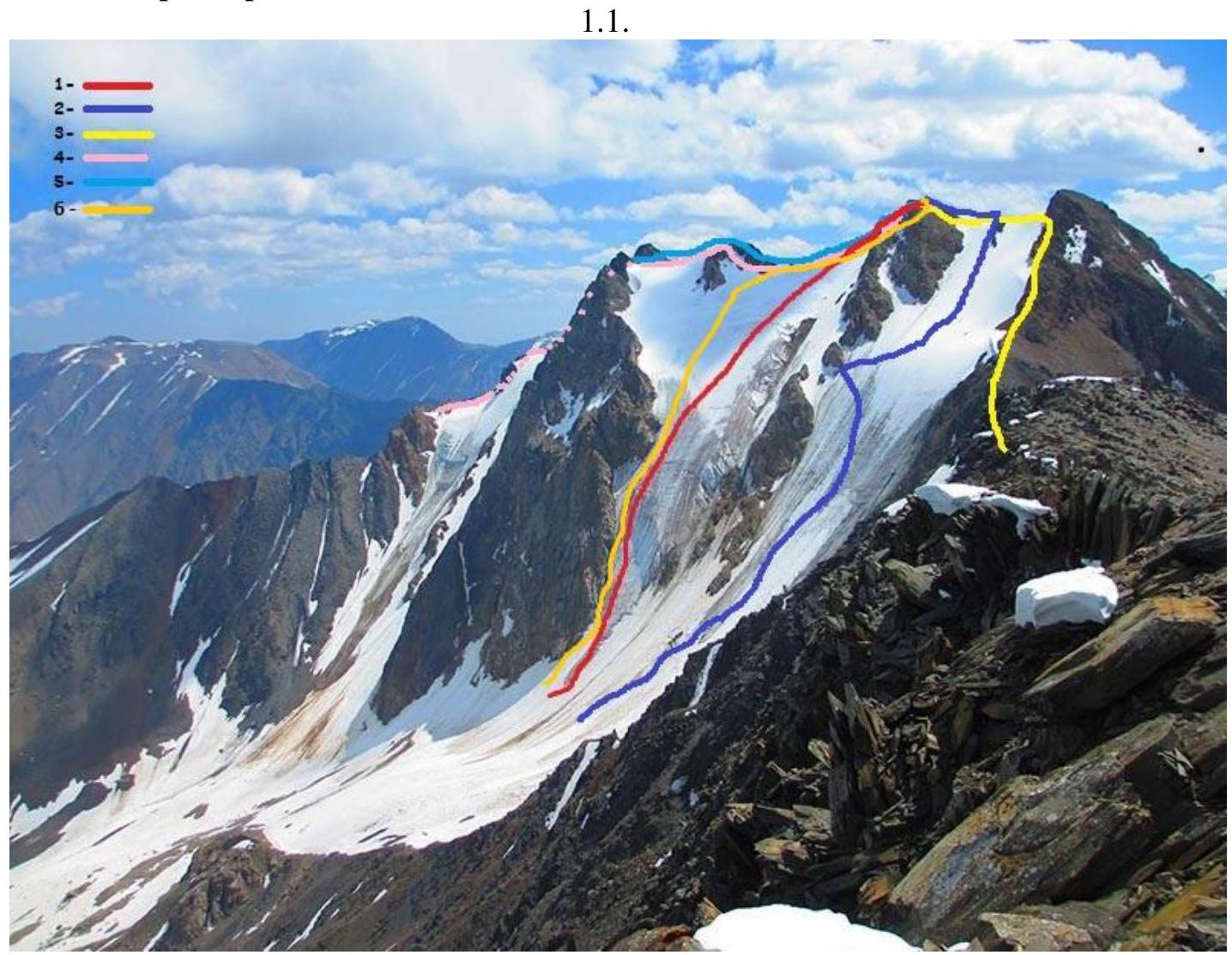
Figure 1 — Threads of neighboring and traversed routes.
- 1 — 3B via icefall on NW slope, Ivleev
- 2 — 3A via N slope of SW ridge, Moshkov
- 3 — 1B from Container pass, Kostryulev
- 4 — 3A via middle ridge of S slope, Afanasiev
- 5 — 3B via right ridge of S slope, Afanasiev
- 6 — Traversed route
1.2. Photo profile of the route
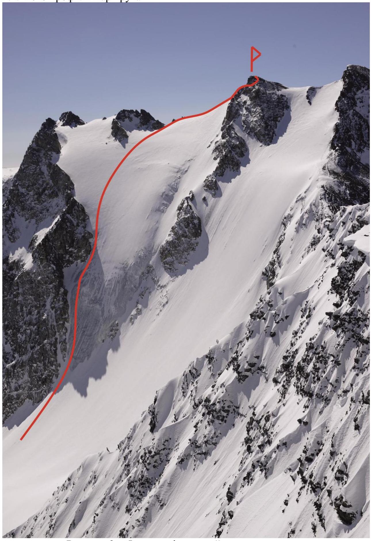
Figure 2 — Photo profile of the traversed route.
1.3. Photo panorama of the ascent area
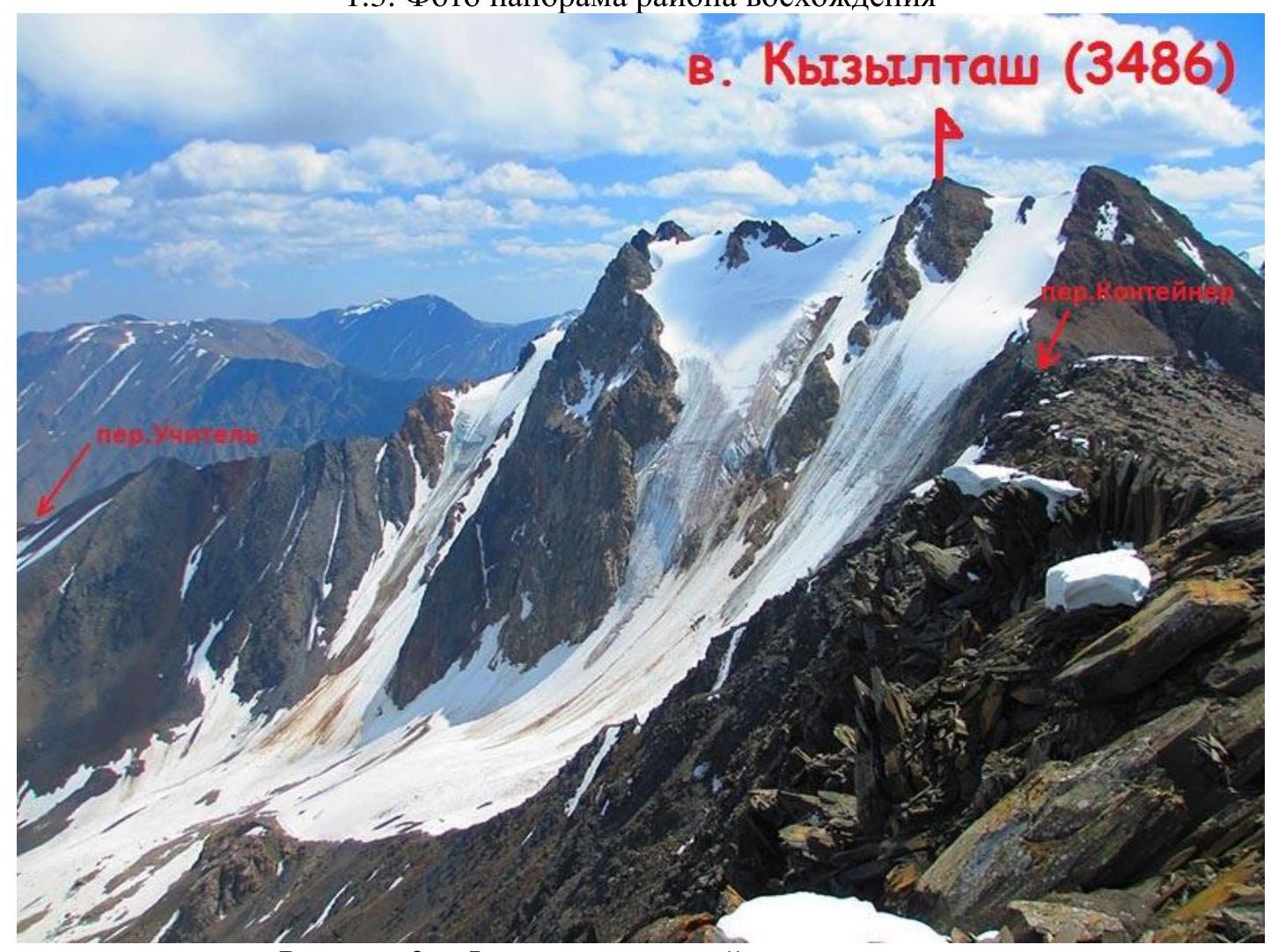
Figure 3 — Photo panorama of the ascent area.
1.4. Map of the ascent area
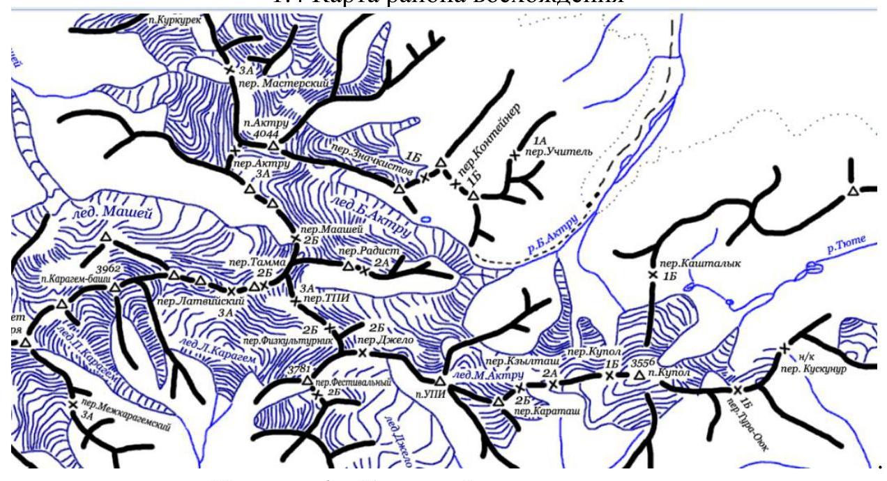
Figure 4 — Map of the ascent area. To the base camp (AU SB Ak-Tru) there is a well-developed network of approaches from the village of Kuray, Kosh-Agach district, Altai Republic. The village is located along the R 256 highway (formerly M 52) Novosibirsk – Ulaanbaatar (Mongolia), passing through:
- Barnaul
- Biysk
- Gorno-Altaisk.
2. Characteristics of the Route
2.1. Technical photo of the route
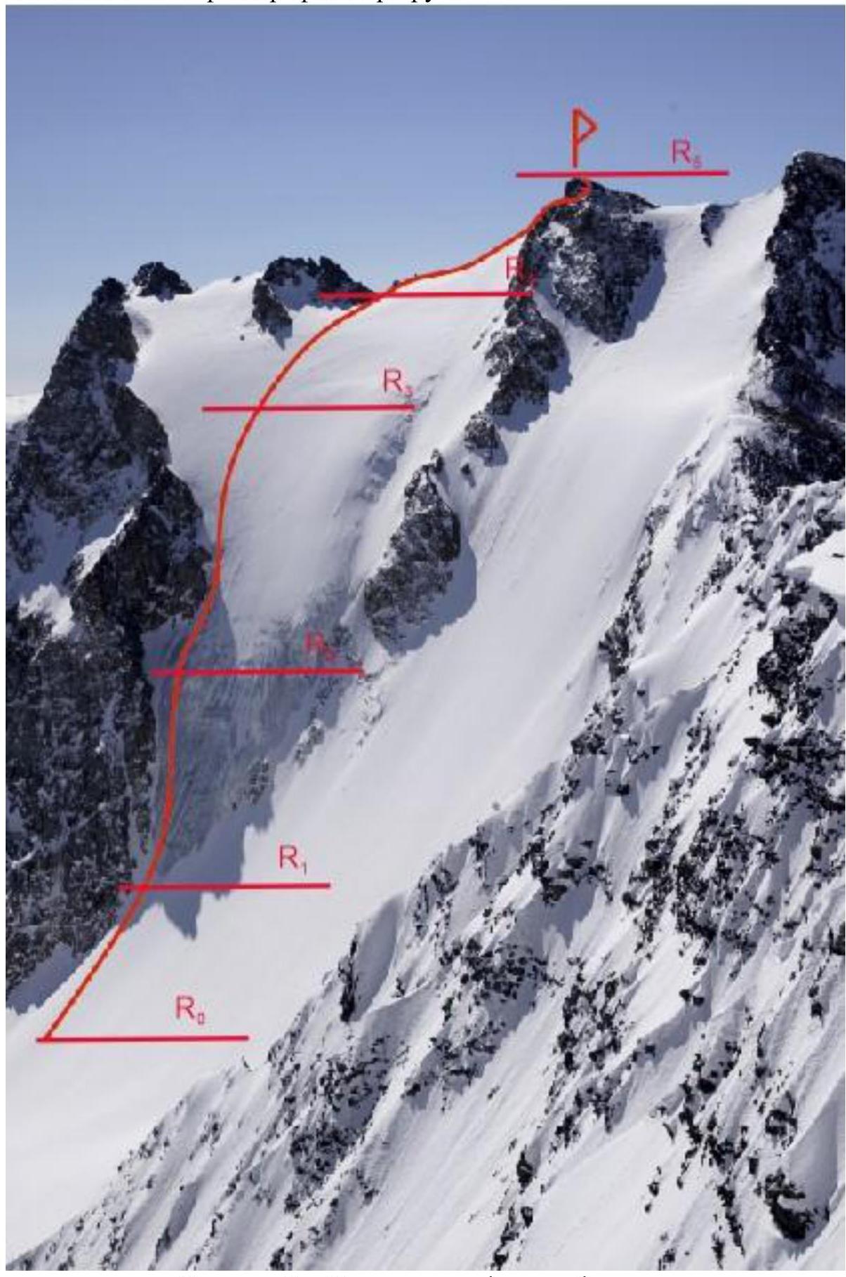
Figure 5 — Technical photo of the route.
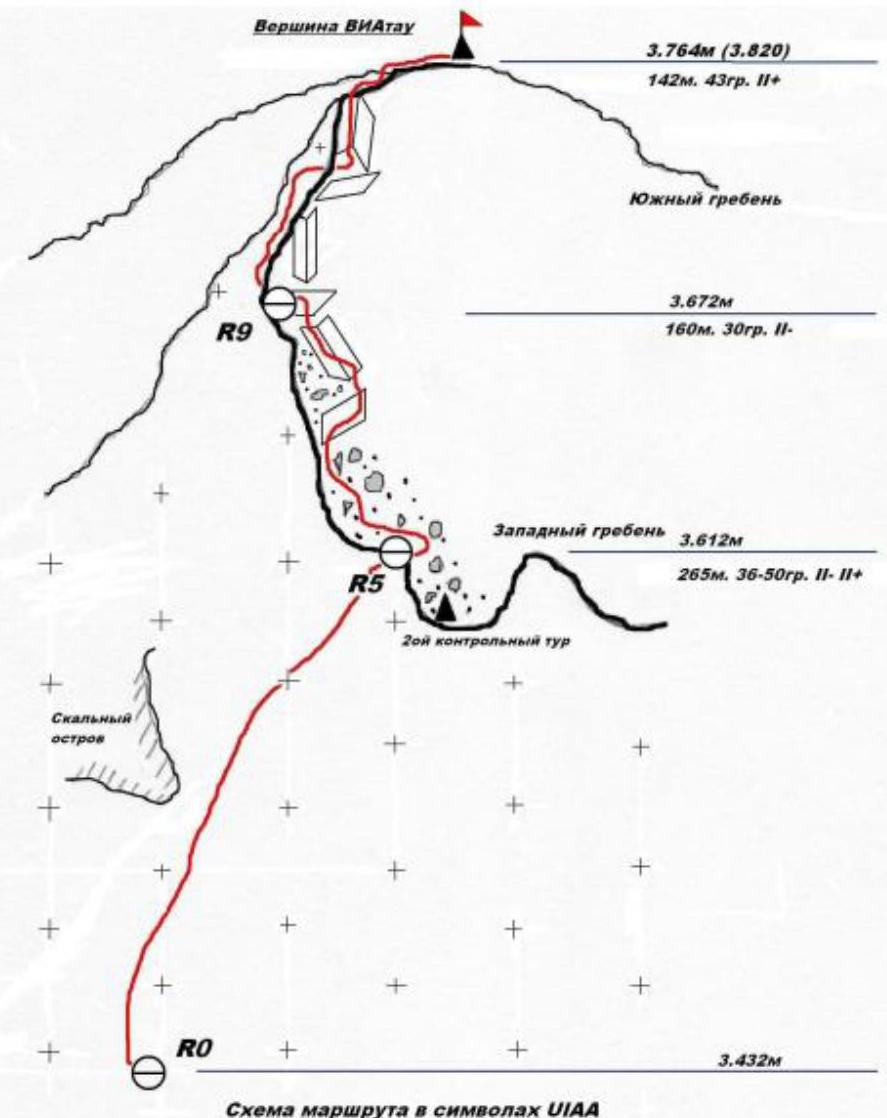
2.2. Scheme of the route in UIAA symbols
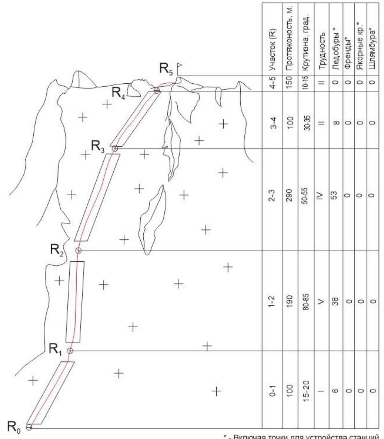
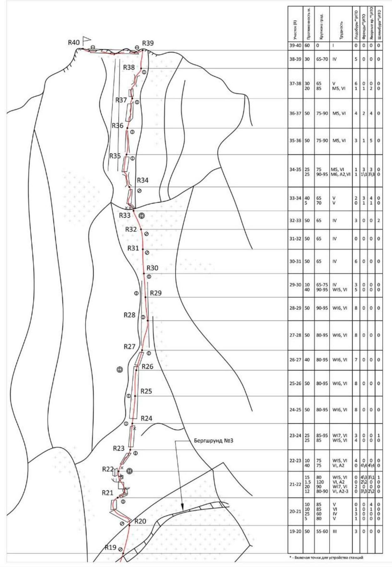
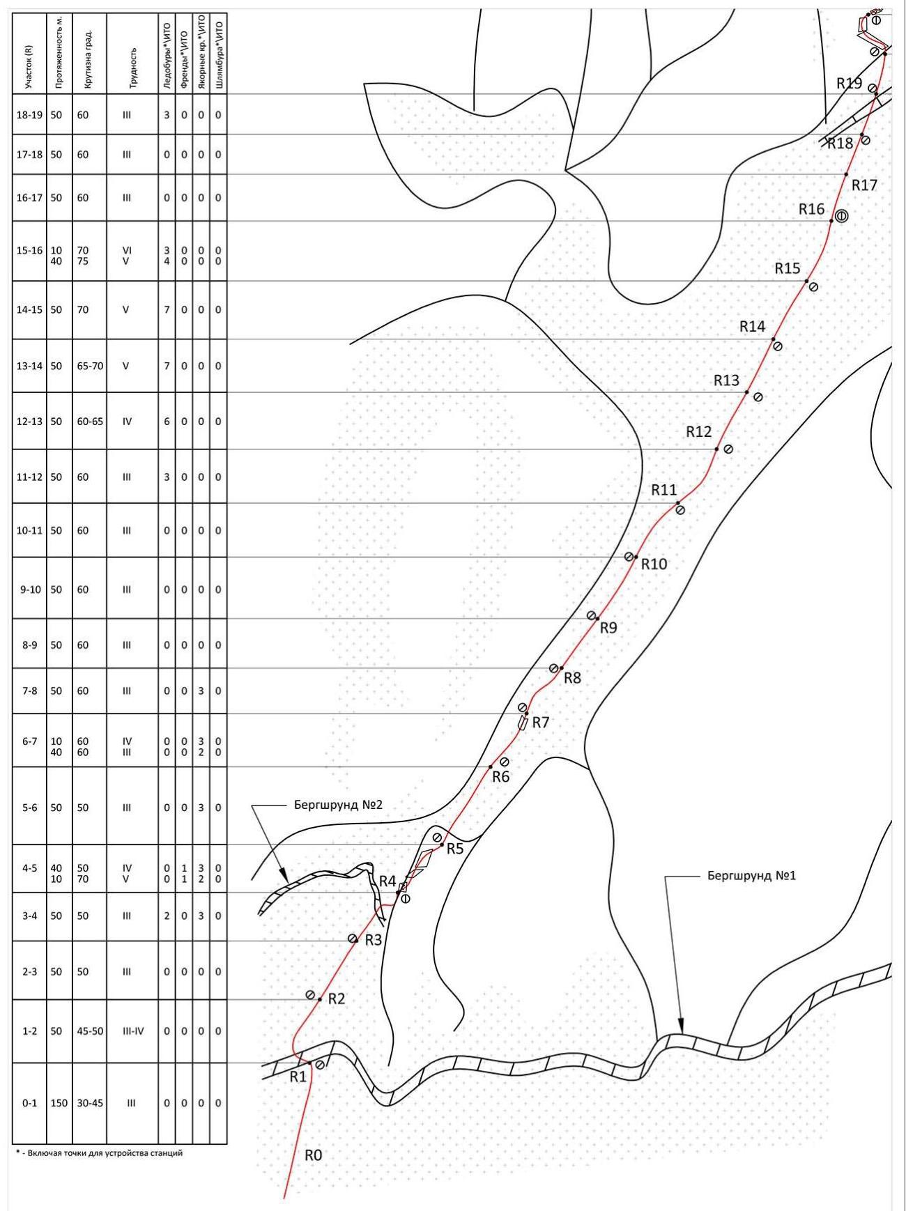
Figure 6 — Scheme of the route.
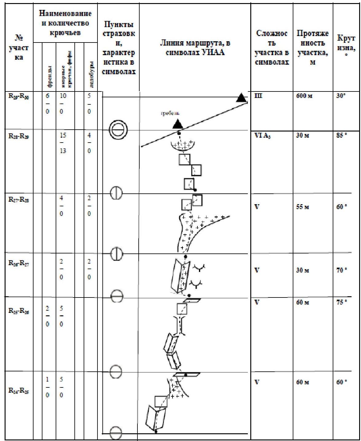
2.3. Table — scheme of the traversed route in UIAA symbols
| Section # | Name and number of ice screws | Insurance points, characteristics in symbols | Route line in UIAA symbols | Complexity of the section in symbols | Length of the section, m | Steepness, ° |
|---|---|---|---|---|---|---|
| R0–R1 | 6/0 | +++ +++ | I | 100 m | 15–20 | |
| R1–R2 | 38/0 | Φ | +++ +++ | V | 190 m | 80–85 |
| R2–R3 | 53/0 | Ø | +++ +++ | IV | 290 m | 50–55 |
| R3–R4 | 8/0 | Ө | +++ +++ | II | 100 m | 30–35 |
| R4–R5 | 0/0 | Ө | +++ +++ | II | 150 m | 10–15 |
3. Characteristics of the Team's Actions
3.1. Brief description of the route passage
| Section # | Description | Photo number |
|---|---|---|
| 0-1 | Beginning of the route, snowy slope with increasing angle of inclination. Movement is simultaneous in a rope team with intermediate points on ice screws. Approach to the key part of the route (left side of the icefall). | Figure 8 |
| 1-2 | Key section of the route. The icefall is traversed with thorough insurance on ice screws, stations are reliable but inconvenient due to being in a suspended state. The ascent line goes left in a gentle traverse towards the rocks, creating a possibility of a "pendulum" fall, but the last rope goes vertically up a clearly defined ice wall. The ice wall ends at a large convenient snowy ledge. | Figures 9, 10 |
| 2-3 | From the snowy ledge, up the icy slope, initially hugging the counterfort. After passing it, the ascent continues upwards along the line of water fall, and in the upper part, it starts to flatten out. Climbing is easier than on the previous section but requires thorough insurance; for teams of two, simultaneous climbing is recommended. Insurance is still hampered by suspended stations. | Figure 11 |
| 3-4 | The slope actively flattens out, a significant layer of snow appears, which turns into a snowy slope. Movement is simultaneous in a rope team with insurance on ice screws. | Due to poor weather conditions, photos are absent |
| 4-5 | Snowy ridge turning into a rocky one. The rocky part of the ridge is несложное climbing with insurance on rock outcrops. Hampered by snowy terrain and crumbling rocks. The summit gendarme is bypassed on the right in the direction of travel. | Due to poor weather conditions, photos are absent |
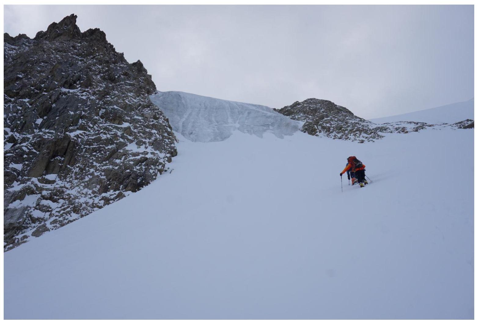
Figure 7 — Approach to the route.
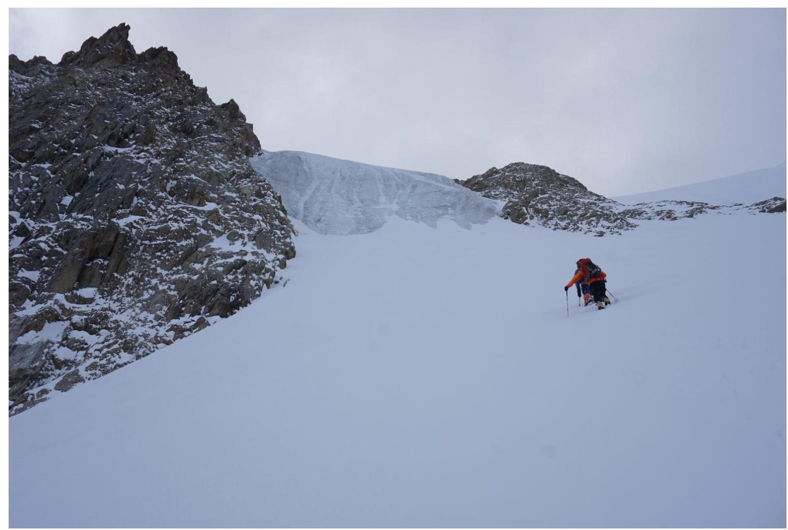
Figure 8 — Start of work on the route, section R0–R1.
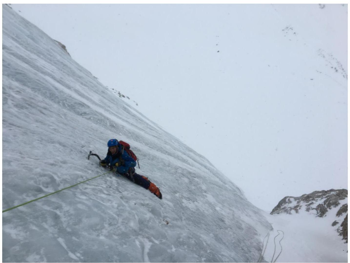
Figure 9 — Work on the route, section R1–R2.
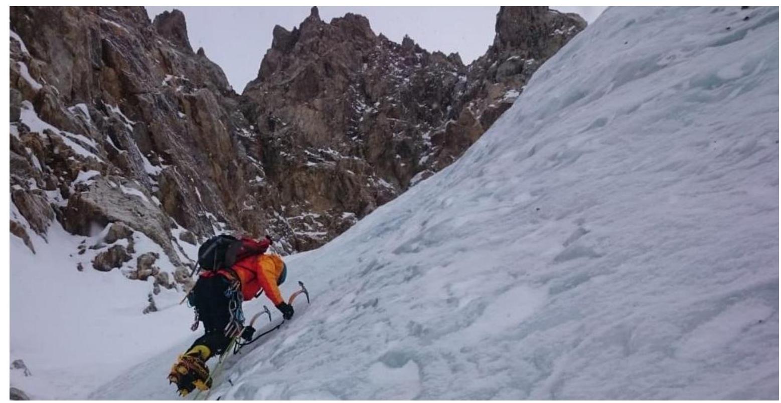
Figure 10 — Work on the route, section R1–R2.
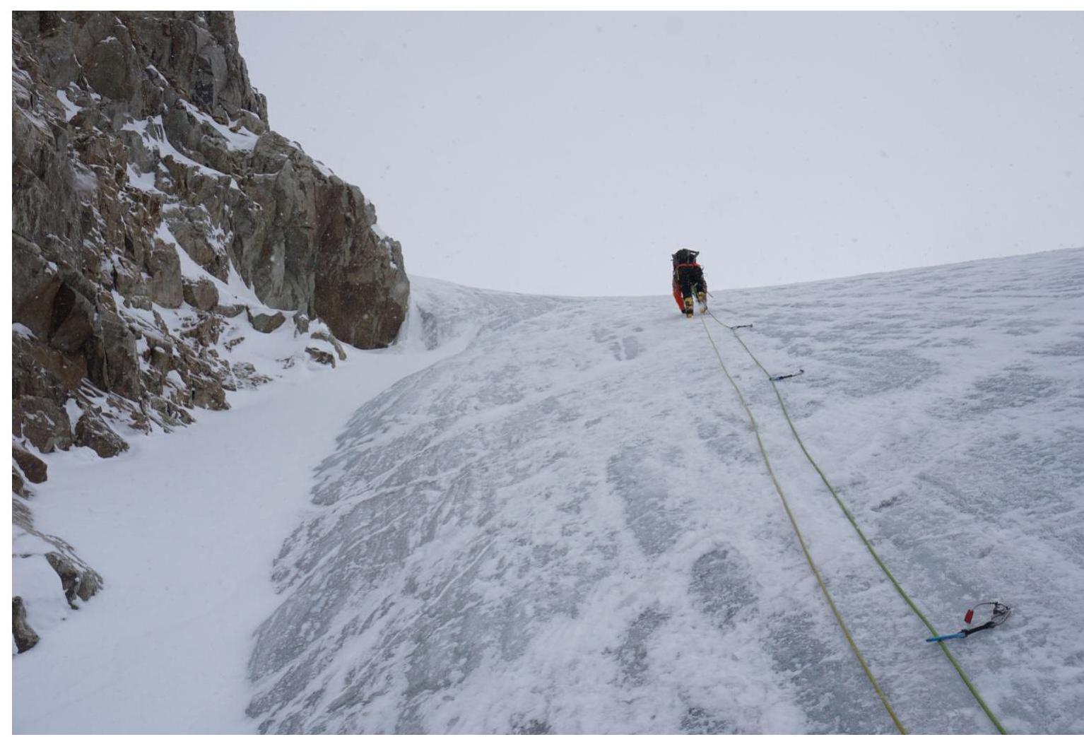
Figure 11 — Work on the route, section R2–R3.
3.2. Photo of the team on the summit with the control tour
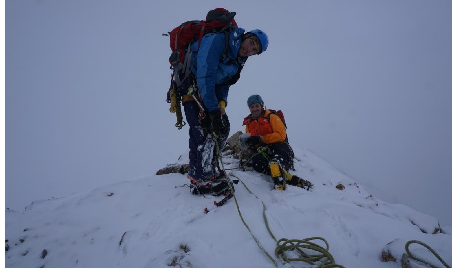
Figure 12 — Summit. At the control tour, due to unfavorable weather conditions, it was not possible to take an informative photo.
3.3. The traversed route in winter is relatively safe because the slope has a sufficiently large slope, which prevents the accumulation of snow in sufficient volume for avalanche formation. In summer, however, the main part of the route can be rockfall-prone since a significant portion of the route passes under rocks. Overall, the route has a sufficient number of places for organizing reliable insurance.
Approximately halfway through the route, there is a large convenient ledge suitable for lunch and rest for the group.
Radio communication:
- Is carried out with the base camp of AU SB Ak-Tru.
- On the ice section, radio communication with the camp is unavailable and appears only after reaching the ridge.
Descent:
- From the route, it is recommended to descend via the ascent route using Abalakov loops or self-unwinding.
- From the summit, descent is via a 1B category route from Container pass (Kostryulev), then along the talus slope to the "blue" lake, where there is a possibility for a safe overnight stay, or bypassing the lake — along a convenient trail directly to the formatted alphabet camp.
Characteristics of the route:
- Has an estimated 4A category of complexity.
- Runs along the left extremity of the icefall with steeper and longer ice walls than its central part, classified as a 3B category route.
- The length of the route is increased relative to the route traversed in 2015 by a group of Novosibirsk climbers due to an earlier start of the ice section at a higher altitude and a later end of the "steep" part of the ice slope because of its proximity to the rocks.
4. Characteristics of Weather Conditions *(10)
4.1. Confirmation of data specified in the Ascent Passport with screenshots of weather forecasts from websites:
- https://www.mountain-forecast.com↗
- https://www.meteoblue.com↗
- http://worldweather.wmo.int/en/home.html↗
- https://meteoinfo.ru/forecasts↗
- https://www.gismeteo.ru/↗
*(10) Filled in ONLY when submitting a report for participation in the Russian Championship or Federal District competitions and ONLY in case of unfavorable weather conditions.
Appendix № 3 to the Unified Requirements for the Report for Classification
Sample filling of the route scheme in UIAA symbols
Appendix № 4 to the Unified Requirements for the Report for Classification
Examples of executing the route scheme in UIAA symbols in the form of tracing the route on the mountain.
Example 1 (for routes 1B–3B)
Example 2 (for routes 4А–6B)