Climbing Passport
- Climbing area — Altai, Aktru valley.
- Name of the peak: Karatash, via the center of the north face.
- 6A category of difficulty, 3rd ascent.
- Route type — combined.
- Route elevation gain — 1030 m.
Route length — 1298 m. Length of sections with V category of difficulty – 195 m, VI category of difficulty – 255 m. Average steepness: main part of the route — 73°, total route — 59°. 6. Pitons left on the route: total — 0, including bolted pitons — 0. Pitons used on the route: stationary bolted pitons — 0, including artificial aids — 0; removable bolted pitons — 2, including artificial aids — 2. Total artificial aids used — 71. 7. Team's climbing hours: 49 hours, 6 days. 8. Team leader: Foygt A.V., Master of Sports.
Team members:
- Stalkovsky V.V., Master of Sports
- Belkin A.V., Candidate for Master of Sports
- Zvyagintsev M.V., Candidate for Master of Sports
- Proskurin A.V., Candidate for Master of Sports
- Coaches:
- Kozhemyako N.G., Master of Sports
- Zuev S.V., Candidate for Master of Sports
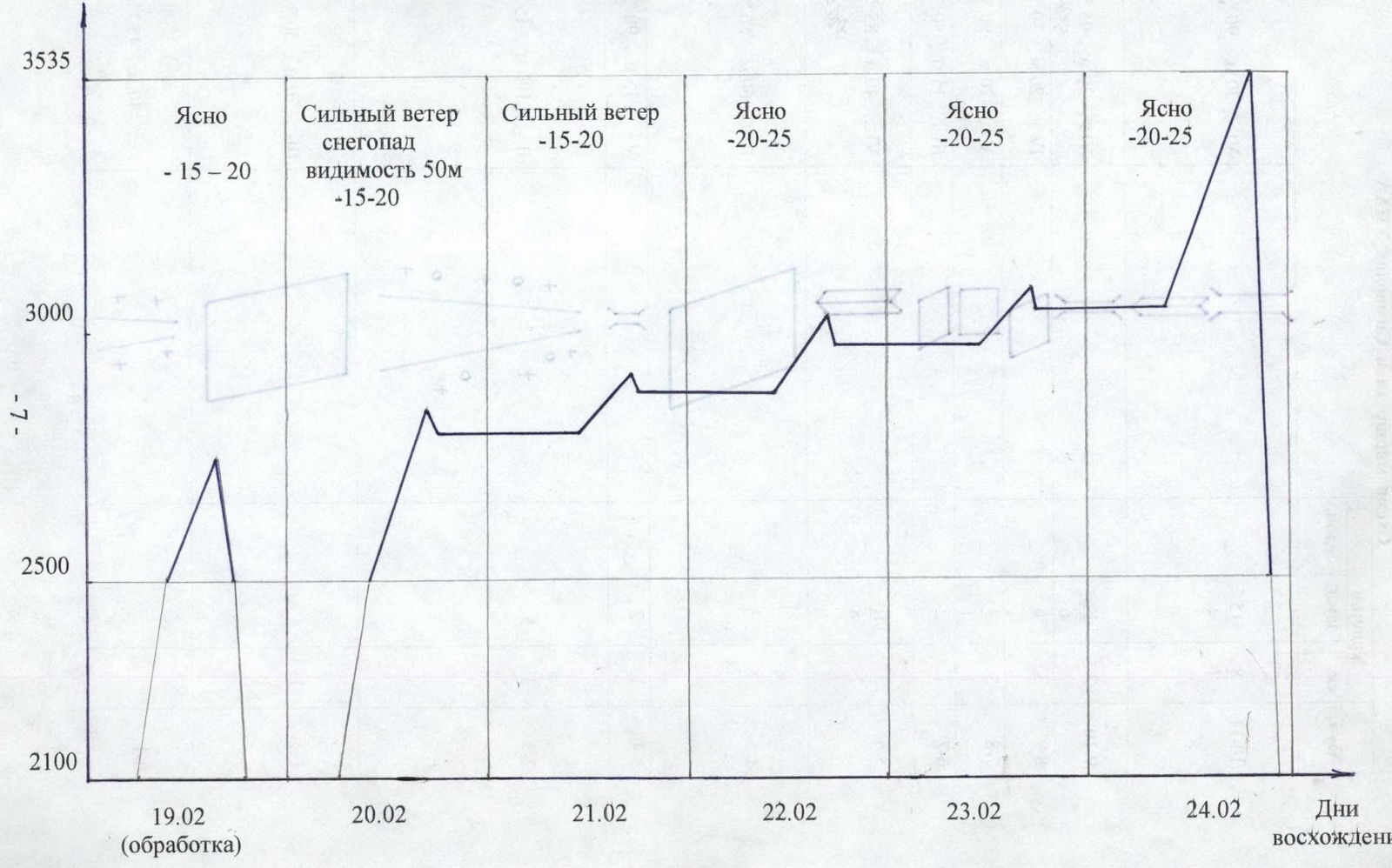
- Departure to the route: 6:00, February 19, 2002.
Reached the summit: 19:00, February 24, 2002. Returned to base camp: 22:30, February 24, 2002. General photo
of the summit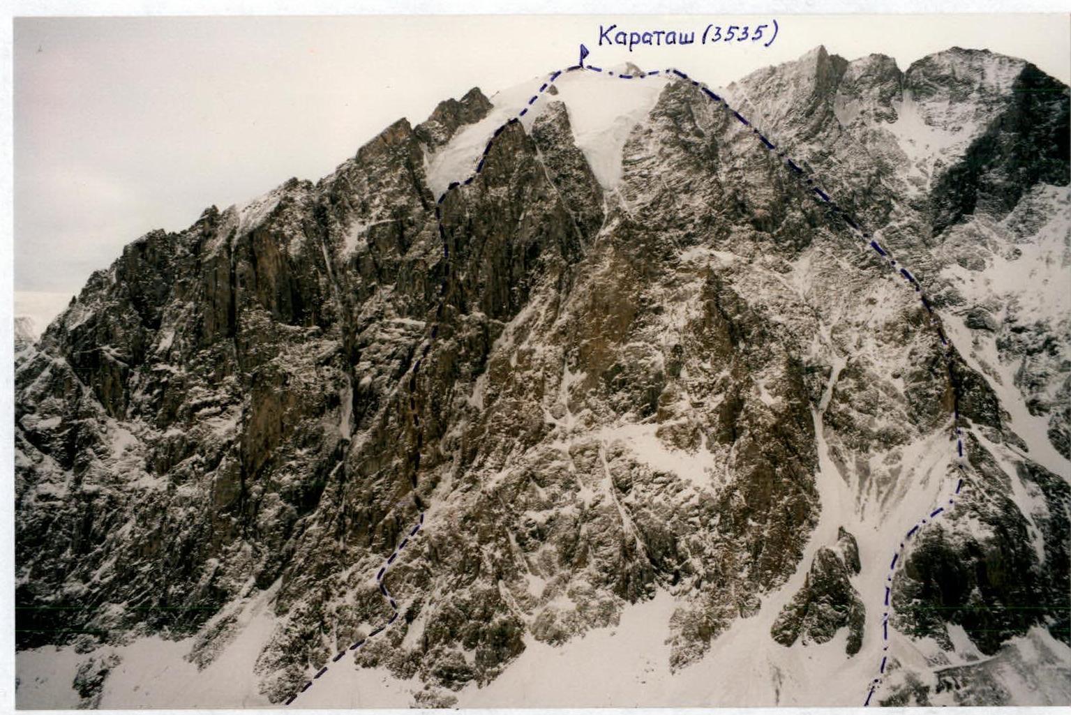
-
-
-
-
-
-
-
- route taken by the team through the center of the north face, 6A category of difficulty.
-
-
-
-
-
-
-
-
-
-
-
-
-
- route via the north face, 4A category of difficulty. (Photo taken on February 22, 2002)
-
-
-
-
-
-
Photo of the face profile
to the right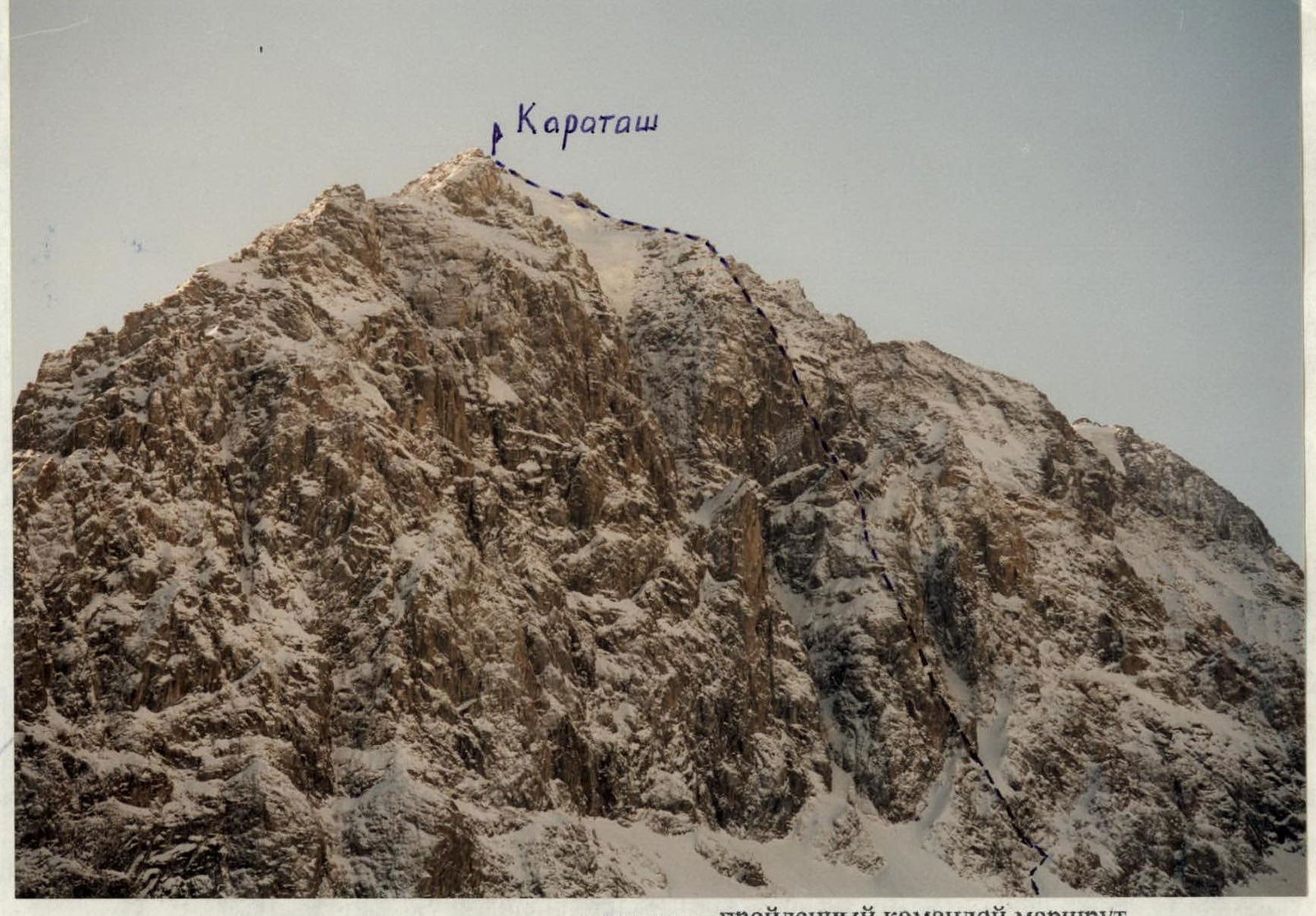 Hand-drawn profile
of the route
Hand-drawn profile
of the route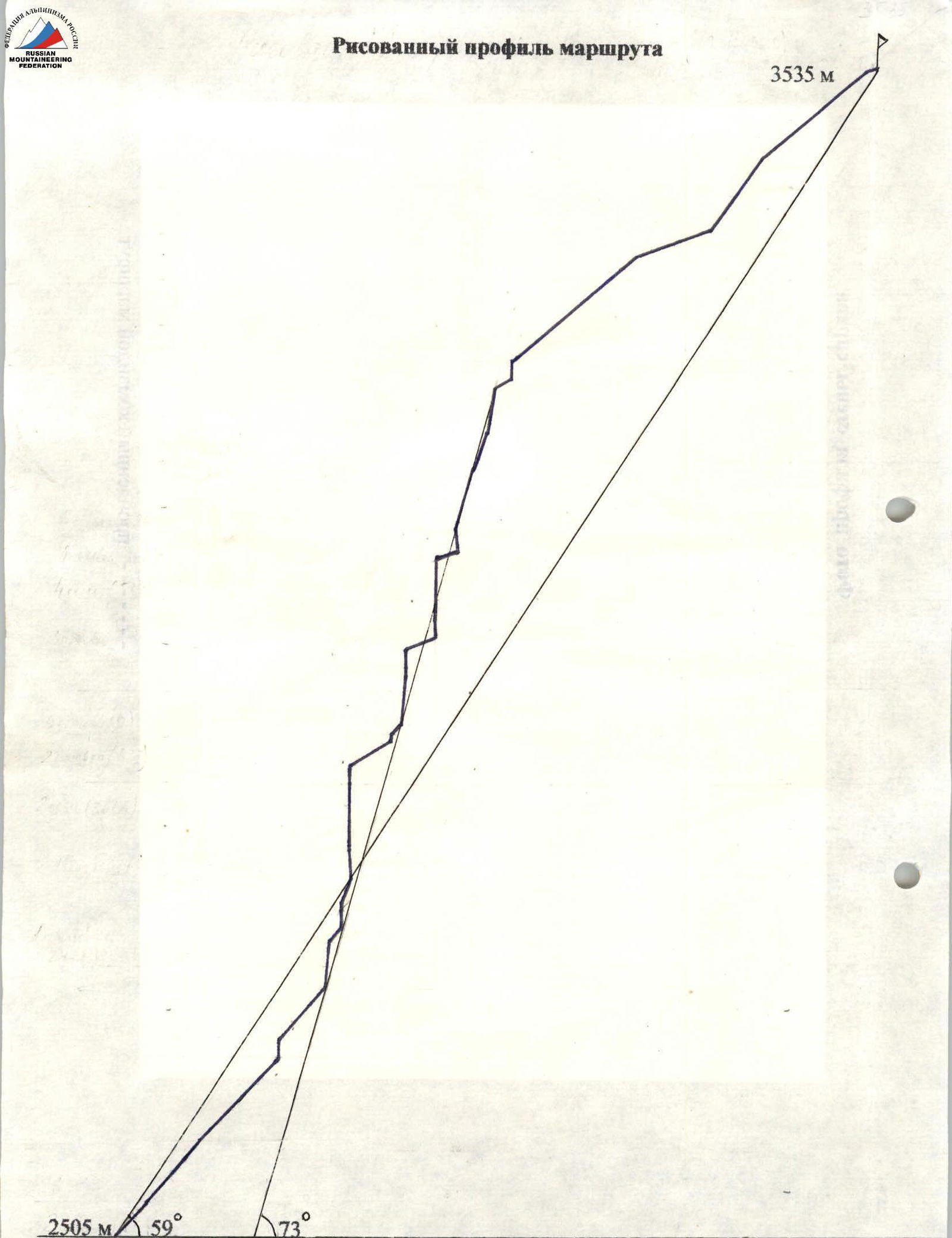 Photopanorama
of the area
Photopanorama
of the area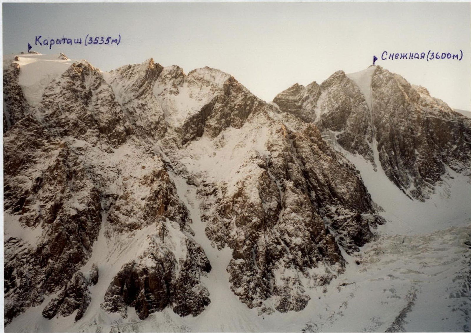
Overview of the Climbing Area
The Karatash peak (3535 m) is located in the north-eastern spur of the Severo-Chuyskie Belki ridge, in the Altai Mountains. From the approach side, i.e., from the Chuya tract from the Kurai steppe, the Karatash peak appears as a kilometer-long rocky wall closing the Aktru valley. Currently, an alpine camp operated by the Tomsk commercial enterprise "Promalp" is periodically active in the valley. It is possible to reach the alpine camp by car. The area is convenient for fulfilling sports qualification standards, so it is frequently visited. The last settlement on the Chuya tract — the village of Kurai — is approximately 40 km away from the camp. The camp has a year-round rescue team and reliable long-range radio communication. The approach to the route takes about 1.5 hours from the base camp.

Climbing Schedule
Height, m
Route Diagram in UIAA Symbols
| Section | rock | chock | ice | |
|---|---|---|---|---|
| R10–R11 | 8 | 15 | - | VI–, 70 m, 90°, A2 |
| 1 | 4 | |||
| R9–R10 | 3 | 12 | - | VI+, 30 m, 95°, A3 |
| 6 | PHOTO № 2 | |||
| R8–R9 | 3 | 6 | - | IV+, 20 m, 30° |
| R7–R8 | 3 | 3 | - | V+, 20 m, 90°, A1 |
| 1 | 1 | |||
| R6–R7 | 1 | 2 | - | III+, 15 m, 50° |
| R5–R6 | 3 | 10 | - | VI, 40 m, 85°, A2 |
| 1 | 8 | PHOTO № 1 | ||
| R4–R5 | 2 | 5 | - | III+, 60 m, 50° |
| R3–R4 | 1 | 2 | - | V–, 15 m, 90° |
| R2–R3 | 3 | 5 | - | II–, 100 m, 45° |
| R1–R2 | 1 | 4 | - | III–, 70 m, 50° |
| R0–R1 | - | - | - | I+, 40 m, 45° |
Route Diagram in UIAA Symbols
| Section | rock | chock | ice | |
|---|---|---|---|---|
| R27–R28 | - | - | - | III, 55 m, 40° |
| R26–R27 | - | 4/1 | - | V+, 15 m, 85°, A1 |
| R25–R26 | 2 | 1 | - | II–, 15 m, 30° |
| R24–R25 | - | 13 | - | V+, 40 m, 80° |
| 3 | PHOTO № 7 | |||
| R23–R24 | 1 | 8 | - | IV, 35 m, 70° |
| R22–R23 | - | 18 | - | V, 55 m, 75° |
| 6 | ||||
| R21–R22 | 1 | 14 | - | VI+, 20 m, 95°, A2 |
| 1 | 10 | PHOTO № 6 | ||
| R20–R21 | - | - | - | III–, 20 m, 20° |
| R19–R20 | 3 | 18 | - | VI+, 35 m, 90°, A3 |
| 1 | 10 | PHOTO № 5 | ||
| R18–R19 | 4 | 8 | - | VI+, 20 m, 90°, A3 |
| 2 | 6 | PHOTO № 5 | ||
| R17–R18 | - | 10/10 | - | VI+, 15 m, 95°, A2 |
| PHOTO № 5 | ||||
| R16–R17 | - | 3 | - | III–, 30 m, 20° |
| R15–R16 | 3 | 7 | - | VI–, 25 m, 90°, A2 |
| 4 | PHOTO № 4 | |||
| R14–R15 | 1 | 14 | - | V+, 40 m, 85°, A1 |
| 4 | PHOTO № 3 | |||
| R13–R14 | - | 3 | - | II–, 10 m, 45° |
| R12–R13 | - | 3/1 | - | V+, 10 m, 80°, A1 |
| R11–R12 | - | - | - | II–, 40 m, 30° |
Route Diagram in UIAA Symbols
| Section | rock | chock | ice | |
|---|---|---|---|---|
| R33–R34 | - | - | - | I–, 20 m, 15° |
| R32–R33 | - | - | 24 | III, 200 m, 40° |
| R31–R32 | - | - | 20 | IV–, 80 m, 55° |
| R30–R31 | - | - | - | II+, 70 m, 20° |
| R29–R30 | - | 10 | - | IV–, 40 m, 55° |
| R28–R29 | - | 10 | - | IV+, 50 m, 55° |
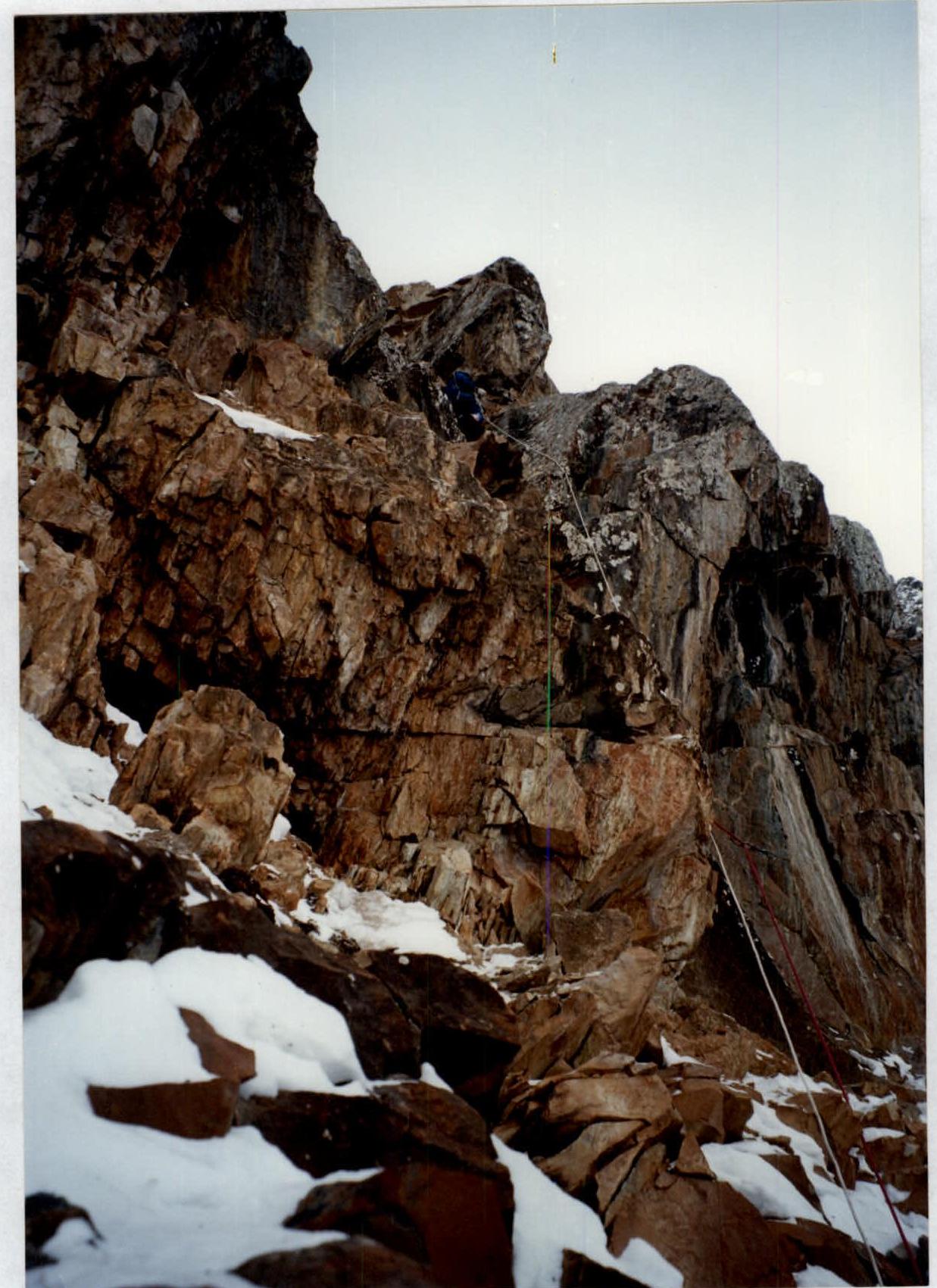
Photo Illustration of the Report
Photo № 1. Section 5–6. Passing the inner corner.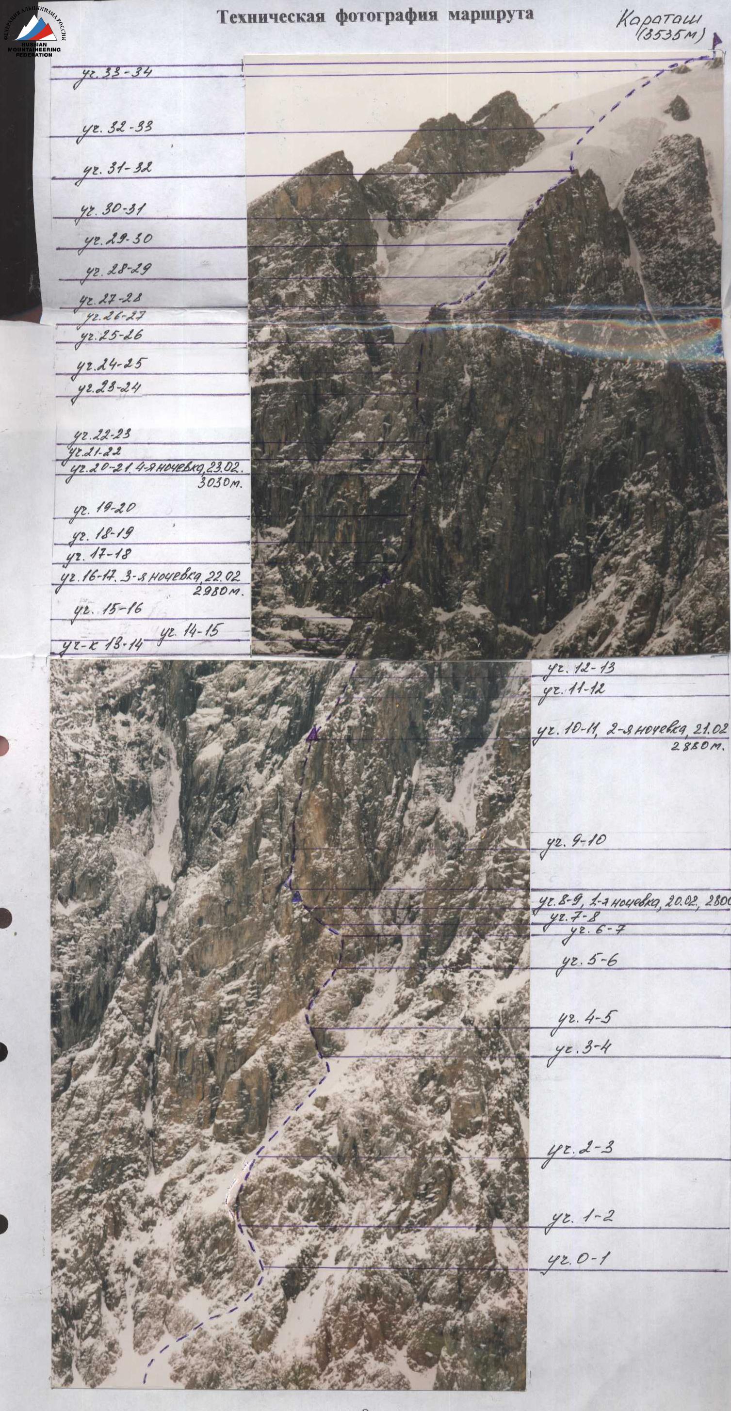 February 23, 2002, 17:00. A team of climbers from Kuzbass: 1. Timofeev N.V. 2. Kozlov A.V. completed an ascent to the Karatash peak via the north face, route category 4A. Descent via route category 2A. "Good luck to all!" No notes were found in the control tours. Left by Tevos.
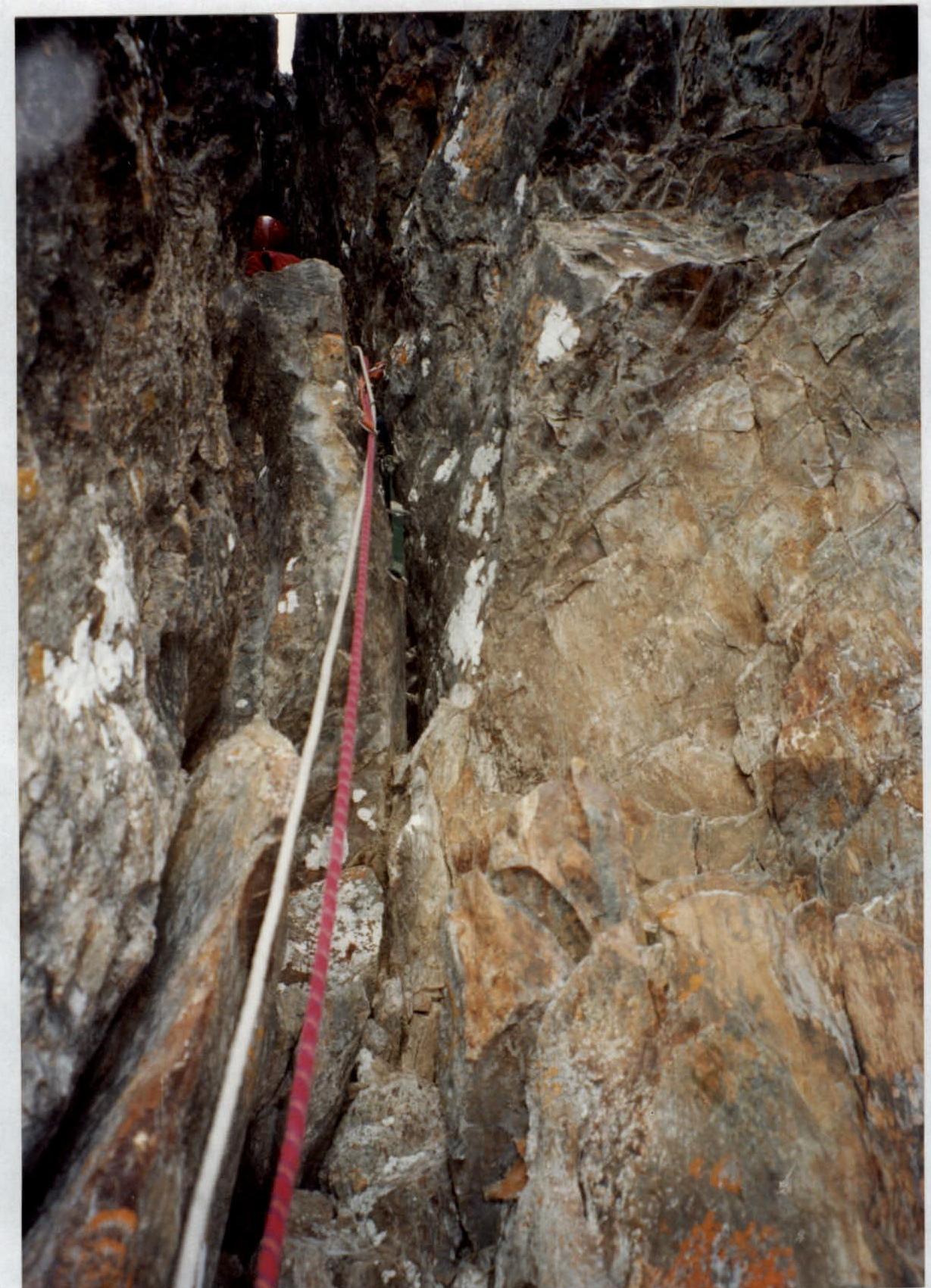
Photo № 2. Section 9–10. Passing the chimney.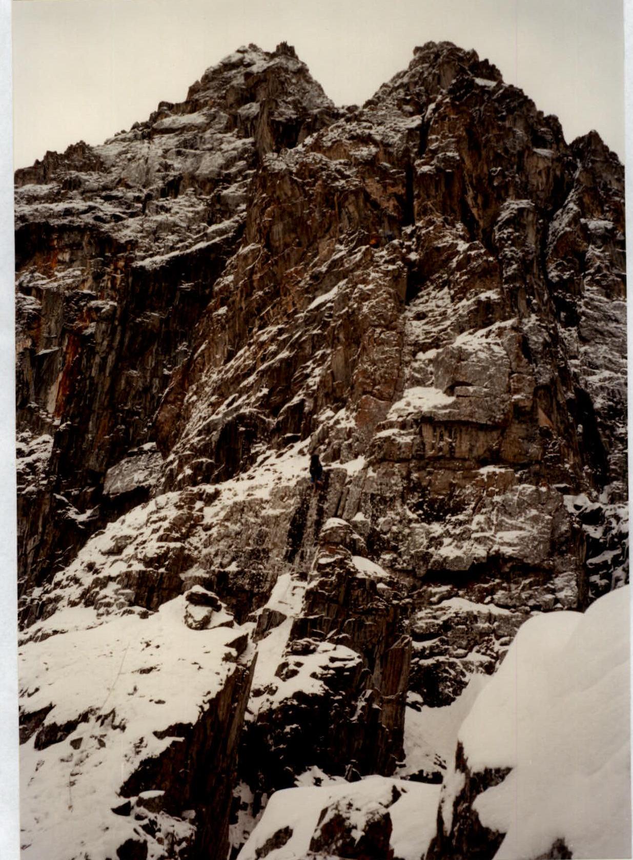
Photo № 3. Section 14–15. Passing 40 m of the destroyed wall.
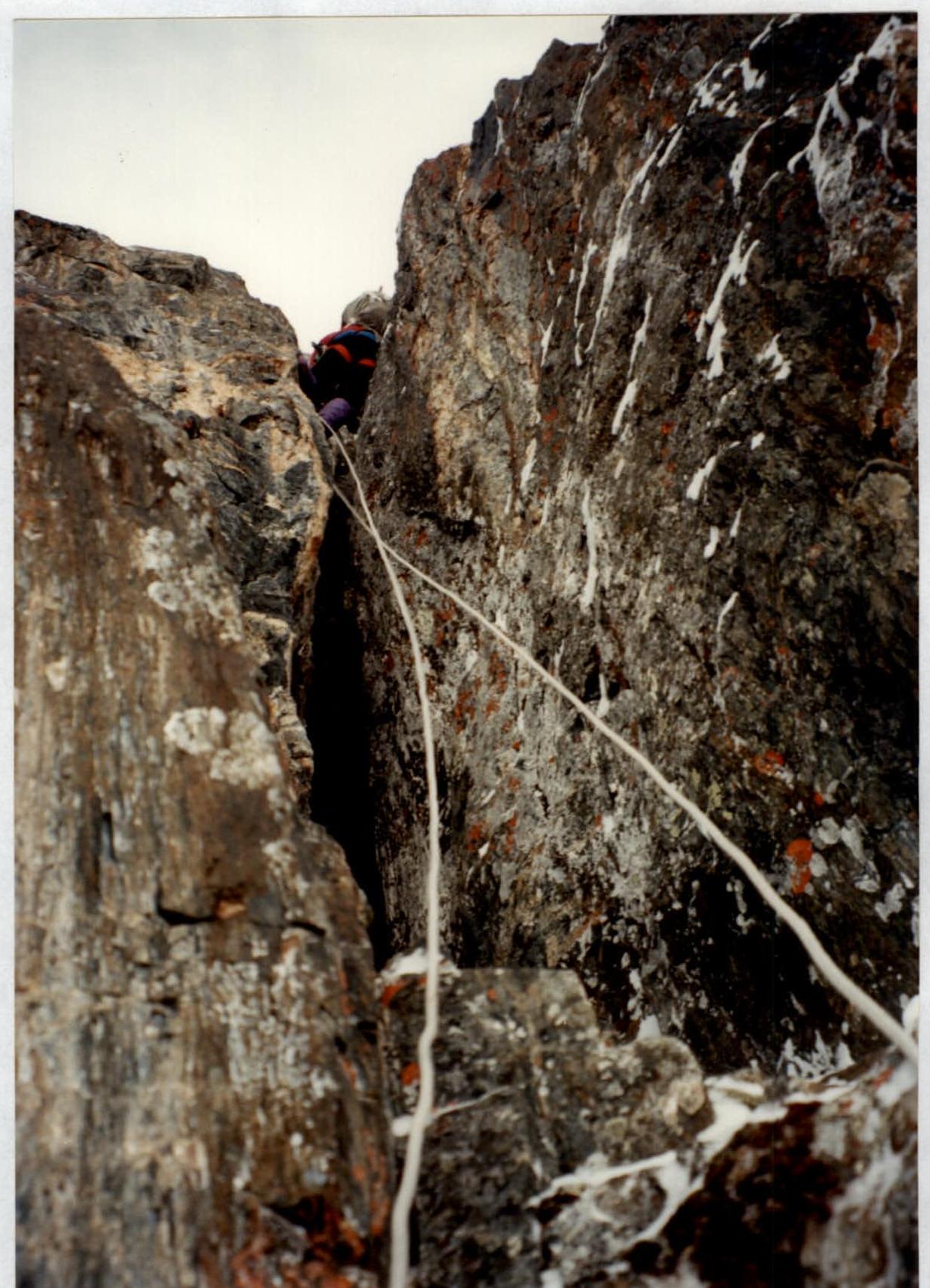
Photo № 4. Section 15–16. Passing a narrow chimney with a plug.
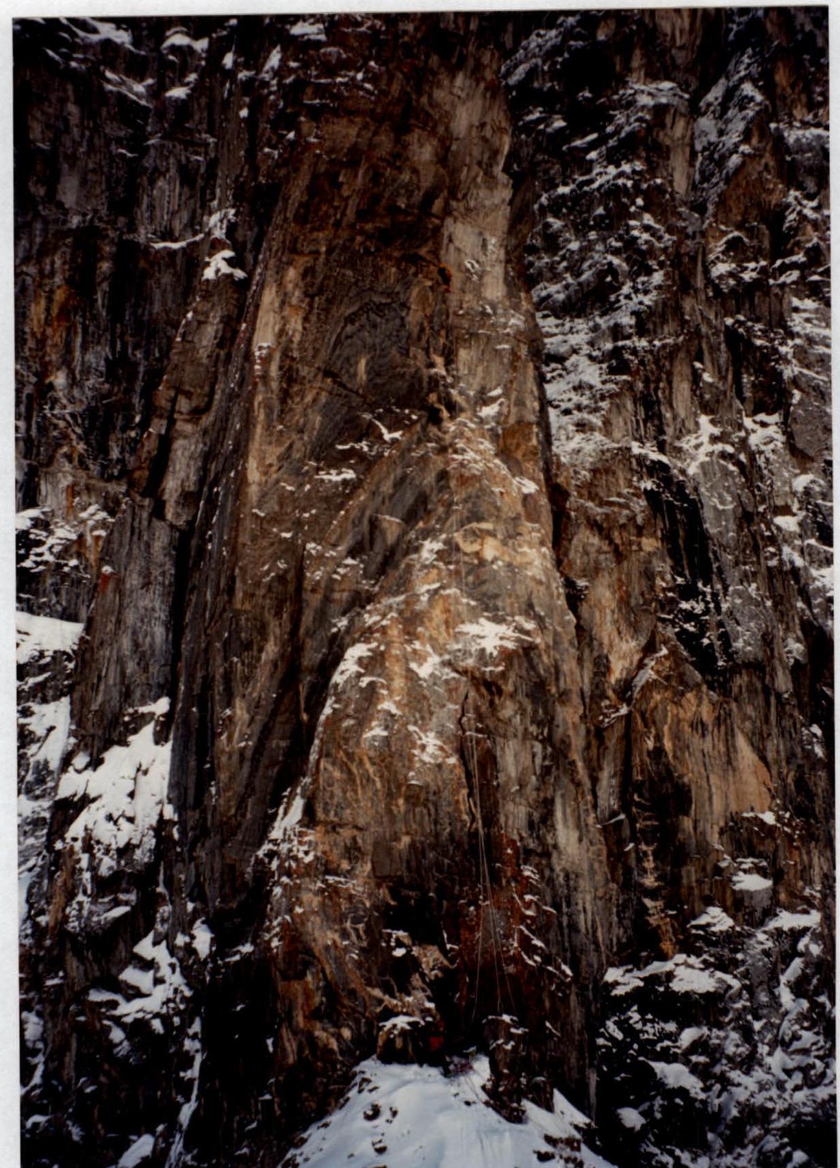
Photo № 5. Section 17–20. Passing the 3rd bastion "Icebreaker".
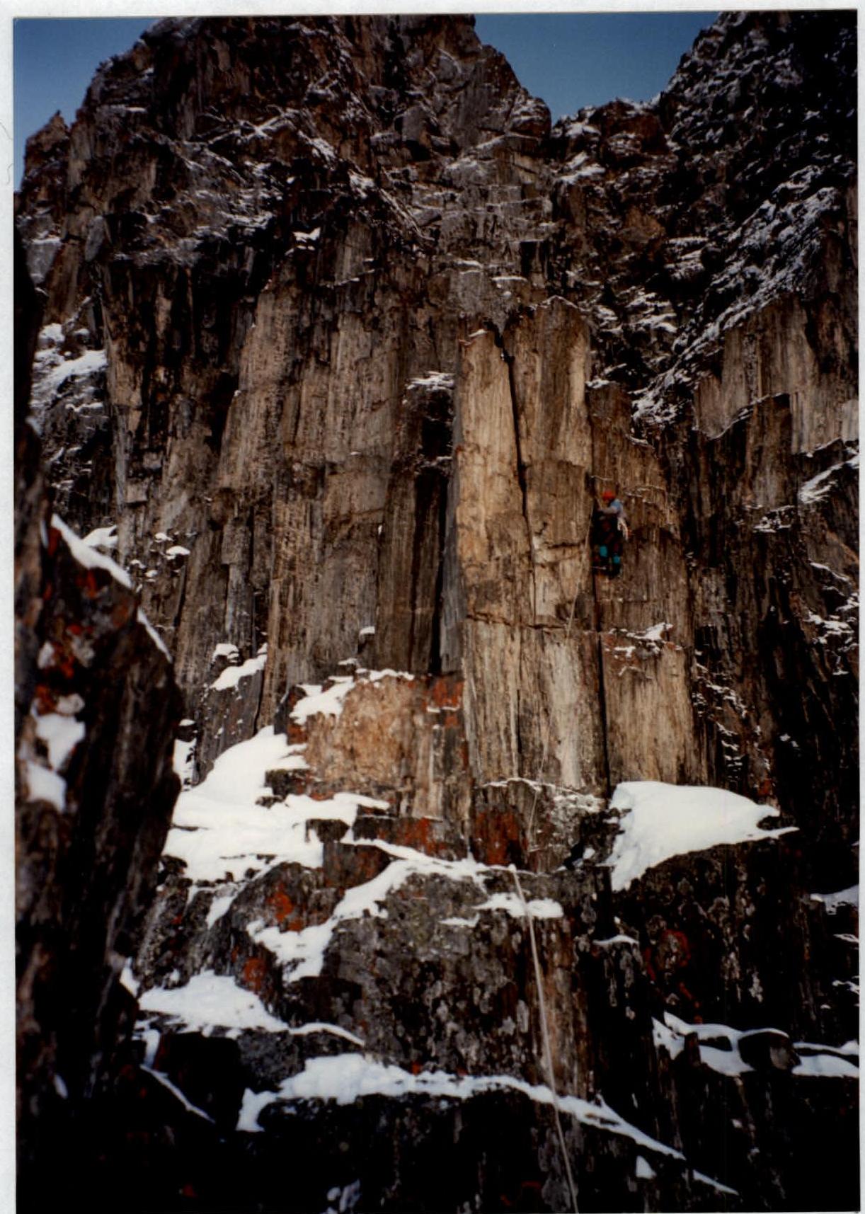
Photo № 6. Section 21–22. Passing the wall with an overhang.
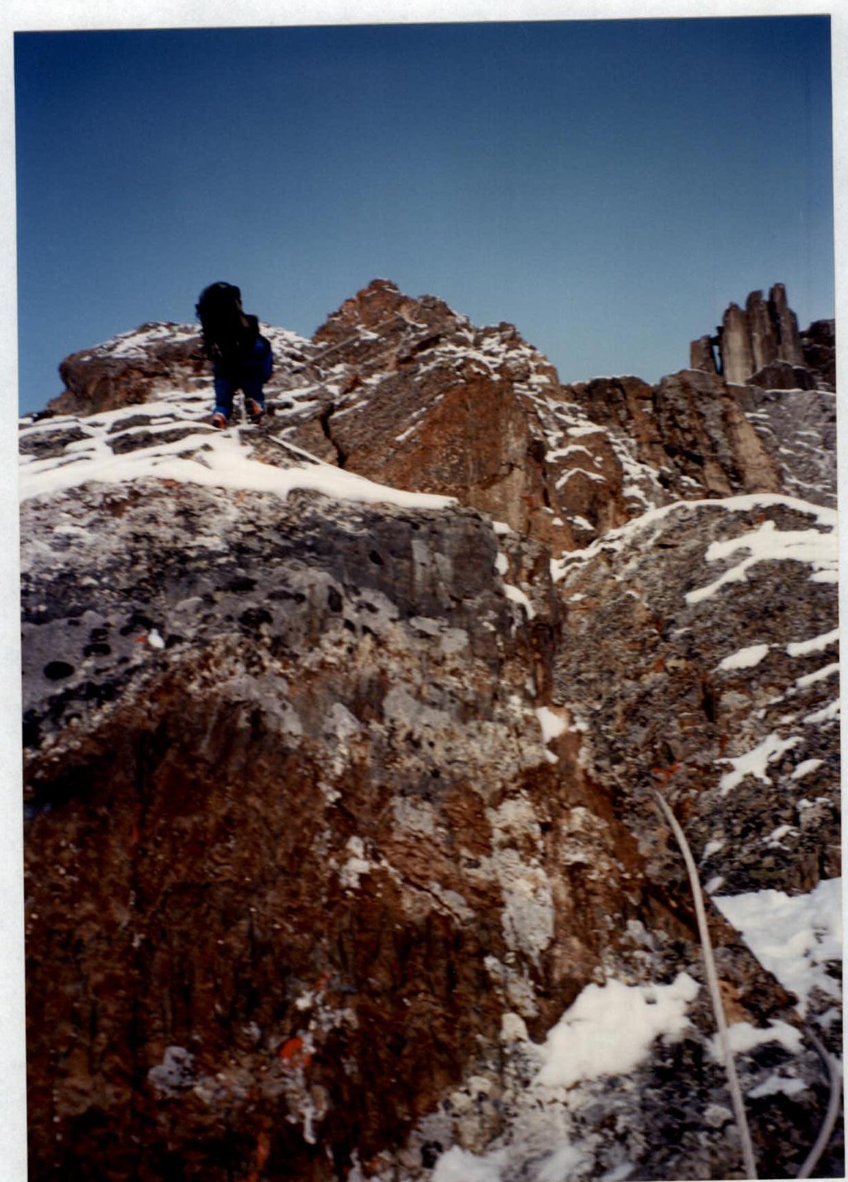
Photo № 7. Section 24–25. Passing the wall with microrelief.


