
For the championship of Central Council of SDSO "Burevestnik" on alpinism in the class of traverses
1.1.44
TRAVERSE
of peaks 50 years of CPSU – Geroycheskaya Korea – Sapozhnikov – Petr Sukhov – Vostochnaya Belukha – Zapadnaya Belukha – 20 years of Oktyabr – peak Razdelny (first ascent):
- 50 years of CPSU
- Geroycheskaya Korea
- Sapozhnikov
- Petra Sukhova
- Vostochnaya Belukha
- Zapadnaya Belukha
- 20 years of Oktyabr
- peak Razdelny (first ascent)
Sports team of Tomsk Regional Council of SDSO "Burevestnik".
Team captain L. Spiridonov Team coach N. Andreev

Tomsk – 1972
REPORT
on the traverse of peaks
- 50 years of CPSU
- Geroycheskaya Korea
- Sapozhnikov
- Petra Sukhova
- Vostochnaya Belukha
- Zapadnaya Belukha
- 20 years of Oktyabr
- Razdelnaya
1. Geographical location and sporting characteristics of the route.
The traverse took place in the Central Altai region, covering the highest part of the Katunsky ridge. Almost all the peaks in this area, rising above 4000 m, were included in the ascent.
The high-altitude part of the Katunsky ridge is extremely interesting in terms of sports. There are much fewer classified routes here compared to the North-Chuya proteins. This is due to the remoteness of the area from highways. Despite this, the Belukha mountain area (4506 m) has always attracted climbers. Among the sporting ascents made by various climbers, there were also traverses:
- in 1953, participants of the alpinist expedition of the All-Union Central Council of Trade Unions (VCSPC), led by E.A. Kazakova, traversed the massif of 50 years of CPSU (4000 m) with an ascent along the eastern ridge and descent along the glacier plateau between the peaks of 50 years of CPSU and Geroycheskaya Korea (4-5 category of complexity);
- peak Geroycheskaya Korea (4A category of complexity);
- Vostochnaya and Zapadnaya Belukha with an ascent to Vostochnaya Belukha along the 10-B ridge and descent from the western plateau to the Mysty-Airy glacier;
- in 1963, a group of Tomsk climbers led by N.G. Andreev made a traverse of the peaks 20 years of Oktyabr – Zapadnaya Belukha – Vostochnaya Belukha – Delaunay from west to east (5B category of complexity).
However, the complete traverse of the entire highest part of the ridge remained unaccomplished.
The fact that the entire traverse as a whole had not been done before, its logic, great length (about 20 km), technical complexity, large altitude differences (up to 1000 m), as well as harsh weather conditions in Altai, were the main motives for choosing it.
2. Climbing conditions.
a/ Relief. The Belukha massif, rising steeply above the Katunsky ridge, is formed by Bar-like main ridge line and three significant spurs.
This part of the Katunsky ridge is characterized by great ruggedness and dissection. A large number of sheer walls. The low snow line boundary (according to glaciologists, 2700 m) causes strong glaciation of the peaks.
Between the peaks of 20 years of Oktyabr and Zapadnaya Belukha at an altitude of 4000 m lies a huge firn plateau, 3 km long and 2.5 km wide, similar to the Pamir plateau on peak Communism.
The rocky rocks of the peaks of the eastern group (50 years of CPSU, Korea, Sapozhnikov, Sukhov) consist mainly of schists; in the more western peaks of this mountain unit, black and gray granites are often found (the north face of Vostochnaya Belukha is entirely composed of gray granite). The peaks of the western group are more dissected.
The traverse route is technically complex (includes ice, snow, and rocky sections of varying difficulty and altitudes (more than 1000 m)) and also has a significant length.
b/. Weather. The climate of the vast mountainous area of Belukha is still poorly understood by meteorological data. According to the observations of the Ak-Kem weather station located nearby:
- Cloud cover reaches its maximum development in this area in July, and its minimum in the winter months.
- Cloud cover has a diurnal cycle: in the first half of the day, cloud cover develops around Belukha much weaker.
- Due to the constantly blowing winds from the leeward, northeastern side, cornices reach 5–8 m.
- Precipitation on the ridges, especially near their axial parts, is quite abundant. Their annual totals are estimated at 1500–2500 mm.
- The bulk of precipitation here falls in the autumn and spring-summer time, with most of it falling in solid form.
- As you rise along the slopes, the amount of precipitation increases.
This year, until mid-July, there was a stable inclement weather. On the night of July 4, there were frosts and snowfall even in the valleys; at the Ak-Kem weather station (altitude 2050 m), the temperature that night was −10 °C. During the traverse, the weather was quite good (only 4 days out of 12 were with bad weather). c/. Exploration of the area. The first European to penetrate the Belukha region was Dr. F. Gebler, who worked at the Kolyvano-Voskresensk silver smelting plants and discovered two large glaciers, Katunsky and Berelsky, in 1835, and roughly determined the height of Belukha.
The first ascent to Vostochnaya Belukha was made in 1914 by brothers M. and V. Tronov. After the October Revolution, alpinadas and ascents were conducted in this area. However, most climbers were limited to ascending Vostochnaya Belukha from the south (2B category of complexity).
A number of new routes were traversed during the work of the VCSPC alpinist expedition in 1953.
In 1963, a group of Tomsk climbers led by G. Andreev made the first 5B category of complexity route in this area.
In the winter of 1970, a group of Tomsk climbers made the first winter ascent to Vostochnaya Belukha. Moreover, it was the first ascent to Belukha from the northern side.
To this day, there are many interesting untraversed routes in this Altai region, waiting for their climbers.
3. Reconnaissance and deliveries.
On July 10, the expedition made a training ascent to peak Tomsk Students (2B category of complexity) with the whole team. On July 12, a group consisting of L. Spiridonov, A. Pugachev, N. Rodionov, and Yu. Koryakin went through the Titov pass to scout the lower part of the Men-Su glacier.
As a result of the reconnaissance, the following information was obtained:
- The glacier is covered with a thick layer of snow, which intensively melts during the day, so the most favorable time for crossing the glacier is early morning.
- It takes ten walking hours from the base camp to the start of the route.
- It is better to organize an overnight stay on the moraine at the confluence of the left tributary into the Men-Su glacier, below the icefall (3 walking hours to the start of the route). This place for organizing an overnight stay is due to the fact that the path to the start of the route can be blocked by ice avalanches from the slope of the ridge between the peaks of 50 years of CPSU and Geroycheskaya Korea, so it is more expedient to pass this section faster, which is easier to do in the morning on the crust.
On July 18-20, a group consisting of Spiridonov, A. Pugachev, S. Avraamov, and Yu. Ustinovshchikov made an ascent to peak Sapozhnikov (4A category of complexity) and made a delivery of food and gasoline to the saddle between the peaks of Geroycheskaya Korea and Sapozhnikov.
At the same time, a group consisting of Yu. Tarabrin, G. Kholmanskich, Yu. Korzunin, and N. Rodionov made an ascent to peak 20 years of Oktyabr along the eastern ridge from the Ak-Kem glacier (first ascent, approximately 4B category of complexity) and organized a delivery there.
4. Organizational and tactical ascent plans.
The reconnaissance data showed that the route would be technically difficult, long, and would take place in conditions of unstable Altai weather, so it was more expedient to go with the entire declared team, i.e., 8 people. The planned time for the entire traverse was 10 days.
To facilitate the passage of the traverse, as well as in case of an emergency situation on the route, two deliveries were made. The team had a two-week control period. Extension of the control period would be carried out by firing two green rockets.
The reserve of time and food allowed the group to maneuver - to wait out the bad weather and pass dangerous sections of the route at the most favorable time of day. The regime of movement and rest was chosen to preserve strength for the entire route. During the traverse, no adjustments were made to the planned route.
During the traverse, the group used equipment according to standard samples. It included:
- Standard mountaineering equipment
- Communication equipment
- First-aid kit and medications
- Food supply for 10 days
- Signaling equipment (including green rockets)
- Radio beacon
- Main rope 2 pcs. 60 m each, 1 pc. 40 m.
- Auxiliary rope 1 pc. - 80 m
- Rock pitons - 20 pcs.
- Ice pitons - 14 pcs.
- Screw pitons - 2 pcs.
- Carabiners - 14 pcs.
- Rock hammers - 2 pcs.
- Crampons - 6 pairs
- Ice axes - 6 pcs.
- "Pamirka" tent - 2 pcs.
- Stove (tebus) - 2 pcs.
All participants were wearing crampons-compatible boots.
5. Assault team.
According to the application:
- Spiridonov L.K. - Master of Sports - captain
- Kholmanskich G.N. - Master of Sports.
- Kharchenko E.F. - Candidate for Master of Sports
- Pugachev N.L. - Candidate for Master of Sports
- Avraamov S.V. - 1st sports category
- Aksenov V.N. - 1st sports category
In reserve:
- Ustinovshchikov Yu.I. - 1st sports category.
- Tarabrin Yu.V. - 1st sports category
Kholmanskich G.N. and Tarabrin Yu.V. did not join the assault: the first was urgently recalled from vacation, the second was ill. Aksenov V.N. and Kharchenko E.F. did not arrive for the gathering. To strengthen the team for the traverse, the following were included:
- Korzunin Yu.K. - Candidate for Master of Sports, entered for the north face of Belukha;
- Rodionov N.E. - 1st sports category, champion of the Central Council in 1970.
The order of passage of the route
(see profile sketch, photographs, and table) On July 23 at 6:00, we left the overnight stay on the moraine at the confluence of the left tributary of the Men-Su glacier and were at the start of the route at 9:00 (photo 0). It took an hour and a half to ascend to the saddle. At the beginning of the path, there was snow on the slope, and above the bergschrund, the snow layer became thin, requiring piton insurance. We ascended to the saddle without crampons. Further on, there were difficult rocks (section R1-R2), photo 1. Although the altitude is not great here, the rocks were covered with snow and a thin crust of ice due to the recent snowfall. Having spent 5 hours on overcoming this section and hammering in 10 rock pitons, the group reached a more gentle section of the ridge. The steepness of this section is 50-55° (photo 2). After 4 hours of work on this section, where 5 rock pitons and one ice piton were hammered in, the group approached a steeper section of rocks. It made no sense to go further, as there was no suitable place for an overnight stay before nightfall. After leveling the platforms and building them up with wet snow and stones, we managed to install tents. On this day, there were 13 hours of movement, 15 rock pitons, and 3 ice pitons were hammered in.
July 24. Ascent at 5:00, departure at 7:00. The eastern ridge was already lit, but it was cold. The rocks were covered with ice, but it was still possible to pass without crampons, and in some places, it was necessary to cut steps. After 2 hours of work, we approached a rocky chimney filled with ice. We used slings to ascend to the ice ridge. The entire group took 3 hours and 30 minutes to pass this section. 3 rock pitons and 1 ice piton were hammered in.
Further, the path is an ice ridge with a steepness of 30-35°, which was traversed with crampons and piton insurance. Here, on the pre-summit, a strong wind was blowing, but the weather was sunny. At 13:30, we reached the first of the 3 peaks of 50 years of CPSU, which is a sharp left pyramid.
After some lowering, the ridge becomes sharp with bizarre, huge cornices hanging:
- either to the south side,
- or to the north.
After a closer look at the ridge, we decided that it was safer to pass it in the morning hours, and it was dangerous to go under the big cornices at noon, in clear weather. At 14:30, we began to cut a platform for tents on the peak. On this day, we worked for 7 hours and 30 minutes, hammering in:
- 3 rock pitons
- 5 ice pitons.
On July 25 at 5:40, the first rope team began to move (section R5-R6). We immediately put on crampons. We had to move either along the south side of the ridge or cross to the north side. Visibility was good, but clouds were creeping in from the west. Photo 3 shows the end of this section and the exit of the last rope team onto the ascent leading to the main peak of 50 years of CPSU. It took 4 hours and 2 ice pitons were hammered in.
The ascent to the main peak was made with crampons on still firm snow, and then began a flat main peak and a smooth transition to the western peak. No notes from the first ascenders were found. A few meters below on the rocks, a tour was found, and a note from the group of Isaev V. was retrieved, who had passed this route 2 days earlier along the 4-5 category of complexity (section R6-R7).
The descent from the peak goes along an ice slope, ending in a rock wall to the west. By this time, clouds had rolled in, and it started snowing. This section R7-R8 is visible on panorama 1. Next begins a sharp snow ridge, along which we had to traverse three large ice "gendarmes" head-on. We walked this entire section in crampons, as we often had to go onto ice. After 6 hours of ice-snow work (4 ice pitons were hammered in), we approached the ascent leading to the peak of Geroycheskaya Korea. It took another 3 hours to pass this ascent. By this time, the sky had begun to clear. This ascent is an ice ridge with a steepness of 30° with occasional rocky outcrops. We passed it with piton insurance on crampons (2 rock pitons and 3 ice pitons were hammered in). At 18:00, we were on the peak, from which a descent to the saddle leads along an ice slope. We retrieved a note from the group of Isaev V.
About a third of the way down the slope from the top, there is a weakly expressed rocky counterfort, along which we began our descent. Below is a pure snow slope, which had softened over the day, making it difficult to descend. At 21:00, we stopped for the night near our delivery. By night, the sky had finally cleared, and we could expect good weather for the next day.
On July 26 at 6:00, the first rope team left for the route. It was clear, cold, and the sun had not yet lit up the saddle. We immediately put on crampons (section R10-R11). The ascent to the peak of Sapozhnikov (photo 4) is an ice slope with a steepness of 45-50° in the lower part of the slope, with a bergschrund. We traversed the slope on the front teeth of our crampons, which took 5 hours and 30 minutes, and 6 ice pitons were hammered in. On the peak, we retrieved a note from climbers from 1963 (leader V. Khizhnyak). Further to the west, there is a narrow ice ridge (section R11-R12), from which thin, intricate cornices hang to the north, and the ridge breaks off to the south in a rocky wall. We had to go on crampons on the border between rocks and ice, using ice pitons and rocky outcrops for insurance. It took 4 hours to pass this section, and 3 ice pitons were hammered in. At 15:30, we approached the summit tower of peak P. Sukhov. This peak was named by Tomsk "Burevestnik" climbers in 1963 in honor of a hero of the Civil War in Altai, at the request of employees of the Biysk Local History Museum. The ascent was made along the western ridge from the Berel saddle (approximately 3-5 category of complexity). The peak is a rocky tower rising 60 m above the ice base (section R12-R13). After an hour and a half, the entire group was on the peak. We hammered in 4 rock pitons. Before the tower, we took off our crampons. On section R13-R14, we also went without crampons, although we often encountered ice sections, where we had to cut steps or traverse around the ice along the rocks on the south side. Part of this section is shown in the photo. After 4 hours and 30 minutes, the group descended to the Berel saddle, with an altitude of about 3200 m, where we stopped for the night. That is, on this day, we lost 700 m in altitude, hammering in 7 rock pitons and 12 ice pitons in 15 hours and 30 minutes of work.
On July 27, we began our ascent at 5:45 (photo 5) to Vostochnaya Belukha along the 10-B ridge. From the overnight stay, the ascent begins on snow (section R14-R15) and is easily passable in the morning hours with crampons. From the bergschrund (section R15-R16), ice begins, the slope becomes steeper than 40°, and fresh snow has already melted from this southern slope. The weather is still good for the second day. Passing this section with the use of piton insurance took 8 hours, during which 6 ice pitons were hammered in. At 17:00, the group stopped for the night, having gained about 800 m in altitude for the day. The overnight stay was chosen on a shoulder of the ridge leading to Vostochnaya Belukha, often called the Berel peak.
On July 28, the morning was foggy, with visibility absent, so we had to delay our departure until 10:00, when gaps in the fog began to appear. We started moving in crampons (section R16-R17) along steep ice. Having passed 3 ropes, we began to encounter rocks sticking out of the ice, near which snow was partially preserved, partially facilitating the ascent (photo 6). After 5 hours, the group reached the eastern pre-summit plateau. The fog forced us to make a half-hour stop. After the fog cleared, we decided to go to the peak through the northern part of the plateau under the cornice, and then directly onto the steep ice slope sticking out like a hump. At 15:00, the group was on the peak. Having descended along the summit ridge to the south from the tour, the group began to descend into the saddle along the talus (section R18-R19). After one rope length, the talus ended, and an ice slope began, covered with a thin layer of wet snow; the crampons were not holding well. We had to hang perils and so on until the saddle. On the descent, 4 ice pitons and 2 rock pitons were hammered in. At 19:00, we stopped for the night. On this day, there were 9 hours of work, 12 ice pitons, and 4 rock pitons were hammered in. In the evening, a strong thunderstorm broke out.
On July 29, we left at 8:30, as it was very cold, and by this time, the sun had lit up the counterfort (section R19-R20), photo 7. After 2 hours of work, the weather began to deteriorate: dense clouds appeared, and the wind strengthened. The ascent along the counterfort was difficult. The rocks were heavily snowed and often icy (photo 8). To make matters worse, the bad weather intensified, and visibility was very poor: we couldn't see our partner in the rope team, and voices were inaudible due to the strong wind. After 7 hours of work, hammering in 10 rock pitons and 2 ice pitons, the group reached the peak of Zapadnaya Belukha, where we stopped for the night, as the weather was bad. In the snowy summit ridge, we dug out a platform for two tents. During the night, we had to leave the tent three times and dig it out, as it was being snowed in. The night was restless.
On July 30, due to the tents being snowed in, we decided not to light the stoves, have a dry breakfast, and descend to the western plateau. At 8:30, we began our descent. Having moved south along the summit ridge to its lowest point, we began to descend along the ice slope. We traversed it with crampons. In the lower part, the slope ends in a small icefall, where there are passages. On the descent, 3 ice pitons were hammered in, and it took 4 hours and 30 minutes. Just as the last rope team was overcoming the bergschrund, a fog rolled in, and it started snowing again, and visibility became zero again. We had to set up tents.
On July 31, the weather was clear in the morning. We left at 6:20 and, after 2 hours and 30 minutes of movement along the western firn plateau (section R21-R22), approached the peak of 20 years of Oktyabr (photo 9).
The ascent to the peak along the ice slope (section R22-R23) took 1 hour and 30 minutes, and 2 ice pitons were hammered in. On the peak, we sorted out the delivery into backpacks and turned north along the ice ridge (photo 10) towards the descent.
Having reached the end of the ridge, we began to descend to the west (photo 10, section R23-R24):
- A steep ice section leading into the Mysty-Airy gorge.
- On the descent to the first gap in the ridge, we hung 180 m of rope.
- Then began an ascent to a "gendarme" and another descent (photo 11).
We traversed this entire section with crampons. It took 8 hours to pass, and 9 ice pitons were hammered in.
We stopped for the night at 18:20 on a gentle section of the ridge, before a large "gendarme". For the day, 11 ice pitons were hammered in, and the working day was 12 hours.
On August 1, the weather was again good, with not a cloud in the sky. We left at 7:30. We immediately began to ascend the monolithic rocks of the "gendarme", visible in photo 10; the character of the rocks is shown in photo 12. The rocks are composed of granite and are warmed by the sun early. The first person had to go without a backpack, with subsequent hauling. The ascent to the "gendarme" took 6 hours, and 14 rock pitons were hammered in. The descent from the "gendarme" is quite simple but soon turns into a sharp rocky ridge, steeply dropping off on both sides (section R25-R26). On the ridge, there are many large and small "gendarmes", which cannot be bypassed and must be traversed head-on. On some, the descent was carried out "sitting on a rope". When ascending one of the "gendarmes" 20 m high, we had to haul all the backpacks. On this section, 8 rock pitons were hammered in. In total, for the day, 13 walking hours were spent, and 22 rock pitons were hammered in. We organized an overnight stay on a section of the ridge beginning after a deep gap and an ascent along destroyed rocks to a wide snowy platform.
On August 2, we left the overnight stay at 6:00. The morning was warm and clear. We felt that we had lost a lot of altitude, as the wind was warm even in the early hours, and the snow began to soften earlier. Section R26-R27 resembles the section passed the day before: the same rocks, the ridge is also broken by gaps, and rocky "fingers" are often encountered, which cannot be bypassed. Only in two places did we bypass "gendarmes" along the western ice slope of the ridge, with the hanging of perils and cutting of steps. After 4 hours of walking, hammering in 6 rock pitons, we approached a peak, from which the descent to the Ak-Kem glacier begins. We conditionally named the peak "Razdelnaya", as it practically separates the high part of the Katunsky ridge from the snowless mountains. The ascent to the peak along the granite wall (photo 13) took 2 hours, and 6 rock pitons were hammered in (section R27-R28).
Further (section R28-R29), a snow slope began; having descended it, the group reached a destroyed rocky ridge, sometimes quite steep, but insurance is organized well and without the use of pitons. Twice we had to make a rappel of 30 m.
At 15:30, we approached a vertical wall, breaking off towards the left tributary of Ak-Kem. Having made a rappel of 2 x 60 m, at 17:30, the group descended to the glacier and, after 2 hours, was at the base camp.
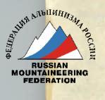
The group evaluates the traverse as 5B category of complexity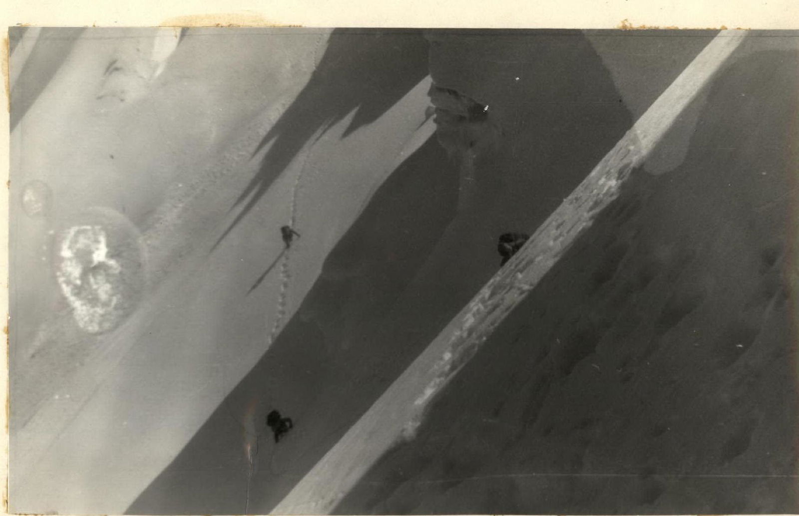 PHOTO. 3. Passage of the ridge between I and 2 peaks of 50 years of CPSU.
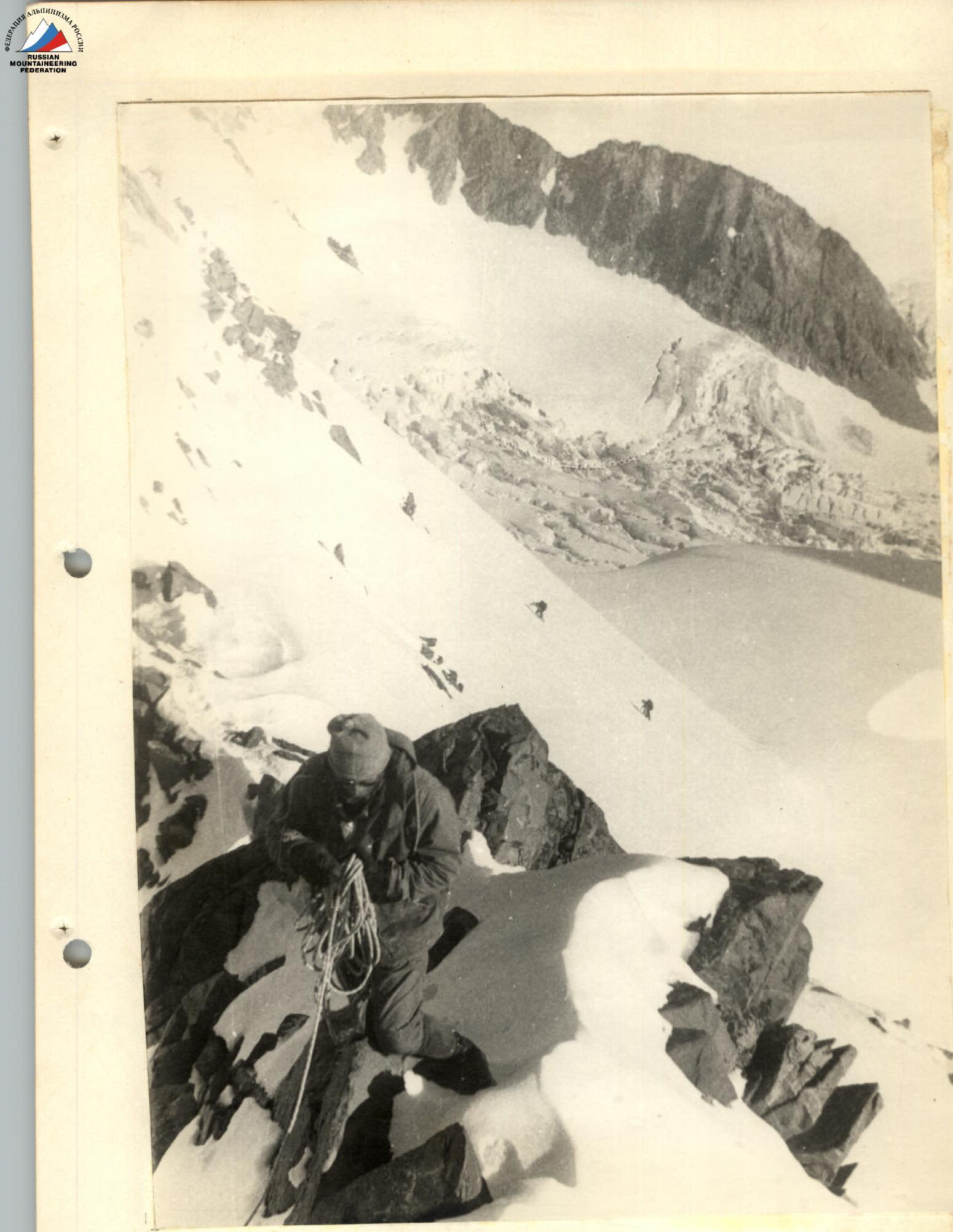
PHOTO. 4. Ascent to peak Sapozhnikov.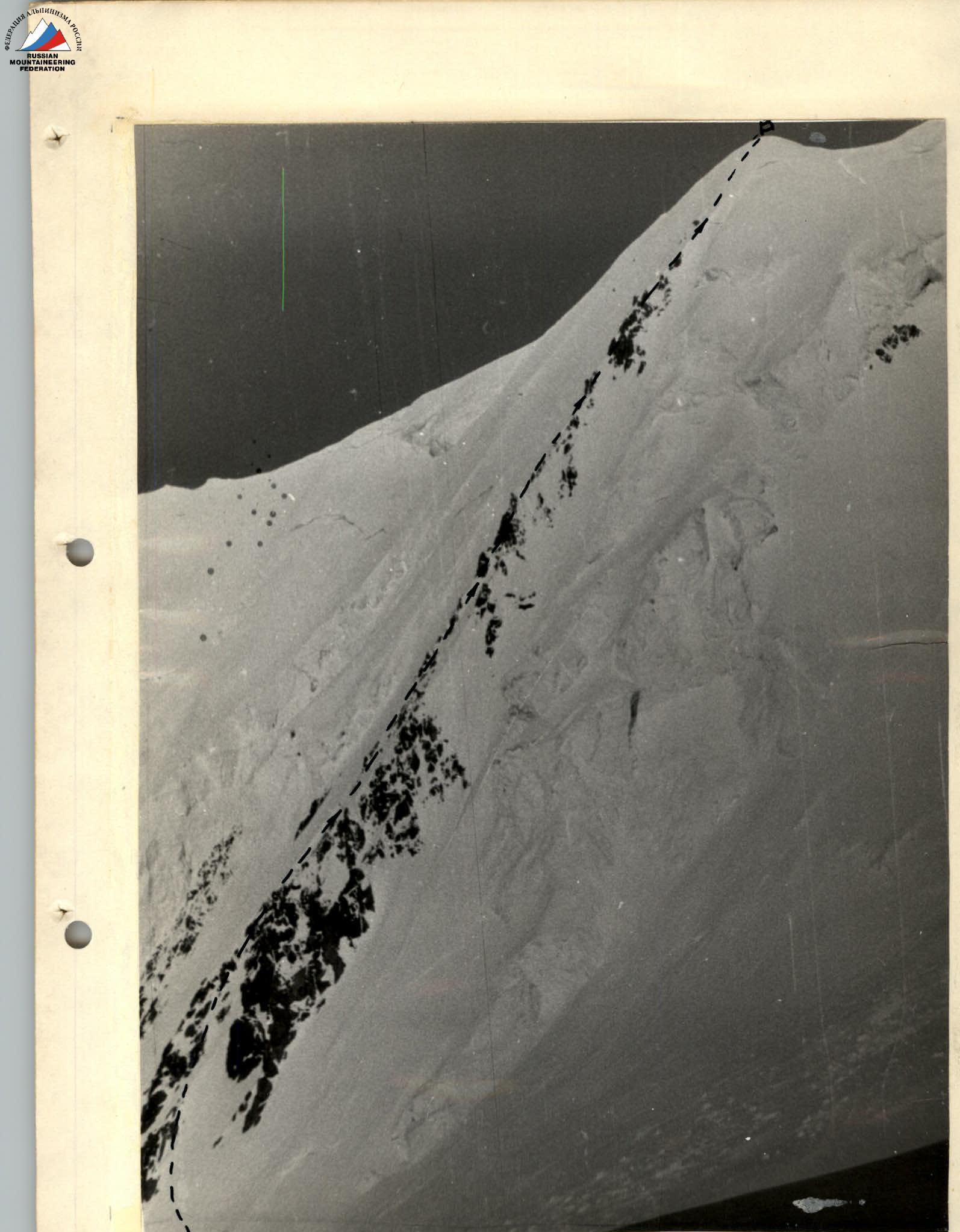 PHOTO. 7. Path of ascent to Zapadnaya Belukha.
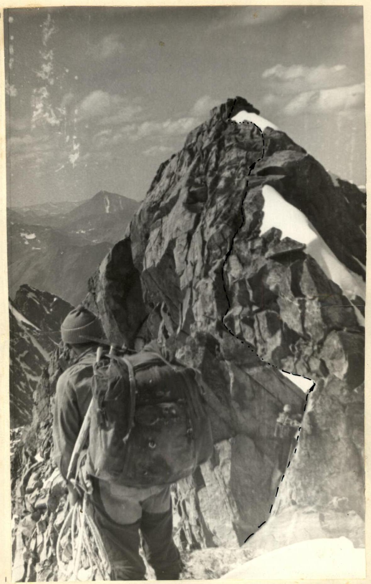
PHOTO. 12. Path of passage of the rocky "gendarme".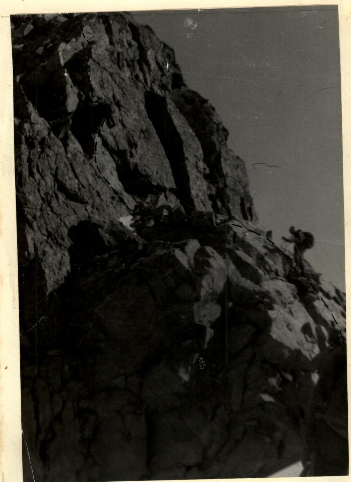
PHOTO. 13. Ascent along the granite wall. Section R27-R28.
Comments
Sign in to leave a comment